Midweek Mountaineers 2025
DECEMBER
December 10th – Johnson motorway to Rocky Peak Fire Road and Back
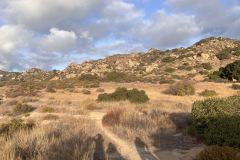
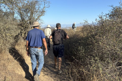
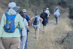
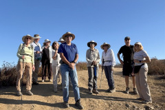
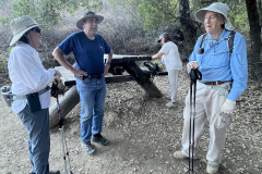
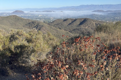
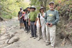
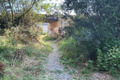
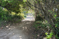
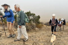
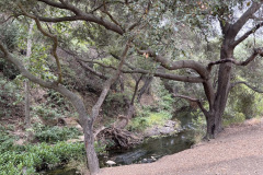
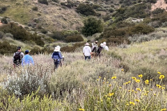
6 hikers met at the trailhead on Iverson Road just outside the gated southern entrance to Indian Springs Estates in Chatsworth on a warm late autumn morning. We walked through the upscale gated community on the designated pathway/easement, enjoying the well-manicured landscaping of the homes along the way. Eventually we reached the beginning of the unpaved Johnson Motorway (once a toll road). The trail (an old dirt and sandstone roadbed) rose westward until it met a short “driveway” leading north to the ruins of the ranch house that was built by Ann and Neils Johnson who were the first English-speaking homesteaders in the San Fernando Valley; they had built their primary home in “Chatsworth Park” in the 1870’s. After admiring the view to the north of Devil Canyon and Oat Mountain, we followed the Johnson Motorway as it passed through a landscape of dramatic rock formations, climbing steadily, but not steeply, toward the Rocky Peak Fire Road. After 3.5 miles we reached the fire road where we could view Simi Valley to the west and the San Fernando Valley to south east. Taking a short break, we then retraced our route downhill back to our vehicles and returned home having completed a pleasant 7.25-mile hike with about 1,450’ of total elevation gain/loss.
December 3rd – Woodridge Lollipop Loop
Ten hikers, 11 counting Sammy, met at the Long Canyon Trail parking lot in Wood Ranch on a bright, brisk morning. The Hike began by going west on the Woodridge Connector Trail that started off flat and straight for about 0.3 miles, then turned into a single-track trail, eventually crossing a paved road into Thousand Oaks. We connected with the Woodridge Loop trail where there were views of elegant houses and Conejo Valley off to the south, and Bard Reservoir to the north. The hike continued around a gated community at the end of Sunset Hills Blvd. until we started heading east into Long Canyon Open Space. We enjoyed different types of scenery and terrain, fresh air, birds and rocks and curiosities along the way, accented with good conversation. It was a fun 4.7 miles round-trip hike with around 660’ of elevation gain/loss when we arrived back to our vehicles at the Long Canyon Trail head.
NOVEMBER
November 19th – Arroyo Simi Greenway Tapo Street to Royal Ave and Back
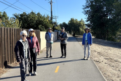
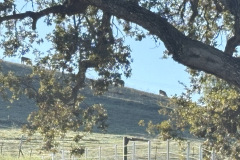
Nine hikers gathered at corner of Ish Dr. and Tapo St. near the Arroyo Simi Greenway. We walked south on Tapo Street a short distance, crossed a bridge over the Arroyo Simi. and continued south along Tapo Street until it curved to the west and its name changed to Guardian Street, then soon passed by the impressive relatively new Rancho Simi Recreation and Park District Activity Center. We continued westward through a surprisingly pleasant wooded “industrial” area where we could see cows grazing to the south in the Brandeis-Bardin Campus of American. We continued on to Tapo Canyon Road where we turned north until we passed over its bridge over the Arroyo Simi.
show more
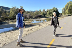
We then turned westward and followed the newly paved (a year ago) Arroyo Simi Greenway (bike and walking path) until we reached Sequoia Avenue. We then headed south on its bridge over the arroyo to the Vista Del Arroyo Park on Chicory Leaf Place with the adjacent (well-appreciated) Arroyo Simi Equestrian Center Restroom. After resting a while at the park, we continued on the south side of the Arroyo Simi to Royal Ave. There we crossed over the Arroyo Simi and headed back eastward on the north side of the Arroyo to and followed the Simi Greenway back to Tapo Street. Along the way we saw quite a few birds; snowy egrets, great white herons, rock doves (pigeons), hummingbirds, a red tail hawk and others. We returned to our motor vehicles, having completed a 4.5-mile hike with a whopping 164’ of elevation gain/loss on a beautiful morning.
show less
November 12th – Las Llajas Canyon to The Abandoned Coquina Mining Operation
9 hikers met at the trailhead on Evening Sky Drive on a pleasant morning with high overcast clouds. We began our hike by descending a short-paved section of road into the canyon bottom; from there we followed the wide well-graded dirt road upstream 1.8 miles to the north, crossing the dry stream bed three times. We then followed a “use” trail (the remnants of an old mining road) as we climbed up the eastern slope of the mountain, atop which we enjoyed panoramic views of the surrounding area including parts of Chivo Canyon, Las Llajas Canyon, and the Santa Susana Mountains.
show more
We took a break when we reached our goal, the site of a coquina (a soft whitish limestone formed of broken shells and corals cemented together and used for road building) mining operation. Various mining equipment artifacts are strewn about near the mining site, most notably a P&H Model 206 shovel. We encountered no other hikers during the first half of our hike (the uphill part) but we saw some bicycle riders and a few hikers during the return part of the hike. The vegetation on the hillsides was dry, though there was some grass starting to grow. We spotted a red-tailed hawk perched in the distance and of course quite a few unidentified birds here and there. We returned to our vehicles having completed a pleasant 6.23-mile hike with about 1,073’ of elevation gain/loss.
show less
November 5th – Hummingbird Trail to Rocky Peak Fire Road and Back
4 hikers met at 7:30 AM at the trailhead next to the paved parking area just outside the gated entrance to Hummingbird Ranch at the north end of Kuehner Drive in Simi Valley to hike up the Hummingbird Trail (and back). The weather was perfect, cool and overcast, as we began our 2.4-mile eastward climb to the Rocky Peak Fire Road. It wasn’t long before we were passing through (and on) a variety of imposing sandstone rock formations along the way including very large boulders and giant slabs of sandstone rock, many with small “caves.” We had the trail almost entirely to ourselves thanks to our early start and the fact that it was a weekday. About a mile into the hike there was an unmarked trail going north that we decided to take to see if we could find the swing Cave. We didn’t go far, unsure if it was the right trail so we turned around and got back on the main trail.
show more
As we continued east and up, the trail was somewhat challenging to follow due to “bandit trails” that cut steeply through the pleasant original switchback trail. Nevertheless, we eventually reached the trail’s junction with the Rocky Peak Fire Road where we took a rest break before retracing our route to our vehicles. As we were coming down, two friendly hikers offered to show us the way to the Swing Cave. The trail, in spots, was not clearly defended and a little treacherous in places making us grateful for our adopted guides. Making it to the Swing Cave and back down to the trailhead, we completed a 6.33-mile out-and-back hike with about 1,762’ of elevation gain/loss on an exciting and adventurous hike.
show less
OCTOBER
October 22nd – Big Sky Trail Lollipop Loop
Seven hikers parked along Big Sky Place and met next to the empty waterfall at the entrance of the Big Sky neighborhood. The hike started north, on the sidewalk off Erringer Road on a slightly cloudy, overcast morning. The stream bed to the south was dry as we continued and went left at the trail junction for a counterclockwise loop. Reaching the summit of the first steep hill, the air was clear and the views were good. The hike continued on the north-south ridge east of the housing development. There we saw a lone coyote that didn’t seem to be bothered by us in the least. We enjoyed the views of the valley below and sections of different neighborhoods and surrounding hills, including Whiteface Mountain. At the highest point of our hike (1,463’) we could see the remnants of Lost Canyons Golf Course and where the CottonWood fire was from a few months ago. We were all enjoying the hike in friendly conversation as we made our way to the oak-lined streambed that runs through the Big Sky development. The hike was a pleasant 4.5-mile hike, with 875’ of elevation gain/loss.
October 15th – Challenger Park To Montgomery Trail and Long Canyon East
Four hikers met in the parking lot of Challenger Park in Simi Valley on a chilly autumn morning. Once we crested the first hill on the Challenger Park Trail, we warmed up nicely. After seeing a lot of deer tracks in the soft, heavily moistened trail, from the rain the previous day, we were relieved when the trail turned to hardened sand and stone. Turning south on the Montgomery Trail (dirt road), that was kind of muddy at first but as the trail steepened and rose higher, the trail dried out and the views became breathtaking. We had great views of Simi Valley and could see Bard Lake in the distance.
show more
show less
October 8th – Wildwood Neighborhood Park Lynnmere Trail Loop
Six hikers met at the trailhead in the Baseball Field Parking Lot at the junction of Avenida de Los Arboles and Canna Street in Thousand Oaks on a pleasant early autumn morning. We began our hike by crossing Avenida de Los Arboles to the east and descending into a tunnel under Avenida de Los Arboles. We then climbed some stairs and crossed Arroyo Conejo on a bridge; next we headed through a neighborhood to the Las Flores Trail which we followed to Lynn Road where we connected to the Lynnmere Trail which we followed west to the Wildwood Canyon Trail which we followed eastward back to Neighborhood Park.
show more
show less
October 1st – Devil Canyon to Johnson Motorway
Three hikers met at 7:30 AM at the starting point of our hike on Poema Place in Chatsworth on a cool morning. We began our hike by descending into the heavily shaded bottom of Devil Canyon where we followed the remnants of the Devil Canyon Motorway upstream as it frequently crisscrossed the dry streambed. After hiking 1.2 miles we came to a junction where an unmarked trail ascended, rather steeply to the west. The trail level out, connecting to the Santa Susana Pass Trail. After a short distance the trail ended at a paved road that eventually reached the beginning of the unpaved Johnson Motorway (once a toll road). The trail (an old dirt and sandstone roadbed) rose westward until it met a short “driveway” leading north to the ruins of the ranch house that was built by Ann and Neils Johnson who were the first English-speaking homesteaders in the San Fernando Valley; they had built their primary home in “Chatsworth Park” in the 1870’s.
show more
show less
SEPTEMBER
September 24th – Tapo Canyon Open Space Trail [T23] to Chivo Canyon
Nine hikers met at 7:00 AM in the dirt trailhead parking area for the Tapo Canyon Open Space Trail (T23) in Simi Valley on a pleasant morning. We began our hike heading northward along the nearly flat dirt road/trail that was partially shaded by high clouds. After a mile or so the road/trail rose steadily to a narrow pass and a dirt-road junction where we took a break and enjoyed the views of the “valley” before us and the rows of mountainous ridges to the northeast. Continuing, we turned right and began hiking the T23 loop, which took us along a dirt road/trail that led downward through oak woodland toward its eastern junction with itself where we saw a mule deer. We took the left fork and descended into Chivo Canyon where we looked at the now famous Simi Tar Pits. We retraced our steps to the T23 loop where we took the left fork and followed T23 through an oak woodland upward to the narrow pass (completing the loop) and then we returned to the original trailhead. We completed our pleasant outing having hiked 5.44 miles with a total elevation gain/loss of 793’ on a nice morning for hiking. We saw small patches of bombing plants including, seaside heliotrope, datura, telegraph weed and California fuchsia.
September 17th – Simi Peak from King James Court via China Flat
Four hikers began their hike at the China Flat trailhead on a nice early end-of-summer morning with intermittent breezes and lots of early morning shade (the day gradually became hotter but wasn’t very hot until the final downhill section of the hike). The trail was a steady rocky climb with switchbacks up Dead Cow Road on the south side of the mountain with interesting rock formations and expanding views to the south. A little way beyond the top of the old road we came to the China Flat Trail, descending into patches of oak trees, shrubbery of various types, and sprawling dry meadows.
show more
show less
September 10th – Santa Susana Pass State Historic Park Loop
6 hikers met at 7:00 AM in the dirt parking area along Lilac Lane at the upper end of the Chatsworth portion of the Stagecoach Trail in the Santa Susana Pass State Historic Park on a lovely cool cloudy (with a full moon showing in the sky late) summer morning [NOTE: The dirt parking area has been leveled considerably!]. We began our hike by following a short loop passing by a pond (with no water) near our starting point; we enjoyed beautiful eastward views. We then headed northeast into the park via the Mattingly Trail which we followed to the Upper Meadow Trail which led us to a rocky overlook of Chatsworth Park South and the surrounding area.
show more
show less
AUGUST
August 27th – Los Robles Trail via Oak Creek Trail Counterclockwise Loop
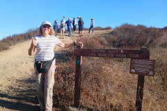
Eleven hikers met at the Los Padres Trail trailhead in Thousand Oaks early (7:00 AM) on a pleasant (but later in the day to be quite hot) summer morning. Since we were going to hike the loop counterclockwise, we headed west on Greenmeadow Avenue. Soon we reached the Oak Creek Canyon trailhead. Then we headed south up heavily wooded Oak Creek Canyon Whole Access Interpretive Trail which is available to equestrians, bicycles, hikers, wheelchairs, and disabled and blind individuals (there is a “guide cable”along a fence; it also provides signs in braille describing the environment; an English version of the signs accompanies each braille version). It was a very pleasant beginning of our hike.
show more
The scenic Overlook was the high point of the hike; from there the route was all downhill. We returned to the Los Robles Trail until we reached a connector trail to our left; we followed it downhill to its intersection with the Los Padres Trail (there’s a sign). We descended along it through a captivating canopy of various native shrubs and trees. We reached our vehicles having completed a very nice 3.94 mile hike with 686′ of elevation gain/loss.
show less
August 13th – Sapwi Park Chumash Indian Museum Double Loop
Six hikers met at 7:00 AM at Sapwi Trails Community Park off of Erbes road in Thousand Oaks, where the hike began. From The children’s play area, we went north east on an open space service road, over a bridge that crossed a small creek bed. The service road passed by some old growth coast live oaks and a BMX race track. As we continued hiking east, we passed a flood control dam adjacent to the Sapwi Trails Disc Golf Course. The trail then followed the flood control basin, eventually emerging onto Westlake Blvd. There we crossed the street and followed Lang Ranch Pkwy, through Lang Ranch Neighborhood Park, then to the end where Albertsons Fire Road starts. We then followed the Fire Road for about a half mile to a trail that drops down leading through the Chumash Indian village and Museum. We enjoyed the birds, rabbits, summer atmosphere, and each other’s company, then headed back the way we came. It was a pleasant 5.1-mile hike with 434 ft. elev. Gain/loss on a great summer morning.
August 6th – Santa Rosa Valley to Paradise Falls
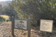
9 hikers met in a dirt parking area on the left (east) side of Hill Canyon Road in Santa Rosa Valley Park. The hike began by crossing a 25-foot-wide bridge over the Conejo Creek, on a typical summer morning. Then South from there, hiking along the Hill Canyon dirt road for 0.8 miles to a junction going east, there is a nameless spur trail leading down to Conejo Creek for a great closeup view of the Creek. After looking at the creek, we then made our way a short distance up to “Five Points” where we continued southeast a short distance turning southwest (right) to the Conejo Canyons Bridge near the Hill Canyon Treatment Plant Wetlands. We walked along the Hill Canyon Fire Rd. a short distance until we reach Lizard Rock Trail and follow it alongside the treatment plant fence 0.3 miles reaching Arroyo Conejo Trail. Then continuing on to Paradise Falls, the shady trail alongside Arroyo Conejo was quite the treat for a summer hike. We returned the way we came, grateful for a pleasant 5.7-mile hike, with 395’ of elevation gain/loss.
JULY
July 30th – Rincon Beach County Park to Tar Pits Park Loop
6 hikers met at the Rincon Beach County Park parking lot after carpooling from the Donut Delite in Simi Valley, on a gorgeous sunny morning. Our hike began by hiking the trail leading to Rincon Bluffs Preserve, with a great view of a blurry beach below breaking through the morning haze. Crossing the railroad tracks to an unmarked trail, going up for a few hundred feet and continuing west in the Rincon Bluffs Preserve, there were some belladonna lilies, verbena, tarweed and fennel among the dry shrubbery. The trail turned into a well maintained, irrigated walking path behind an industrial complex, complete with scenic lookouts. The walking path ended at a baseball field, with restrooms, where the Carpinteria Bluffs Trail connects.
show more
show less
July 23rd – Mt. McCoy to the Reagan Presidential Library
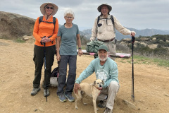
Six hikers gathered at 6:30 AM at the Donut Delight parking lot on a cool overcast morning. We crossed Madera Road, walked the short distance to the west end of Royal Avenue and then headed up Washburn Street to the trailhead. We began our climb up the trail’s many switchbacks, stopping periodically to view Simi Valley below. Upon reaching the cross at the top of Mt. McCoy, we stopped for a short break and met a couple of old friends, Ingrid and Hermon. After taking a short break and a group picture, we headed toward the presidential library, passing the nearby water tank and then following the service road to Presidential Drive which we followed up to the library. As we were going up the sidewalk, we admired quite a bit of milkweed growing along the side of the walkway and noticed there were monarch butterfly caterpillars munching away on the milkweed. There was also a tarantula wasp feeding on the milkweed flower nectar. Reaching the Presidential Library, we wandered around the library grounds for a while enjoying the gardens and décor and then turned back.
show more
show less
July 16th – Long Canyon and Lang Ranch Open Space Clockwise Loop
11 hikers met at 6:30 AM in the Long Canyon Trail parking lot in Wood Ranch on a perfect summer morning. Upward the hike began, along the Long Canyon Trail to the Lang Ranch Open Space where we stopped and regrouped for a short break. We then followed the Sunrise Trail eastward to the Long Ranch Ridge Trail south to the Rocky Incline Trail. Then we followed a connector trail to the Long Ridge Trail which led us to an entrance into the eastern end of the pleasant heavily-wooded area that contains the Chumash Interpretive Center portion of the Oakbrook Regional Park.
show more
show less
July 9th – Devil Canyon to Browns Canyon Road
Four hikers met at 6:30 AM at the starting point of our hike on Poema Place in Chatsworth on a summer morning. We began our hike by descending into the heavily shaded bottom of Devil Canyon where we followed the remnants of the Devil Canyon Motorway upstream as it frequently crisscrossed the dry streambed. We zigzagged our way down the trail until eventually we reached the large check dam at the junction with the mouth of Ybarra Canyon (which extends north to the Regional Park at Joughin Ranch). This first part of our hike led through a mostly heavily shaded environment bordered with interesting rock formations, and quite a bit of poison oak.
show more
show less
July 2nd – Big Sky Trail Lollipop Loop
Nine hikers parked along Big Sky Place and met next to the empty waterfall at the entrance of the Big Sky neighborhood. The hike started north, on the sidewalk off Erringer Road on a pleasantly overcast summer morning. The stream bed to the south was dry as we continued and went left at the trail junction for a counterclockwise loop. Reaching the summit of the first steep hill, the pleasant overcast had dissipated. We stopped to catch our breath and took a group picture. The hike continued on the north-south ridge east of the housing development. We enjoyed the views of the valley below and sections of different neighborhoods and surrounding hills, including Whiteface Mountain. At the highest point of our hike (1,463’) we could see the remnants of Lost Canyons Golf Course. There was some greenery though not many wildflowers, but we were all enjoying the hike in friendly conversation. We made our way to the oak-lined streambed that runs through the Big Sky development. Along the way we passed a few people walking their dogs as we finished our 4.5-mile hike, with 884’ of elevation gain/loss, on an enjoyable early-morning hike.
JUNE
June 25th – Chivo Canyon and Tapo Open Space Loop
Ten hikers met on Westwood Street in the Wild Horse Canyon housing development in northeastern Simi Valley on a mostly sunny morning. After a short walk to the mouth of nearby Chivo Canyon we began hiking northward for about 0.7 miles, passing some abandoned mining equipment and a local oil seep. Reaching a trail junction, we turned left (west) and began hiking a short distance on a fairly well-maintained connector trail until coming to the east junction of the Tapo Open Space Loop Trail. Taking the right fork, there were trees and shrubs that gradually thinned to drying grass and mustard plants. The trail rose steeper until we came to the high point of our hike, where we took a short break and enjoyed the views.
show more
There weren’t too many blooming flowers. There was always the faithful summer flower, datura, some milkweed, California buckwheat and caterpillar phacelia. Nonetheless, we had a great time.
show less
June 11th – Wildwood Park: Mesa Trail, Stagecoach Bluff Trail, Lizard Rock Trail, Paradise Falls, Wildwood Canyon, Indian Creek Trail Loop
Eight hikers and 1 dog met at 7:00 AM at the main Wildwood Park parking lot at the west end of Avenida De Los Arboles in Thousand Oaks. The parking lot was nearly empty when we arrived, on a densely overcast morning. Happy to see old and new friends, we began our counterclockwise loop hike by heading west on the Mesa Trail. Soon we turned left (south) and hiked a short distance on the Tepee Trail until turning right (west) when we came to the Stagecoach Bluffs Trail which rose steadily uphill with hazy views of the hillsides dotted with prickly pear cactus.
show more
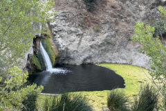
We then headed upstream into heavily shaded Wildwood Canyon. The trail crossed crystal clear flowing water several times on short wooden bridges. When we reached Hoegeman’s Hollow, there were several picnic tables (and bathrooms). We took a short break then continued upstream to Paradise Falls where we enjoyed looking at and listening to the waterfall. Continuing on up Wildwood Canyon we eventually reached the always pleasant Indian Creek Trail and followed it up to a short unnamed trail that led us back to our vehicles, thus completing a very pleasant 4.8-mile hike with about 850’ of elevation gain/loss. Flowering plants photographed were; Heart Leaved Penstemon, watercress, yerba mansa, bladderpod, chalk dudleya (live-forever) and castor bean.
show less
MAY
May 28th – Los Robles Trail via the Los Padres Trail and Oak Creek Double-Loop
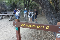
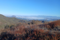
Six hikers met at the Los Padres Trail trailhead in Thousand Oaks on a May Gray morning, perfect for hiking. We began our hike through a very pleasant oak woodland into the hills south of Thousand Oaks. This initial stretch of trail with its many oak trees and other flora provided a peaceful experience (there was even a short stretch of barely flowing water in the creek). When we reached a dirt access road, we followed it up to its junction with the Los Robles Trail (the primary trail in Thousand Oaks). Upon reaching the trail junction, we headed west on the Los Robles Trail but soon turned right onto the “Scenic Loop” trail which led us to the Conejo Valley Scenic Overlook where there was not much of a view because of haze. After stopping to take a short break we continued on along the Los Robles Trail as it descended to a junction with a connector trail that led us to the upper (south) end of the Oak Creek Canyon Loop Trail.
show more
After hiking the heavily shaded western section of this loop we walked a short distance eastward along Greenmeadow Avenue to the (partially shaded) eastern section trailhead and hiked back up to the connector trail that led us to the south end of Moorpark Road. We returned to our vehicles about a block away and returned home invigorated, having completed a 4.4-mile hike with 744’ of elevation gain/loss.
show less
May 21st – Santa Rosa Valley Park (Conejo Canyons Open Space)
Four hikers met in a dirt parking area on the left (east) side of Hill Canyon Road in Santa Rosa Valley Park. The hike began in cool shade, crossing a 25-foot-wide bridge over the Conejo Creek, walking at a brisk pace until the sun creeped over the top of the mountains to the east. Hiking along the Hill Canyon dirt road for 0.8 miles to a junction going east, there is a nameless spur trail leading down to Conejo Creek for a great closeup view of the Creek. After looking at the creek, we then made our way a short distance up to “Five Points” where we continued southeast a short distance turning southwest (right) onto the Hawk Canyon Trail, a narrow trail leading through a dense riparian woodland. The shaded canyon trail runs along a seasonal feeder stream, presently nearly dry, to the Western Plateau dirt Road. Turning east (right) the road steadily rose to Conejo Center Drive, passed the impressive Thousand Oaks Municipal Service Center, and we made our way onto the Hill Canyon Fire Road (normally gated).
show more
show less
May 14th – East Canyon Up and Back
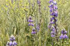
Three hikers met at the trailhead in the “East Canyon, Rice Canyon, and Michael D. Antonovich Open Space” section of the 4,000-acre Santa Clarita Woodlands Park via Interstate 5 and “The Old Road” in Santa Clarita. The sun was shining and the air was fresh and pleasant. The hike begins southward along the partially maintained East Canyon Motorway, following a small creek in the canyon bottom. The route was lined with bay laurel, healthy black walnut, cottonwood, sycamore, and oak trees. Soon the dirt road began rising more steeply along the western side of a wooded ridge, yielding new growth and blooming plants that included, disk mayweed, sticky monkey flower, golden yarrow, common vervain, winecup clarkia, caterpillar phacelia, lupin, Chinese houses, fiesta flower, California poppy. We enjoyed views of the steep slopes to the west and relics of the Bigcone Douglas-fir trees that once covered the mountain.
show more
show less
May 7th – Porter Ranch Loop
Five hikers met at 7:30 AM at the Aliso Canyon Trail trailhead just below Porter Ridge Park at the east “end” of Sesnon Blvd at the north end of Reseda Blvd in Porter Ranch. It was a welcoming cool and cloudy morning as we began our clockwise-loop, dropping down into Aliso Canyon and followed the recently widened dirt trail southward toward Rinaldi Street. The trail has been repaired after being damaged by heavy rains in recent years, by repositioning a large drainage pipe (culvert) and grading over where the trail passes over the Aliso Canyon creek. The trail nearly leveled and became surrounded with large oak trees, always a favorite part of the hike. Not far from the Aliso Canyon Park parking lot there was a trail junction; we turned right and started heading northeast following the well-defined connector trail that led somewhat steeply upward to Eddleston Park at Reseda Blvd. Crossing to the west side of Reseda Blvd, we hiked northward a short distance on an unnamed trail to the eastern trailhead for the Palisades Trail which we followed westward. The wide well-maintained Palisades Trail provided views of the surrounding area mainly to the south.
show more
show less
APRIL
April 30th – Sapwi Park Chumash Indian Museum Double loop Double Loop
Six hikers met at 7:30 AM at Sapwi Trails Community Park off of Erbes road in Thousand Oaks, where the hike began. From The children’s play area, we went north east on an open space service road, over a bridge that crossed a small creek. The road was surrounded with trees, lush green grass, flowers and rabbits and birds. As we continued hiking east, we passed a flood control dam adjacent to the Sapwi Trails Disc Golf Course. The trail then followed the flood control basin, eventually emerging onto Westlake Blvd. There we crossed the street and followed Lang Ranch Pkwy, through Lang Ranch Neighborhood Park, then to the end where Albertsons Fire Road starts. We followed the Fire Road for about a half mile to a trail that drops down leading through the Chumash Indian village and Museum.
show more
show less
April 23rd – Corriganville Santa Susana State Historic Park Double Loop
Seven hikers met at 7:30 AM at Corriganville at the east end of Simi Valley on a pleasant overcast morning. We began our hike south of the railroad tracks on the old Lower Stagecoach Trail, going east until we reached the Santa Susana Pass Road opposite the north end of Lilac Lane. We then followed Lilac Lane, seeing quite a few scrub jays and quail, to the Stagecoach Trail kiosk. Located at the upper end of the Chatsworth portion of the Stagecoach Trail in the Santa Susana Pass State Historic Park (SHP).
show more
The overcast sky and cool temperature provided us with an enjoyable hike, seeing trees and plants and flowers, such as; purple nightshade, wishbone bush, various lupin, western wallflower, fiddleneck, yerba santa, sticky monkeyflower and a southern umbrellawort.
show less
April 16th – North Ridge Trail, Chumash Park, Mt. Sinai Loop
Nine hikers met at 7:30 AM at the North Ridge Trail trailhead on Flanagan Dr. and Yosemite Ave. on a pleasant overcast morning. Our hike began as a narrow path, surrounded on both sides with a mixture of lush green grass, lupine and mustard. Continuing past Broken Arrow Street trailhead on the North Ridge trail until we reached Evening Sky Dr. There we walked to the end of the Dr. where there was a gate that opened to a trail that led through Chumash Park. Heading east the trail turned into an old dirt road that ran along the east side of Mount Sinai Cemetery. When the road leveled out we turned left (northeast) onto the remains of a dirt road leading into what was once Douglas White Oaks Park , but is now “A few crumbling stone foundations dotting a small canyon in northeastern Simi Valley,” all that’s left of what was once a 355-acre ranch property used by Douglas Aircraft Company as a recreation area for its employees. Coming back to the dirt road, we went southward to a point where we could turn right and head northwest alongside Mt. Sinai Drive to an unmarked trailhead a short distance west of the main entrance to the Mt. Sinai Cemetery. That trail led us northwest uphill to the Flanagan Rocks area. We crossed Flanagan Drive and walked down the sidewalk back to our vehicles, thus completing a 4.7-mile hike with about 687’ of elevation gain/loss, on a pleasant morning for hiking.
show more
show less
April 9th – Wildwood Neighborhood, Park Lynnmere Trail Loop
Eight hikers met at the Baseball Field Parking Lot, at the junction of Avenida de Los Arboles and Canna Street in Thousand Oaks. The hike began by crossing under Avenida de Los Arboles through a tunnel and walking through Wildwood Neighborhood Park. We then climbed some stairs and crossed Arroyo Conejo on a bridge; next we headed through a neighborhood to the Las Flores Trail which we followed to Lynn Road. Then we connected to the Lynnmere Trail, which we followed west to the Wildwood Canyon Trail. Crossed the Arroyo Conejo again and followed the trail eastward back to the Neighborhood Park.
show more
show less
April 2nd – Sage Ranch Loop
Three hikers met at the lower parking lot in Sage Ranch Park in the Simi Hills on a beautiful, chilly spring morning. The 625-acre park is located just north of the Santa Susana Field Laboratory (SSFL) (aka Rocketdyne/Boeing) at an elevation of 2,000’. The park is full of world-class sandstone rock formations, great for visualizing animal shapes and faces. To the north there is a side trail that will take you to a nice overlook that usually provides a sweeping view of Simi Valley. We continued hiking along the main Loop Trail enjoying, a lush green landscape and stopping to climb Sandstone Ridge (aka “Sugarloaf”). Eventually we reached the “detour” where the environmental cleanup effort is continuing. Turning onto the “detour” trail, leading us northward through the center of the ranch, the hike offered us more unique terrain.
show more
There were plenty of birds and some rabbits and a few flowering plants, such as; hairy ceanothus, hoaryleaf ceanothus, common fiddleneck, wishbone bush, wild cucumber, California everlasting, sticky monkeyflower, thick-leaved yerba santa, purple nightshade, poison oak, Bermuda buttercup and a large patch of padre’s shooting star.
show less
MARCH
March 26th – Chivo Canyon and Tapo Open Space Loop
Seven hikers met on Westwood Street in the Wild Horse Canyon housing development in northeastern Simi Valley on a cloudy morning. After a short walk to the mouth of nearby Chivo Canyon we began hiking northward for about 0.7 miles, passing some abandoned mining equipment and a local oil seep. Reaching a trail junction, we turned left (west) and began hiking a short distance on a fairly well-maintained connector trail until coming to the east junction of the Tapo Open Space Loop Trail. Taking the right fork, the trail began adorned with trees and shrubs. After passing a divinely decorated tree stump, the shrubbery thinned as the trail wound through a grassy dell, and gradually got steeper until it rose to the high point of our hike. There we took a short break and enjoyed the views.
show more
There were some blooming flowers along our hiking route that included (but not limited to) wishbone bush, tree tobacco, datura, California sunflower, sugar bush, western wallflower and a lot of prickly phlox. The surrounding hills were a splendid blend of deep green for a vastly enjoyable hike.
show less
March 19th – Big Sky Trail (lollipop loop)
Eight hikers met near the waterfall on Big Sky Pl. on a clear, breezy and cool morning. We walked northwards along Erringer, for about a ¼ mile until we came to the trailhead and turned east at the entrance to Big Sky Trail. After crossing the small stream and going a short distance to a trail junction, we went left for a clockwise loop. Going east, we enjoyed the fresh air, the new grass growth and sage brush coming alive after the recent rains. Soon we came to the Big Sky HOA service trail, with its shade trees and some shelter from a strong breeze. When the service trail ended, we began a hilly hike that gradually increased our views of the valley below and sections of different neighborhoods among the surrounding hills, including Whiteface Mountain. The trail was in good condition for a pleasant hike. At the highest point of our hike (1,463’) we could see the remnants of Lost Canyons Golf Course. From there going back to our vehicles was an enjoyable downhill trek. completing a 4.6-mile, with 800’ of elevation gain/loss hike.
FEBRUARY
February 19th – Long Canyon
6 hikers met at 8:00 AM in the Long Canyon Trail parking lot in Wood Ranch on a perfectly beautiful morning. The outing began by hiking up the Long Canyon Trail to the Lang Ranch Open Space where we followed the Sunrise Trail eastward to the Long Ranch Ridge Trail south to the Rocky Incline Trail. Then we followed a connector trail to the Long Ridge Trail which led us to an entrance into the eastern end of the pleasant heavily-wooded area that contains the Chumash Interpretive Center portion of the Oakbrook Regional Park.
show more
show less
JANUARY
January 29th – Mt McCoy
Eleven hikers and a cute dog gathered at 8:00 AM at the Donut Delight parking lot on a chilly [but wind-free] winter morning. We crossed Madera Road, walked the short distance to the west end of Royal Avenue and then headed up Washburn Street to the trailhead. We began our climb up the trail’s many switchbacks, enjoying our first opportunity to hike after the recent very strong winds and the resulting destructive wildfires in Los Angeles and Ventura Counties abated and the red-flag warnings stopped. Upon reaching the cross at the top of Mt. McCoy, we stopped for a short break. The sun was out and the morning had warmed up some. We enjoyed the views in all directions. Before long we headed toward the presidential library, passing the nearby water tank and then following the service road to Presidential Drive which we followed up to the library. After we took a lengthy break at the tables outside the library enjoying what had become a very nice morning, we began returning the way we came.
show more
show less
January 1st – Wildwood Park Loop
The early winter morning sky was a bright blue behind scattered high clouds when 14 hikers with 2 dogs met at 8:00 AM at the main Wildwood Park parking lot at the west end of Avenida De Los Arboles in Thousand Oaks The parking lot was nearly empty when we arrived (but completely full when we finished). We began our counterclockwise loop hike by heading west on the Mesa Trail. Soon we turned left (south) and hiked a short distance on the Tepee Trail until turning right (west) when we came to the Stagecoach Bluffs Trail which rose steadily uphill affording us with views of hillsides dotted with prickly pear cactus and soon we could look down into Wildwood Canyon below.
show more
We then headed upstream into heavily shaded Wildwood Canyon (which was noticeably chillier than the previous trails we had hiked). As we headed upstream we crossed flowing water several times on short wooden bridges. When we reached Hoegeman’s Hollow, there were several picnic tables (and bathrooms). We took a short break and continued on upstream to Paradise Falls where we enjoyed looking at and listening to the waterfall. Continuing on up Wildwood Canyon we eventually reached the always pleasant Indian Creek Trail and followed it up to a short unnamed trail that led us back to our vehicles, thus completing a very pleasant 4.8-mile hike with about 850’ of elevation gain/loss.
show less
