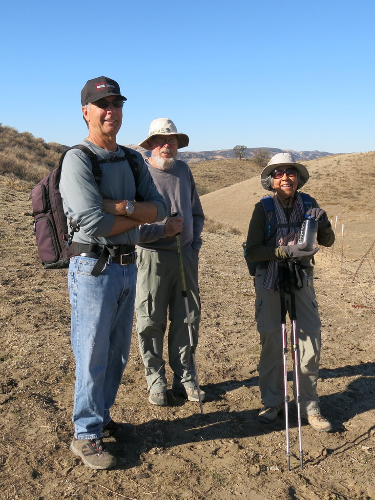
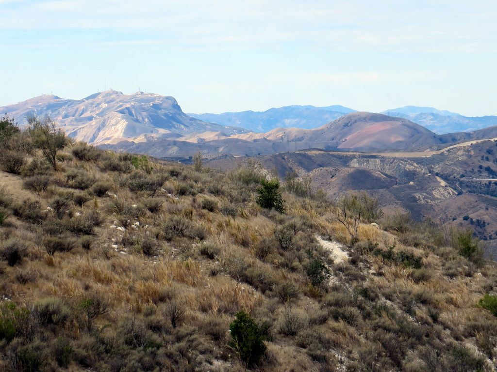
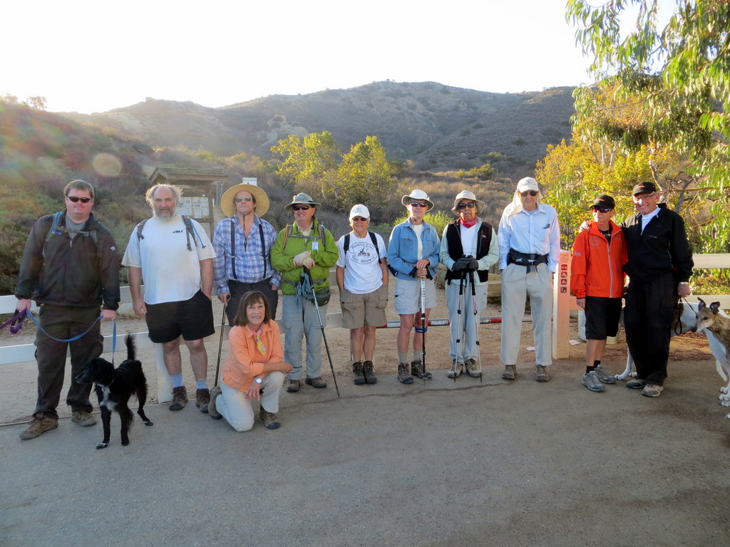
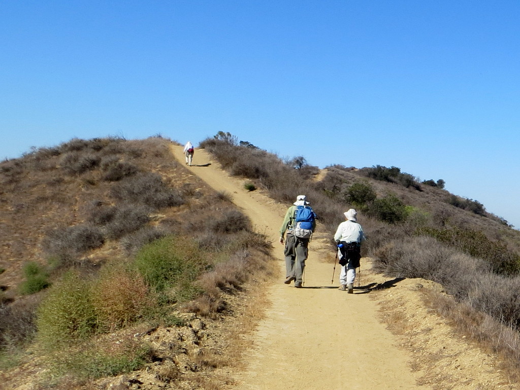
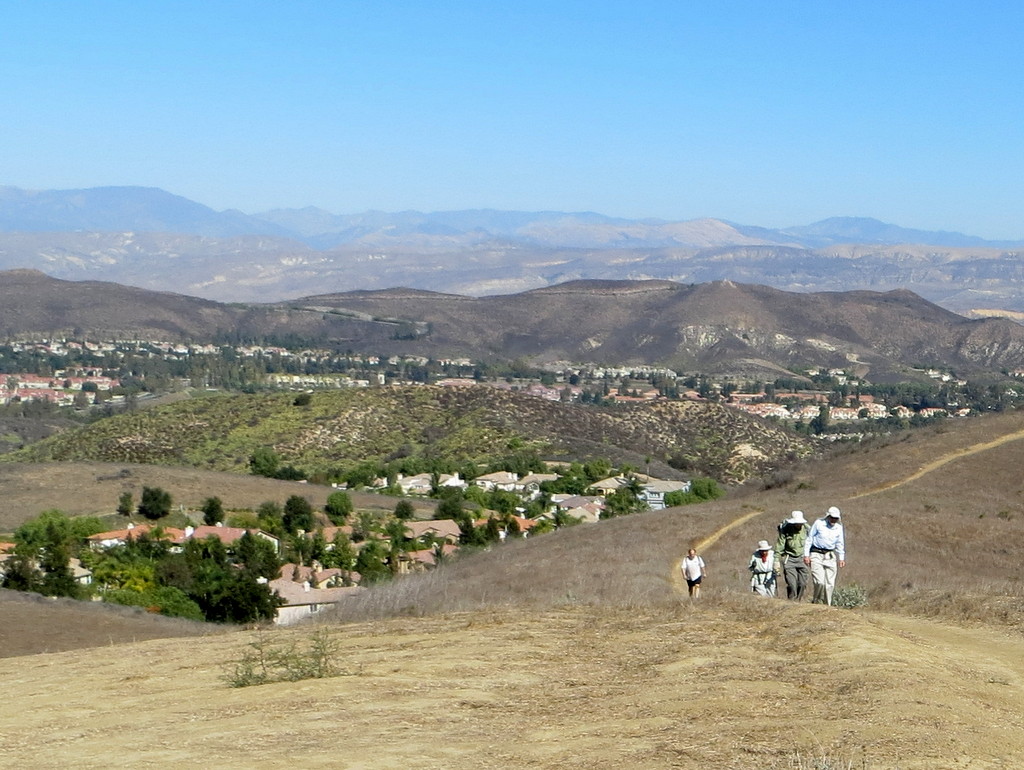
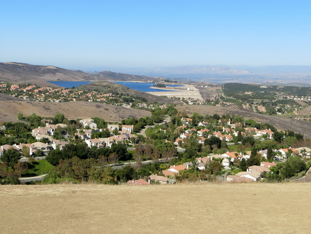
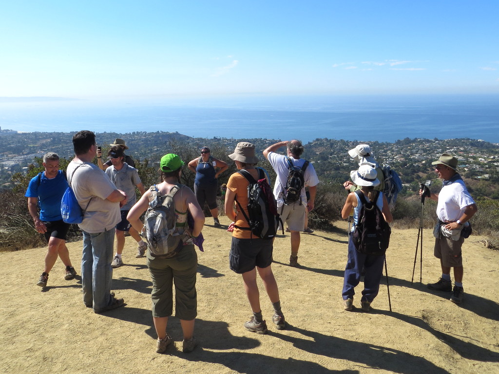
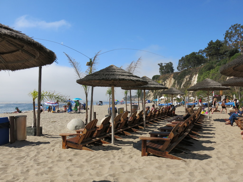
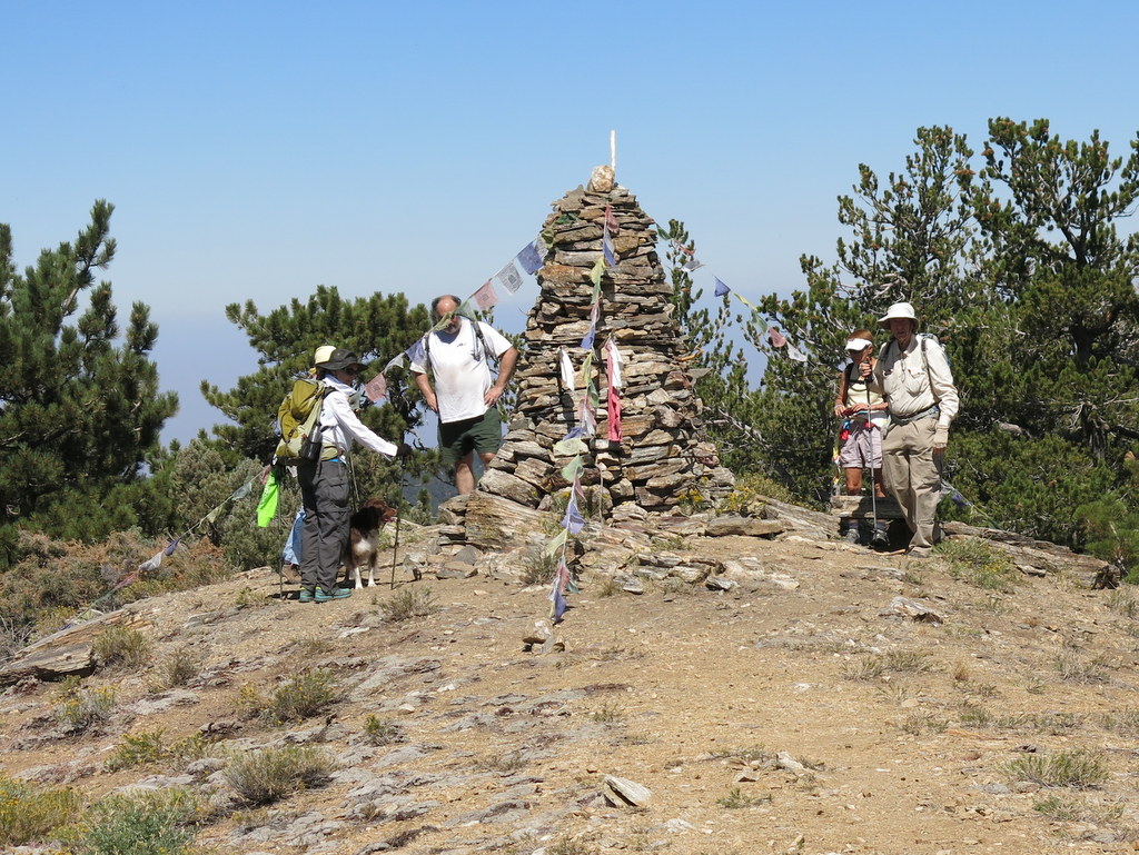
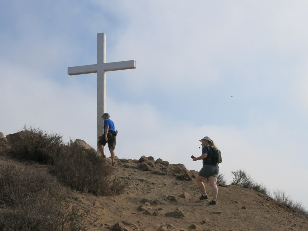
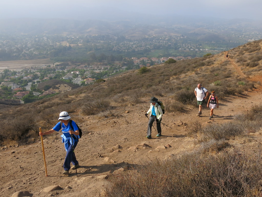
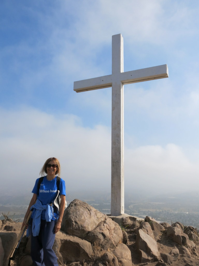
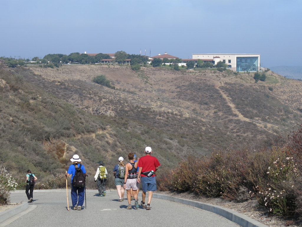
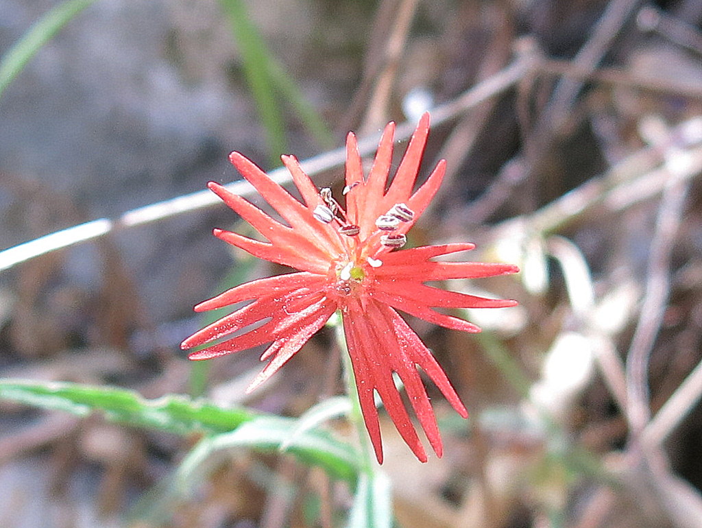
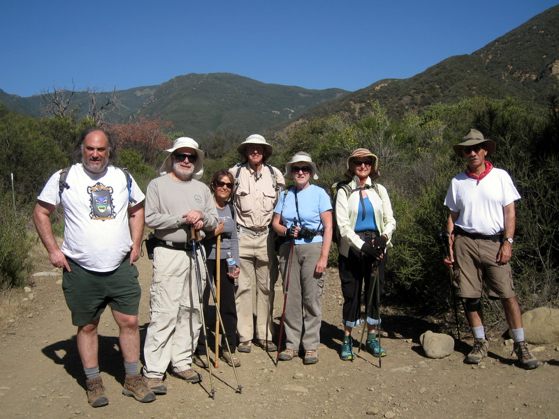
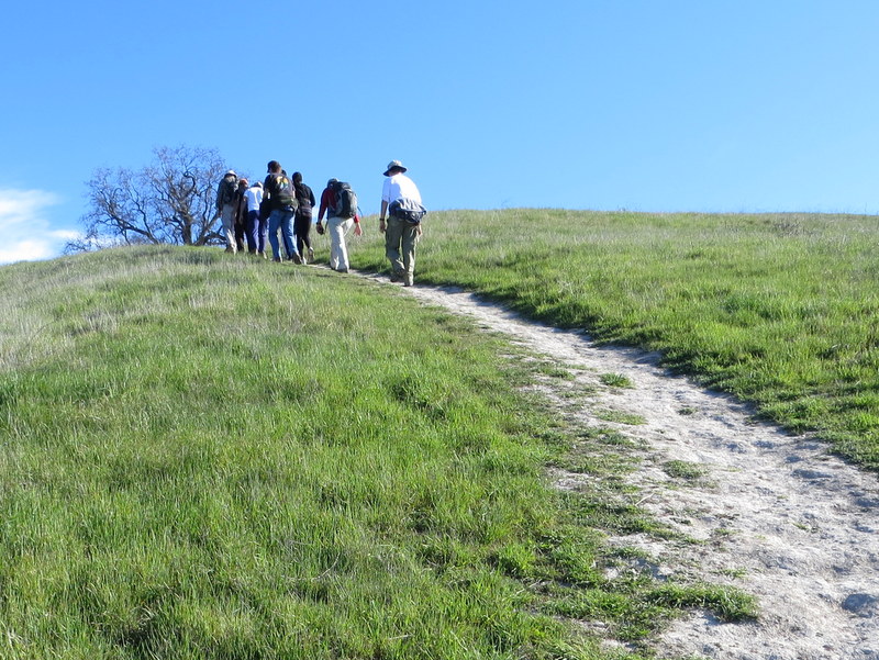
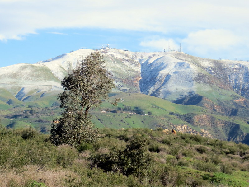
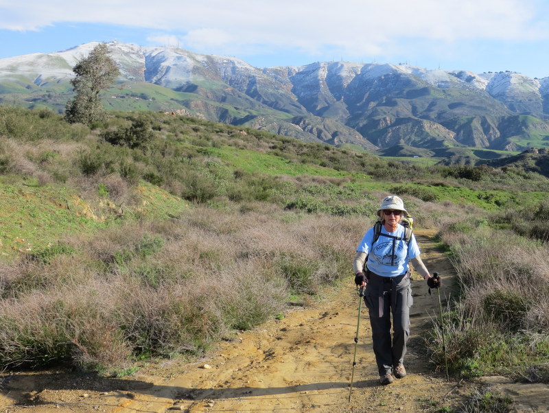
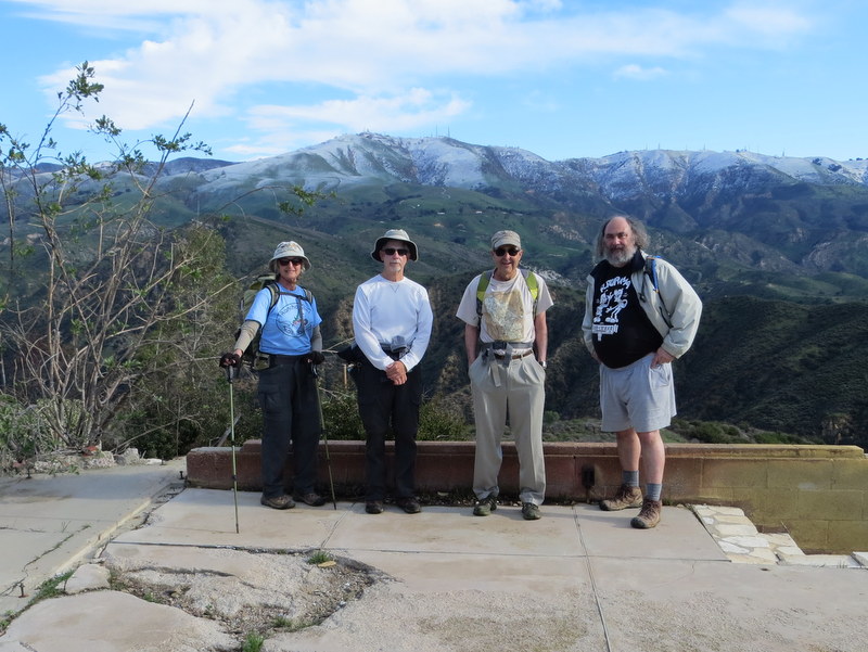
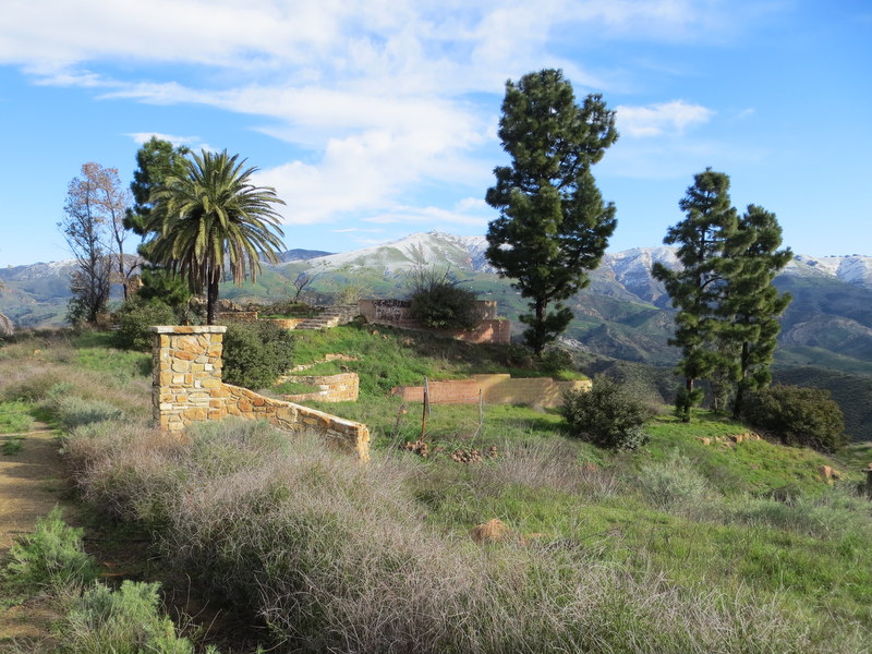
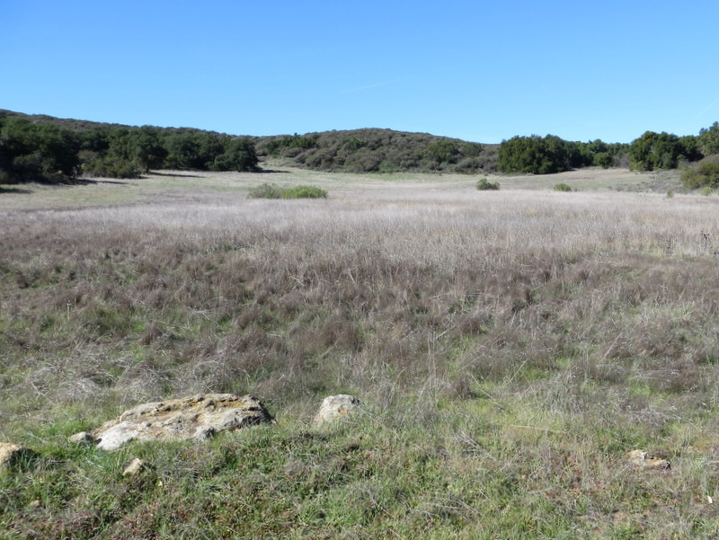
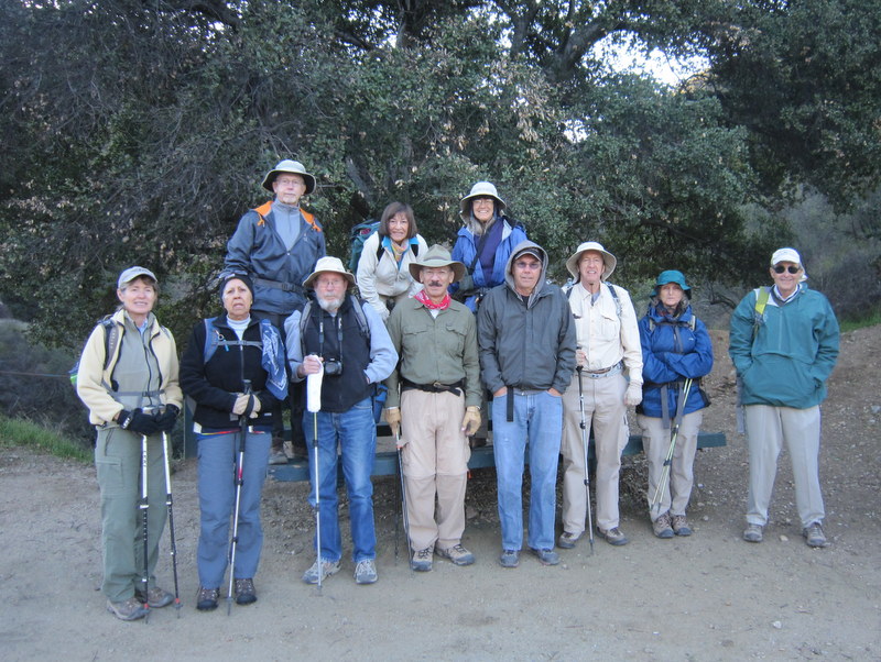
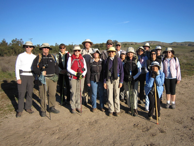
December 28th – Big Sky Loop
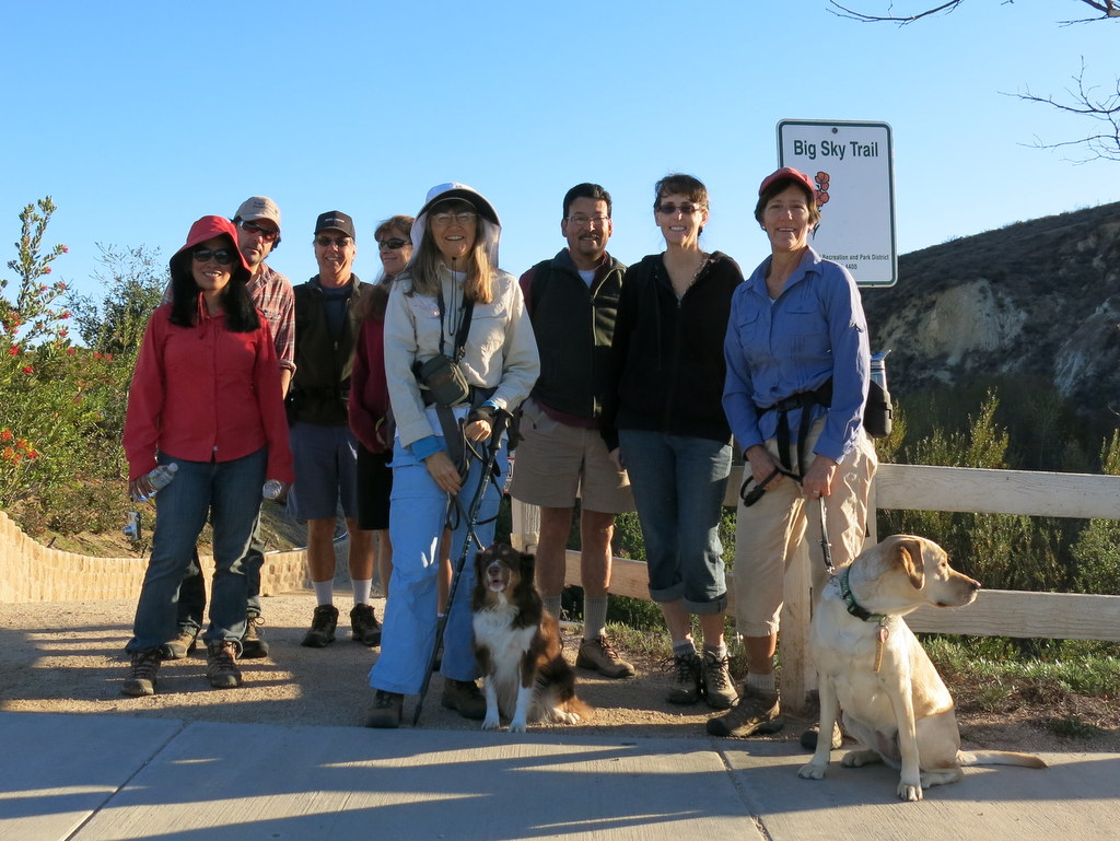
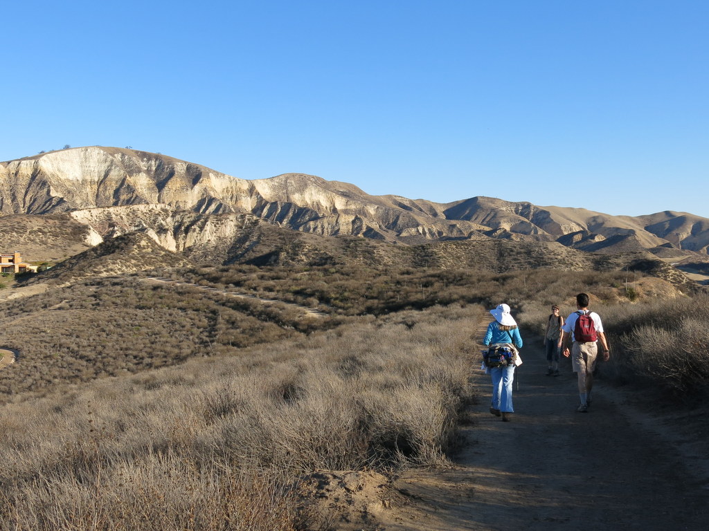
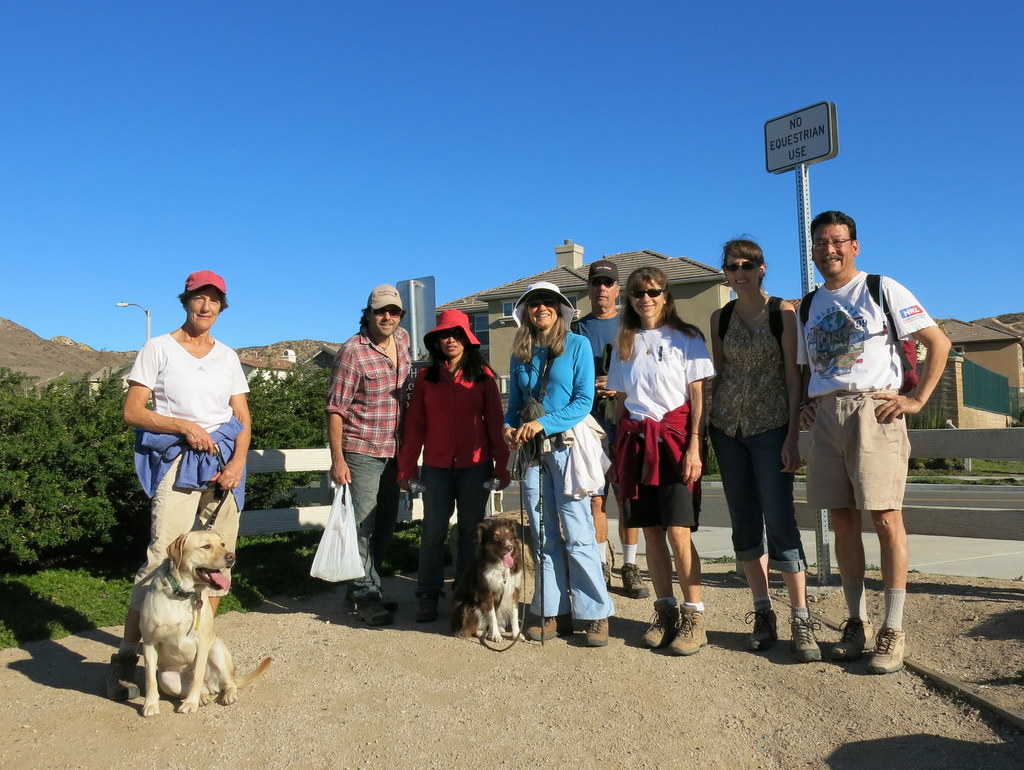
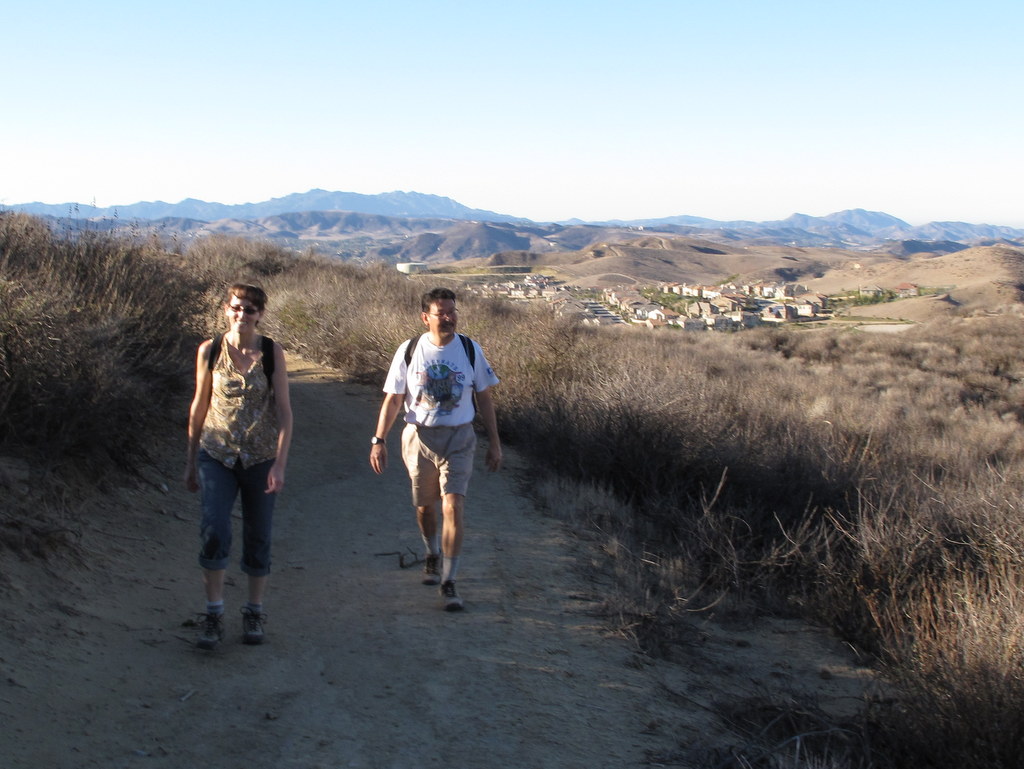
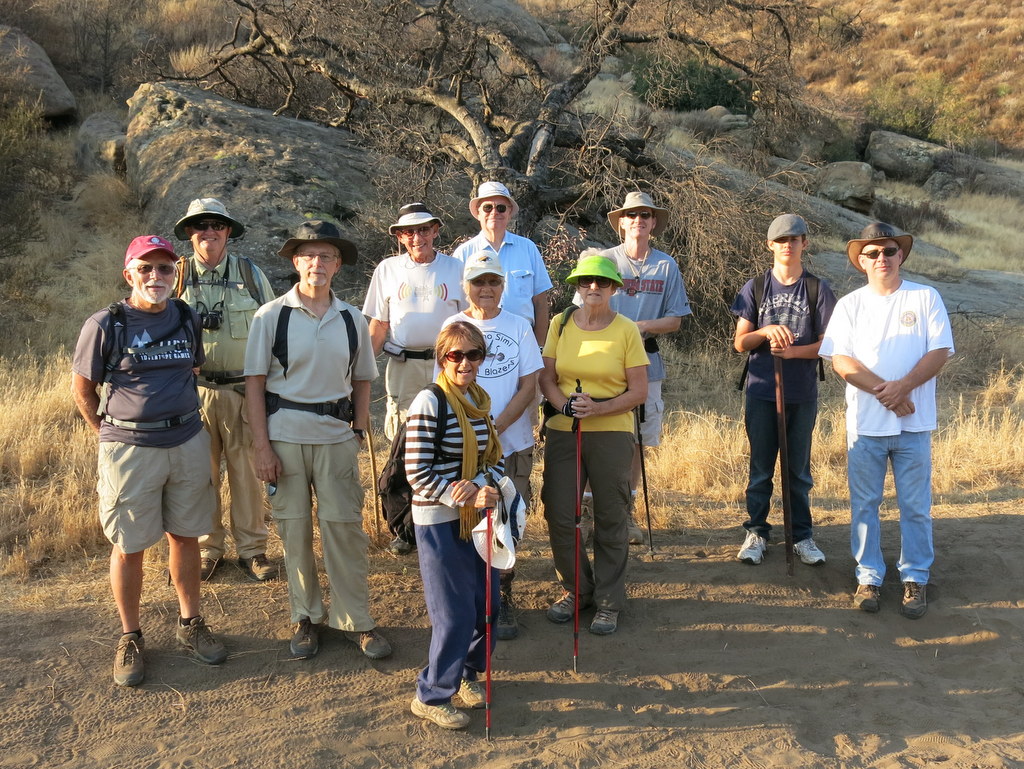
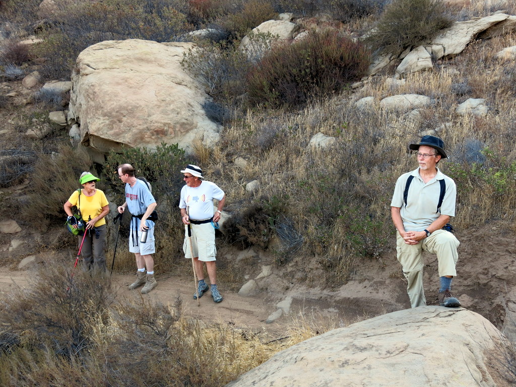
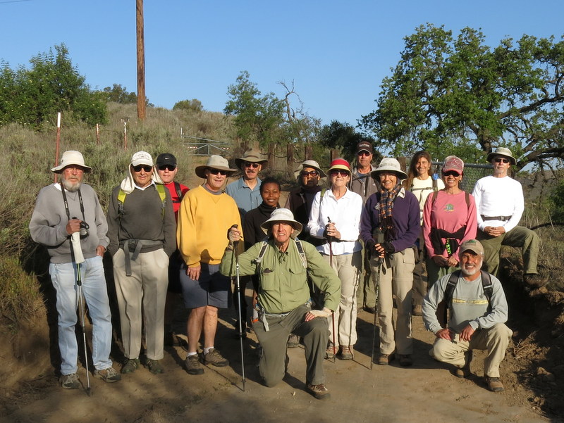
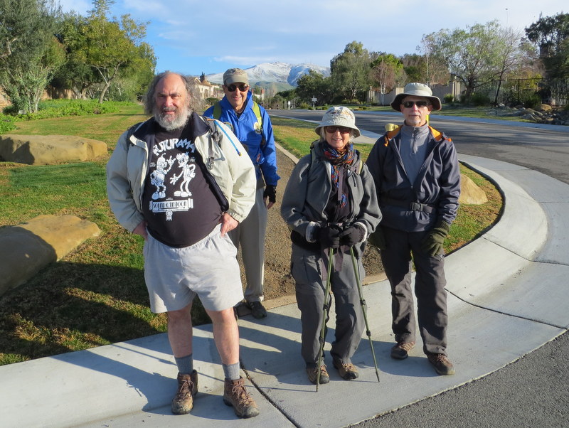
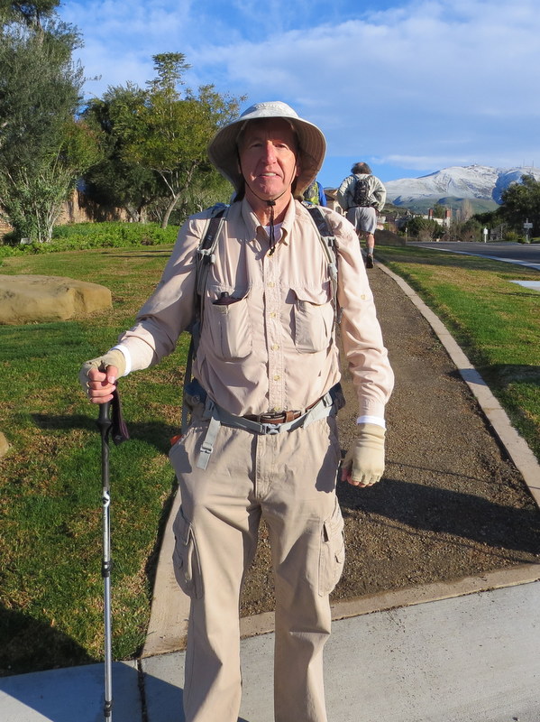
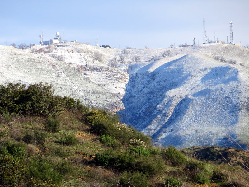
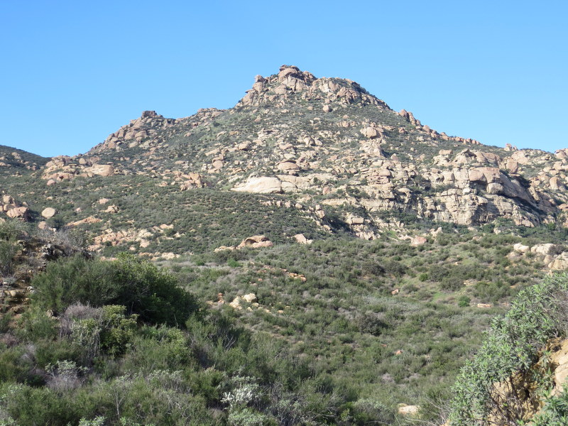
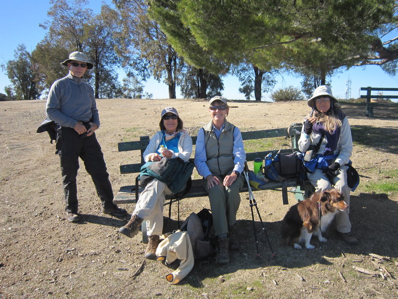
Nine hikers met at Big Sky Place at 8 AM this morning. The previous week was very windy, so it was a pleasure to hike on a cool and still morning. The recent Santa Ana winds left us with a very clear day, so we were rewarded with some fine views on the first half of the hike. Our hike took only two hours, so we finished in plenty of time to get on with the day’s activities. The loop was 4.5 miles, with 975′ of elevation gain.
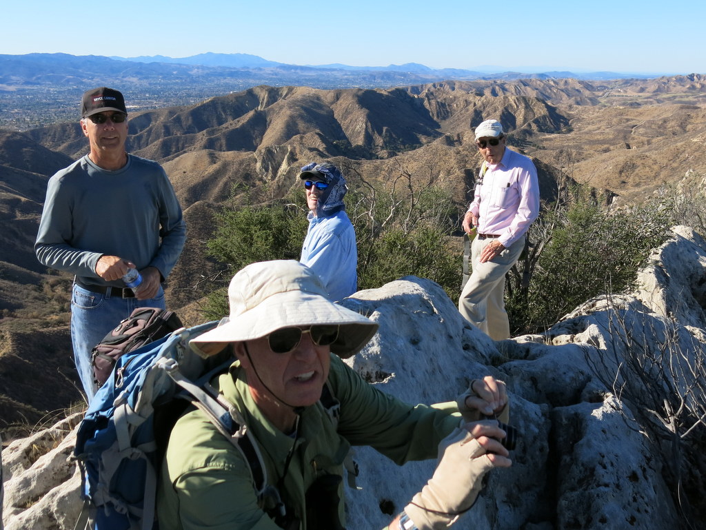
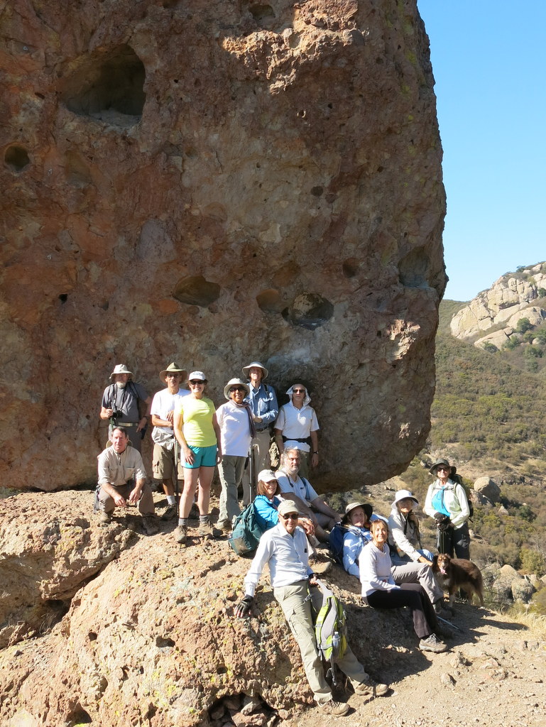
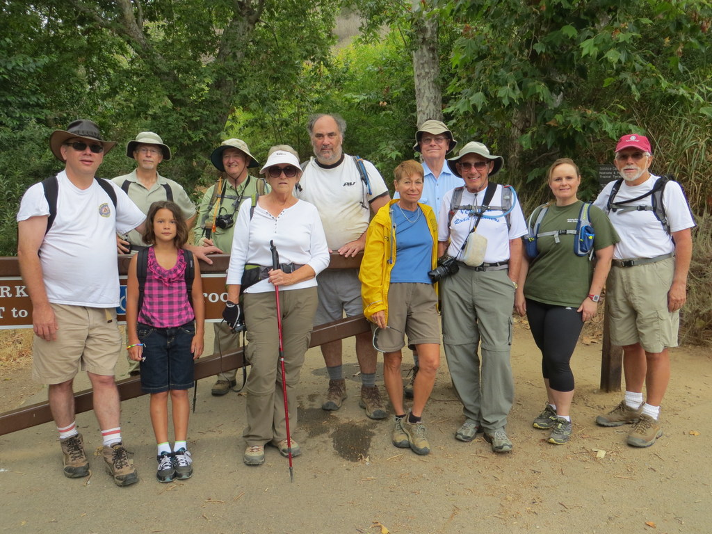
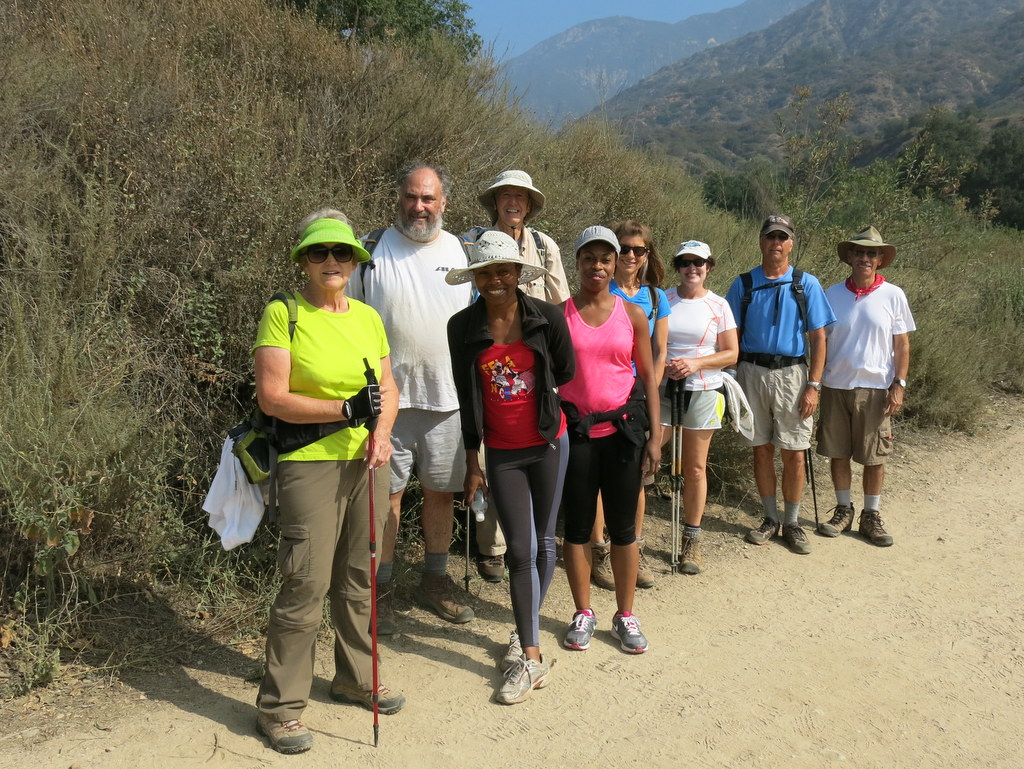
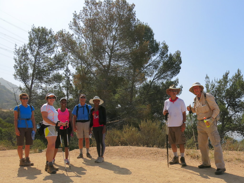
December 14th – Vasquez Rocks – Pacific Crest Trail
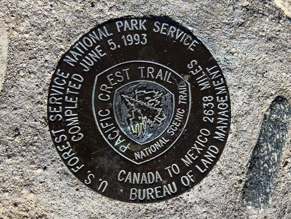
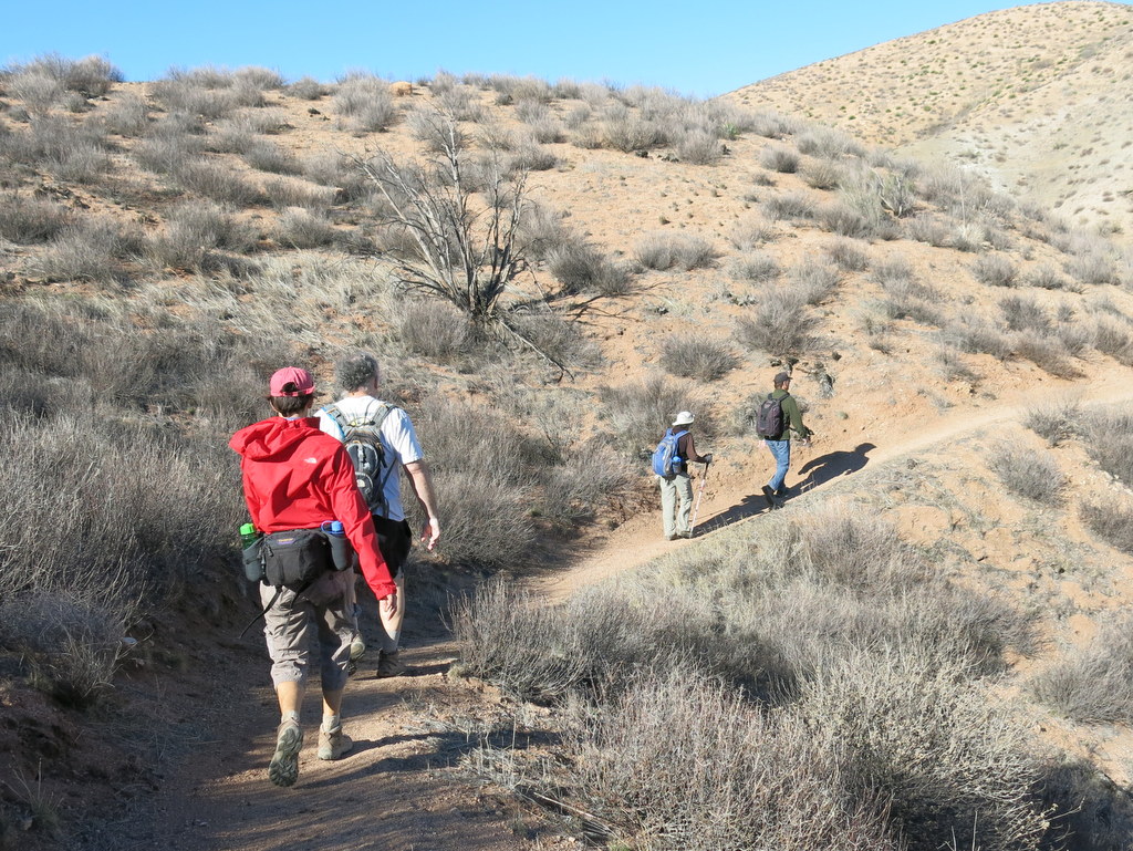
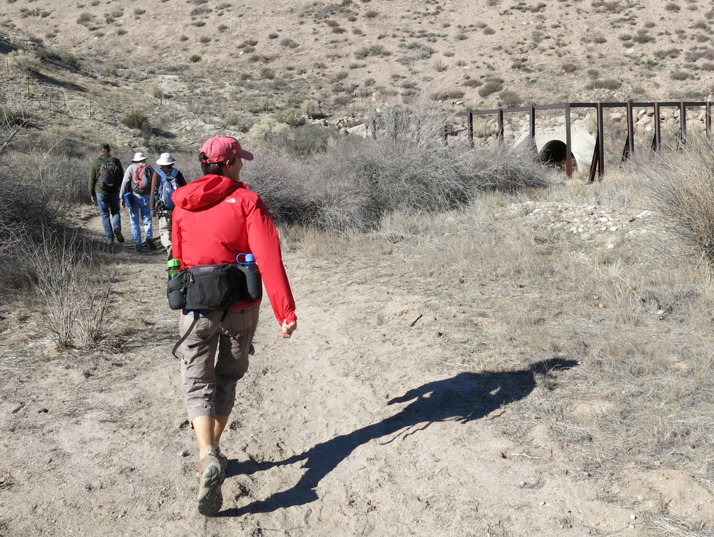
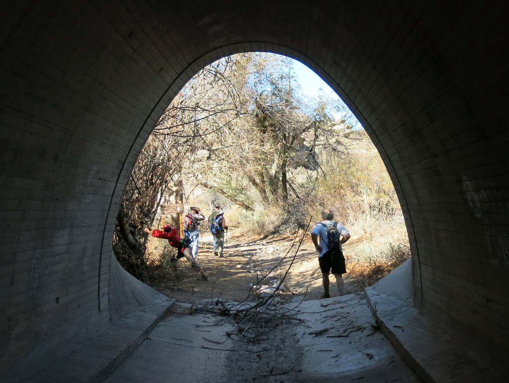
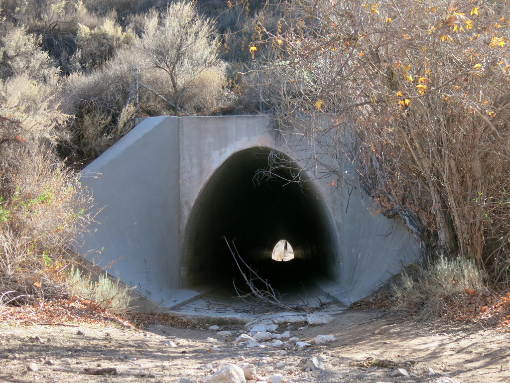
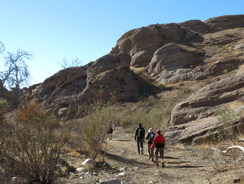
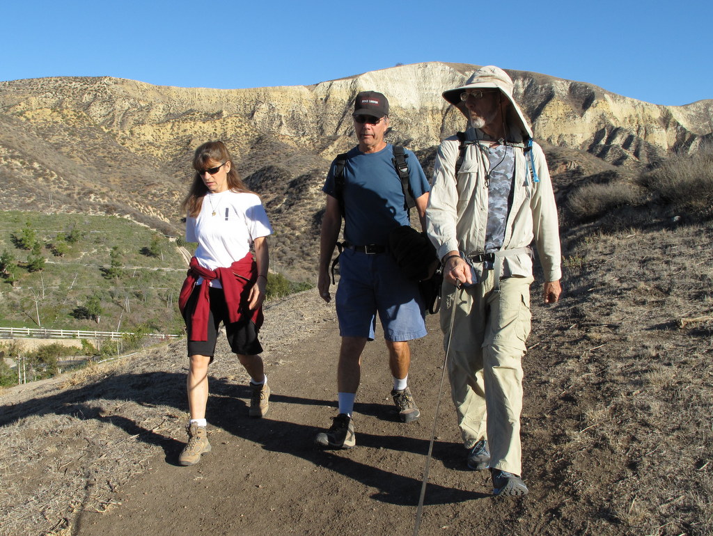
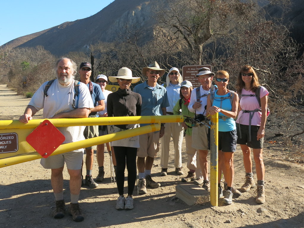
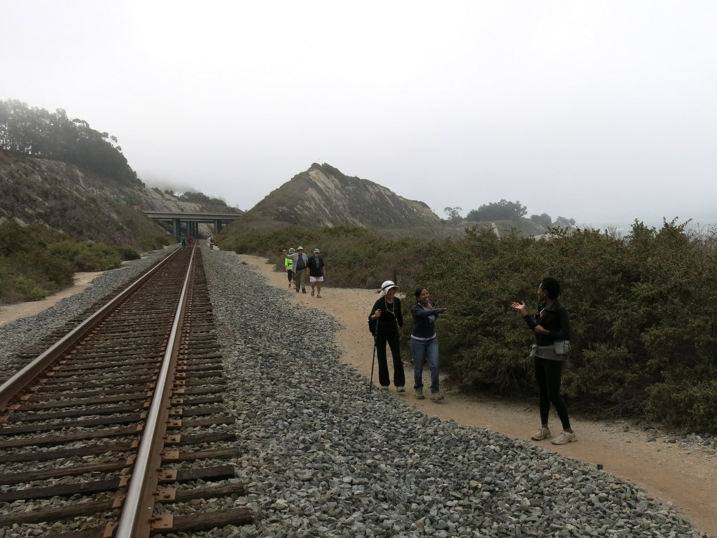
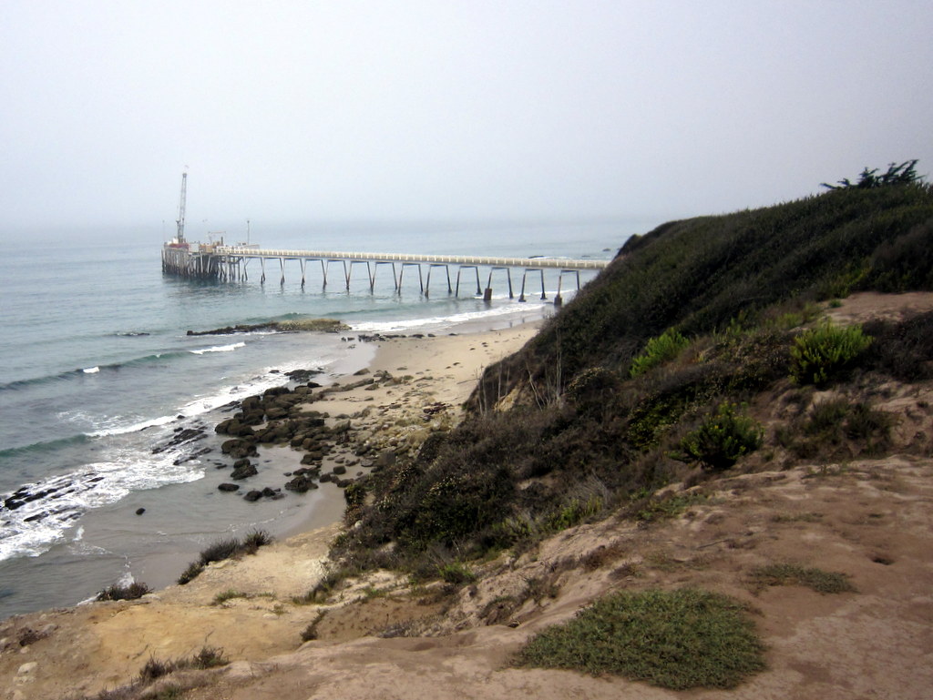
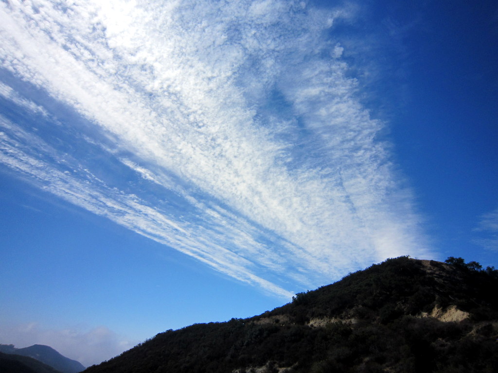
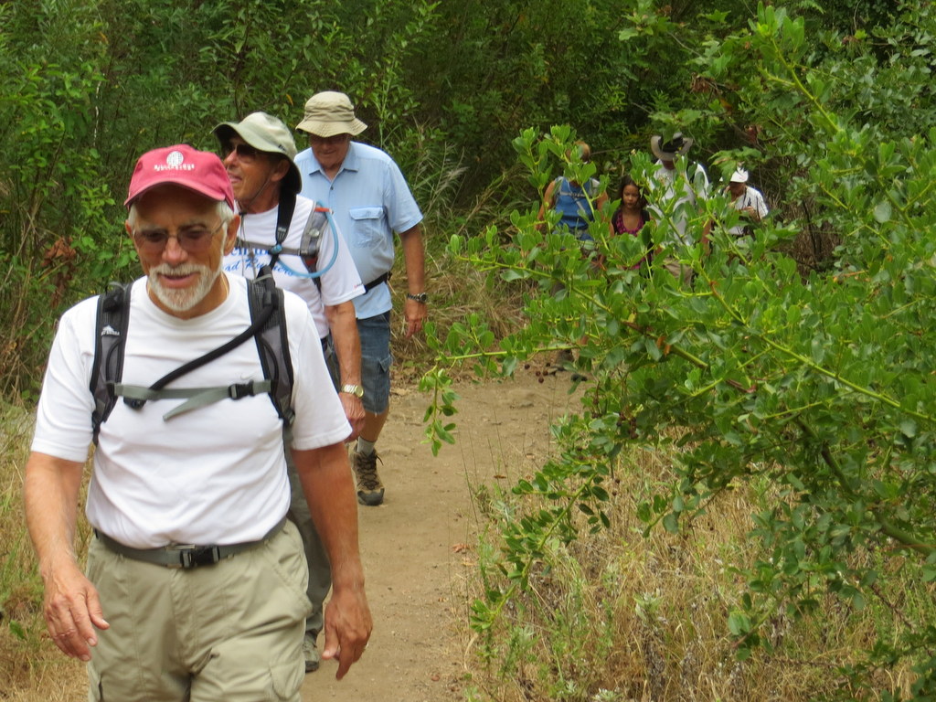
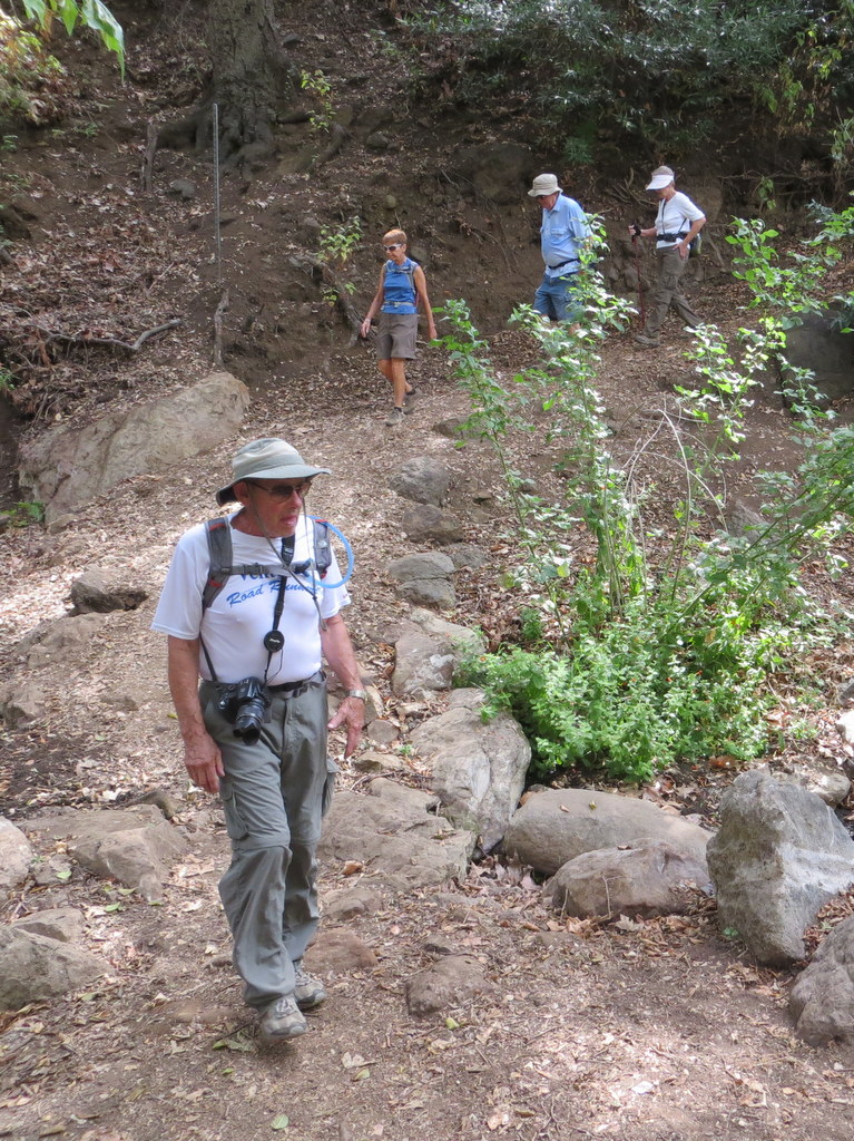
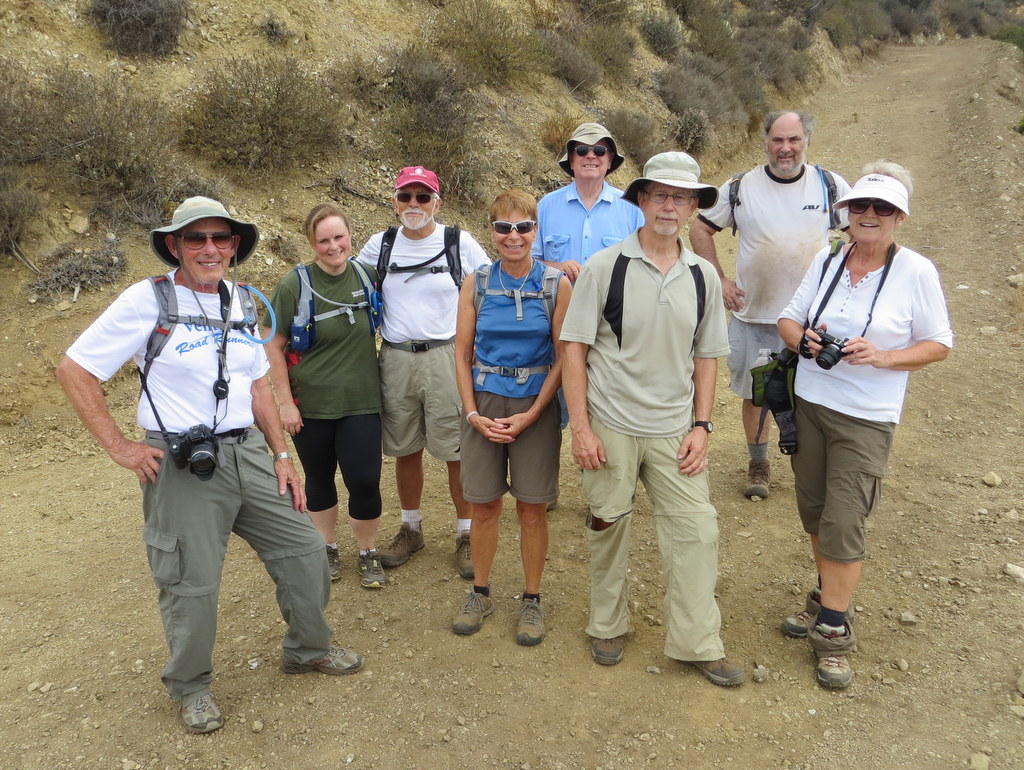
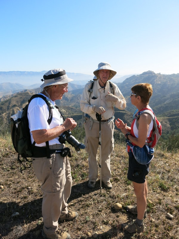
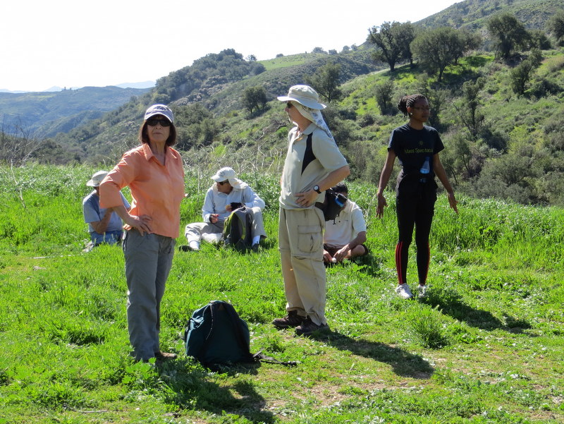
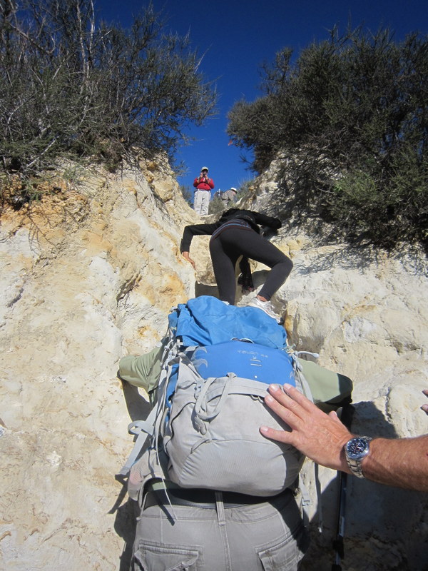
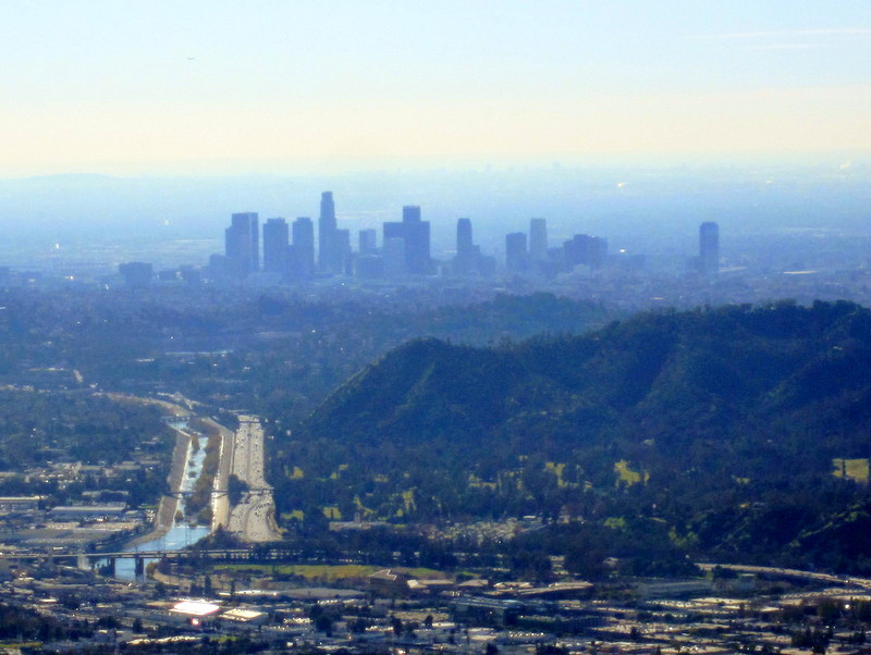
6 hikers met at the Stearns Street Park-and-Ride lot in Simi Valley on a sunny, unseasonably warm, and windy morning. We carpooled east Vasquez Rocks County Park, where we left a shuttle vehicle and then drove to the Soledad Canyon Road traihead access point of the Pacific Crest Trail (PCT). Unlike past years, trailhead access was quite easy, apparently to a good deal of work completed by trail maintenance volunteers. Crossing the dry Santa Clarita River, via a new bridge, shortened our hike perhaps a quarter of a mile. We soon passed the Golden Spike Monument marking the completion of the PCT on June 5, 1993. The trail then began a gradual and relentless climb reminiscent of terrain in the Simi Hills area. Temperatures remained warm, but the constant, and often very gusty Santa Ana winds, kept us from overheating. There were some exposed points on the trail where the gusts made it difficult to walk a straight line. Finally arriving at the high-point of the climb, we were encouraged by the expansive view of Highway 14 and the tunnel passing under the freeway. Once passing through the tunnel, we took a lunch break, before continuing on into Vasquez Rocks County Park, the site of a multitude of movie and TV sets through the years. Continuing on the PCT, we reached our shuttle vehicle, having completed a 9.3 mile hike with 2,600′ of total elevation gain.
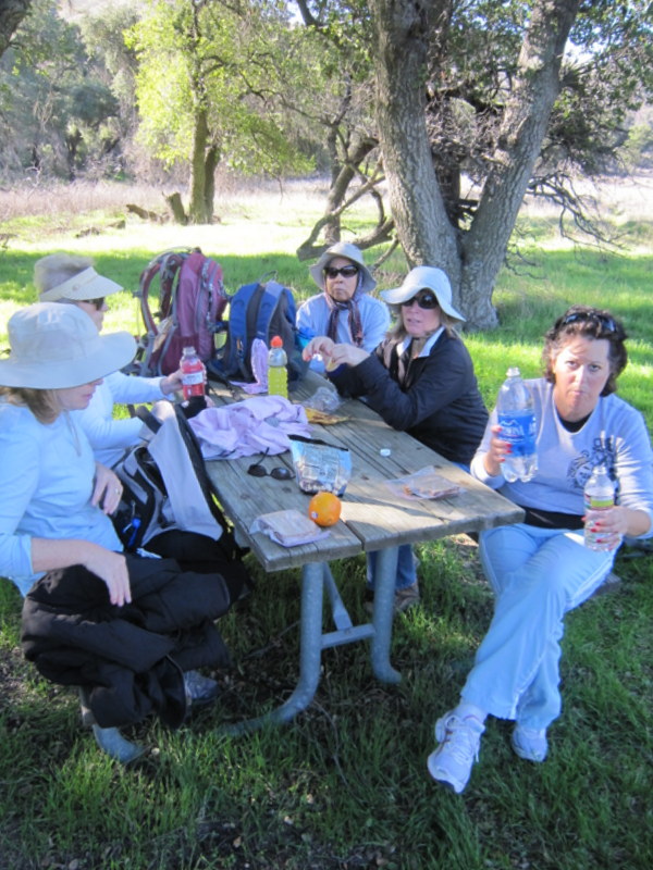
December 7th – Christmas Holiday Party

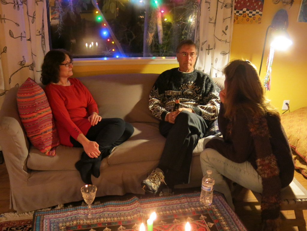
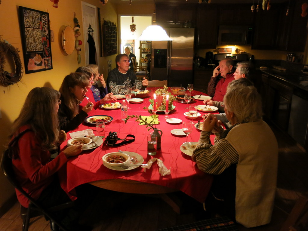
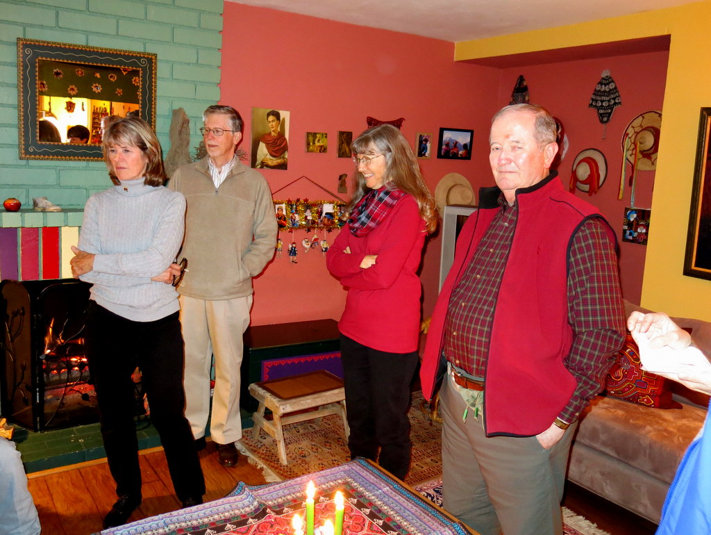


Again this year, Ursula graciously opened up her beautiful home and hosted our annual Christmas Holiday party. We all enjoyed the live music, super tasty food, and great conversation.
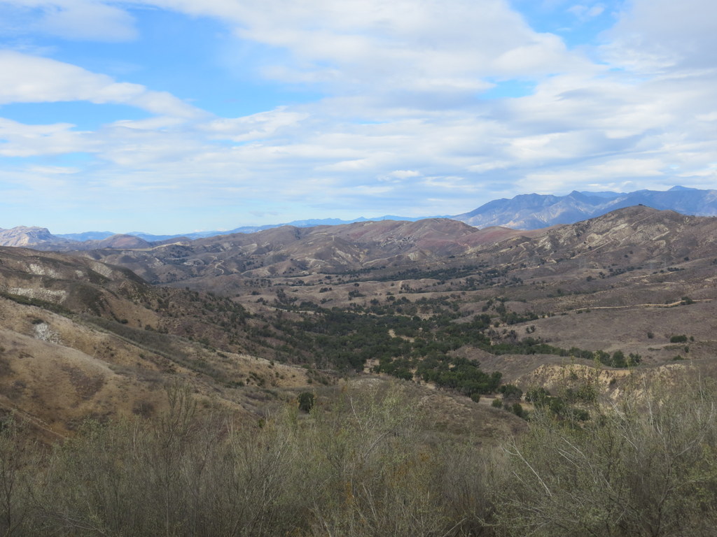
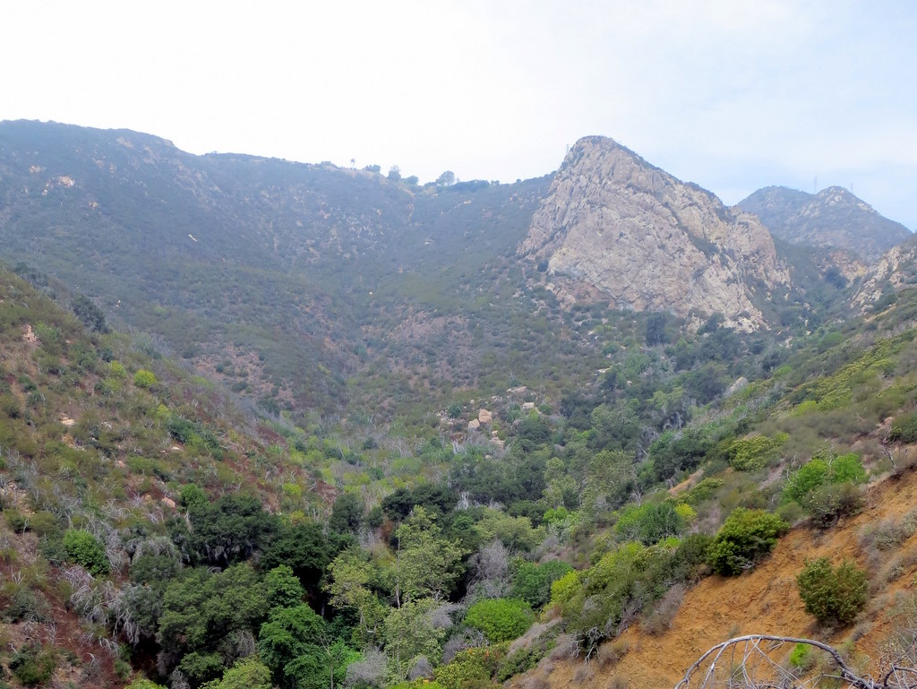
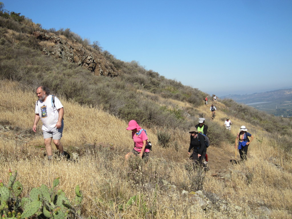
November 30th – Stony Overlook via Chivo Canyon
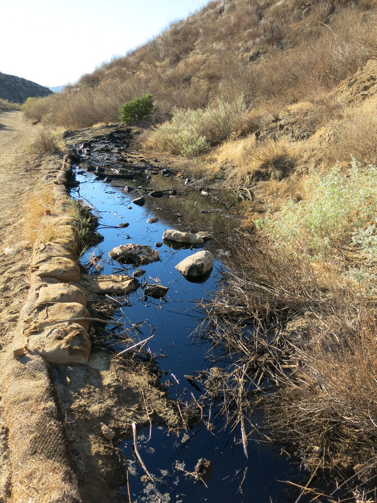
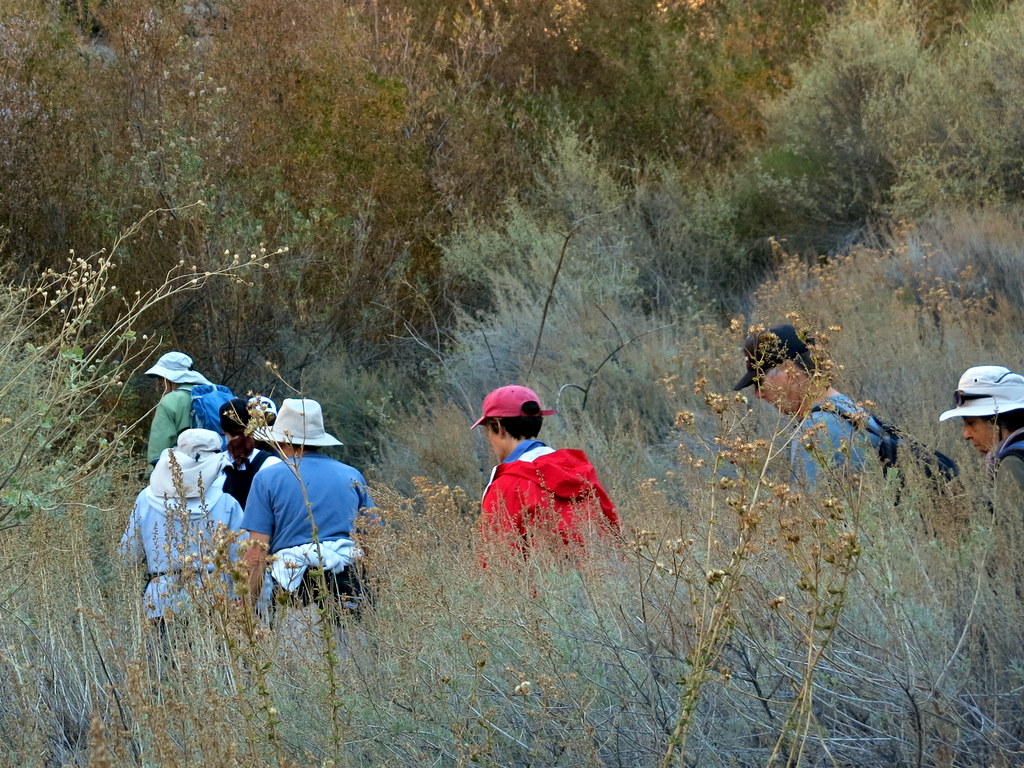
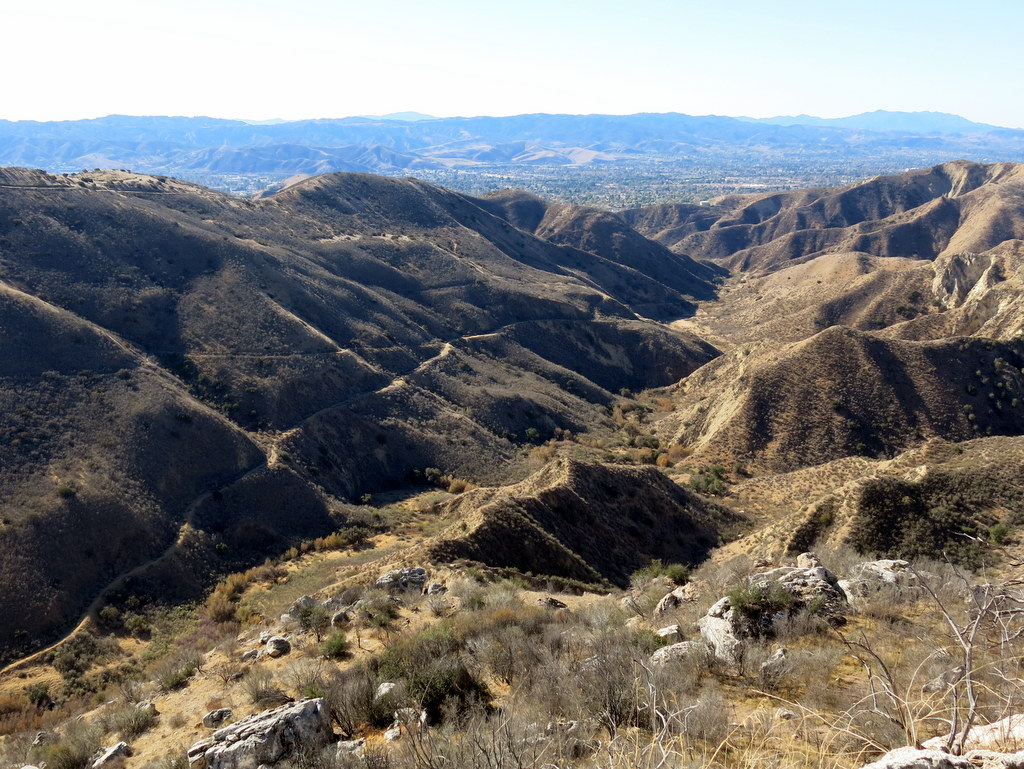
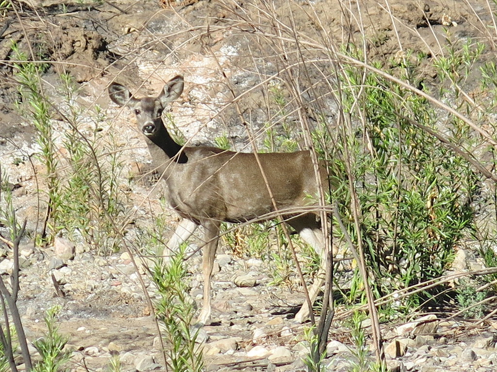
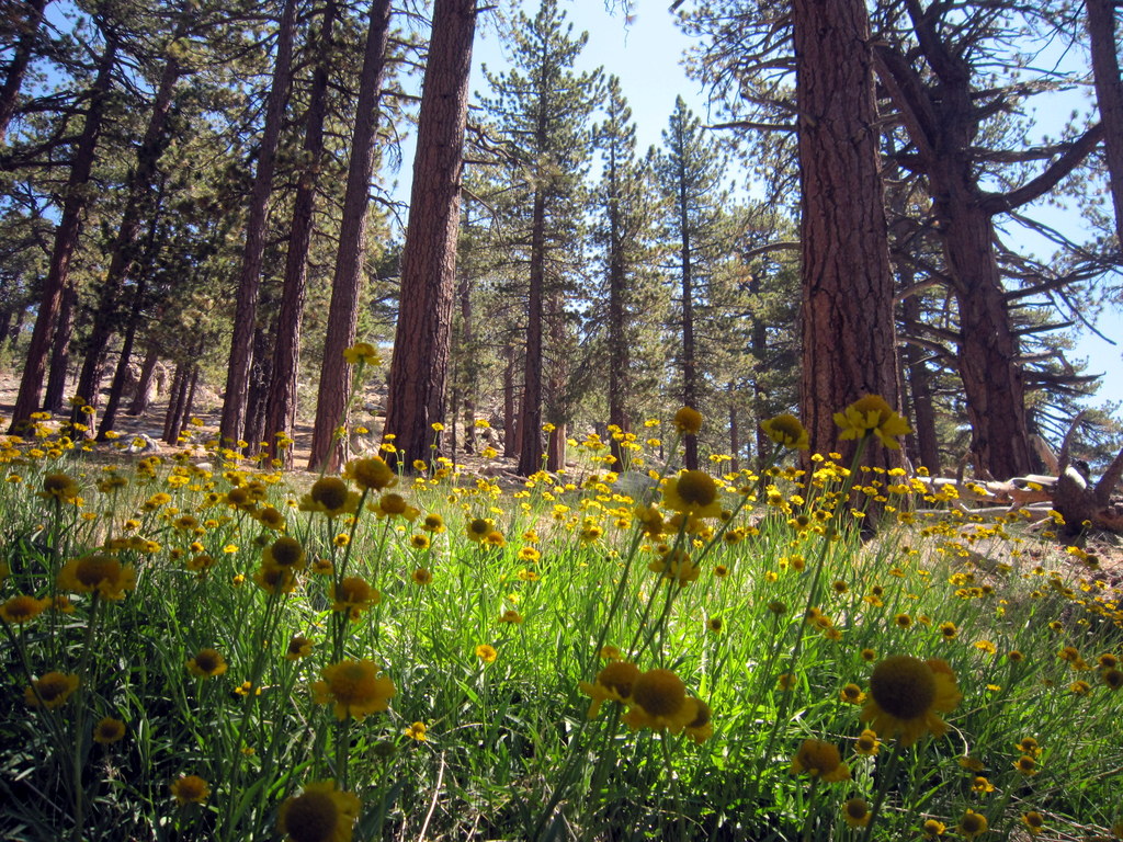
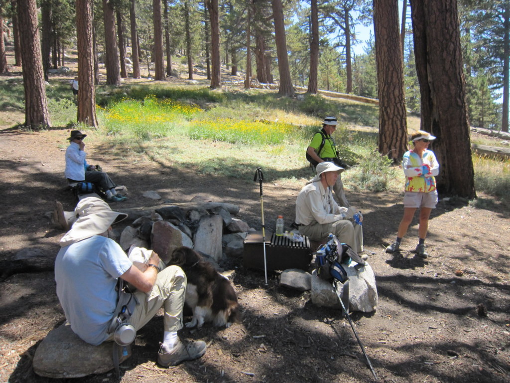
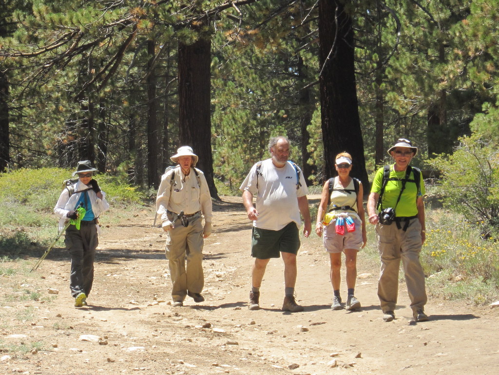
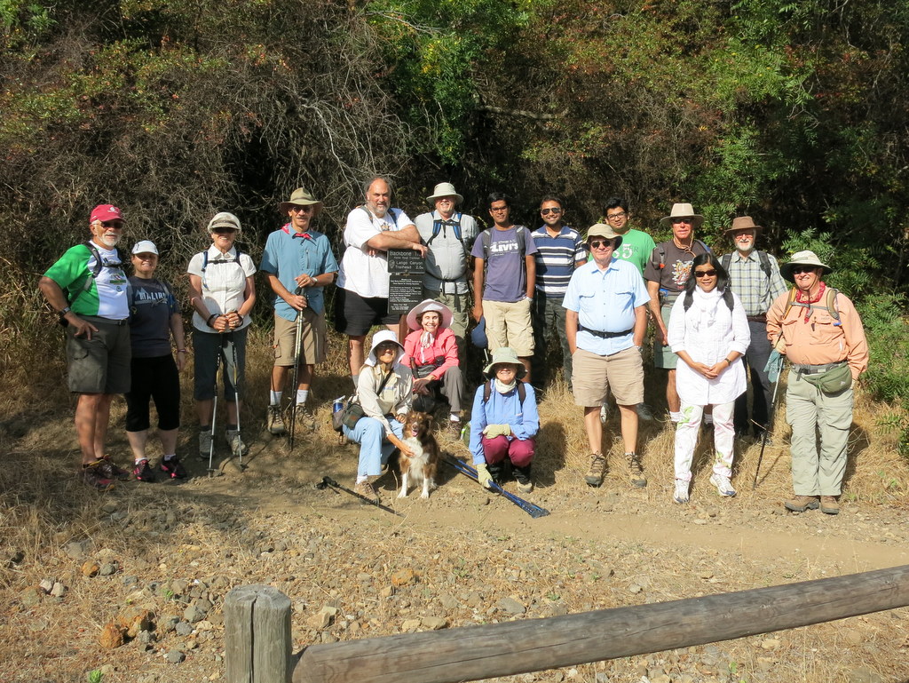
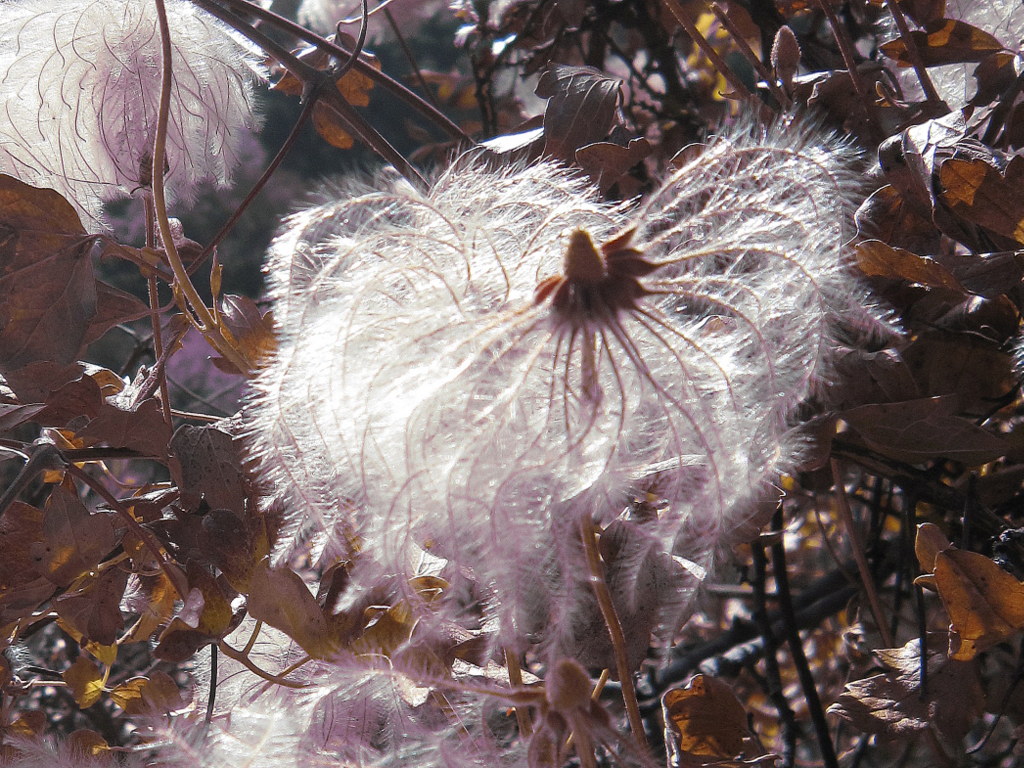
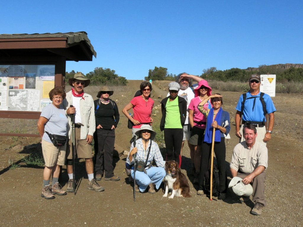
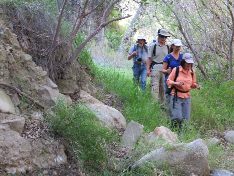
19 hikers met on a pleasant fall morning near the mouth of Chivo Canyon in the Marr Ranch Open Space in northeast Simi Valley. After we descended into the canyon bottom, we followed the trail (now a recently bulldozed wide dirt road) 0.7 mile northward until the old road again became a more-pleasing single-track trail along the eastern slope of the canyon. Upon reaching the upper end of lower Chivo Canyon we continued carefully through a narrow gorge into upper Chivo Canyon and its large oak woodland. Eventually we climbed out of the canyon and made our way to a rocky promontory on the west side of lower Chivo Canyon where we enjoyed sweeping 360-degree views of the entire surrounding area. We then returned via the same route to the parking area having completed an 8.25-mile hike with 1,650′ of elevation gain/loss. NOTE: The effects of the continuing multi-year drought in southern California on both the vegetation and the wildlife in the area were quite evident.
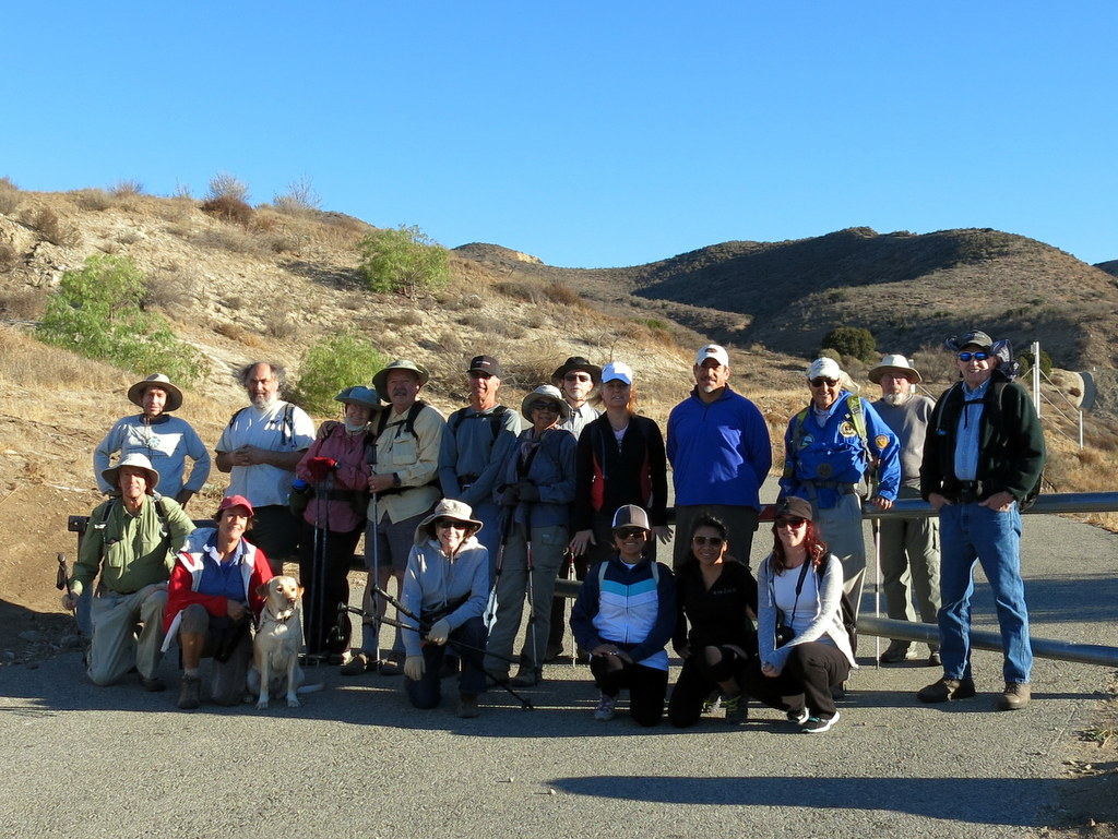
November 23rd – Happy Camp Canyon, Middle Range Fire Road Loop
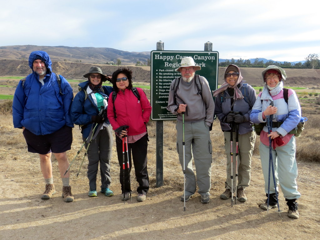
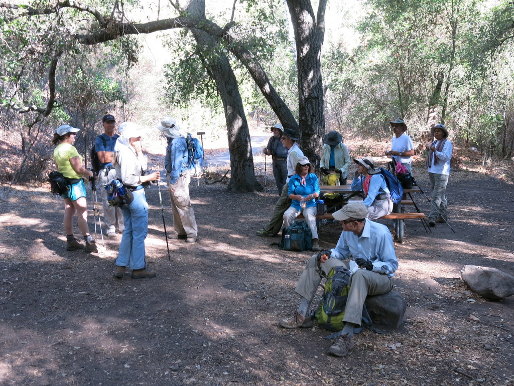
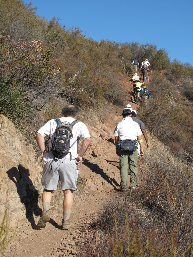
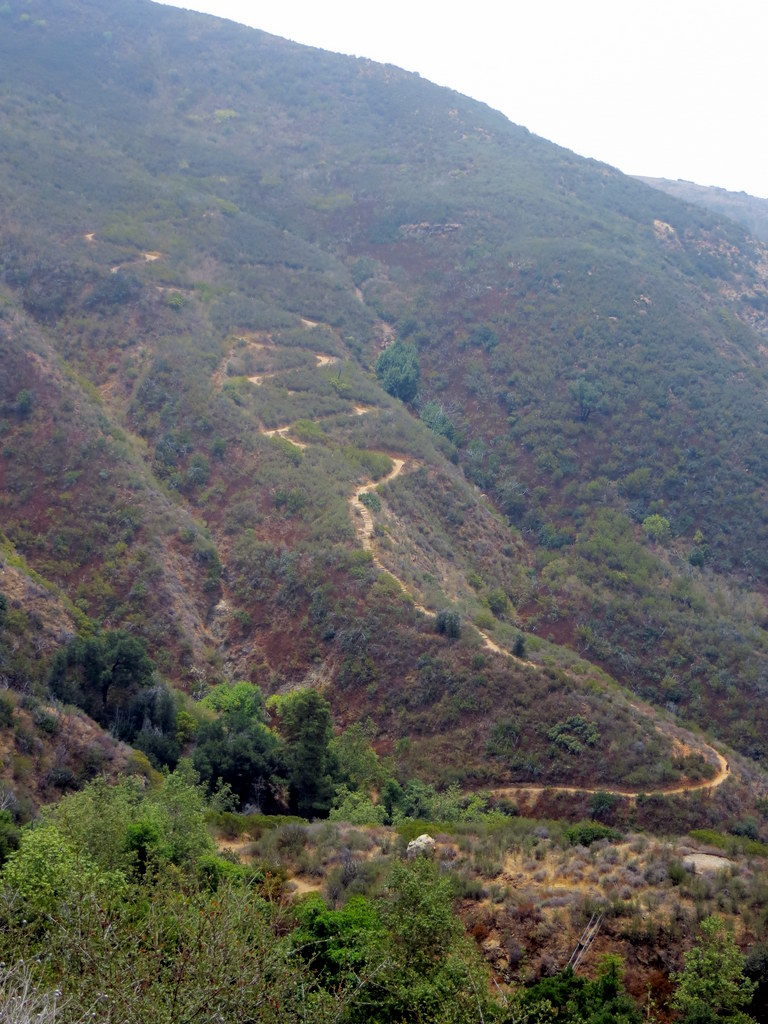
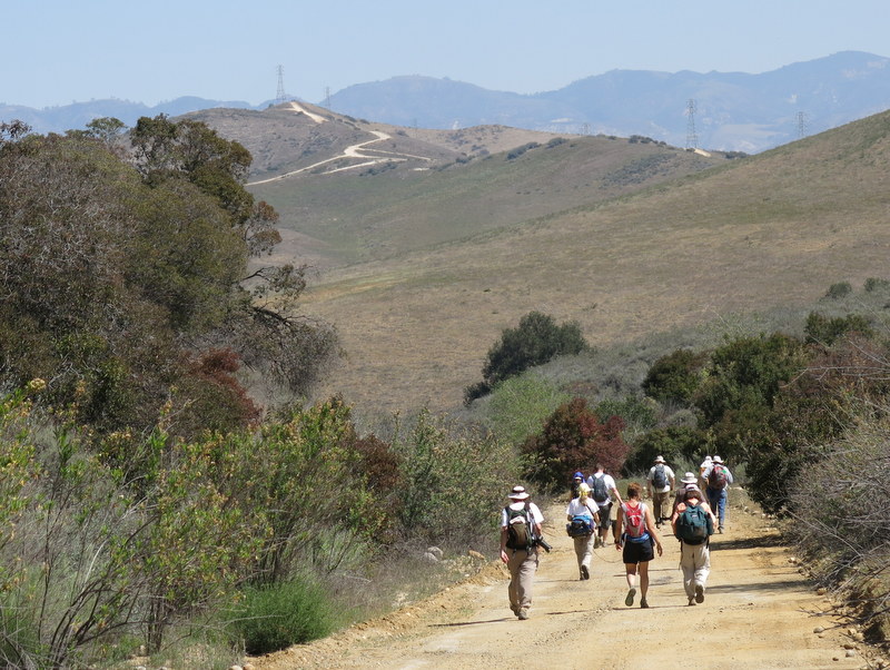
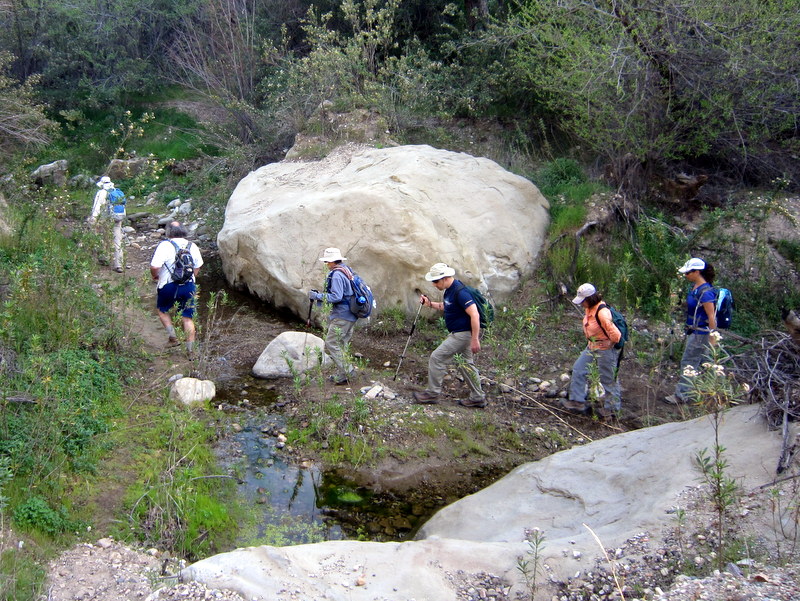
7 intrepid hikers met on a very windy Saturday morning in Simi Valley to carpool to the dirt parking lot at the east end of Broadway Road north of Moorpark. The wind was particularly ferocious as we hurriedly hiked one mile to the entrance to Happy Camp Canyon, “a lush riparian oak woodland with an intermittent stream.” Largely protected from the wind, we followed an old ranch road eastward as it rose gradually in the canyon bottom between Oak Ridge and Big Mountain. At 4.5 miles we took a break in an oak grove with picnic tables and hitching rails. We then climbed steeply for 0.5 mile up Big Mountain to the Middle Range Fire Road via an abandoned, partially eroded dirt road. Once we reached the ridge we were treated to unusually clear distant views to the south and west including the Santa Monica Mountains and two of the Channel Islands. We were subject to intermittent strong gusts of wind during our return trip along the ridge. We eventually made it to the parking lot, having completed a 10.9-mile hike with 1,200′ of elevation gain/loss.
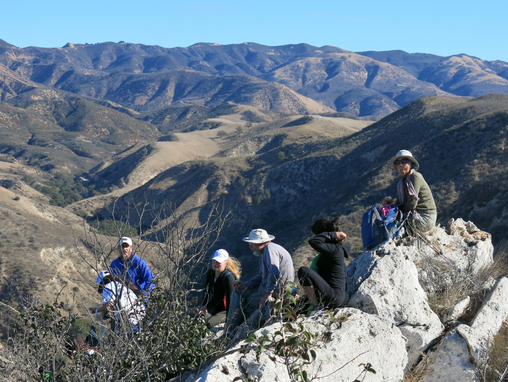
November 9th – Mishe Mokwa Trail, Sandstone Peak loop
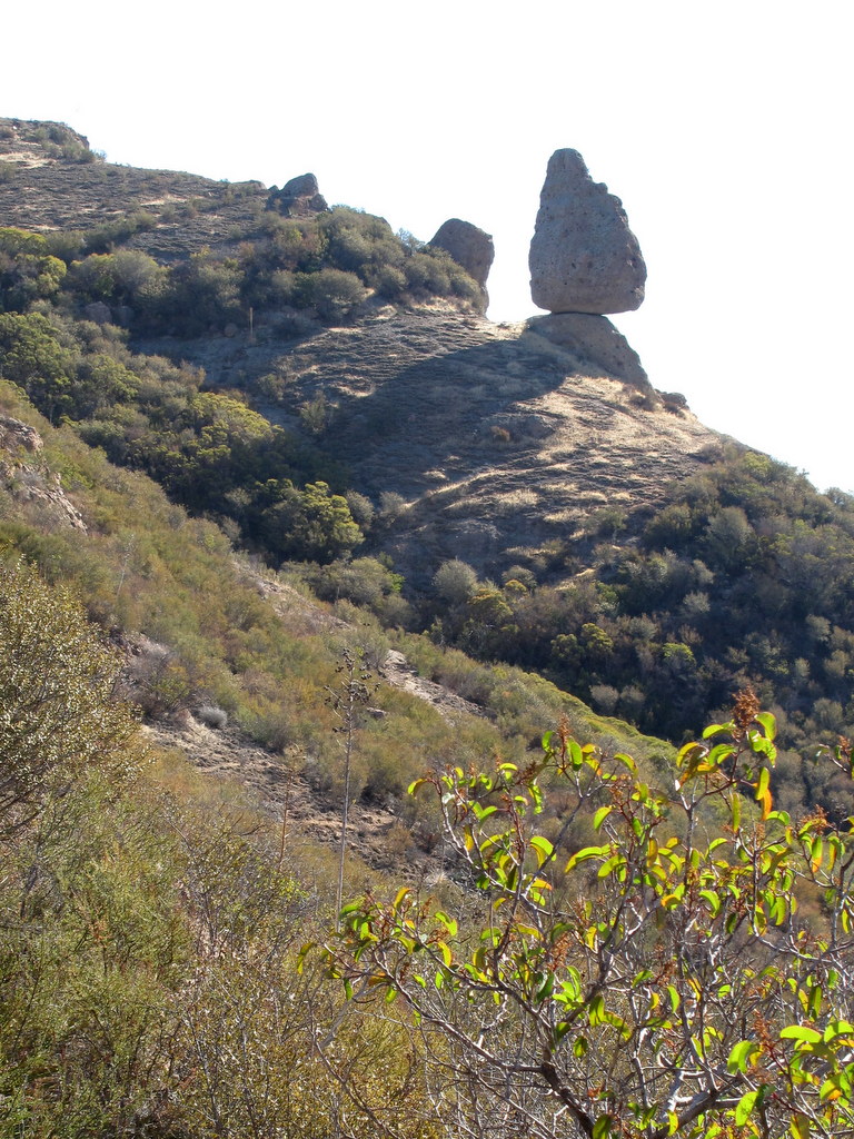
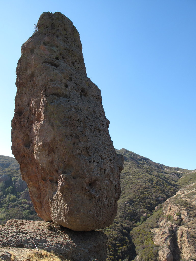
17 hikers traveled to Triunfo Pass (2,100′) in the Santa Monica Mountains on a lovely fall morning. The counterclockwise loop hike began on the Mishe Mokwa Trail. The trail climbed quickly and then leveled out for a while before descending into Carlisle Canyon, providing excellent views of the reddish-colored Echo Cliffs (a long stretch of sheer vertical sandstone rock faces) against the green side of Boney Mountain and Balanced Rock, a huge house-sized boulder precariously balancing atop a smaller boulder. We took a break at Split Rock where there’s a thick mini-grove of shade trees overhanging a large broken boulder (Split Rock) and one deteriorating picnic table. We then followed a rugged side trail to Balanced Rock. As we resumed our hike, the trail climbed southward to a junction with the Backbone Trail (BBT) on a mesa affording great views of various peaks surrounding the area. We took the left (east) fork and continued along the BBT taking the short spur trail to Sandstone Peak (3,111′), aka Mt. Allen, the highest peak in the Santa Monica Mountains. The peak is just a hunk of grayish-white rock, but it provides a stunning 360-degree view (depending on the air quality) of the ocean, the mountains, and the Oxnard Plain. Visibility was only fair on this day, but the temperature was perfect for mountain hiking. Returning to the BBT we continued eastward to a junction with a short connector trail which led us again to the Mishe Mokwa Trail; we descended to the parking lot having completed a refreshing 7.3-mile hike with ~1,800′ of elevation gain.
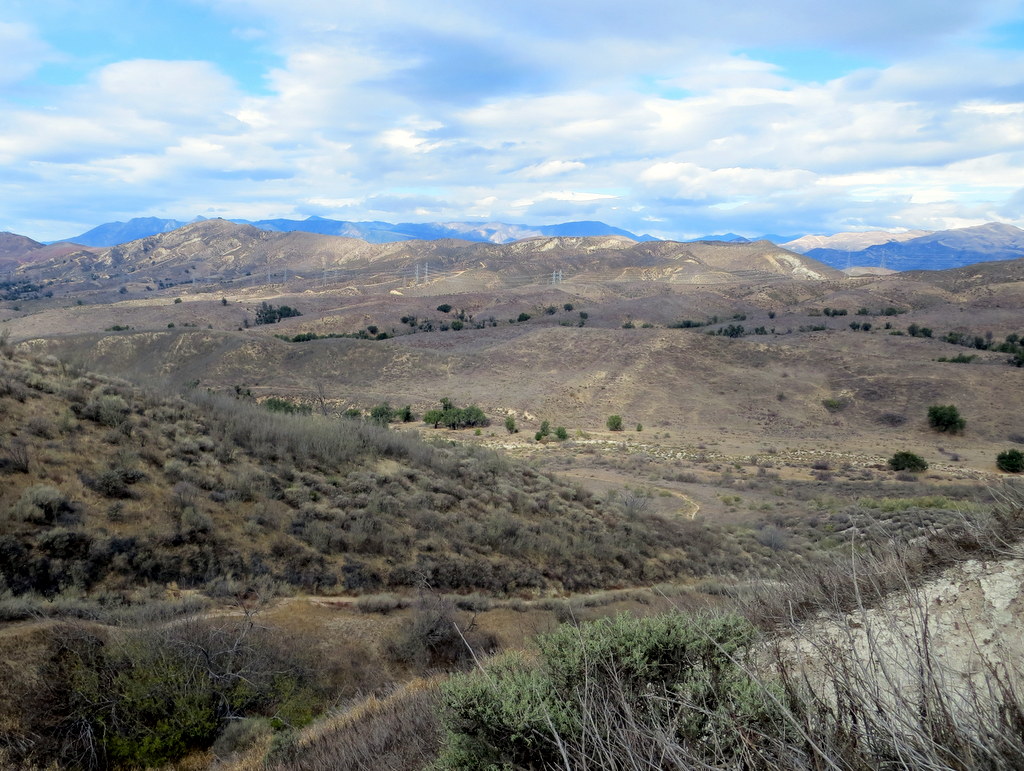
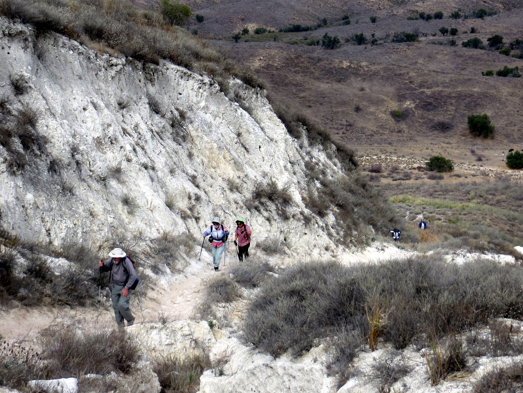
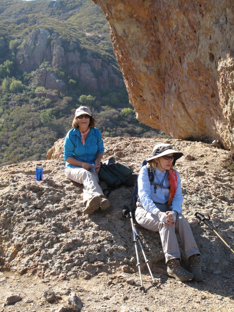
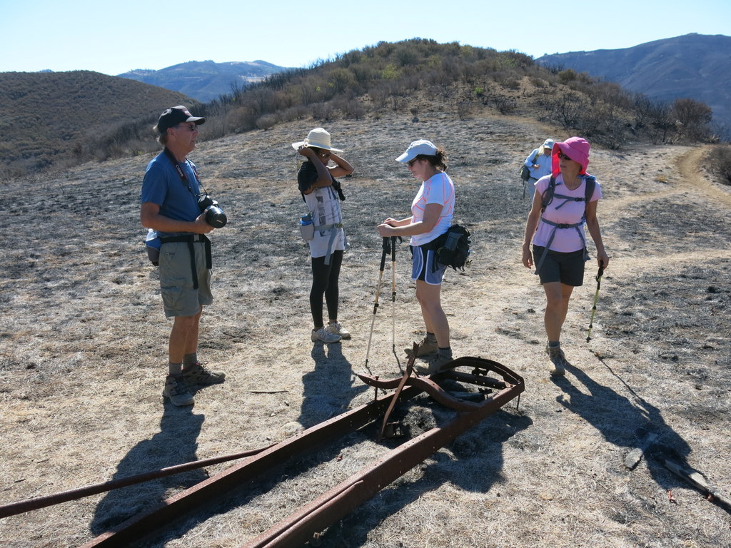
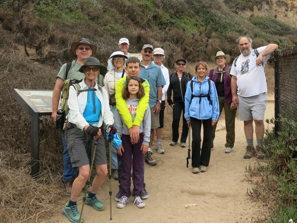
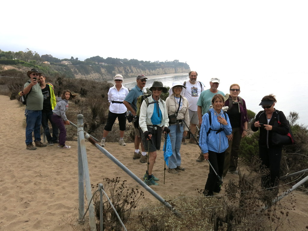
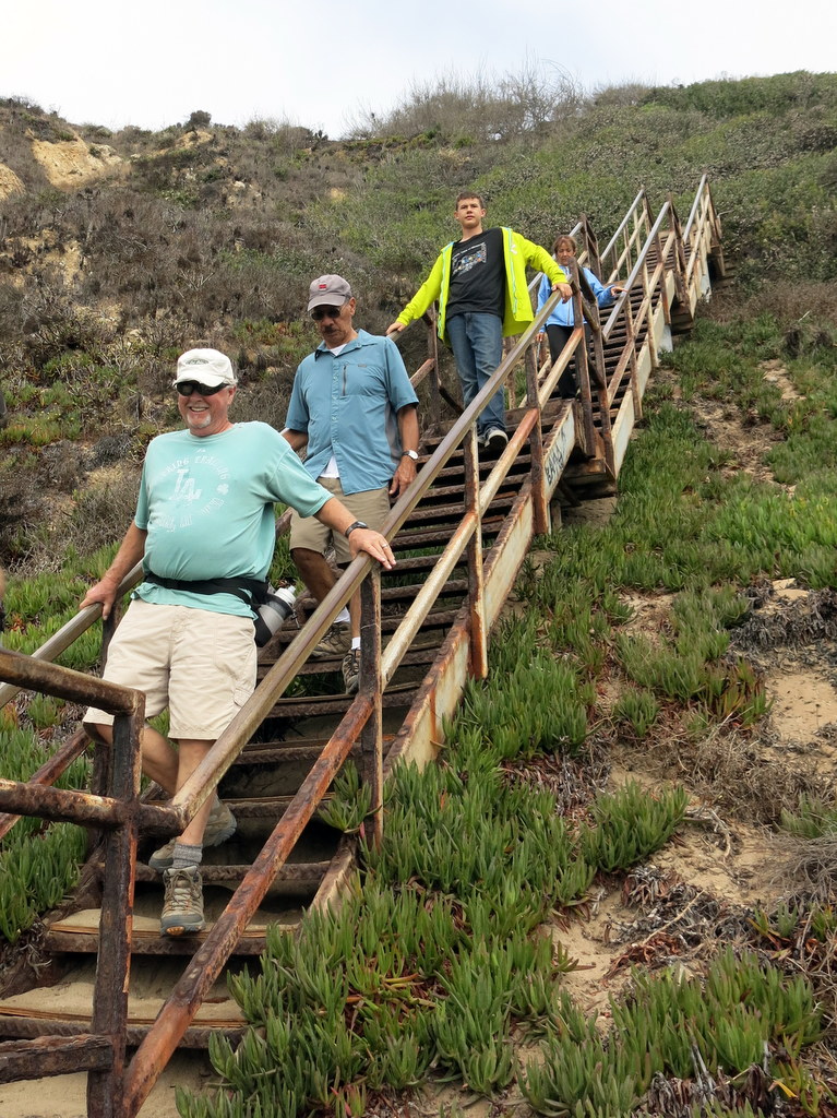
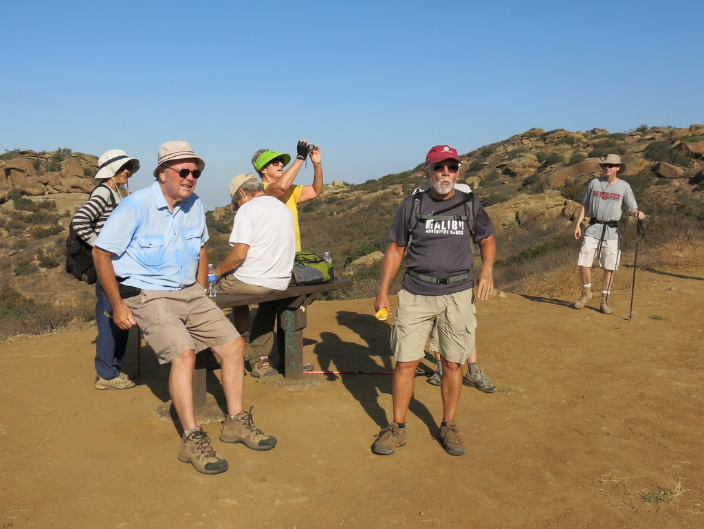
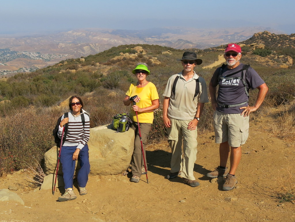
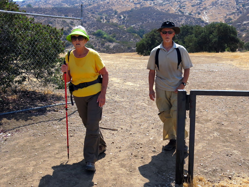
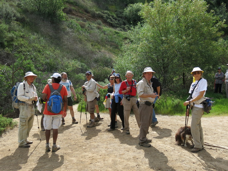
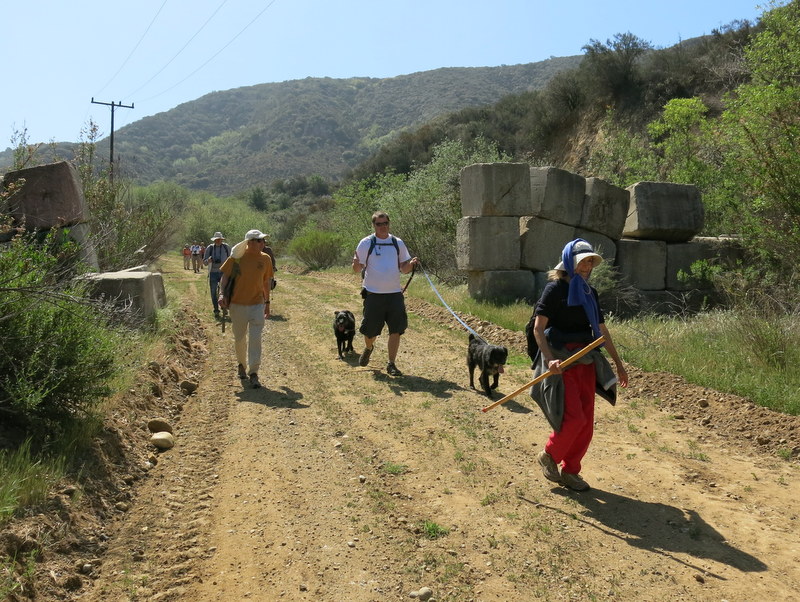
November 2nd – Las Llajas Canyon, Rocky Peak Fire Road, and Chumash Trail Loop
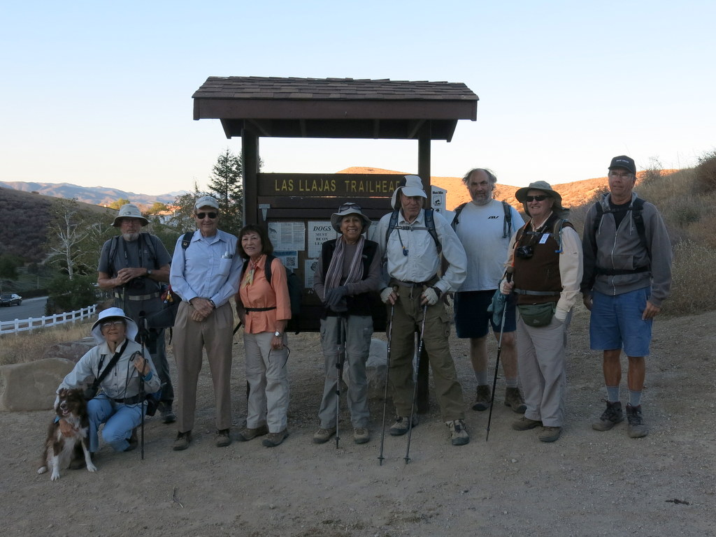
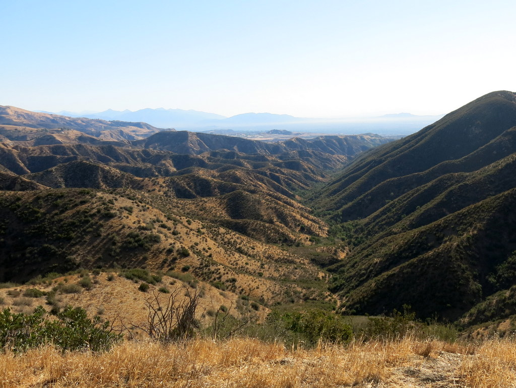
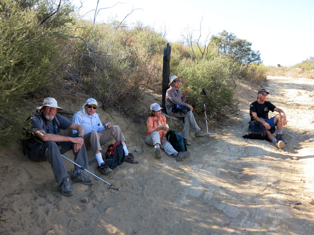
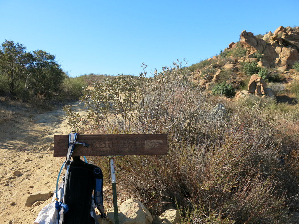
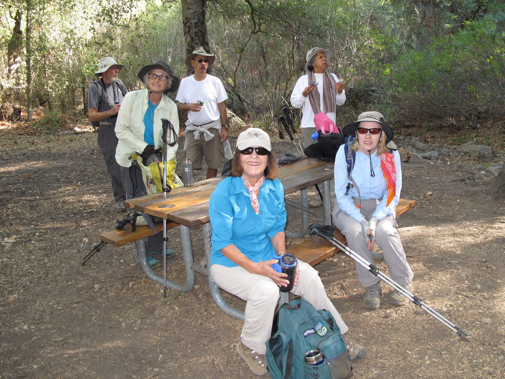
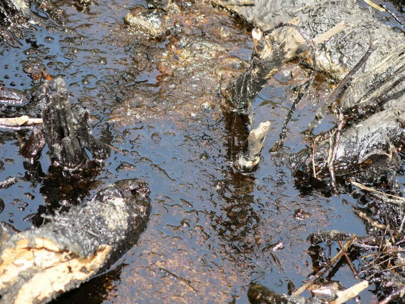
Ten hikers met at the Las Llajas Canyon trailhead on a cool and clear autumn morning. The hike began by descending a short paved section of road into the canyon bottom, and from there a wide graded dirt road followed a stream north through the canyon, crossing the dry stream bed three times. The steep canyon walls provided shade as we enjoyed an easy 3.5 mile trek up the canyon. Taking the the right (east) fork we continued up the dirt road, past the now vacant oil fields, and then on up to a junction with the Rocky Peak Fire Road. After reaching the Rocky Peak Fire Road, we turned right and headed south toward the upper end of the Chumash Trail. Along the way we passed Fossil Hill, named for the shells of sea creatures left behind when the area was under a vast sea. We enjoyed the panoramic views of mountains and canyons to the east, south, and west. Upon reaching the upper end of the Chumash Trail, we took a much needed break and then rapidly descended the familiar trail from our Thursday evening hike. We then turned right (west) and followed a short trail to a closed, through a fence, at the east end of Evening Sky Drive. A short walk along Evening Sky Drive took us back to our vehicles, having completed a pleasant 9.3 mile hike with 1,963′ of elevation gain.
October 26th – Mt. Islip
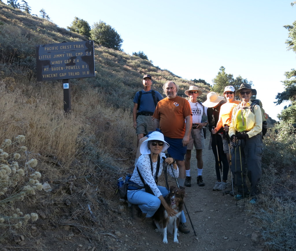
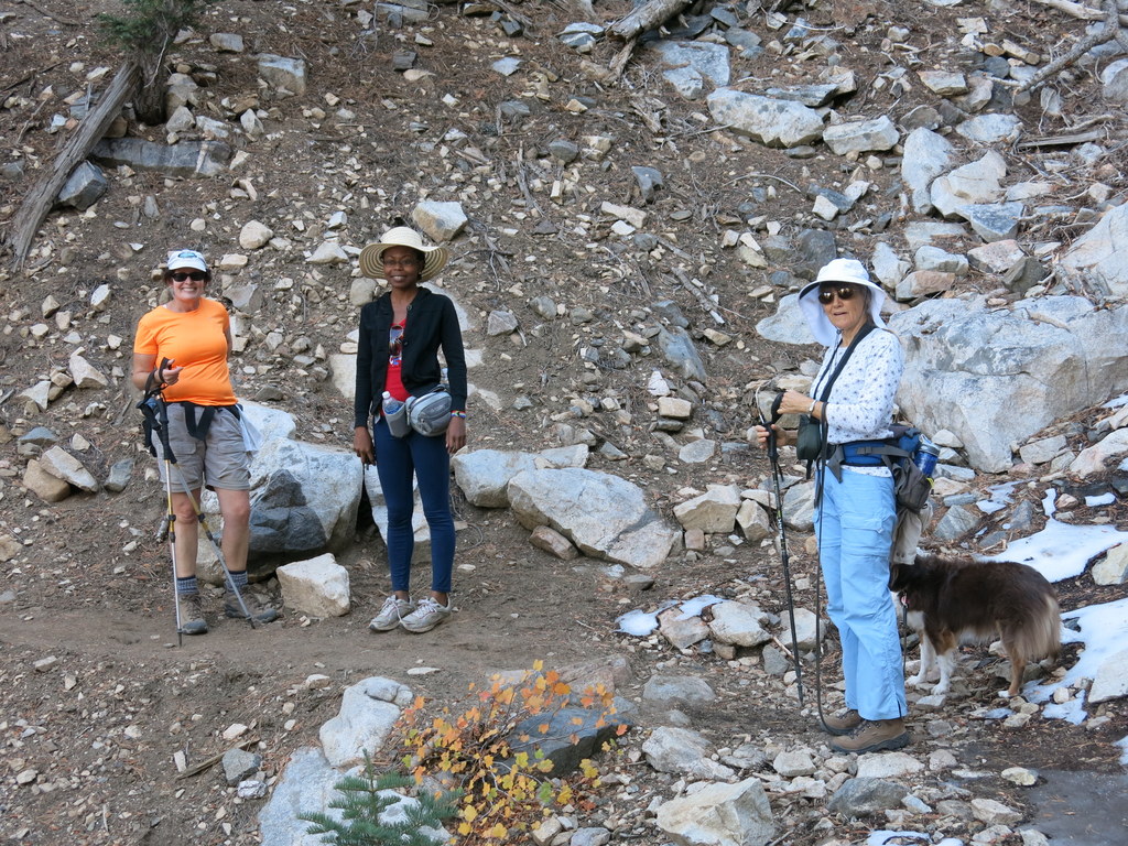
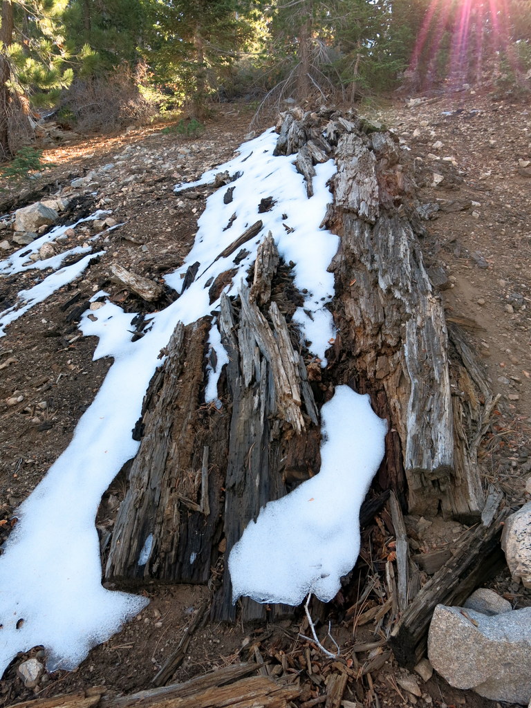
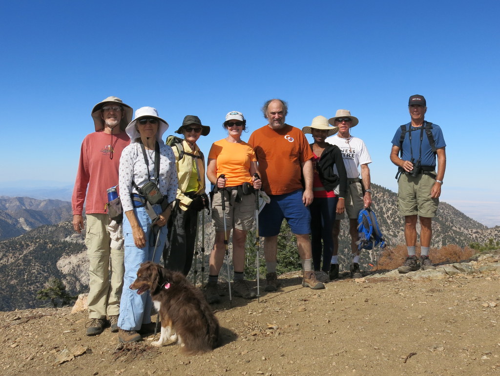
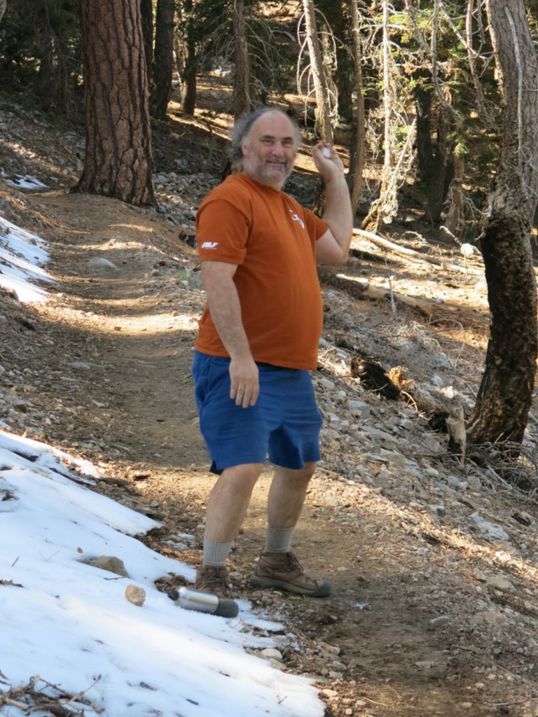
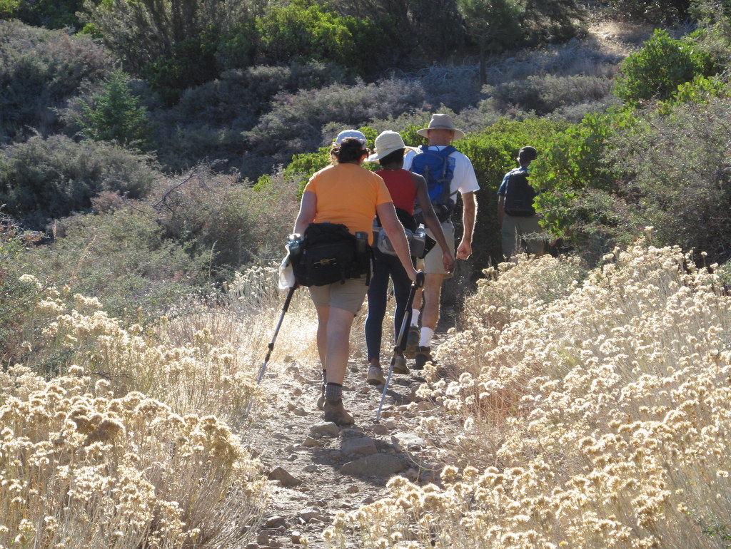
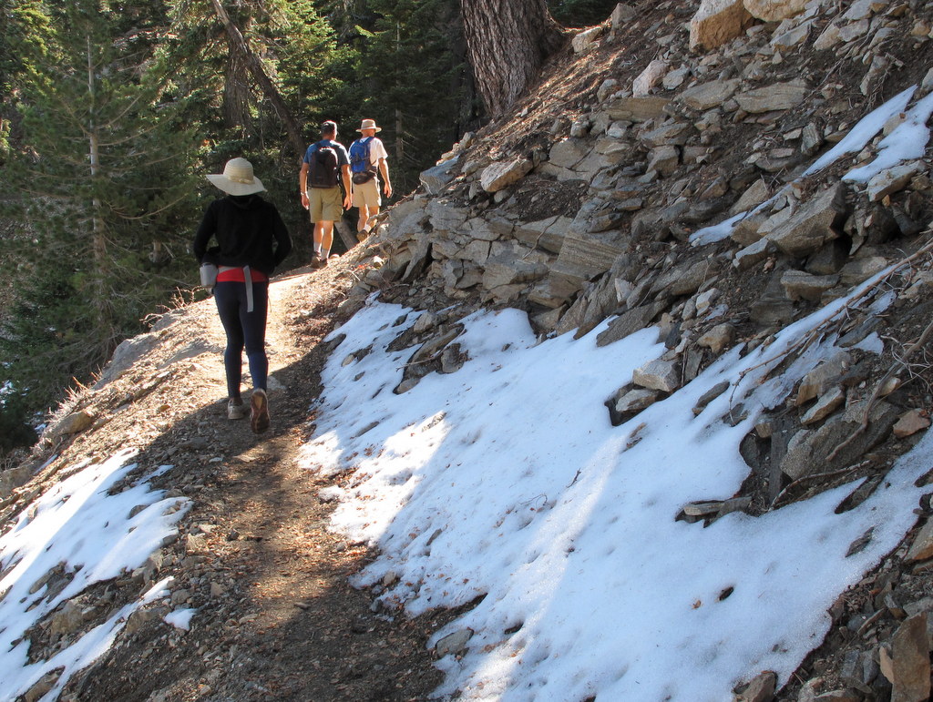
Eight hikers carpooled via Highway 118, the I 210, and the Angeles Crest Highway, to Islip Saddle in the San Gabriel Mountains. The hike began along the Pacific Crest Trail, adjacent the Islip Saddle parking lot. The trail climbed eastward, skirting a large meadow, and then entering a pine-scented forest. Snow was still in display in the shady northern parts of the trail, from a storm just over a week before. Two miles down the trail, we reached Little Jimmy Trail Camp. After a short break, we continued on to Windy Gap where we met and spoke with another group of friendly hikers. Next we followed the Islip Ridge Trail to the south as it ascended to the peak of Mt. Islip. Once there we took a lunch break and enjoyed the unobstructed 360 degree view of the surrounding mountains, the Antelope Valley, and the Crystal Lake Recreation Area. The view were only obscured by distant valley fog, on this cool and clear day. We descended the peak, via the trail through Little Jimmy Camp. We arrived back at the Stearns St. Park & Ride, having completed a very pleasant 7.3 mike hike, with 1954′ of elevation gain.
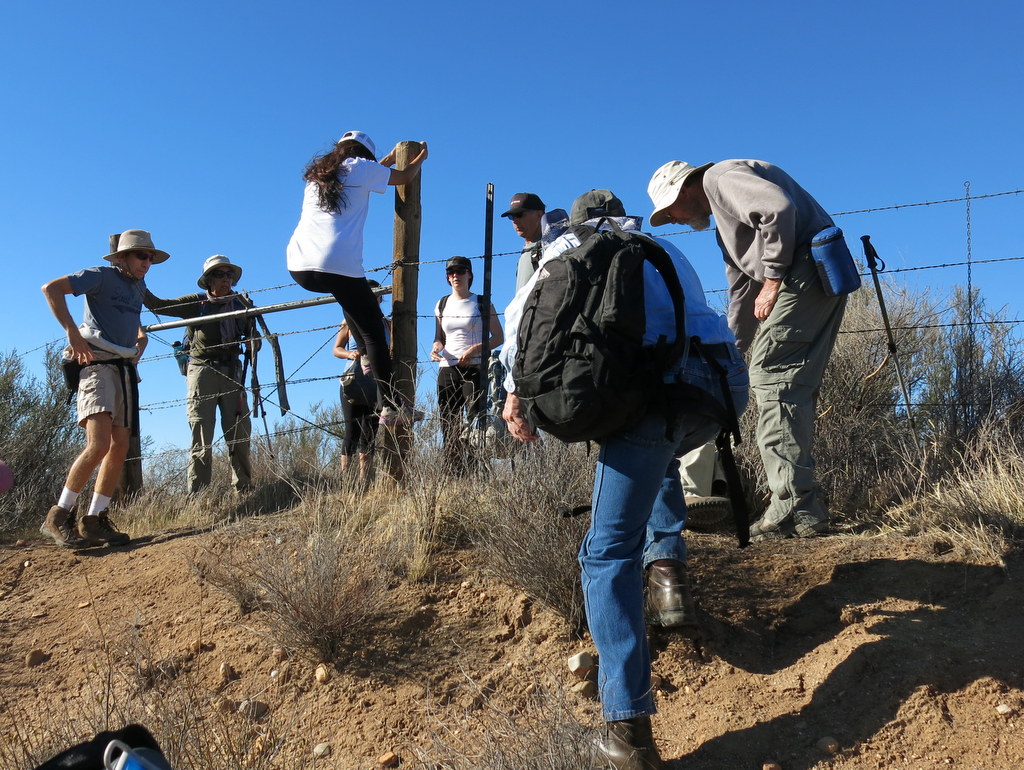
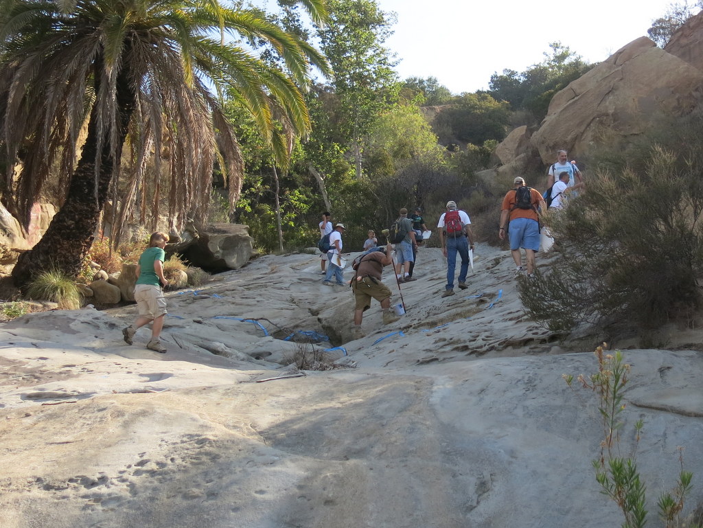
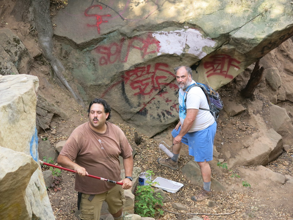
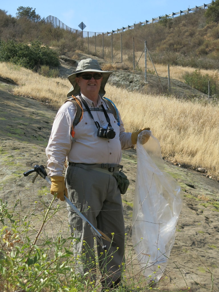
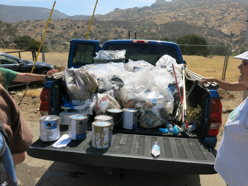
October 19th – Work Party – Wild Animal Corridor – Cache In Trash Out Event
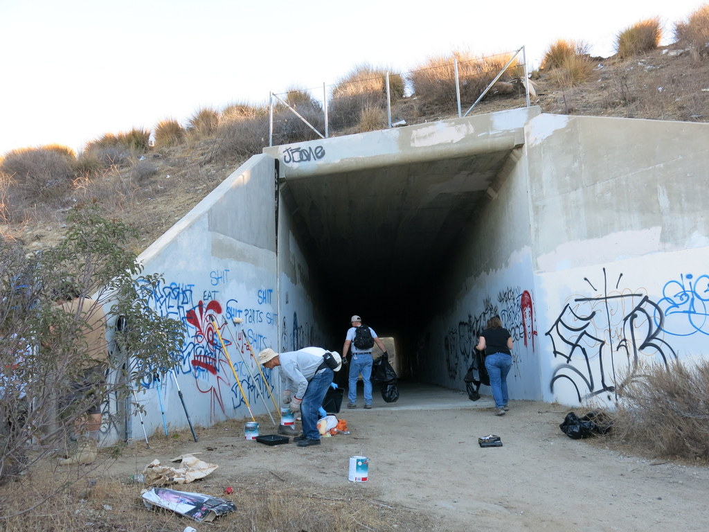
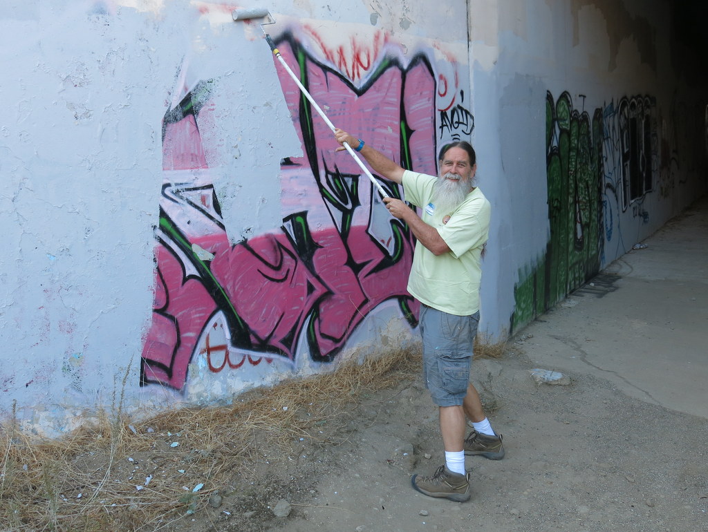
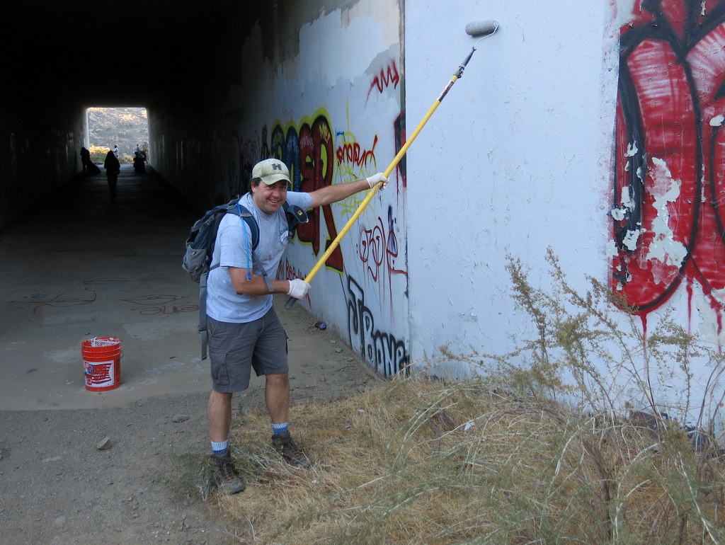
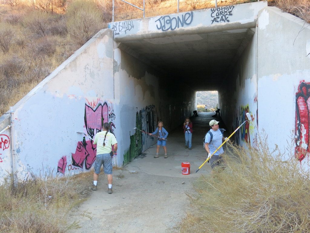
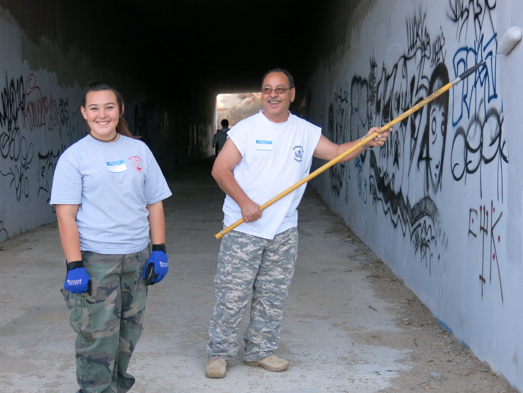
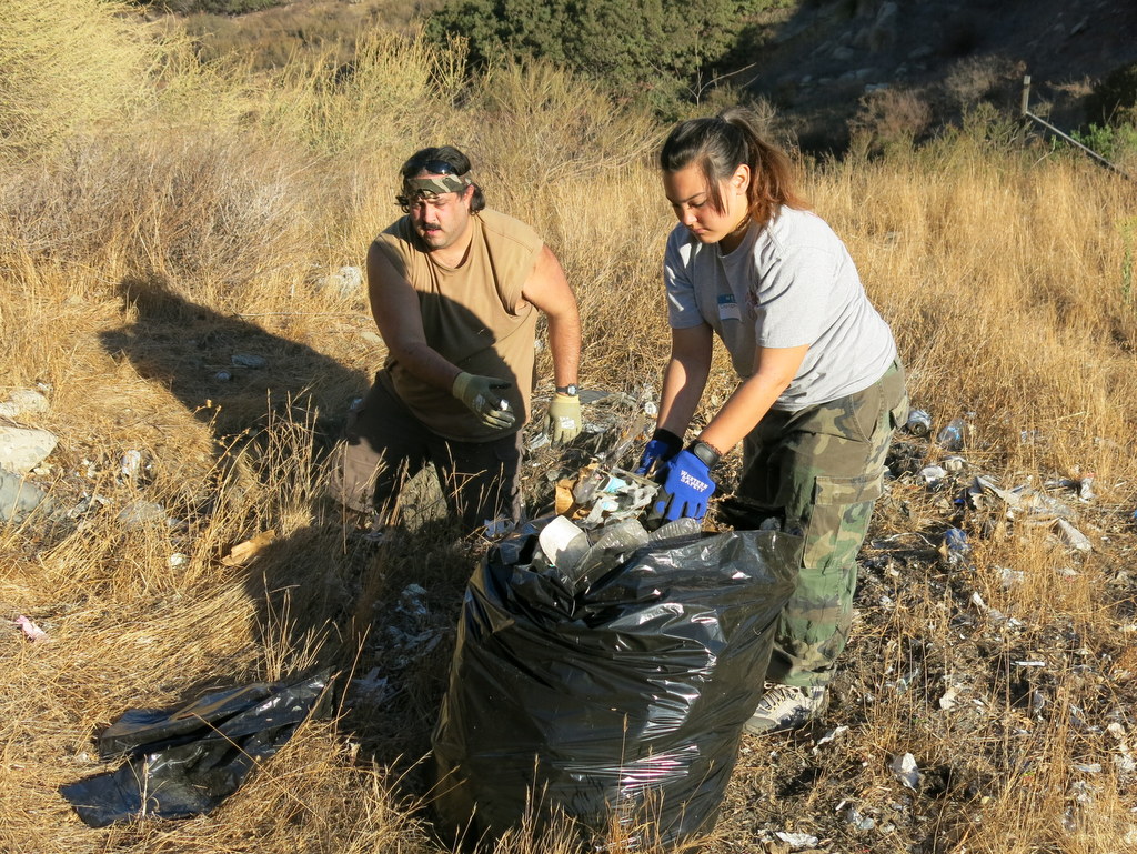
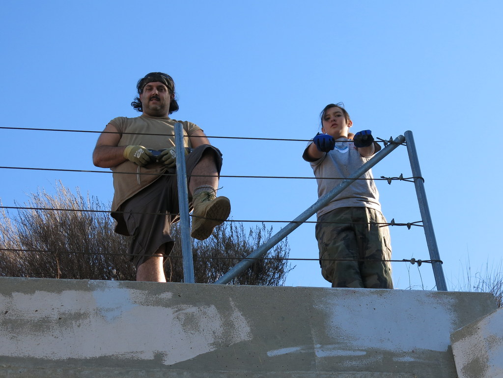
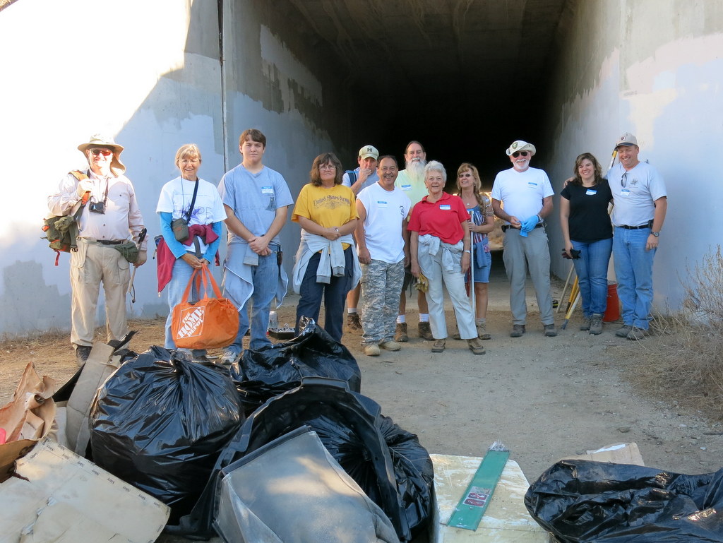
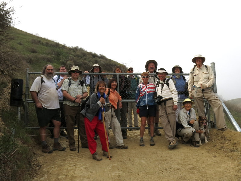
Fourteen Trail Blazers, and Geocaching community members, met at the far eastern end of Smith Road for our annual Wildlife Corridor work party cooperative effort. We carried everything required to complete the job, up the .3 mile (with 350′ of elevation gain) trail to the Corridor. This year, there was twice as much graffiti and trash, than the previous year. Five gallons of paint, and six large trash bags later, we headed down the trail to enjoy some healthy snacks, good stories and a free drawing. An enjoyable time was had by all in attendance. Next year we’ll have the event on the second Saturday of October, so mark your calendars now.
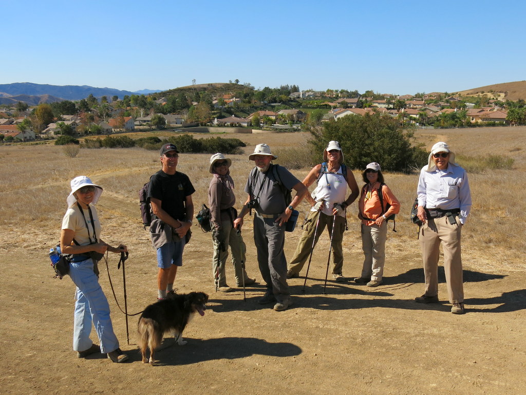
October 12th – Long Canyon, Montgomery Canyon, Canyon View Trail loop
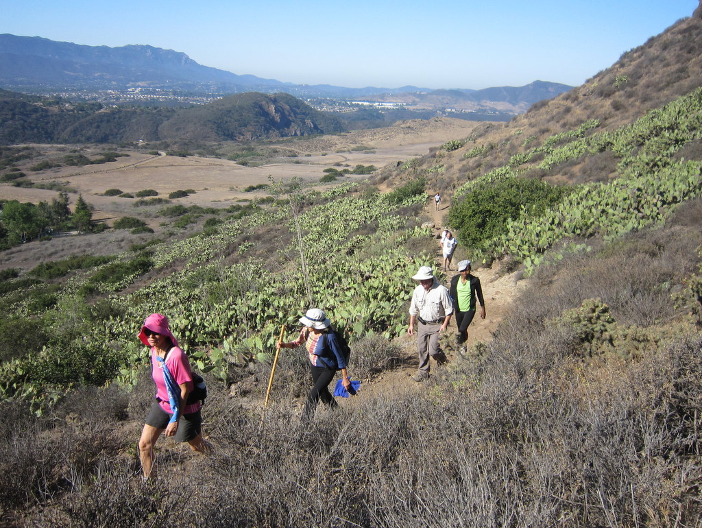
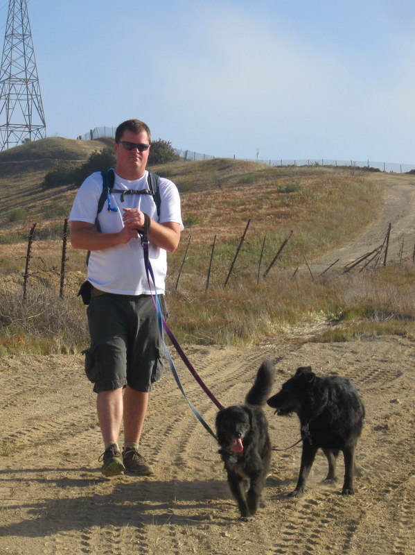
12 hikers (+ 4 dogs) gathered at the Long Canyon Trail trailhead parking lot at Wood Ranch in Simi Valley on a mild fall morning. We began hiking the Long Canyon trail as it climbed steeply 0.7 mile to a trail junction atop a ridge overlooking western Simi Valley to the north as well as the Lang Ranch Open Space to the south. We then followed a “use” trail down to the dirt road in Oak Canyon while enjoying views of the surrounding mountain slopes with their parched vegetation. After a short break several hikers continued through Oak Canyon and returned to the original trailhead via the sidewalk along Long Canyon Road; the rest of us headed eastward up a dirt connector road to a ridge that provided nice views of western Simi Valley. We continued along the dirt road as it dropped into Montgomery Canyon and soon reached Long Canyon Road. After crossing it we climbed steeply up the Canyon View Trail which provided excellent views of the surrounding area including Bard Reservoir and followed it as it undulated along a ridgeline back to the trailhead parking lot, completing a 6-mile loop hike with 1,486′ of elevation gain/loss on a pleasant day for hiking.
September 28th – Serrano Canyon Loop
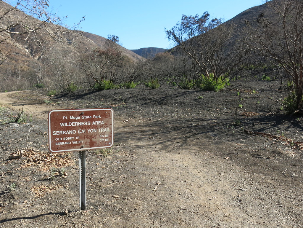
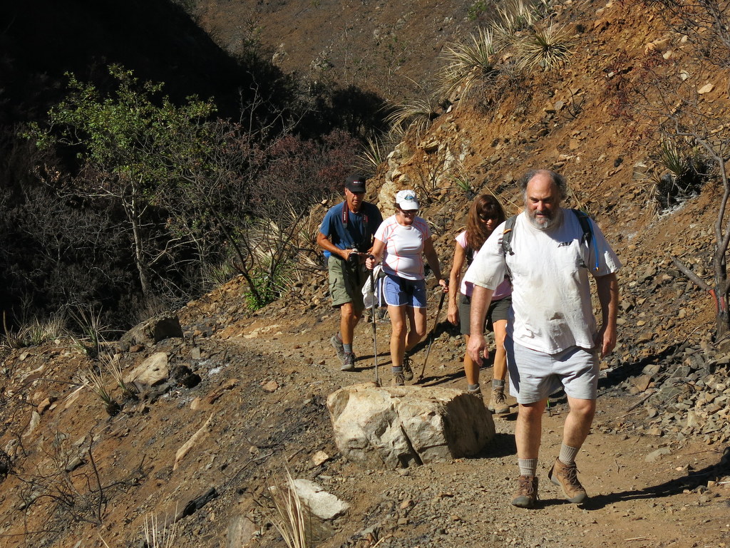
It worked! The plan was to avoid the forecast 90 plus degree, with 35 MPH gusts, at Hondo Canyon. The weather could have been more beautiful at the beach. Highs were in the mid-seventies, with a gentle on-shore breeze. Eleven hikers met at Donut Delite and carpooled to the Sycamore Canyon trailhead. Since this was the first Trail Blazer hike in Mugu State Park, since the fire, we expected to see overwhelming damage. Our worst fears were realized. Most of the area looked much like the surface of the moon. Much to our surprise, there were a small number of patches untouched by the fire. There was also a bit of regrowth, especially evident at the base of the charred Ceanothus shrubs. After completing the hike, we all met at the beach to eat our lunch and snacks. The tide was high, but still a beautiful beach day. A grand time was had by all, having hiked 10.2 miles, with about 1,600′ of elevation gain/loss.
September 14th – Palm Springs to Mt. San Jacinto via the Palm Springs Aerial Tramway
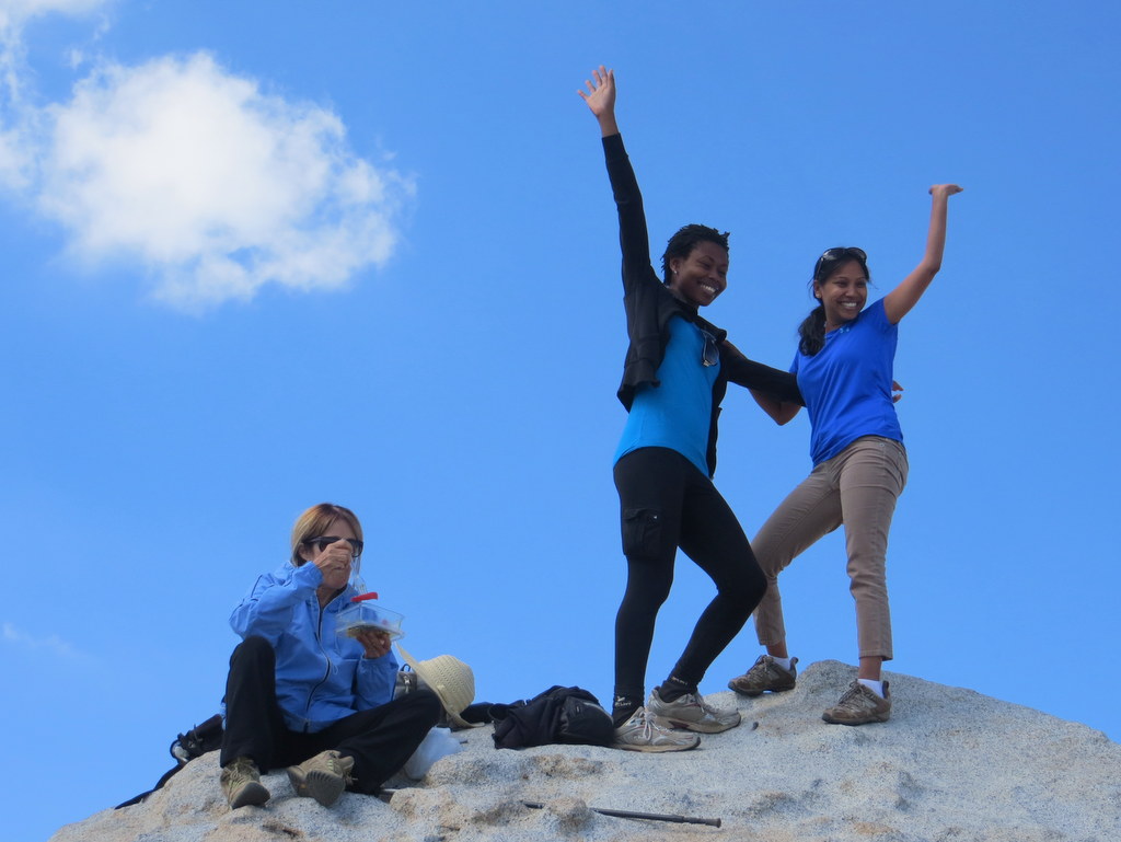

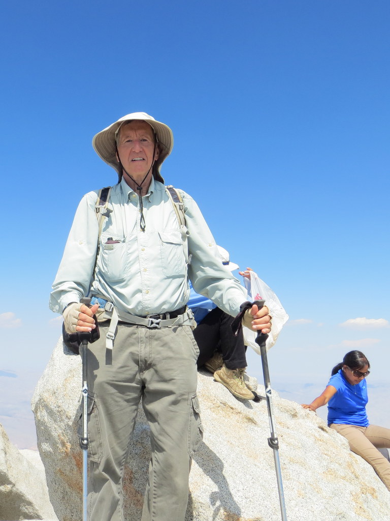
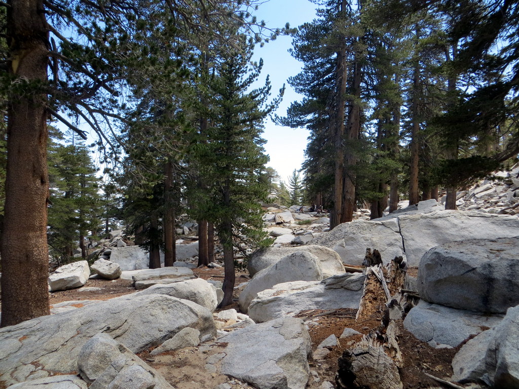

Four hikers arrived at the Palm Springs Aerial Tramway (with its rotating cabin providing a 360-degree view) around 9:00 a.m. on an already hot morning for a scenic 10-minute vertical lift from 2,643′ at the Valley Station to 8,516′ at the Mountain Station where the trail for a planned hike to the peak of Mt. San Jacinto (10,834′) began in the 14,000-acre San Jacinto Wilderness and State Park. Despite the high temperatures on the desert floor, we were greeted by a clear, cool, pine-scented morning as we began our hike, pausing briefly at the nearby Long Valley Ranger Station to obtain a free day-hiking permit. The trail soon began rising through a lovely forest of conifers; the nearby stream bed was dry. After hiking about 2.5 miles, we reached Round Valley, the location of one of only four campgrounds in the park. NOTE: A pipe near the trail junction provided a steady stream of water, but a nearby sign stated that the water needed to be filtered/purified before drinking it. We continued our hike, heading east along the trail as it climbed steadily to Wellman’s Divide where we took a short break and enjoyed somewhat murky views to the east of the desert and the Santa Rosa Mountains. Resuming our hike we headed west on the somewhat rocky trail as it climbed along the rim of a large bowl-shaped valley providing beautiful views to the north; we spotted the Tramway Mountain Station (where we had begun our hike) across the valley. Eventually we reached a switchback in the trail which allowed us to continue our climb, but now to the southeast. Soon we reached a trail junction with a sign proclaiming that a right turn would take us to the base of the summit in 0.3 mile. We soon reached a stone shelter built by the Civilian Conservation Corps in the 1930’s. From there we began scrambling carefully up large boulders to the actual mountain peak where we joined other “peak baggers,” took photos, rested, and enjoyed the panoramic views. After a lengthy stay, we regrouped and retraced our steps to the Mountain Tramway Terminal and descended to our vehicles, tired but happy, having completed an 11.5-mile hike with ~2,600′ of elevation gain/loss.
September 7th – Temescal Canyon/Viewpoint Trail Loop
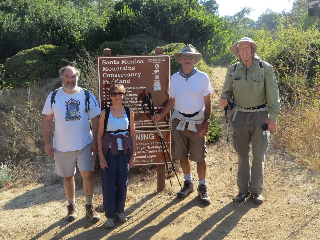
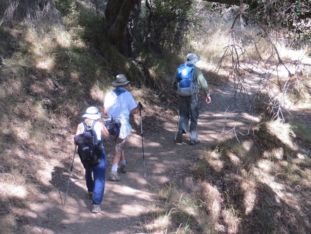
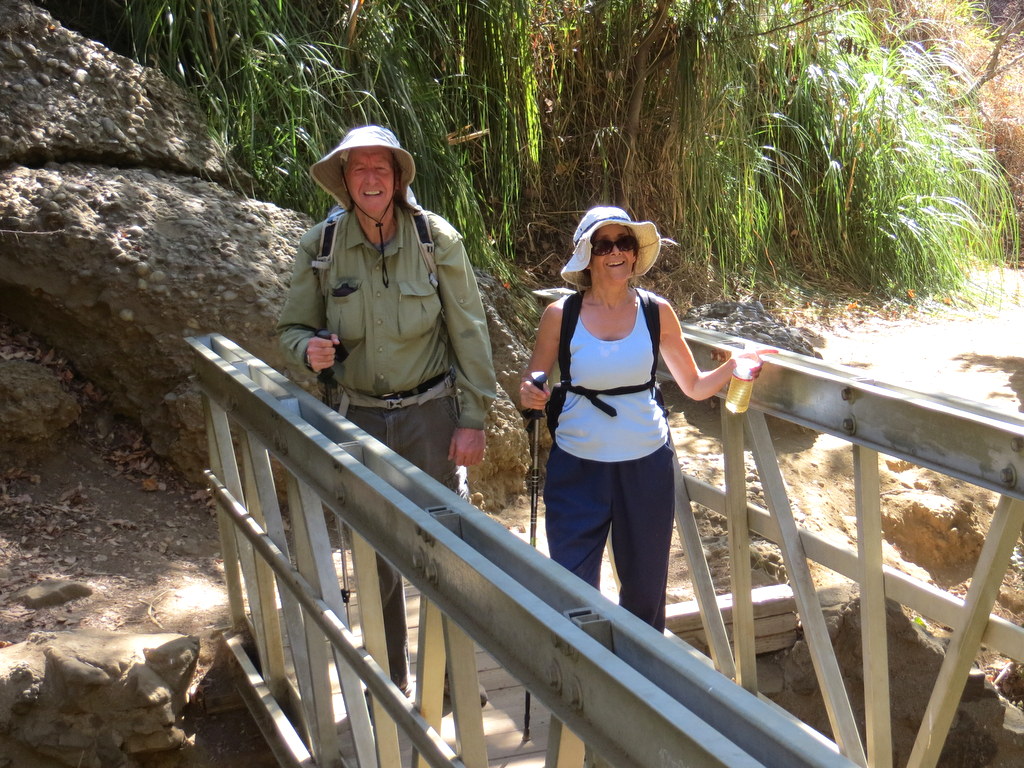
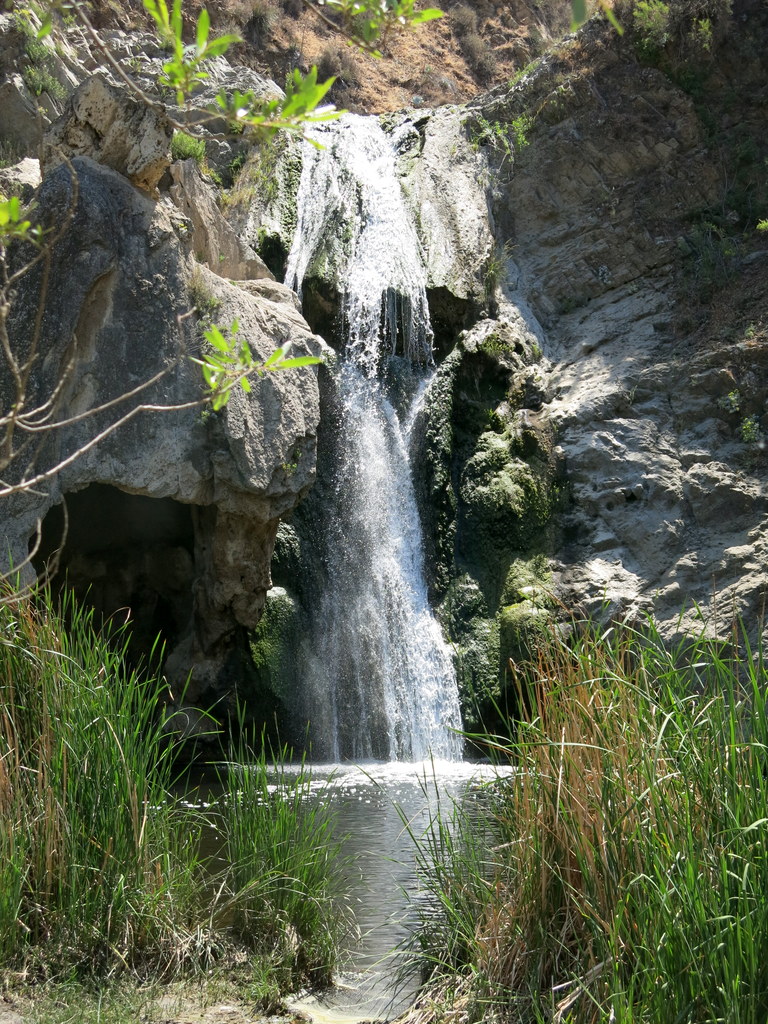
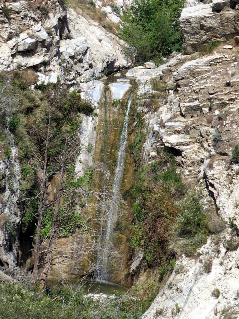
5 hikers carpooled via Hwy 118, I-405, and Sunset Blvd to the lower parking lot at Temescal Gateway Park in Pacific Palisades. A lovely refuge from the nearby urban congestion, it borders Topanga State Park. Our hike began on a shady trail along the streambed in Temescal Canyon and led pleasantly past rustic buildings constructed in the 1920’s for the Methodist Church as a west coast center for the Chautauqua movement. The whole area is shaded by towering sycamore, oak, and eucalyptus trees and a variety of other non-native trees such as palms and conifers. The trail began rising (as did the temperature) in Temescal Canyon as it entered Topanga State Park and we soon reached a wooden bridge crossing the (non-existent-today) stream at a point where there is usually a series of cascades (a “waterfall”) though there was almost no water due to drought conditions. Continuing westward along the trail as the temperature continued to climb, we soon reached Temescal Ridge and were rewarded by panoramic views of the Santa Monica Mountains, the coastline, and the Los Angeles skyline. However, the day had turned into a real scorcher, so we quickly descended along the Temescal Ridge (aka Viewpoint) Trail to the canyon bottom where we rested for a while in the shade, having abandoned the planned continuation of the hike over to Will Rogers State Historic Park due to the excessive heat. We returned to Simi Valley having completed a 4-mile hike with 1,010′ of elevation gain.
August 29th – September 2nd – Backpack Trip – Cottonwood Lakes
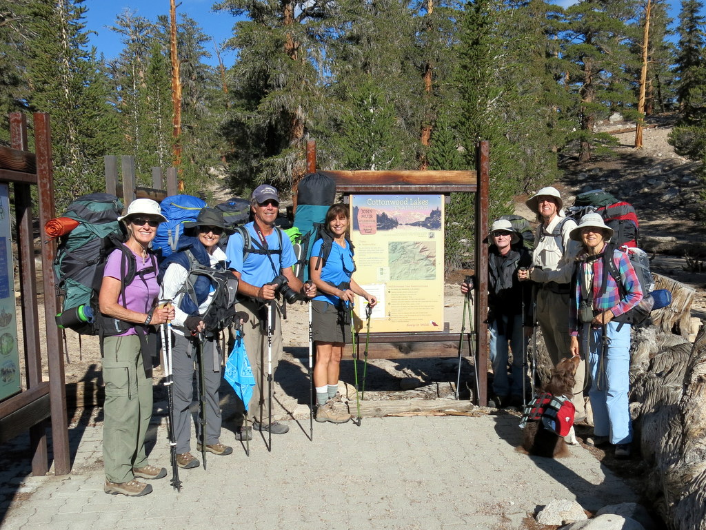
Thursday, August 29, 2013 – Travel to Horseshoe Meadow in the Eastern Sierra Nevada (and car-camp overnight)
Eight enthusiastic hikers (and Heidi, a dog) made their way north along Highway 395 in the Owens Valley to Lone Pine, CA (the gateway to Mt.Whitney). From there we headed southwest 23 miles on Horseshoe Meadows Road as it climbed steeply into the eastern Sierra Nevada, eventually reaching the walk-in campground (10,050′) for backpackers not far from the Cottonwood Lakes Trailhead. After pitching our tents we embarked separately on varying degrees of hiking in the Horseshoe Meadow area to begin to acclimate to the high elevation; some of us hiked to Cottonwood Pass (11,130′) and back [a total of 5.8 miles w/1,350′ of elevation gain/loss]. After dinner we talked and then turned in as darkness enveloped the campground.
Friday, August 30, 2013 – Backpack from Horseshoe Meadow to our Base Camp near Cottonwood Lake #3
The next morning we struck camp, repacked our backpacks, moved our vehicles a short distance over to the longer-term parking area near the Cottonwood Lakes Trailhead (10,061′) and prepared for our trek to the base-camp location we had selected. After taking several group photos, we shouldered our (heavy) backpacks and began hiking along the trail toward [Old] Army Pass. As we hiked slowly (to minimize the impact of the increasingly high altitude), we enjoyed the scenery, the nearby stream, and the cool day. Eventually we reached our intended base-camp location (~11,125′) on the flat part of the small ridge rising to the north of Cottonwood Lake #3 among some large trees (and rocks) having hiked 6.5 miles w/1,259′ of elevation gain. We were greeted by a few minutes of light rain as we set up our tents, after which we familiarized ourselves with the area, rested, admired the views, took photos, filtered water, took short walks, etc. After dinner most of us turned in fairly early, having been worn out by our heavy-backpack-laden hike in.
Saturday, August 31, 2013 – Hike trails at altitudes of less than 11,625′
Most of the group hiked a loop that started by hiking west beside Cottonwood Lakes #3 thru #5 [near (Old) Army Pass]; the route then took us uphill, cross-country to pretty seldom-visited Cottonwood Lake #6 (11,613′). We then hiked cross-country to Muir Lake (11,140′), passing several lovely ponds along the way; it is arguably the prettiest of the lakes in the Cottonwood Lakes basin. While we were at Muir Lake, it started raining fairly hard so we returned to camp, having completed a 4.2-mile loop w/800′ of elevation gain/loss. After resting a while in camp, several of us hiked to Cirque Lake (11,115′) and back. We passed by Cottonwood Lakes #1 thru #3 and South Fork Lake #1 (11,007′) along the way. This second hike covered a total of 4.9 miles w/725′ of elevation gain/loss. The scenery in both hikes was spectacular. The rain returned after dinner and we soon retreated to our tents.
Sunday, September 1, 2013 – Hike to higher (than 11,625′) altitudes
The new day arrived sunny and clear, filled with promise. Everyone in the group hiked all the way to New Army Pass (12,295′), passing Cottonwood Lakes #1 thru #3, Long Lake (11,160′), and High Lake (11,488′) along the way. There were very good views to the east, west, and north from the pass. Four members of the group continued on cross-country (encountering countless rocks/boulders along the way) to Cirque Peak (12,900′) from which there were spectacular views in all directions. After passing Long Lake on the way down, we had a glimpse of South Fork Lake #3. The hike to New Army Pass and back was 8 miles round-trip w/1,500′ of elevation gain/loss. The longer hike to Cirque Peak was 12.5 miles round-trip w/2,345′ of elevation gain/loss.
Monday, September 2, 2013 – Backpack from our Base Camp to Horseshoe Meadow (and return home)
After a quick breakfast we struck camp, shouldered our (still heavy) backpacks and began hiking out of the wilderness. We took a different route for the first half of the hike, this time including a very pretty portion of the “New Army Pass” Trail (including a two-tiered waterfall). Although it was mostly downhill (until near the end) and our packs were somewhat lighter, we took our time hiking out and arrived back at the Cottonwood Lakes Trailhead parking lot just before noon, having completed a hike of 6.4 miles w/260′ of elevation gain (and over 1,200′ of elevation loss). We soon headed home for a shower, a good meal, and a good night’s sleep in a comfortable bed with wonderful memories of a spectacular setting in the beautiful Sierra Nevada.
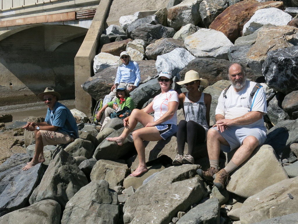
August 18th – Westward Beach to Paradise Cove

August 24th – Carpinteria Bluffs, Tar Pits Park, and Bates Beach
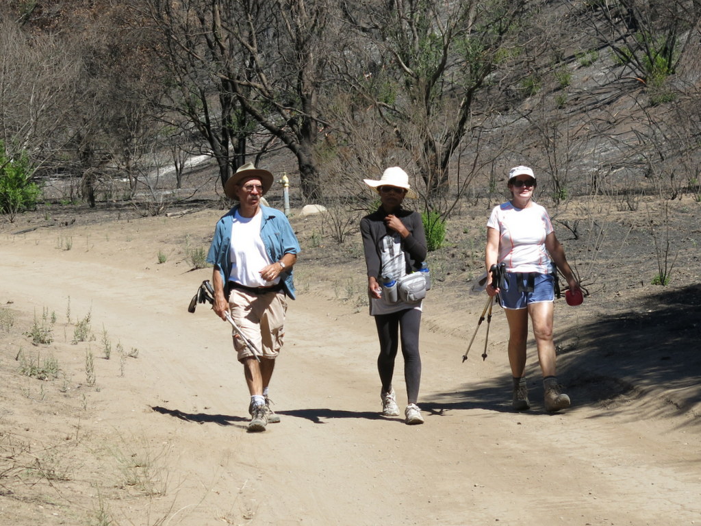
August 10th – Mt. Pinos to Sheep Camp
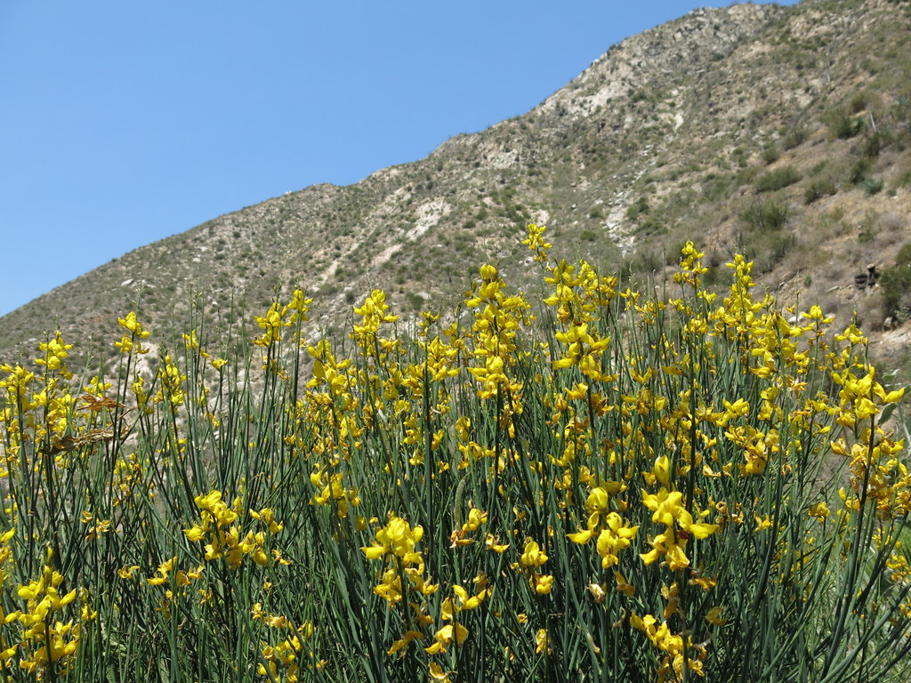
Seven hikers carpooled the Chula Vista parking lot (favored by stargazers) about two miles from the summit of Mt. Pinos (8,831′). The hike began on a pleasantly cool morning by following a dirt road through the forest to the Tumamait-Mt. Pinos Trail (21W03) trailhead at the Condor Observation Point where the views to the north, south and west were obscured by smoke/smog. The well-maintained dirt trail then entered the Chumash Wilderness as we descended the open western slope – which displayed a variety of wildflowers – via switchbacks; we then crossed a saddle and ascended the forested eastern slope of Sawmill Mountain. We then followed an unmarked side trail to the Sawmill Mountain peak (8,818′), marked by a large rock monument. Returning to the main trail we descended to a junction with the North Fork Trail (22W02) which we followed as it descended southward half a mile to Sheep Primitive Camp (8,200′) under a stand of Jeffrey Pines. There we took a rest/lunch break and enjoyed the pleasant forest environment. We then retraced our route up Sawmill Mountain and back to the Condor Observation Point. After regrouping atop Mt. Pinos on a still-cool day, we hiked back to the parking lot and then returned home having completed a 10-mile hike with 1,925′ of elevation gain.
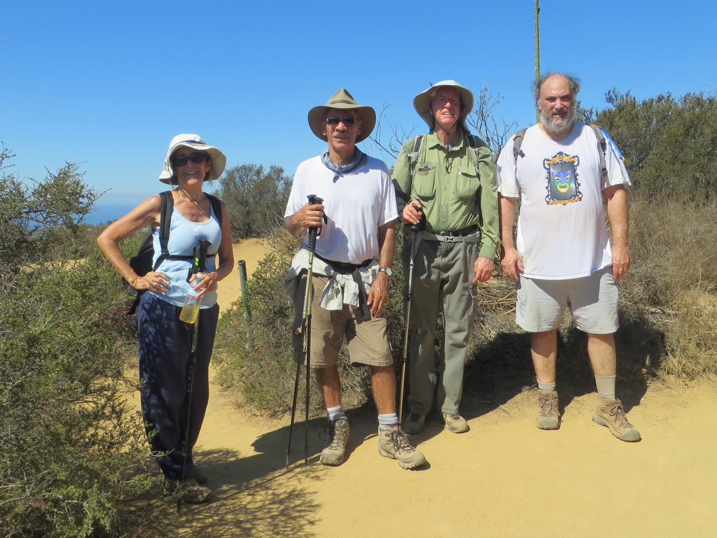
August 3rd – Newton Canon

Eleven hikers met at Donut Delite on an unseasonably cool and cloudy morning. Once we arrived at the Kanan Road trailhead, we were met by seven more hikers, increasing the total count to eighteen. The clouds and fog left us, once we arrived, but the cool temperatures remained. Up and over Kanan Road we climbed, on a middle segment of the famous Backbone Trail. Crossing Latigo Road, and passing by its Backbone Trail parking lot, we thought it quite unusual, because not a single car was in the lot. Quite often, this same parking lot is completely full. Continuing on down the trail, we left the Backbone Trail, stopped at our Castro Motorway saddle turn-around point, and enjoyed some trail snacks. The heat and the humidity of the day began catching up with us, so it was most reassuring to know that it was mostly down hill on the way back to our cars. If was a fine hike, having completed 7.4 miles, with about 1,900′ total elevation gain and loss.
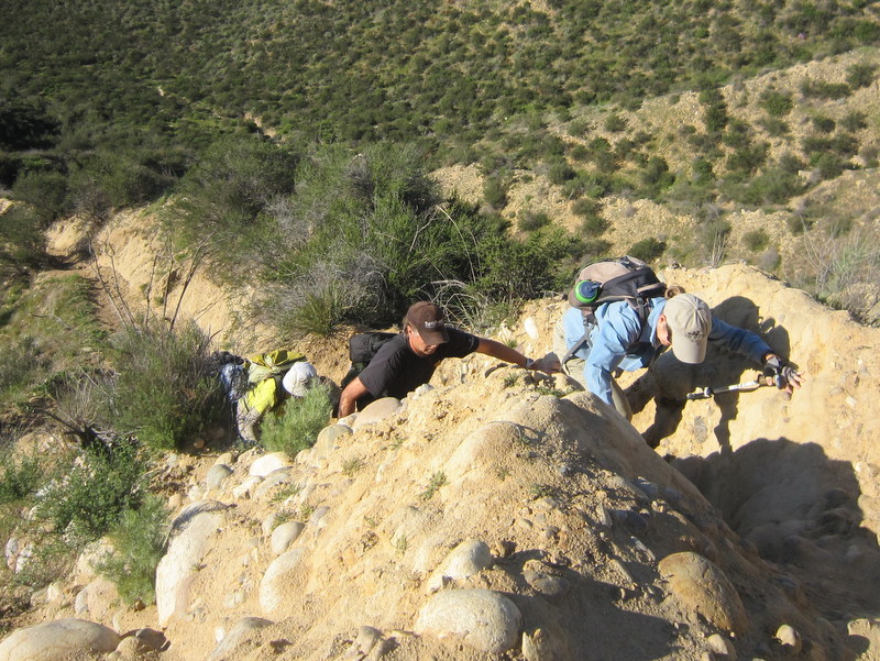
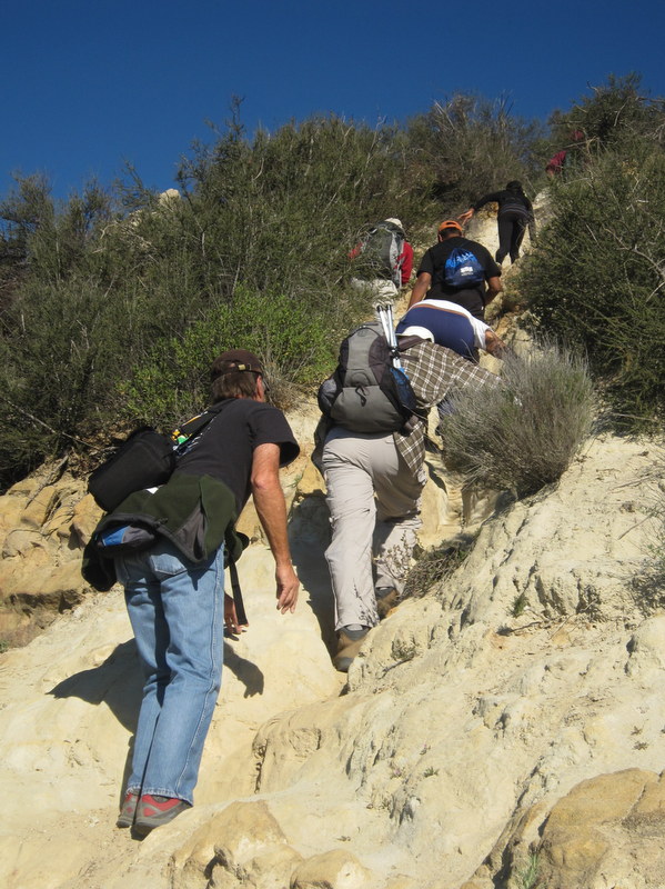
July 27th – The Hummingbird Trail and Rocky Peak
Twelve bright-eyed and bushy-tailed hikers met at the Kuehner Drive Hummingbird Trailhead. Seven AM is mighty early to start a hike, and we hoped this early start would help beat the heat later in the day. Seven hikers, went to the junction of the Hummingbird Trail and Rocky Peak Fire Road, and turned back. Five other hikers continued up the Rocky Peak Fire Road to the summit, where we quickly enjoyed some fine views. This point is the same place where we turn around on our regular Sunday evening hike. We started back down the trail just in time. By the time we got back to our cars, the temperature had already climbed to the high eighties. All in all it was a great hike, having completed 7.3 miles with about 2,100′ elevation gain.
July 20th – Solstice Canyon – Sostomo Trail – Deer Valley Loop & Tropical Terrace
12 hikers carpooled to Solstice Canyon in the Santa Monica Mountains National Recreation Area on a fairly cool but humid overcast morning. The out-and-back hike began by following barely flowing Solstice Creek along the easy well-shaded Solstice Canyon Trail (a dirt road). Taking advantage of two short trails paralleling the dirt road along the way, we reached the Sostomo Trail after about one mile. We then followed the Sostomo Trail as it climbed steadily toward a junction with the Deer Valley Loop Trail. As the trail rose we had good views of Solstice Canyon and the Rising Sun Trail across the canyon. Our shirts were soon soaked due to the high humidity, but the marine layer shielded us from direct sunlight (making the hike more pleasant). The well-maintained trail crossed Solstice Creek twice. After reaching Deer Valley, we followed the loop trail in a clockwise direction as it ascended the mountainside to an overlook of the Pacific Ocean. After enjoying the view, we completed the loop and then returned along the Sostomo Trail to the Solstice Canyon Trail. Turning left we walked a short distance to shady Tropical Terrace, the ruins of the Roberts house built in the 1950s and destroyed by wildfire in 1982. At one time there were giraffes, camels, buffalo, African deer, and exotic birds in the canyon. We took a break at Tropical Terrace, read the signs describing it, and enjoyed the ambiance of palm trees and trickling cascades in the adjacent Solstice Creek. We then returned to our vehicles (parked along Hwy 1) via the Solstice Canyon Trail completing a 7.5-mile hike with over 1,600′ of elevation gain.
July 6th – Mt. McCoy to the Reagan Library


June 22nd – The Secret Trail, Calabasas Peak, Red Rock Canyon
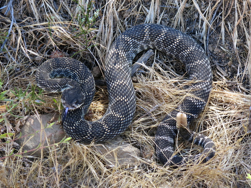

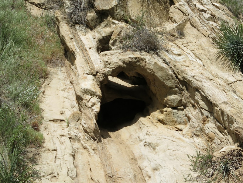
16 hikers carpooled in six vehicles from Simi Valley to Red Rock Canyon in the Santa Monica Mountains where we dropped off three shuttle vehicles. We then used the remaining three vehicles to carpool to the trailhead of “The Secret Trail” [aka the Calabasas Cold Creek Trail] on Mulholland Highway. We initially headed south through an oak woodland following the partially shaded trail as it crossed a ridge to the east and then climbed up to the Calabasas Motorway. We followed the dirt motorway southward to the short spur trail that led to Calabasas Peak (2,129′) which afforded a panoramic view of the surrounding mountains and valleys. After taking a short break we descended southward along the motorway to the dirt road leading up from Red Rock Canyon to the east; we encountered a large rattlesnake and took photos. We soon reached the shaded bottom of the canyon where we explored some small caves and arches. Our route took us by many lovely sculptured sandstone rock formations with colors ranging from white to dark red. We then retrieved all of our vehicles and headed home having completed a pleasant 5-mile hike with 900′ of elevation gain/loss.
June 15th – Devil’s Punchbowl Trail to Devil’s Chair

Ten hikers met near the Nature Center in the Devil’s Punchbowl Natural Area a few miles southeast of Pearblossom, CA on a still-pleasant morning to hike the Devil’s Punchbowl Trail to the Devil’s Chair. Our hike began by climbing uphill on the Burkhart Trail for about a mile to a junction with the Devil’s Punchbowl Trail. We followed the partially pine-shaded Devil’s Punchbowl Trail as it wound along the north slope of the San Gabriel Mountains overlooking the Antelope Valley; there was fairly good visibility to the north including ever-changing views of spectacular rock formations. The Devil’s Punchbowl is the point at which the San Andreas Fault and the Punchbowl Fault meet; it’s part of the San Andreas Rift Zone. The trail eventually descended to a junction with the spur trail leading out to the Devil’s Chair which provided excellent “up-close” awe-inspiring views of the colorful geologic formations created by the friction between the two earthquake faults. After taking lots of photos and enjoying a rest/lunch break under some nearby pine trees, we retraced our route to the Nature Center. On our way home we stopped at the famous Charlie Brown Farms store (highly recommended) at 8317 Pearblossom Highway for lunch/shopping. We hiked 7.9 miles with about 1,900′ of elevation gain/loss.
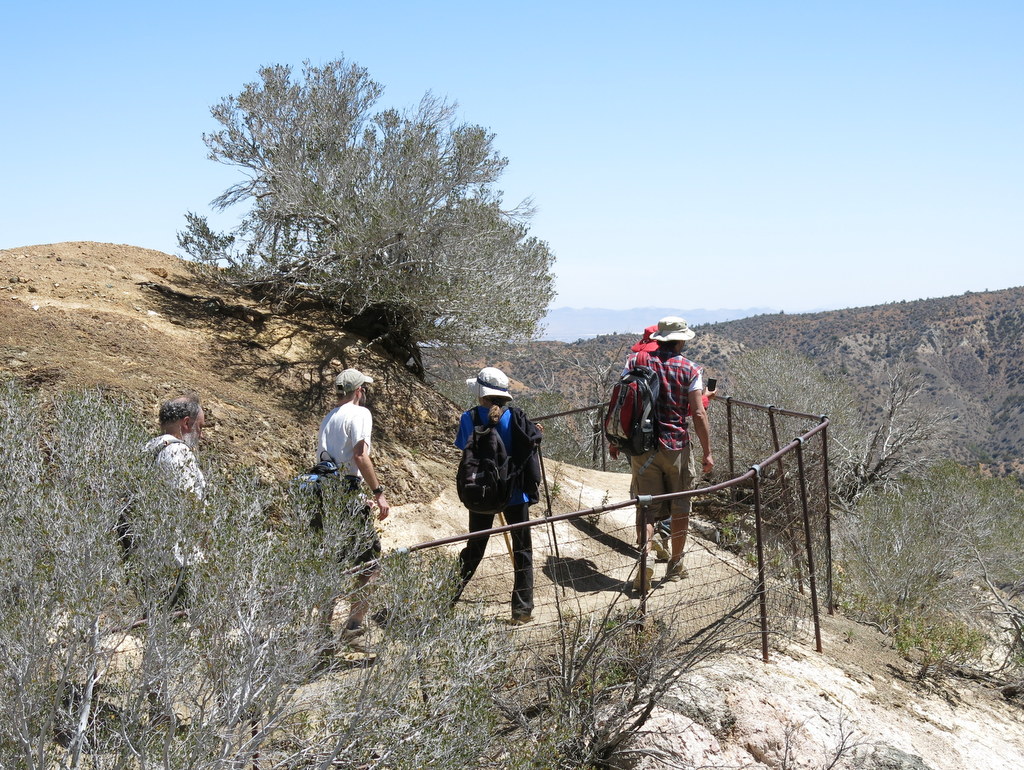
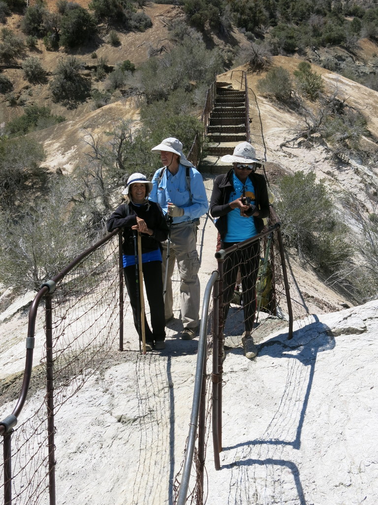
June 8th – Eaton Canyon Park to Henninger Flats
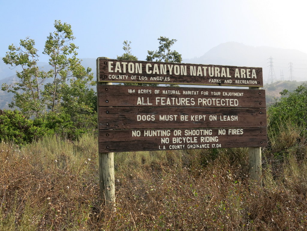
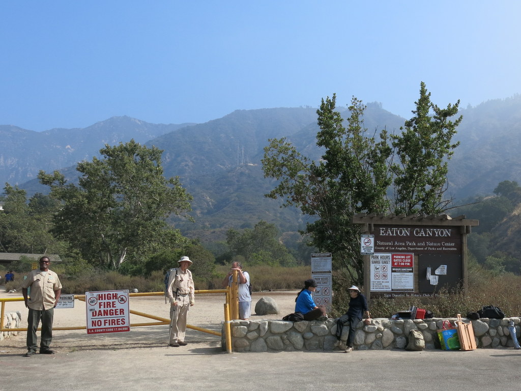
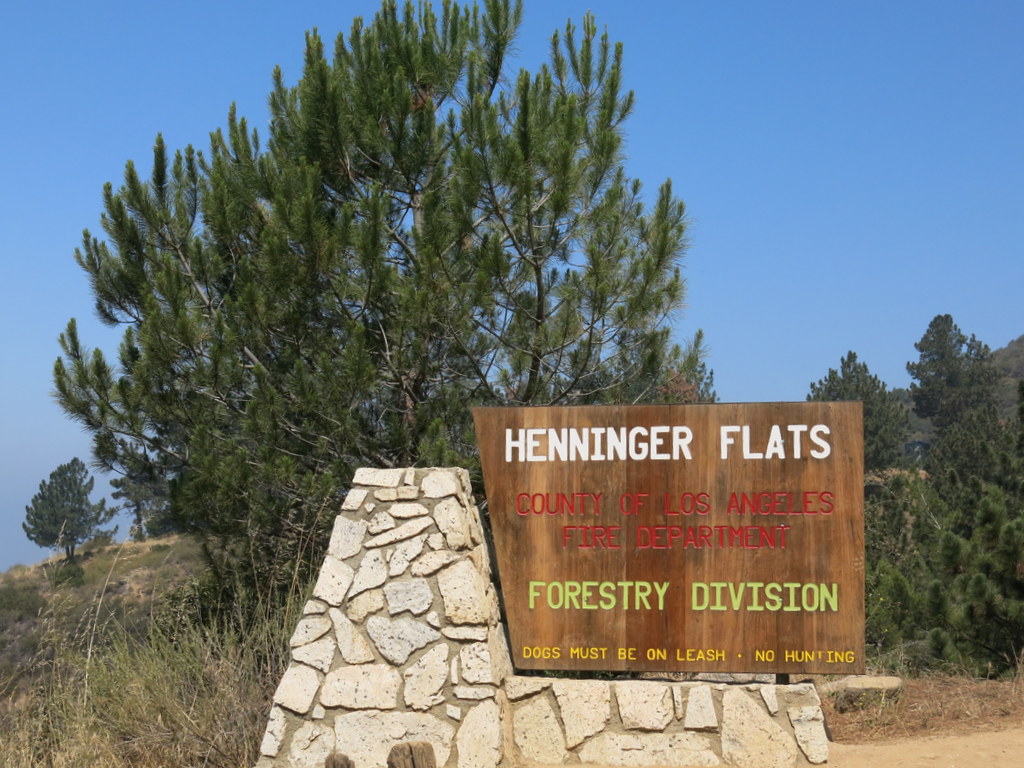
Ten hikers met near the Eaton Canyon Nature Center in Pasadena on a soon-to-be-hot late-spring morning. Our hike began along the seasonally dry streambed in Eaton Canyon, but we soon began ascending a steep equestrian trail to its junction with the Mt. Wilson Toll Road. As we followed the old toll road up the mountain the view expanded, but was limited by the haze over Pasadena. Somewhat winded due to the nearly 1,700′ elevation gain, we eventually reached lovely Henninger Flats, a cool forested notch sitting high on the mountain slopes above Altadena. Henninger Flats is complete with water, picnic tables, bathrooms, and a nature center/museum. It is also the home of the Los Angeles County Experimental Forestry Nursery. After taking a leisurely break in the shade of the forest, we descended along the Mt. Wilson Toll Road to Eaton Canyon. We continued hiking upstream in the canyon bottom which soon provided shade and water in the stream (as well as lots of other day hikers) until we reached Eaton Canyon Falls. After enjoying the lower waterfall and its pool, we returned along Eaton Canyon to the Nature Center and headed home having hiked 9 miles with about 1,900′ of elevation gain/loss.
June 1st – Hummingbird Trail Work Party & Cache In Trash Out Event – National Trails Day
In conjunction with National Trails Day, 23 Trail Blazers and local geocachers, participated in a work party on the Hummingbird Creek Trail. We completely filled the back of a pickup truck with the trash we collected. The waterfall area graffiti has been painted over once again. We all had a great time together, giving back to the community.
May 24th – May 27th – San Miguel Island Backpack
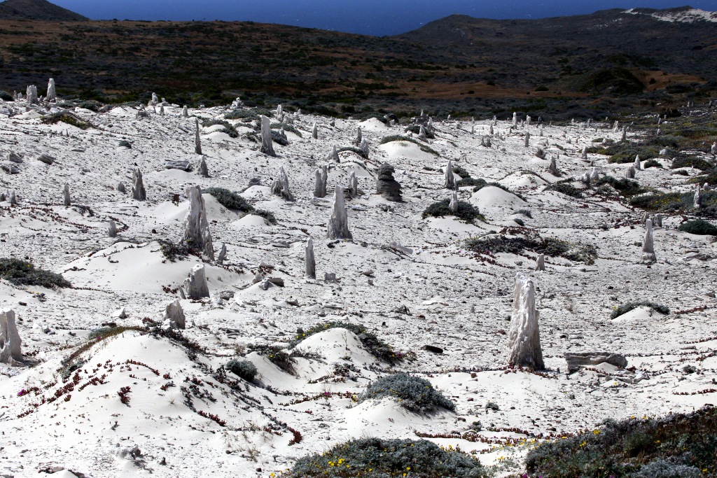

FRIDAY, MAY 24, 2013 – Travel to San Miguel Island, backpack to the campground, set up camp, and hike to Brooks Overlook – 4.8 miles w/1,443′ elevation gain/loss
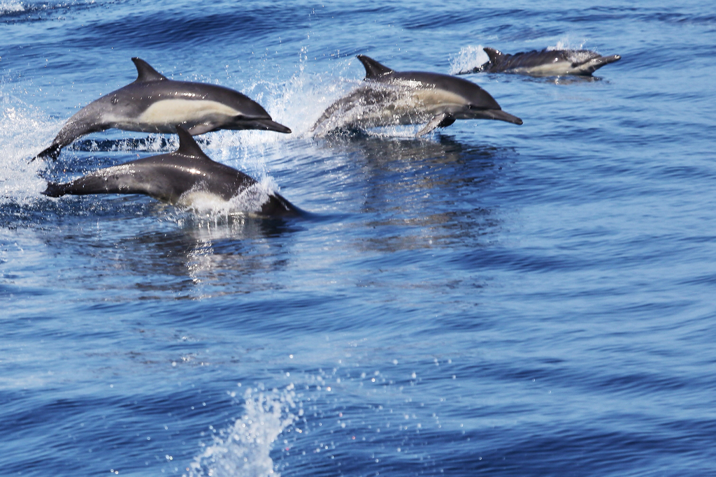
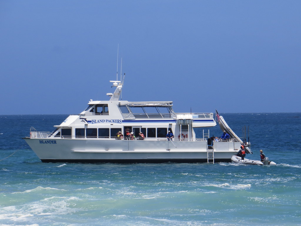
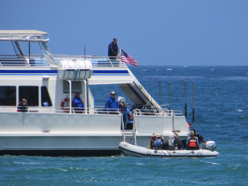
Fifteen eager hikers assembled around 7:00 a.m. at the Island Packers facility in Ventura Harbor with their backpacking, hiking, and camping gear, looking forward to exploring San Miguel Island, the westernmost of the five islands in the Channel Islands National Park. Since there is no potable water available on the island, everyone brought at least 2.5 gallons of drinking/cooking/washing water with them. By 8:00 a.m. all passengers and their gear were aboard the boat and the journey began. Once we were in deeper water in the Santa Barbara Channel, we spotted many dolphins; Anacapa Island was barely visible to the south. The somewhat rough boat ride continued along the south side of 22-mile-long Santa Cruz Island to Santa Rosa Island where most of the passengers disembarked. The remainder of the trip was quite rough since there was a strong oncoming wind in the aftermath of a “gale warning” in the area for the previous night. After anchoring in Cuyler Harbor the crew ferried us and our gear via a zodiac inflatable boat to the beautiful sandy beach where we were greeted by Inge Rose, a very knowledgeable volunteer who was our guide for the weekend.
After landing ashore, we faced the task of carrying our gear and water 0.7 mile through soft sand at first, then along a narrow trail leading steeply up Nidever Canyon and then through a coreopsis forest to the only campground on the island, an elevation gain of 500′. Most of us carried our loaded backpacks up to the campground first and then returned to the beach for our water, daypacks, etc. The second trip up the trail seemed much harder than the first one — water is heavy! We occupied eight of the nine campsites in the campground; each one was equipped with a picnic table with two benches, wooden fencing in an L-shape that served as a much-needed windbreak, and a wooden cupboard to keep food away from the foxes, mice, etc. We set up our tents and unpacked. Inge Rose then led us on a “warm-up” hike to Brooks Overlook near Cardwell Point. Along the trail we passed by several no-longer-used island fox breeding enclosures (to protect them from Golden Eagles); there was a nice view to Crook Point. Later, after dinner and after availing ourselves of the most important facility on the island — the nearby outhouse (with a tile floor!) — we crawled into our sleeping bags and slept fitfully through the night as 20-plus-mph winds swept the island.
SATURDAY, MAY 25, 2013 – CARDWELL POINT AND LESTER POINT
Hike #1. Campground to Cardwell Point – 6.1 miles RT w/666′ of elevation gain/loss
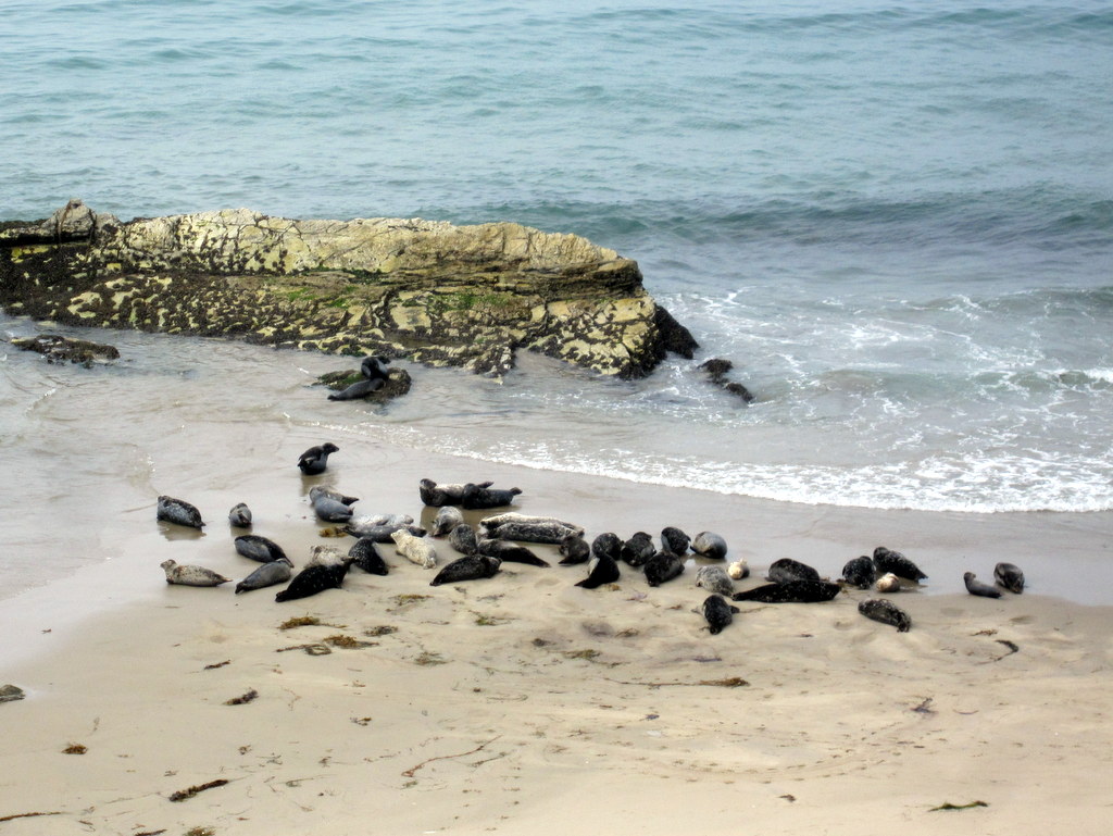
Inge Rose led the group on a 6.1-mile round-trip hike to Cardwell Point on the east end of the island. We had a great view from about 100′ up on a cliff of scores of elephant seals on the beach (some were nearby in the ocean). We took care not to let them see us standing upright since Inge told us that they would take that as a sign of aggression and they might all retreat into the ocean. We then walked a short distance northward where we had a good view of lots of California sea lions and more elephant seals. We returned to the campground for lunch and a brief rest.
Hike #2. Campground to Lester Point – 6.2 miles RT w/1,081′ of elevation gain/loss
Inge Rose led the group on a 6.2-mile round-trip hike to Lester Point on the north side of the island. Along the way we stopped at the locations/ruins of an old adobe ranch house and the previous ranger station, both in the Nidever Canyon area. There were stunning views of Cuyler Harbor and Simonton Cove and there were many blooming plants along the trail.
The island’s vegetation has made a miraculous recovery since the sheep overgrazed it from the 1850’s to the late 1940’s and the U.S. military used it for target practice, the result of both actions being that the island was mostly a sandy wasteland by the 1950’s.
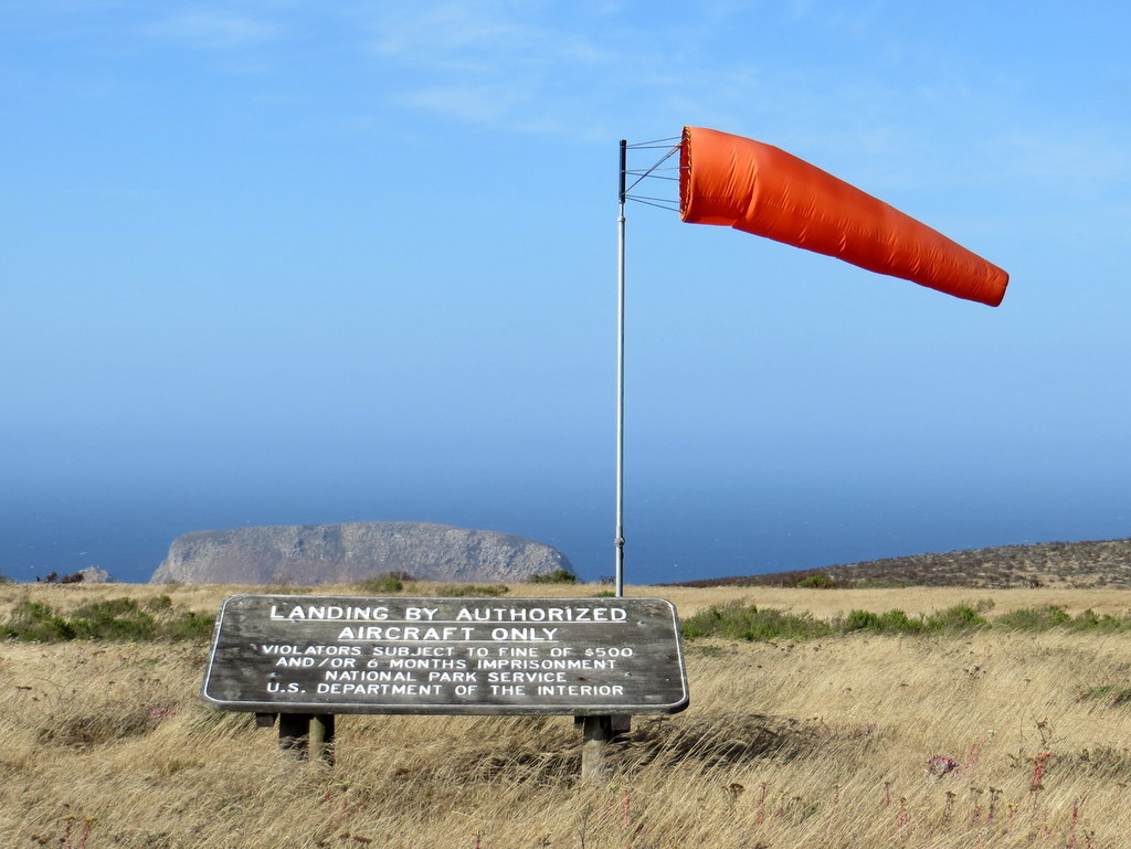
SUNDAY, MAY 26, 2013 Ð POINT BENNETT AND THE CALICHE FOREST – 14.5 miles RT w/1,736′ of elevation gain/loss
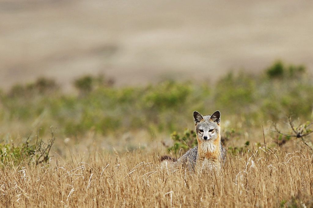
The trail first climbed westward to the top of San Miguel Hill (831′), the highest point on the island [we bagged another peak!], where there is a state-of-the-art naval weather tower. A fairly short (downhill) distance farther on at a nicely signed fork in the trail, a side trail led west to the Caliche Forest (which we visited on the way back). The trail continued undulating westward through a landscape of non-native grass and wind/thin-soil-stunted plants (some of which were blooming), eventually passing another airstrip [this one used primarily by visitors to the Point Bennett Research Station]. A mile or so further on Point Bennett came into view in the distance. It appeared that quite a bit of kelp (seaweed) had washed ashore. However, as we drew closer, it became apparent that we were looking at over a thousand pinnipeds (seals and sea lions) lying on the beach [they rest during the day and “fish” at night]. We hiked down to a vantage point a couple of hundred yards away and watched and took photos of them for a while. We then retraced our path to the side trail leading to the Caliche Forest (the calcified remains of an ancient forest) and followed it. This strange-looking “forest” is apparently one of only two such “forests” in the world. After resting for a few minutes, we resumed our trek back to the campground, arriving tired but mentally refreshed. We were fortunate to spot several island foxes during this hike; they are about the size of a housecat (about a foot in height, weighing 4-to-5 pounds). We experienced another very windy night on the island. In fact, there was a real question as to whether Island Packers would be able to retrieve us from the island the next day; if not, we would probably have spent two additional nights on the island.
NOTE 1: The island fox was nearly extinct only a few years ago, but there are now about 400 of them on San Miguel Island thanks to the successful breeding program.
NOTE 2: San Miguel Island (and Point Bennett in particular) hosts tens of thousands of pinnipeds each year. Six species of seals and sea lions visit the island (the largest variety found anywhere in the world); two of the species deliver and raise their offspring on the island’s shores. The island is sometimes referred to as the California Galapagos.
MONDAY, MAY 25, 2013 – “RESCUE” AND RETURN TO “CIVILIZATION”
After breakfast, we struck camp and made another two trips between the campground and the beach in Cuyler Harbor to transfer all our gear. It was easier this time since there was no weight on our backs during the one uphill trip and the two downhill trips were easier since we were no longer carrying 20+ pounds of water (each). Once on the beach we waited expectantly until 11:45 a.m. when the Island Packers boat came into view; a few elephant seals were resting on the beach to the west of us. This time the boat had no passengers until we boarded using the zodiac-inflatable-boat-shuttle method again. This time the trip from the beach to the boat was much more “exciting” as the zodiac pitched in the rough sea as we hung on tightly; everyone was soaked to some extent by saltwater. Once on board, we headed for the junk food counter on the boat; there’s nothing like some sugar and grease to make you feel good (at least briefly).
On the return boat trip, there were good views of the shorelines of San Miguel Island, Santa Rosa Island (where we picked up additional passengers), and Santa Cruz Island. Unfortunately the sea was too rough for the boat to enter the Painted Cave (on Santa Cruz Island) and we spotted virtually no sea life during the trip.
We arrived happily back in Ventura Harbor around 4:30 p.m., helped unload our gear from the boat/pier, and then headed home for a shower, a good meal, and a good night’s sleep in a comfortable bed without wind noise.
SUMMARY – A great trip (despite the strong winds) in one of America’s beautiful national parks that is experienced by few people, despite the park’s proximity to over 20 million people in southern California.
May 4th – Wildwood Park Loop
Eleven hikers met at the Donut Delite parking lot, and car pooled to the trailhead, where we met one additional hiker. The morning was clear and beautiful, promising a great hike. Paradise Falls was flowing well, augmented by a good deal of recent lawn watering, due to the elevated temperatures just a week before. The heat an humidity began to take it toll, by the end of the hike, so we opted to return via the less exposed Indian Creek Trail. We returned to the trailhead, just before the heat of the day peaked, having completed 7.1 miles, with just over 1,900′ of elevation gain.
May 4th – Trail Canyon to Big Cienega Meadow
Eighteen hikers (and three dogs) carpooled to the Trail Canyon trailhead in Big Tujunga Canyon a few miles northeast of Sunland, CA on a pleasant spring morning. The August, 2009 Station Fire in the San Gabriel Mountains resulted in the closure of the Big Tujunga Canyon area including this trail. The area was reopened to the public on May 25, 2012 and this was our group’s first hike in the area since the fire. The trail, a dirt road at first, passed several homes that survived the fire near the mouth of the canyon and then began a long, but not steep, climb along a gently flowing stream in the verdant canyon bottom, crisscrossing the stream several times. The trail, adorned with a variety of blooming plants, then climbed along and around a mountainside until at the two-mile mark we were treated with views of the pretty Trail Canyon Waterfall. Continuing past the waterfall, we hiked another mile to the Tom Lucas Trail Camp where we rested for a while. The trail to this point was in good condition. However, as we continued another mile up the canyon it soon became more challenging since it hasn’t been maintained since the Station Fire. The riparian environment was still lush, but the trail was significantly overgrown and required trail-finding skills; there was also lots of poison oak. We turned around at the four-mile mark without having reached/identified Big Cienega, “a lush meadow,” but having tired of the bushwhacking. We returned the way we came and headed home having completed an enjoyable 8-mile hike with around 1,700′ of elevation gain/loss.
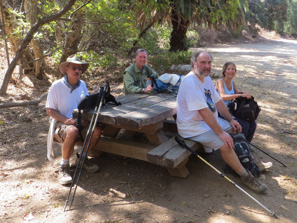
April 20th – Matilija Falls
Seven hikers carpooled to the trailhead at the west end of Matilija Road a few miles northwest of Ojai on an already warm, soon-to-be-hot morning; one other hiker met the group at the trailhead. The hike began along a road that headed west through the private Matilija Canyon Ranch Wildlife Refuge where we were greeted by several loud, but beautiful peacocks. The first stream crossing at the 0.4-mile mark was easy since the water level was relatively low. After a little over a mile our route crossed through a lovely private ranch via a dirt road that hikers are restricted to. At about the 2-mile mark the dirt road became a narrow trail as it wound through a shady poison-oak-paradise stretch. In fact, since the route closely followed Matilija Creek the rest of the way, poison oak was frequently present [long pants and a long-sleeved shirt are recommended]. After a while we stopped by the stream at a particularly lovely spot and took a short break (and some photos). Continuing upstream the maintained trail ended and we began to scramble and boulder hop, frequently finding short open stretches of trail. Occasionally we were required to cross the stream in order to continue; fortunately the lower water level made this possible without having to wade. We were rewarded for our effort by beautiful scenery including the flowing creek, several large pools of water, vast expanses of sedimentary rock layers, an extensive riparian oak woodland, towering canyon walls, and occasional wildflowers. At about the 4.5-mile mark we reached a 30-foot cascade and a beautiful shaded campsite just above it. We took a rest-and-lunch break in this idyllic location. Continuing on upstream we soon reached the two fabled waterfalls, took some photos, and rested briefly. The scrambling and boulder-hopping going downstream seemed somewhat easier than going upstream and the scenery was just as beautiful though the temperature rose to 88 degrees Fahrenheit. We made it back to our vehicles with only minor scratches, cuts, and bruises. We returned home after a 9.5-mile hike with around 1,300′ of elevation gain/loss.
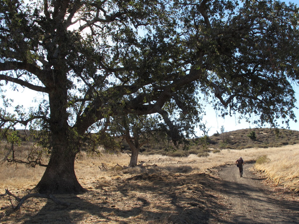
April 6th – Towsley Canyon
19 hikers met at the “Ed Davis Park at Towsley Canyon” section of the 4,000-acre Santa Clarita Woodlands Park on a pleasant spring morning. We began hiking along a dirt road toward the Sonia Thompson Nature Center, crossing Towsley Creek on a concrete bridge. Soon we began a counterclockwise hike on the Towsley View Loop Trail. After passing through The Narrows section of Towsley Gorge, the trail began rising via switchbacks along the shaded eastern slope of the canyon. The verdant north-facing slopes of the Santa Susana Mountains rose steeply to the south. The single-track trail passed through sage scrub, stands of California walnut, bay laurel, and scattered oak trees as we made our way to the 2,450’ high point on the trail from which much of the Santa Clarita Valley could be seen. The area’s oil-producing history was evidenced by the foamy water in Towsley Creek as well as a sulfurous smell in several places along the trail. The trail then began dropping into shady Wiley Canyon where the group took a break near another creek. A short distance on, we turned left onto the Canyon View Loop Trail which rose along the northern flank of the mountain before descending to the Sonia Thompson Nature Center. After resting in the shaded grassy area near the nature center, we followed the paved road back to our vehicles, having completed a 6.8-mile hike with 1,400’ of elevation gain/loss.
March 30th – Edison Road, Albertson Motorway, Upper Las Virgenes Trail
15 hikers (+ three dogs) met at Vista Del Arroyo Park on Chicory Leaf Place in Simi Valley for a hiking adventure in the springtime Simi Hills. At first we headed east along the Arroyo Simi but we then began climbing a north-south ridge along an Edison Road toward the Albertson Motorway which runs east-west atop the Simi Hills. We were soon rewarded with views of the nearby mountains and canyons as well as the American Jewish University’s Brandeis-Bardin campus to the east and Runkle Canyon and beyond to the west. As we climbed higher, the Arness Fire Road appeared to the east and several unusually shaped structures on the Santa Susana Field Laboratory property [aka Boeing/Rocketdyne] loomed into view. Eventually we reached the Albertson Moorway and enjoyed a rest/lunch break on lush green grass in the shade of some large oak trees. We continued to the south to a higher vantage point with sweeping views of the Simi Hills to the south and the Santa Susana Mountains to the north. We then returned to our vehicles, having completed a 9.3-mile hike with about 1,900’ of elevation gain/loss on a nice day for hiking.
March 23rd – Tierra Rejada Park
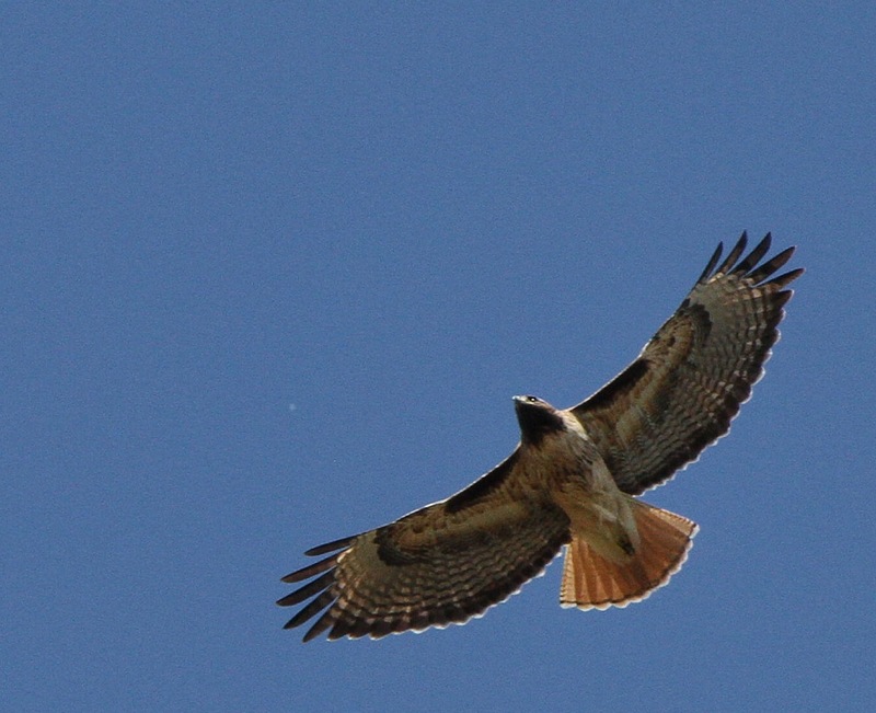
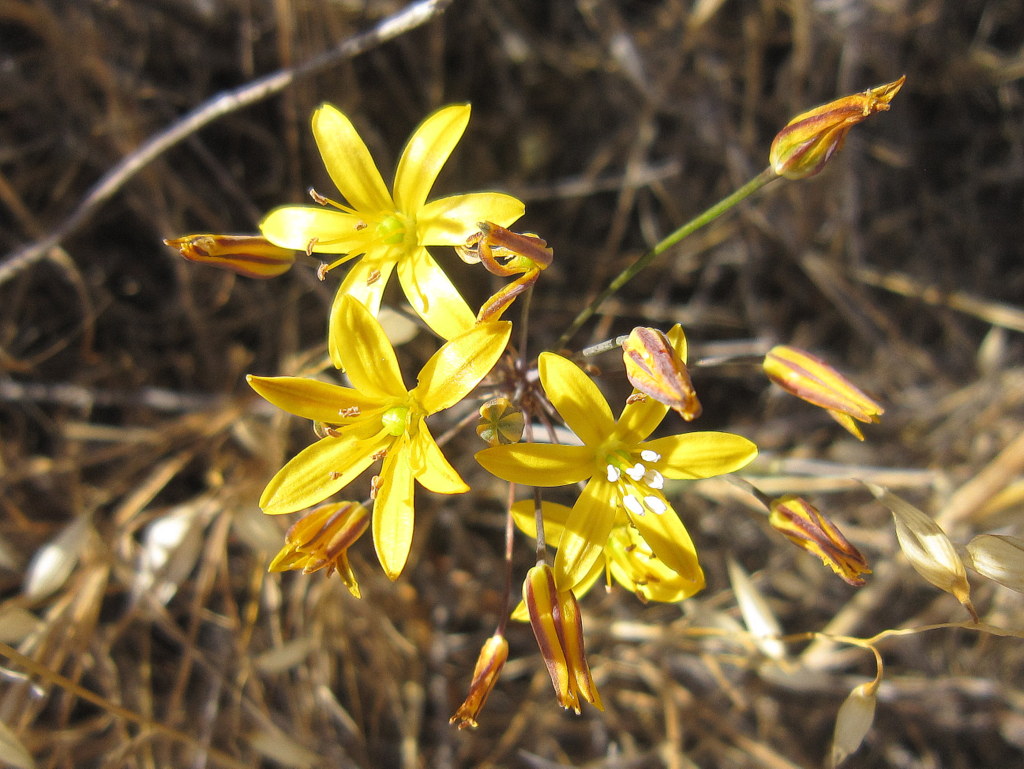
16 hikers met at Stargaze Park in Simi Valley on a chilly spring morning. After introductions we headed north toward Tierra Rejada “Park” and the Arroyo Simi, but soon headed uphill to the west along an Edison Road. The still-green hillsides were sprinkled with occasional wildflowers. We spotted a hawk perched high in an oak tree; later we watched as another hawk circled lazily overhead searching for a meal and a couple of turkey vultures flew by. Eventually the trail headed south and then climbed west/northwest along an abandoned, somewhat overgrown, flower- and grass-covered ridge road affording excellent 360-degree views of the surrounding mountains and valleys, including the Reagan Presidential Library and Moorpark College. After taking a lunch/rest break atop a high ridge from which we could see Fairweather Crossing, we retraced our steps to our vehicles, having completed an 8.2-mile hike with 1,700’ of elevation gain on a nice day for hiking with both old and new friends.
March 9th – Joughin Ranch to Oat Mountain

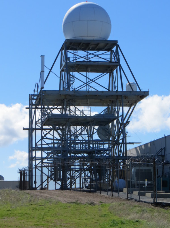

15 hikers met in the parking lot on Browns Canyon Road [the northern extension of De Soto Avenue in Chatsworth] at the Michael D. Antonovich Regional Park at Joughin Ranch on a cold windy morning. After paying the $5.00 parking fee, our hike began on the asphalt-paved road that climbs steadily to the western end of Oat Mountain. After 0.7 mile we passed through the abandoned site of a 1950’s Nike missile site, once manned by U.S. soldiers but used more recently by LAPD SWAT for training. As we continued our upward climb, we were treated to increasingly beautiful views of the lush green mountainside (but were still buffeted by strong chilly winds). When we reached the ridge of Oat Mountain we hiked around to the north side of the “golf-ball tower” where we enjoyed panoramic views to the north, west, and south of the Santa Clarita Valley, the Santa Susana Mountains, Simi Valley, and the distant snow-capped Topa Topa and San Gabriel Mountains. Many of the hikers then returned to the parking lot completing a 7-mile hike with 1,813’ of elevation gain/loss. As the morning warmed and the wind let up, the remaining hikers strolled eastward on the Oat Mountain Motorway for a while enjoying views to the north and south. As we returned to the parking lot we watched a Los Angeles Fire Department helicopter as it was being used in a training exercise. We completed a 9.2-mile hike with 2,629’ of elevation gain/loss.
March 2nd – Devil Canyon, Browns Canyon Road, Rocky Peak Fire Road, Las Llajas Canyon
14 hikers (including several new-to-the-group hikers) met at the Las Llajas Canyon trailhead in Simi Valley and then carpooled to the Devil Canyon trailhead on Poema Place in Chatsworth. Our hike began by dropping into the heavily shaded canyon bottom where we followed the remnants of the Devil Canyon Motorway upstream as it frequently crisscrossed the creek. We enjoyed views of several varieties of blooming wildflowers and bushes as we made our way up to the large dam near the Ybarra Canyon junction. Continuing upstream the canyon soon widened and the surrounding hills were covered with bright green grass and intermittent oak trees which eventually became an oak forest in the upper portion of the canyon. Upon reaching (dirt) Browns Canyon Road, we took a lunch break while enjoying the beautiful surroundings and then hiked west to the three-way junction of Rocky Peak Fire Road, Las Llajas Canyon Road, and Browns Canyon Road where we headed south on Rocky Peak Fire Road with excellent views of the Santa Susana Mountains. We descended along an abandoned oil field road to Las Llajas Canyon and then hiked out to the trailhead on Evening Sky Drive while admiring the stunning green mountainsides, completing a 10.5-mile hike (with about 1,600’ of elevation gain).
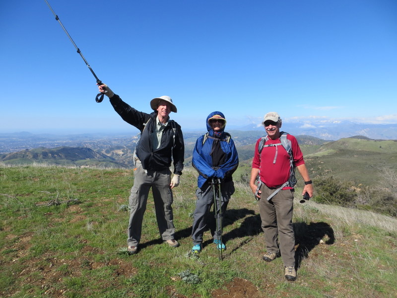
February 23th – Whiteface Mountain Exploratory Hike
16 hikers (including several new-to-the-group hikers) met in the parking lot at Big Sky Park on a pleasantly cool morning, determined to scale Whiteface Mountain just north of the Big Sky housing development in Simi Valley. Once ready, we walked up to the nearby trailhead on the south side of the large water tank and began climbing the ridge to the northwest of the softball fields. The trail quickly led upward to a narrow, but level, path (with drop-offs on both sides) leading northeast to the main trail heading north. The possibility of a serious fall kept our attention riveted to the trail. We then climbed steeply until the trail leveled off again and then dropped into a hidden bowl as it approached the final lengthy ascent. This final section presented some steep Class 2 stretches that required careful maneuvering. Eventually we found ourselves atop Whiteface Mountain with panoramic views of the city and the surrounding mountainous terrain. We hiked to the east for better views of the Tapo Canyon area and then embarked on the exploratory part of the hike. We followed fire roads through the picturesque countryside which was green as a result of winter rains, enjoying distant views of the Simi Hills and the Santa Monica Mountains. We headed home with a sense of accomplishment, having completed a 10-mile hike with 1,900’ of elevation gain.
February 10th – Johnson Motorway to Rocky Peak
5 hikers met at the trailhead on Iverson Road just outside the gated southern entrance to Indian Springs Estates in Chatsworth on a gorgeous winter morning. After following the easement through the gated community, we reached the beginning of the unpaved Johnson Motorway (once a toll road). The rain the night before had not only created crisp clear air; it had left rarely-seen snow on the slopes of Oat Mountain as well as patches of snow and ice on the slopes of the Rocky Peak ridge. The trail (an old dirt and sandstone roadbed) rose westward until it met a short “driveway” leading north to the ruins of the ranch house that was built by Ann and Neils Johnson who were the first English-speaking homesteaders in the San Fernando Valley; they built their home in “Chatsworth park” in the 1870’s. Leaving the ruins, we followed the Johnson Motorway as it passed through a landscape of dramatic rock formations, climbing steadily, but not steeply, toward the Rocky Peak Fire Road. After 3.5 miles we reached the fire road where we took a short break. We then headed southward along the Rocky Peak Fire Road enjoying views of both Simi Valley and the San Fernando Valley. Upon reaching the short trail leading eastward to Rocky Peak, we made our way over to the peak where we enjoyed panoramic views of the surrounding area, including snow atop distant peaks in the San Gabriel Mountains. We retraced our route downhill back to our vehicles and returned home having completed a terrific 9.5-mile hike with about 1,800’ of total elevation gain.
February 2nd – Griffith Park: Mt. Hollywood Trail from Ferndell Park
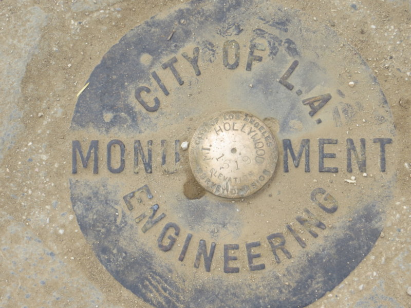
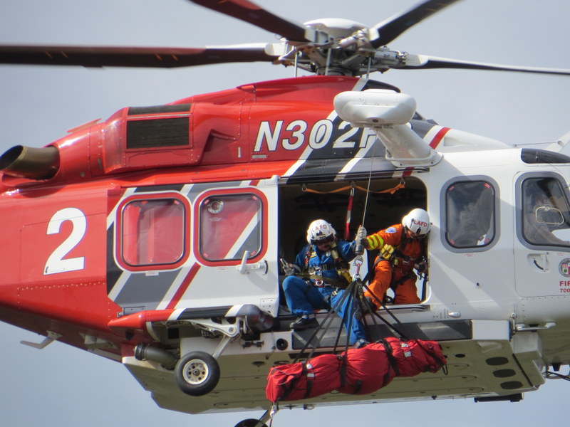
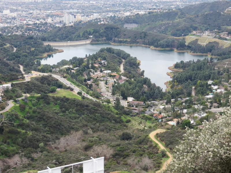
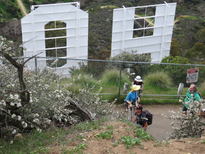
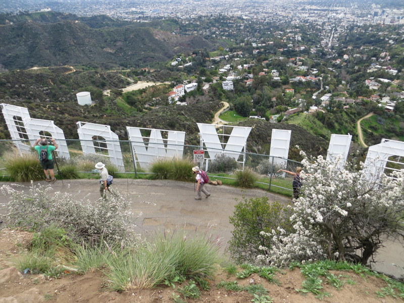
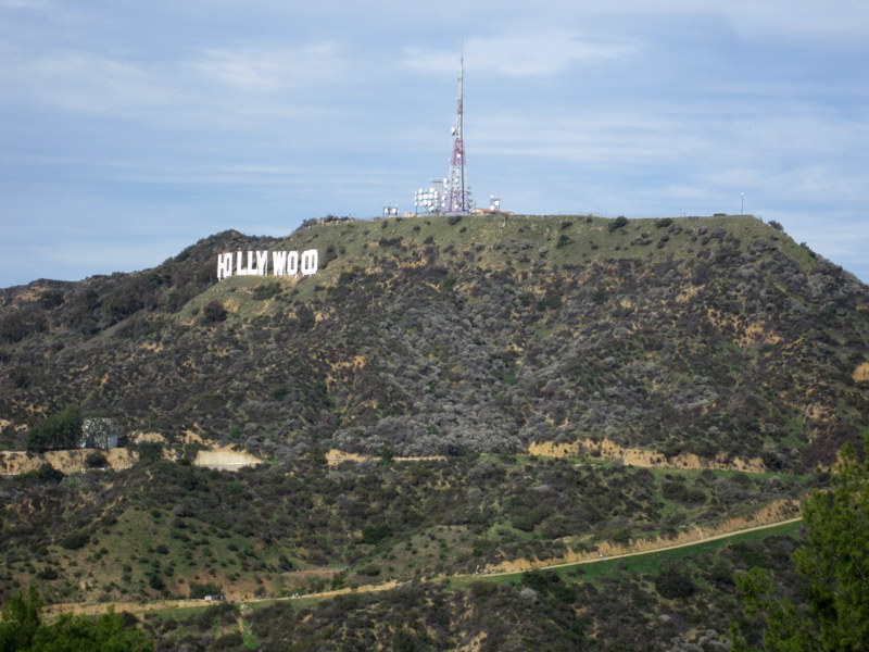
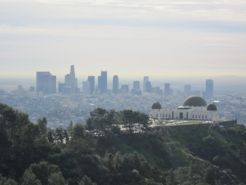
11 hikers gathered at the carpool point in Simi Valley on a cool overcast morning and then headed to Ferndell Park (600’) near the southwest corner of Griffith Park. The hike began serendipitously on the Mt. Hollywood Trail (rather than the Observatory Trail) and soon began climbing northward to Western Canyon Drive near the Griffith Park Observatory (1,131’) in a mile or so. The hike continued northward through the Berlin Forest, then crossed the Mt. Hollywood Drive tunnel and followed another dirt fire road as it wound its way uphill to the Mount Hollywood overlook (1,625’), the highest point in Griffith Park. It afforded a surprisingly clear 360-degree view of the surrounding area: the Los Angeles basin, the San Fernando Valley, and the San Gabriel Mountains. We then embarked on the westerly portion of the hike, heading north and then west (passing near Mt. Bell and Mt. Chapel) via a combination of dirt fire road and steep narrow single-track trail to the top of Mt. Lee (1,680’), just above the famous Hollywood sign. Shortly before reaching Mt. Lee we encountered the aftermath of a helicopter rescue. We returned to the Griffith Park Observatory a different way via the Mulholland Trail and paved Mt. Hollywood Drive; we then followed the Lower Observatory Trail back down to Ferndell Park. Happy, but a bit weary, we headed home having completed an 11-mile figure-8 loop hike with 2,014’ of elevation gain/loss.
January 19th – Nicholas Flat Trail from Leo Carillo State Park in Malibu to Nicholas Pond

Five hikers met on a pleasant Saturday morning in Simi Valley to car pool to the Nicholas Flat Trail trailhead in Malibu. We drove through the Santa Monica Mountains via Hwy 23 to Pacific Coast Highway (Hwy 1) and then headed west to the parking lot at Leo Carillo State Park. Thanks to overnight winds our journey provided magnificent views of mountains, valleys, the Pacific Ocean, and a clear blue sky. The hike began with a steady, fairly steep, ascent as the trail gained around 1,600Õ in about 2.5 miles which tested our pulmonary and circulatory systems. The mild morning temperature and a light breeze combined perfectly to keep us from overheating. There were great views of the Santa Monica mountains, Point Dume, and the ocean as well as views of Santa Catalina, Santa Barbara, Anacapa, and Santa Cruz Islands. We crested the mountain, descended through a large meadow, and followed the trail down to Nicholas Pond which was several feet lower than its high-water mark; however, a variety of ducks and coots were floating on the pond. We then followed a short trail up to some large boulders and enjoyed a shaded lunch break. As we did so we also enjoyed the view toward the ocean looking out over San Nicholas Canyon. After lunch we returned the way we came, taking the Willow Creek Trail on the last leg of our journey. We had most of the hike to ourselves although we encountered some picnickers at the pond and a few hikers toward the end of our hike. Our very pleasant outing covered 7.8 miles with a total elevation gain/loss of nearly 2,200′.
January 12th – Verdugo Mountains: La Tuna Canyon Trail to the Verdugo Motorway to Plantation Lateral to the Grotto Trail loop
12 hikers carpooled to the La Tuna Canyon trailhead parking area (1,347’) along La Tuna Canyon Road in the Verdugo Mountains on a cold winter morning. The grass along the trail had frost on it and there was a chilly breeze as we began climbing the east side of a shady canyon via a series of long switchbacks. After a while we reached a level section of the trail where there was warming sunlight before the trail dropped down into a parallel heavily wooded canyon and began climbing gradually southward; it then rose at a steep 25 percent grade for half a mile leading to Horny Toad Ridge where we were treated to expansive views of the San Fernando Valley and mountains to the west and north as a more-moderate trail led to the Verdugo Motorway. After resting briefly we followed the gradually rising dirt road eastward to Plantation Lateral (2,988’) with its pine trees and benches to sit on. After a break to enjoy the magnificent views of the surrounding mountains, we followed the single-track Grotto Trail (aka the La Tuna Foot Trail) as it undulated, mostly downward, to the Grotto trailhead. We then walked along La Tuna Canyon Road a short distance to our vehicles and returned home having completed a 7.3-mile hike w/2,200’ of elevation gain/loss on what turned out to be a perfect day for hiking in the mountains.
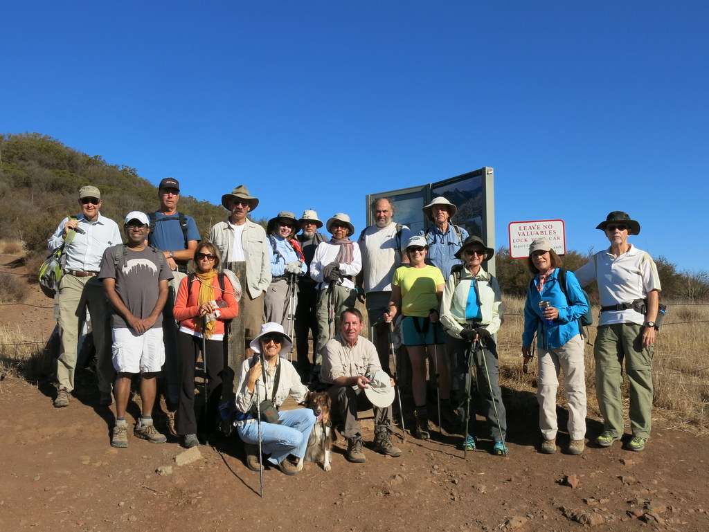
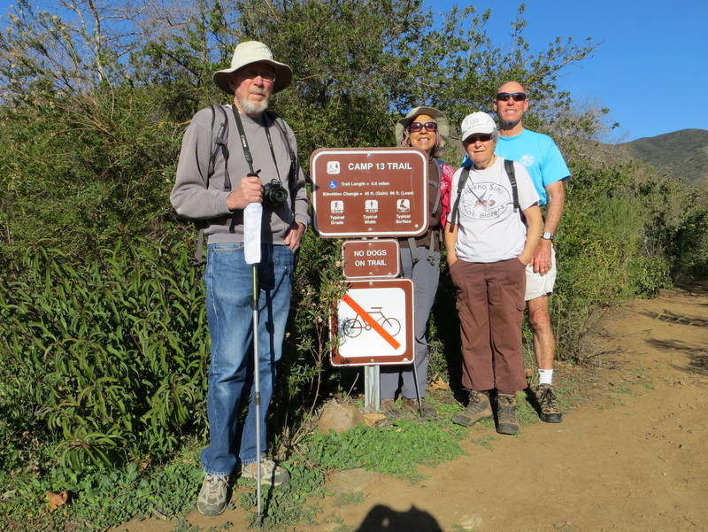
January 5th – Happy Camp Canyon Loop

18 hikers met in the dirt parking lot at the east end of Broadway Road north of Moorpark on a cool, clear, sunny morning. We followed a well-maintained trail beside the Rustic Canyon golf course one mile to the entrance to Happy Camp Canyon, “a lush riparian oak woodland with an intermittent stream”. We followed an old ranch road eastward as it rose gradually in the canyon bottom between Oak Ridge and Big Mountain. At 4.8 miles we reached a pleasant oak grove with picnic tables and hitching rails where we took a leisurely rest-and-snack break. Resuming our hike we soon found ourselves climbing up the steep gets-your-heart-pumping connector road to the Middle Range Road. Once there we headed west along the ridge, enjoying spectacular views of the surrounding area. After descending to the Happy Camp Canyon dirt/sand road we returned along the trail we had followed for the first mile of our hike to our vehicles, having completed a 10.75-mile hike w/1,300. of elevation gain/loss on a beautiful winter morning.