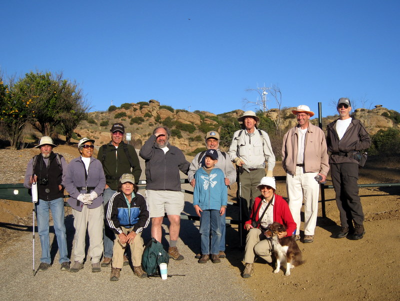
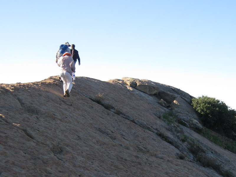
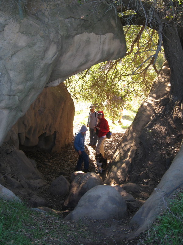
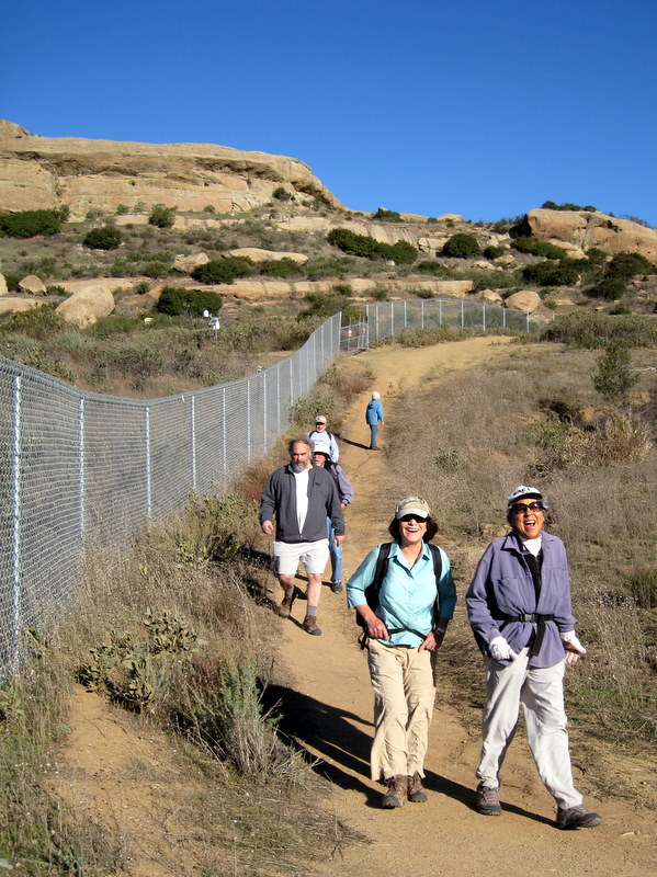
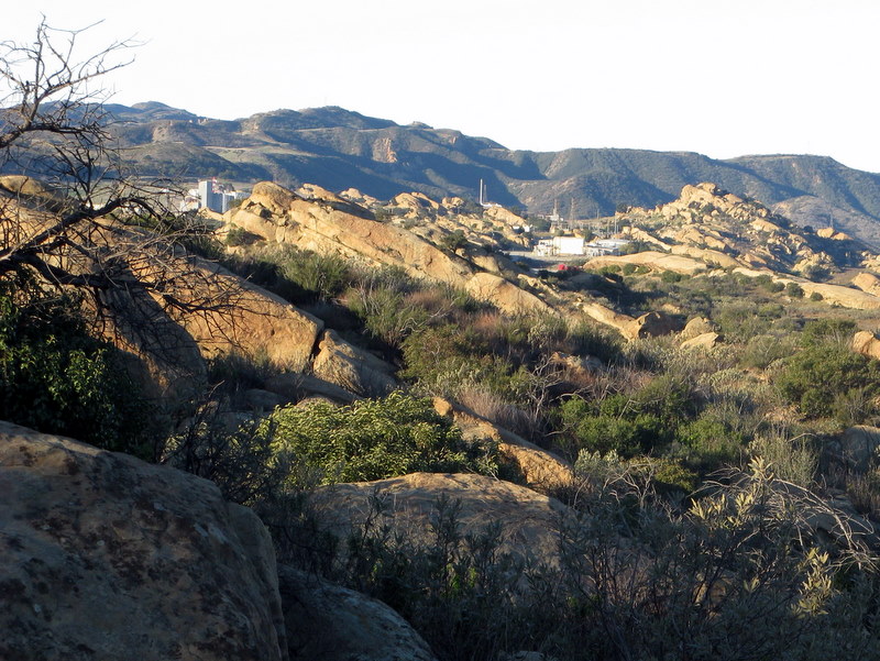
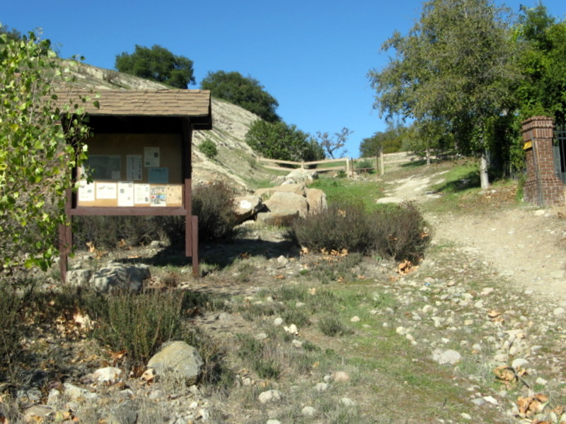
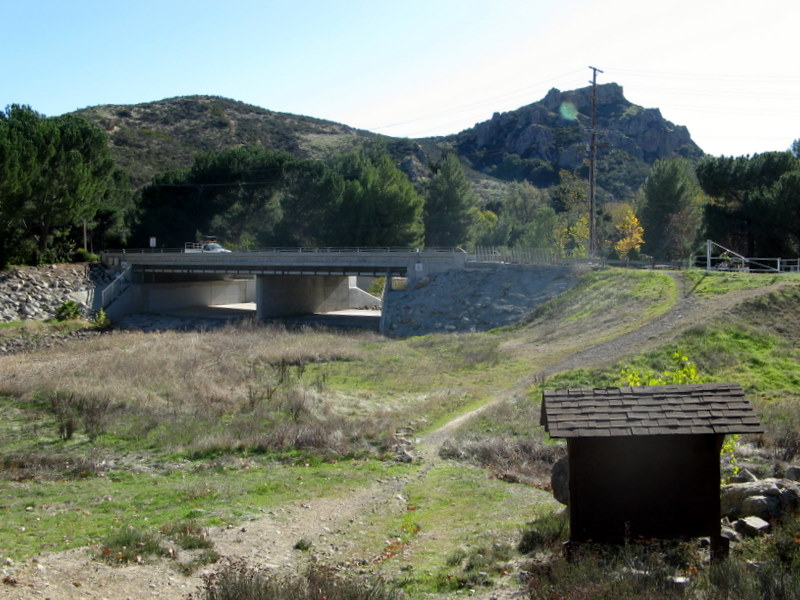
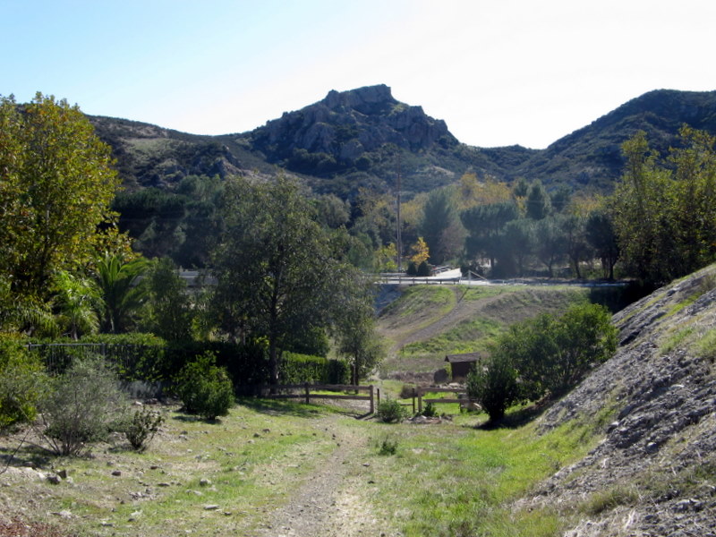
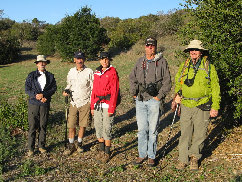
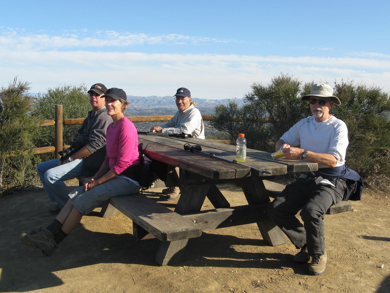
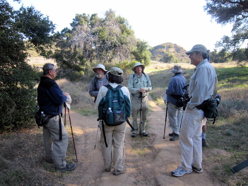
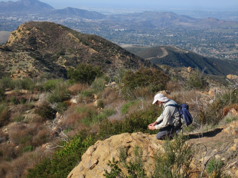
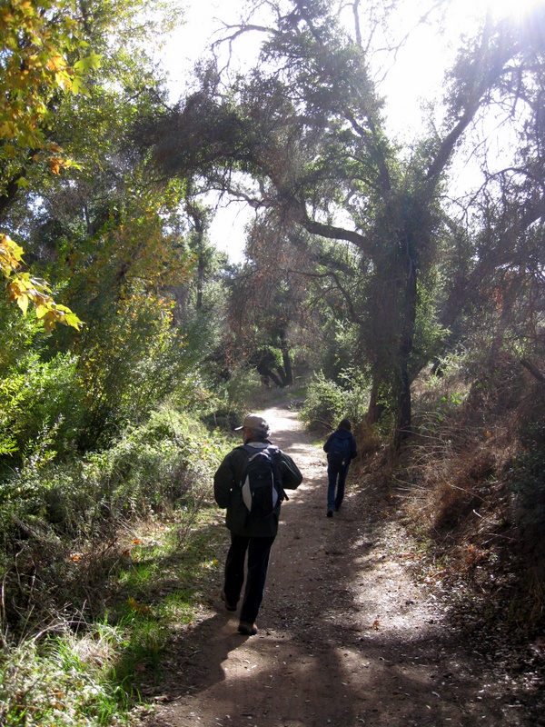
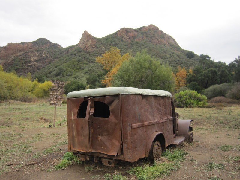
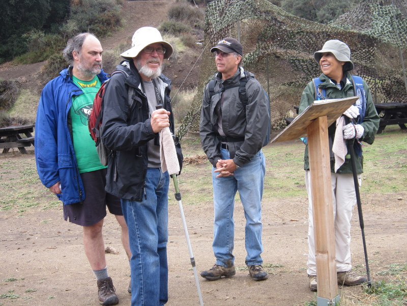
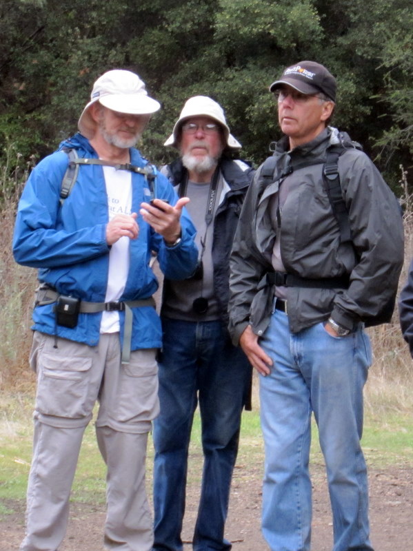
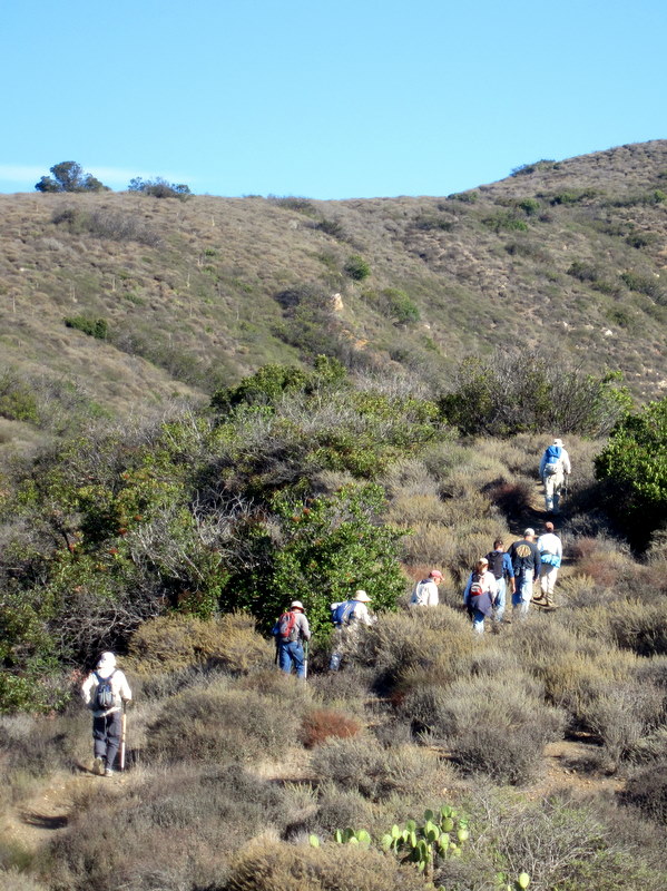
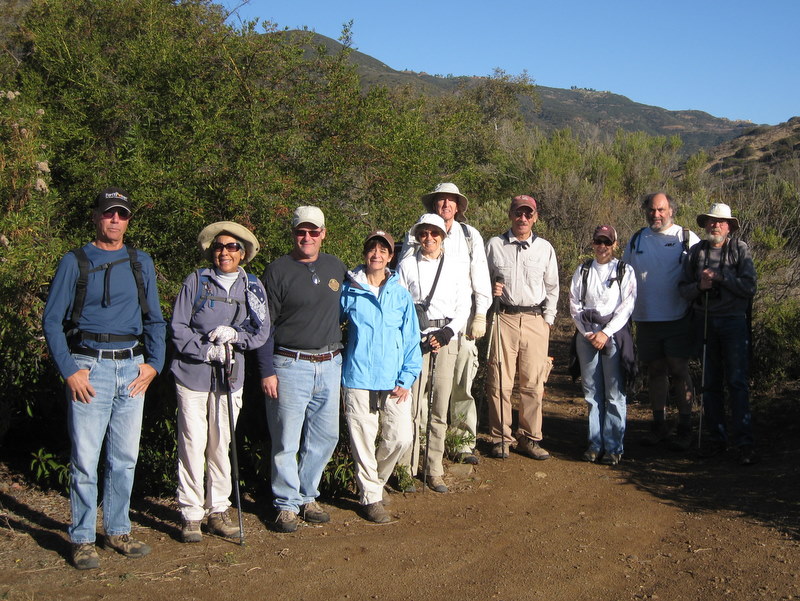
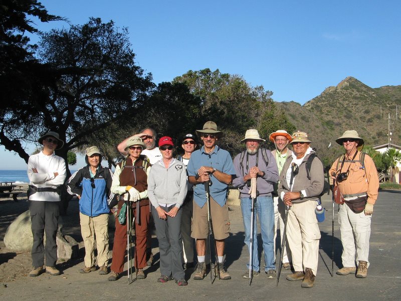
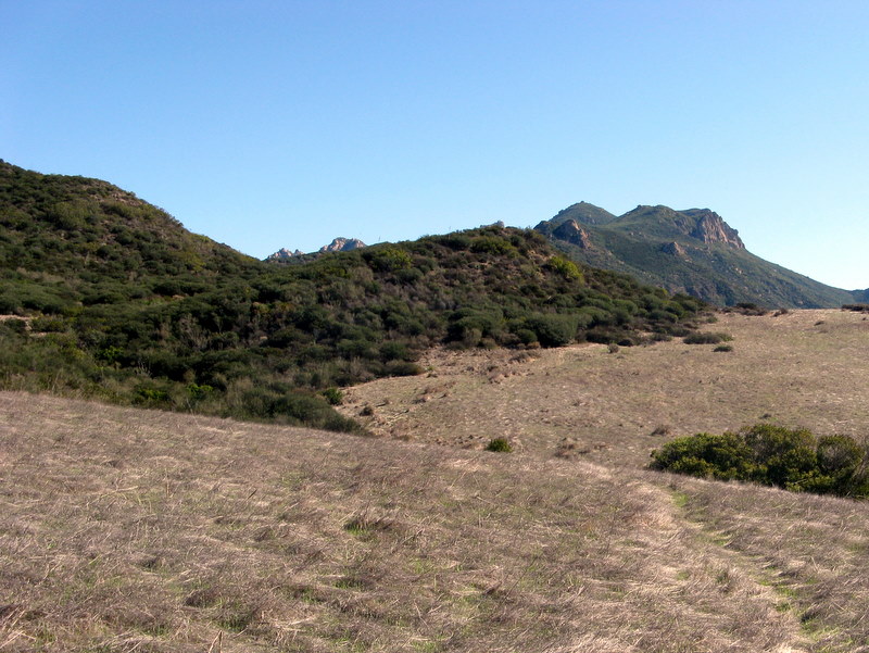
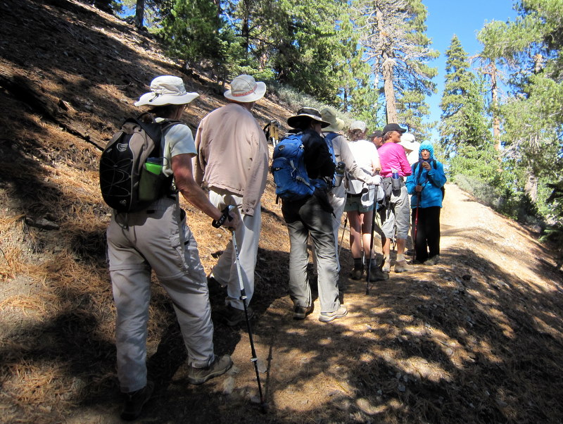
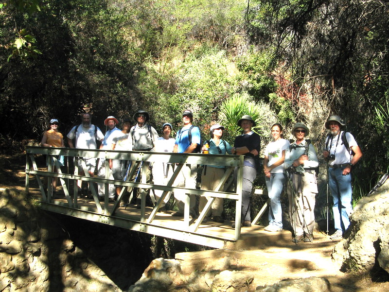
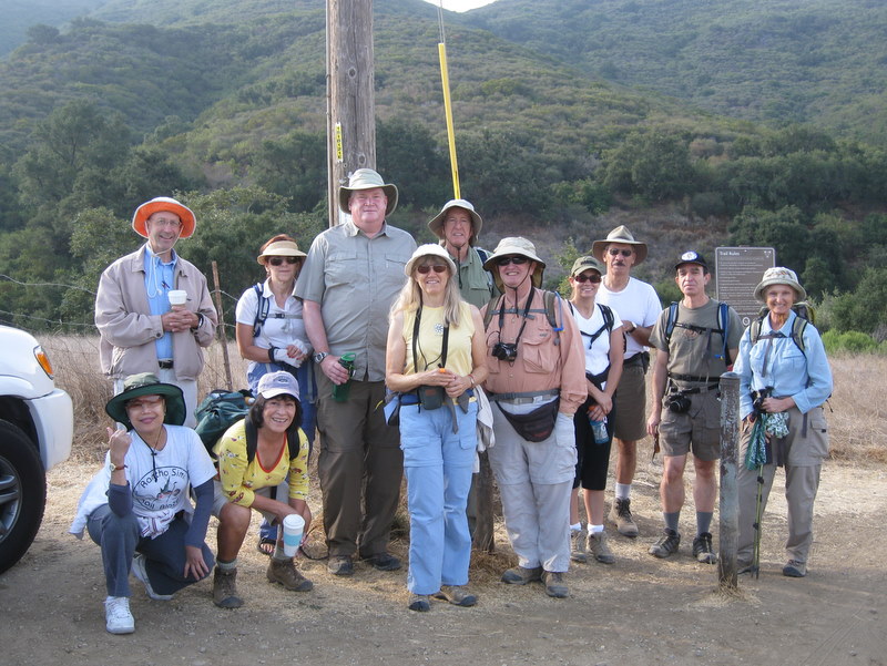
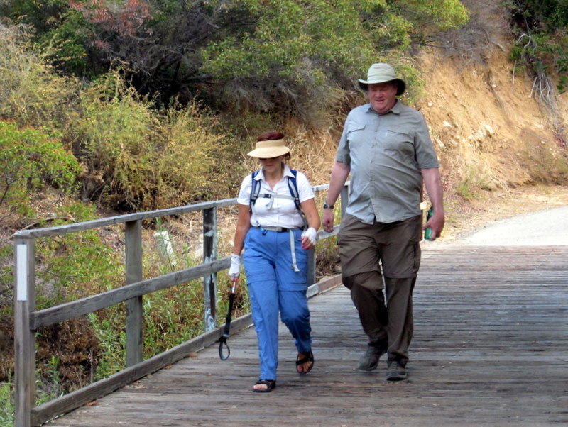
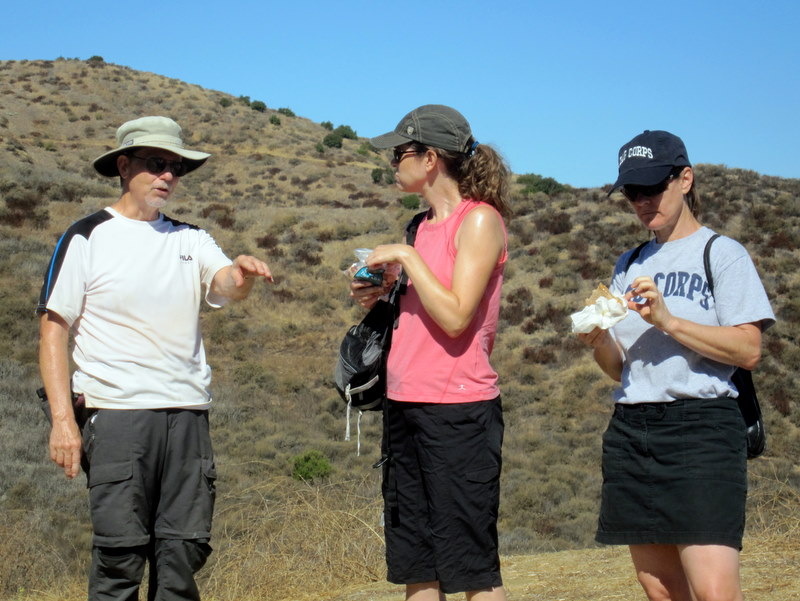
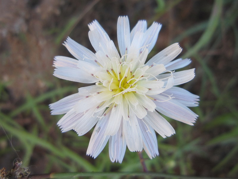
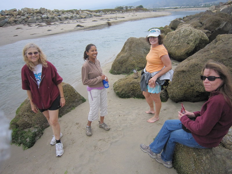
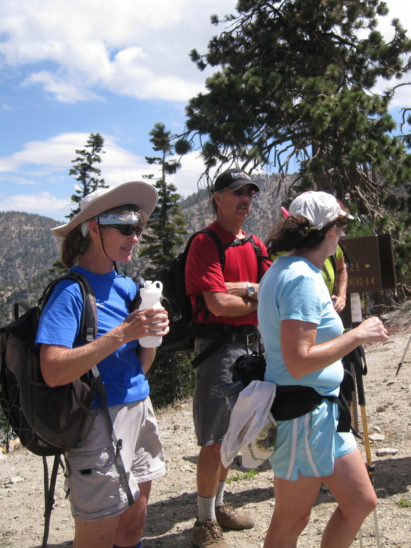
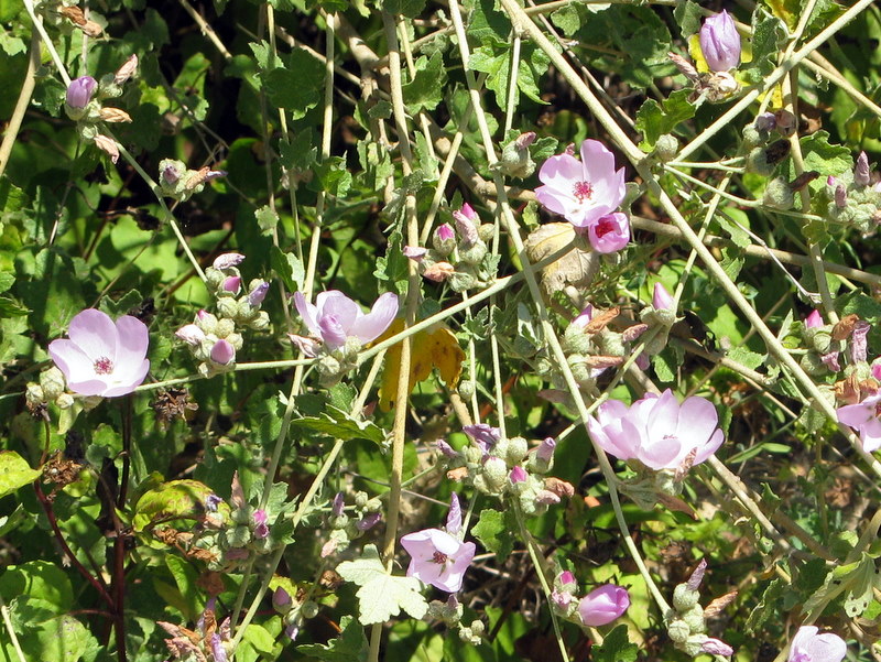
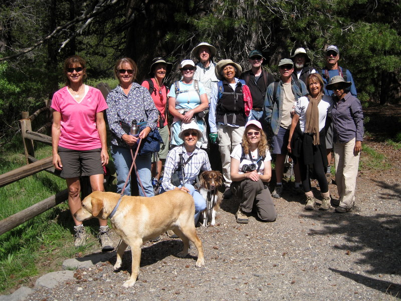
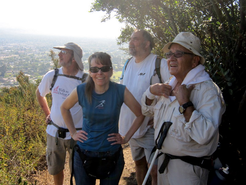
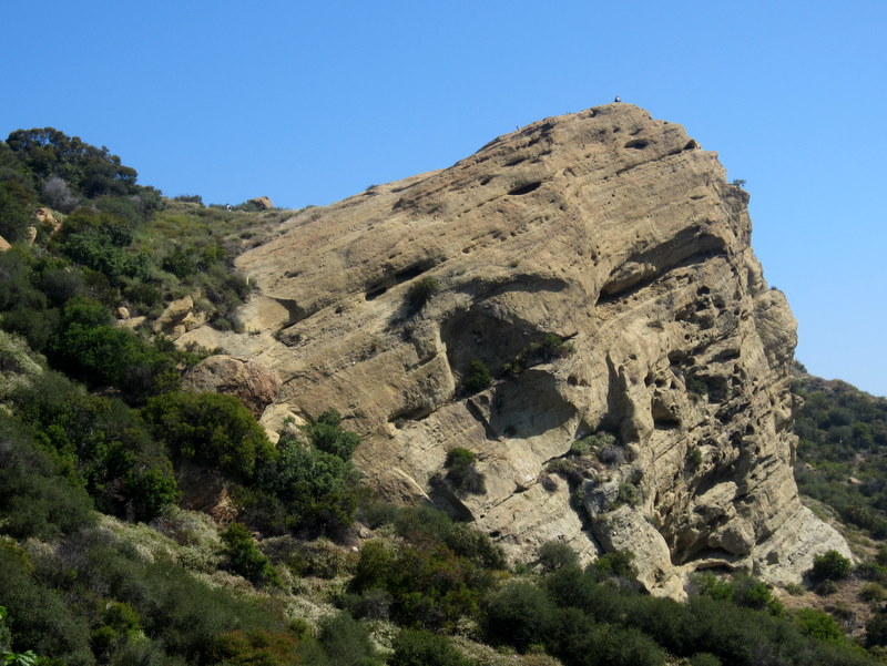
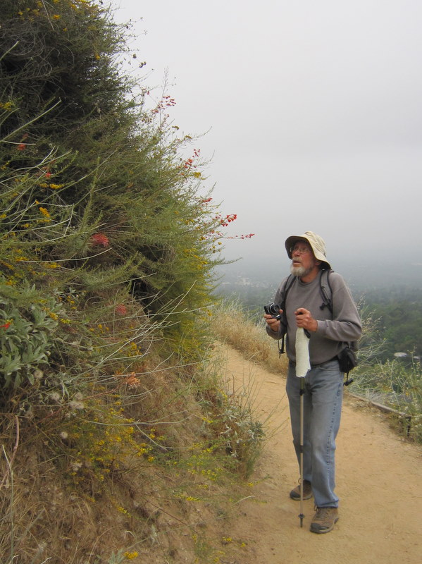
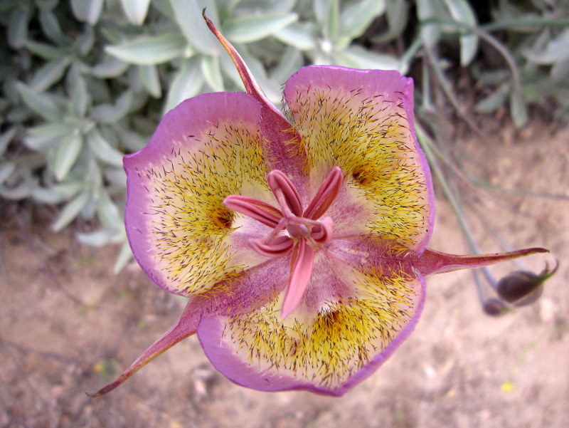
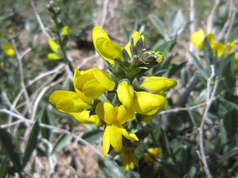
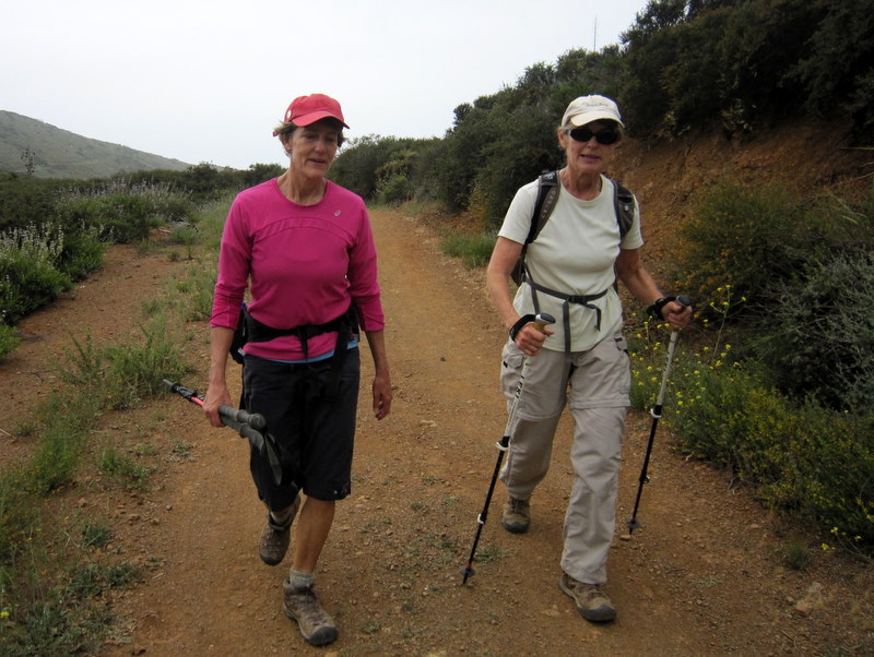
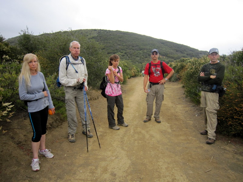
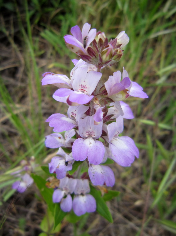
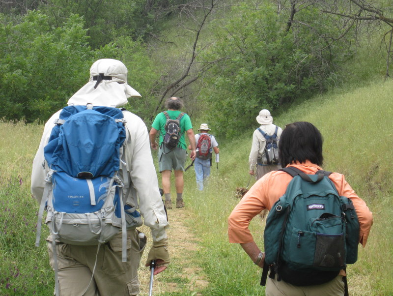
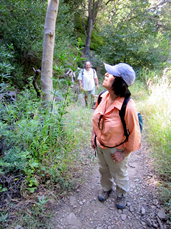
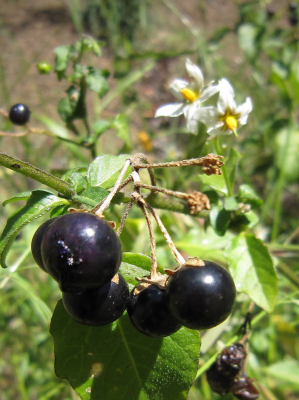
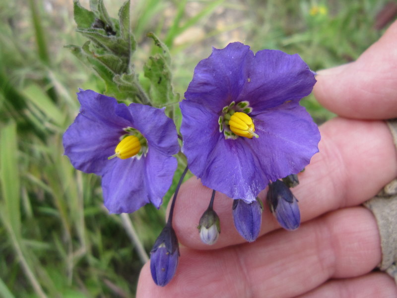
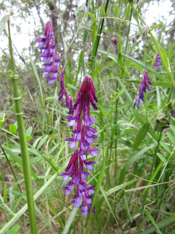
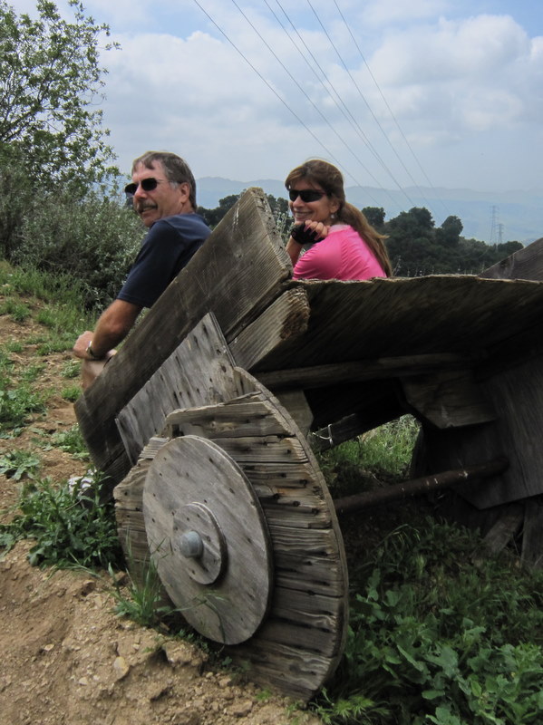
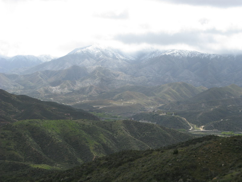
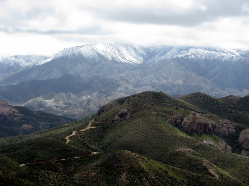
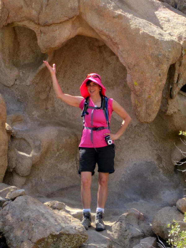
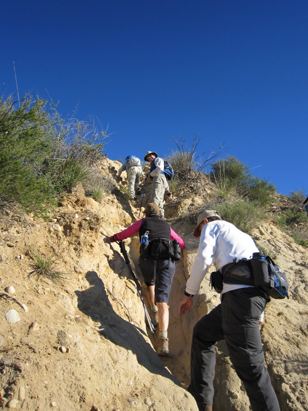
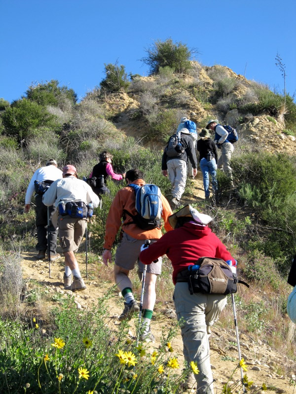
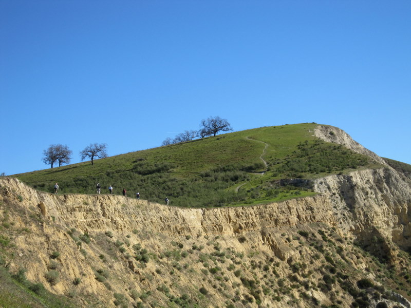
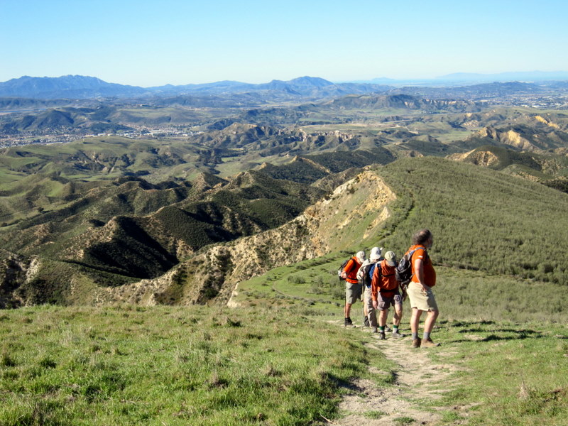
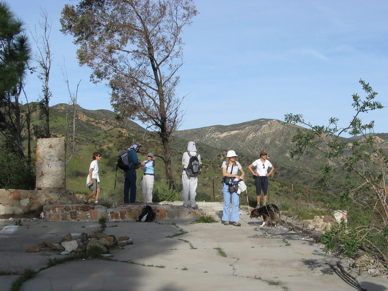
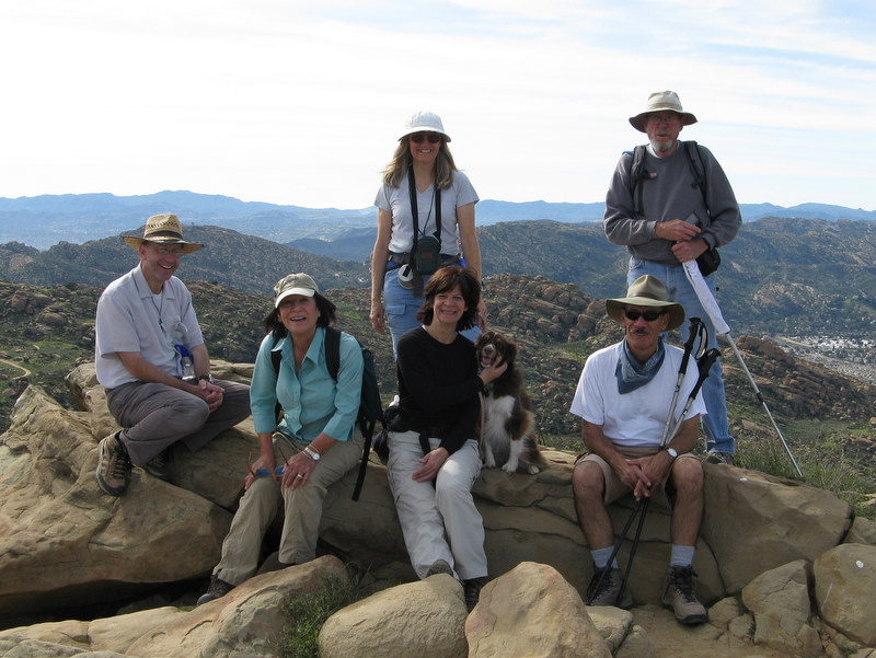
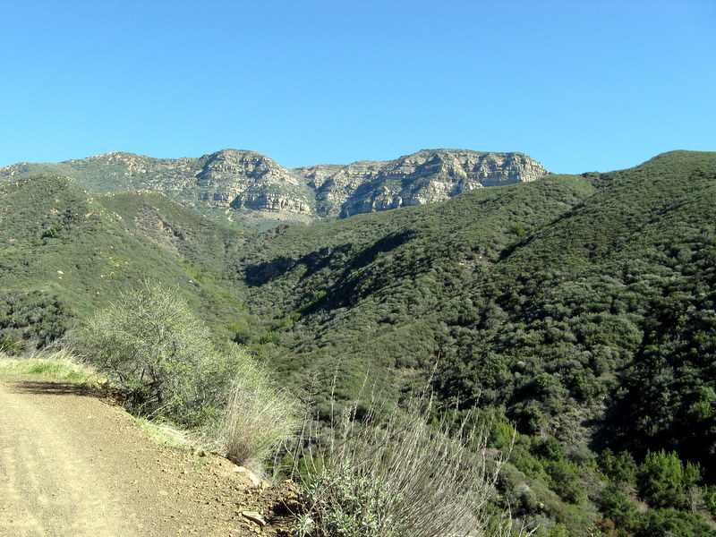
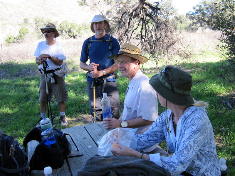
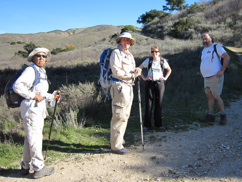
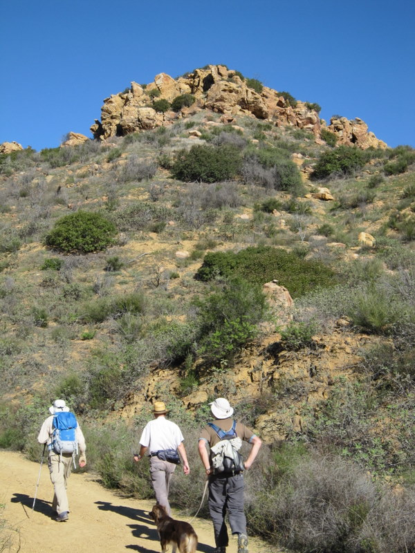
December 31st 2011 – The Hummingbird Trail
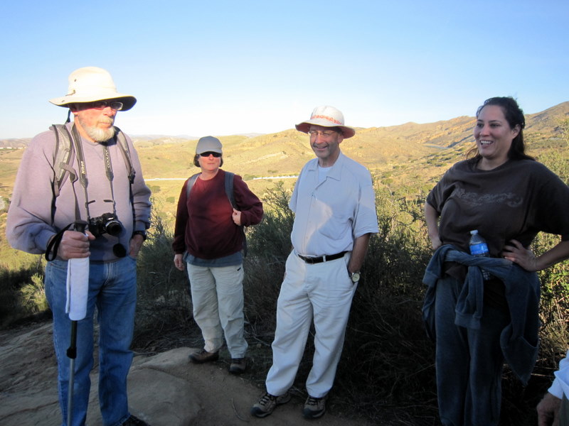

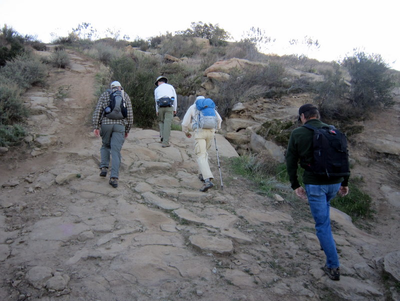
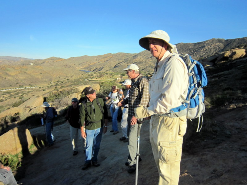
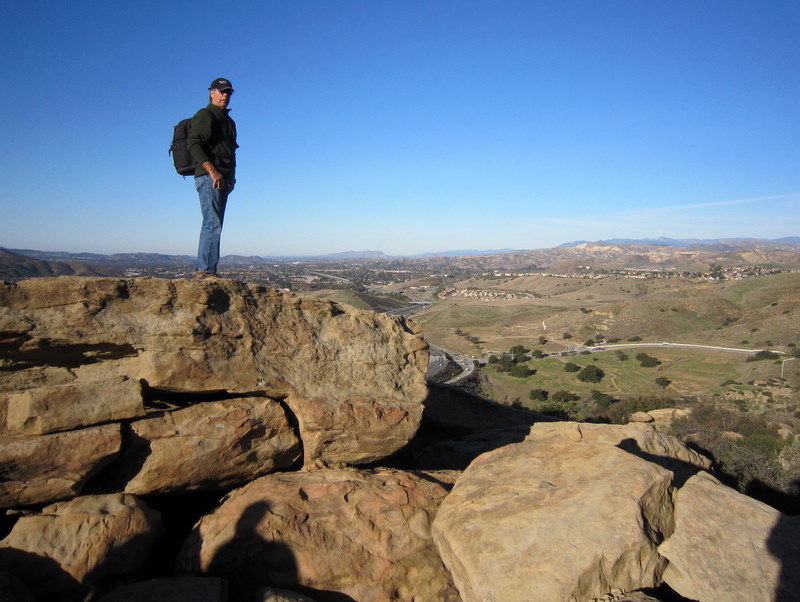
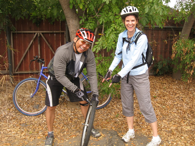
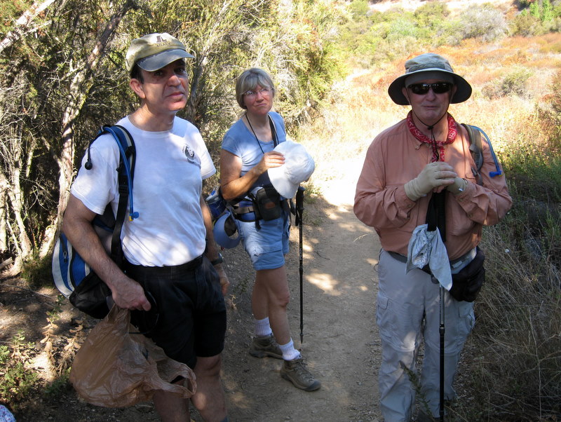
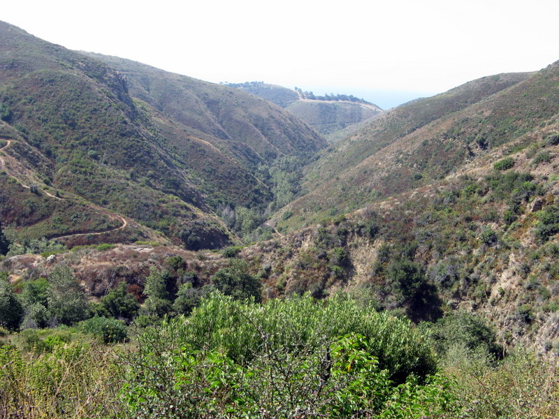
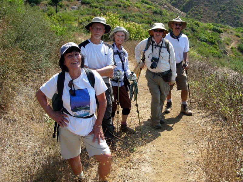
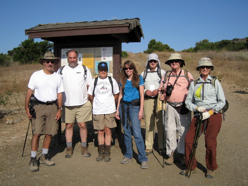
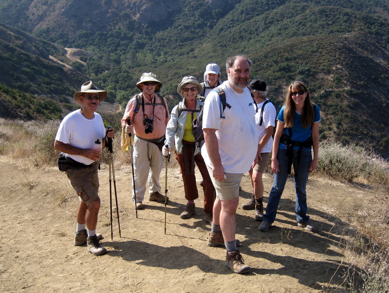
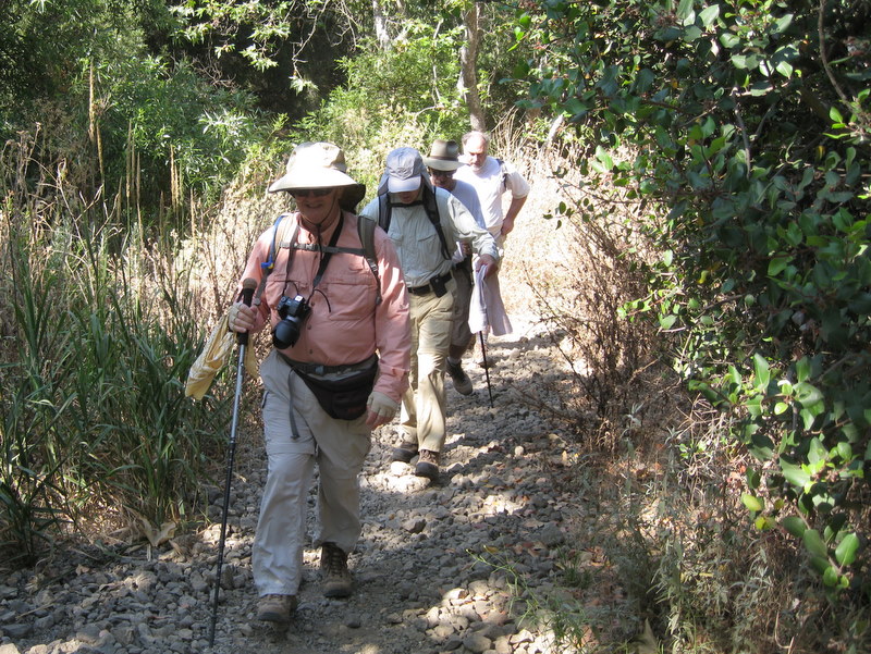
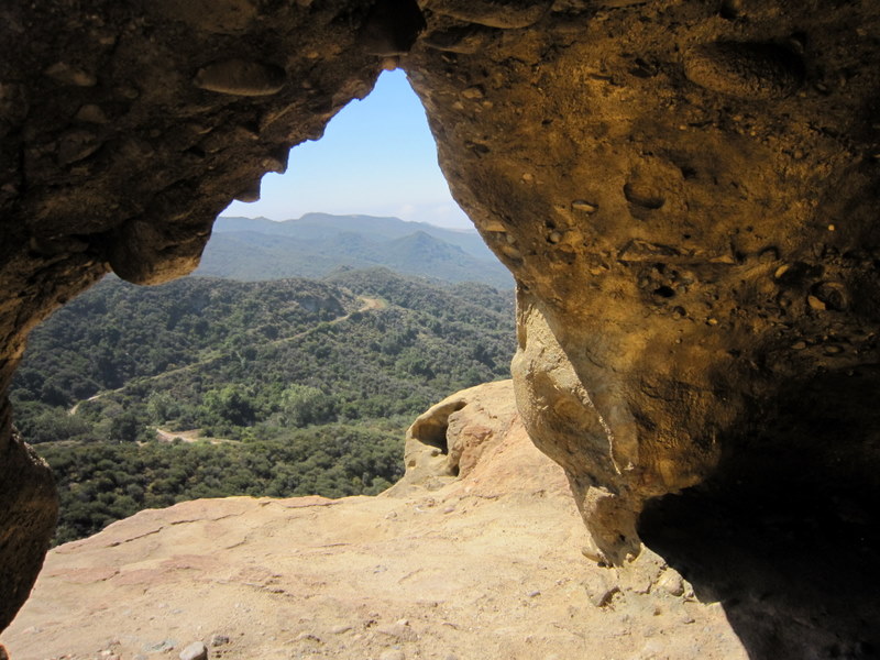
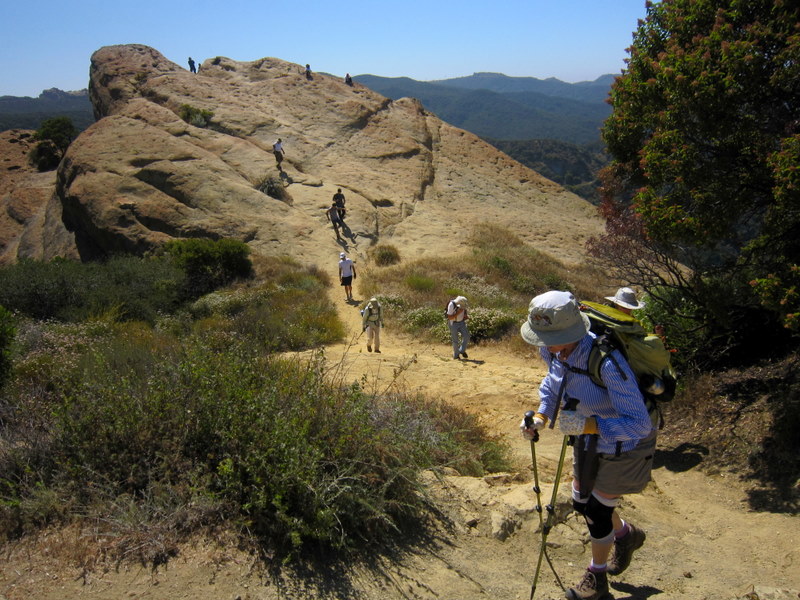
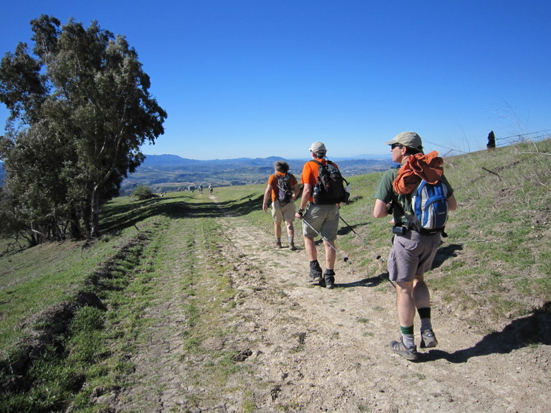
15 hikers met in the dirt parking area on the east side of Kuehner Avenue just north of Hwy 118 in Simi Valley to hike the Hummingbird Trail. It was a cool, clear morning as we began our eastward climb to the Rocky Peak Fire Road. The trail passed through (and on) a variety of imposing sandstone rock formations along the way including very large boulders and giant slabs of sandstone rock, many with small “caves.” There were sweeping views of eastern Simi Valley, the Santa Susana Mountains, and the Simi Hills (including the Boeing/Rocketdyne facility). Reaching the Rocky Peak Fire Road, we rested and talked with some of the many bicycle riders and other hikers who were also enjoying the pleasant morning and the beautiful scenery – and working off some of those extra holiday calories! We retraced our route and reached the trailhead having completed a 4.6-mile hike with 1,341’ of elevation gain/loss.
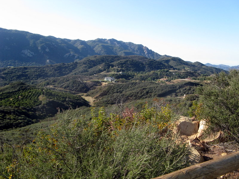
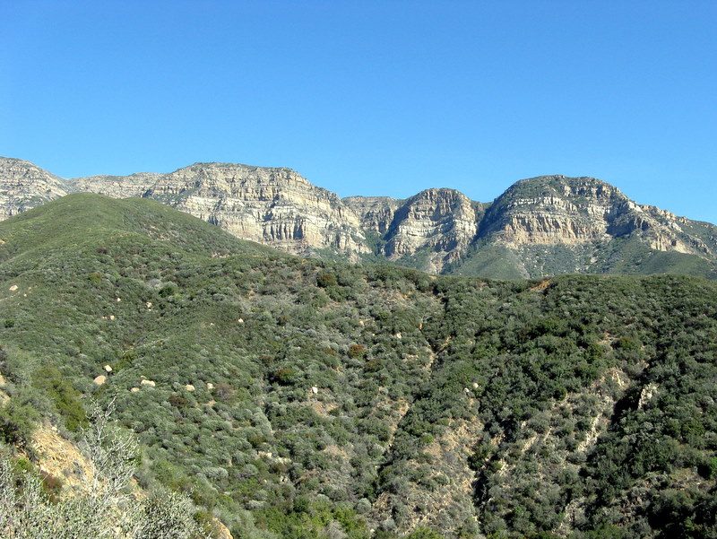
December 24th 2011 – Sage Ranch Loop
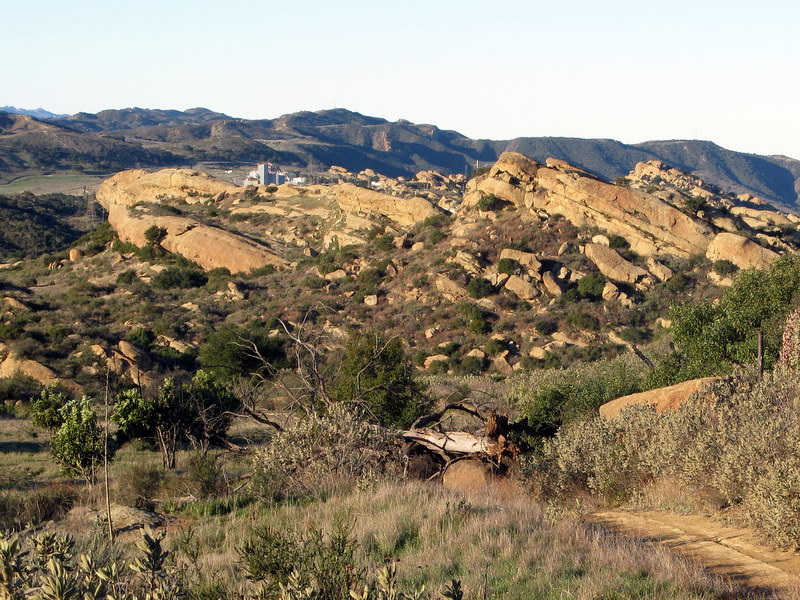
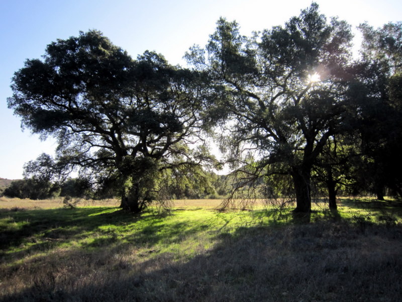
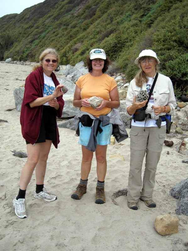
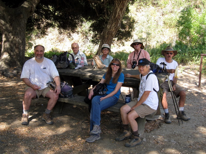
12 hikers arrived at the parking lot in Sage Ranch Park in the Simi Hills via Black Canyon Road on a cool, clear morning. The 625-acre park is located just north of the Santa Susana Field Laboratory (SSFL) (aka Rocketdyne/Boeing) at an elevation of 2,000’. It is chock-full of world-class sandstone rock formations and has lots of picnic tables shaded by large oak trees. Shortly after we began our hike, we were rewarded with expansive views of Simi Valley and the mountains to the north. We explored various side trails and climbed up on Sandstone Ridge, a long, steep rock formation rising alongside the trail on the west side; it afforded us with excellent views of the once-bustling SSFL. The beautiful setting was enhanced by many oak trees and large patches of bright green grass. All too soon, we completed our short, but delightful, holiday stroll (3.3 miles with about 500’ of elevation gain).
December 10th 2011 – Los Robles Trail Shuttle

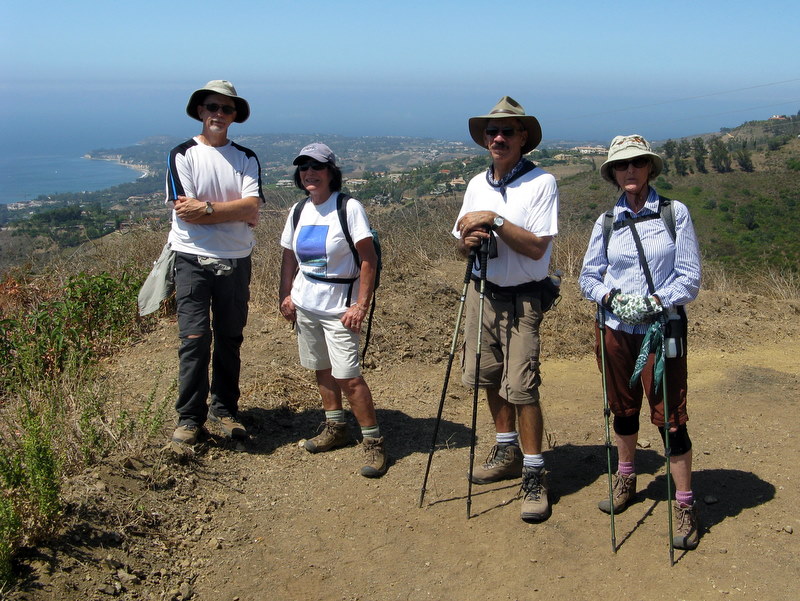
6 hikers met at the Stearns Street Park-and-ride lot at 7:00 a.m. on a chilly-but-clear morning. Since it was to be a one-way hike, we dropped two shuttle vehicles off at the White Horse Canyon trailhead in Westlake Village and then drove to the parking lot at the west end of the Los Robles Trail on Potrero Road in Newbury Park. We followed the Los Robles Trail as it wound its way along the mountain slopes to Angel Vista overlooking the Conejo Valley, Camarillo, Boney Mountain, Anacapa Island, and Santa Cruz Island. Continuing along the trail as it rose and fell we had excellent views of Hidden Valley and its horse ranches. After passing the junction with a short connector trail that leads to Moorpark Road, the trail climbed eastward back up the mountain where we paused to enjoy the view of the Topa Topa Mountains to the north. Continuing eastward we spotted a deer and eventually reached the upper end of the White Horse Canyon Trail. We followed it to the southeast, descending to its trailhead on Potrero Road (where we had parked our shuttle vehicles) having completed a lengthy 10.8-mile hike with 2,077’ of elevation gain. We retrieved our other vehicles and returned to Simi Valley, tired but grateful for a very pleasant hike.
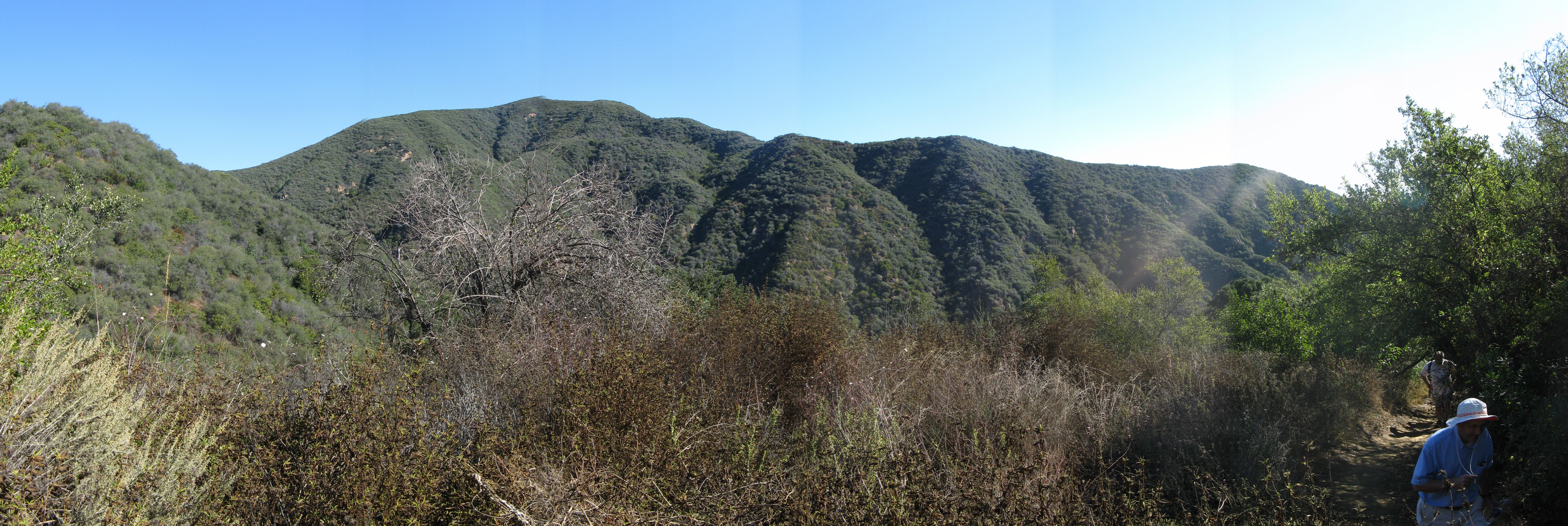
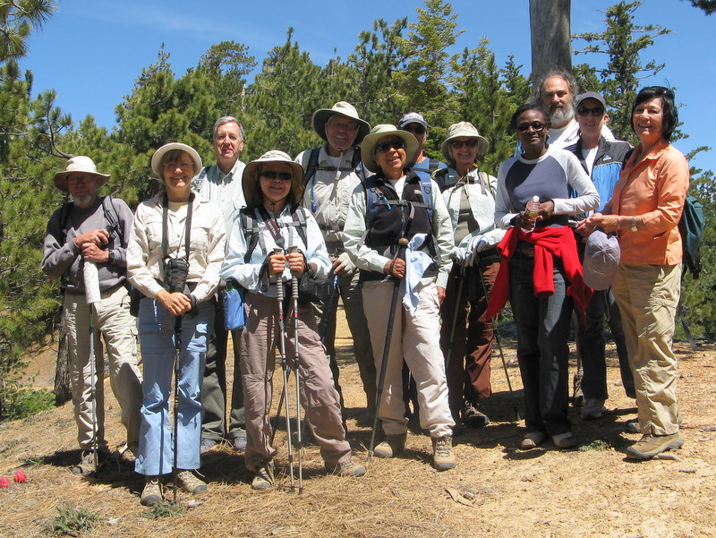
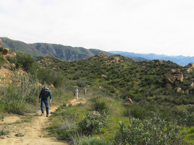
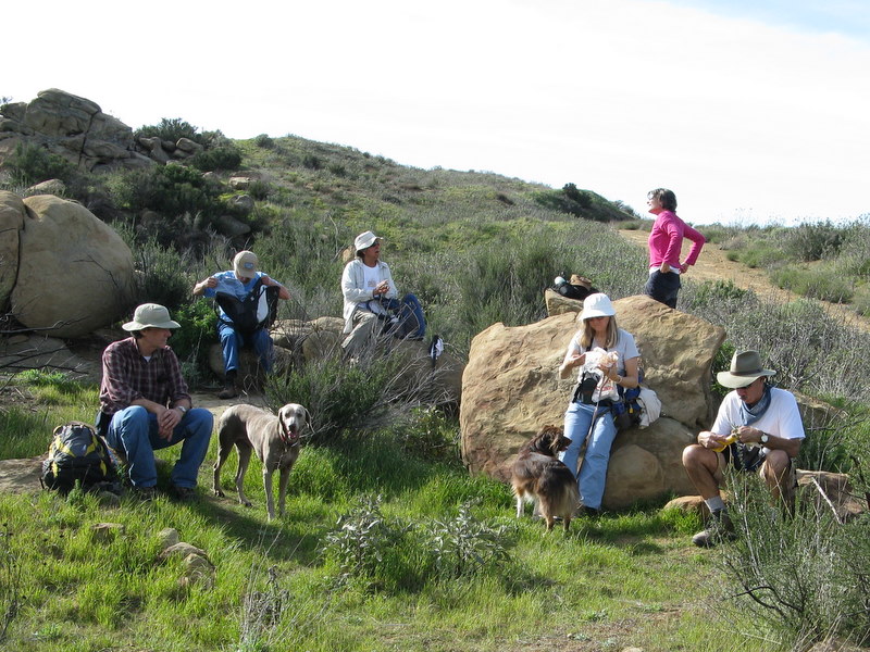
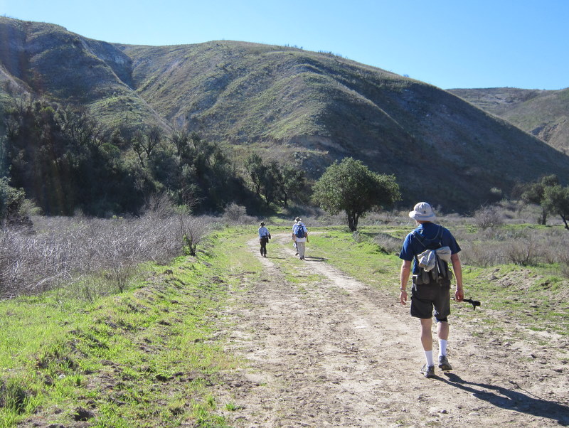
December 3rd 2011 – Simi Peak via China Flat
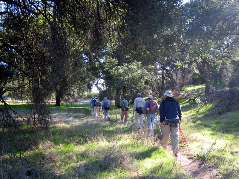
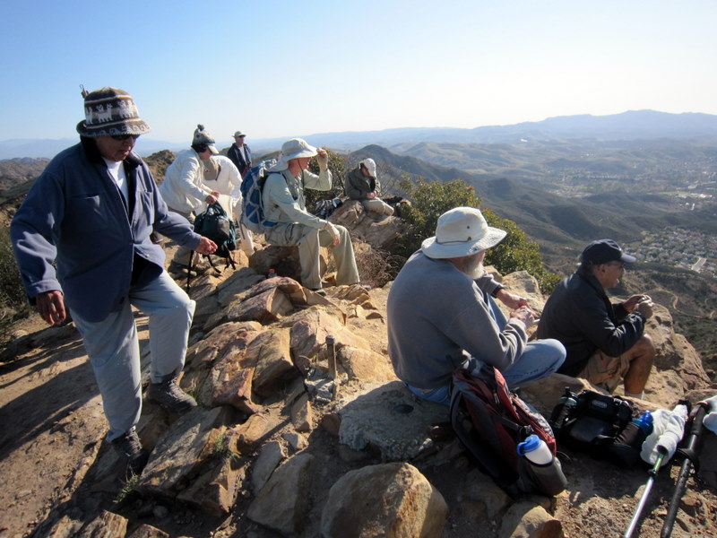
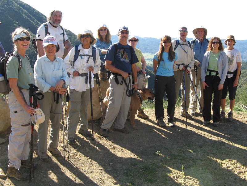
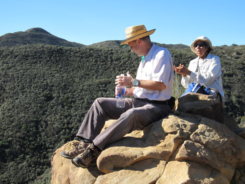
12 hikers (+ Heidi, a cute dog) met at the trailhead on Lindero Canyon Road (near King James Court) in Oak Park on a chilly fall morning. This hike in the Simi Hills began along a single-track trail, but soon continued along an old dirt-and-rock road as it rose up the south side of the mountain, providing ever-expanding views to the south. Upon reaching the apex of the old road, we headed north and descended into lovely China Flat with its oak trees and sprawling grassy meadows. After nearly circling China Flat in a counterclockwise direction, we followed a trail southwest and climbed to Simi Peak (2,403’), the highest point in the Simi Hills (which occupy the area between Simi Valley and Hwy 101 and between Hwy 23 and the San Fernando Valley), where we were greeted by a cold wind. We took a lunch break atop the peak and enjoyed the panoramic view, including looking almost straight down at Oak Park to the south. After a while we returned to our vehicles, completing a 7.25-mile hike with about 2,000’ of elevation gain/loss.
November 26th 2011 – Chivo Canyon
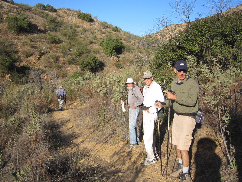
18 hikers met on a mild Saturday morning in Simi Valley near the mouth of Chivo Canyon in the Marr Ranch Open Space in northeast Simi Valley. Our hike began along Trail #22 (as shown on the RSRPD “Park Facilities Directory Map of Simi Valley and Oak Park”) as it headed up Chivo Canyon. At 0.7 mile we turned left (west) on Trail #23 and followed it through a side canyon as it climbed westward to an overlook that revealed Tapo Canyon. Returning (via a loop) to Chivo Canyon we continued north to the head of lower Chivo Canyon where several of the hikers turned around and returned to the parking area. The remaining hikers continued carefully through a narrow gorge into upper Chivo Canyon and its large oak woodland. Eventually we climbed out of the canyon and made our way to a rocky promontory on the east side of lower Chivo Canyon where we had sweeping 360-degree views of the entire area. We then returned via the same route to the parking area. Our very pleasant outing covered 10 miles with a total elevation gain/loss of about 1,800’.
November 12th 2011 – Malibu Creek State Park
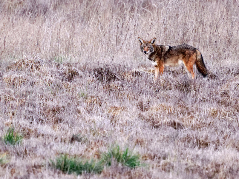
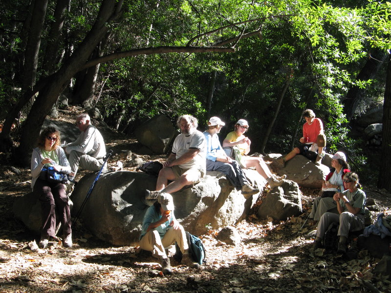
It was one of those drizzly and gloomy days, just perfect for staying in bed late. Still, this didn.t stop seven intrepid Trail Blazers from enjoying a fine hike. Because of all the rain the previous night, and fear of a very muddy trail, we thought it might be wise not to enter the Park at our usual Cornell and Mulholland trailhead. Instead, we took the Grassland Trail, to Craigs Road, heading north into Park headquarters.
Only a few minutes into our hike, we saw five deer to the left of the trail. Moments later, there were four coyotes to the right of the trail. The day would prove to be one of our very best wildlife hikes ever. Two more deer and another coyote were spotted before the hike was over.
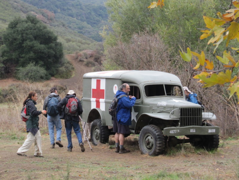
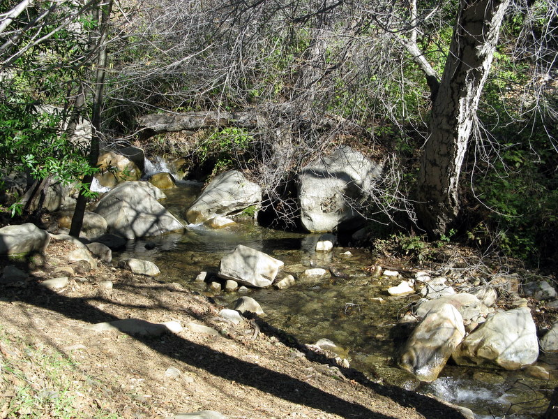
After a brief stop at Park headquarters, we visited the Rock Pool. Soap must have been introduced into the Malibu Creek system, much further upstream. There were mini-glacier like soap suds floating all the creeks, lakes and ponds, and all the way to the Malibu Dam. Our hike continued to Century Lake, the Redwood Forest, The M*A*S*H site and then on to the Malibu Dam. Retracing our steps back to the trailhead, we covered just under 10 miles, with just under 600. of elevation gain. The hike was enjoyed by all in attendance.
November 5th 2011 – Nicholas Flat from Leo Carillo State Park
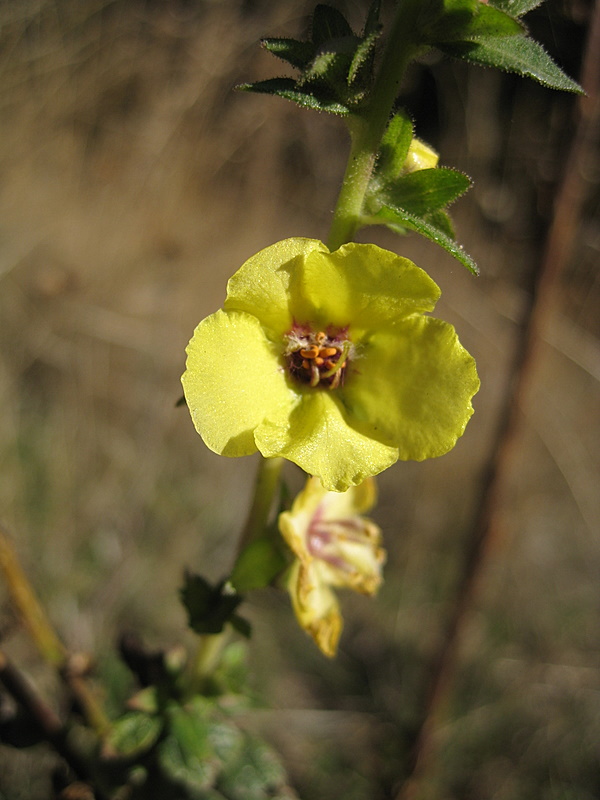
Eleven hikers met on a chilly Saturday morning in Simi Valley to car pool to the Nicholas Flat Trail trailhead. We drove through the Santa Monica Mountains via Hwy 23 to Pacific Coast Highway (Hwy 1) and then headed west to the parking lot at Leo Carillo State Park where we were met by two other hikers. Our journey provided magnificent views of mountains, valleys, and a clear blue sky. Once the group had assembled, we began a steady ascent toward Nicholas Pond, gaining about 1,600’ in about 2.5 miles and testing our circulatory systems. The chilly morning temperature and a cool breeze combined perfectly to keep us from overheating. There were great views of the mountains and the ocean as well as somewhat murky views of several of the Channel Islands. The rain the day before had washed the dust from the trees and bushes and the air was fresh and clean. We crested the mountain, descended through a large meadow, and followed the trail down to Nicholas Pond which was surprisingly full; two ducks were busy at its far end. We then followed a short trail up to some large boulders and enjoyed a lunch break. As we did so we also enjoyed the view toward the ocean looking out over San Nicholas Canyon. After lunch we returned the way we came, taking the Willow Creek Trail on the last leg of our journey. We had most of the hike to ourselves; we encountered no other hikers until we had nearly finished our hike. Our very pleasant outing covered 7.4 miles with a total elevation gain of nearly 2,200’.
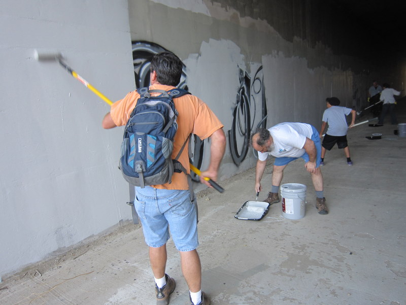
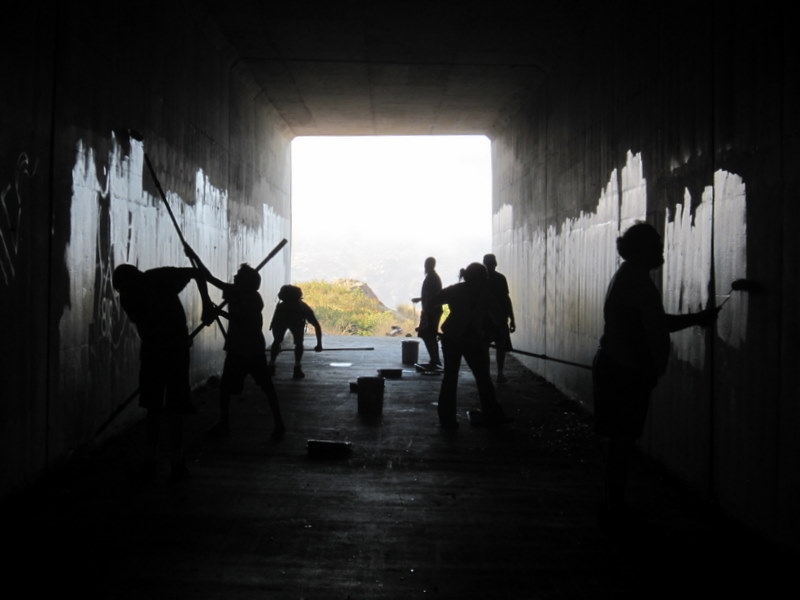
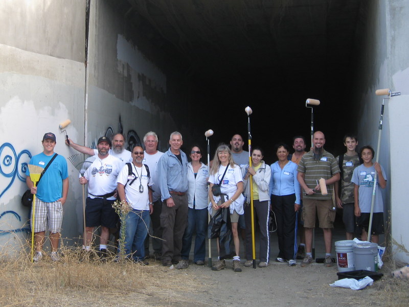
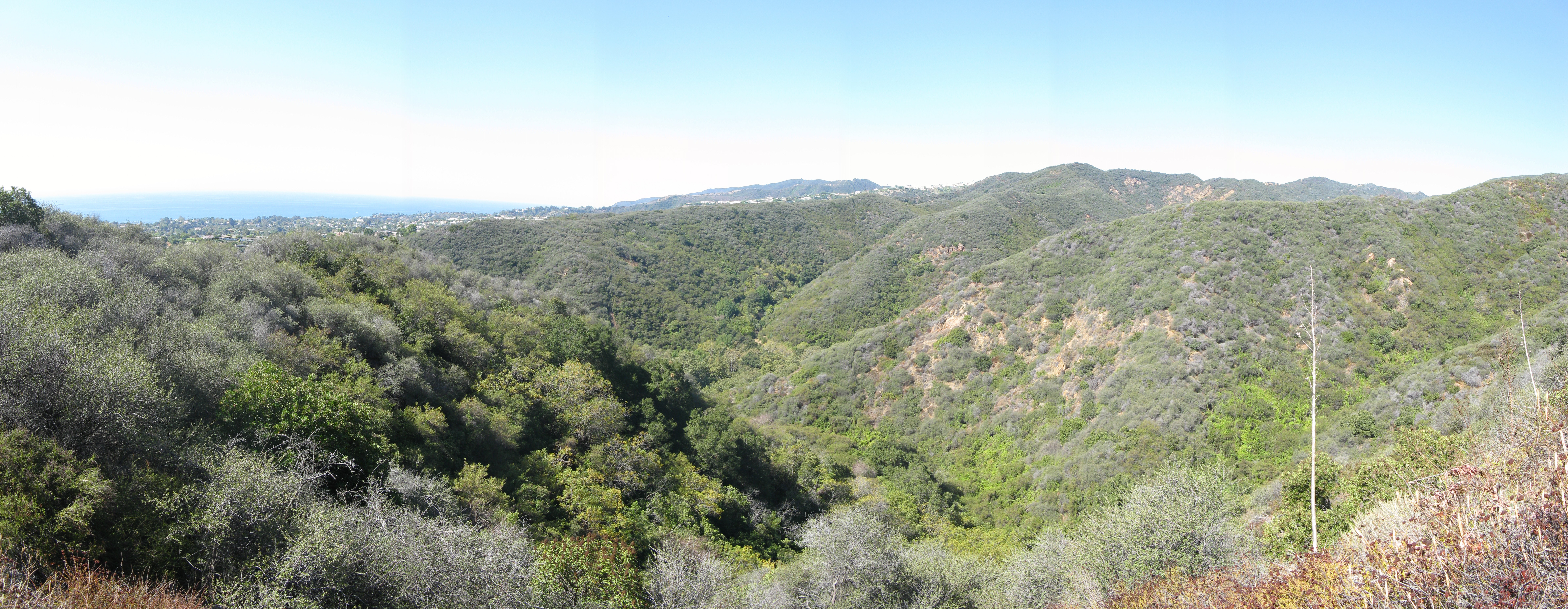
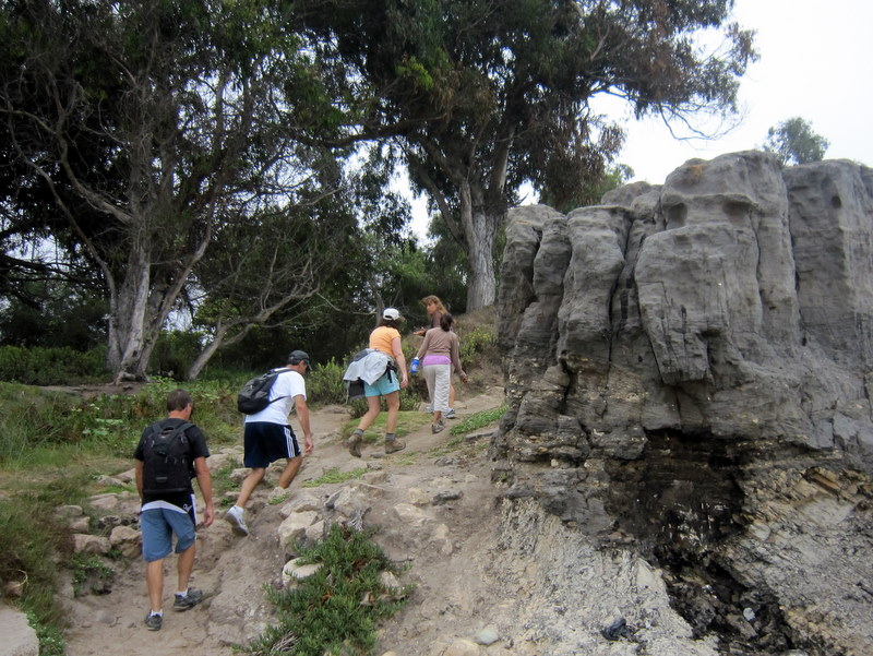
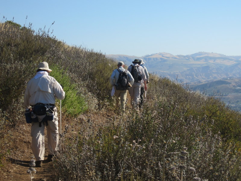
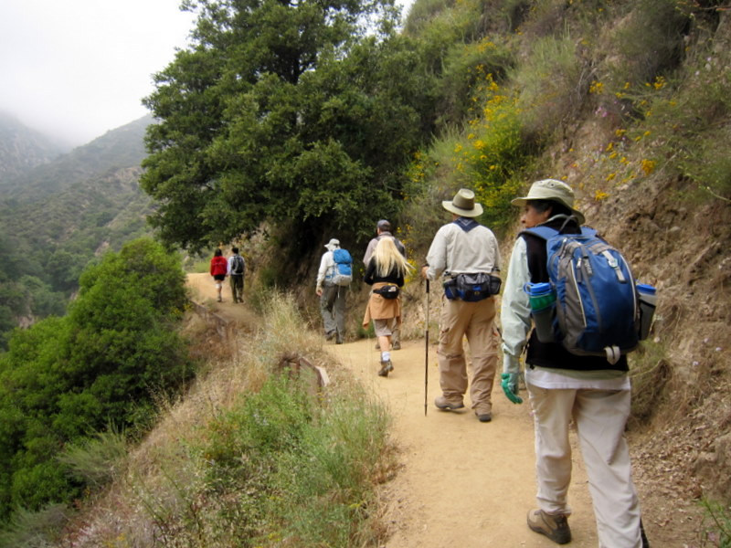
October 29th 2011 – Serrano Canyon & Serrano Valley Loop from Sycamore Cove
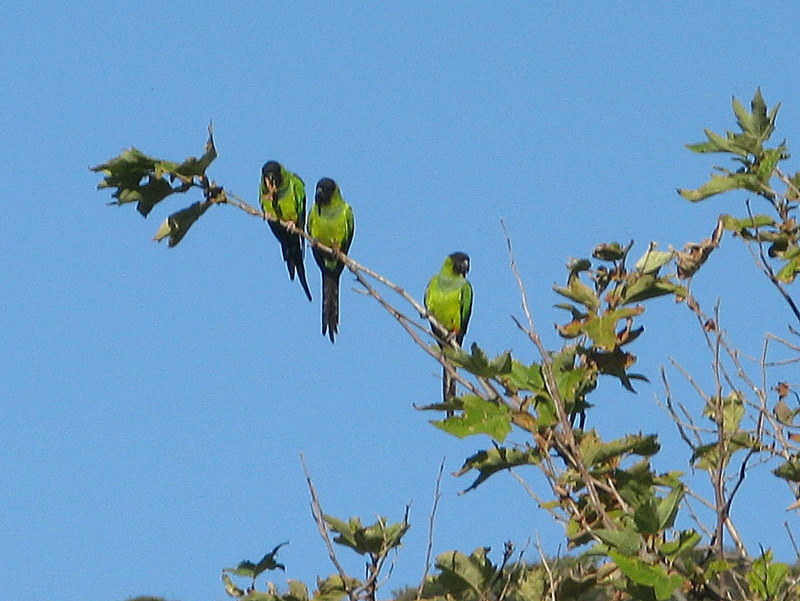
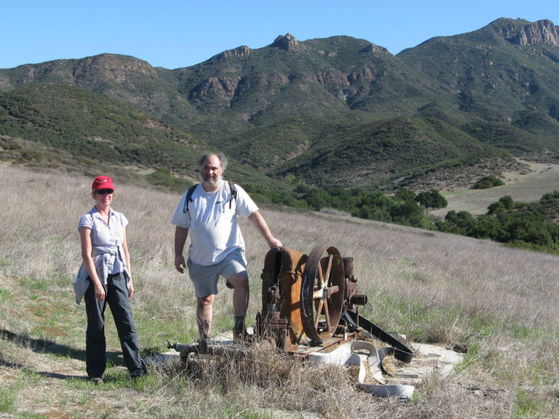
12 hikers carpooled via Hwy 23, Hwy 101, Las Posas Road, and Hwy 1 (aka PCH) to the parking lot at Sycamore Cove in Point Mugu State Park. The hike began by walking through a tunnel under Hwy 1 to the Big Sycamore Canyon Campground where we were greeted by the raucous cries of a flock of bright green South American conures perched in a large sycamore tree. We continued through the campground and hiked about a mile north on the Sycamore Canyon Fire Road to its junction with the Serrano Canyon Trail. We headed eastward upstream for 1.7 miles through the shady wooded canyon which was quite pleasant despite it being the dry season. We emerged from the canyon into lovely Serrano Valley which is ringed on all sides by mountains; it consists mainly of large meadows covered by wild grasses and dotted with a few trees and some bushes along the seasonal streams. There we began hiking the Serrano Valley Loop in a clockwise direction, stopping briefly to examine ranch artifacts such as an old water pump and an old abandoned car frame. The west side of the loop climbed part way up the mountain to a fork in the trail where we turned right and followed the faint trail as it climbed into the foothills along the north side of the loop [the left fork would have taken us to the Old Boney Trail]; it provided great views of the towering mountains to the northeast. Soon the trail began descending along the east side of the loop affording us with excellent views of the western part of Serrano Valley and the mountains to the south. We completed the loop and then descended through pleasantly cool Serrano Canyon to Big Sycamore Canyon where there were surprisingly few bicycle riders and virtually no other hikers. We returned downstream to the parking lot at Sycamore Cove, said our goodbyes to our friends, and returned to Simi Valley having completed a 9.6-mile “lollipop loop” hike with 1,300’ of elevation gain/loss on a great day for hiking.
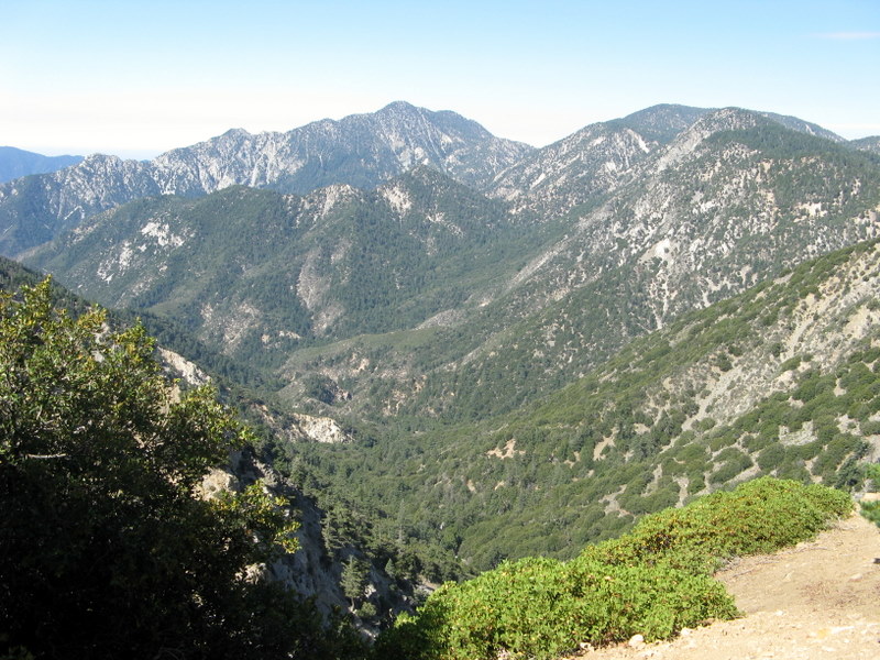
October 22nd 2011 – Mt. Baden-Powell from Vincent Gap via the PCT
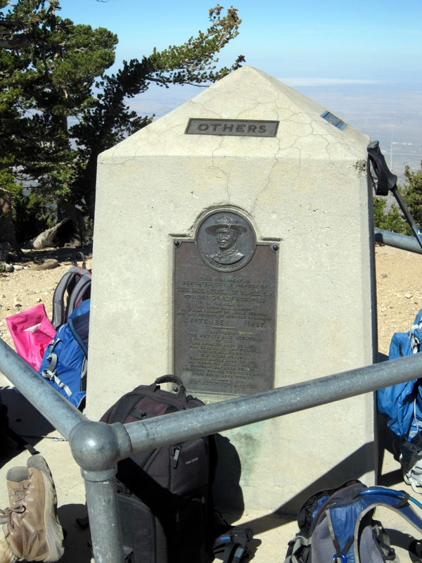
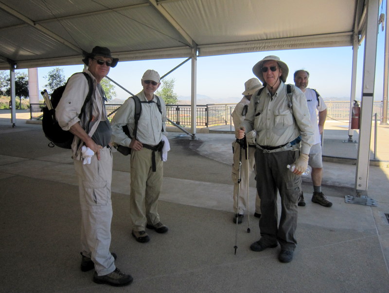
Thirteen hikers carpooled via Hwy 118, I-210, and Angeles Crest Hwy (ACH aka Hwy 2) to Vincent Gap in the San Gabriel Mountains [Angeles National Forest]. The long drive along the ACH (which reopened on June 3, 2011) provided an opportunity to witness the ongoing recovery of the forest in the aftermath of the Station Fire which started on August 26, 2009. The hike began along the Pacific Crest Trail (PCT) from Vincent Gulch Divide (6,593’) on a still-chilly-but-pleasant morning. The trail immediately began its steady climb up Mt. Baden-Powell via three-dozen switchbacks as it passed through an ever-present forest of Jeffrey pines, fir trees, Lodgepole pines, and finally Limber pines. At the summit (9,399’) there is a concrete monument to Lord Robert Baden-Powell, the founder of the world scout movement, and there are 360-degree views of Mt. Baldy, Mt. San Gorgonio, Mt. San Jacinto, the San Gabriel Mountains, and the Mojave Desert to the southern Sierra Nevada. After taking a lunch break and enjoying the view, we retraced our route to the parking lot, stopping very briefly to visit Lamel Spring on the way down. We returned home via the ACH, Big Pines Highway (N4), Pearblossom Highway, and Hwy 14, with a food-and-drink stop at Charlie Brown Farms in Littlerock, having completed a challenging 8.4-mile hike with 2,800’ of elevation gain/loss.
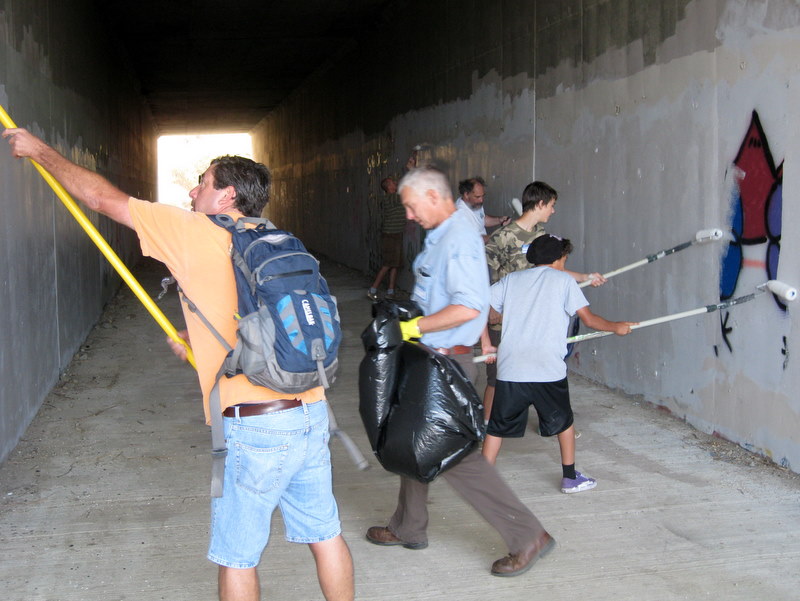
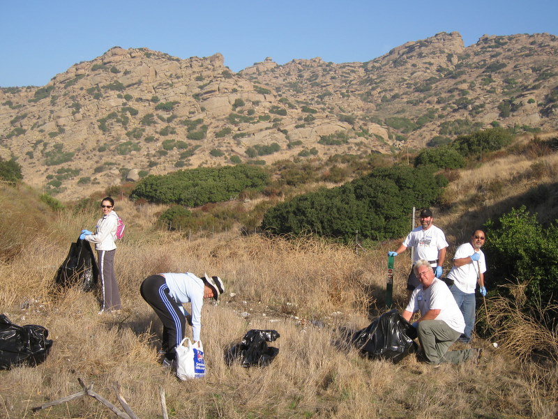
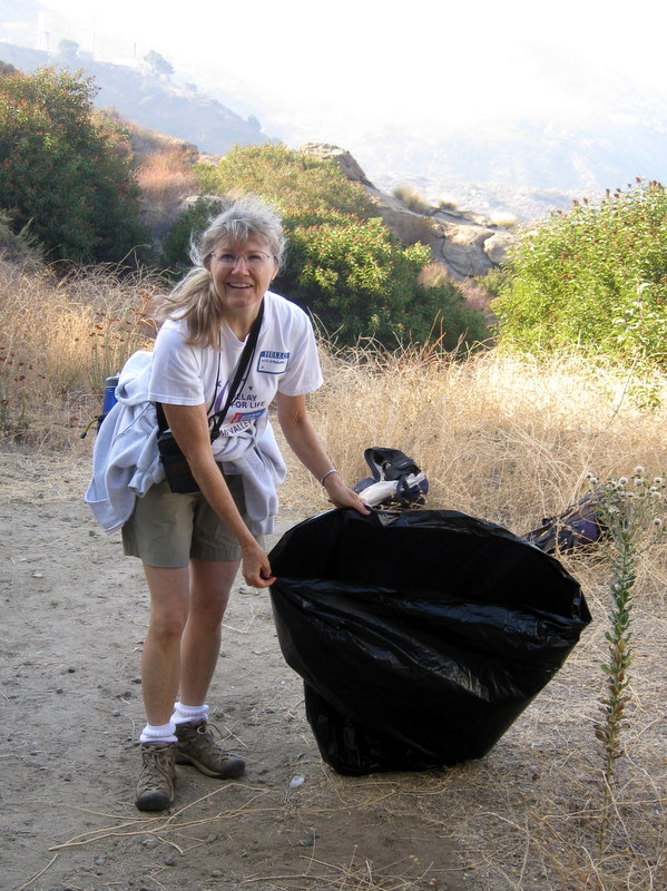
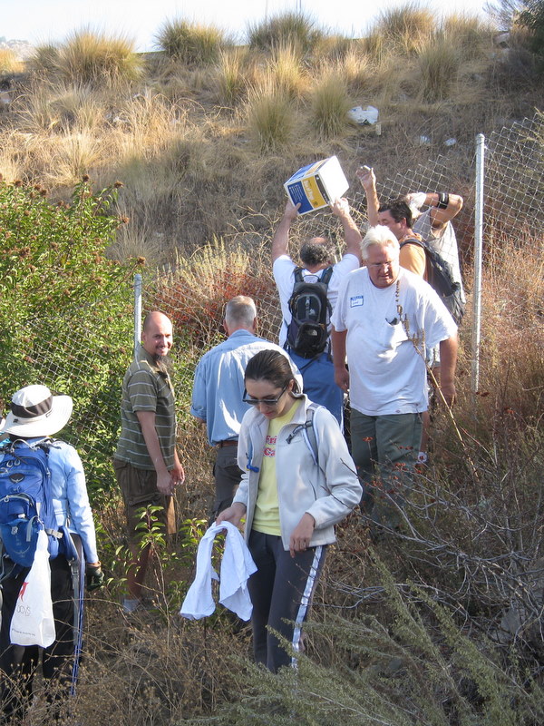
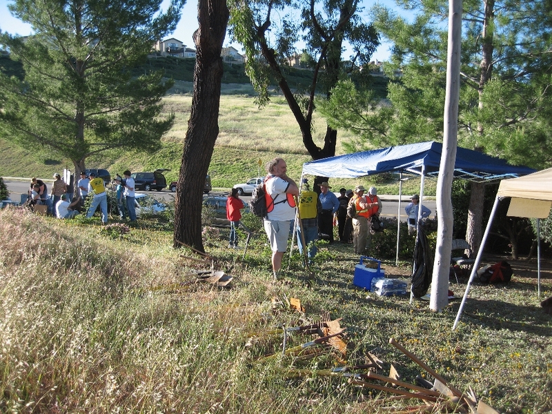
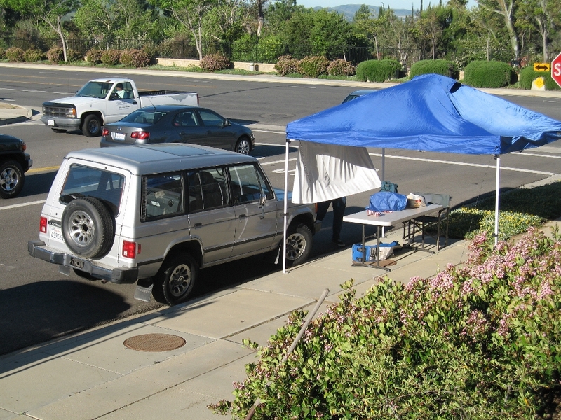
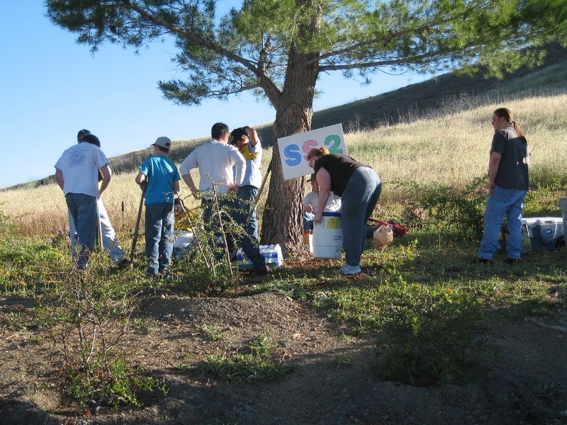
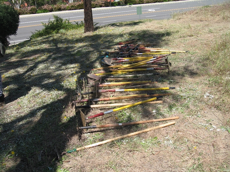
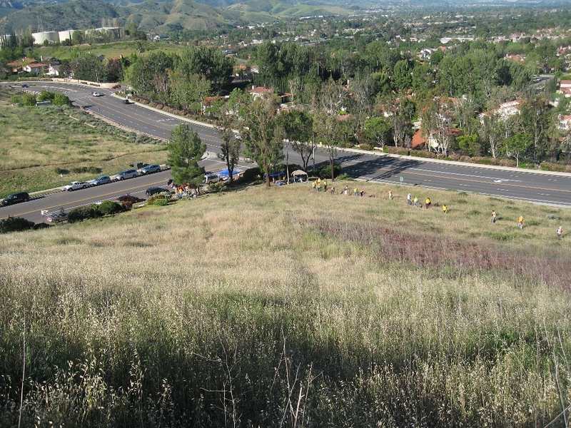
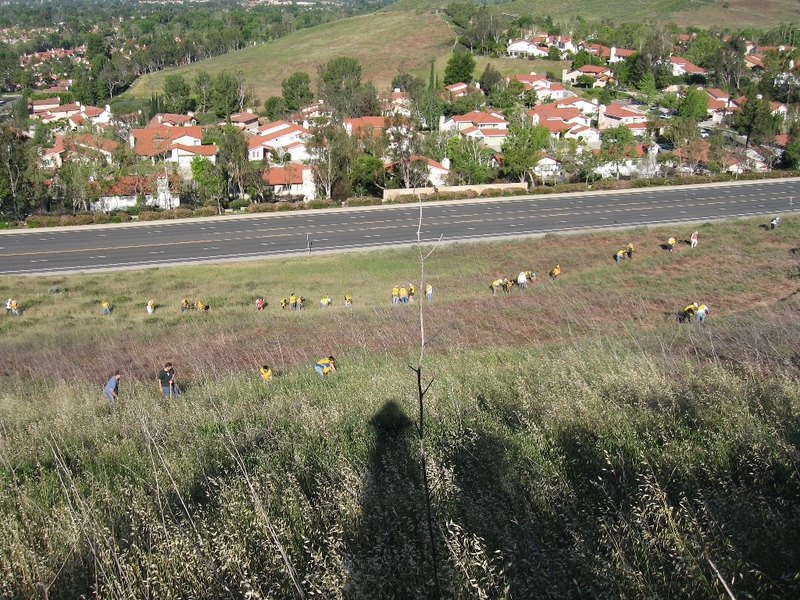
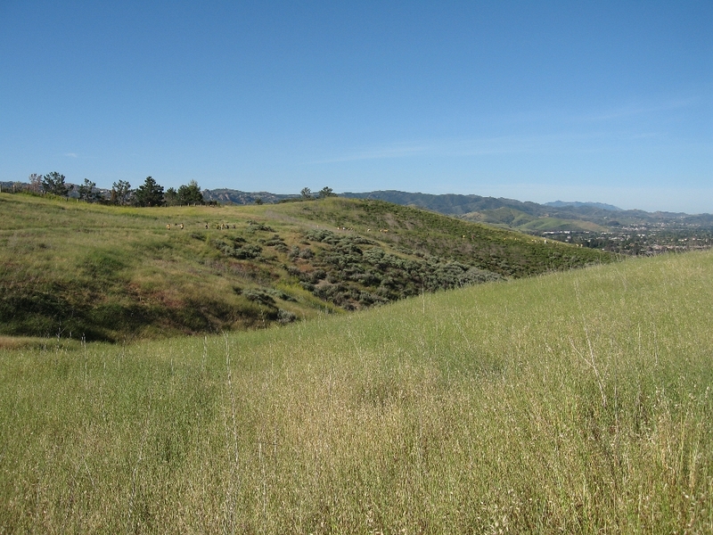
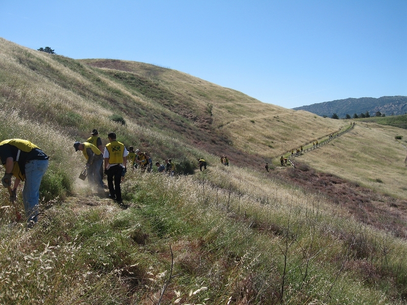
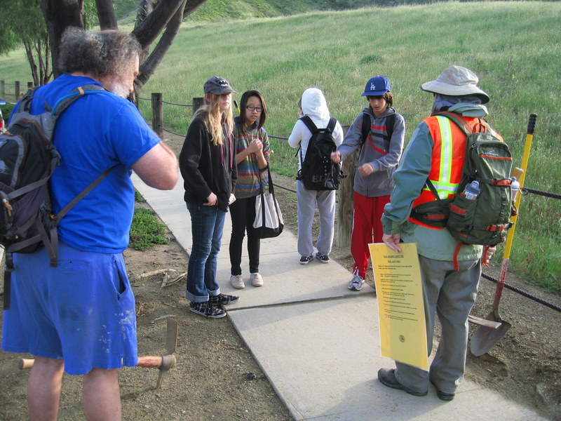
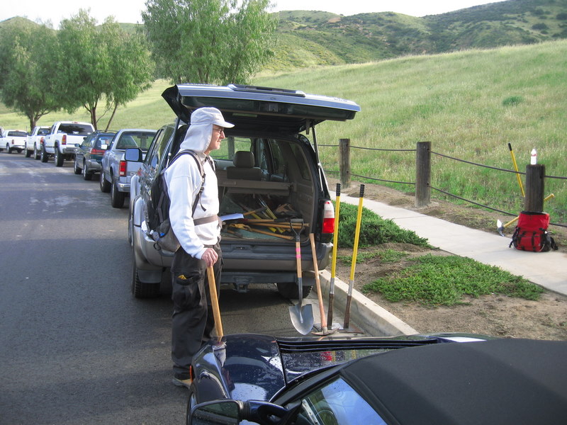
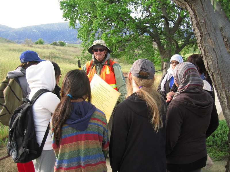
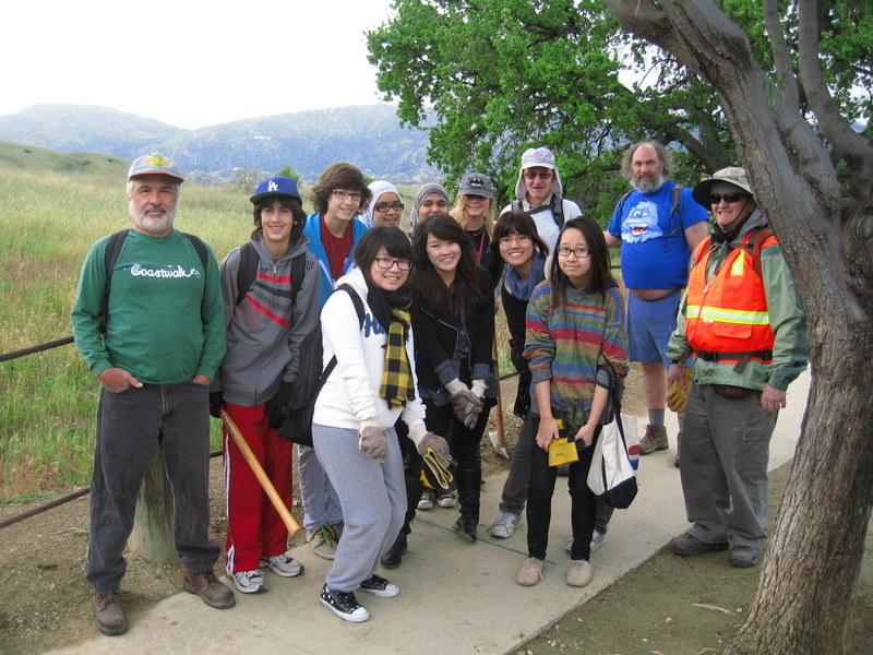
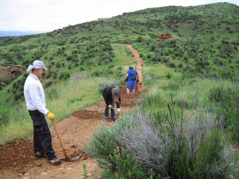
October 15th 2011 – Work Party – Cache In Trash Out Event – The Simi Valley Wildlife Corridor
October 8th 2011 – Temescal Canyon-Viewpoint Trail Loop and Will Rogers SHP via the Rivas Canyon Trail
13 hikers carpooled via Hwy 118, I-405, and Sunset Blvd to the lower parking lot at Temescal Gateway Park. A lovely refuge from the nearby urban congestion, it borders Topanga State Park. Our hike began on a shady trail along the streambed in Temescal Canyon and led pleasantly past rustic buildings constructed in the 1920.s for the Methodist Church as a west coast center for the Chautauqua movement. The whole area is shaded by towering eucalyptus trees as well as oak trees and a variety of other non-native trees such as palms and conifers. The trail began rising in Temescal Canyon as it entered Topanga State Park and we soon reached a wooden bridge crossing the stream at a point where there was a series of cascades (a .waterfall.) though there wasn.t much water at this time of year. Continuing westward along the trail we reached Temescal Ridge and were rewarded by panoramic views of the Santa Monica Mountains, the coastline, the Los Angeles skyline, and hazy views of Santa Catalina island and the San Gabriel Mountains. We then descended along the Temescal Ridge (aka Viewpoint) Trail to the canyon bottom where we rested briefly and visited the restrooms and the small store which was open after a long closure. Then we hiked eastward on a shady trail over another ridge and down into Rivas Canyon where the trail followed a seasonal stream. Using a short connector trail, we reached Will Rogers State Historic Park where we took a lunch break on the front porch of the old ranch house and enjoyed the rocking chairs and the views of the spacious green lawn and the nearby polo field. Some of us met Will Rogers. great-granddaughter who happened to be visiting the park this day. We then returned to Temescal Gateway Park and our vehicles via the Rivas Canyon trail, completing an 8.8-mile hike with 1,978. of elevation gain/loss on a great day for hiking.
September 29th – October 2nd 2011 – Big Bear Weekend Getaway
THURSDAY, SEPTEMBER 29, 2011 – Snow Summit Loop (4.0 miles RT w/1,200’ elevation gain/loss) and Arrival at the Condominium at Which We Stayed – – –
After arriving at the condominium (~7,000’) in which we stayed at the foot of the Snow Summit Ski Area on the south side of Big Bear Lake, we headed out for a late afternoon acclimatization hike. We began by following a pleasant trail behind the condos eastward about half a mile to a small stream which we hiked along for a short distance before climbing steeply up the forested slope on a “use” trail to a dirt fire road. We then continued along dirt roads through the forest to the top of Snow Summit (8,200’) where we looked at the various skiing-related facilities and enjoyed views of Big Bear Lake and the surrounding mountains. We then descended along the Summit Run ski slope to the condominium.
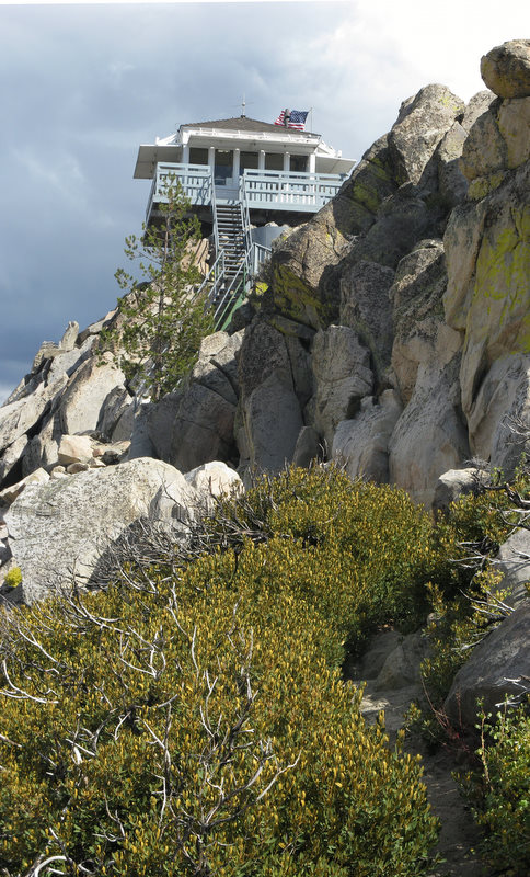
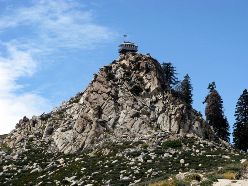
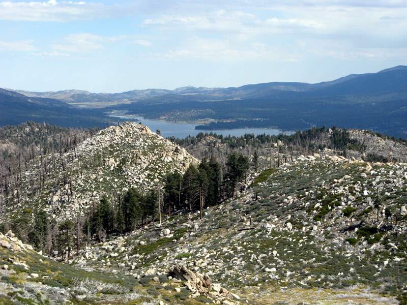
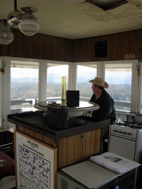
FRIDAY, SEPTEMBER 30, 2011 – Butler Peak Fire Lookout Tower (10 miles RT w/1,419’ of elevation gain/loss) – – –
After breakfast we drove a short distance from Fawnskin (on the north side of Big Bear Lake) on Forest Service Road (FSR) 3N14 to a locked gate at the east end of FSR 2N13 where we parked and began hiking westward along the very good gravel road. The gate was locked because of the severe fire damage caused by a fairly recent wildfire; most of the conifers were severely burned but were still standing. Despite the fire damage, the hike was pleasant since the smaller flora are well on the way to recovery, there were many stunning rock formations to view, the day was cool, and the road wasn’t steep. When we reached the road junction with FSR 2N13C, we turned left and hiked along it until it ended immediately below the fire lookout tower (8,537’). After climbing steep steps up to the tower, we were treated to fantastic views in every direction including Big Bear Lake, Lake Arrowhead, the San Bernardino Forest, Mt. San Gorgonio, Mt. San Jacinto, Mt. Pinos, and the southern Sierra Nevada (though the latter three were quite hazy on this day). We returned to the trailhead via the same route.
SATURDAY, OCTOBER 1, 2011 – Sugarloaf Mountain and Onyx Peak – – –
- Sugarloaf Mountain (7.1 miles RT w/1,625’ elevation gain/loss)
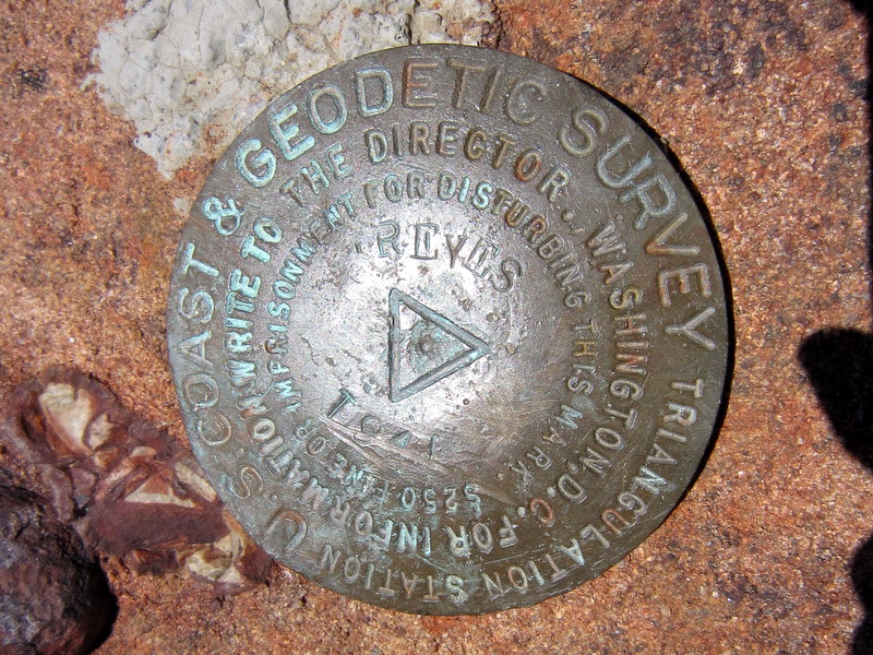
We drove south on Hwy 38 [toward Redlands] a few miles to its upper junction with unpaved FSR 2N93 (aka Wildhorse Meadows Road) which we then followed 5.75 miles to the little-used “upper” Sugarloaf Mountain trailhead, passing the lower end of the Sugarloaf National Recreation Trail (SNRT/2E18) along the way. We began hiking cross-country [no trail was evident] uphill to the north to an old dual-track dirt road which we followed to the west until it met the SNRT. We then hiked along the forested SNRT as it followed a long ridge with great views of Mt. San Gorgonio (11,502’), passing three false summits before reaching the peak (9,952’). After signing the register and locating the “S. Coast & Geodetic Survey Triangulation Station” marker, we had lunch and enjoyed the serene environment. We then returned the way we had come along the very rocky trail.
- Onyx Peak (2.2 miles RT w/217’ elevation gain/loss)
After completing the Sugarloaf Mountain hike, we continued southeast on FSR 2N93 to its lower junction with Hwy 38 (NOTE: A four-wheel drive vehicle with high clearance is needed to travel this route). We were treated to excellent views of the canyon carved by Wild Horse Creek which flows into the Santa Ana River. We drove north on Hwy 38 to Onyx Pass where we turned right onto a dirt access road; we drove to a “closed” gate where we parked. We then hiked on the dirt road to the peak (9,113’) which is adorned with telecommunications towers. There were excellent views to the north and east, mostly of barren desert and mountains. We then hiked back down to our vehicle and returned to Big Bear Lake.
SUNDAY, OCTOBER 2, 2011 – Holcomb Valley Auto Tour – – –
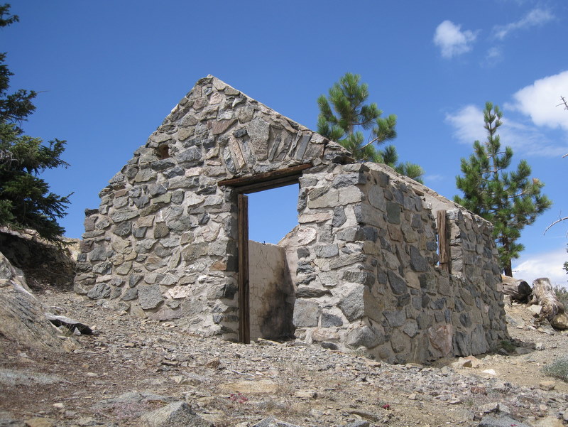
After stopping at the U.S. Forest Service’s well-equipped “Discovery Center” located along Hwy 38 on the north side of Big Bear Lake to pick up a copy of the “Gold Fever Trail Self-guided Auto Tour” brochure, we took FSR 2N09 (Polique Canyon Rd, a dirt road) north to its junction with 3N16, another dirt road. We followed it and FSR 3N05 through Holcomb Valley stopping to look at attractions such as Hangman’s Tree, Belleville (log cabin), Ross’ Grave, and Metzger Mine (which we entered and explored). This area was thriving with activity during the gold rush of the 1860s; in 1861 1,500 people lived in the valley. After completing the auto tour of the valley we headed home to Simi Valley, thus ending a very interesting and enjoyable four days.
September 24th 2011 – Bicycle Ride: Ventura to Ojai
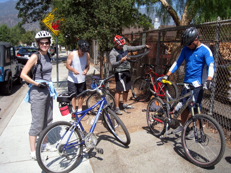
The weather was perfect for our annual bicycle ride. Ventura offered the usual coastal-influence overcast with temperatures in the low-sixties. Ojai was clear and in the mid-seventies. There was only a mild breeze near the end of the ride. We were plagued with three flat tires during our 34 mile round trip. We passed several bicyclists, making the necessary repairs along the way. Since Ojai was our half-way point, and turn-around point too, we piled our bicycles together, locked them up, and enjoyed a tasty lunch at Ojai Cafe Emporium. All seven of us agreed it was a fine ride on a beautiful trail.
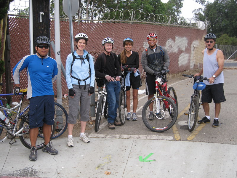
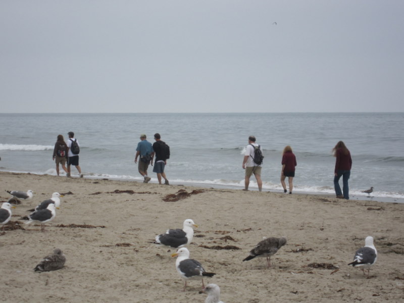
September 10th 2011 – Sycamore Canyon Shuttle
Three Rancho Simi Trailblazers volunteered to drive shuttle vehicles met at 7:30 a.m., so that they could leave two shuttle vehicles in the Big Sycamore Canyon Campground parking lot [the parking fee is now $12.00 for day use], after which they returned to the Wendy Trail trailhead on Potrero Road in Newbury Park to join the other hike participants. The temperature was in the 60’s as the thirteen hikers headed southwest on the Wendy Trail to the Satwiwa Native American Indian Culture Center where we took advantage of the restrooms. We continued our one-way hike along the paved Big Sycamore Canyon Trail as it descended into the canyon where the road soon turned to dirt. Friendly bicycle riders, runners, and some other hikers were also taking advantage of the relatively low morning temperature in the canyon. Surprisingly there was water in two places in the seasonal stream that runs through the canyon bottom. The towering California sycamore trees had bright green leaves, there were a few flowers, and there were large patches of pretty green and red poison oak along the trail, particularly in the upper canyon. The temperature remained cool as we drew closer to the ocean and a light rain began to fall. At about the same time we heard and then spotted a dozen or more bright green wild parrots in a nearby tree. The rain stopped and we made our way under Hwy 1 to the beach at Sycamore Cove. After enjoying the ocean view for a while, we headed for our shuttle vehicles as lightning and thunder began. Soon a very heavy downpour began, but we were already safely in our vehicles on our way back to the trailhead parking lot having completed a pleasant 8.6-mile hike with very little elevation gain/loss.
September 3rd 2011 – Long Canyon to Montgomery Canyon to Challenger Park Shuttle
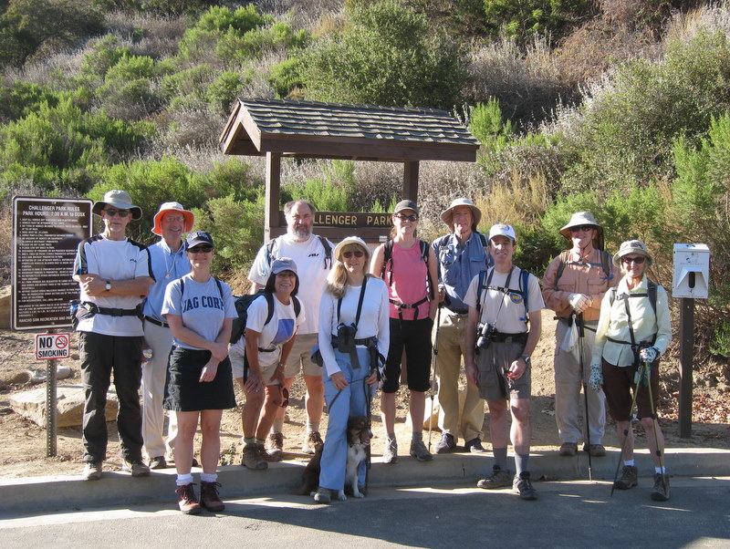
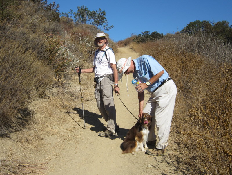
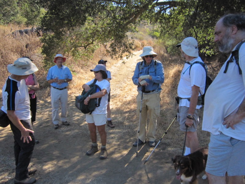
12 hikers (+ 1 dog) met in the parking lot at the junction of Wood Ranch Parkway and Long Canyon Road in Simi Valley on a morning that held the promise of high temperatures to come. After carpooling to the trailhead in Challenger Park, the hike began along a trail that soon climbed to a three-way junction. Taking the middle fork to the south, we followed the undulating trail to a T-junction near the mouth of Montgomery Canyon where we headed southeast along a shady ranch road further into the canyon. Eventually the dirt road began rising steeply up a ridge between Montgomery Canyon and Oak Canyon; it soon provided broad views of the surrounding mountainous landscape (and lots of direct sunlight). The dirt road then descended to a T-junction with the dirt road in Oak Canyon. After resting in the cool shade of some large oak trees, we resumed our hike along the dirt road and then followed a single-track trail up to a trail on the ridge above Long Canyon, from which there were distant views to the north, south, and west. From there we descended on the main trail to the Long Canyon parking lot having completed a pleasant 4.6-mile hike with 1,084’ of elevation gain/loss (before the day turned really hot).
August 27th 2011 – Newton Canyon
It was a warm hike. In fact, it was our hottest Saturday hike so far this year. The current heat wave was having its way with us all. It was 85 degrees at the trailhead, when we began hiking, and it rose to a toasty 95 degrees by the time our hike was done. Twelve of us took our time, paced ourselves well, drank lots of water and did our best to stay in the ever decreasing shady spots. We agreed to only complete the Newton Canyon Trail, so our hike was only 4.6 miles, with 904’ total elevation gain. There was an unexpected showing of late-season wildflowers accenting our trail. From a favorite vantage point, Catalina Island was clearly visible in the distance, cloaked by fog. We all enjoyed the good company of friends and a beautiful hike too.
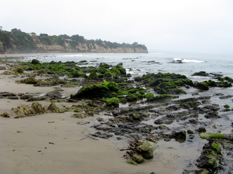
August 20th 2011 – Carpinteria Bluffs and Seal Sanctuary
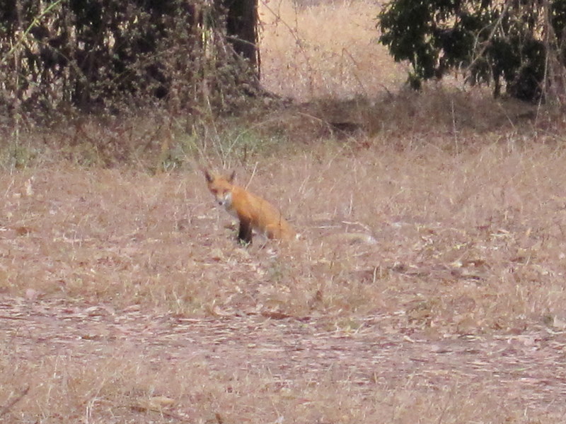
So we decided to be a bit creative today. The hike was advertised as 4.5 miles round trip. By the time we were back to our cars, the total mileage was about 8.4 miles, with a whopping 160’ of elevation gain. We started at a different trailhead, which was actually the far-eastern end of the Carpinteria Bluffs Trail. From there we walked the entire Carpinteria Bluffs trail, then continued past the campgrounds, and then walked along Carpinteria State Beach all the way to the far-western end of Avenue Del Mar. We returned the same way, but took the beach route all the way to Rincon Beach Park, finally returning to our trailhead via the bluffs trail along the railroad tracks. A real highlight of the hike was the sighting of a red fox (not the comedian) near the western end of the Carpinteria Bluffs trail. Eleven of us enjoyed the perfect 68 degree hiking weather. Perhaps this new route will become a new tradition for us.
August 13th 2011 – Mt. Islip
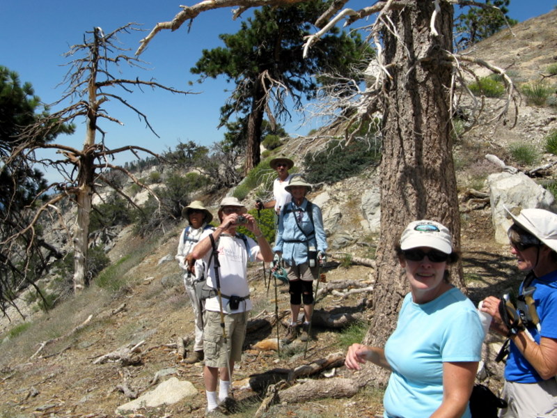
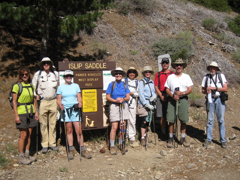
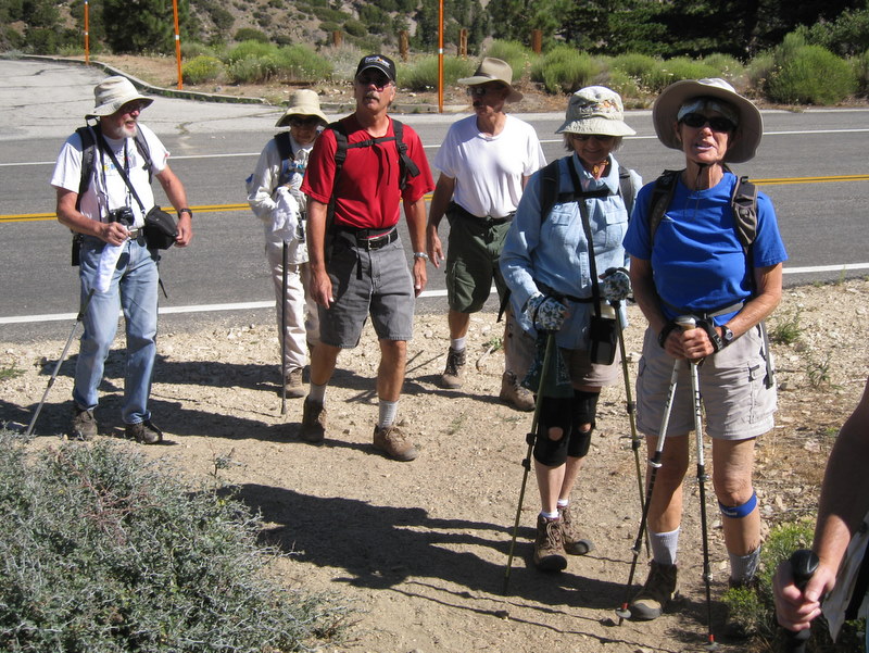
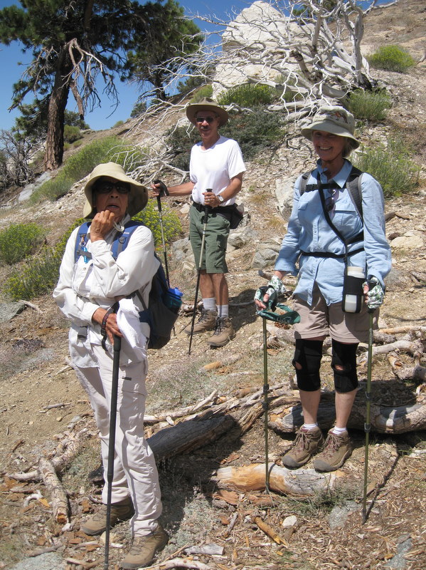
Ten hikers carpooled via Hwy 118, I210, and Angeles Crest Hwy (ACH aka Hwy 2) to Islip Saddle in the San Gabriel Mountains [Angeles National Forest]. The long drive along the ACH (which reopened on June 3, 2011) provided the first opportunity for many of the hikers to witness the aftermath of the Station Fire which started on August 26, 2009. The hike began along the Pacific Crest Trail (PCT) opposite the Islip Saddle parking lot. The trail climbed eastward soon skirting a large meadow and then entering a pine-scented forest. After two miles of hiking we reached the Little Jimmy Trail Camp (with picnic tables and bathrooms) where some backpackers were preparing to leave. We soon continued on to Windy Gap where we met and spoke with another group of hikers who had hiked up from Crystal Lake. Next we followed the Islip Ridge Trail to the south as it ascended to the peak of Mt. Islip. Once there we took a lunch break and enjoyed the 360-degree views of the surrounding mountains, the Antelope Valley, and the Crystal Lake Recreation Area to the east. Leaving Mt. Islip, we descended to Little Jimmy Trail Camp via an old trail, bypassing Windy Gap. We then retraced our route to the parking lot at Islip Saddle. While driving back along the ACH, we encountered a road block resulting from a fatal traffic accident a short distance ahead. Electing to turn around (rather than wait at the road block), we drove to the northeast end of the ACH and then made our way to Palmdale and returned home via Hwy 14, adding over two hours to our journey. We arrived home having completed a very pleasant 7.2-mile hike with 1,455’ of elevation gain/loss.
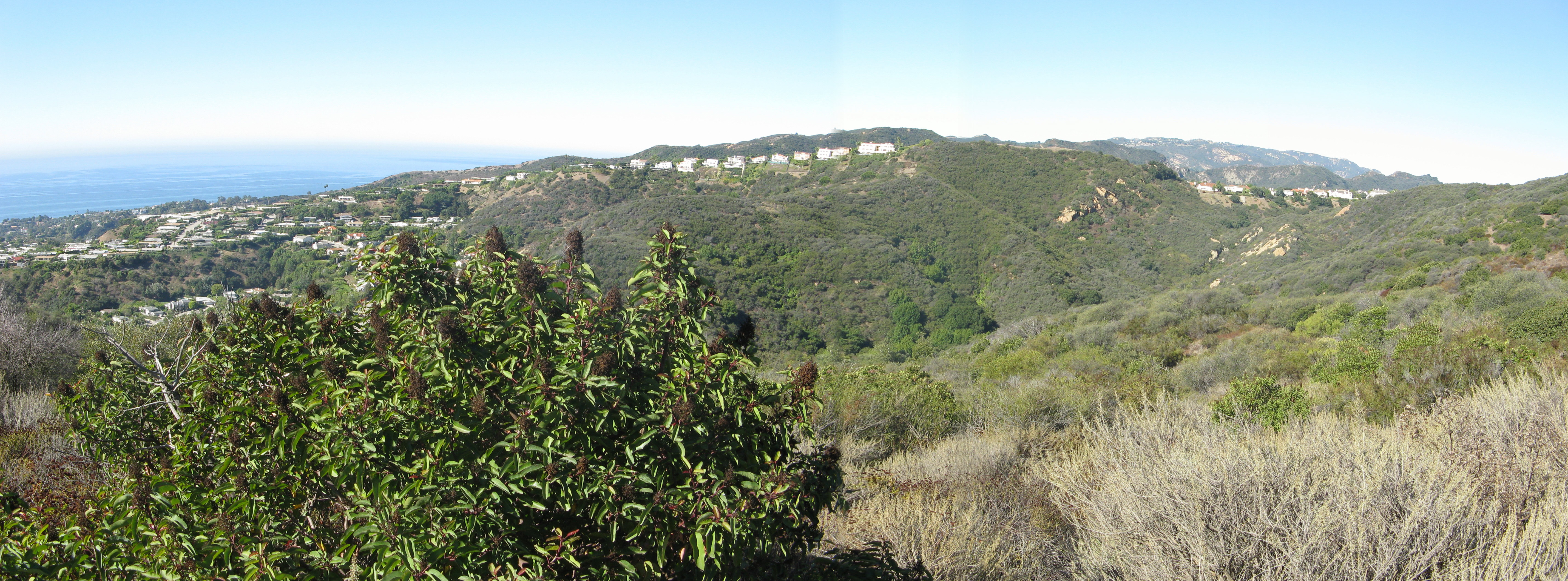
August 6th 2011 – Point Dume to Paradise Cove

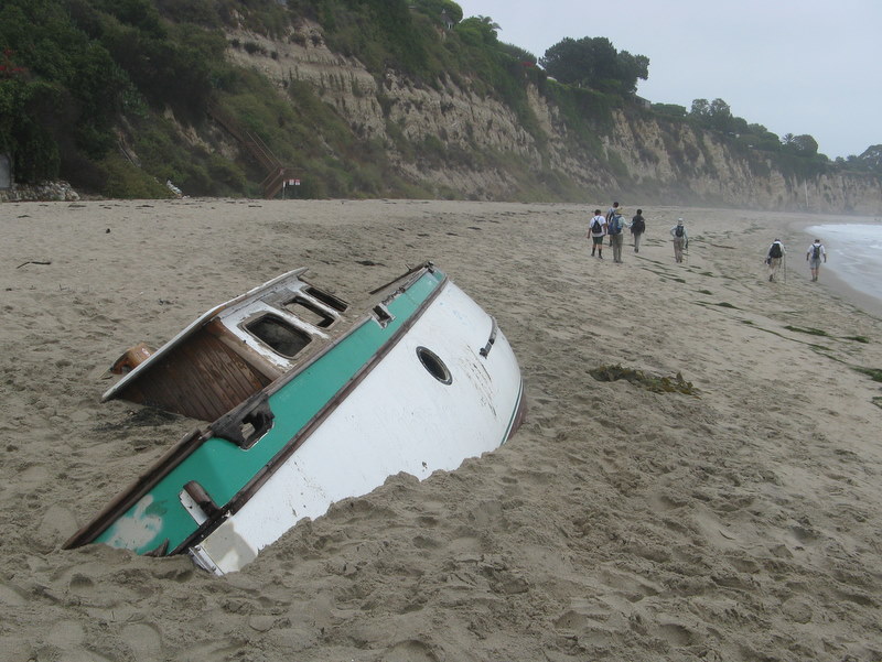
9 hikers carpooled to Malibu via Highway 23, Highway 101, and Kanan (Kanan Dume) Road. Reaching Pacific Coast Highway (Hwy 1), we turned right (west) and then turned left a short distance later on Westward Beach Road where we parked for free along the road and then hiked to the parking lot trailhead. A marine layer blanketed the coast, keeping the temperature pleasantly cool as we began hiking up and over Point Dume. After an easy climb onto Point Dume, we followed a trail as it led down to Dume Beach where we soon encountered a shipwreck partially buried in the sand. The tide was just coming in as we leisurely walked along the sandy beach for two miles, enjoying the ocean sounds and sights, eventually arriving at the Paradise Cove Beach Café (http://www.paradisecovemalibu.com ), a landmark for decades. We rested for a while in the free Adirondack chairs provided outside the café and watched the beachgoers and distant surfers. We resumed our hike and headed back along the beach the way we had come. After climbing back onto Point Dume, we hiked to an observation point (with two benches), but spotted no marine life. We then continued on the trail around the point, descended to the parking lot, and hiked back to our cars. We headed home having completed an easy 6.5-mile hike with 318’ of elevation gain.
July 30th 2011 – Solstice Canyon Loop
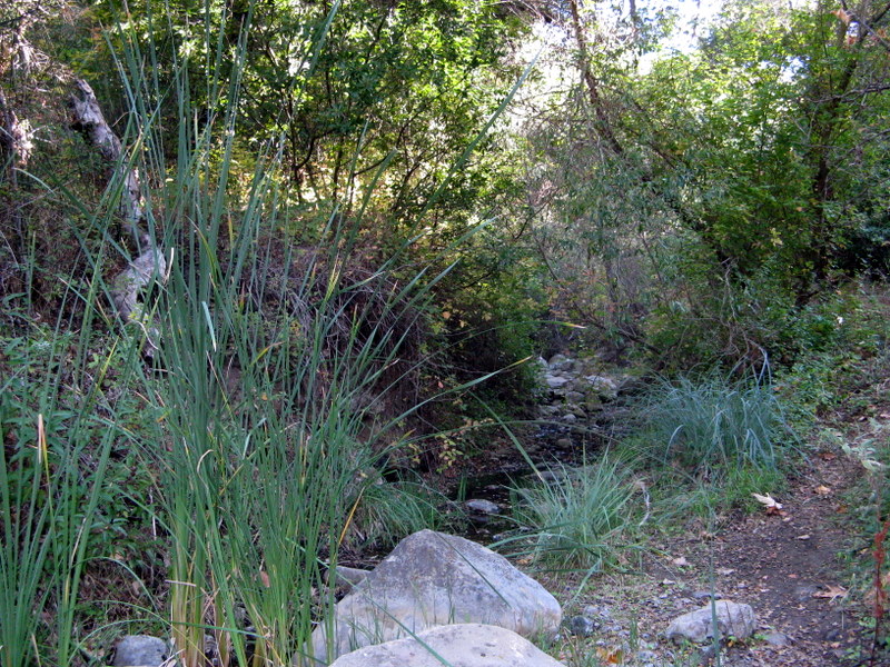
Six hikers carpooled to Solstice Canyon via Hwy 23, Hwy 101, Kanan Road, Pacific Coast Highway (Hwy 1), and Corral Canyon Road where we discovered the parking lots were full, so we began our hike at Hwy 1. The out-and-back hike began by following gently flowing Solstice Creek along the easy well-shaded Solstice Canyon Trail (a dirt road), taking advantage of two short trails paralleling the dirt road along the way, and reaching the Sostomo Trail after about one mile. We followed the Sostomo Trail as it climbed steadily toward a junction with the Deer Valley Loop Trail. As the trail rose we were afforded excellent views of Solstice Canyon and the Rising Sun Trail across the canyon. The trail crossed Solstice Creek twice; both crossing areas were quite lovely, peaceful, and cool. After reaching Deer Valley, we followed the loop trail in a clockwise direction as it ascended the mountainside to an overlook of Point Dume and the Pacific Ocean. After enjoying the view and the ocean breeze, we completed the loop and then returned along the Sostomo Trail to the Solstice Canyon Trail. Turning left we walked a short distance to Tropical Terrace, the ruins of the Roberts house built in the 1950s and destroyed by wildfire in 1982. At one time there were giraffes, camels, buffalo, African deer, and exotic birds in the canyon. We took a break at Tropical Terrace, read the signs describing it, and enjoyed the ambiance of palm trees and waterfalls in adjacent Solstice Creek. We then returned to the parking lot via the Solstice Canyon Trail having completed an 8.6-mile hike with 1,500. of elevation gain/loss.
July 23rd 2011 – Mt. Pinos to Sheep Camp
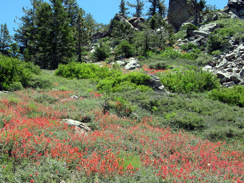
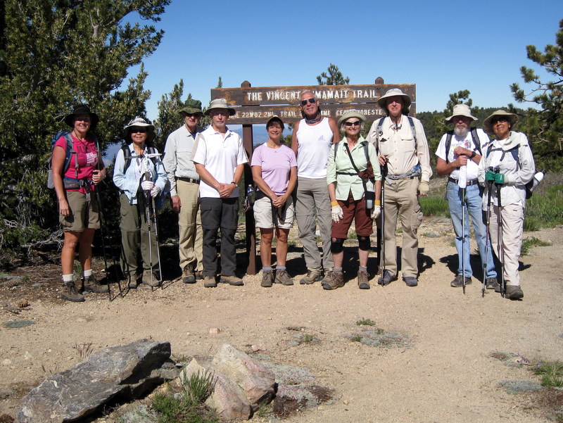
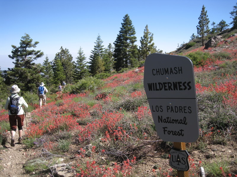
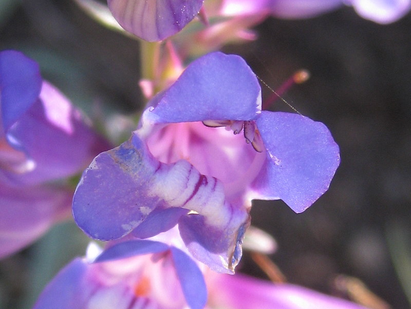
Eleven hikers carpooled via Hwy 118, Interstate highways 405 and 5, Frazier Mountain Park Road, Cuddy Valley Road, and Mt. Pinos Road to the Chula Vista parking lot (favored by stargazers) less than two miles from the summit of Mt. Pinos (8,831‘). The hike began on a beautiful morning by following a dirt road through the forest to the Tumamait-Mt. Pinos Trail (21W03) trailhead at the Condor Observation Point where there were excellent views to the north, south and west. A well-maintained dirt trail then entered the Chumash Wilderness as it descended the open western slope, bursting with wildflowers, via switchbacks; it then crossed a saddle and ascended the forested eastern slope of Sawmill Mountain. We then followed a faint side trail to the Sawmill Mountain peak (8,818’), marked by a large rock monument. Returning to the main trail we descended to a junction with the North Fork Trail (22W02) which we followed as it descended southward half a mile to Sheep Primitive Camp under a stand of Jeffrey Pines. There we took a rest/lunch break and enjoyed the pleasant forest environment. We then retraced our route up Sawmill Mountain and back to Condor Observation Point. After regrouping atop Mt. Pinos on a still-cool day, we hiked back to the parking lot and then returned home having completed a 9.3-mile hike with 1,645’ of elevation gain.
July 16th 2011 – Wildwood Park
Are we done changing the hike location? Does anybody know? Malibu Creek State Park too hot this time of year? Don’t know if we can even get to Newton Canyon ‘cause of Carmegedon. Wildwood Park? Haven’t been there for a while. That’s safe. Let’s do it.
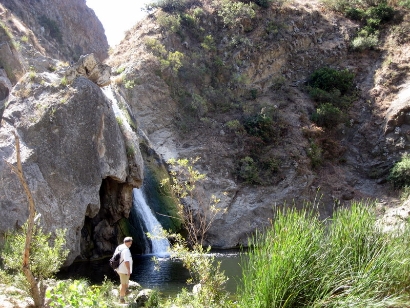
Eight hikers completed a 4.75 mile, 865’ elevation gain, loop hike today. We started on the Mesa Trail and enjoyed the solitude and fine views from the top of Lizard Rock. From there, we dropped down into the canyon, passing the Hill Canyon Water Treatment Facility on the right. We stopped at Skunk Hollow to eat some snacks and enjoy the shade under a picnic table. Next was Paradise Falls, for a long look and some pictures. Finally, we climbed up and out of the canyon, and back to our cars, via the Lynnmere Trail. It was a fine local hike, enjoyed by all.
July 5th – 10th 2011 – Eastern Sierra Hiking and Camping Trip
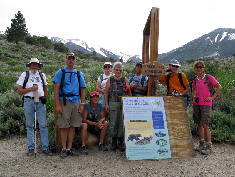

TUESDAY, JULY 5, 2011 – Parker Lake Trail (4.4 miles w/619’ elevation gain/loss) and Arrival at Oh Ridge Campground – – –
After arriving at Oh Ridge Campground (~7,724’) on the northeastern shore of June Lake, checking in, and setting up camp, most of the 15 Rancho Simi Trailblazers who participated in the six-day outing in the Eastern Sierra Nevada headed for the Parker Lake (8,320’) hiking trailhead located west of Grant Lake on the June Lake Loop (Hwy 158) at the southwestern end of Parker Lake Road. At first the trail rose somewhat steeply amid sagebrush and abundant wildflowers as it entered Parker Canyon. It then rose gently beside quaking-aspen-lined Parker Creek which was overflowing its banks due to the melting of the three-times-normal snowpack, until it reached lovely Parker Lake located in the granite cirque below Kolp Peak at the head of the canyon. On the return trip, there were good views of Mono Lake in the distance.
WEDNESDAY, JULY 6, 2011 – Fern Lake Trail (3.4 miles RT w/1,469’ elevation gain/loss) + Yost Lake Trail (6.6 miles w/731’ elevation gain/loss) = 9.0 miles w/2,200’ elevation gain/loss – – –
Immediately after leaving the signed trailhead [located along the June Lake Loop (Hwy 158) west of town], we crossed snow-melt-swollen Fern Creek on a log. The shaded, rocky, twisting trail then climbed rather steeply up the forested, wildflower-adorned mountain slope with views of Silver Lake (7,226′) along the way. After a while it closely paralleled roaring Fern Creek Falls (actually a series of steep cascades) just before reaching a trail junction. We took the right fork for the steep 0.7-mile climb to spectacular Fern Lake (8,920’) which is located in a steep-sided cup formed by rugged outliers of snow-capped Carson Peak and San Joaquin Ridge. After resting, exploring, and enjoying the gorgeous scenery, several of the hikers returned the way they had come to the Fern Lake Trail trailhead. The remaining hikers, departing sooner from Fern Lake, returned 0.7 mile to the fork in the trail at Fern Creek Falls and then continued eastward to Yost Lake (9,090’) – somewhat of a disappointment when compared to Fern Lake – then on to a large meadow (formerly a lake itself), and finally down the Yost Lake Trail to its trailhead opposite the June Lake Fire Station on June Lake Loop where they were picked up by two of their fellow hikers.
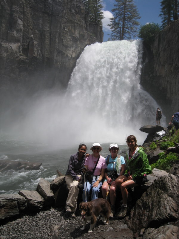
THURSDAY, JULY 7, 2011 – Devils Postpile National Monument; Obsidian Dome; and Glass Creek Trail – – –
· Devils Postpile and Rainbow Falls [upper fall only] (3.9 miles w/500’ elevation gain/loss)
We parked near the Mammoth Mountain Adventure Center, purchased $7.00 one-day shuttle-bus tickets to Reds Meadow, and then rode the shuttle bus to Stop #6. A pleasant trail led along the Middle Fork of the San Joaquin River to Devils Postpile (7,547’), an excellent example of columnar basalt which appears to be hexagonal. A side trail led to the top of the Postpile where the tops of the basalt columns (created by lava flows) resembled a parquet floor. We then followed a little-used forest trail to the trailhead of the Rainbow Falls trail which dropped through an area devastated by fire in 1992, eventually reaching overlooks that provided views of the spectacular upper waterfall and granite stairs leading down to the bottom of the waterfall. After resting, eating lunch, and enjoying the view (but not the hordes of tourists), we hiked up to the restaurant and store in Reds Meadow and caught the shuttle bus back to the Mammoth Mountain Adventure Center and our vehicles.
· Obsidian Dome (0.8 mile w/130’ elevation gain/loss)
Heading north on Hwy 395 from Mammoth Lakes, we turned left (west) on signed Obsidian Dome Road 0.2 mile north of Deadman Summit. We followed this well-graded dirt road to a sign reading “Obsidian Dome Parking,” parked, and looked briefly at a large ugly pile of rubble. Continuing on, we stayed left at a junction with a road leading to Hartley Springs Campground and eventually reached a second fork in the road. We took the left fork a short distance and parked near a dirt road cut into the hill on the left. Hiking up the hill, we were soon atop the southwestern section of the Obsidian Dome (8,281’), a huge collapsed volcanic dome (a mile in diameter) created out of lava which solidified to black glass; it’s made up of giant (car-sized) obsidian boulders and smaller obsidian pieces as well as rhyolite. This small part of the dome is an awe-inspiring otherworldly wonderland of multi-colored rock formations; it stands out uniquely on Google Earth due to its high concentration of obsidian (black glass).
· Glass Creek Trail (2.8 miles w/500’ elevation gain/loss – or further)
Leaving the Obsidian Dome, we drove a very short distance back to the fork in the road and turned left; we then drove a short distance to the trailhead parking lot (at a dead-end in the road) for the Glass Creek Trail. At first the pleasant trail climbed gently along Glass Creek which is lightly forested with lodgepole pines, Jeffrey pines, and red firs, but then it rose steeply beside a long series of noisy heavily flowing cascades to a relatively level area where it led to a low ridge (8,665’) with views of the towering High Sierra peaks to the west. At this point some of the hikers turned back and returned to the parking lot. Several of the hikers continued on to the next ridge and descended into the Glass Creek Meadow which is moist and green virtually year-round and at this time of year was bursting with wildflowers. Soon the remaining hikers returned to the parking lot.
FRIDAY, JULY 8, 2011 – Panum Crater and Mono Lake; Bodie State Historic Park; and Lundy Canyon Trail – – –
· Panum Crater and Mono Lake (1.5 miles w/300’ elevation gain/loss)
Panum Crater (6,960’) is a rhyolitic volcanic cone about 650 years old. It is located south of Mono Lake and is accessed via Hwy 120 and a hard-to-spot dirt road requiring a left (north) turn. After parking in the dirt lot at the base of the crater, we hiked up a dirt road to a junction of the Plug Trail (which leads down and then up to the center of the crater) and the Rim Trail which circumnavigates the crater’s rim and provides panoramic views of Mono Lake; we hiked the Rim Trail. After leaving the Panum Crater, we drove over to the nearby Mono Lake South Tufa Area.
Mono Lake (6,376’), which has no outlet except evaporation, is a large salty, alkaline lake harboring algae, alkalai flies, brine shrimp, various migratory bird species (including seagulls), and tufa towers composed of calcium carbonate (limestone). The unusual spires and knobs of the tufa towers are formed when calcium-bearing freshwater springs (fed by water from the Sierra Nevada) happen to well up through alkaline lake water which is rich in carbonates. We participated in a docent-led walk at the South Tufa Area and then explored the area on our own, some of us wading into the water and many of us taking photos.
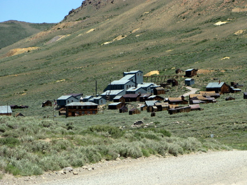
· Bodie State Historic Park (1.1 miles w/160’ elevation gain/loss)
After leaving Mono Lake and stopping briefly in Lee Vining for provisions, we drove north on Hwy 395 to the junction (7 miles south of Bridgeport) with Hwy 270. We then drove east 10 miles on the paved road, followed by 3 miles on the continuation dirt road to Bodie (8,400’) where we were required to pay a $7.00 per person fee to enter the area. The town is a genuine California gold-mining ghost town, preserved in a state of “arrested decay”; it looks much the same as it did 50 years ago. There are no facilities except bathrooms and a parking lot. Bodie became a mining boomtown in 1877 and had a reputation for lawlessness: gunfights, stage holdups, robberies, and street fights. One little girl, whose family was taking her to the remote and infamous town, wrote in her diary: “Goodbye God, I’m going to Bodie.” We walked around the ghost town imagining what it must have been like to live there during its heyday and a few of us joined an interesting tour of the Standard Mine Mill.
· Lundy Canyon Trail (3.0 miles w/600’ elevation gain/loss – or further)
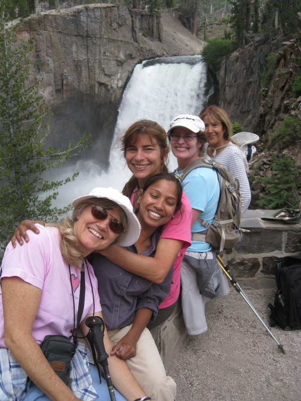
After leaving Bodie State Historic Park, we headed south on Hwy 395 to Lundy Lake Road which we followed westward past Lundy Lake to the end of the pavement and continued on the dirt road, carefully driving through several pools of water on the road, eventually reaching the parking loop near the trailhead. The trail, bordered by quaking aspens, led along Mill Creek into Lundy Canyon. We soon reached a large beaver pond which provided us with stunning views of the lower Lundy Canyon Falls, the forested slopes ahead, and the snow-capped peaks of the cirque beneath Black Mountain at the head of the canyon. After taking many photos, we followed the trail as it rose and passed near the top of the falls and then entered the Hoover Wilderness. We hiked past several beaver ponds, meadows, countless wildflowers, and several beautiful tributary creeks with very active cataracts; we very carefully crossed several fast-flowing streams on logs and rocks. Eventually we reached the ruins of a small building; at this point the trail became quite muddy and was frequently filled with water. A short distance further (8,070’), some of the hikers decided to return to the parking lot, but the remaining hikers continued on for some distance until snow (on the ground) caused them to turn back. NOTE: The trail in Lundy Canyon eventually climbs steeply up a chute via switchbacks and out of the canyon, thus providing access to the Twenty Lakes Basin.
SATURDAY, JULY 8, 2011 – Rush Creek Trail to Agnew Lake and Gem Lake – – –
· Rush Creek Trail to Agnew Lake and Gem Lake (10.0 miles w/2,650’ of elevation gain/loss – or further)
The trailhead for this hike is at the Rush Creek Pack Station on the June Lake Loop (Hwy 158). We headed south on the trail as it entered the Ansel Adams Wilderness and began climbing southward through quaking aspens parallel to Silver Lake. After passing the southern end of Silver Lake, the trail continued southward, rising more steeply as it headed toward Agnew Lake (8,502’). We soon reached a large rock outcropping that afforded us an excellent view of a very large waterfall below the outlet to Agnew Lake as well as the surrounding mountains. We rested, took photos, and enjoyed the beautiful views. Continuing our hike we soon reached the old mining rail bed which is no longer in use. The trail rose steeply up to the Agnew Lake outlet, crossing the rail bed twice [in fact, one may walk up/down the steep rail bed]. When we reached the trail junction at Agnew Lake, we took the right fork (the north side of the lake) and followed the trail as it led along the lake and climbed up to the Gem Lake (9,066’) outlet. We then followed the trail as it rose and fell along the north side of Gem Lake, a large hydroelectric reservoir, enjoying the views and the wildflowers. When we reached the Alger Lake trail junction at the west end of Gem Lake, we rested and ate lunch. Some of the hikers decided to return to the parking lot from that point, but the remaining hikers continued on to the Rush Creek trail junction and then hiked on to Waugh Lake (9,460’) from which they returned to the parking lot.
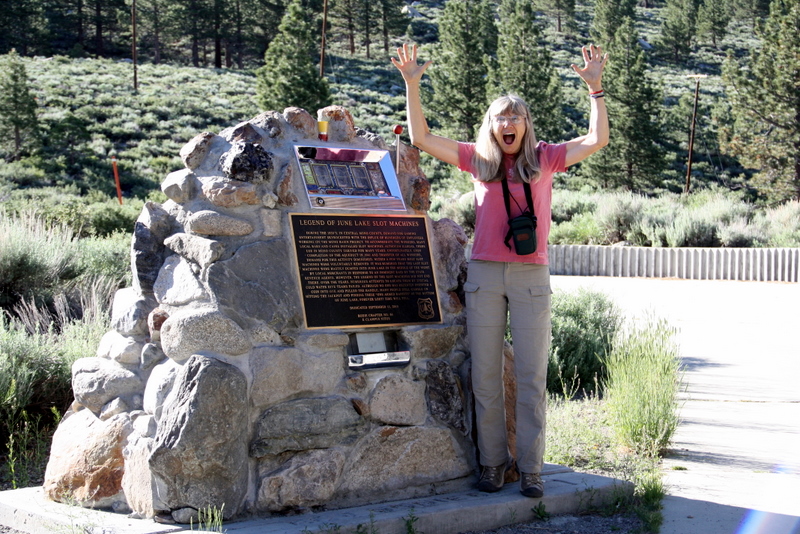
SUNDAY, JULY 10, 2011 – Breakfast at the Silver Lake Resort and Departure – – –
Several of the hikers ate breakfast at the Silver Lake Resort (7,240’) which is located on the June Lake Loop (Hwy 158).
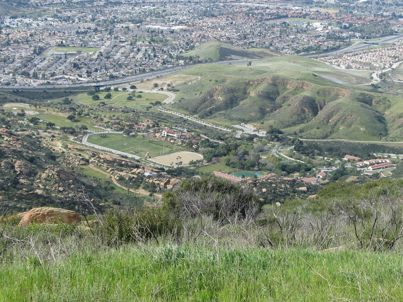
July 2nd 2011 – Mt. McCoy Trail and the Reagan Library
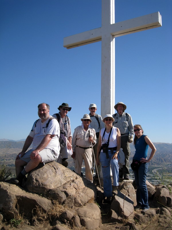
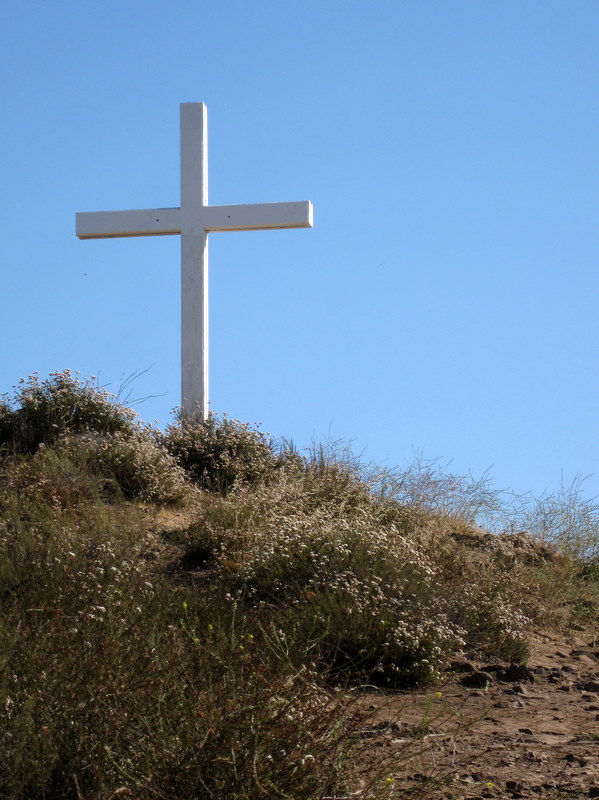
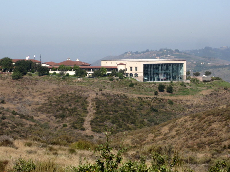
8 hikers met at the carpool point near the intersection of Royal Avenue and Madera Road on an already warm morning and then (since trailhead parking is quite limited) walked from there to the Mt. McCoy trailhead on Washburn Street a few blocks to the west. The hike began along the trail heading south but it quickly began climbing gradually westward along the well-maintained trail leading to the summit via a series of switchbacks. As the trail rose up the mountainside, we were rewarded with excellent views of the western end of Simi Valley, including Sinaloa Lake, Wood Ranch, and the Bard Reservoir. There is a concrete cross as well as two concrete benches at the summit, from which the Ronald Reagan Presidential Library can be seen. After a short break to enjoy the panoramic view, we hiked southwest to Presidential Drive and then hiked along it to the west side of the library where President Reagan was buried in 2004. The setting of the library is quite beautiful. We sat in the shade on the patio and enjoyed a cool breeze for a while. Eventually we returned the way we came completing a 5.6-mile hike with 700’ of elevation gain/loss, glad that the return trip was mostly downhill since the day had heated up considerably.
June 25th 2011 – Topanga Canyon State Park – Eagle Springs Loop

9 hikers met at the carpool point near the intersection of Royal Avenue and Madera Road on a morning cooled by a light marine layer and then carpooled to the parking lot at Trippet Ranch in Topanga State Park via Hwy 118, Hwy 23, Topanga Canyon Blvd, and Entrada Road. We spotted several deer including 3 fawns as we entered the parking lot. The hike began along the Nature Trail that wound its way upward to the junction of the Santa Ynez Canyon Trail and the Eagle Springs Fire Road. We followed the fire road up to Eagle Junction and then on up to the western approach to Eagle Rock. The inland marine layer had burned off along the way causing a considerable warming. We snacked atop the imposing Eagle Rock monolith and enjoyed the panoramic inland views. Resuming the hike we headed over to Hub Junction which on this Saturday was bike-rider central. We then looped back to Eagle Junction via the upper section of the Eagle Springs Fire Road enjoying a profusion of blooming wildflowers along the way. We then descended along the Musch Trail, a section of the Santa Monica Mountains Backbone Trail with interspersed sections of chaparral, woodlands, meadows, and seasonal streams (presently dry). We reached the parking lot having completed a pleasant 7.1-mile figure-eight loop hike with 1,347’ of elevation gain/loss.
June 18th 2011 – Echo Mountain (White City) via the Sam Merrill Trail + Mt. Lowe Rail Bed Trail

Seven hikers left Simi Valley shortly after 6:30 a.m. and headed east via Hwy 118 and Hwy 210 to Arcadia and then north via Santa Anita Avenue to Chantry Flat (the end of the road) to hike in Big Santa Anita Canyon. However, the parking lot was full when we arrived and the area was quite foggy. Therefore, we decided to go to “Plan B” and hike the Sam Merrill Trail which begins at the north end of Lake Avenue in Altadena. We started up the well-maintained trail via a series of switchbacks that climbed steadily up the east slope of Los Flores Canyon, benefitting from the cool, foggy morning. The trail soon reached the old rail bed of the Mount Lowe Railway (built in the 1890’s) and we enjoyed a level walk over to the White City ruins where we reviewed the history of the area and imagined how exciting it must have been over a hundred years ago. White City (named for the elegant white-painted Echo Mountain House Hotel which opened in 1896, but burned in 1900) was conceived by Professor Thaddeus S. C. Lowe (for whom Mt. Lowe is named) and engineer David J. Macpherson. In addition to the main hotel, a second smaller hotel (The Chalet), an observatory, and a small zoo were built. Supporting infrastructure included a powerhouse, machine shop, reservoir, and the world’s most powerful searchlight. The resort drew more than three million visitors from 1896 to 1936. The incline railway was abandoned in 1938. After a quick lunch, we decided to follow the four-mile route of the Alpine Division of the Mt. Lowe Railway (the rail bed now a foot trail) one mile west to the Cape of Good Hope where the rail bed curved northward. After checking our map and noting the much-improved visibility on the mountain, we decided to continue following the rail bed (now a rocky dirt road) as it climbed the mountain toward the Mt. Lowe Campground and the end of the line at Ye Alpine Tavern. The route was ablaze with a variety of beautiful blooming wildflowers and bordered by conifers as we gained elevation. A sunbathing rattlesnake made its presence known along the way (we took photos). About a mile short of the end of the rail line, we decided to return to the trailhead. We arrived at our vehicles having hiked 12.4 miles with an elevation gain/loss of 2,203’ on what turned out to be a beautiful day.
June 11th 2011 – Reyes Peak & Chorro Grande Shuttle
13 hikers met at the carpool point near the intersection of Royal Avenue and Madera Road on an overcast morning. Since it was to be a one-way hike, we took four vehicles to the lower end of the Chorro Grande Trail (4,080‘) via Madera Road, Hwy 23, Hwy 101, and Hwy 33. We parked one of the vehicles there and then everyone boarded the other three vehicles for the 7-mile drive along poorly maintained Pine Mountain Road (6N06) to its east end (6,980’). After assembling our hiking gear, we set out along a short stretch of abandoned road and then followed a “use” trail as it climbed fairly steeply through the forest toward Reyes Peak (7,514’) which we reached after hiking one mile. Since there were no clouds or fog this far inland, we were treated to sweeping views of the mountainous terrain of parts of the Matilija Wilderness, the Sespe Wilderness, and the Dick Smith Wilderness as well as the Lockwood and Cuyama Valleys. We returned to the parking lot at the east end of Pine Mountain Road and hiked westward along it one mile to the upper end of the Chorro Grande Trail (7,160’). We then began our five-mile 3,000’ descent to our shuttle vehicle. After passing through Jeffrey and Ponderosa pines for about one mile we reached Chorro Spring (6,400’) which has water year-round. Continuing our trek, the flora soon changed to scrub oak, Manzanita, and rabbitbrush (chaparral) providing us with great views to the south of the Sespe Creek drainage and Ortega Hill (5,660’) in the Matilija Wilderness. As we approached Oak Camp (4,550’) alders grew in profusion along the creek which burbled pleasantly. As we neared the end of the hike we were treated to views of huge white boulders (piedra blanca). We encountered a wide variety of blooming wildflowers along the entire trail. After retrieving the three vehicles we had left on Pine Mountain, we returned to Simi Valley, having completed a moderately strenuous hike of 8.25 miles with 957’ of elevation gain and 3,800’ of elevation loss.
May 21st 2011 – Work Party – Upper Stagecoach Trail
The May 21st work party was done on the Upper Stagecoach Trail between Lilac Lane and Santa Susana Pass Road. There was a lot of new growth and it took quite a bit of effort to clear the trail. Participants included Richard Bradley, Caroline Carol, Martin DeGoey, Louise Pomes, Mary Rogers and John Sabol. Many thanks to everyone for your time and effort in improving and maintaining our trails.
The next work party is scheduled for June 4th. in conjunction with National Trails Day. Work will be done in Corriganville Park. Corriganville is located at the east end of Smith Road off of the south end of Kuehner Drive. Meet at the east end of the parking lot at 8:00 AM. More information is available on page 5 and the website. Hope to see you there!
May 14th 2011 – Ray Miller Trail – La Jolla Canyon Loop

May 7th 2011 – East Canyon to Mission Point

12 hikers met at the Stearns Street Park-and-Ride lot in Simi Valley and then carpooled east and then north to the “East Canyon, Rice Canyon, and Michael D. Antonovich Open Space” section of the 4,000-acre Santa Clarita Woodlands Park via Hwy 118, I405, I5, and “The Old Road.” Two additional hikers joined us at the trailhead and we began hiking southward along the non-maintained and somewhat-eroded East Canyon Motorway as it followed the small creek in the canyon bottom. The route was lined with bay laurel, black walnut, cottonwood, sycamore, and oak trees. Soon the dirt road began rising more steeply along the western side of a wooded ridge and we were greeted by an abundance of wildflowers including lupine and sticky monkey flower. We enjoyed views of the steep slopes to the west and remnants of the bigcone Douglas-fir trees that once covered the mountain. The fog created by an onshore airflow kept us cool as the road led inexorably upward to a junction with Bridge Road (and the Oat Mountain Motorway) which is blocked by a SoCal Gas fence and gate. Having reached the highest point in our hike, we headed southeast along the very pleasant Corral Sunshine Motorway to Mission Point which provides a panoramic view of the San Fernando Valley and beyond (though the view was restricted by the fog on this day). After resting, we retraced our route to the trailhead, enjoying the sunlight that appeared just as we started downhill. We reached our vehicles and returned home having completed a 9-mile hike with 1,618’ of elevation gain/loss on a great day for mountain hiking.
April 30th 2011 – Romero Canyon
15 hikers met at the carpool point near the intersection of Royal Avenue and Madera Road on a pleasant spring morning and then carpooled northwest to the trailhead in lovely Montecito via Hwy 23, Hwy 101, Sheffield Drive, Romero Canyon Road, and Bella Vista Drive. After securing parking, donning our hiking gear, and taking a group photo, the hike began along the east side of well-shaded Romero Creek. As the forested trail ascended through Romero Canyon, the creek cascaded soothingly over boulders on its way to the ocean and there were views of waterfalls and inviting pools. The trail climbed steadily and fairly steeply reaching unpaved Old Romero Canyon Road at the two-mile point. After a much-needed rest break, 7 of the hikers decided to complete a single loop by hiking downhill on Old Romero Canyon Road and then back to their vehicles, thus completing a 6.3-mile hike with 1,360’ of elevation gain/loss. The other 8 hikers crossed the road and continued up the mountain via a trail that provided great views of Romero Canyon and the ocean. The trail eventually reached the ridgeline and led westward to Romero Saddle at the east end of paved Camino Cielo (highway in the sky) at the 3.25-mile point. After taking a lunch break at the colorful graffiti-adorned water tank and enjoying the panoramic views, including the Santa Ynez River valley and the mountains of the Dick Smith Wilderness and the San Rafael Wilderness to the north/northwest, the hike continued downhill on unpaved and pleasantly overgrown flower-lined Old Romero Canyon Road. Portions of Santa Barbara as well as the silhouettes of Santa Cruz Island and Anacapa Island were visible as the road followed the mountain’s contours. After completing the double (figure-8) loop we reached our vehicles, having completed a gorgeous 10.3-mile hike with 2,385’ of elevation gain/loss.
April 23th 2011 – Sulphur Mountain Road Recreation Trail Shuttle
7 hikers met at the carpool point near the intersection of Royal Avenue and Madera Road on a slightly chilly morning. Since it was to be a one-way hike, we took four vehicles to the trail’s end via Madera Road, Hwy 23, Hwy 101, Hwy 33, and the paved west end of Sulphur Mountain Road where we parked two of them. Everyone boarded the other two vehicles for a very scenic drive through the Ojai Valley to the eastern trailhead via Hwy 33, Hwy 150, and the paved east end of Sulphur Mountain Road which wound pleasantly uphill through an oak forest. After assembling our hiking gear, we set out along the trail which was paved with asphalt at first. We were treated to sweeping views of the beautiful rolling green terrain between our trail and the ocean as well as barely discernable evidence of the Channel Islands. After passing a couple of large houses, the trail became a dirt road bordered intermittently by black walnut trees. We continued westward with the upper portion of the Sulphur Mountain Ridge immediately to our north and continuous vistas of rolling hills dotted with oak trees, grassland meadows, and valleys to the south and west. Our route was naturally decorated with a wide variety of beautiful wildflowers. We stopped about halfway along the trail for lunch in a pleasant setting that invited us to linger a while longer, but we resumed our journey, continuing to walk through the beautiful pastoral countryside. The bucolic atmosphere was reinforced as we walked past many free-range cattle that were grazing near the trail. Eventually the trail began providing views of the Ojai Valley and the distant towering mountains to the north and west and of Lake Casitas to the west. The last mile of the trail wound downhill, heavily shaded by oak trees and we eventually reached our shuttle vehicles, having completed a very pleasant 10-mile hike with 400’ of elevation gain and 2,200’ of gradual elevation loss on a perfect day for hiking. We returned by vehicle to the trailhead, retrieved the other two vehicles, and returned to Simi Valley.
April 16th 2011 – North Ridge Trail – California Trail Days Project
California Trails Day was celebrated on Saturday April 16. The entire North Ridge Trail was rehabilitated by approximately 300+ volunteers, including some 250 volunteers from 10 wards from the Church of Jesus Christ of Latter-Day Saints. We have never had such a large turnout for a work party. Much thanks to the church volunteers and the good work of Colleen Janssen of the park district. It was a good day with beautiful weather. No one was injured, and we had a wonderful group of people.
April 9th 2011 – Towsley Canyon Loop
12 hikers met at the Stearns Street Park-and-Ride lot in Simi Valley on a chilly morning under a clear sky and then carpooled east and then north to the “Ed Davis Park at Towsley Canyon” section of the 4,000-acre Santa Clarita Woodlands Park via Hwy 118, I405, I5, and “The Old Road.” Two additional hikers joined us in the free parking lot at the park and we began hiking along a dirt road toward the ranger station and the Sonia Thompson Nature Center. As we crossed a concrete bridge over year-round Towsley Creek, mounds of wood debris gave testament to the power of the water produced by recent rainstorms. Soon we began a counterclockwise hike on the Towsley View Loop Trail. After carefully negotiating The Narrows section of Towsley Gorge, the trail soon began rising via switchbacks along the eastern slope of the canyon and we were treated to an increasing variety of blooming plants. The north-facing slopes of the Santa Susana Mountains sparkled like emeralds in the distance to the south. The single-track trail was pleasantly shaded and populated with many flowers as we passed through sage scrub, stands of California walnut, bay laurel, and scattered oak trees as we neared the 2,450’ high point on the trail from which much of the Santa Clarita Valley could be seen. The area’s oil-production history was evidenced by the foamy water in Towsley Creek as well as a sulfurous smell in a few places along the trail. The trail then began dropping into shady Wiley Canyon where the group took a lunch break near another creek. A short distance on, we took the left fork onto the Canyon View Loop Trail which rose back up the mountain before dropping to the Sonia Thompson Nature Center. After enjoying the beauty of the surrounding area we followed the paved road back to our vehicles, having completed a 6.6-mile hike with 1,400’ of elevation gain/loss on what turned out to be a gorgeous day.
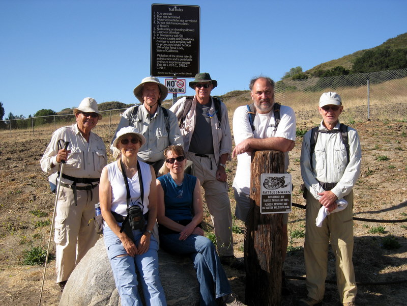
March 26th 2011 – Vasquez Rocks + Pacific Crest Trail Section
6 hikers met at the Stearns Street Park-and-Ride lot in Simi Valley on a chilly overcast, slightly windy morning and then carpooled east and north to the Vasquez Rocks County Park via Hwy 118, I405, I5, Hwy 14, and Agua Dulce Canyon Road. Once there we left a shuttle vehicle and then drove to the point on Soledad Canyon Road at which the 2,650-mile long Pacific Crest Trail (PCT) crosses it. As the hike began we immediately reached the raging Santa Clara River (usually a mere trickle). Deciding it was too dangerous to attempt to ford it, we crossed instead on the bridge into Robin’s Nest RV Park 1/3 mile downstream. We soon reached the Golden Spike Monument representing the completion of the PCT on June 5, 1993. The trail then began a gradual climb up the mountainous terrain. The temperature remained chilly which kept us from overheating as the trail led us to the northwest, providing sweeping views of the snowcapped San Gabriel Mountains. As the trail rounded the mountains to the west we encountered an increasing number and variety of wildflowers and occasional glimpses of sunlight. Eventually the trail began descending toward the tunnel under Hwy 14 through which the PCT passes into Vasquez Rocks County Park; seasonal streams were flowing and provided a pleasant accompaniment to the hike. After passing through the tunnel (as did the stream), we were greeted by the awe-inspiring Vasquez Rock formations that abound in the county park, a popular film industry location (Bonanza, Star Trek, and many others). The park is named for the 1850’s bandit Tiburcio Vasquez who used the mazes of rocks to hide out. Continuing on the PCT, we reached our shuttle vehicle, having completed a rain-free 9.8-mile hike with 1,700’ of elevation gain.
March 19th 2011 – Work Party – The Chumash Trail
The March 19 work party was done on the middle section of the Chumash Trail. Participants included 10 students from Santa Susana High School. They were: Xiao Peng, Sohil Bammi, Michael Gulino, Kathy Nguyen, Katei Ebert, Musrat Lasne, Apurva Govande, Nina Vo, Dannie Yuan, and Raahima Shoaib. Trail Blazers included Bart Hibbs, Richard Bradley, Martin DeGoey, Alan Cueba, John Sabol, and Mike Kuhn. Thanks so much for your time and effort in improving and maintaining our trail.
March 10th – 13th 2011 – Joshua Tree National Park
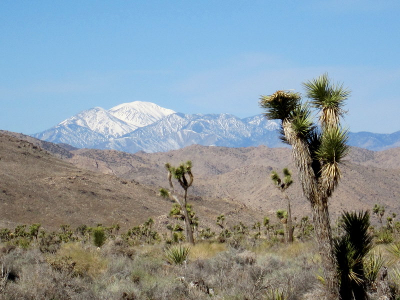
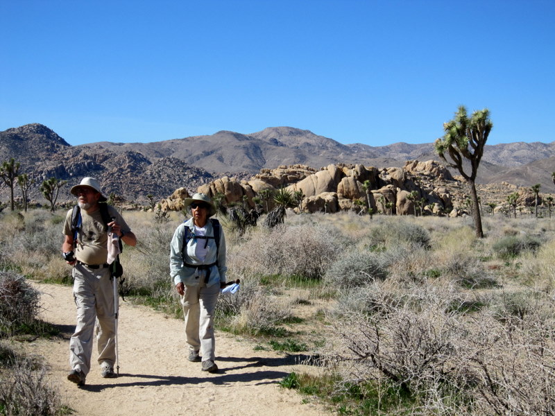

THURSDAY, MARCH 10, 2011 – Black Rock Canyon Wash + Panorama Loop (6.6 miles w/1,151’ elevation gain/loss) and Arrival at Black Rock Canyon Campground – – – After arriving at Black Rock Canyon Campground (~4,000’), checking in, and setting up camp, most of the 14 Rancho Simi Trailblazers who participated in the 4-day outing in Joshua Tree National Park (JTNP) headed for the hiking trail in Black Rock Canyon Wash. The sandy trail led southward, rising gradually but steadily until its junction with the Panorama Loop trail which we began hiking in a clockwise direction. The trail passed through a landscape dotted with Joshua, pinyon, and juniper trees as well as Mojave yucca, various cholla, and sprawling oak trees. Eventually the trail began a steep ascent out of the canyon on its east side to a narrow ridgeline (5,154’) to the south where there were 360-degree views of several nearby peaks and Mount San Jacinto. The trail then descended to complete the loop; from there we retraced our steps northward through Black Rock Canyon Wash and returned to the campground where we greeted late arrivals, prepared dinner, enjoyed a campfire, and turned in early.
FRIDAY, MARCH 11, 2011 – Willow Hole and the Wonderland of Rocks; Hidden Valley Nature Trail Loop; and Barker Dam Loop – – –
- Willow Hole and the Wonderland of Rocks (7.2 miles w/300’ elevation gain/loss)
The trail began by crossing an open landscape dotted with Joshua trees before entering the aptly named Wonderland of Rocks, a surreal labyrinth of uniquely sculpted monzogranite boulders and rock formations, via a sandy wash; it ended at a chokepoint in the wash where there are several seasonal waterholes and a willow tree.
- Hidden Valley Nature Trail Loop (1.2 miles w/164’ elevation gain/loss)
This easy trail rings the inside of a natural corral made of towering rock walls, formations, and large boulders. There are Joshua, pinyon, juniper, and oak trees as well as mesquite, yucca, nolina, and various cacti. There are interpretive signs throughout.
- Barker Dam Loop (1.1 miles w/100’ elevation gain/loss)
This trail leads to an impressive desert lake (created by a dam built by ranchers in the early 1900’s) ringed by monzonite granite and some dazzlingly bright petroglyphs (touched up in recent years by a movie crew). Plant species include the Turbinella oak and nolina (which provided food for the Cahuilla Indians).
SATURDAY, MARCH 12, 2011 – Ryan Mountain; Cap Rock and Nature Trail Loop; Lost Horse Mine; and Keys View [and Inspiration Peak] – – –
- Ryan Mountain to the peak (3.1 miles w/996’ of elevation gain/loss)
The trail climbs steadily to this centrally located peak which affords some of the park’s best panoramic views of landmarks such as Mt. San Jacinto, Mt. San Gorgonio, the Wonderland of Rocks, Pinto Basin, and Lost Horse, Queen, and Pleasant Valleys. It is best lit (and hiked) in the morning.
- Cap Rock and Nature Trail Loop (0.4 mile w/20’ of elevation gain/loss)
The trail loops around a spectacular monzogranite formation on a hard-surfaced barrier-free path; signs along the trail provide information about desert plants. Cap Rock balances atop a large rock formation overlooking the picnic area (a good place to stop for lunch, which we did).
- Lost Horse Mine (4.3 miles w/450’ of elevation gain/loss)
The trail, an old mine road, leads to the ruins of a large historic mine; in addition to the mine ruins, a sweeping view of the southern end of Queen Valley, Malapai Hill, and Pleasant Valley can be seen by hiking to the crest of the hill above the old mill site. Hazardous open pits and tunnels still remain, so care should be taken. A recent fire had blackened much of the nearby landscape.
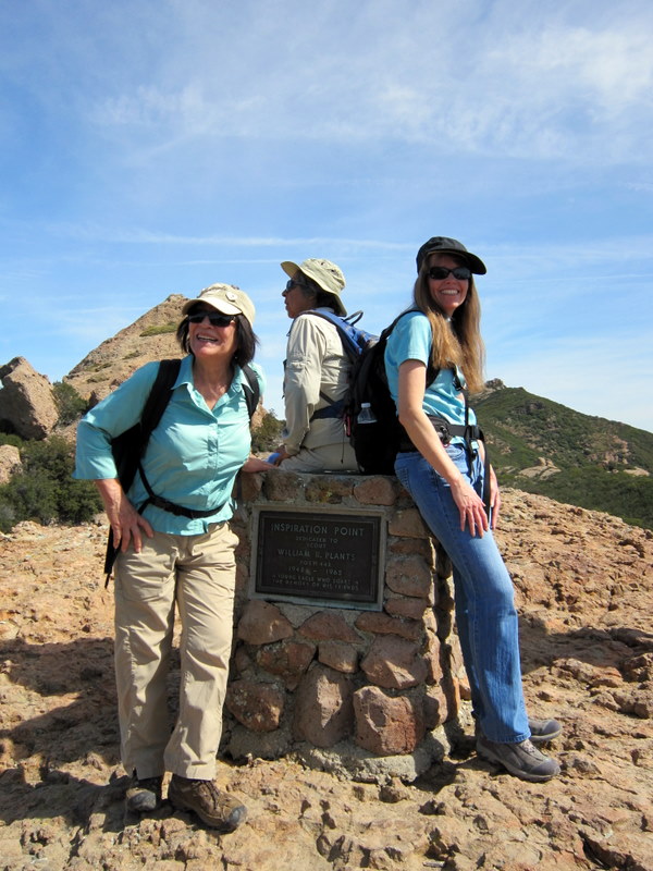
- Keys View (0.25 mile w/40’ elevation gain/loss) and Inspiration Peak (1.5 miles w/525’ elevation gain/loss)
The Keys View overlook is on the crest of the Little San Bernardino Mountains; it provides an expansive view of Coachella Valley and the San Bernardino Range to the west. A hard-to-find trail leads to nearby Inspiration Peak; only two of the hikers tackled it.
SUNDAY, MARCH 13, 2011 – South Park Peak Trail Loop; High View Nature Trail Loop; and Departure – – –
- South Park Peak Trail Loop (0.9 mile w/254’ elevation gain/loss)
This poorly maintained trail provides a sweeping view of the park’s northwestern section and the town of Joshua Tree in the valley below. Note: This trail and the High View Nature Trail have a common point at the customary trailhead for each hike.
- High View Nature Trail Loop (1.4 miles w/324’ elevation gain/loss)
This nicely maintained trail provides a lofty view of surrounding peaks and the sprawl nearby in Yucca Valley; a brochure available at the nearby Black Rock Canyon Ranger Station describes numbered sites along the trail.
DEPARTURE: After striking camp most of us headed home, but several of the campers hiked a couple of other trails in JTNP before heading home. We had great weather and cool temperatures during our outing, except for several hours of high winds the second night. A good time was had by all (but don’t try it when it’s hot).
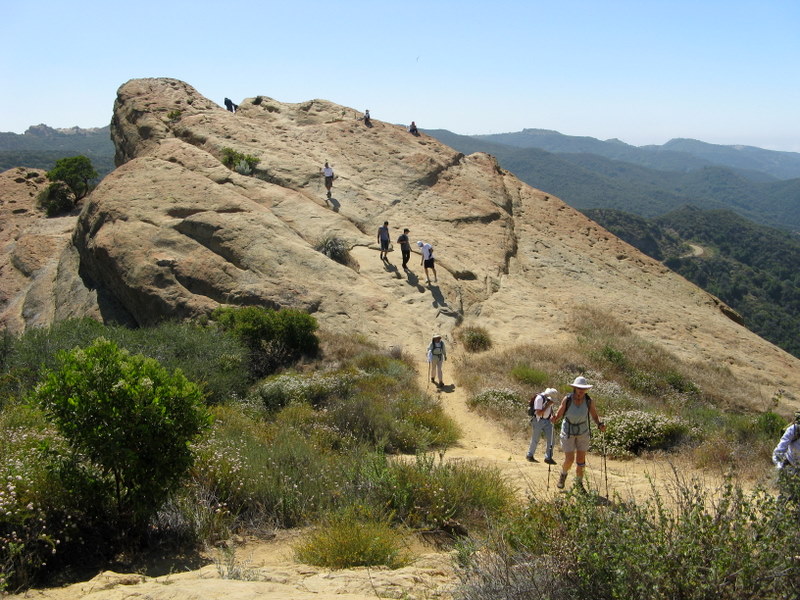
March 5th 2011 – Sandstone Peak Loop (via the Mishe Mokwa Trail)

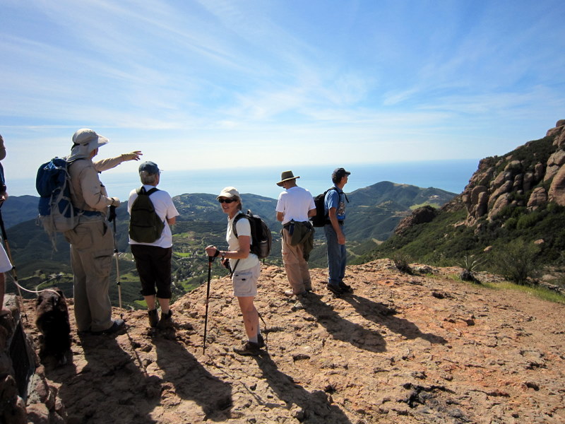
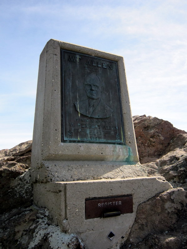
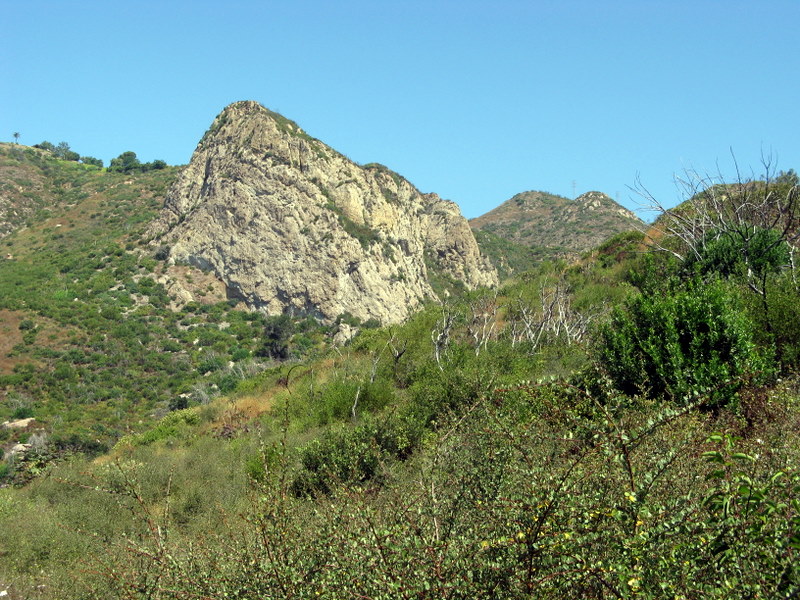
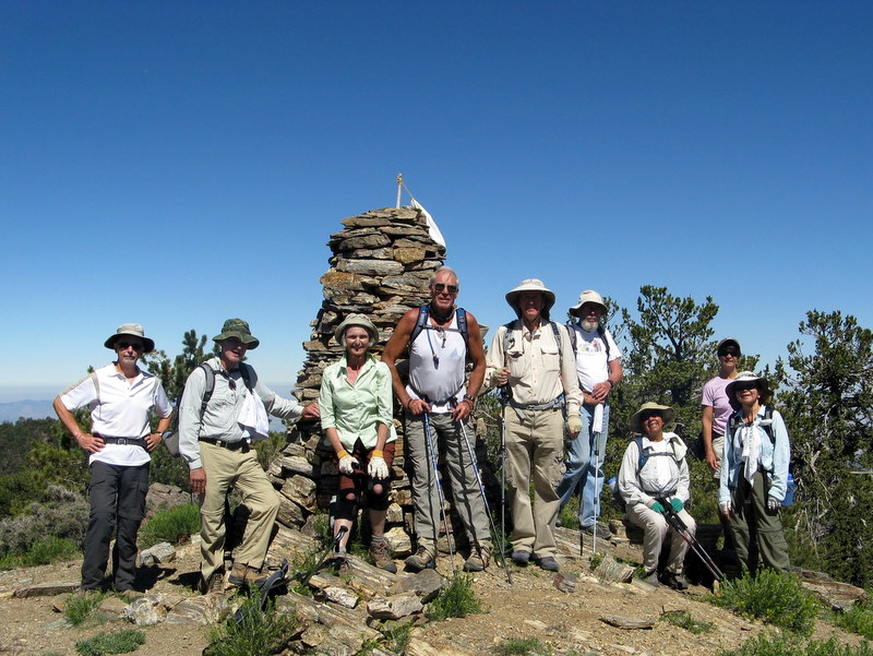
15 hikers (+ Heidi, a cute dog) met at the carpool point near the intersection of Royal Avenue and Madera Road on a pleasant morning and then traveled to the Mishe Mokwa trailhead at Triunfo Pass (2,100.) in the Santa Monica Mountains via Hwy 23, Hwy 101, Hwy 23 (again), Mulholland Hwy, and Little Sycamore Canyon Road. The counterclockwise loop hike began on the Mishe Mokwa Trail (the name is from the Chippewa Indian legend of the mother bear, Mishe-Mokwa, and her two cubs who swim Lake Michigan for safety after a raging fire destroys their forest home in Wisconsin). The trail climbed quickly and then leveled out for a while before descending into Carlisle Canyon, providing excellent views of the reddish-colored Echo Cliffs (a long stretch of sheer vertical sandstone rock faces) against the green side of Boney Mountain and Balanced Rock, a huge house-sized boulder precariously balancing atop a smaller boulder. Two seasonal streams fed by recent rains provided a soothing accompaniment to the hike. We took a break at Split Rock where there.s a thick mini-grove of shade trees overhanging a large broken boulder (Split Rock) and one deteriorating picnic table. We attempted to follow a rugged side trail to Balanced Rock, but being unsure of the route we eventually decided to try again next time. As we resumed our hike, the trail climbed southward to a junction with the Backbone Trail (BBT) on a mesa affording great views of various peaks surrounding the area. We took the left (east) fork and continued along the BBT taking the short spur trail to Inspiration Point (~2,800.) and a little later the spur trail to Sandstone Peak (3,111.), aka Mt. Allen, the highest peak in the Santa Monica Mountains. The peak is just a hunk of grayish-white rock, but it provides a stunning 360-degree view (depending on the air quality) of the ocean, the mountains, and the Oxnard Plain. Visibility was only fair on this day, but the temperature was perfect for mountain hiking. Returning to the BBT we continued eastward to a junction with a short connector trail which led us again to the Mishe Mokwa Trail; we descended to the parking lot having completed a refreshing 6.3-mile hike with ~1,500. of elevation gain.
February 12th 2011 – Big Sky Ranch: Whiteface Mountain Shuttle Hike

16 hikers (+ one cute dog) met in the parking lot at Big Sky Park on a windy morning, determined to scale White Face Mountain just north of the Big Sky housing development in Simi Valley. Once ready, we walked up to the nearby trailhead on the south side of the large water tank and began climbing the ridge to the northwest of the softball fields. The trail initially led upward to a narrow, but level, path (with drop-offs on both sides) leading northeast to the main trail heading north. The brisk wind and the possibility of a serious fall kept our attention riveted to the trail. We then climbed steeply for a while until the trail leveled off again and then dropped a bit as it approached the final fairly lengthy ascent. This final section presented some steep stretches that required careful maneuvering. Heidi (the dog) was impressive as she ascended the trail and demonstrated why four legs are sometimes better than two. Eventually we found ourselves atop White Face Mountain with panoramic views of the city and the surrounding mountainous terrain. We hiked to the east for better views of the Tapo Canyon area and then embarked on the exploratory part of the hike. We followed fire roads through the picturesque countryside which was green as a result of winter rains, enjoying distant views of the Simi Hills and the Channel Islands. We headed home having completed a 9-mile hike with 1,600’ of elevation gain.
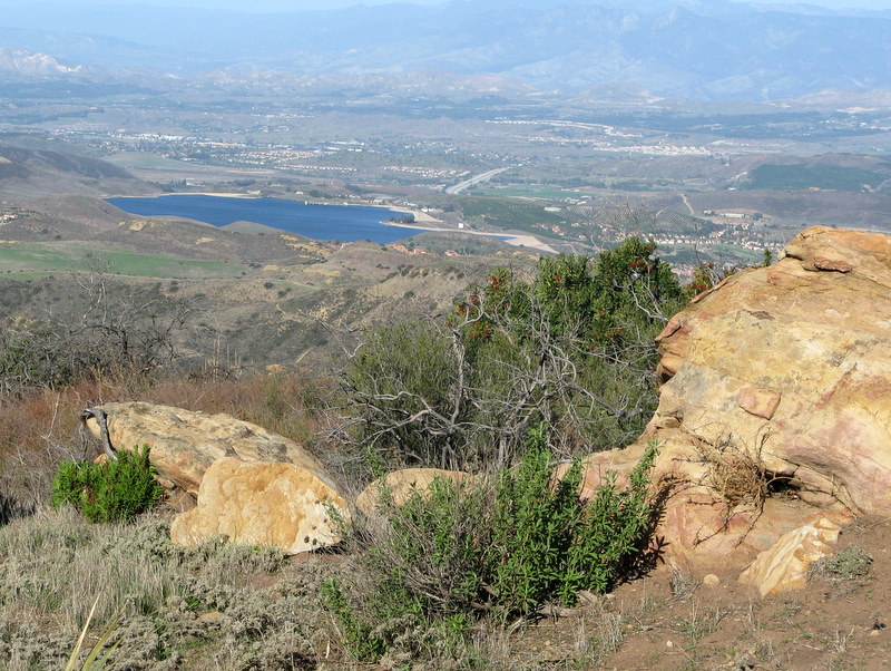
February 5th 2011 – Johnson Motorway to Rocky Peak


17 hikers + two dogs met at the carpool point at the Stearns Street Park-and-Ride lot in Simi Valley on a pleasant winter morning and then traveled to the trailhead, at the northwest end of Poema Place (just outside the gate to Indian Falls Estates) in Chatsworth. After walking through Indian Falls Estates, carefully following the green-line easement painted on the street while gazing at the expensive homes along the way, we reached the beginning of the unpaved Johnson Motorway. The trail (an old dirt and sandstone roadbed) rose westward until it met a short driveway, leading north to the ruins of the ranch house that was built by Ann and Neils Johnson who were the first English-speaking homesteaders in the San Fernando Valley; they built their home in Chatsworth park in the 1870s. Leaving the ruins, we followed the Johnson Motorway as it passed through a landscape of dramatic rock formations, climbing steadily toward the Rocky Peak Fire Road. After 3.5 miles we reached the fire road where we took a short break. Seven of the hikers decided to return to the trailhead; the remaining ten hikers headed southward along the Rocky Peak Fire Road enjoying views of both Simi Valley and the San Fernando Valley. Upon reaching the short trail leading eastward to Rocky Peak, we made our way over to the peak where we enjoyed panoramic views of the surrounding area, including some snow atop a distant peak in the San Gabriel Mountains. We retraced our route downhill back to our vehicles and returned home. The hike all the way to Rocky Peak and back was 9 miles with about 1,600′ of total elevation gain.
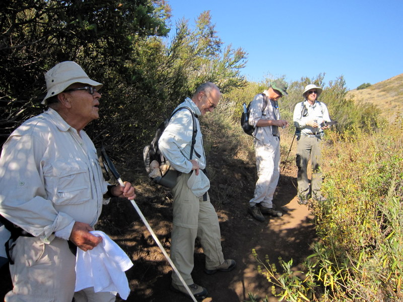
January 29th 2011 – Sisar Canyon
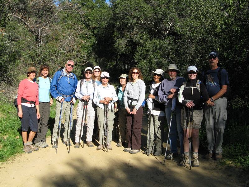
11 hikers met at the carpool point near the intersection of Royal Avenue and Madera Road on a cool morning and then traveled to the trailhead via Hwy 118, Hwy 23, Hwy 126, Hwy 150, and Sisar Road, a narrow paved lane leading to a final 0.4 mile of rocky, rutted dirt road [Note: if you decide to drive on the dirt road, a high-clearance four-wheel-drive vehicle will make the journey easier]. Four additional hikers (plus one dog) met us at the trailhead. The sky was a clear blue as the hike began on a shaded dirt fire road which ascended to the north along the strongly flowing creek which provided a pleasant accompaniment . and required two careful crossings. Eventually the road turned southwestward and emerged into the sunlight as it headed ever-upward (toward its eventual end at the Nordhoff Ridge Road). We were treated to increasingly panoramic views of the mostly green hillsides of the surrounding mountains, including the Topa Topa Ridge, and the Ojai Valley. After hiking about 3.5 miles, the trail leading to White Ledge Trail Camp diverged from the fire road. We followed it over a mile to the trail camp which is situated near the creek among towering conifers, admiring some early wildflowers along the way. After a welcome and refreshing respite at the trail camp, we retraced our steps downhill back to our vehicles and returned home. The hike starting from the end of the pavement was about 9.3 miles with a total elevation gain of about 2,000.; it was about 8.5 miles for those who drove up the dirt road to the trailhead.
January 22nd 2011 – Happy Camp Loop
January 15th 2011 – Cheeseboro Canyon / Palo Comado Canyon Loop
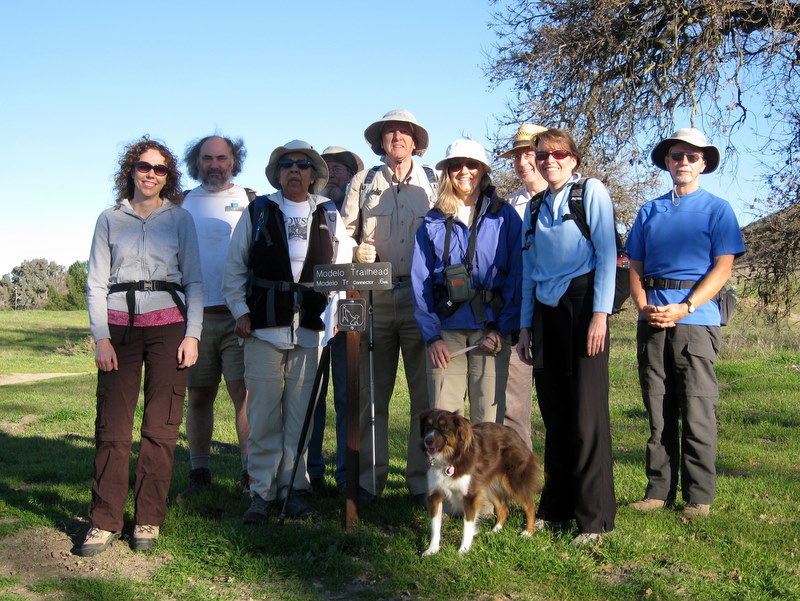
10 hikers (+ Heidi, a cute dog) met at the carpool point near the intersection of Royal Avenue and Madera Road on a crisp winter morning and then traveled to the Cheeseboro Canyon trailhead in the Simi Hills via Hwy 23, Hwy 101, and Chesebro Road. The hike began on the Modelo Trail as it rose to the north from the main parking lot along a ridge, providing views of the rolling countryside under a clear blue sky. Soon the trail headed west on the Palo Comado Connector trail, passing a couple of horse ranches whose four-legged residents curiously watched our passage. Heading north along the main dirt road in Palo Comado Canyon, we passed through a wide grassland dotted with occasional stands of large oak trees; it was a beautiful, somewhat windy day. At the junction with the Ranch Center Drive, three of the hikers elected to follow it eastward up and over to Cheeseboro Canyon, thus shortening their hike. Soon after the Palo Comado road began its climb toward China Flat, we turned right (east) onto a dirt trail that led up to an overlook of Palo Comado Canyon to the south. We shared our overlook perch with a group of bicycle riders. After a short break to rest and enjoy the view, we headed east, descending toward Shepherd’s Flat at the north end of Cheeseboro Canyon and passing the abandoned Sheep Corral along the way. Turning southward, we began our return trip via always lovely Cheeseboro Canyon, first passing through terrain dominated by striking rock formations and then passing through a riparian woodland at Sulphur Springs. The bicycle traffic in the canyon increased significantly in Cheeseboro Canyon since many other people were also taking advantage of the nice weather. We continued southward, passing through a dense oak woodland and then through an open grassland, eventually reaching the parking lot, having completed a 10.5-mile hike with 1,254’ of elevation gain on a great day to be outside.