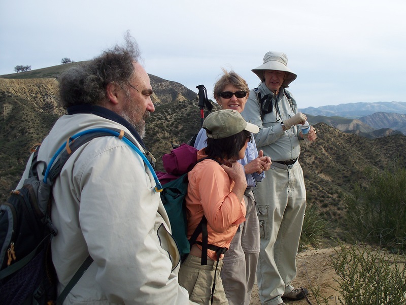
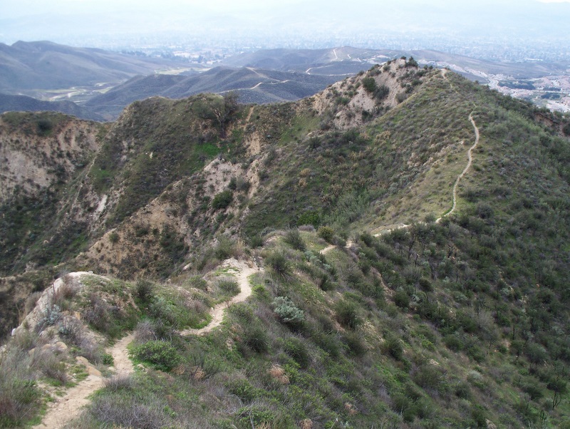
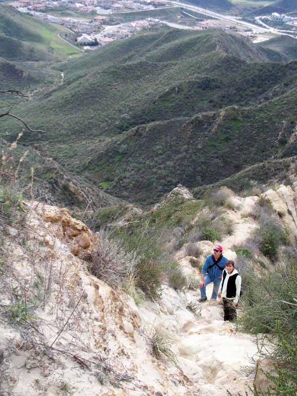
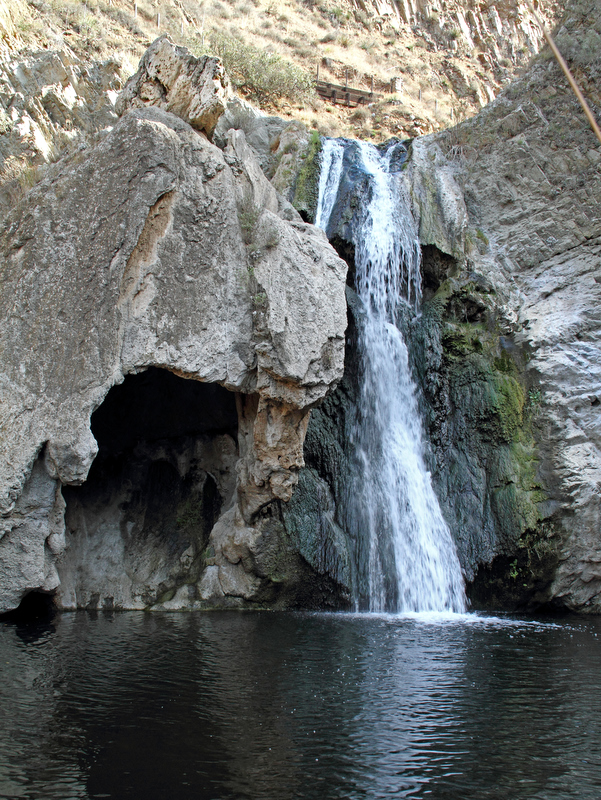
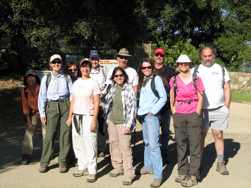
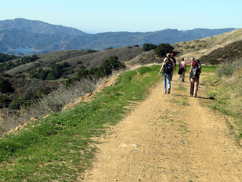
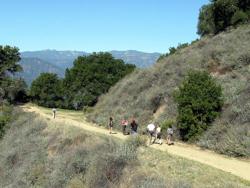
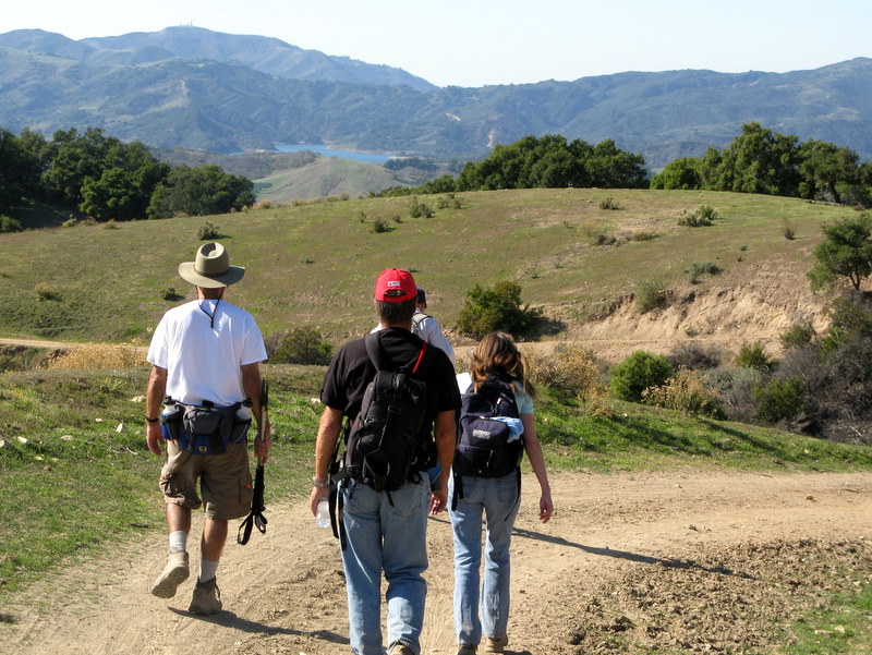
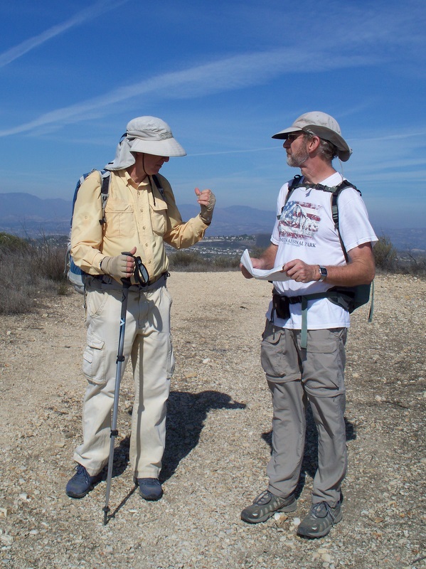
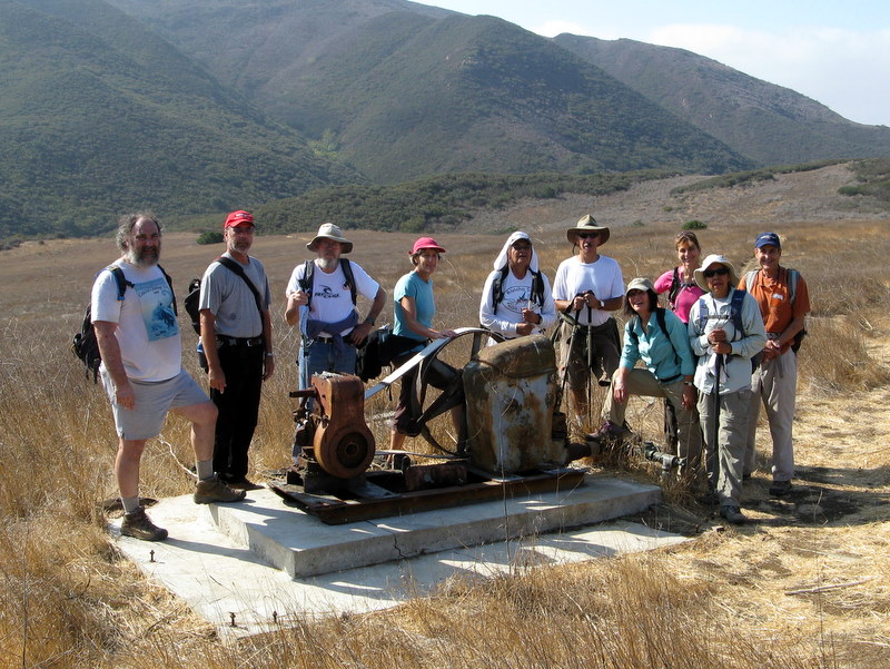
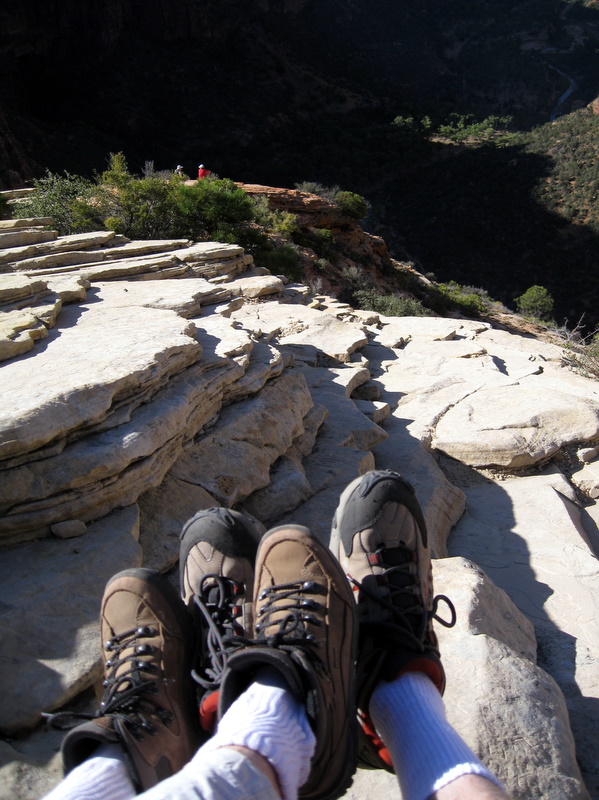
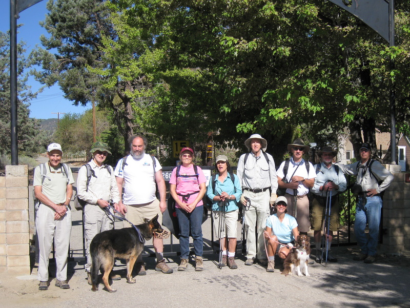
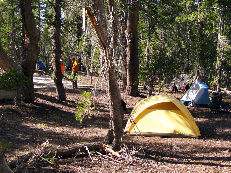
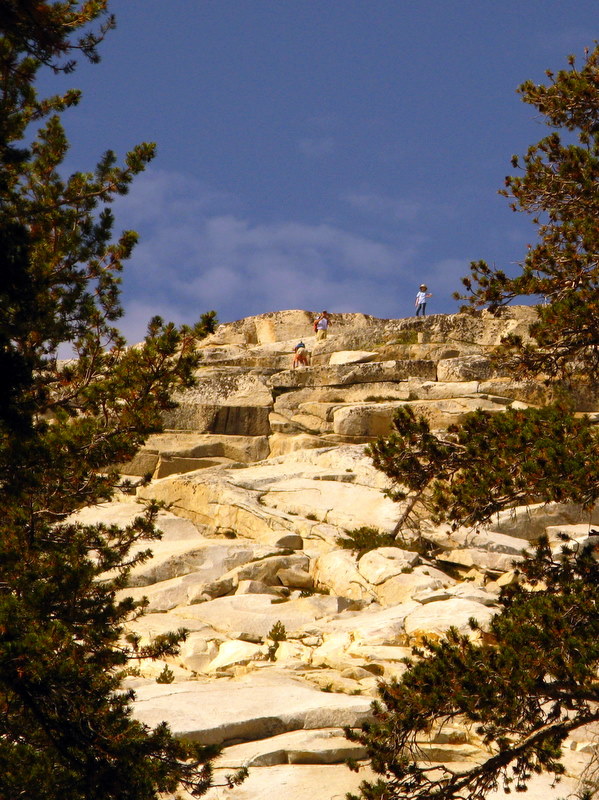
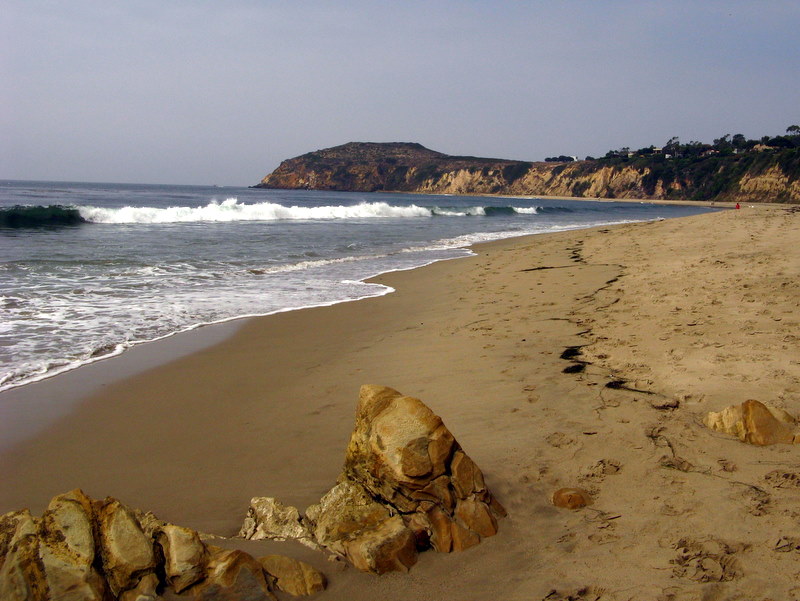
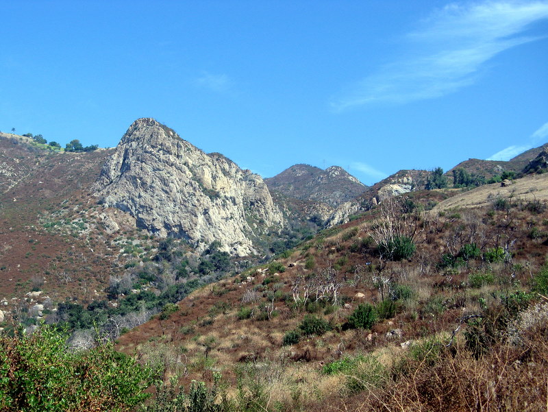
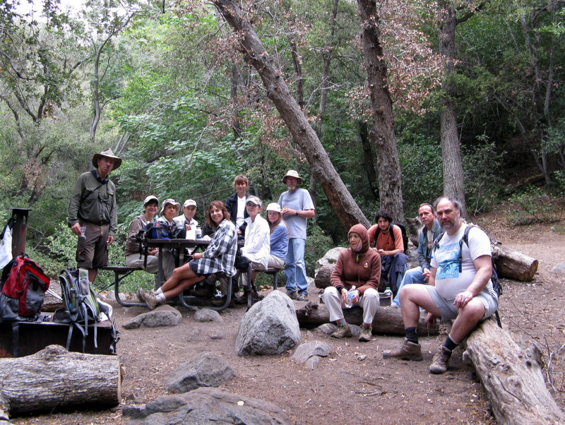
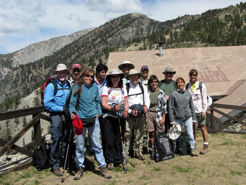
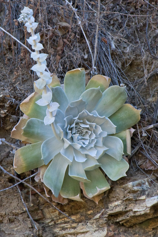
December 26th 2009 – Big Sky Ranch: Whiteface Mountain Exploratory Shuttle Hike
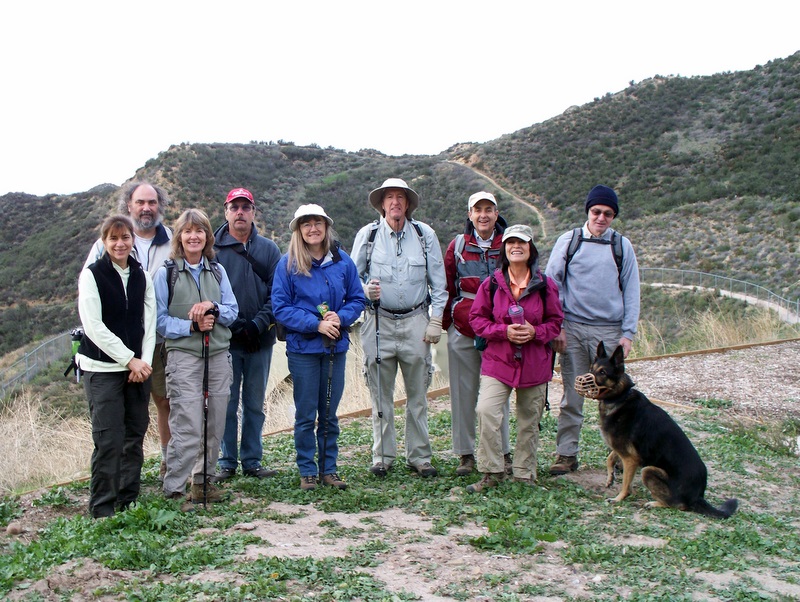
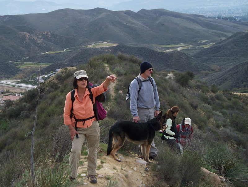
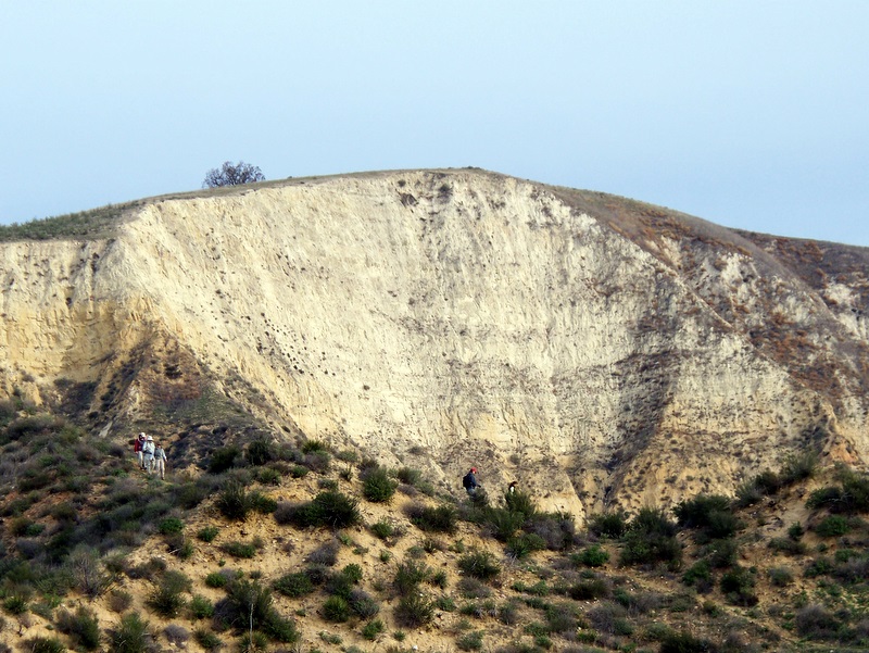
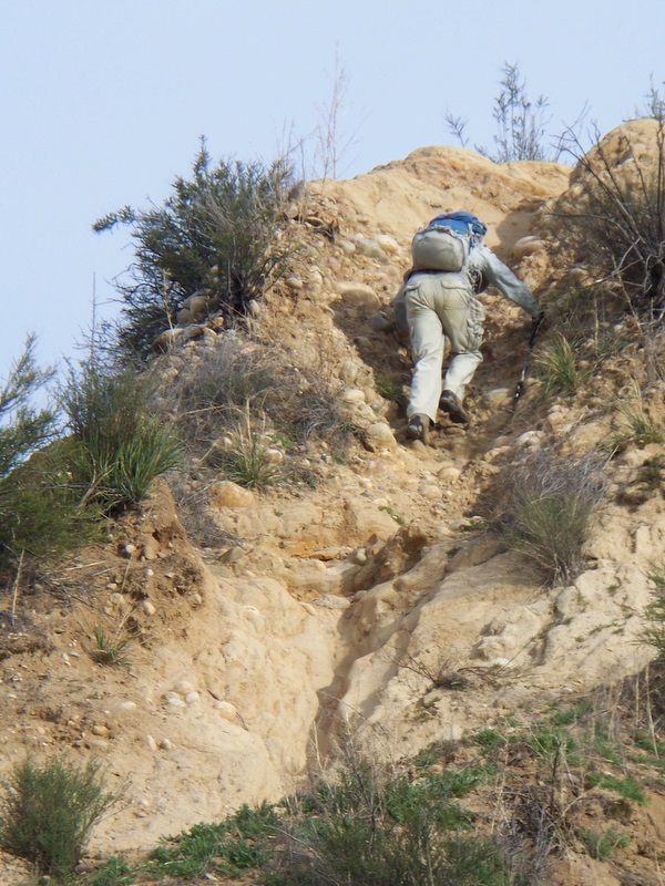
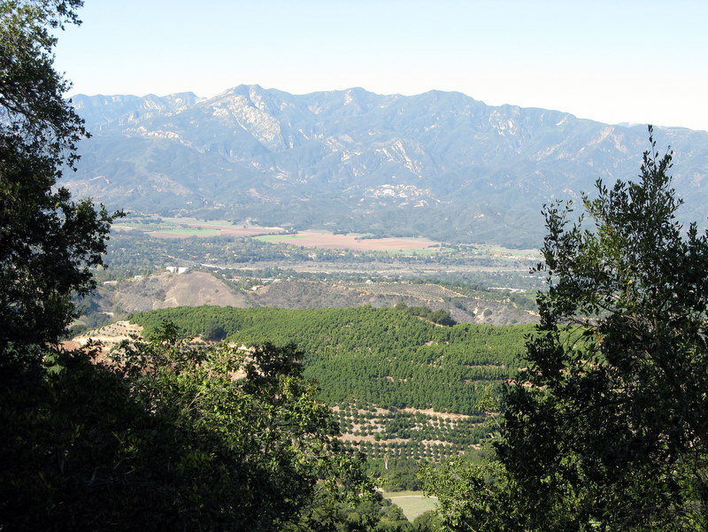
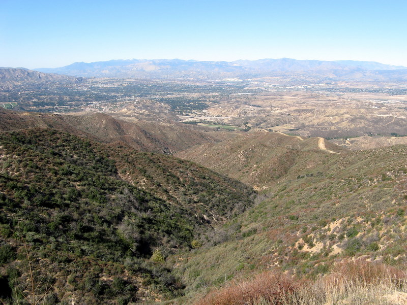
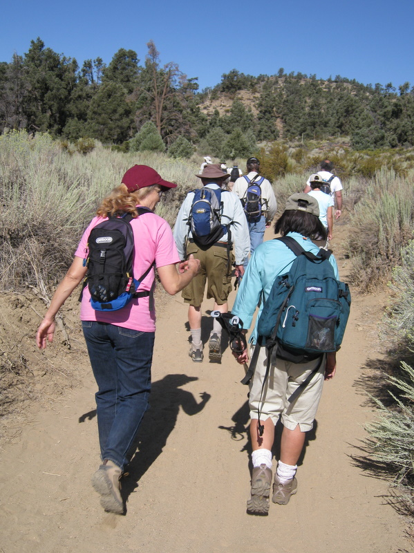
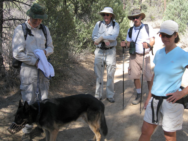
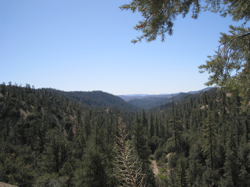
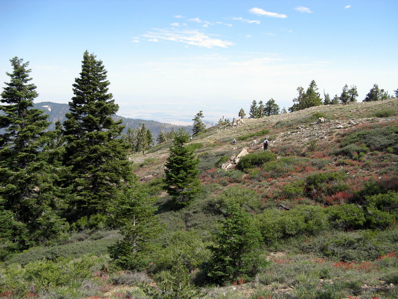
9 hikers (+ Kobi, a dog) met in the parking lot adjacent to the Simi [Valley] Dog Park on a chilly, overcast morning, determined to conquer White Face Mountain just north of the Big Sky housing development in Simi Valley. Once ready, we began climbing the ridge just to the east of the dog park, following it as it headed north and then northwest. However, we soon decided that at least three sections of the trail ahead were too dangerous to traverse; there was a serious risk of injury or worse. Therefore we retraced our steps to the parking lot and headed for the ridge to the west of the dog park. Fortunately it offered a challenging, but much less risky route to the top of the mountain. The trail initially led upward to a narrow, but level, connector to the main trail. It then climbed steeply for a while, but leveled off again and then dropped a bit as it approached the final upward section of trail. This final section presented some steep stretches that required careful maneuvering, but was much easier than the eastern trail that we had abandoned. Kobi (the dog) was impressive as he ascended the trail and demonstrated why four legs are sometimes better than two. Eventually we found ourselves atop White Face Mountain with panoramic views of the city and the surrounding mountainous terrain. We hiked to the east for better views of the Tapo Canyon area and then embarked on the exploratory part of the hike. We followed fire roads through the picturesque countryside which had been enhanced by recent rains, heading west and south, eventually reaching Los Angeles Avenue. We headed home having completed a 9.2-mile hike with 1,600’ of elevation gain.
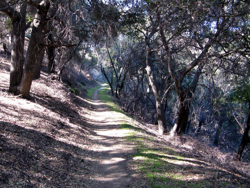
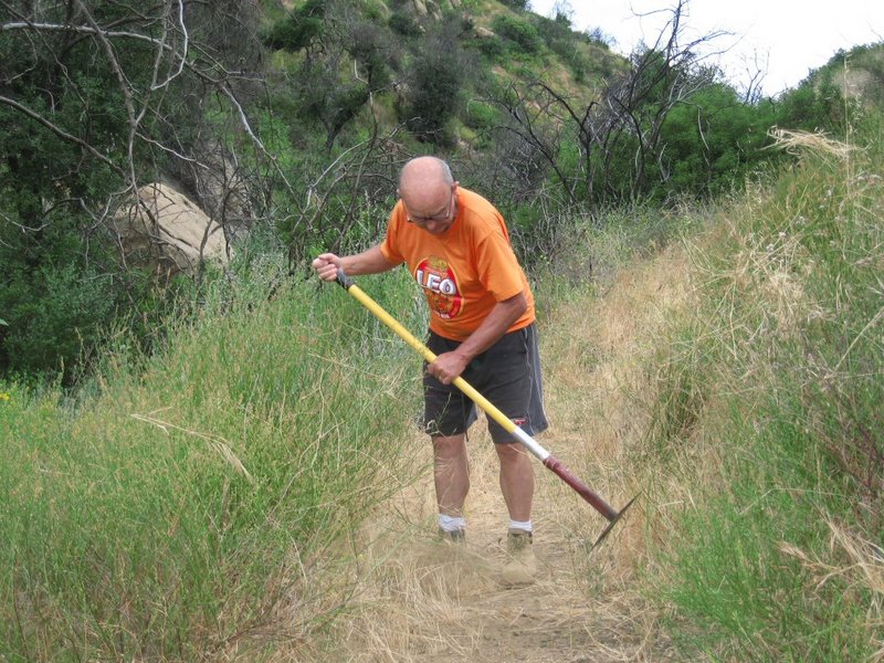
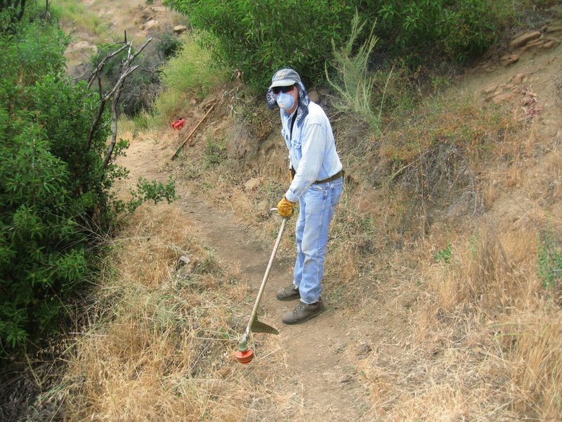
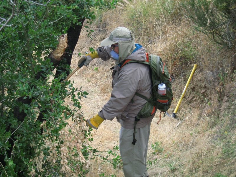
December 19th 2009 – Work Party: China Flat Trail

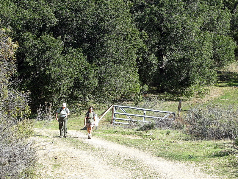
The Trail Blazers December trail work party was held on the China Flat Trail in Oak Park. We were joined by five members of Boy Scout Troup 10 Reseda, consisting of two leaders and three boy scouts. A considerable amount of work was accomplished with major sections of rutted trail repaired and brush blocking the trail removed. Many thanks to Trail Blazers Martin DeGoey and John Sabol, Troup 10 leaders Brad Haehnel and Tamber Johnson and scouts Hayden Johnson, Ryan Lake and Griffin Thill.
December 11th 2009 – Holiday Party
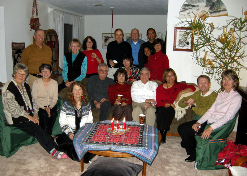
The Trail Blazers 2009 Christmas Party was held Friday, December 11 at Ursula Christie’s home. Approximately twenty-five adventurers attended the annual potluck event which had an international flair. All the dishes were scrumptious and Betty Cameron’s paella was the talk of the dinner. Thanks to lots of delicious food, drink and good companionship, a great time was had by all. Special thanks to Ursula for extending the hospitality of her home to the Trail Blazers for the evening.
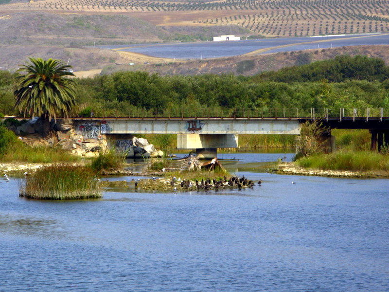
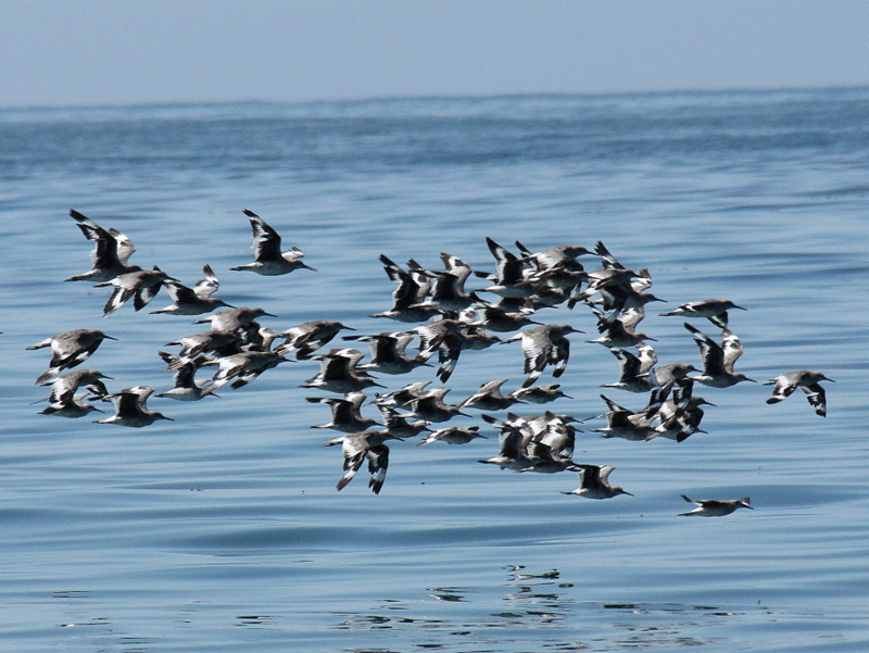
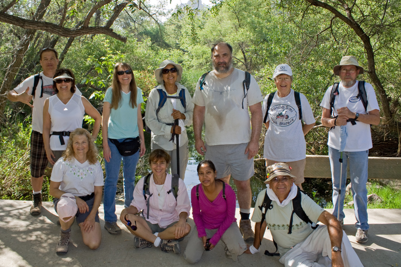
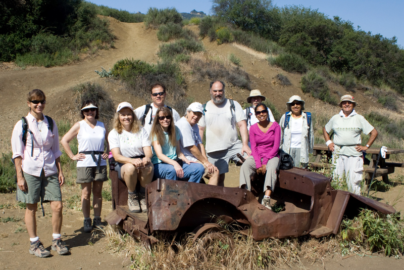
December 5th 2009 – Bicycle Ride: Arroyo Simi Bike Path – Simi Valley
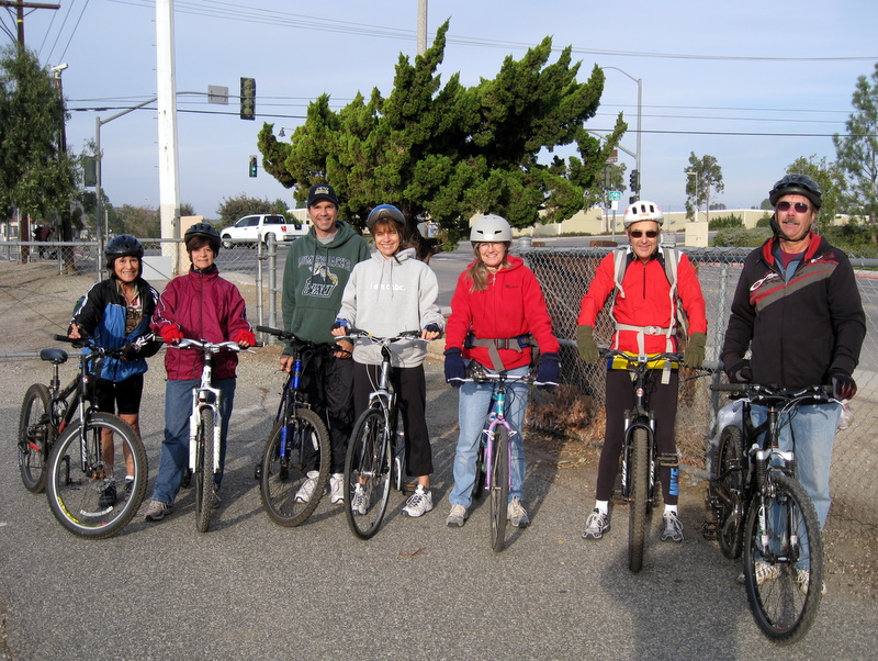
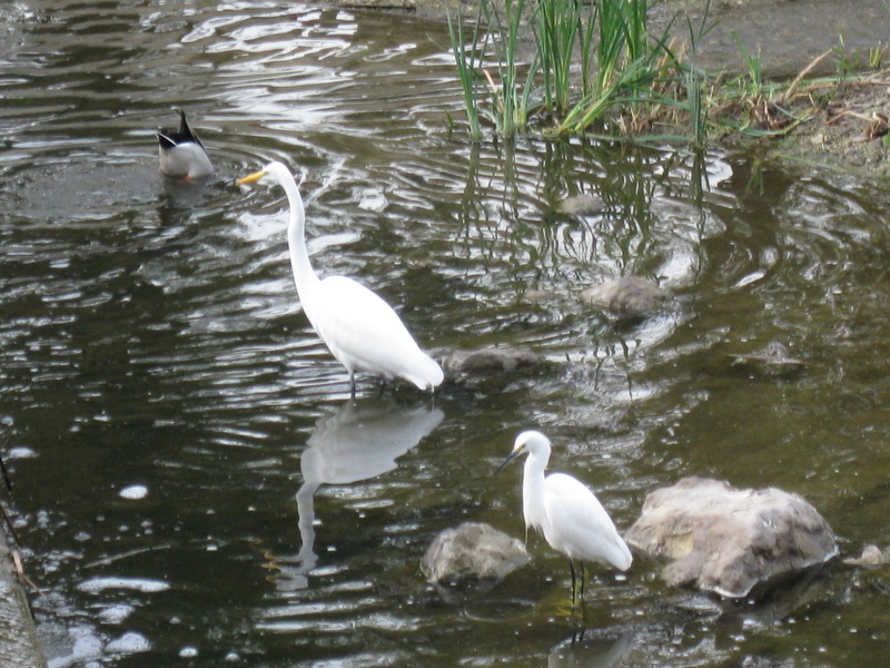
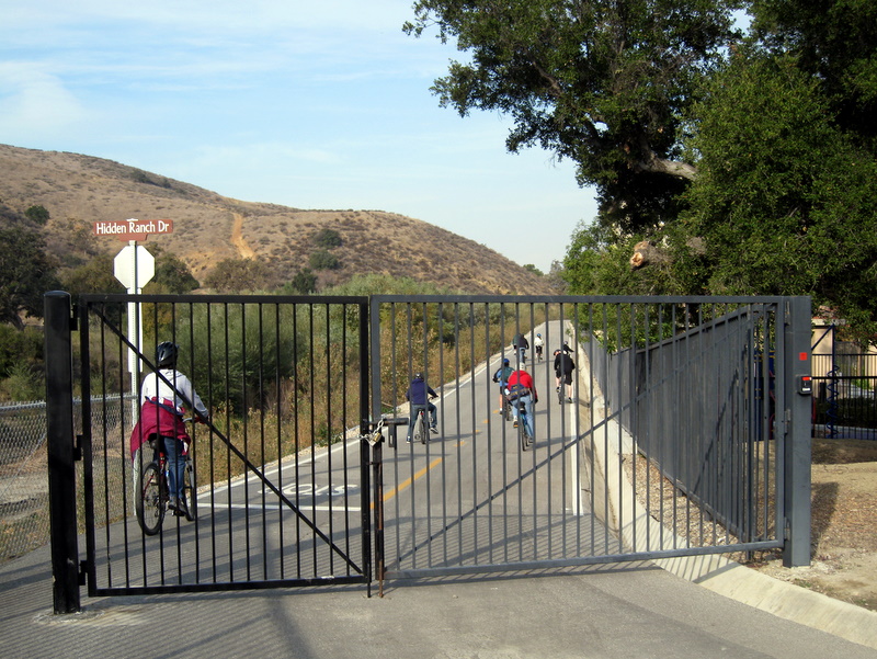
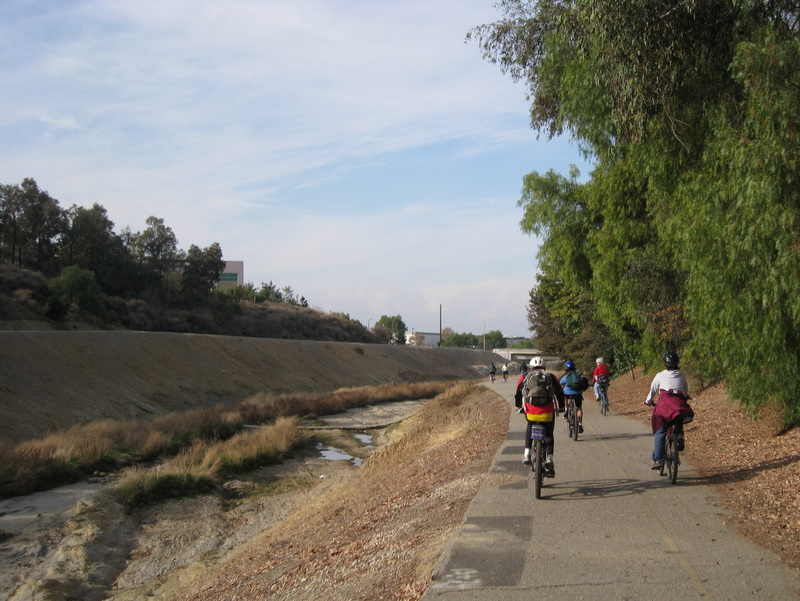
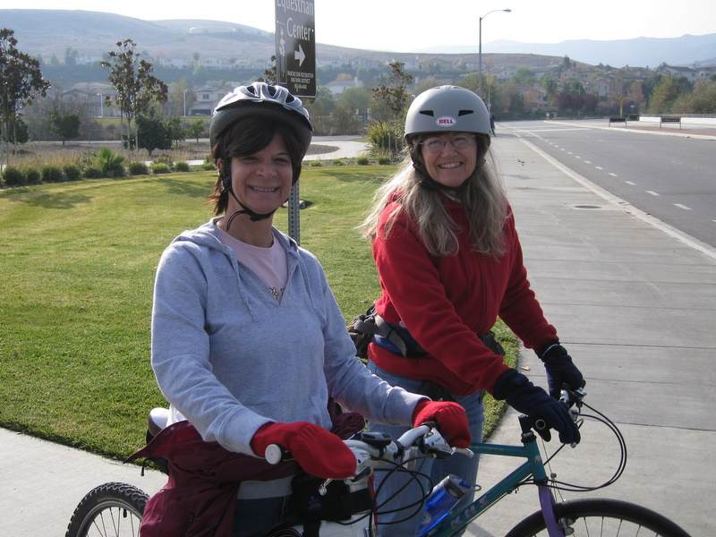
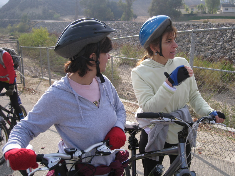
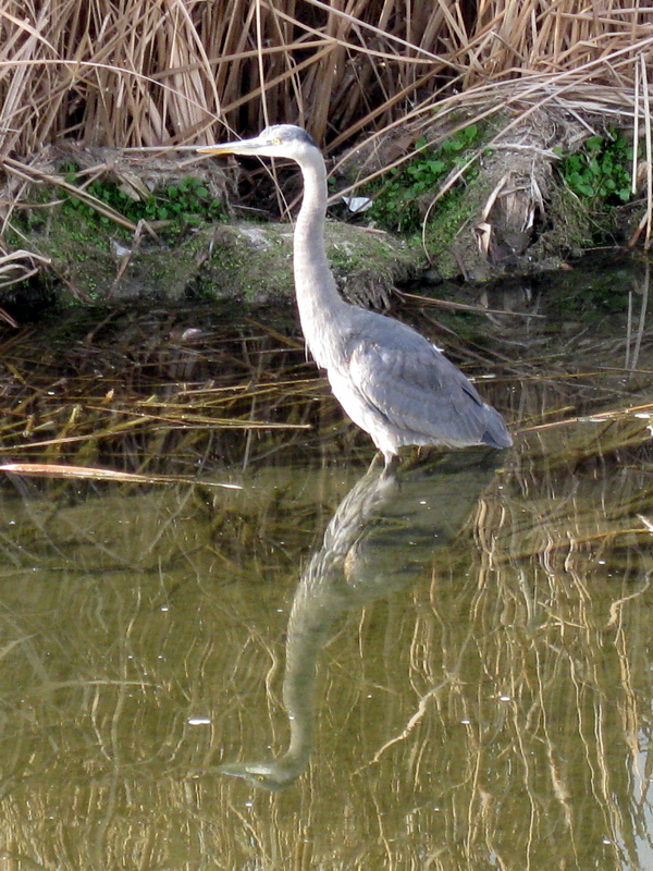
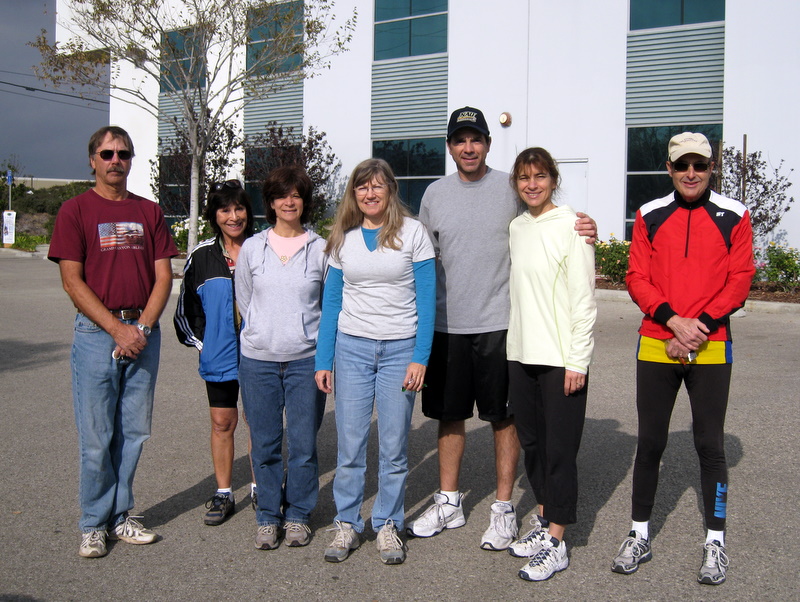
On a sunny and cool morning, we gathered in what was the old 123 InkJets parking lot, located conveniently across the street from the western entrance to the bike path. The western end of the Arroyo has quite a bit of water and supports a good deal of wildlife, mostly birds. Soon after the ride began, we spotted a Great Blue Herron in the Arroyo. There were also number of Egrets and ducks of several species. The path extended a bit further than expected, so in total we rode about 14 miles round trip. The morning was over all too quickly and everyone enjoyed this very different Trail Blazer activity.
November 28th 2009 – Wildwood Park: Santa Rosa Trail Loop and Paradise Falls Figure Eight Loop
The Wildwood Park hike on Saturday the 28th of November was on a perfect Fall day. We hit the Santa Rosa trail first, with a few missteps, we made it to the Paradise Falls trail. We hiked to the falls and had our lunch there. We turned around and hike to our cars. There were 9 of us: Doug and Margarita, Cliff and Betty, Lori, Caroline, Sherrie, Beth, Bart and Roger. It was about a 9 mile hike with our misteps, but a success for the exercise alone.
November 14th 2009 – Sulphur Mountain Shuttle
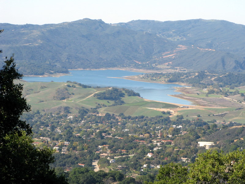
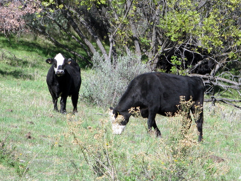
12 hikers met at the carpool point near the intersection of Royal Avenue and Madera Road on a slightly chilly morning. Since it was to be a one-way hike, we took six vehicles to the trail’s end via Madera Road, Hwy 23, Hwy 101, Hwy 33, and the paved west end of Sulphur Mountain Road where we parked three of them. Everyone boarded the other three vehicles for a very scenic drive through the Ojai Valley to the eastern trailhead via Hwy 33, Hwy 150, and the paved east end of Sulphur Mountain Road which wound pleasantly uphill through an oak forest. After assembling our hiking gear, we set out along the trail which was paved with asphalt at first. Soon we were treated to a view of Anacapa Island and the beautiful rolling green terrain between our trail and the ocean. After passing a couple of large houses, the trail became a dirt road bordered intermittently by black walnut trees. We continued westward with the upper portion of the Sulphur Mountain Ridge immediately to our north and continuous vistas of rolling hills dotted with oak trees, grassland meadows, and valleys to the south and west. The huge bulk of Santa Cruz Island soon joined Anacapa Island in our view of the ocean. We could also see the Oxnard Plain and Boney Mountain to the southeast. We stopped about halfway along the trail for lunch in a pleasant setting that invited us to linger a while longer, but we resumed our journey, continuing to walk through the beautiful pastoral countryside. The bucolic atmosphere was reinforced as we walked past several head of cattle grazing near the trail. Eventually the trail began providing views of the Ojai Valley and the distant towering mountains to the north and west and of Lake Casitas to the west. The last 1-2 miles of the trail wound downhill heavily shaded by oak trees and we eventually reached our shuttle vehicles, having completed a very pleasant 10-mile hike with 400’ of elevation gain and 2,200’ of gradual elevation loss. We returned by vehicle to the trailhead, retrieved the other three vehicles, and returned to Simi Valley.
November 7th 2009 – Sandstone Hills Trail and Hillcrest Open Space Preserve Shuttle
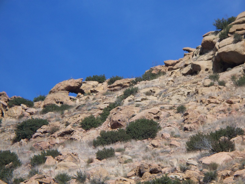
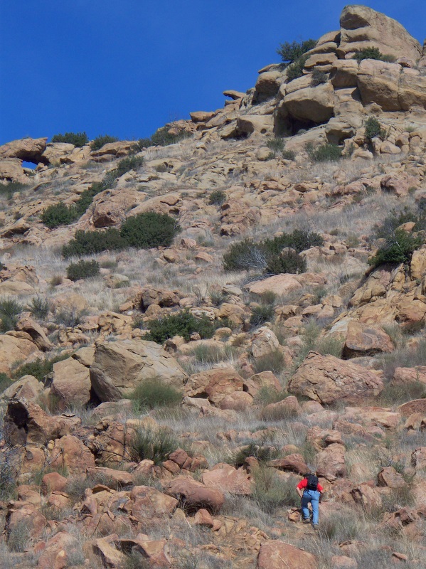
12 hikers (+ Heidi, a cute dog) met at the carpool point near the intersection of Royal Avenue and Madera Road on a cool morning. Since it was to be a one-way hike, we took six vehicles to the trail’s end via Madera Road, Hwy 23, and Hillcrest Drive and left three of them parked nearby on Blue Mesa Street. Everyone boarded the other three vehicles and we drove to the trailhead on Pathfinder Avenue via Westlake Blvd, Kanan Road, and Falling Star Avenue. The Sandstone Hills Trail immediately ascended to the north into the sandstone hills below Simi Peak, then turned to the northwest and continued its ascent. At 1.4 miles from the trailhead, we followed a dirt access road 0.6 mile east to an Edison power transmission tower where we were rewarded by a close-up view of a variety of interesting rock formations including “caves” and arches. It seems likely that one could climb to the ridge from here and then make one’s way east to Simi Peak, but we left that exploration for another day. Returning to the main trail, we continued to the west and soon began descending into Hidden Meadow. Avoiding a couple of left forks, we continued northwest along the Oakbrook Vista Trail which provided us with sweeping views to the north/northwest including the Albertson Motorway and the Topatopa Mountains in the distance. About four miles from the trailhead, we took a left fork to the southwest and followed it a little over a mile through rolling grasslands past a large water tank and into a gated upscale housing enclave at Allyson Court. There we were fortunate to encounter a helpful resident who opened the locked gate (which was not mentioned in the hiking book we were using) for us so that we could reach Westlake Blvd without backtracking and taking a different route. After crossing Westlake Blvd, we headed south along the unnamed trail (dirt road) that bisects the Hillcrest Open Space Preserve. As this part of the hike led us through rolling grassland hills, we encountered several surprisingly steep uphill and downhill stretches with panoramic views of the area available from the highest points. Fortunately our luck held and we were caressed by cool breezes as we ascended the hills. Inevitably we eventually reached the end of the trail at Hillcrest Drive, having completed a somewhat strenuous 8.9-mile hike with 2,214’ of elevation gain. We returned by vehicle to the trailhead, retrieved the other three vehicles, and returned to Simi Valley.
October 31st 2009 – Placerita Canyon – Los Pinetos Trail
12 hikers (+ Kobi, a dog) met at the Stearns Street Park-and-Ride lot in Simi Valley on a cool morning. They traveled to the Placerita Canyon County Park via Hwy 118, I405, I5, Hwy 14, and Placerita Canyon Road. After parking near the Nature Center (1,550’) and donning their hiking gear, the group began hiking briskly eastward along the Placerita Canyon Trail. The air was chilly at first, but warmed up some as sunlight penetrated the canyon. The creek in the canyon was completely dry as a consequence of a prolonged drought in the region. After two miles, the group reached the Walker Ranch site (1,800’) and headed south on the Los Pinetos Trail, climbing steadily upward toward Wilson Saddle (3,100’) and the Santa Clara Divide Road. After the first steep mile or so, the trail entered a pleasant live oak forest for the remainder of the three-mile-long trail, passing Los Pinetos Spring along the way. The group enjoyed a break at Wilson Saddle which has comfortable seating and bathroom facilities, followed by a short walk to the southeast to an overlook of the San Fernando Valley (and the tops of the tallest buildings in downtown Los Angeles). The hike resumed along a short portion of Whitney Canyon Road, but soon turned northward onto an unmarked firebreak leading down toward the Nature Center. This firebreak is not a fire road; it has many steep downhill stretches as it heads to the northwest, as well as several short sometimes-steep uphill stretches. It is challenging and strenuous, particularly if one is heading up it (rather than down it as we were). We were buffeted by strong winds as we hiked along the firebreak; fortunately they kept us cool since there is no shade on the firebreak. Eventually we reached an unnamed trail leading down to a large water tank overlooking the Nature Center. We then descended to the parking lot via the Hillside Trail. Despite the drought, there was a sprinkling of wildflowers along the trail. After a lunch break by the Nature Center, we returned to the carpool point in Simi Valley, having completed a pleasant 7.5-mile hike with 1,842’ of elevation gain.
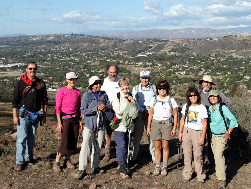
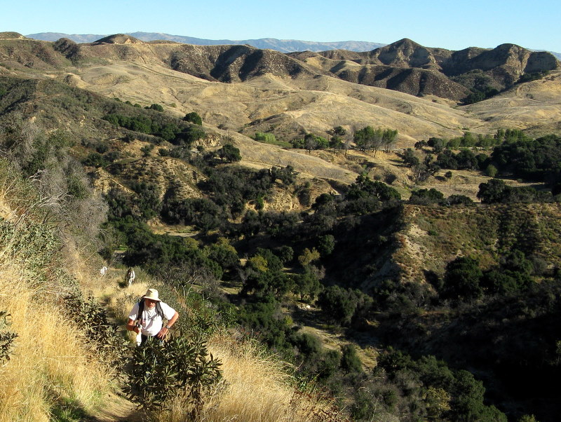
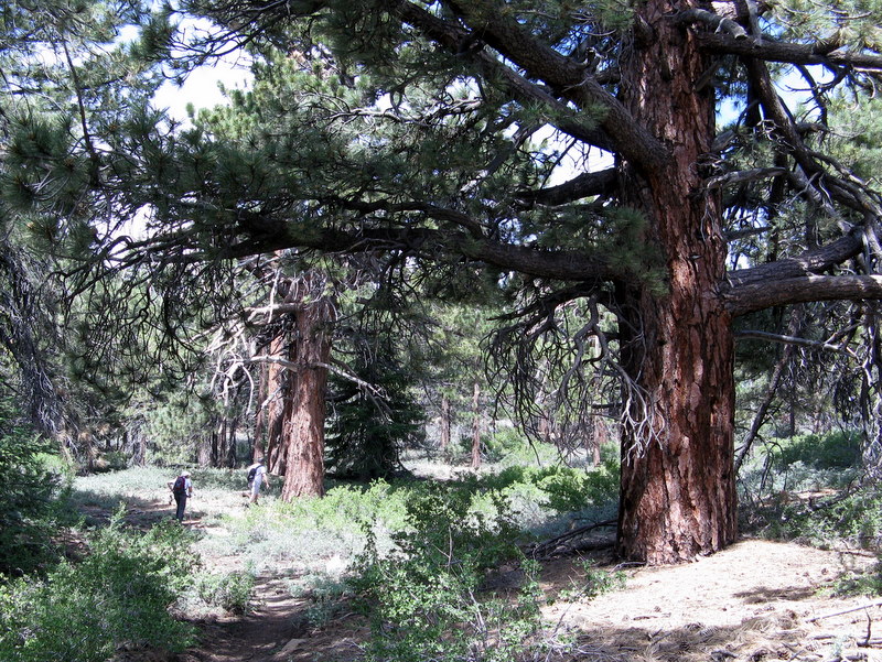
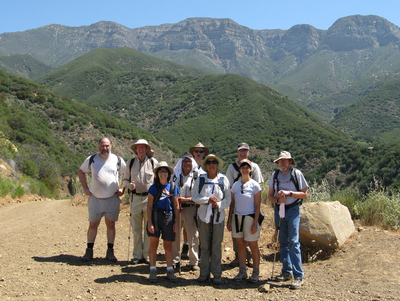
October 24th 2009 – Simi Peak (via the Long Canyon trailhead)
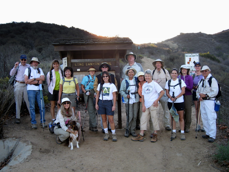
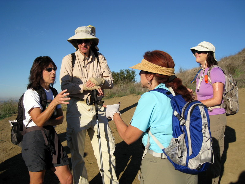
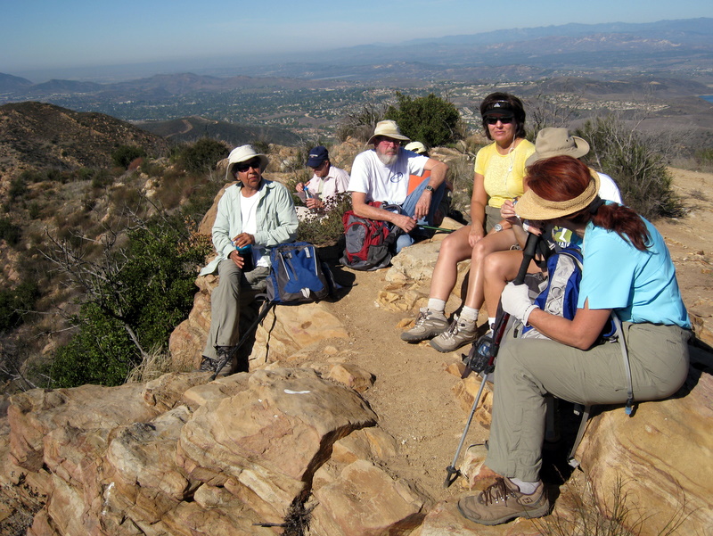
16 hikers (+ Heidi, a cute dog) met in the Long Canyon Trail parking lot (1,103‘) near the junction of Wood Ranch Parkway and Long Canyon Road on a relatively cool morning. After brief introductions and a reminder of certain hiking etiquette, the hike began by climbing the moderately strenuous Long Canyon Trail to a ridge east of Simi Valley; along the way there were good views of the west end of Simi Valley and beyond, including the Bard Reservoir. Soon thereafter two of the hikers turned back, having already gotten a pretty good workout. The rest of the group continued eastward along a fire/ranch road to a partially shaded trail that led southward down to the Albertson Motorway, a wide, nicely graded dirt fire road that is roughly parallel to Hwy 118. We followed the motorway as it climbed steadily to the east, eventually reaching a junction with the primary north-south trail that runs through China Flat (~2,050’), a lovely grassy meadow that is dotted with oak trees. Two additional hikers in our group decided to turn back at this point. We followed a winding trail (the China Flat Loop Trail) to the south and west until its junction (2,148’) with the Simi Peak Trail. We then began the final ascent along the fairly well-maintained trail to Simi Peak (2,403‘), the highest point in the Simi Hills (which occupy the area between Simi Valley and Hwy 101 and between Hwy 23 and the San Fernando Valley). We rested atop the peak and enjoyed the panoramic view, including looking down at Oak Park to the south; the hikers who arrived at the peak first spotted a deer that bounded away through the brush. After a while we returned to the Long Canyon Trail parking lot, deviating slightly from our earlier route. The day had warmed up noticeably by that time so the climb from the Albertson Motorway to the ridge just east of Simi Valley was noticeably harder than our uphill efforts earlier in the day. Reaching the parking lot, we had completed a 10-mile hike with 1,911’ of elevation gain.
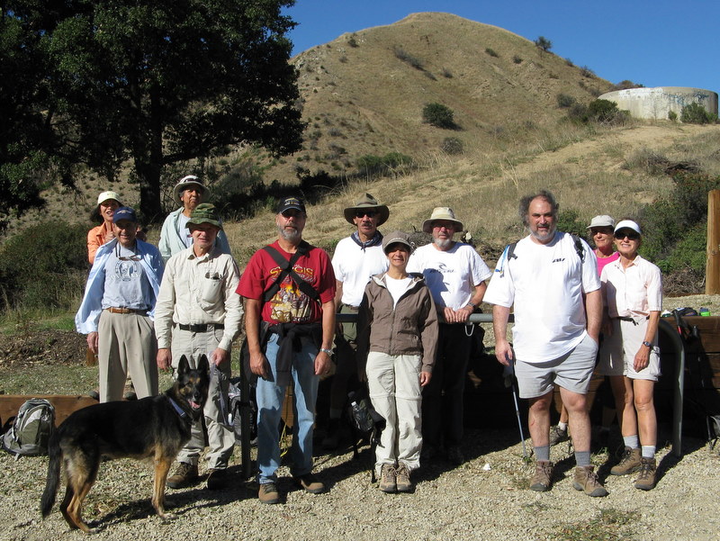
October 17th 2009 – Work Party – Wildlife Corridor in Corriganville
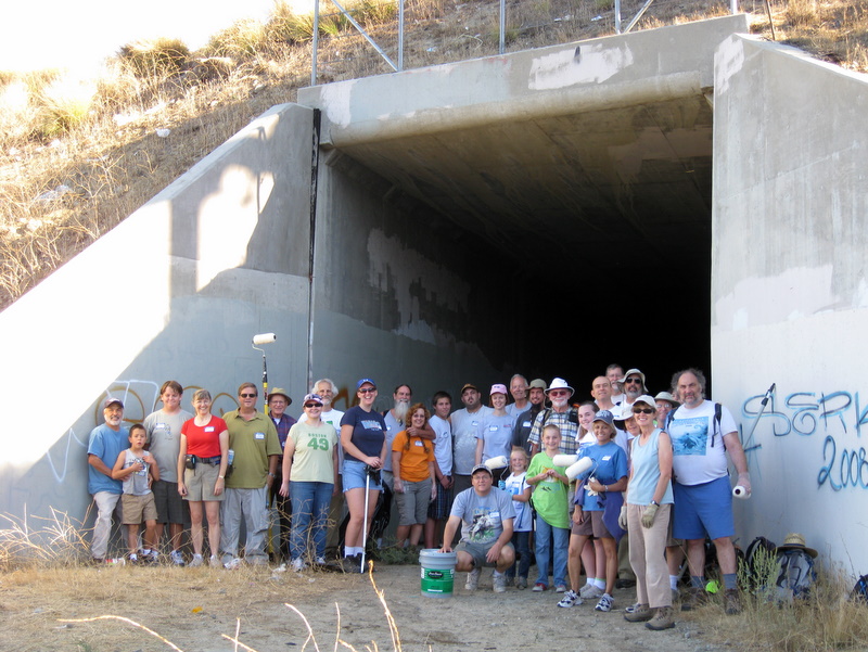
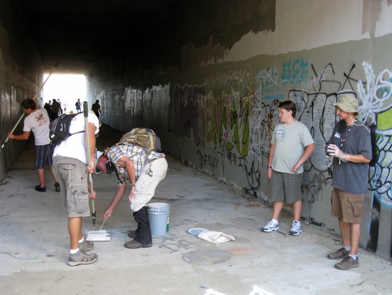
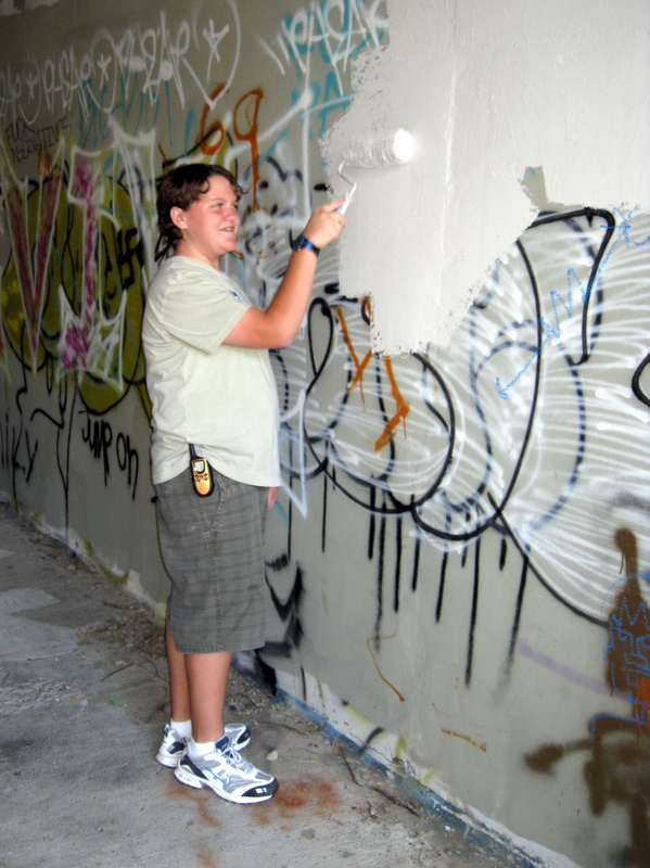
And now for something completely different… Instead of a trail maintenance project, the Trailblazers participated in a joint effort with the geocaching community. The idea to have this event was the brain-child of a local 13 year old Valley View middle-school student. We painted over the graffiti and cleaned up the trash at the Wildlife Corridor above Corriganville. There were a total of 29 people in attendance: 8 Trailblazers and 21 geocachers. With that many able-bodied workers, the whole effort took just over an hour. Since the event was so successful, the RSRPD asked us to do it again next year. Everyone in attendance agreed it was a whole lot of fun and a definite for next year.
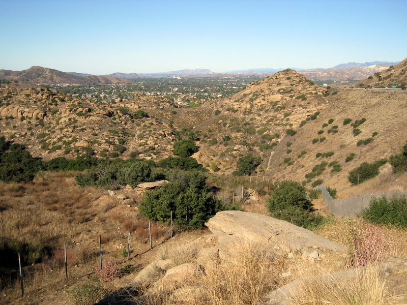
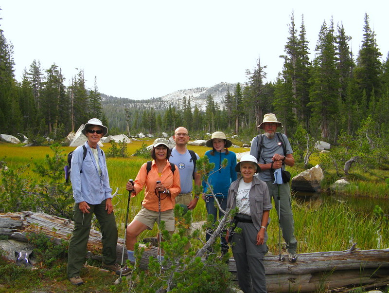
October 10th 2009 – Serrano Canyon
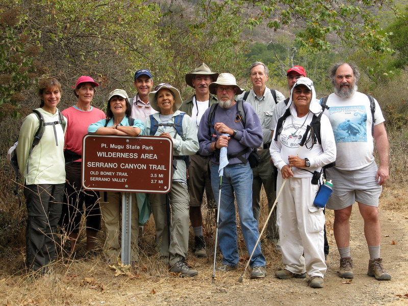

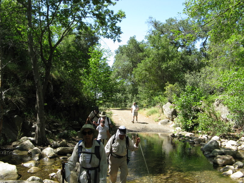
Eleven hikers met at the Madera Road carpool point on a slightly chilly morning. They then drove to the Big Sycamore Campground parking lot in Point Mugu State Park (the entrance fee is now $12; $11 if a “senior” is driving). The hike began by our walking north on Sycamore Canyon Road which is paved in the campground, but soon becomes a dirt road. After walking a little over a mile on the dirt road, we reached the trailhead for Serrano Canyon on the right. Our hike immediately improved dramatically as the trail [not a dirt road] headed eastward upstream for 1.7 miles through the shady wooded canyon which was pretty despite the prolonged absence of rainfall. We emerged from the canyon into lovely Serrano Valley which is ringed on all sides by mountains; it consists mainly of large meadows covered by wild grasses and dotted with a few trees and some bushes along the seasonal streams. There we began hiking the Serrano Valley Loop in a clockwise direction, stopping briefly to examine ranch artifacts such as an old water pump, an old abandoned car frame, and an old horse watering trough. The west side of the loop climbed part way up the mountain to a fork in the trail. We took the fork to the right and followed the trail as it climbed into the foothills along the north side of the loop [the left fork would have taken us to the Old Boney Trail]; it provided great views of the towering mountains to the northeast. Soon the trail began descending along the east side of the loop affording us with excellent views of the western part of Serrano Valley and the mountains to the south. We completed the 2.6-mile loop, rested briefly, and then descended through pleasantly cool Serrano Canyon to Big Sycamore Canyon where there were surprisingly few bicycle riders and virtually no other hikers. After a brief lunch break, we returned downstream to the campground parking lot, said our goodbyes to our friends, and returned to Simi Valley having completed an 8.8-mile “lollipop loop” hike with 950’ of elevation gain on a good day for hiking.
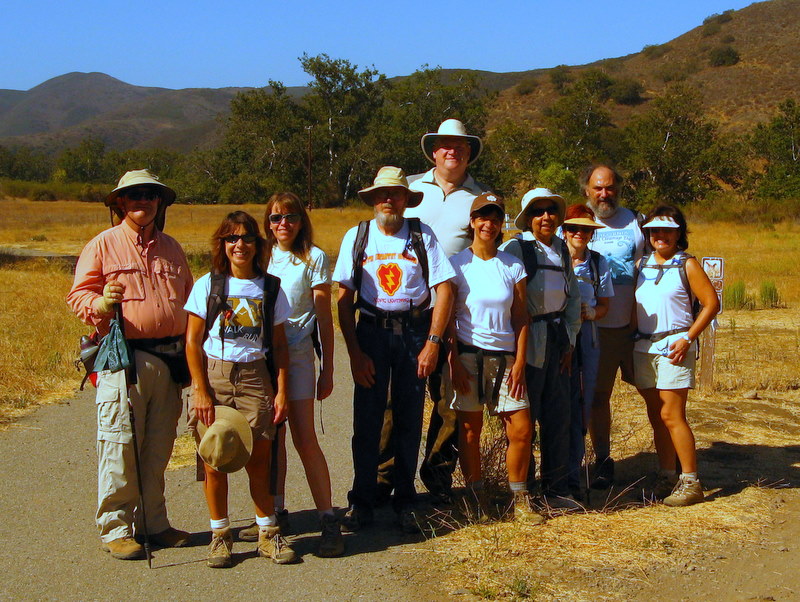
October 3rd 2009 – Hummingbird Trail to Chumash Trail via Rocky Peak Road Loop
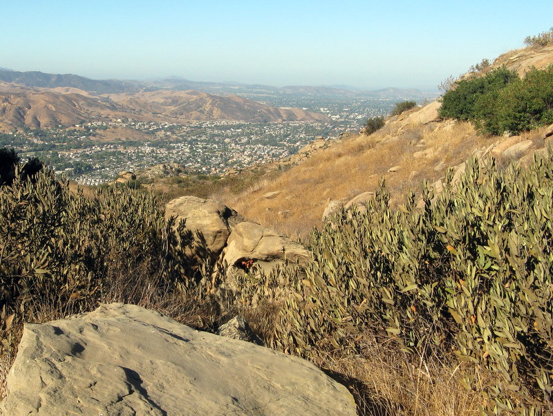
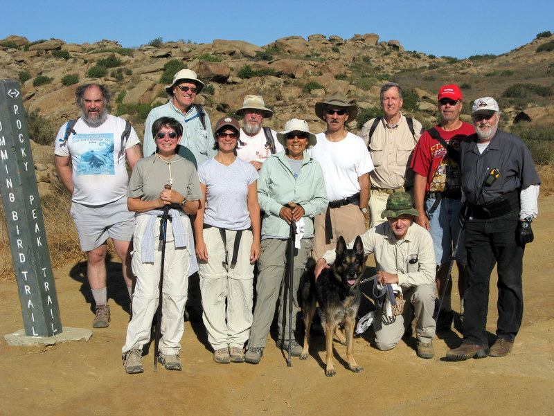
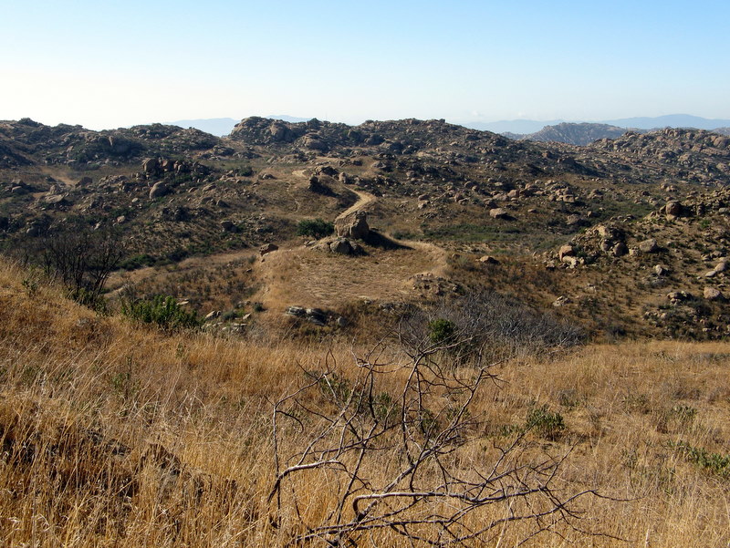
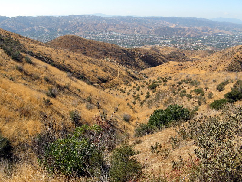
Eleven hikers met in the dirt parking area on the east side of Kuehner Avenue just north of Hwy 118 in Simi Valley to hike the Hummingbird Trail. It was a cool morning as we began our 2.3-mile eastward climb to the Rocky Peak Fire Road. The trail passes through a variety of interesting rock formations along the way and provides sweeping views, particularly of eastern Simi Valley including the Boeing (Rocketdyne) facility in the Simi Hills. Reaching the Rocky Peak Fire Road, we rested, took some group photos, and decided to complete a longer loop hike rather than returning down the Hummingbird Trail. We headed north (and uphill) on the Rocky Peak Fire Road, passing the spur leading to Rocky Peak itself and the junction with the Johnson Motorway which rises from Chatsworth to meet the fire road. We had excellent views of the Hummingbird Nest Ranch, looking down from the fire road, and very good views of Simi Valley and the surrounding mountains. The dusty boulder-rich landscape bore witness to several years of less-than-average rainfall. When we reached the junction with the Chumash Trail, we again rested, and then began descending the 2.6-mile Chumash Trail. As we neared the bottom of the Chumash Trail we followed old trails and dirt roads to complete a 9-mile loop with 1,853’ of elevation gain, reaching our vehicles somewhat tired, but grateful that the temperature was still relatively mild.
September 20th – 27th 2009 – Zion & Bryce Canyon National Parks
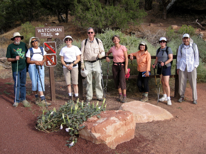
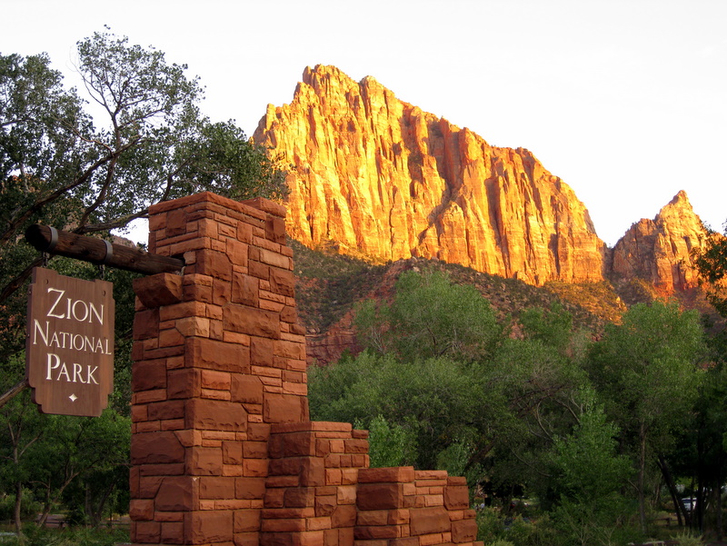
SUNDAY, SEPTEMBER 20, 2009 – Zion National Park – Arrival and Watchman Trail – – –
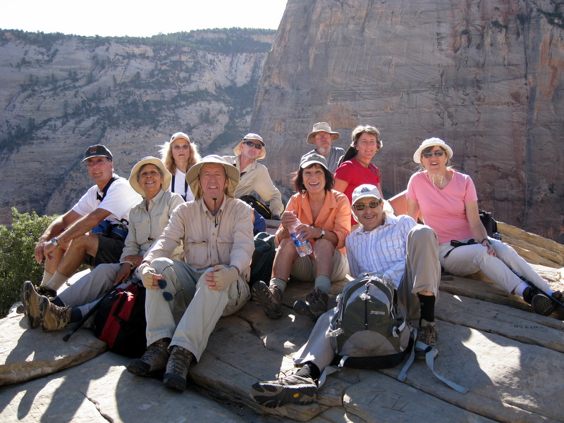
12 Rancho Simi Trailblazers gathered at the Watchman Campground in southern Zion National Park for a week of camping and hiking in another one of the most beautiful spots on earth. After setting up camp (3,970’), we walked over to the Visitor Center, then along a path next to the Virgin River to the Watchman Trail trailhead as part of a 3-mile warm-up hike with about 400’ of elevation gain. The trail climbed part-way up red-sandstone Bridge Mountain via a series of switchbacks, eventually reaching a short loop (4,340’) with a good view of the Watchman monolith as well as other nearby mountains. We returned to camp, had dinner, and turned in early.
MONDAY, SEPTEMBER 21, 2009 – Zion National Park – Angel’s Landing and West Rim Trail to Cabin Spring – – –
After a quick breakfast we caught an early shuttle at the Visitor Center and rode up-canyon to the Grotto stop where we began hiking the West Rim Trail. After we crossed the footbridge, the trail headed northward along the west side of the Virgin River, then northwest via a series of paved switchbacks rising hundreds of feet in about a mile. We then entered Refrigerator Canyon, a hanging canyon between Angels Landing and Cathedral Mountain, which provided a cool respite from the morning sun. Soon we reached Walter’s Wiggles, a series of 21 cleverly engineered short switchbacks leading to a saddle known as Scout Lookout (5,370’) at the junction of the West Rim Trail and the Angel’s Landing Trail; a privy was available at this point. Most of the group then undertook the final climb to the top of Angels Landing (5,785’) which has a well-deserved reputation for its rigor and its danger – the very narrow trail rises steeply and there are vertical drops of hundreds of feet on both sides it; a fall would surely result in death. A reassuring safety measure is the presence of sections of a single chain that the hiker can hold on to on most, but not all, of the trail. Since we started our hike early in the morning there were few other hikers descending while we ascended, but there were quite a few coming up as we descended. The stunning views of Zion Canyon and the surrounding mountains made the climb well-worthwhile. After resting, photo-taking, and sightseeing, we returned carefully to Scout Lookout. Most of the group then hiked (on a hot afternoon) three miles farther to the west on the West Rim Trail to Cabin Spring (6,720’), a small spring atop the main western plateau. Then they returned to the Grotto stop and took the shuttle back down-canyon. The hike to Angel’s Landing is 2.5 miles each way with a 1,488’ elevation gain; the hike from Scout Lookout to Cabin Spring is 3 miles each way with a 1,350’ elevation gain for a total of 11 miles with an elevation gain of 2,838’.
Here’s the web link for the National Park Service’s virtual tour (eHike) of Angels Landing in Zion National Park:
http://home.nps.gov/zion/photosmultimedia/angels-landing-ehike.htm
TUESDAY, SEPTEMBER 22, 2009 – Bryce Canyon National Park – Rainbow Point – Riggs Spring Loop (counter-clockwise) – – –
We left the campground early for the two-hour trip to the trailhead at Rainbow Point (9,115’) in Bryce Canyon National Park; we traveled east on Hwy 9, north on Hwy 89, east on Hwy 12, and then south on Hwy 63 (which runs through the park) to the end of the road. It was a chilly morning (perfect for hiking) as we began our search for the Riggs Spring Loop Trail trailhead. Just before we located the trailhead, we found ourselves at Yovimpa Point from which we had excellent views to the south. The trail led us southward down through a forest of burned, but still-standing, conifers eventually reaching the Yovimpa Pass Campsite in a lovely (unburned) woodland setting. After a short break, we continued down the trail to the Riggs Spring campsite and spring. Along the way we passed through a forest of aspens, maples, and ponderosa pines; many of the aspens and maples wore their fall colors (golden and red) in a magnificent display contrasted by the colors of the ponderosa pines, Gambel oak, white fir, and junipers and the hues of the Pink Cliffs to the north. The Riggs Spring area was very beautiful and invited a longer stay, but after a very pleasant interlude we continued along the trail beginning the upward portion of the loop. The next mile continued to dazzle us with its fall colors. As we gained elevation we were presented with distant views to the east. The trail continued to rise and we eventually found ourselves back at Rainbow Point. We took advantage of the opportunity to shower (for only $2.00 each) at the general store near Sunrise Point on our return trip to the Watchman Campground, having completed a 9.8-mile hike with 1,550’ of elevation gain.
WEDNESDAY, SEPTEMBER 23, 2009 – Zion National Park – Observation Point – East Mesa Trail – – –
After a leisurely breakfast we took the shuttle from the Visitor Center to the Weeping Rock stop where we began hiking the East Rim Trail on the shady east side of the canyon. The trail climbed hundreds of feet up to Echo Canyon via a series of paved switchbacks, passing the short trail to Weeping Rock and the Hidden Canyon trailhead along the way. Echo Canyon is a narrow hanging canyon that leads northeast away from Zion Canyon; it is a gorgeous canyon that offers stunning rock formations. Leaving Echo Canyon, the trail rises less gently as it approaches a junction with the Observation Point Trail after which it rises fairly steeply via sun-drenched switchbacks to a higher view of Zion Canyon. The trail gains a little more elevation in its final mile as it wends its way across a plateau to Observation Point which provides spectacular views (perhaps the best in the park) of the length of Zion Canyon including a downward view of Angels Landing. After relaxing, sightseeing, and photo-taking, most of the group returned to the shuttle stop having hiked 8 miles with a 2,236’ elevation gain. Four members of the group decided to hike a portion of the East Mesa Trail which starts about a third of a mile from Observation Point. The path climbed a few hundred feet before becoming a relatively level dirt road heading north through a forest of pine trees, about half of which had been severely burned. After hiking about three miles along the trail, the hikers returned to the Observation Point Trail and returned to the shuttle stop having hiked 14.5 miles with around 2,900’ of elevation gain. That evening there were two kinds of very good cake to celebrate the birthdays of two members of the group.
THURSDAY, SEPTEMBER 24, 2009 – Bryce Canyon National Park – “Figure 8” Loop (Navajo Trail + Peekaboo Trail) [counter-clockwise] – – –
We again left the campground early for the 90-minute trip to the trailhead at Sunset Point (8,010’) in Bryce Canyon National Park; we followed the same route as on Tuesday. It was somewhat warmer than Tuesday as we began our descent via the Navajo Trail into the wonderland of hoodoos and other colorful formations that awaited us; we passed such notable formations as Thor’s Hammer, The Temple of Osiris, and Sinking Ship on our way down into the canyon. This unique area is indescribably beautiful and must be seen in person. Reaching the bottom, we took a connector trail to the Peekaboo Loop where we waited while a party of horseback riders sauntered past. We began hiking the up-and-down loop, passing stunning scenery such as The Cathedral and the Wall of Windows, grateful for the high-capacity memory in today’s digital cameras. Just before we reached the junction with the Bryce Point Trail, we took a rest/lunch break. We then finished the Peekaboo Loop, passing The Alligator and the Fairy Castle among other sights. We then retraced our steps on the connector trail and began the climb to Sunrise Point, passing the Queen’s Garden along the way. After admiring the near-and-distant views from Sunrise Point, we hiked one-half mile along the Rim Trail back to Sunset Point. We again took advantage of the $2.00 shower opportunity as we headed back to the Watchman campground having hiked 7 miles with an elevation gain of 1,592’.
FRIDAY, SEPTEMBER 25, 2009 – Zion National Park – The Narrows in the Virgin River – – –
After breakfast, we took the shuttle from the Visitor Center to the Temple of Sinawava stop where we hiked one mile along paved Riverside Walk to the beginning of the hike in the river. After ensuring that our gear, particularly our hiking poles and footwear, was in working order and that our valuables were stowed safely in dry sacks, we entered the North Fork of the Virgin River and headed upstream. At first the knee-deep water felt cold, but our bodies soon adjusted only to be shocked again as the water occasionally deepened so that it reached our waists and at one point reached our chests. The canyon’s sheer walls, carved and smoothed by the Virgin River over eons, were stunningly colorful as they twisted into the distance; there were many hanging gardens clinging to the sides of the canyon. Sometimes there was rocky land that could be walked on for short distances on one side or the other of the river requiring many tricky river crossings over submerged slippery rocks with an insistent current tugging at us; frequently it was necessary to walk in the river because the water spanned the entire channel. When there was land alongside the river, there were tall trees and bushes and sometimes a short trail on the sandy land. Four Trailblazers hiked to Big Spring, a lovely set of three cascades, one above the other; this is the furthest point hikers are allowed to go without a special permit. Along the way the river passed confluences with Mystery Canyon and Orderville Canyon, but we didn’t explore them. The other members of the group hiked varying distances up the river; everyone had a great time. Eventually everyone made it back to Riverside Walk, hiked back to the shuttle stop, and returned to the campground, wet but happy, agreeing that the Zion Narrows deserves its reputation as a world-class slot-canyon river walk. The hike to Big Spring and back was 9.6 miles (including Riverside Walk) with a few hundred feet of elevation gain/loss.
Here’s a web link to some (other) great photos of the Zion Narrows in Zion National Park:
http://www-personal.umich.edu/~jensenl/visuals/album/2006/narrows
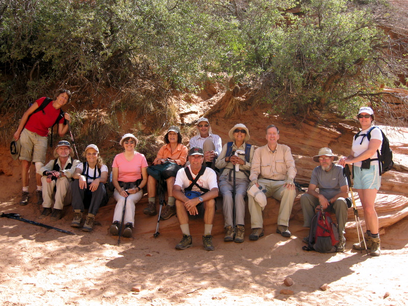
SATURDAY, SEPTEMBER 26, 2009 – Grand Staircase-Escalante National Monument – Lower Calf Creek Falls – – –
After an early breakfast ten Trailblazers left the campground for the three-hour trip to the Lower Calf Creek Falls campground (5,340’) in the Grand Staircase-Escalante National Monument (northeast of Bryce Canyon National Park). We traveled east on Hwy 9, north on Hwy 89, and east on Hwy 12 to the turnoff 16.3 miles northeast of the town of Escalante, Utah. It was a hot day so we quickly began the hike upstream along the west side of Calf Creek (though not right next to it). The trail, sandy in places, rose and fell moderately as it led eastward through the broad valley which was bordered on both sides by towering white and pink Navajo Sandstone mountains; pinon and juniper trees provided some relief from the sun. Eventually the trail ran next to the creek which widened as it neared its source and the last mile was more pleasant since there was much more vegetation including cottonwood and box elder trees; the creek contained some fish. At the end of the trail were the hundred-foot Lower Calf Creek Waterfalls (5,510‘) with a large pool of water at the base (swimming is allowed). Many people were enjoying the ambience of this beautiful setting (which included a cooling mist from the waterfall). After a lengthy respite, we returned to the parking lot. Six Trailblazers returned to the Watchman Campground having completed a 6.2-mile hike with about 250’ of elevation gain; the other four went on the outing described next.
SATURDAY, SEPTEMBER 26, 2009 – Kodachrome Basin State Park (5,800’) – Panorama Trail Loop to Panorama Point (counter-clockwise) – – –
After the Lower Calf Creek Falls outing described above, four Trailblazers drove back along Hwy 12 through Escalante to Cannonville, Utah where they then drove 9 miles south on Cottonwood Canyon Road to the entrance to the park. After paying a small entry fee and parking a short distance up the road, the hikers headed west on the aptly named Panorama Trail. The park is populated with an amazing variety of sandstone chimneys, such as the Fred Flintstone spire, the Ballerina spire, and the Hat Shop. “Some of the 70 monolithic spires, sedimentary sand pipes ranging from six to 170 feet in height, jut up from the valley floor or protrude from the sandstone.” A highlight of the hike was our exploration of the Secret Passage Trail with its sandstone playground. At the halfway point in the loop, we climbed fairly steeply up to Panorama Point which provided an excellent view (to the east) of the area. We completed the loop having seen only two other humans on the trail and having hiked 3.5 miles with 350’ of elevation gain. We then returned to the Watchman Campground.
SUNDAY, JULY 12, 2009 – Break camp and return home.
Everyone expressed great satisfaction with this week-long outing. If you haven’t been to these areas, visiting Zion and Bryce Canyon should be on your “bucket list” of things to do.
September 12th 2009 – Camp Three Falls to Lilly Meadows
September 5th 2009 – Sycamore Canyon Shuttle

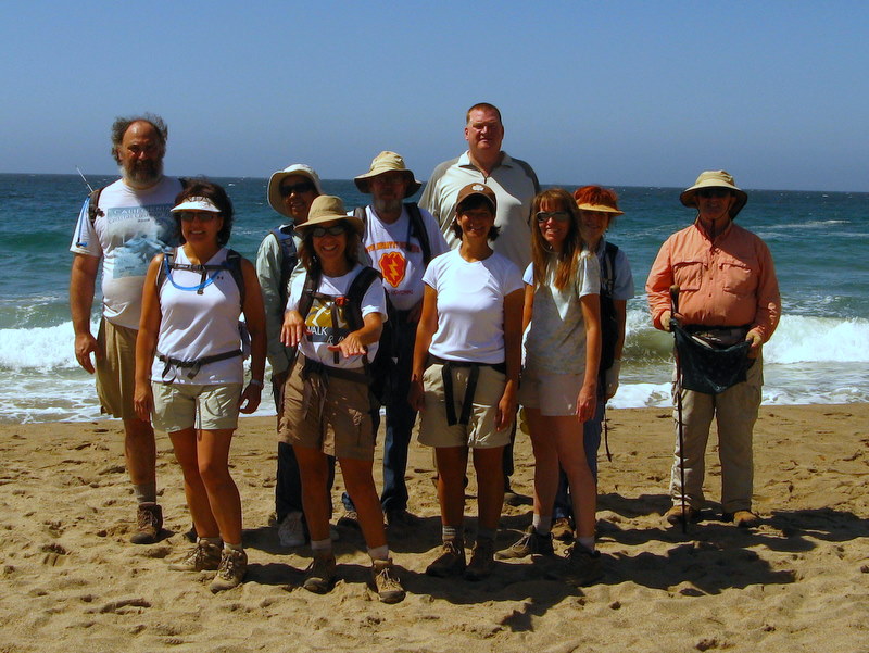
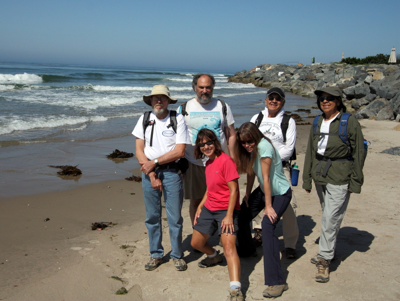
Four Rancho Simi Trailblazers who volunteered to drive shuttle vehicles met at 7:30 a.m. so that they could leave three shuttle vehicles in the Sycamore Cove Beach parking lot [the parking fee is now $12.00 for day use] – after which they returned to the Wendy Trail trailhead in Newbury Park to join the other hike participants. The temperature was in the 70’s as the eleven hikers headed southwest on the Wendy Trail to the Satwiwa Native American Indian Culture Center where we learned that several of the local rattlesnakes had been given names; fortunately we didn’t encounter any of them! We continued our one-way hike along the Big Sycamore Canyon Trail as it descended into the canyon. Many bicycle riders were taking advantage of the relatively low morning temperature in the canyon, so we were frequently passed on the wide fire road by friendly cyclists, a few runners, and an occasional hiker. There was no water in the seasonal stream that runs through the canyon bottom. Nevertheless the towering California sycamore trees had bright green leaves, there were a few flowers, and there was lots of pretty red poison oak (which will turn green again in the spring). The temperature remained in the 70’s and as we drew closer to the ocean we were caressed by cool breezes. After taking a break in the shade of a large tree at the point where the Backbone Trail meets the Big Sycamore Canyon Trail on the west side of the road, we continued downstream. As we drew nearer to the Big Sycamore Canyon Campground, the bicycle and foot traffic increased; many of the people we encountered were children (with their parents for the most part), a clear indication that we were drawing nearer to our destination. Eventually we crossed under Highway 1 (PCH) through a tunnel and were immediately on Sycamore Cove Beach with a great view of the ocean. We found a picnic table, had lunch, visited the shore, and then carpooled back to the trailhead in Newbury Park (where it was noticeably warmer than when we started our hike), dispersed, and headed home having completed a pleasant 9-mile hike with less than 200’ of elevation gain.
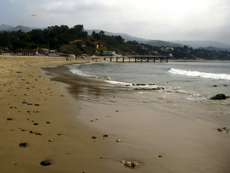
August 29th 2009 – San Buenaventura State Beach to Emma Wood State Beach and beyond . . .
Five Rancho Simi Trailblazers decided to escape the blazing August temperatures and the nearby forest fires in the Angeles National Forest by driving to the city of Ventura and hiking/walking near the beach. We headed north on Hwy 101 to the Seaward Avenue exit in Ventura, turned right (west) on Harbor Boulevard, drove 0.4 mile to San Pedro Street and turned left onto it, then drove 0.2 mile to the San Buenaventura State Beach parking lot entrance and turned right; there was a $10.00 day-use parking fee. We headed from the parking lot toward the ocean, turned right on the paved walking/biking path, and headed north toward the Ventura Pier (which is 1,700’ long). After passing the pier, we strolled past Promenade Park and then Seaside Park; many surfers were in evidence in the ocean and on the beach. There were many runners, bikers, and casual strollers in the area; the public was making good use of the parks and beaches. We passed the Ventura County Fairgrounds (on the inland side) and eventually reached the Ventura River Trail which heads north toward Ojai [its name changes to the Ojai Valley Trail at Foster Park]. We followed this trail to West Main Street where we turned left and crossed the Ventura River via a bridge. We soon passed the Seaside Wilderness Park and reached the Emma Wood State Beach. Feeling energetic and enjoying the cool ocean breeze, we continued walking northward as the path ran parallel to (and near) the beach, finally turning around after about 4.5 miles. As we retraced our steps, the day warmed up and the breeze vanished, but it was still 30 degrees cooler than Simi Valley. We enjoyed walking along the sandy (and somewhat rocky) beach next to the water for a while on the way back, but were happy to reach the parking lot and our air-conditioned car. We returned to Simi Valley (where it was over 100 degrees), having completed a 9.1-mile hike with virtually no elevation gain.
August 20th – 23rd 2009 – Dinkey Lakes Backpack
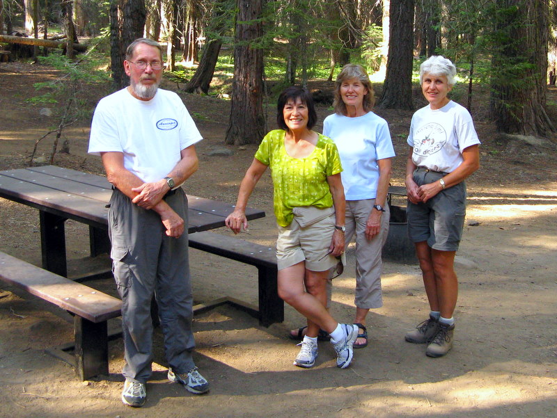
THURSDAY, AUGUST 20, 2009 – Travel from Simi Valley to Dinkey Creek Campground
Five of the seven Rancho Simi Trailblazers who participated carpooled (in two vehicles) from Simi Valley to Dinkey Creek Campground, following Hwy 118 east to I-405, then north to I-5, then north to Hwy 99 (in the San Joaquin Valley) passing through Bakersfield and on to Fresno, then north on Hwy 41, east on Hwy 180, and northeast on Hwy 168. After stopping at the Ranger Station in Prather and picking up our wilderness permit, we continued along Hwy 168 to the community of Shaver Lake where we headed east on Dinkey Creek Road eventually arriving at the Dinkey Creek Campground (5,710’) where we car-camped overnight in sleeping bags/tents. Fortunately there were only a few mosquitoes around, it was a relatively warm night, and there was fresh drinking water (and a bathroom with a flush toilet) nearby. The campsite was set among towering conifers and we were allowed to have a campfire. We retired early, eager to continue our adventure the next morning.
FRIDAY, AUGUST 21, 2009 – Travel/Backpack to Our Base Camp at First Dinkey Lake
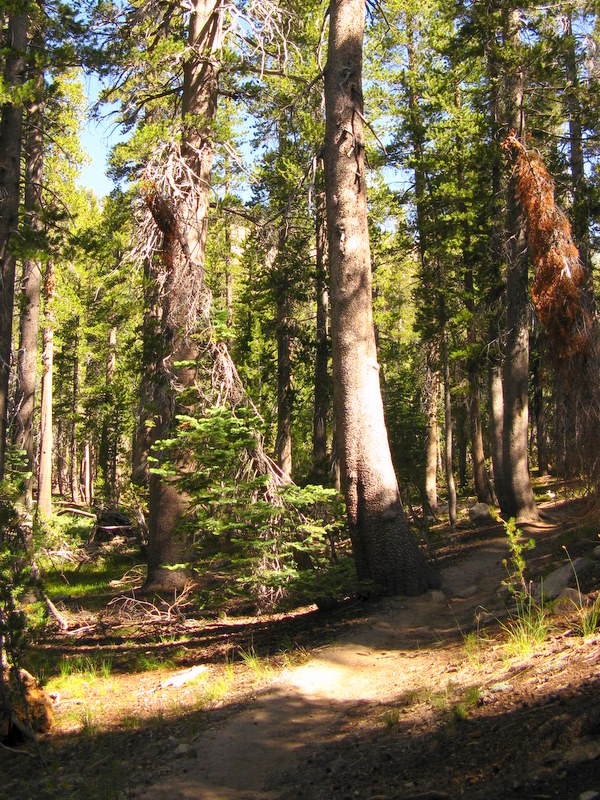
We arose early, ate a quick breakfast, struck camp, and drove to the Willow Meadow Trailhead (8,620’) via Dinkey Creek Road, Rock Creek Road (9S09), 9S10, and 9S62 (to its end at a large parking lot). Although this route was mostly unpaved, the condition of the road was unexpectedly good, except for some easily avoided potholes on Rock Creek Road [the “secret” was to slow down]. After changing into our hiking boots and strapping on our bulging backpacks, we began a three-mile trek along a well-maintained trail that followed Dinkey Creek upstream to First Dinkey Lake. Our path was shaded by large pine trees and granite rock formations were abundant; there was even a little water in the creek. After an elevation gain of a little over 600’ we spotted the lake. We turned right onto a use trail and walked a short distance to a large campsite (9,250‘) set among the trees with adequate level spots in which to set up our tents; there was also a fire ring and some firewood. We set up our tents and filtered water from the nearby pond (adjacent to the lake), then rested and waited for the two remaining members of our group to arrive a couple of hours later [they hadn’t been able to leave home until early Friday morning]. We had dinner, discussed the following day’s hiking, and eventually climbed into our sleeping bags for some well-earned rest.
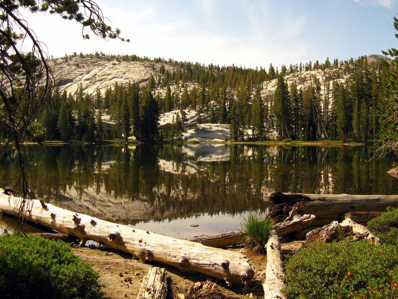
SATURDAY, AUGUST 22, 2009 – Second Dinkey Lake, Island Lake, Rock Lake, Cliff Lake
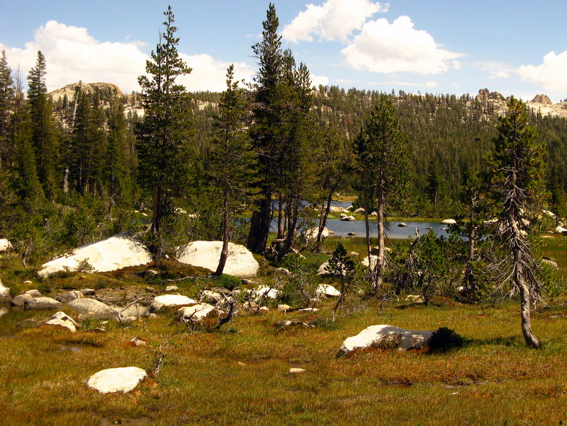
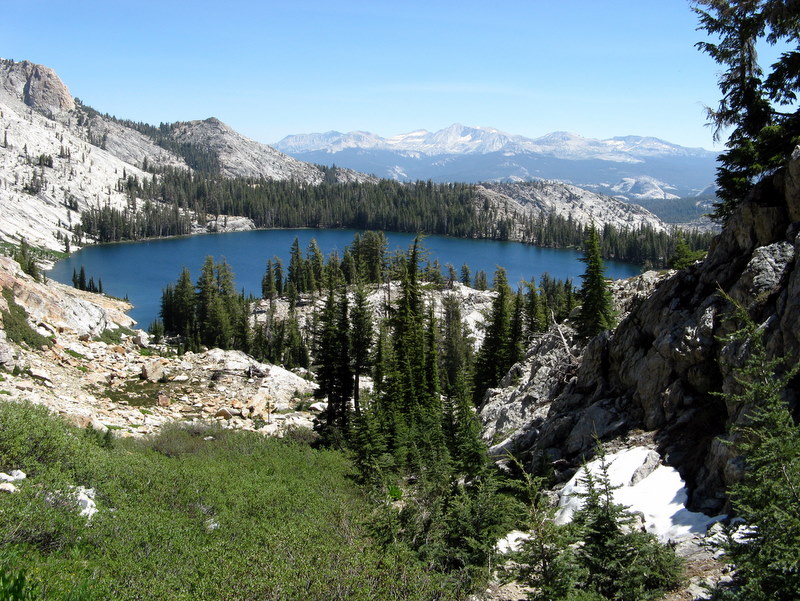
After breakfast, we headed east along First Dinkey Lake (9,240’) and then northeast to a very large meadow. Next we climbed the heavily shaded trail from First Dinkey Lake toward Second Dinkey Lake. At the crest of this trail we walked over to an overlook which afforded fine views of First Dinkey Lake, South Lake, and a nearby granite dome. Three members of our group decided to climb to the top of the dome (and did so). The rest of the group decided to follow the trail (27E07) to Second Dinkey Lake, agreeing to meet at Island Lake. We soon reached Second Dinkey Lake (9,600’), a beautiful glacially carved lake with a steep granite backdrop. After enjoying the view for a while, we climbed the non-maintained rocky trail (27E30) to Island Lake (9,810’) and rejoined the other members of our group along the shore of another beautiful lake. Those of us who had not already done so then climbed to the top of the granite dome where we were rewarded with magnificent views of Island Lake with its Three Sisters (10,438’) backdrop, First and Second Dinkey Lakes, South Lake, and Rock Lake. Most of the group then headed back to Second Dinkey Lake and then continued along 27E07 to lovely Rock Lake (9,640’). After passing it the trail climbed to a pass (9,920’) from which we descended part-way toward Cliff Lake (9,438’) to a point from which we could take photos of the lake. We retraced our steps back up to the pass and then climbed cross-country to a view (10,173’) of Dogtooth Peak. Since the sky was overcast and it looked as if it might rain, we decided to head back to camp (via 27E07). After preparing and eating our freeze-dried dinners (which taste pretty good in the wilderness!) and cleaning up, we retired to our respective tents. Shortly thereafter it began raining; the rain continued pretty much unabated for most of the night.
SUNDAY, AUGUST 23, 2009 – Return to the Willow Creek Trailhead and Drive Home
When we arose and exited our tents we were relieved to discover that the rain had stopped (though water dropping from the trees made it sound as if it were still raining). After a light breakfast we struck camp, resigned to having to jam very wet tents, ground cloths, etc., into our backpacks. It turned out to be another nice day as we hiked downstream along Dinkey Creek to the parking lot and our waiting vehicles. Bonuses were that there was more water in the creek than there had been before the rain – and the trail was not dusty. Once in our vehicles we followed 9S09 northwest to Hwy 168 and had lunch at Trapper’s Bar & Grill overlooking Shaver Lake. We then returned to Simi Valley having completed a rewarding outing involving 16 miles of hiking (including over 6 miles of backpacking) with 2,200’ of elevation gain.
August 15th 2009 – Zuma/Westward Beach to Point Dume to Paradise Cove
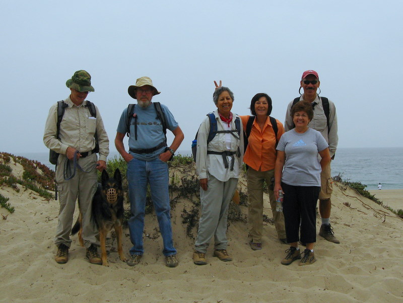
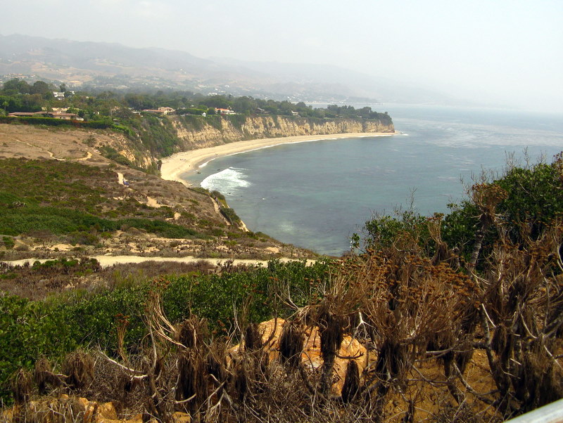
Seven hikers carpooled to Malibu via Highway 23, Highway 101, and Kanan (Kanan Dume) Road to Pacific Coast Highway (Hwy 1), turned right (west) on PCH and then turned left a short distance later on Westward Beach Road and followed it to a kiosk where a $7.00 parking fee was paid; we then parked a short distance beyond the kiosk. A marine layer blanketed the coast, keeping the temperature pleasantly in the 60’s as we began hiking toward the Point Dume land mass. After an easy climb onto Point Dume, we followed a trail as it led down to Dume Beach. We then strolled along the sandy beach for a couple of miles, enjoying the ocean sounds and sights, eventually arriving at the Paradise Cove Beach Café ( http://www.paradisecovemalibu.com ), a landmark for decades. We rested in the free-to-the-public beach chairs outside the restaurant, bought (and consumed) beverages and ice cream, watched the other beachgoers, and reminisced about the “good old days” (including the TV series The Rockford Files which was set in Paradise Cove). After a while we walked out onto the nearby pier, watched a few fishermen, and enjoyed the view. Eventually we resumed our hike and headed back along the beach the way we had come. After climbing back onto Point Dume, we hiked to its highest point which afforded excellent panoramic views. We then took a slightly lower trail to an observation point (with two benches) where we spotted what appeared to be seals and dolphins. We continued on the trail around the point and descended to the parking lot. We then headed home having completed an easy 6.1-mile hike with 400’ of elevation gain, vowing to return again, perhaps in the spring when the coreopsis plants are in bloom.
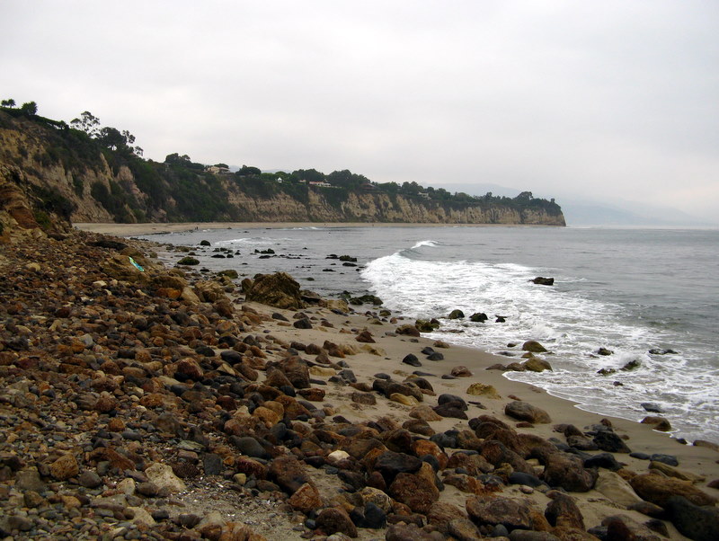
August 8th 2009 – Carpinteria Bluffs
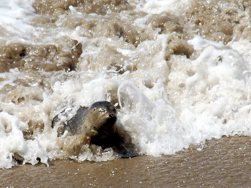
Seven hikers looking for a day of beach tranquility hiked the Carpinteria Bluffs trail this morning. We started at the trailhead and walked along the bluffs with a view of the ocean most of the way. We stopped at the Seal Sanctuary and spotted a few seals enjoying the surf. Next, we headed towards the campground and spent the rest of the hike walking on the sand along the shore dodging the waves and enjoying the view of the surf and the cool breeze on a warm day. Most of us felt overdressed for the hike….. We sat on the rocks and had lunch and then returned the same way, stopping again at the Seal Sanctuary where Roger captured a spectacular picture of a seal lion playing near the rocks. It was a calming and reflective way to spend a Saturday morning.
August 1st 2009 – Palos Verdes Peninsula Trail
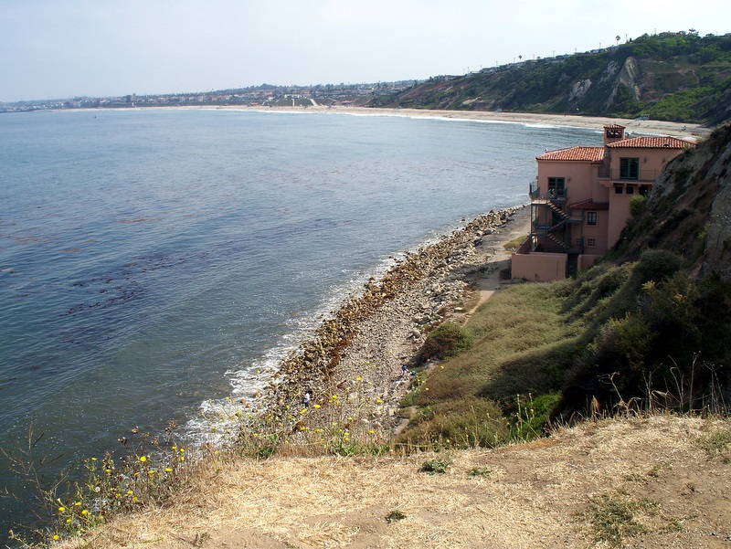
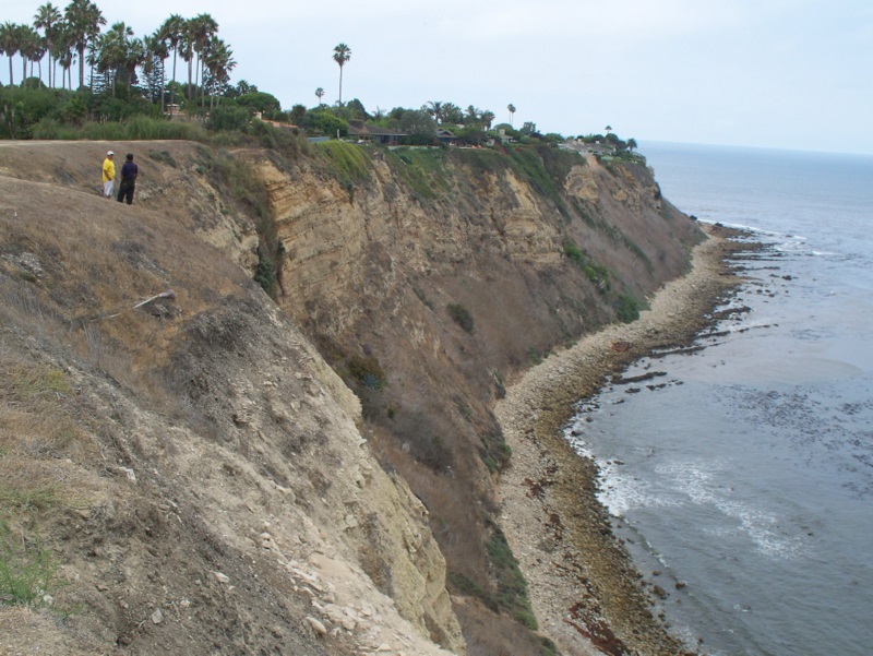
Ten of us thought we would take our chances today. We learned about this hike from an article in the newspaper. Since none of us had ever done any hiking in The Palos Verdes area, we thought it would be a great opportunity. On the first look down the cliff from the trailhead, it became very obvious that the path ahead would be a difficult one. There was no real trail, just a path along the beach, ridden with bowling-ball sized boulders and many very slippery rocks. So, half of us decided to take the high road and the other, far braver half, took the low road. The high road was on the bluffs, well above the beach, and also through some rather affluent residential streets. After a total of only about 2.6 miles, those that decided to brave the beach, found a path back up the cliff and on to the bluffs. This is where the whole group met and talked back to our cars via the bluffs. It was a noble effort, but this hike is definitely off our list. Although the weather was cool, at best we only made it about 1/3 rd of the way to our destination.
July 25th 2009 – Solstice Canyon

Ten hikers carpooled to Solstice Canyon in Malibu via Madera Road-Olsen Road, Highway 23, Highway 101, Las Virgenes Road-Malibu Canyon Road, Pacific Coast Highway, and Corral Canyon Road. The hike began with an easy 1.2-mile hike upstream along the Solstice Canyon Trail which follows Solstice Creek, a year-round stream. Along the fairly shady oak-and-sycamore-tree-lined trail (which is mostly a dirt road) we passed the remains of the Keller House, a stone cottage built in 1865. A short distance before reaching Tropical Terrace, we turned left onto the Sostomo Trail and began climbing the west wall of the canyon via moderate switchbacks. The warm morning sun soon drew perspiration from our bodies though there were occasional cooling breezes. As we gained elevation we were rewarded with excellent views of Solstice Canyon, including the Rising Sun Trail on the east side of the canyon. We crossed Solstice Creek, continued our ascent, and soon passed the burned remnants of an old home; only its chimney was left standing. A huge rock monolith loomed in the distance to the northwest, but the trail skirted it to the left (south). The trail dropped again to Solstice Creek and we crossed it a second time, almost immediately passing the burned-out shell of a small rock house. We continued our climb until we reached the Deer Valley Loop at an open grassy flat. Deciding to hike the loop in a clockwise direction, we eventually climbed to an overlook with broad coastal views including Point Dume and its shoreline a short distance to the southwest. After a short rest and some photo-taking, we continued northward on the loop and soon began our descent to the intersection with the Sostomo Trail. We retraced our steps to the Solstice Canyon Trail while enjoying cool ocean breezes. We then turned left (upstream) and walked the short distance to Tropical Terrace, the ruins of the Roberts home which was built in the 1950s and was destroyed by wildfire in 1982. The stone courtyard, garden terraces, stairways, and exotic tropical plants still remain, but the exotic animals (giraffes, camels, buffalo, African deer and exotic birds) that once roamed the property do not. A short distance further upstream Solstice Canyon Falls displayed its beauty, though diminished by the dry season. After a rest/lunch break, we returned along the Solstice Canyon Trail to the parking lot. We then returned home having completed a 6.3-mile hike with 1,200’ of elevation gain, once again beguiled by the beauty of this year-round destination.
July 18th 2009 – Sheep Camp Day Hike
Nine hikers carpooled via Hwy 118, Interstate highways 405 and 5, Frazier Mountain Park Road, Cuddy Valley Road, and Mt. Pinos Road to the Chula Vista parking lot (favored by stargazers) less than two miles from the summit of Mt. Pinos (8,831‘). The hike began by following a dirt road through a forest to the Tumamait-Mt. Pinos Trail (21W03) trailhead; there were excellent views to the north, south and west. A well-maintained dirt trail then descended an open western slope, which was covered by a variety of wildflowers, via switchbacks, crossed a saddle, and began ascending the wooded eastern slope of Sawmill Mountain. Eventually the trail reached its apex and began descending the western slope of Sawmill Mountain. It soon reached a junction with the North Fork Trail (22W02) which we followed as it descended the forested southern slope of Sawmill Mountain half a mile to Sheep Primitive Camp under a stand of Jeffrey Pines. There we took a rest/lunch break and enjoyed the pleasant environment. Some campers were nearby (in the lower campground). The North Fork Trail continues downhill to the south, passing through Lilly Meadows, and eventually reaching the Three Falls Boy Scout Camp in Lockwood Valley. However, we retraced our route up Sawmill Mountain and back to Mt. Pinos where we were grateful for the switchbacks leading up to the top. Although the temperature was a bit warm, it was much cooler than Simi Valley. After regrouping atop Mt. Pinos, we hiked back down the dirt road to the parking lot having completed a 10.5-mile hike with 1,800’ of elevation gain. We returned home, stopping just before getting on Interstate 5 for some much-appreciated cool beverages.
July 7th – 12th 2009 – Yosemite National Park: Tuolumne Meadows Hiking & Camping Trip
TUESDAY, JULY 7, 2009 – Arrival and Elizabeth Lake – – –
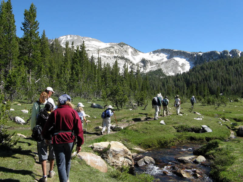
22 Rancho Simi Trailblazers gathered at the Tuolumne Meadows Campground in northern Yosemite National Park for several days of camping and hiking in one of the most beautiful spots on earth. After setting up camp (8,700’), we walked over to the Elizabeth Lake trailhead (conveniently located on the south side of the campground) and then hiked uphill through an evergreen forest to the picturesque lake (9,487’), spotting a deer along the way. We then hiked around the lake below Unicorn Peak, enjoying the cool mountain air and the great scenery. Retracing our steps down to the campground, we arrived in time to prepare dinner and satisfy the appetites we worked up on the 7.3-mile hike with 919’ of elevation gain. After dinner and conversation, we retired to our tents, quickly crawling into our sleeping bags as the temperature dropped into the 30’s at night.
WEDNESDAY, JULY 8, 2009 – May Lake and Mt. Hoffman – – –
After a leisurely breakfast, we carpooled to the May Lake trailhead (8,800’) beside a small pond on Snow Flat. We then hiked 1.2 miles through a forest of hemlock, red fir, and western white and lodgepole pines to May Lake (9,329’) where there is a High Sierra Camp. Along the way there were views of Cathedral Peak, Mt. Clark, Clouds Rest, and Half Dome. Rising above May Lake on its western edge is Mt. Hoffman (10,850’). After a brief respite on the shore of the lake, most of us continued to hike toward the peak of Mt. Hoffman. The trail rose along the southern edge of May Lake providing excellent views to the north; it then followed a pretty creek as it climbed to the south, crossed a large meadow, and then rose to the west through forest to the tree line. The trail then rose steeply up the boulder-strewn slope with lots of small wildflowers until it neared the summit. The final approach required scrambling up a steep granite mountainside to the summit. Once on top, we were treated to “the best all-around views of the park’s varied landscapes.” After taking many photographs and resting a bit, we retraced our steps and returned to the campground, having hiked 6.3 miles with 1,870’ of elevation gain. We stopped at the Tuolumne Meadows Visitor Center and the nearby store/grill for supplies and ice cream! At bedtime everyone fell asleep easily, tired out from the day’s activities – and fighting off mosquitoes.
THURSDAY, JULY 9, 2009 – North Dome and Indian Rock Arch – – –
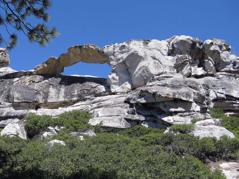
After breakfast, we carpooled to the Porcupine Creek parking lot (8,100’) to begin our hike to North Dome (7,542’) across Yosemite Valley from Half Dome. The trail immediately descended through a forest of lodgepole pines and red firs, crossing a pretty creek, and continuing on to a junction with an out-and-back trail to Indian Rock Arch. Most of us hiked the 0.3 mile up to the 15-foot natural granite arch (a very unusual formation in this area) and were rewarded by a bird’s-eye view of the area. Returning to the main trail, we continued hiking southward toward Yosemite Valley, and soon could see our final destination in the distance. At the next trail junction we took the left fork and descended through a small forest to a saddle, and then hiked up the northwest side of North Dome (a huge granite monolith). Atop the dome we had an incredible close-up view of Half Dome and an unsurpassed view of Clouds Rest, as well as spectacular views of the Yosemite Valley floor and Illilouette Fall. After an extended break for photographs, rest, and just enjoying the beauty of the spot, we began the return hike. Since the afternoon had warmed up quite a bit and the return trip was generally uphill, many of us were happy to get back to the parking area, despite the beauty of the trail, having completed a 9.4-mile hike with about 1,000’ of elevation gain. We returned to the campground, stopping again at the store/grill on the way.
FRIDAY, JULY 10, 2009 – Yosemite Creek, Yosemite Falls, Yosemite Valley – – –
After breakfast, most of us carpooled to the trailhead at the Yosemite Creek Campground (7,204’). The final four miles were on a dirt track leading through the forest, along which we stopped and took photos of a large meadow that was bursting with wildflowers. The trail followed beautiful Yosemite Creek downstream mostly through forest for six miles to the top of Yosemite Falls (6,526’) where we enjoyed the view of Yosemite Valley and rested a while. We then descended the trail beside the falls to the floor of Yosemite Valley (4,000’) and hurried over to the Yosemite Valley Visitor Center to catch the 5:00 p.m. YARTS bus back to Tuolumne Meadows [we’d have been stuck in the Valley if we’d missed it], having completed a 10-mile hike with about 400’ of elevation gain and about 3,400’ of elevation loss. NOTE: Three Trailblazers (Cliff, Gary, and Roger) began hiking earlier than the main group. They completed a strenuous round-trip hike of about 19 miles with an elevation gain (and loss) of nearly 4,000’ (from the Yosemite Creek Campground to Yosemite Falls to the floor of Yosemite Valley and back). Some of the other Trailblazers spent the day in Yosemite Valley shopping and sightseeing; three of them saw a black bear and two bear cubs in the Valley.
SATURDAY, JULY 11, 2009 – Lembert Dome, Dog Lake, and Tuolumne Meadows – – –
After breakfast, on our last day of hiking, we walked from the campground to the trailhead (8,500’) on the west side of Lembert Dome (9,450‘) and began the steep climb up to the junction with the Dog Lake Trail. The trail passed through a pleasantly cool forest, along a creek for much of the way; we saw several rock climbers on the sheer west face of the dome. At the trail junction, we headed east to the short approach trail leading to the granite monolith. We then scrambled up the granite surface (which provides great traction) to the final approach to the top where we carefully made our way to the summit. Once there, we were rewarded with spectacular views of Tuolumne Meadows and the surrounding mountains. After photo-taking and a leisurely break, we returned the way we had come to the trail leading to Dog Lake (9,240’) and followed it a short distance to the lake. Most of us decided to hike around the lake and did so, enjoying views of Mt. Dana, Mt. Gibbs, and Mt. Lewis. Eventually we headed back down the trail on the west side of Lembert Dome and took the stock trail over to the pack station (lots of horses/mules). Then we hiked through Tuolumne Meadows, enjoying views of grasses, wildflowers, and the Tuolumne River. Tired but happy we returned to the campground, completing an 8-mile hike with 1,375’ of elevation gain. Several members of our party decided to pack up and return to Simi Valley Saturday afternoon; some stopped for lunch/dinner at the Whoa-Nellie Deli in Lee Vining [at a Mobil gas station] – those who did were rewarded with outstanding food and a good outdoor view of Mono Lake.
SUNDAY, JULY 12, 2009 – Break camp and return home.
Everyone expressed great satisfaction with this outing. If you haven’t been to the area [or if you have], we highly recommend it!
June 27th 2009 – Sam Merrill Trail to Echo Mountain

Ten hikers left Simi Valley shortly after 7:00 a.m. and headed east via Hwy 118 and Hwy 210 to Arcadia and then north via Santa Anita Avenue to Chantry Flat (the end of the road) to hike in Big Santa Anita Canyon. However, the parking lot was full when we arrived and all available “parking spaces” along the narrow mountain road within a quarter mile of Chantry Flat were already taken. Therefore, we decided to go to “Plan B” and hike the Sam Merrill Trail which begins at the north end of Lake Avenue in Altadena. We quickly found parking not far from the Sam Merrill Trail trailhead (and a lot less dangerous). We started up the well-maintained trail via a series of switchbacks that climbed steadily up the east slope of Los Flores Canyon, benefitting from the shade provided by the mountain for the first two-thirds of the hike upward. Eventually the sun and the temperature rose high enough to convince us that summer is indeed here. As it became hotter, the hiking became more strenuous, requiring several brief rest stops (during which we enjoyed the view despite the smog to the south of us). The trail soon reached the old rail bed of the Mount Lowe Railway (built in the 1890’s) and we enjoyed a level walk over to the White City ruins and the much-appreciated nearby shade-producing Coulter pine trees (planted in the 1940’s) and oak trees. White City (named for the elegant white-painted Echo Mountain House Hotel which opened in 1896, but burned in 1900) was conceived by Professor Thaddeus S. C. Lowe (for whom Mt. Lowe is named) and engineer David J. Macpherson. In addition to the main hotel, a second smaller hotel (The Chalet), an observatory, and a small zoo were built. Supporting infrastructure included a powerhouse, machine shop, reservoir, and the world’s most powerful searchlight. The resort drew more than three million visitors from 1896 to 1936. The incline railway was abandoned in 1938. After inspecting the ruins and enjoying lunch at a shady secluded picnic table, we began our return trip down the mountain. The sun was now at its zenith and shade was scarce, but gravity (pulling us downhill) and the abundant switchbacks in the trail made this half of the hike fairly easy. We arrived at our vehicles having hiked 6 miles with an elevation gain of 1,417’, turned on the air conditioners, and headed home, grateful for the abundance of trails in the area.
June 20th 2009 – Switzer Falls and Bear Canyon Trail Camp
Fourteen hikers carpooled via Hwy 118, Hwy 210, and the Angeles Crest Highway (Hwy 2) to the parking lot at the Switzer Picnic Area (10.5 miles from La Canada Flintridge) in the San Gabriel Mountains. A heavy marine layer was in evidence and a very light rain fell steadily during the drive to the trailhead; for several miles on Hwy 2 it was necessary to drive carefully through heavy fog, but the trail itself was not foggy. The hike began by following a pleasant heavily shaded trail (the remnants of an old blacktop road) one mile downstream along the Arroyo Seco to the remains of the Commodore Switzer Trail Camp which was a bustling weekend spot around 100 years ago. The Switzer Falls are a short distance further downstream, but the U.S. Forest Service warns the hiker not to continue downstream. Instead, the trail crossed to the west side of the stream and climbed the hillside to skirt the narrow gorge; parts of the hillside trail were fenced in to protect hikers from falling. Soon the trail dropped into the Arroyo Seco gorge downstream from Switzer Falls [one must hike back upstream, a fairly strenuous undertaking, to see the falls]. We followed the trail downstream to the point at which the creek in Bear Canyon flowed into the Arroyo Seco and then began climbing steadily upstream in lovely Bear Canyon. We crossed the gurgling stream many times on our way to the Bear Canyon Trail Camp, our turnaround point, four miles from the trailhead. There were many mirror-like pools, cascades, and small waterfalls along the way and tall big-cone spruce trees provided heavy shade; wildflowers (including the Humboldt lily) and ferns made their presence known. The Bear Canyon Trail Camp is situated in a very nice spot; it makes one want to linger (in fact there were several campers there), but some members of our party needed to return to Simi Valley by mid-afternoon, so we returned the way we had come, choosing not to visit Switzer Falls due to the time constraint. One advantage to hiking upstream in the Arroyo Seco is that doing so provides much better views of the small waterfalls and pools along the way. The unseasonably cool overcast day made the chore of hiking up and around the narrow gorge in the Arroyo Seco much easier than anticipated. Eventually we reached the parking lot, a bit damp but filled with the tranquility of the truly beautiful hike (8 miles round-trip with about 1,000’ of elevation gain). We returned to the carpool point in Simi Valley vowing that next time we’ll hike upstream to Switzer Falls.
June 13th 2009 – Matilija Falls

Ten hikers carpooled to the trailhead at the west end of Matilija Road a few miles northwest of Ojai on a cool “June gloom” morning; two other hikers met the group at the trailhead. The hike began as the dirt road headed west through the private Matilija Canyon Ranch Wildlife Refuge where beautiful flowers lined the road. The sun soon came out to warm the hikers. The first creek crossing at the 0.4-mile mark was easy since the water level was relatively low. After a little over a mile the sun disappeared and the route crossed through a lovely private ranch via a dirt road that hikers are restricted to. At about the 2-mile mark the dirt road became a narrow trail as it wound through a shady poison-oak-paradise stretch. In fact, since the route followed Matilija Creek the rest of the way, poison oak was frequently present [long pants and a long-sleeved shirt are recommended]. Eventually we encountered the first large shaded pool and two small “waterfalls” on the right side of the trail; we took a short break and took some photos. Continuing upstream the maintained trail ended and we began to scramble and boulder hop, frequently finding short open stretches of trail. Occasionally we were required to cross the stream in order to continue – fortunately the lower water level made this possible without having to wade. We were rewarded for our effort by beautiful scenery including the flowing creek, many large pools of water, vast expanses of sedimentary rock layers, an extensive riparian oak woodland, towering canyon walls, and occasional wildflowers. At about the 4-mile mark we reached a 30-foot “waterfall” and a beautiful shaded campsite just above it. We took a rest-and-lunch break in this idyllic location. We decided that we had not yet reached the two fabled waterfalls we had read about, but the strenuous trip upstream (and our bodies’ protests) convinced us to turn around at this point. As we prepared to return downstream, three hikers approached on the trail and confirmed that we were about 0.25 mile short of the first waterfall (and about 0.5 mile short of the second waterfall). The scrambling and boulder-hopping going downstream seemed somewhat easier than going upstream and the scenery was just as beautiful; we made it back to our vehicles with only minor scratches, cuts, and bruises. We returned home after an 8-mile hike with around 800’ of elevation gain, determined to make another assault on the two fabled waterfalls in the future.
June 6th 2009 – Work Party – Lower Stagecoach Trail

The Trail Blazer work party this month was held on the Lower Stagecoach Trail on June 6th. in conjunction with National Trail Day. We worked down from the upper trailhead on Santa Susana Pass Road. Tasks included trimming trees and brush overhanging the trail as well as using hand tools and a gas powered brush cutter to clear overgrowth from the trail. We completed the clearing of the trail that was started on March 20th. Many thanks to Alan Cueba, Bart Hibbs, Mike Kuhn, John Sabol and Gabe Sende.
May 30th & 31st 2009 – The Harwood Lodge & Mt. Baldy
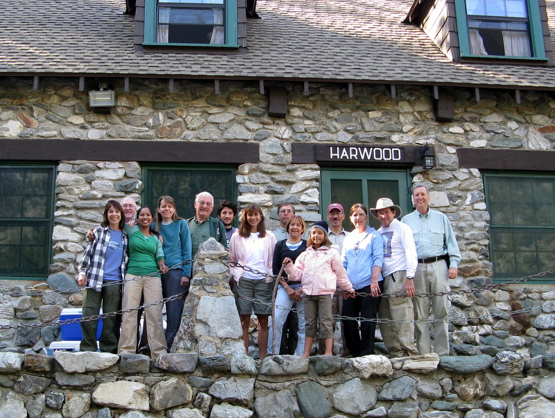

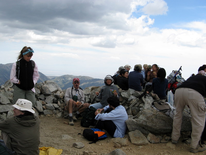
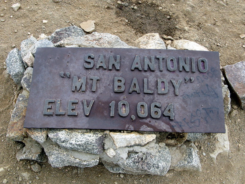
13 hikers departed from Simi Valley in four vehicles shortly after 7:00 a.m. on Saturday morning heading for Mt. Baldy (Mt. San Antonio), the highest peak in the San Gabriel Mountains. After stopping at the Mt. Baldy Visitor Center (in Mt. Baldy Village), we checked in at the Sierra Club’s Harwood Lodge (6,000’), a charming structure built in 1930 [$12-$15 overnight], conveniently located close to the Mt. Baldy Ski Lift and the entrance to Icehouse Canyon. We then drove up to the parking lot at the north end of Mt. Baldy Road, purchased our round-trip ski lift tickets ($14 including a group discount), and rode the ski lift up to Baldy Notch (7,802’). We then set out on a 3.6-mile climb to the top of Mt. Baldy (10,064’), gaining over 2,200’ of elevation on the way. Initially the trail followed a fire road/ski run heading up the mountain to the west for about 1.25 miles, eventually leading to the well-named Devil’s Backbone portion of the trail. This middle portion of the trail led onto a sharp narrow ridge with steep drop-offs on both sides posing a serious danger to careless hikers, but affording great views into the deep gorge of Lytle Creek to the north and into San Antonio Canyon to the south. The trail then narrowed to a pulse-raising 12”-18” width as it wound around the southeast flank of Mt. Harwood, again requiring a keen focus on the trail. After what was probably a shorter time than it seemed, Mt. Baldy peak came into view in the distance. After crossing a saddle, we began climbing the steep trail to the top of the mountain, pausing as needed to catch our breath. Finally we reached the top of Mt. Baldy and were rewarded with a 360-degree view (which was somewhat limited by the overcast day). After resting, eating our lunches, and enjoying the view we retraced our route to Baldy Notch, took the ski lift down to the parking lot, and returned to the Harwood Lodge. We enjoyed a wonderful potluck dinner (turkey lasagna, tossed salad, garlic bread, etc.), talked with other visitors at the lodge, listened to a slide presentation regarding an attempt to expand the boundaries of the Cucamonga Wilderness, and turned in for a good night’s sleep in the dormitory-style sleeping quarters.
Sunday morning we arose, had a quick breakfast, packed up, performed some quick lodge cleanup chores, and then drove down to the parking lot at the mouth of Icehouse Canyon (5,120’), having decided to hike up-canyon until we felt like turning around. Shortly after entering the canyon, the trail entered a beautiful forest of oak, incense cedar, big-cone spruce, ponderosa pine, and sugar pine trees as it rose along a lovely creek which had lots of water in it, providing a feast for the eyes and ears for the next mile. At one point as we hiked through the forest, we came upon a 20-foot stretch of trail (as well as adjoining rocks and logs) that was completely covered by thousands (perhaps tens of thousands) of ladybugs. The creek eventually disappeared underground as the trail climbed ever upward toward Icehouse Saddle (7,580’), but there were many wildflowers along the way. We continued hiking through an open forest of tall pines and firs, reaching Icehouse Saddle in time for lunch. After resting a while and enjoying the view, we returned the way we had come, again enjoying the sights and sounds we’d experienced on the way up. We reached the parking lot after a 7.7-mile round-trip hike with a total elevation gain of 2,600’. We headed back to Simi Valley, arriving mid-afternoon, tired but happy, having hiked nearly 15 miles with a total elevation gain of nearly 5,000’ in two days.
May 23rd 2009 – Mt. McCoy Trail and the Reagan Library
A baker’s dozen worth of hikers showed up for a cool and foggy Memorial Day weekend hike. Spirits were high, on this brief respite from the holiday weekend, so the poor visibility did not put a damper on the morning. It good to have a short, and nearby event, to add spice to our holiday.
May 16th 2009 – Malibu Creek State Park

A dozen hikers joined together on a long exploratory hike of the beautiful and diverse Malibu Creek State Park. We did so much exploring that we were not sure how far we went, but we knew we were “hiked-out” by the time we returned. The hike started at the parking lot and the group headed to the M*A*S*H Site via the Cage Creek Trail and Craig’s Road. We were amazed that the flowers were so abundant this year. We saw blankets of lilac and golden Mariposa lilies, golden yarrow, and orange colored monkey flowers. There have been 150 birds observed in this area by bird watchers, which explains why we saw and heard so many. After visiting the Mash site, we went onto the Malibu Lake Dam that had some nice picnic tables, but not much to see. Next, we doubled back and explored the Forest Trail, which was cool and shady with a view of some large ducks on Cage Creek. It unfortunately had a lot of poison oak, which we had to dodge coming and going. This trail led to Century Lake. Next, we took Craig’s Road to the other side of Century Lake and saw a small family of ducks and stopped to rest. Then, it was on to the Visitor’s Center, which had information on the area and was air-conditioned. Lastly, we headed home with one group blazing a trail through Lookout trail and the rest returning via Cage Creek Trail Overall, this trail received a lot of praise from the folks hiking. It was really pretty and overall not too warm until the end. It is really a beautiful trail.
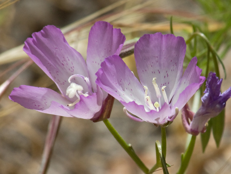
April 30th – Sisar Canyon to White Ledge
Ten hikers met at the Simi Valley car pool point on a cool, foggy morning. The drive to the trailhead led through Moorpark, Fillmore, and Santa Paula to Sisar Road, a narrow paved lane leading to a final half-mile of rocky, rutted dirt road [Note: if you decide to drive on the dirt road, a high-clearance, four-wheel-drive vehicle will make the journey easier]. The sky was clear as the hike began on a shaded dirt fire road ascending to the north along the creek in the canyon; the creek provided the pleasant sounds of flowing water as a welcome accompaniment. Eventually the road turn westward and emerged into the sunlight as it headed ever-upward toward its eventual end at the Nordhoff Ridge Road and we were treated to increasingly panoramic views of the mostly green hillsides of the nearby mountains, including the Topa Topa Ridge. After hiking about 3.5 miles, the trail leading to White Ledge Trail Camp diverged from the fire road. We followed it over a mile to the trail camp which is situated near the creek among towering conifers, admiring various wildflowers along the way. After a welcome and refreshing respite at the trail camp, we retraced our steps downhill back to our vehicles. Upon reaching Highway 150, we stopped at a convenient store for much-needed libations (the day had warmed up as we hiked!). The hike starting from the end of the pavement was about 10 miles with a total elevation gain of about 2,000’; it was about 9 miles for those who drove up the dirt road to the trailhead.
April 28th – May 3rd – Las Vegas Hike-A-Palooza

MONDAY, APRIL 27, 2009 —
Seven veteran Rancho Simi Trailblazers headed to Las Vegas, the home of casino gambling, gaudy (and bawdy) shows – and great hiking! The “campsite” for this outing was the bargain-priced Stratosphere Hotel (which boasts the best/highest views in town from its roof).
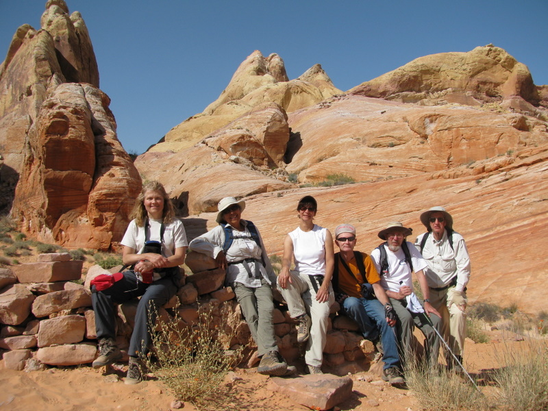
TUESDAY, APRIL 28, 2009 – VALLEY OF FIRE STATE PARK —
Valley of Fire State Park is located only six miles from Lake Mead and 55 miles northeast of Las Vegas via Interstate 15, then east at exit 75. Valley of Fire is Nevada’s oldest and largest state park, dedicated in 1935. The valley derives its name from the red sandstone formations and the stark beauty of the Mojave Desert.
1. Natural Arch Trail – 3.5 miles w/323’ elevation gain
After touring the Visitor Center, we followed a dry wash northwest from the John J. Clark Memorial through fine red sand, passing many hauntingly beautiful rock formations. We turned around after we reached the natural arch (and some other nearby arches) for which the trail is named.
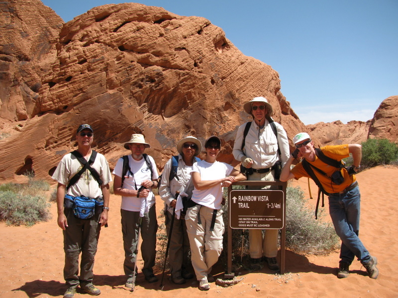
2. Rainbow Vista Loop Trail to the Fire Canyon Overlook – 1.7 miles w/245’ elevation gain
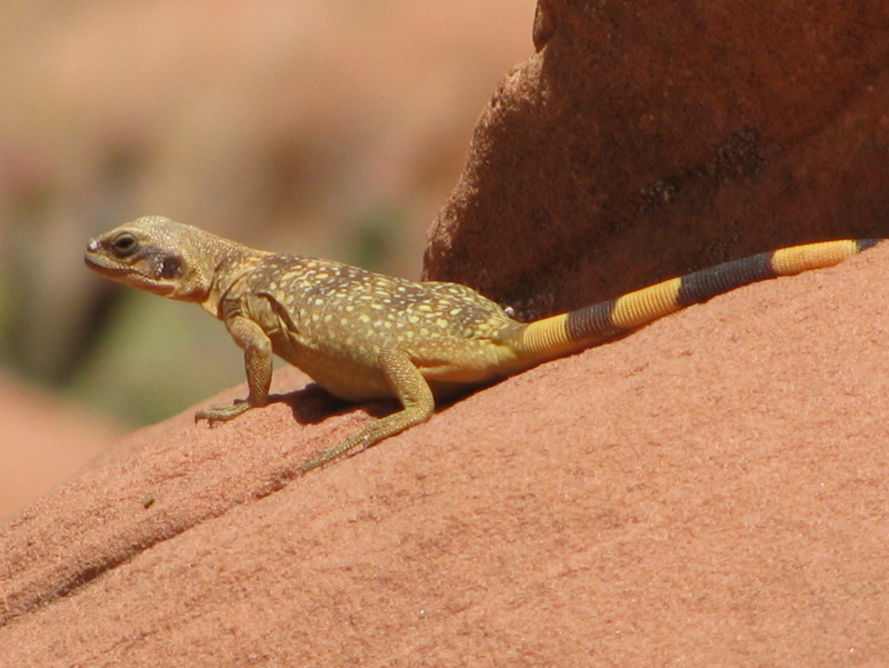
We hiked the southern half of the Rainbow Vista Loop Trail, including a “bonus” excursion into a blind canyon. As we returned to the main trail, we discovered a desert tortoise; it obligingly let us photograph it. We continued along the out-and-back trail to the Fire Canyon Overlook which provided spectacular views of a complex jumble of large red sandstone boulders and canyons. Returning to the Rainbow Vista Loop Trail, we completed its northern half which included the multicolored layered sandstone formations for which the trail is named.
3. White Domes Loop Trail – 1.3 miles w/259’ elevation gain
This trail is named for the white upper portion of most of the boulders and rock walls in the canyon, but this trail is the true “rainbow vista” trail in the park. It is bordered by (and sometimes lined with) a seemingly unending profusion of stunning rock formations composed of layers of rock with amazing colors.
4. Mouse’s Tank Trail (aka the Petroglyph Canyon Trail) – 0.9 miles w/54’ of elevation gain
“Mouse” was an American Indian outlaw who hid out in this area; the “tank” was (and is) a natural pool of water that sustained him in his hideout. There are many petroglyphs carved into (not painted on) the rock walls on the north side of the trail in areas where a black “varnish” already covered the red sandstone (as a result of a natural chemical process).
5. Petrified Logs Trail – 0.4 miles w/50’ of elevation gain
This short trail leads the hiker by several petrified logs. A long time ago some wooden logs were washed down to their current location and minerals gradually replaced all of the wood while retaining the original shapes of the logs.
6. Beehives
Several beehive-shaped rock formations are visible next to the main road that runs through the park.
WEDNESDAY, APRIL 29, 2009 – RED ROCK CANYON NATIONAL CONSERVATION AREA —
Red Rock Canyon National Conservation Area is located 20 miles west of Las Vegas, Nevada. Its 83,100-acre area is managed by the Bureau of Land Management (BLM). It contains a 13-mile one-way scenic drive, many miles of hiking trails, picnic areas, and a Visitor Center. It can be reached easily by following Charleston Boulevard west from Las Vegas.
1. Turtlehead Peak “Trail” – 4.0 miles w/2,000’ of elevation gain This trail is well-defined for a mile or so as it climbs along the side of a dry wash toward a steep gully leading northward to the summit ridge below and to the west of the peak. However, there are many roughly parallel unmaintained “use” trails that climb steeply up the mountainside to the ridge (rising 800 feet in about 0.4 mile); care must be taken to avoid a possibly serious injury. After the strenuous climb to the ridge, we rested and enjoyed the views from there before resuming our climb to Turtlehead Peak, again via our choice of many “use” trails. We took a lunch break at the peak (as well as many photos) and enjoyed the 360-degree view of the Spring Mountains National Recreation Area to the north and west, Red Rock Canyon to the south and west, and Las Vegas to the east and south. After a while we retraced our path down to the parking lot without incident (although on the way up the wash we had encountered a 2 ½-foot rattlesnake that was annoyed at being disturbed by us).
2. Keystone Thrust Trail – 2.1 miles w/473’ of elevation gain
This trail led to an exposed earthquake fault amid lots of layered red sandstone and some gray limestone. It also afforded an excellent view of the east side of the White Rock Hills (which appeared to have been intentionally adorned all over with small white boulders).
THURSDAY, APRIL 30, 2009 – RED ROCK CANYON NATIONAL CONSERVATION AREA —
3. Ice Box Canyon Trail – 2.5 miles w/342’ of elevation gain
An easy trail bordered by wildflowers led to the entrance of the shaded canyon; it then led along the north side of the canyon on a shelf overlooking the creek, but the shelf narrowed until we had to descend into the dry streambed. Our trip upstream required quite a bit of boulder-hopping and some bushwhacking. We passed a tall dead ponderosa pine tree (a landmark) in the streambed; a short distance beyond the tree we reached two (perhaps three) water-sculpted pools at the base of a waterfall. We turned around and returned to the parking lot, stopping along the way to help a couple of young lads who said they were lost (and they had no water).
4. Pine Creek Canyon Trail – 3.8 miles w/1,249’ of elevation gain
The trail led down from the parking lot into and westward across a dry wash; it then passed through an abundance of wildflowers as it continued toward and into the canyon to the remains of Horace Wilson’s old homestead and a nearby grove of large ponderosa pine trees. From there we continued up the canyon via a narrow trail and then up the creek itself, dallying by the running water and watching two rock climbers who were scaling a nearly vertical wall on the south side of the creek. As we returned downstream, we completed a loop trail around the old homestead and returned to the parking lot.
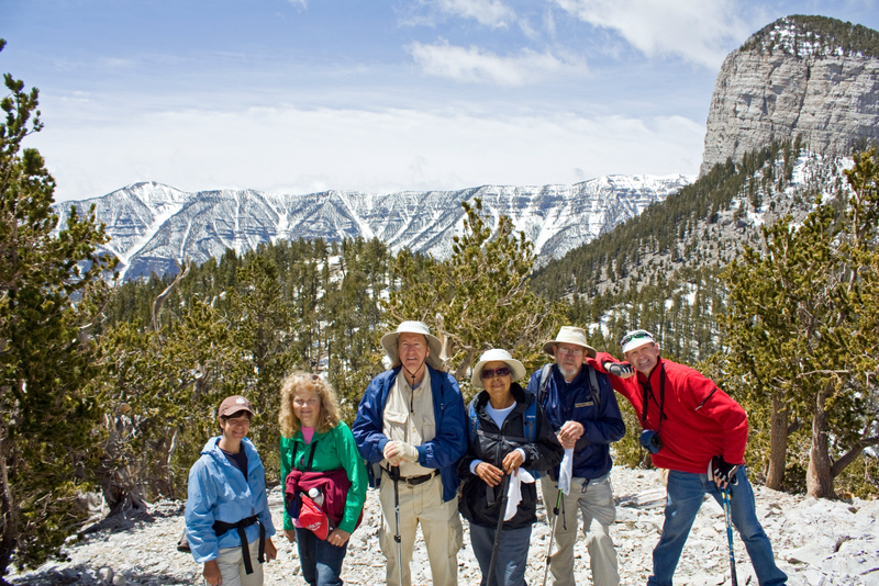
SATURDAY, MAY 2, 2009 – MT. CHARLESTON (in the Spring Mountains National Recreation Area) — The Spring Mountains are a north-south-aligned range of mountains that stretch 55 miles along the west side of the Las Vegas Valley. They are anchored by Mount Charleston (11,918’) to the northwest of Las Vegas. The mountains rise from desert valleys that are at elevations below 2,000’, creating a variety of climate and vegetation zones. Hiking trails can be reached by motor vehicle via either Kyle Canyon Road (Hwy 157) or Lee Canyon Road (Hwy 156) which has ski runs at its upper end; both roads head west from Highway 95.
1. North Loop Trail – 4.4 miles w/1,550’ of elevation gain
This beautiful trail rises a little over two miles from its trailhead on Highway 158 (a connector road high up on the mountainside that connects Hwy 156 and Hwy 157) through a pine-fir forest to a “high point” which affords fantastic 360-degree views of mountains, desert, and city. We encountered easily-navigated patches of snow on the trail until we neared the “high point.” Then the trail was completely covered by snow/ice. We hiked alongside the snow/ice to the “high point” where we leisurely enjoyed the panoramic views. After a little exploration, we decided that it was too dangerous to continue on toward the Trail Canyon junction (we had originally intended to descend that canyon to a shuttle vehicle), so we returned the way we came.
2. Fletcher Canyon Trail – 4.0 miles w/800’ of elevation gain
The first mile of this trail was quite easy; it was gravel-filled and climbed gently alongside a tree-lined streambed to its official end. The trail continued for another mile in a scenic winding slot canyon which had water running in the creek, several snow banks, and required some boulder-hopping. Eventually we reached a point in the canyon beyond which we could not go so we retraced our path to the parking area.
NOTE: Each of the hikes described above had its own unique feature(s); no two were exactly alike. Everyone agreed that this outing exceeded expectations and was a rousing success.
April 25th 2009 – 2nd-chance Day 2 Backbone Trail hike from the Mishe Mokwa trailhead to the Sycamore Canyon

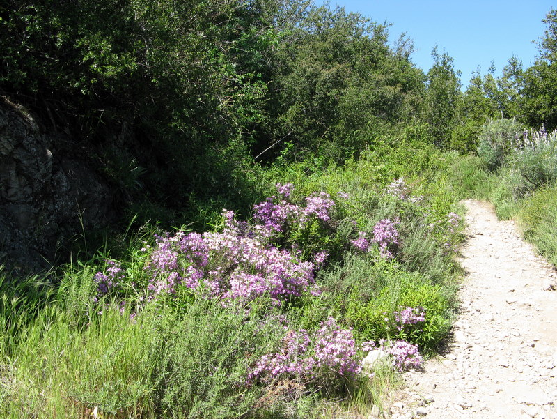
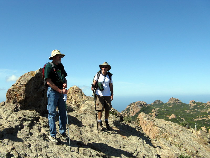
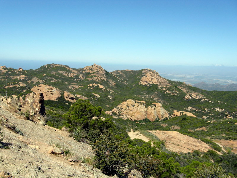

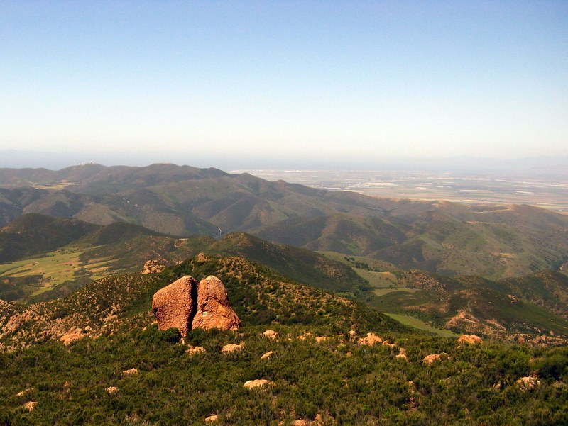
Seven hikers gathered for a second opportunity to hike the second section of the Santa Monica Mountains Backbone Trail on a pleasantly cool, spring morning. The hike began at the Mishe Mokwa trailhead located at the northern end of Yerba Buena Road in Triunfo Pass. The trail rose to the west through heavy chaparral to a junction with a short connector trail which we followed to the Sandstone Peak Trail. The new trail rose gradually for about a mile while it provided spectacular views down the canyon to the north until it reached the path leading up to Sandstone Peak. We climbed to the top of Sandstone Peak (elevation 3,111’), the highest point in the Santa Monica Mountains, where we enjoyed a 360-degree view of the mountains, valleys, and the Pacific Ocean. Returning to the main (Backbone) trail, we followed it north and then west to its junction with the Mishe Mokwa trail. Continuing to the southwest on the Backbone trail, we were treated to great views of the boulder-rich Tri-Peaks area. The trail then descended to Chamberlain Rock (named for Henry Chamberlain, a beloved local who died in 1945); we stopped there for a short lunch break and took advantage of the panoramic views of Serrano Valley to the southwest and Big Sycamore Canyon and beyond to the west. Resuming our journey toward the bottom of Big Sycamore Canyon, we began encountering an increasing variety and quantity of pretty wildflowers. We also encountered many volunteers performing trail maintenance in observance of Santa Monica Mountains Trails Days (April 24-26); we thanked each of them for their trail work [without which there would soon be no trails to hike]. As we approached the Old Boney Trail junction, there was an unexpected, but much-appreciated, profusion of wildflowers. We followed the Old Boney Trail to a junction with the Serrano Valley Trail (leading eastward). We stayed on the Old Boney Trail as it descended to the main fire road in the bottom of Big Sycamore Canyon. We then followed the fire road toward the ocean, passing the junction with the portion of the Backbone Trail known as the Wood Canyon Vista Trail which descends from the western ridge (part of the first section of the Backbone Trail), and eventually – to the eternal gratitude of our weary bodies – reached our shuttle vehicles in the Sycamore Canyon Campground parking lot. After returning (by motor vehicle) to the Mishe Mokwa trailhead parking lot to pick up the remaining vehicles, we headed home, having completed a 12.9-mile hike with 1,534’ of elevation gain and approximately 3,300’ of elevation loss.
April 18th 2009 – Towsley Canyon
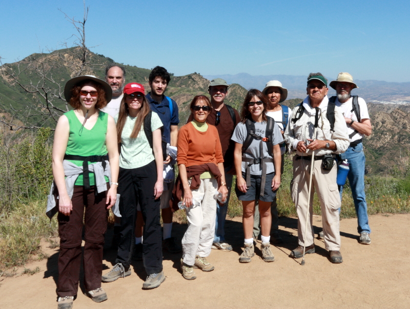
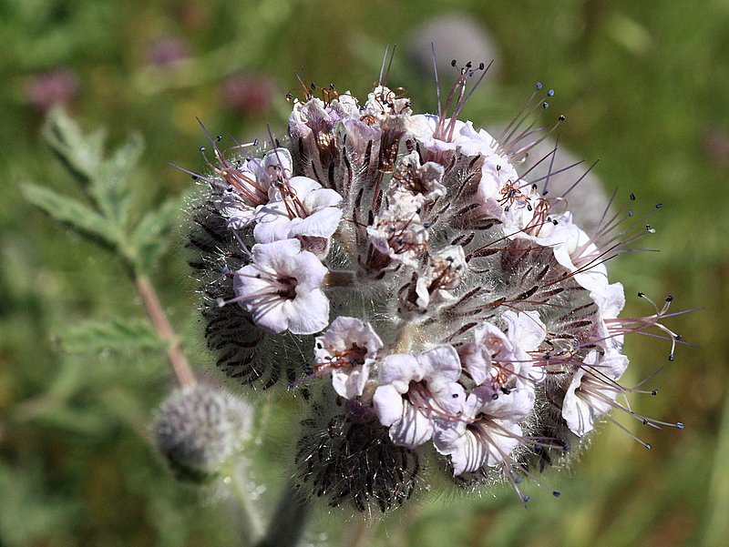
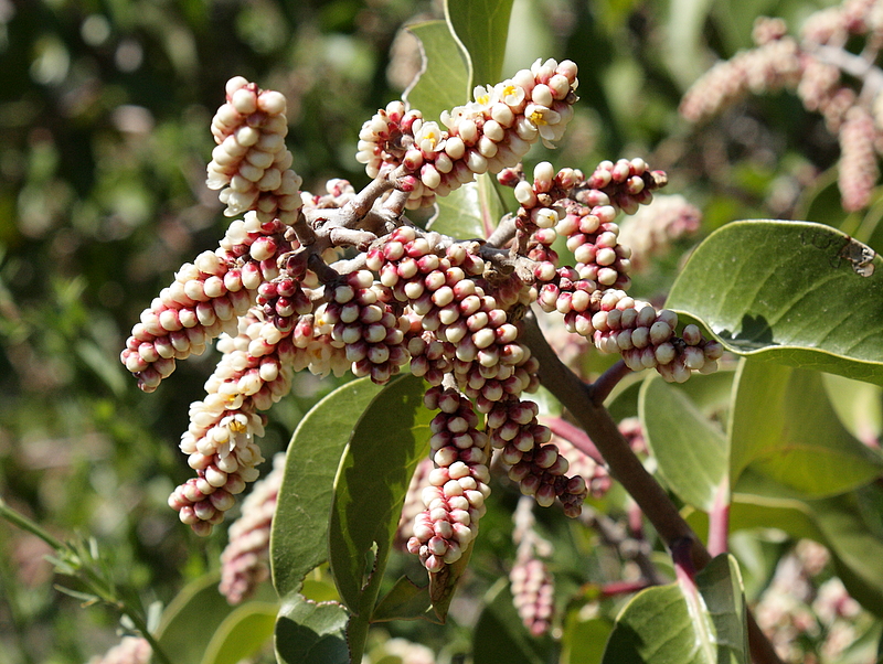
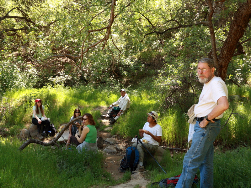
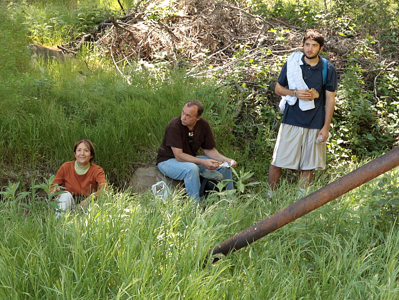
Eleven of us hiked about 6.5 miles on Towsley Canyon loop trail. There was plenty of elevation gain too. It was a warm day, but fortunately the trail was shady most of the way and we were able to get back before the true heat hit. We saw numerous flowers, and were especially impressed with the Chocolate Lilies and yellow Bush Poppy trees that are rarely seen on our other hikes. The hike also featured streams, rock formations and views of the Santa Clarita valley. We had some excitement at the end of our hike when we saw fire trucks, police cars, and ambulances. A hiker from another group was bitten by a rattlesnake. Anti-venom was administered within minutes of their arrival, and bitten hiker was doing well by the time we departed.
April 4th 2009 – Backbone Trail Part 8: Trippet Ranch to Will Rogers State Park Shuttle
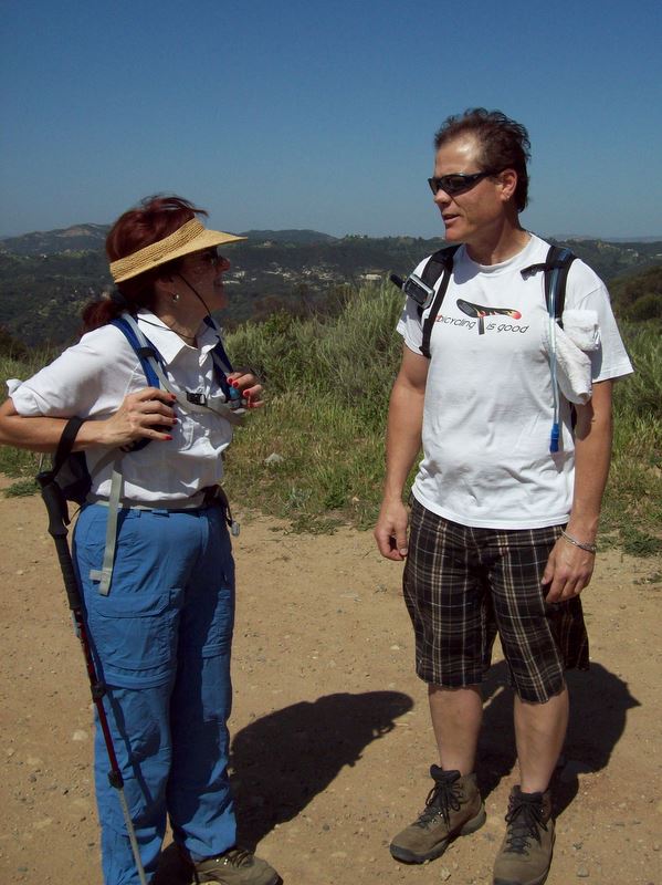
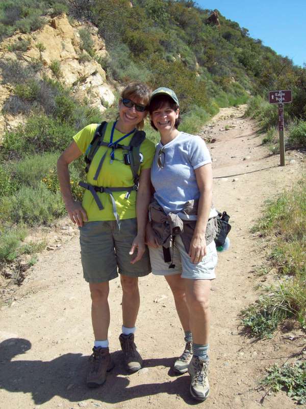
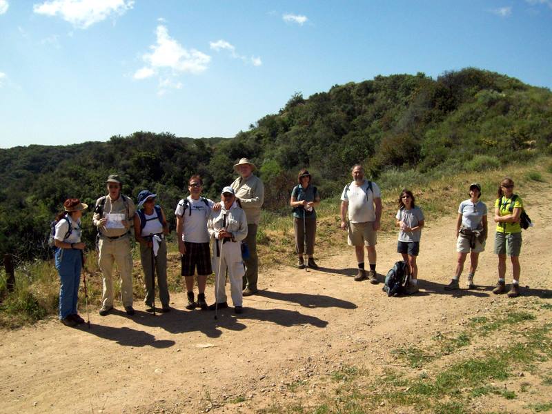
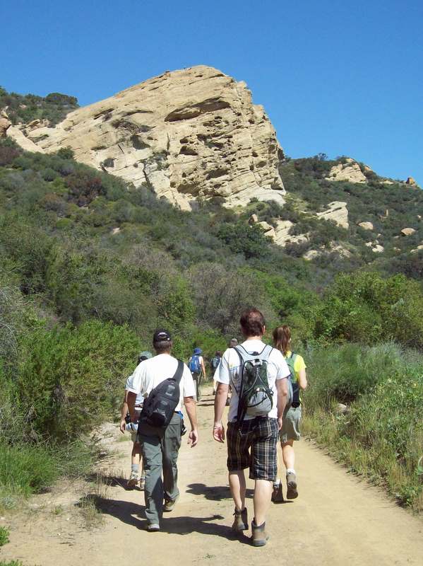
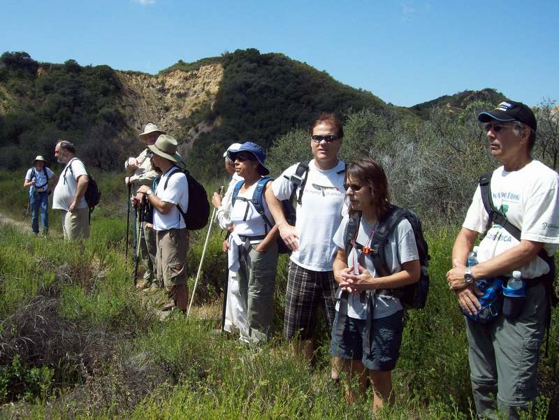
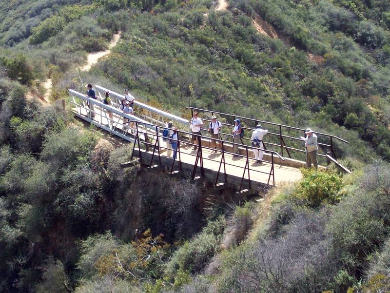
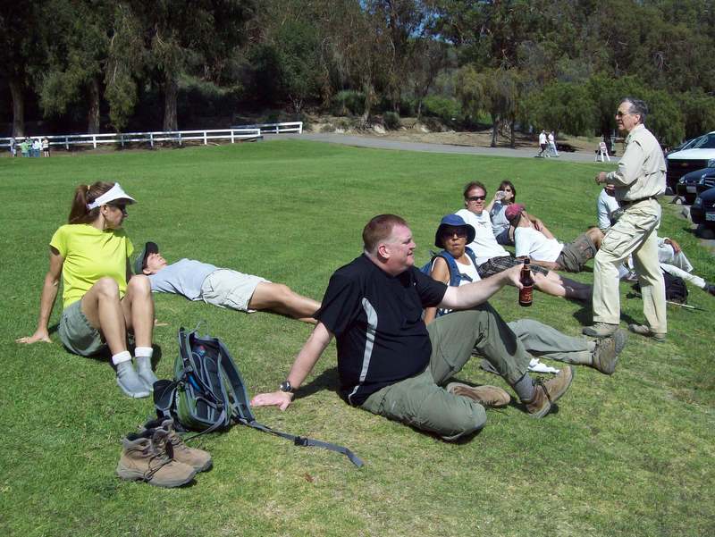
Seventeen hikers gathered at the Simi Valley car pool point for the opportunity to hike the eighth (and final) section of the Santa Monica Mountains Backbone Trail. After a lengthy car shuttle, the hikers left the parking lot at Trippet Ranch (in Topanga State Park) and followed the Musch Trail as it climbed the heavily shaded mountainside, passing several meadows, scattered wildflowers, and seasonal stream beds to Eagle Junction. After a short break, the hike continued along the dirt fire road below Eagle Rock, climbing to “Hub Junction” to the east affording distant views to the north and the south. Continuing mostly uphill to the east on the dirt fire road, the route passed Cathedral Rock. Eventually the road headed south toward Temescal Ridge, but we turned left onto an actual trail and soon began the long descent toward Will Rogers State Park, catching brief glimpses of the Los Angeles basin along the way. After a short lunch break, we reached “Chicken Ridge,” a well-named narrow isthmus with dangerous drop-offs on both sides made navigable by two bridges; the bridges provided excellent views. Continuing downhill, we reached the end [or beginning] of the Backbone Trail in Will Rogers State Park having hiked 11.6 miles with 1,859’ of elevation gain. After resting briefly on the broad green lawn in front of the ranch house and reflecting on the successful completion of the eight Backbone Trail-segment hikes (a total of 72 miles with about 11,000’ of elevation gain) over a two-month period, we headed home, perchance to dream of the John Muir Trail.
March 28th 2009 – Backbone Trail Part 7: Saddle Peak (Stunt Road) to Trippet Ranch Shuttle
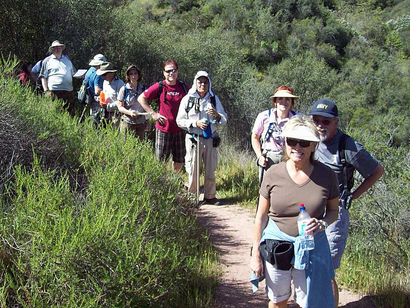
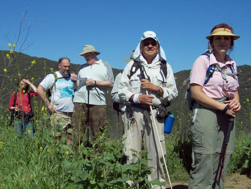
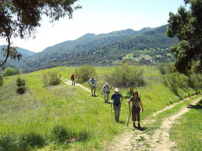
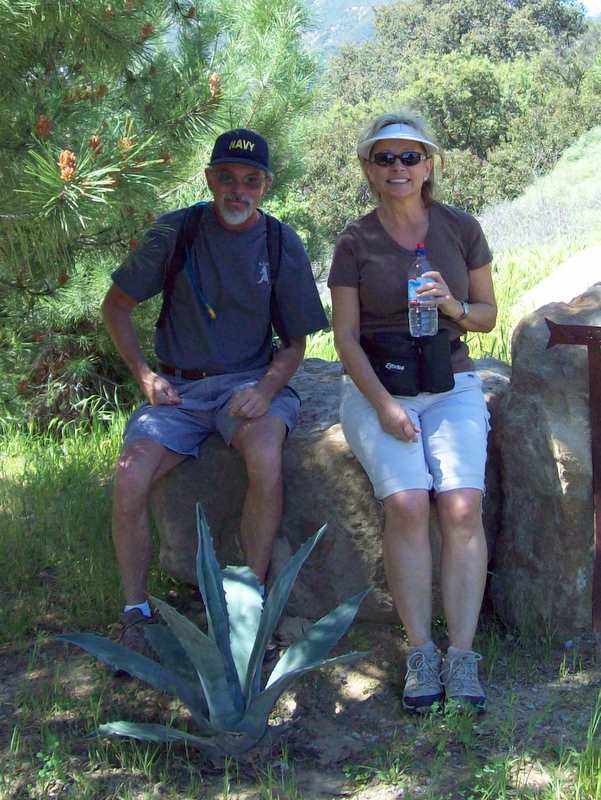
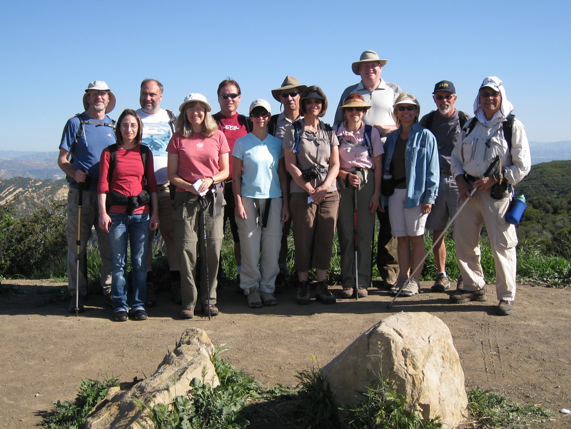
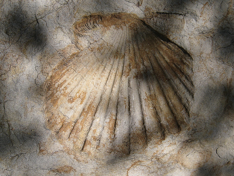
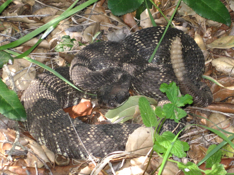
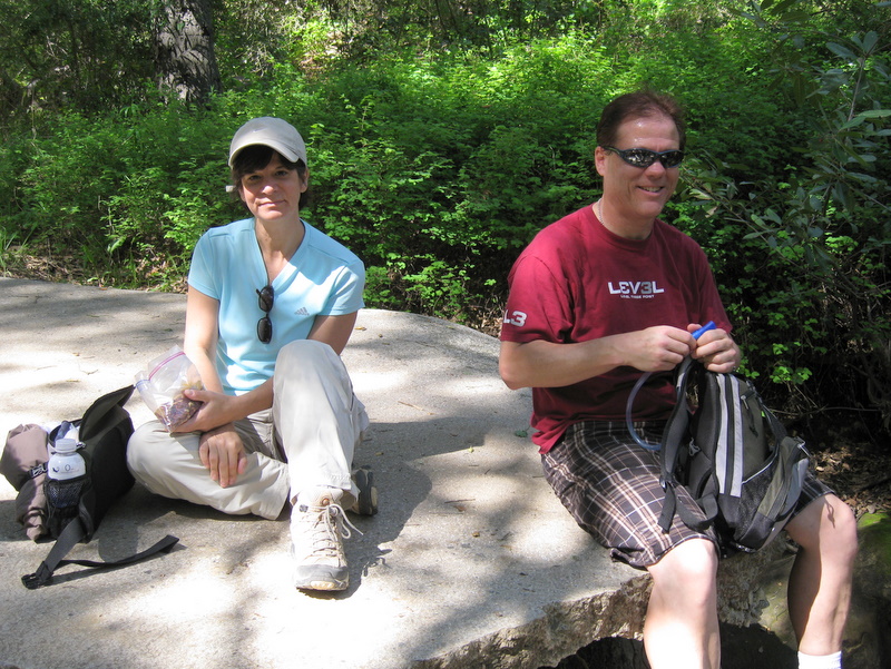
Thirteen Traiblazers Began at Stunt Road, hiked down Hondo Canyon and up the Dead Horse Trail, finally arriving at Topanga State Park Trippet Ranch. We were treated to expansive views and a warm day peaking in the mid-seventies. Soon after the hike began, we saw a good many fossils. A bit past the halfway point in Hondo Canyon, we were suddenly alerted by a large rattlesnake, just off the trail on the right. This particular snake was rattling for all he was worth, but showing no signs of argression. There was a fine showing of flowers today, including Fuchsia-flowered Gooseberry, California Buttercup, Woodland Star and Large Flowered Lotus. We’re looking forward to the last segment of the Backbone Trail next Saturday and also the safe return of our Costa Rica travelers.
March 20th 2009 – Work Party: Lower Stagecoach Trail
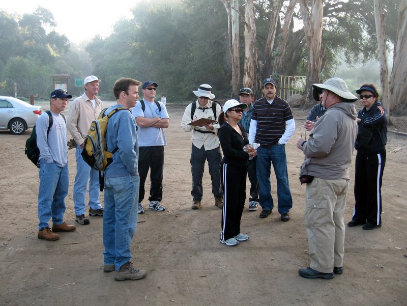
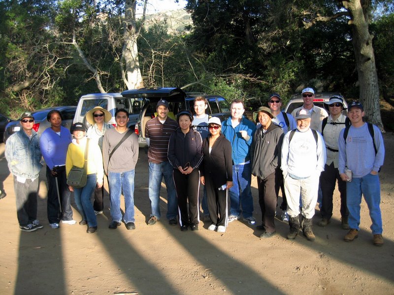
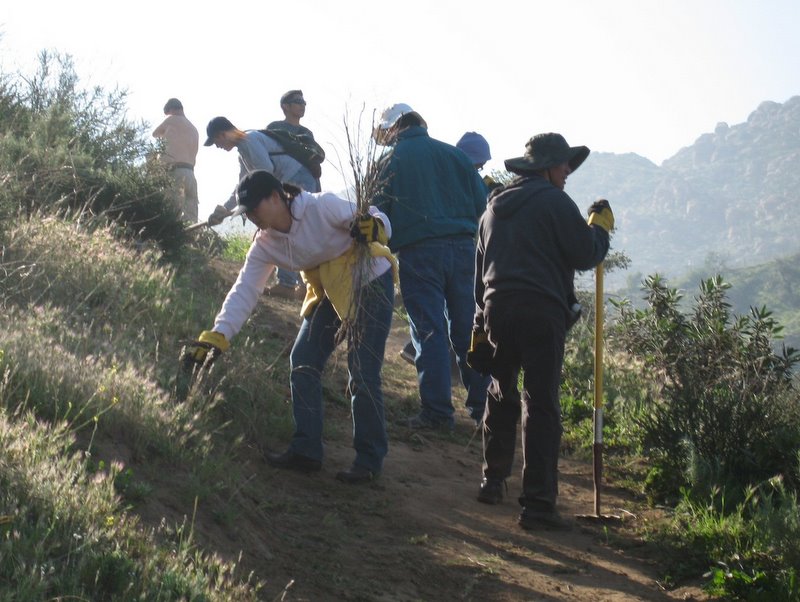
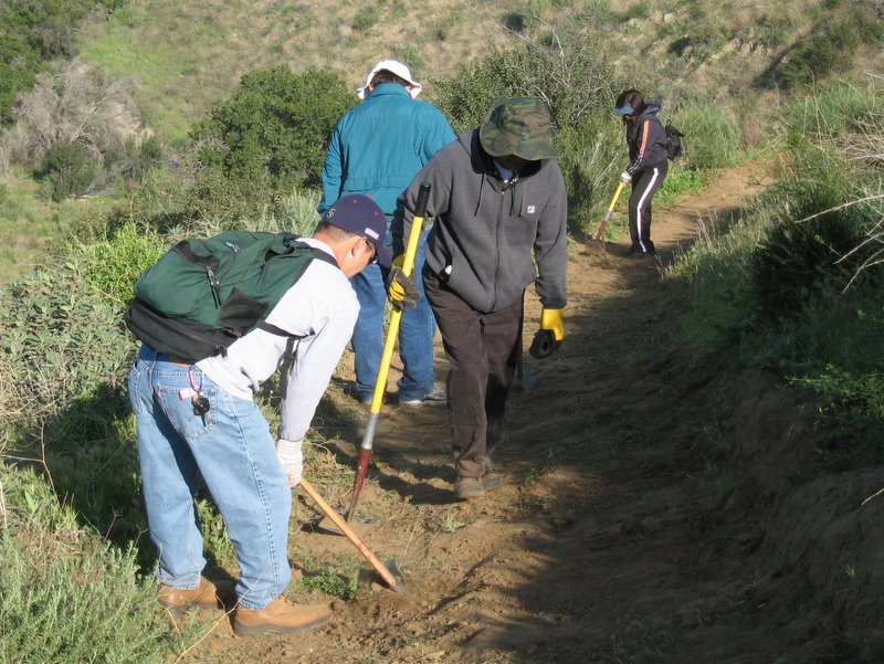
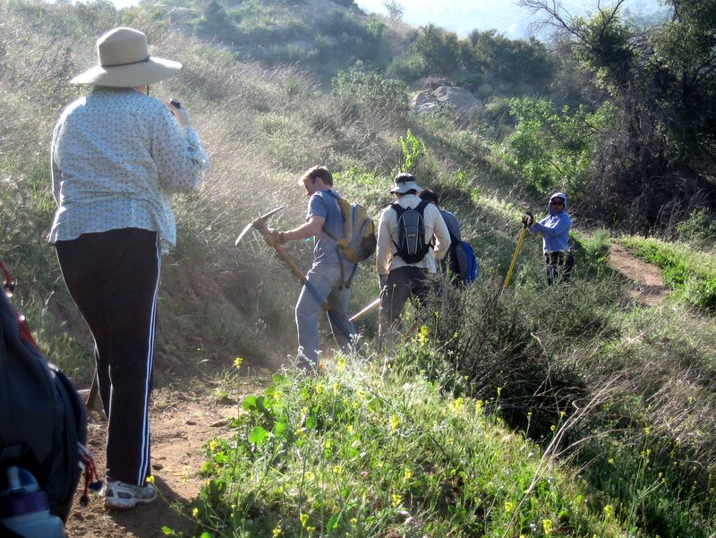
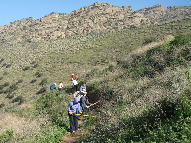
Our March Work Party was held on Friday, March 20th. Baxter BioScience, a Thousand Oaks-based firm, closed down their facility for one day. Their employees were still paid, and they asked each employee to give one day of community service. The following employees took part in our maintenance effort on the Lower Stagecoach Trail: Tony Tamac, Estrella Bergstrom, Yue Wang, Jesus Cunanan, John Morris, Stan Enomoto, Dennis Du, Scott Owens, James Kreuger, Coby Wheeler, Myriam Arily, Susan Nanziri, Enyi Li, Rey Catuciano, and one other person whose name we couldn’t decipher. Trailblazers in attendance were Martin DeGoey, John Sabol and Mike Kuhn. Many thanks to Baxter BioScience and all of the individual participants.
March 14th 2009 – Backbone Trail Part 6: Malibu Canyon Road Trailhead (Piuma Road) to the Saddle Peak/Stunt Road Trailhead Shuttle
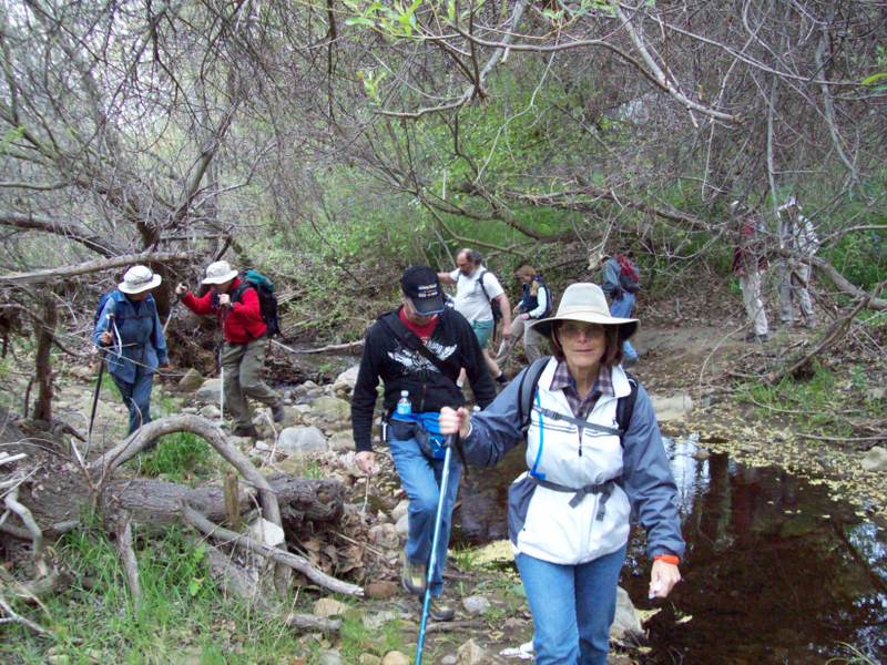
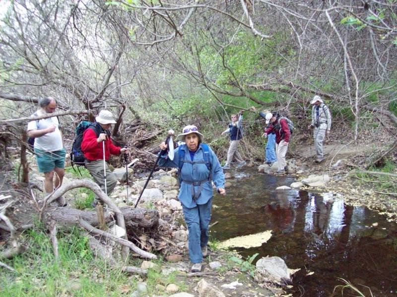
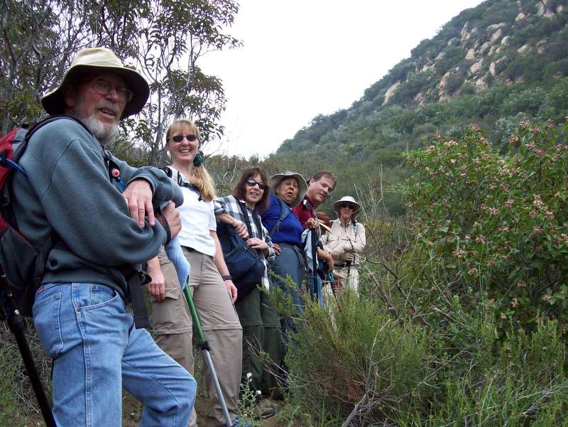
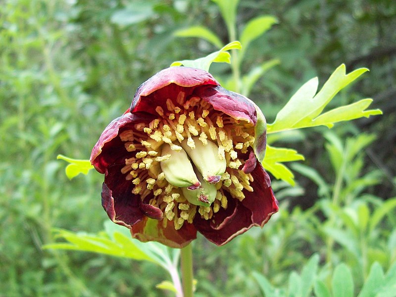
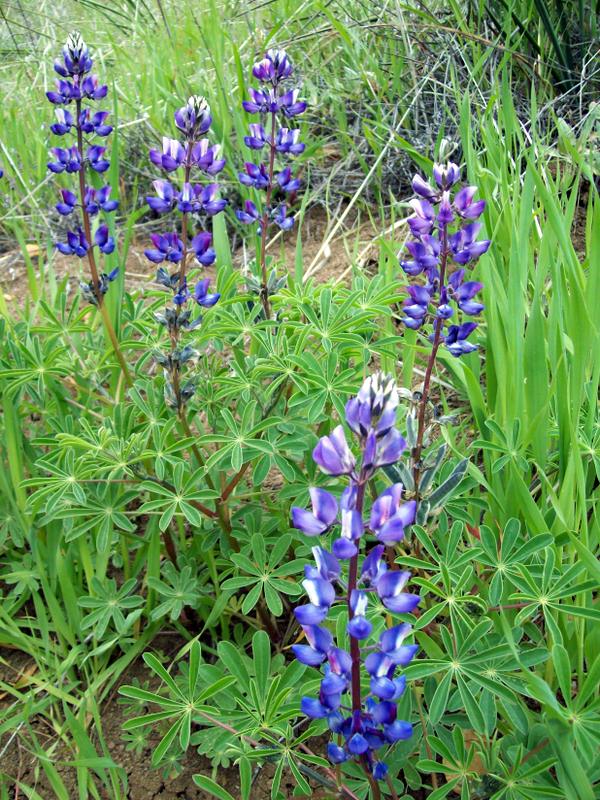
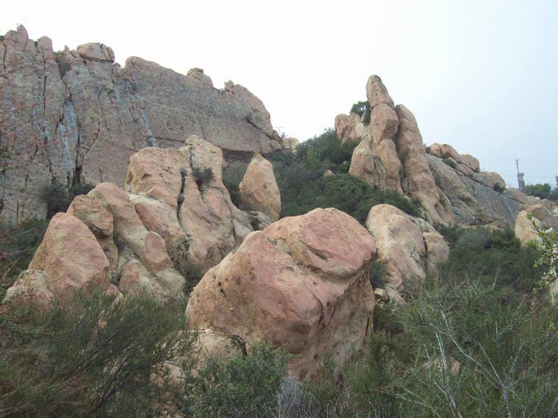
Fifteen hikers assembled for a crack at the sixth section of the Santa Monica Mountains Backbone Trail on another hiker-friendly crisp, cool, late-winter morning. The hike began at the Malibu Canyon trailhead which is actually located a couple of hundred yards east of Malibu Canyon Road on the south side of Piuma Road (there’s a sign). The trail immediately crossed a seasonal creek and began climbing to the east along the heavily shaded north side of the mountain; ferns were abundant and various wildflowers were blooming. The trail provided an excellent warm-up as it gained about 350’ per mile for the first 2.5 miles. It then climbed noticeably more steeply through continuing shade for the next 2.5 miles as the trail reached a junction near Stunt Road. After a quick lunch break, we took the right fork and continued up the mountain toward (but not to) Saddle Peak. As we neared the highest point of our hike, we were presented with a stunning view of some beautiful rock formations that towered above us. We continued on up the trail to the final fork in the trail; we took the left fork and descended past a large water tank to Stunt Road and our shuttle vehicles, thus completing a 7.1-mile one-way hike with about 2,700’ of elevation gain. Next up: Day 7.
March 7th 2009 – Backbone Trail Part 5: Latigo Canyon Trailhead to Malibu Canyon Trailhead Shuttle
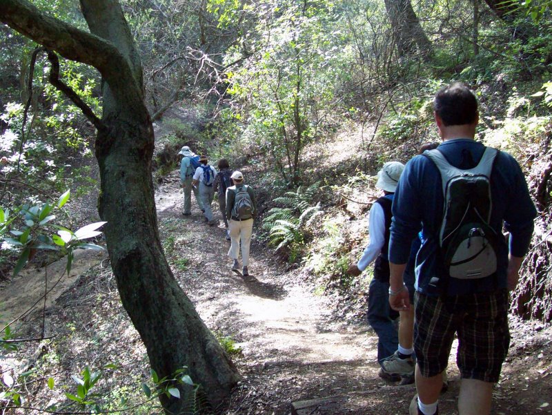
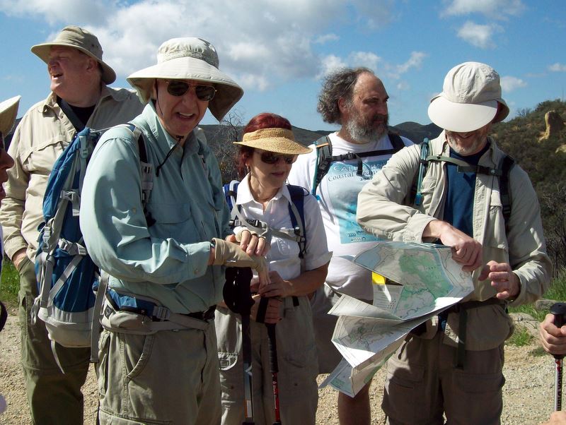
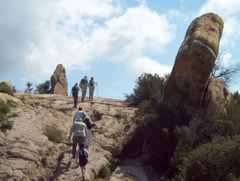
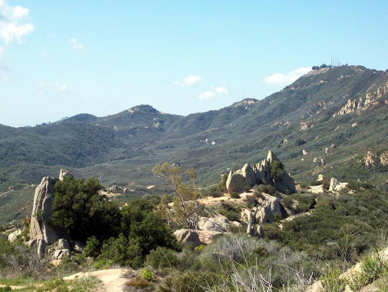
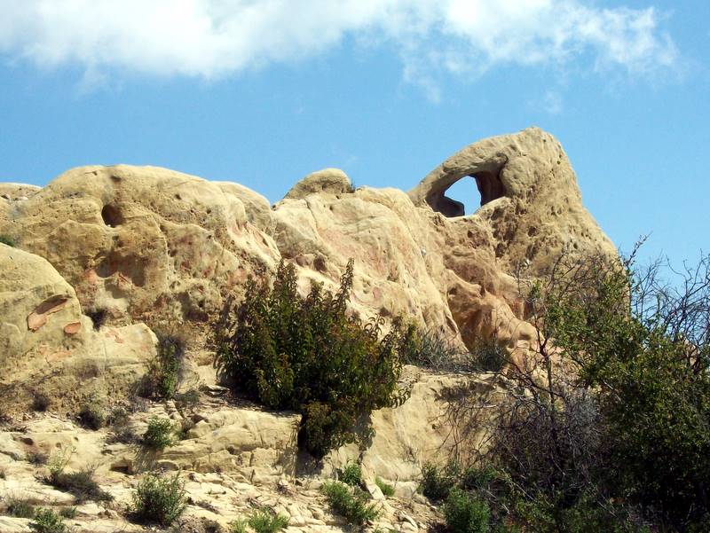
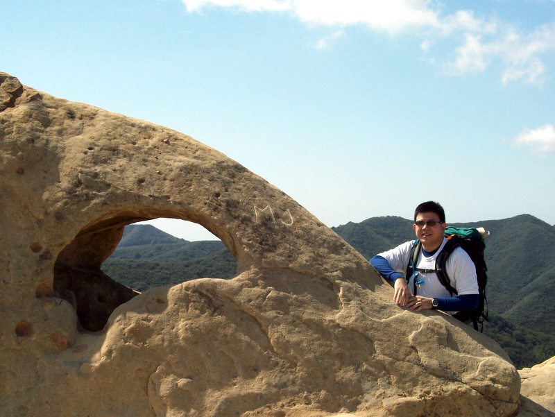
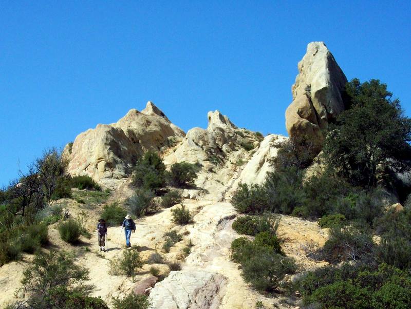
Sixteen hikers tackled the fifth section of the Santa Monica Mountains Backbone Trail on another crisp, cool, late-winter morning (perfect for hiking). The hike began at the Latigo Canyon trailhead and headed northwest down into a heavily shaded canyon; it then led northeast through a riparian woodland along a seasonal creek passing several meadows filled with bright green grass; the trail then rose and fell as it wound along chaparral-covered slopes on its way to Corral Canyon Road. After crossing the road, we soon found ourselves walking among (and on) a variety of stunning sandstone rock formations. We decided to take our lunch break atop the highest such formation where we examined the ruins of an old dwelling and enjoyed the panoramic views afforded by our high perch. After lunch, we headed east along the Mesa Peak Fire Road toward (but not to) Mesa Peak. This section of the hike provided excellent views of both the mountains to the north and the ocean to the south. About seven miles into the hike we turned north and began a three-mile descent through an oak woodland into Malibu Canyon where we had left our shuttle vehicles, thus completing a 9.8-mile one-way hike with about 1,290’ of elevation gain. We retrieved the vehicles we had left at the Latigo Canyon trailhead and headed home, already anticipating hiking the next section of the Backbone Trail.
February 29th 2009 – Backbone Trail Part 4: Encinal Canyon Road Trailhead to Latigo Canyon Road Trailhead Shuttle
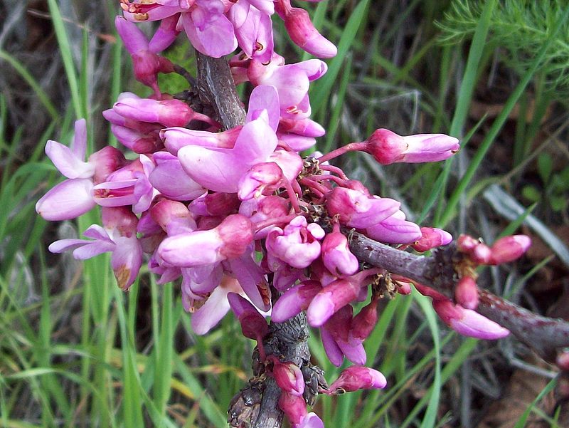
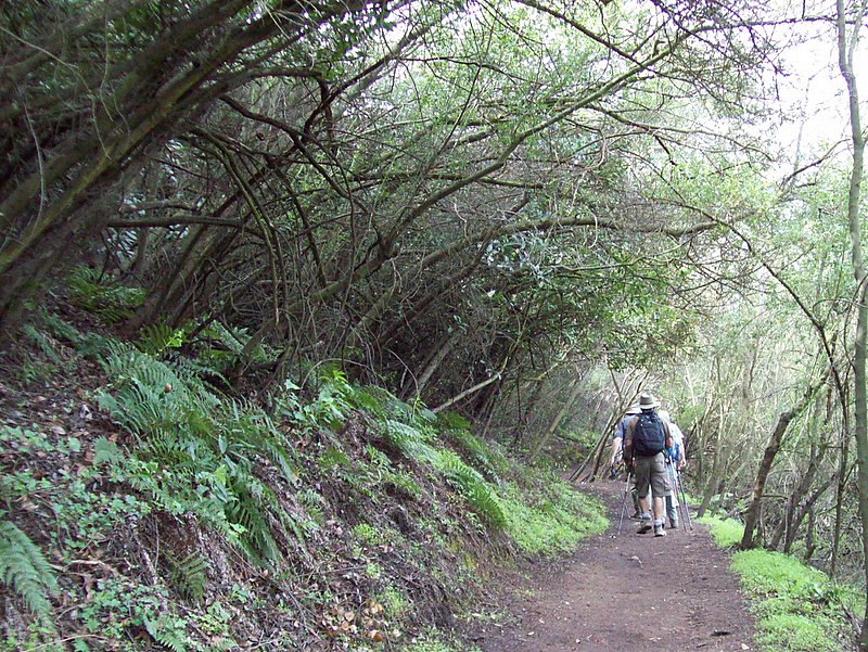
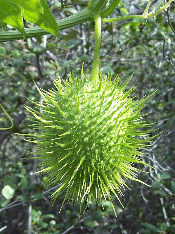

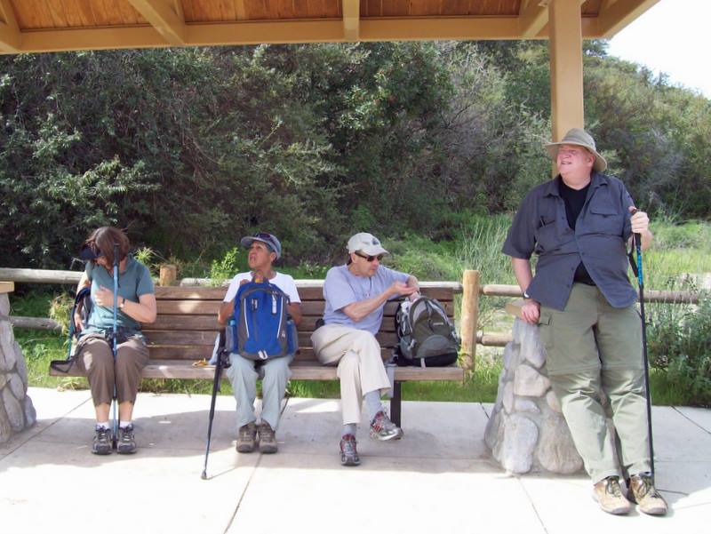
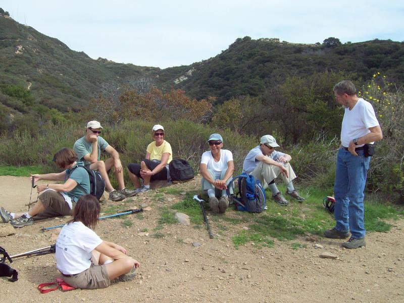
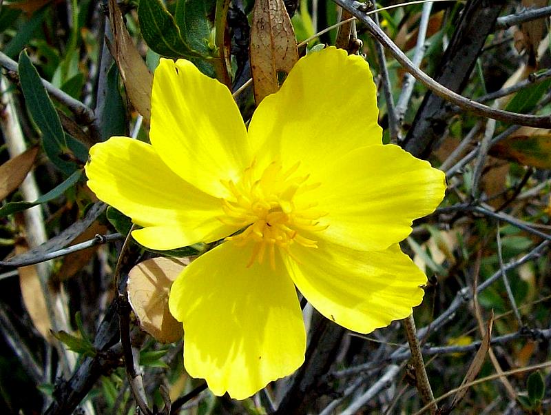
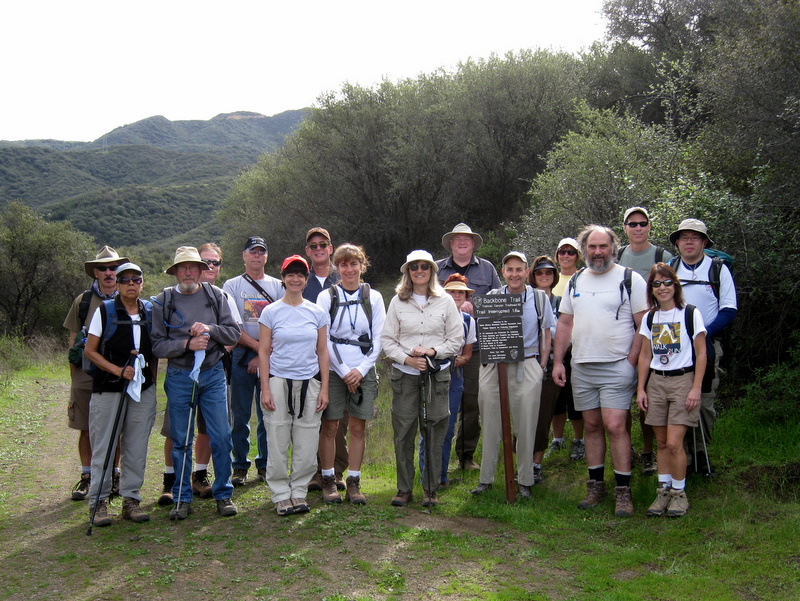
Nineteen eager Trailblazers hiked the fourth segment of the Backbone Trail today. Although the hike was a relatively short seven miles, compared to other backbone segments, the nearly 1,700’ elevation gain provided a good workout. The weather was a bit warmer than usual because of a mild Santa Ana condition. Shirt sleeves were the rule for the day. An early spring seems like it’s here and were treated to quite a show of early wildflowers.
February 21st 2009 – Backbone Trail Part 2: Mishe Mokwa Trailhead to the Big Sycamore Canyon Trailhead Shuttle
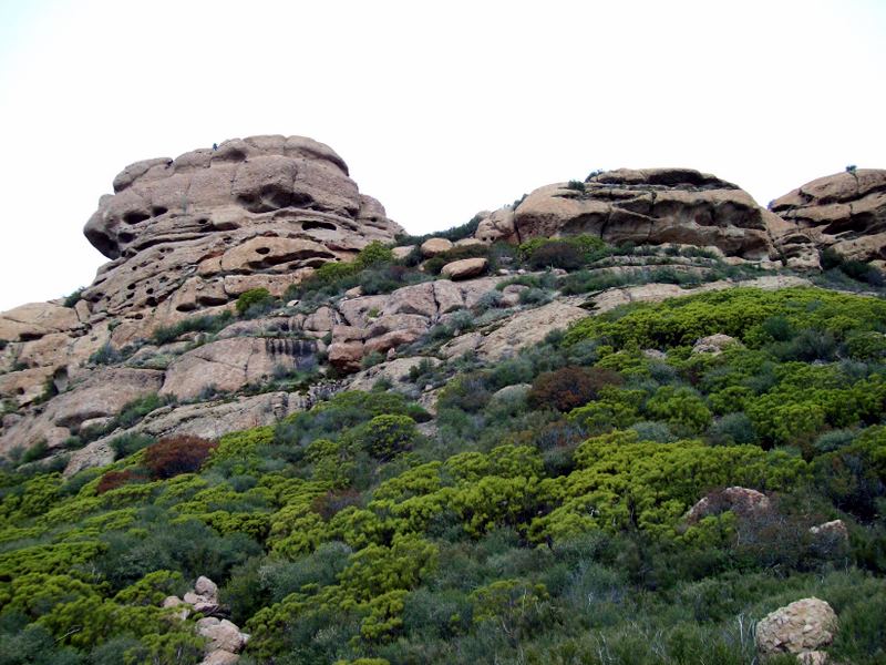
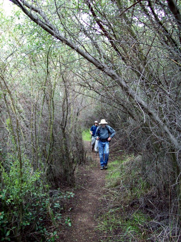
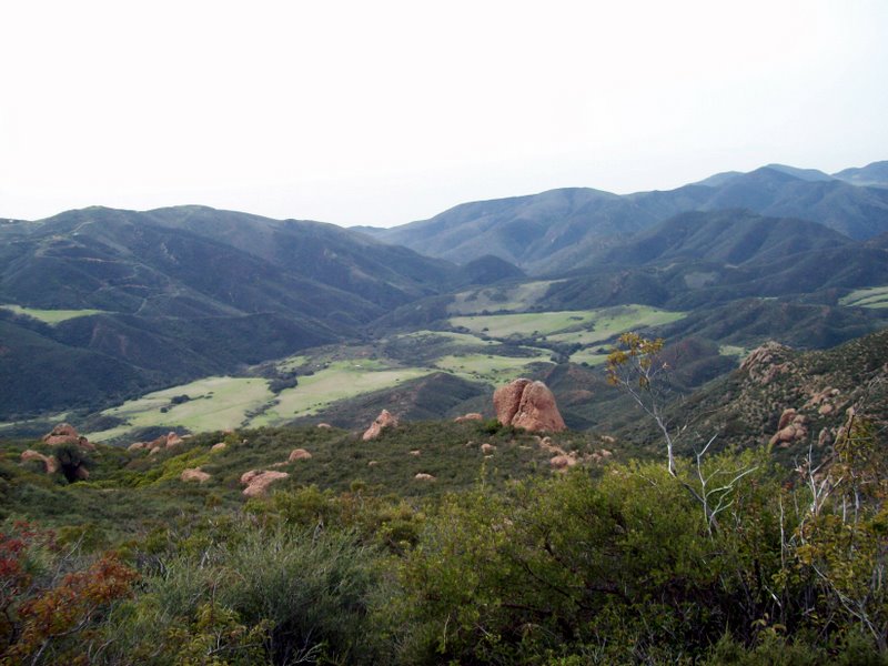
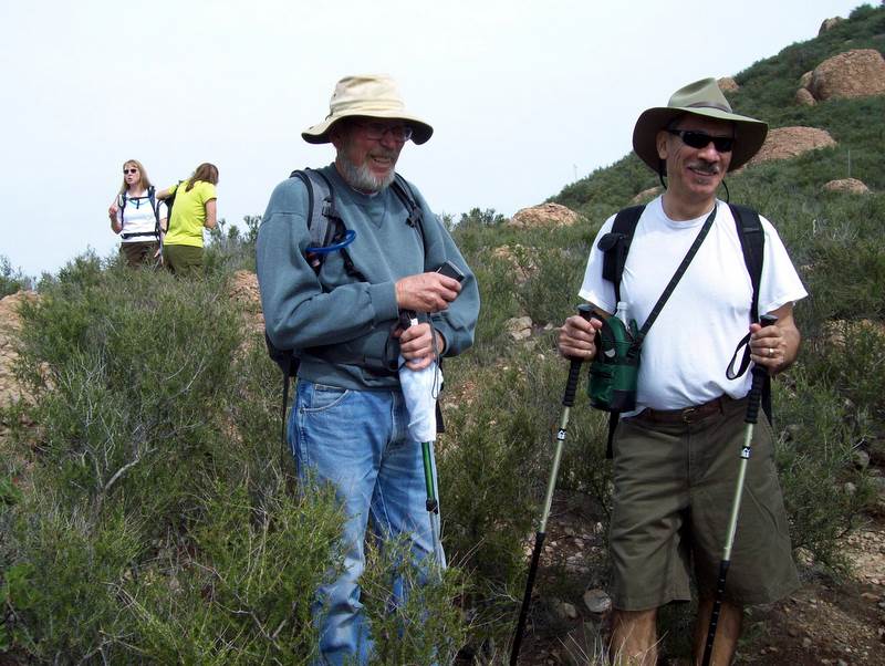
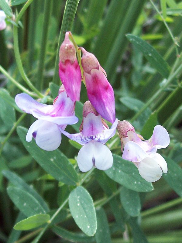
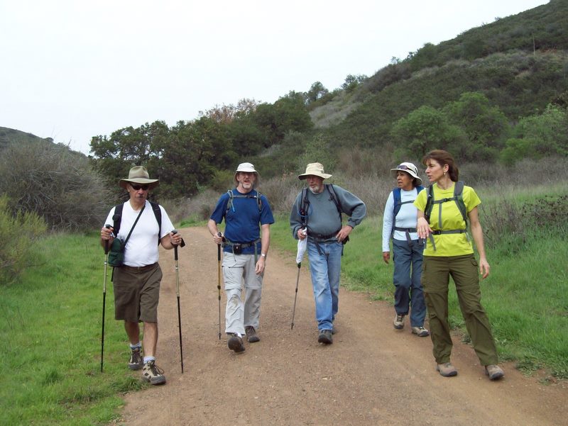
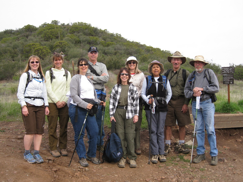
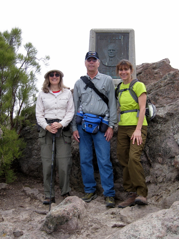
On an overcast and cool day, ten hikers conquered the second segment of the backbone trail. Without question, this segment is the most difficult, yet most panoramic, of the eight total segments. At 12.5 miles in length, 900’ elevation gain and 3,000’ elevation loss, it’s exhausting and yet exhilarating to finally reach the beach at Sycamore Canyon. Segment two was originally scheduled for the first Saturday of February, but was cancelled because of a rainstorm that day.
Our recent rainstorms have been a godsend, bringing us the green grasses and the beginning of what promises to be a grand wildflower season. We were treated to hundreds of early season Shooting Stars, Wild Pea, and a patch of rare Indian Warrior. New life was spring up all around us. We’re all looking forward to segment four with great anticipation.
February 14th 2009 – Friday Morning Work Party – Chumash Trail
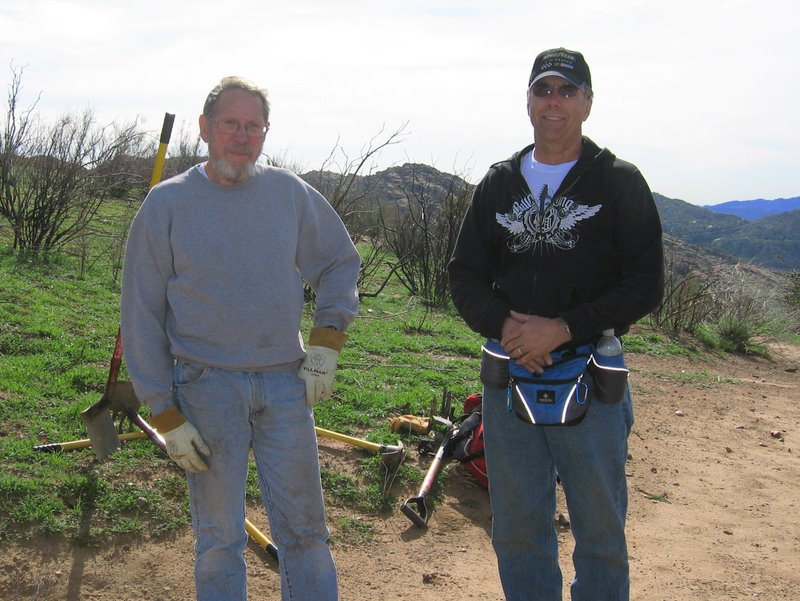
The Trail Blazer work party this month was held on Friday 20 Feb. on the Chumash Trail. We went up to roughly the 1-3/4 mile mark to fix an area where a trail edge slide had narrowed the trail. Then worked down, pulling old brush stumps sticking up in the trail. Replanted the 1-1/2 mile marker post on the uphill side of the trail as the downhill side site was too close to the trail. We pulled in a section of berm just below Hamilton’s Saddle. We removed some large rocks in the center of the trail people were tripping over. The last thing we did was dig a trench for water drainage at the low spot at the start of the trail at the Flanagan trailhead. The mud was like peanut butter. Just stuck to our tools. Many thanks to Doug Marsh, Roger Steffen and John Sabol.
February 14th 2009 – Backbone Trail Part 3: Backbone Trailhead to Encinal Canyon Road Trailhead Shuttle
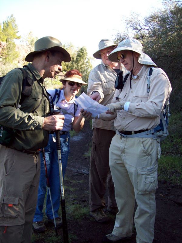
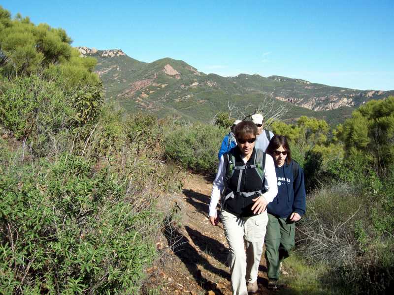
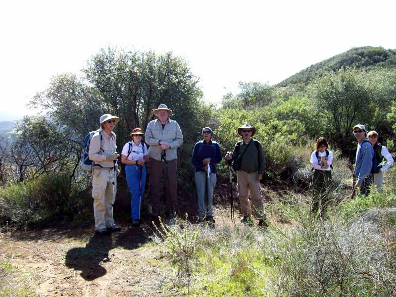
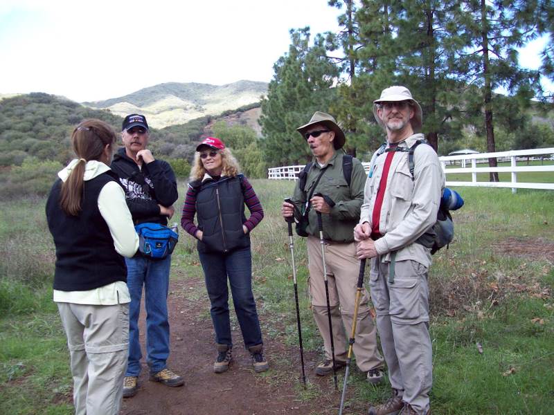
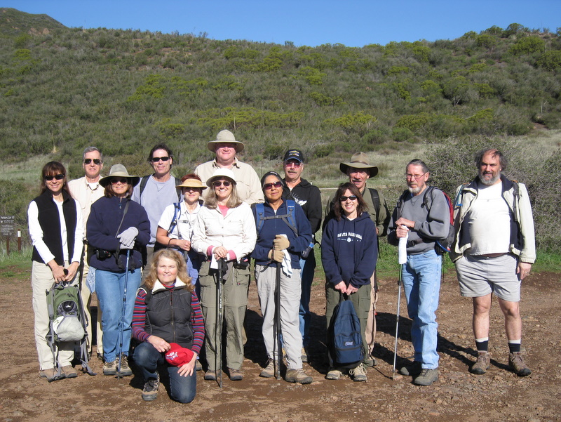
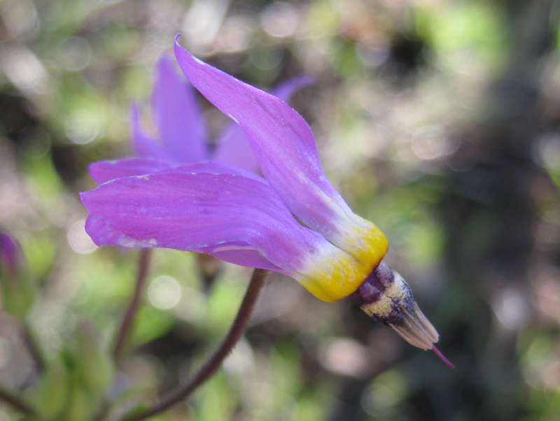
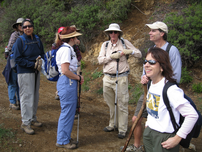
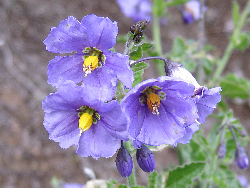
On a clear, chilly winter morning, 15 hikers assembled at the Simi Valley carpool point ready to tackle the third section of the Backbone trail. A couple of days of rain immediately preceding the hike had washed the smog from the sky and left the newly washed foliage sparkling brightly in the sunlight; a few stretches of the trail were a little muddy, but most of the trail was in good shape. The road to the trailhead wound through the Santa Monica Mountains providing beautiful views along the way, particularly to the north where the Topa Topa (Chumash for village) mountains wore a mantle of fresh snow. The trail began at the edge of the parking lot directly across Yerba Buena Road from the Mishe Mokwa trailhead. It headed east along the south flank of the mountain for several miles until it met Little Sycamore Canyon Road. There were excellent views of mountains, coastal valleys, the Pacific Ocean, and a couple of the Channel Islands. There were also a few patches of early wildflowers near the trail. After a short walk along the paved road, the trail continued along the Etz Melloy Motorway (an old dirt road); there were panoramic views to the north (all the way to the Topa Topa Mountains) and to the south (over the ocean). Eventually we left the old motorway and descended to Mulholland Drive via the newest section of the Backbone Trail, a wide gently sloping serpentine section that was built in 2006/2007 and opened to the public in late 2007. After crossing Mulholland Drive, the final portion of the Day 3 hike led us along a pretty section of trail to our shuttle vehicles parked along Encinal Canyon Road, completing a 10.2-mile one-way hike with about 1,300’ of elevation gain. As he was returning home along Westlake Boulevard, but still in the mountains, one of the hikers was startled when a bobcat raced down a slope to his right and sprinted across the road a very short distance in front of his car. Fortunately there was no collision and the driver was grateful for this rare sighting.
January 31st 2009 – Backbone Trail Part 1: Ray Miller Trailhead to the Big Sycamore Canyon Trailhead Shuttle
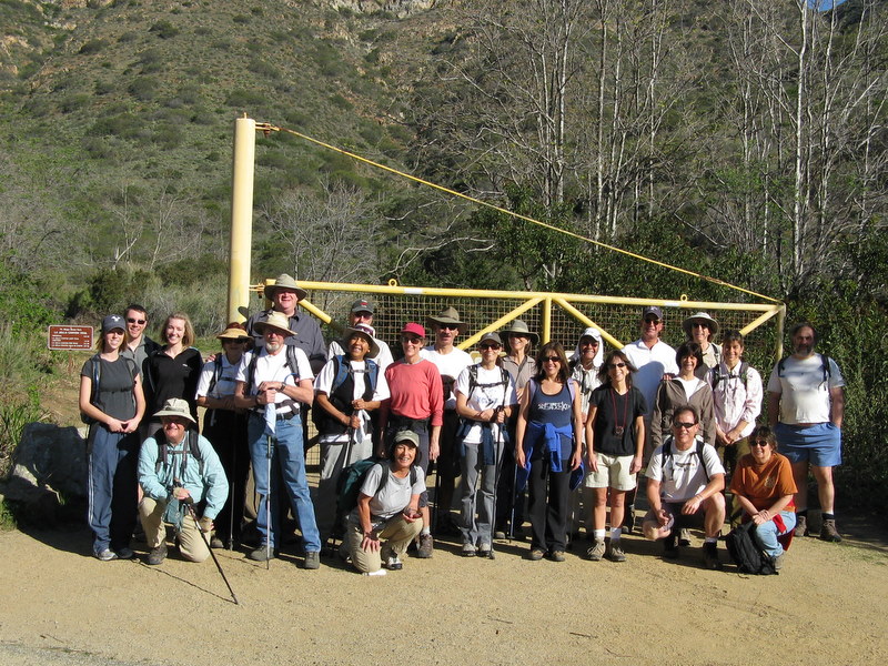
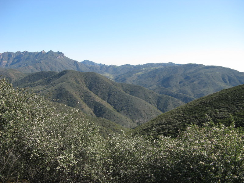
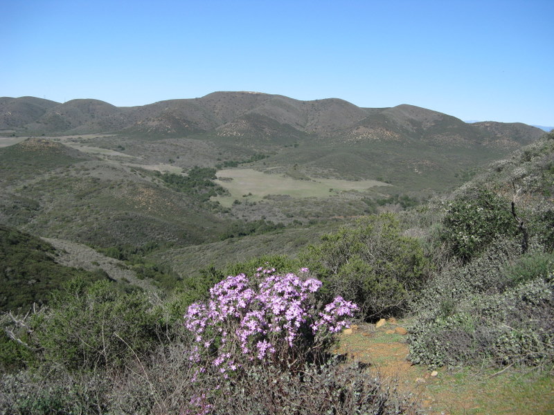
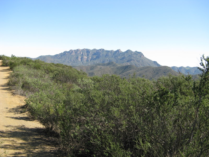
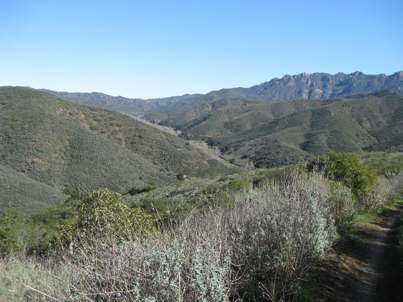

On a clear unseasonably warm winter day 23 hikers assembled near the Ray Miller trailhead in La Jolla Canyon in the Santa Monica Mountains, ready to embark on the first of eight Saturday day-hikes which will cover the entire Backbone Trail. The nearly 70-mile long Santa Monica Mountains Backbone Trail (BBT) winds through the Santa Monica Mountains National Recreation Area from the mouth of La Jolla Canyon in Point Mugu State Park to Will Rogers State Historical Park in Pacific Palisades. On its way it crosses three major canyons – Big Sycamore Canyon, Malibu Canyon, and Topanga Canyon. It travels along ridgelines that offer spectacular views of the Pacific Ocean, the Channel Islands, unique rock formations, deep canyons, and, given a normal rainfall, a dazzling array of wildflowers in season. It passes through grasslands, valleys, and oak woodlands and crosses seasonal creeks.
As the Ray Miller trail climbed via gentle switchbacks up to the Overlook Fire Road, it afforded views of the Pacific Ocean and Santa Cruz Island, the largest of the Channel Islands. The mountainside was pleasantly green and a few wildflowers were blooming (perhaps confused by the recent warm weather). The BBT (Backbone Trail) then followed the fire road to the Wood Canyon Vista Trail (also part of the BBT). Along the way the hikers were treated to panoramic views of La Jolla Valley to the west and Boney Mountain, Serrano Valley, and Big Sycamore Canyon to the east. The trail then descended into Big Sycamore Canyon until it met the dirt road in the bottom of the canyon. The hikers took a lunch/rest break at the junction, taking advantage of the availability of drinking water (from a faucet), a nice log to sit on, and a good vantage point from which to watch the bicycle riders go by on their way down the canyon. As we resumed our hike and headed downstream toward our shuttle vehicles, we were serenaded by beautiful bright green South American parrots in the sycamore trees (the birds are not native to the area, but were released or escaped into the wild some years ago). We eventually arrived at our shuttle vehicles, completing a 9.8-mile one-way hike with 1,126’ of elevation gain, and looking forward to hiking the second section of the BBT.
January 17th 2009 – Mt. McCoy Work Party
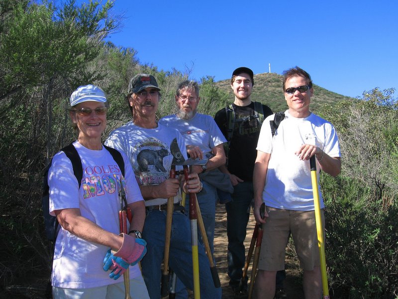
The January trail maintenance work party was conducted January 17th. on the Mt. McCoy trail. We concentrated on cutting back brush that was narrowing the trail. Many thanks to Linda Anderson, Doug Marsh, David Percival, John Sabol, Roger Steffen and Joe Yates for their great work on the trail.
January 17th 2009 – Santa Paula Canyon
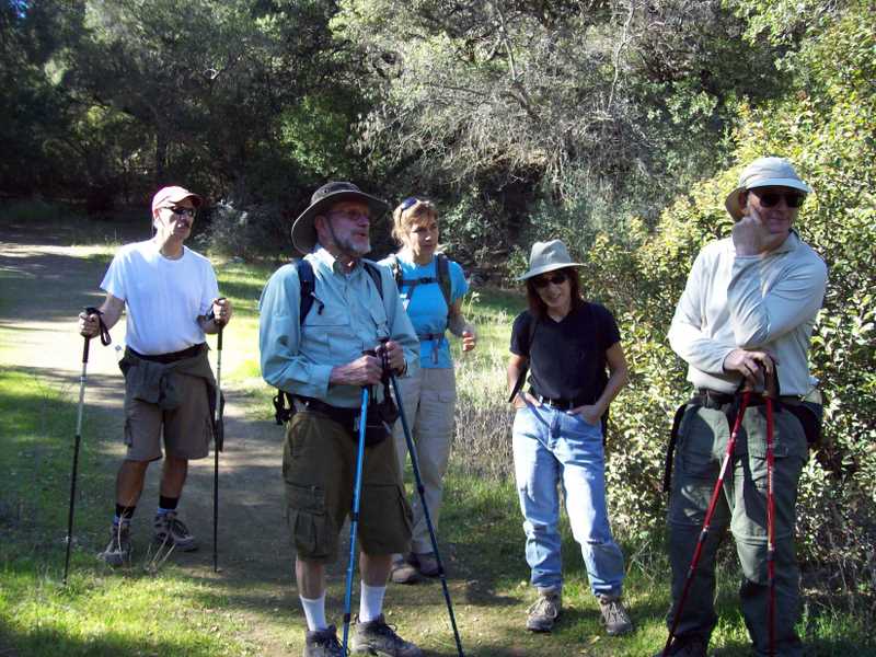
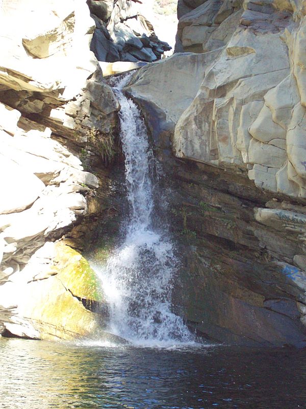
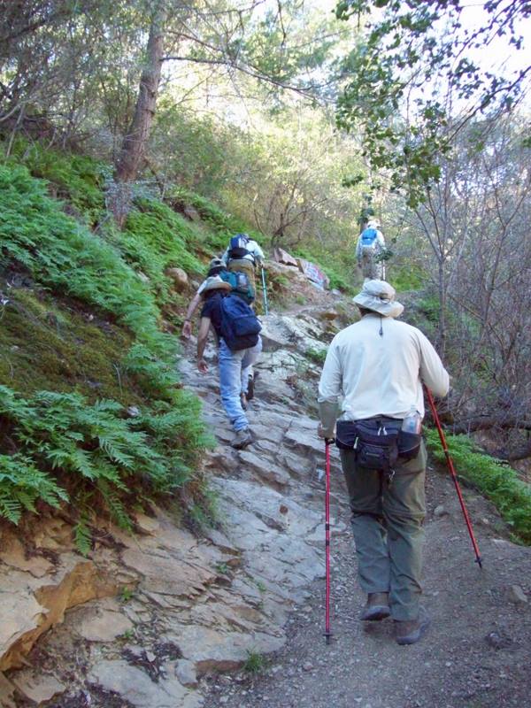
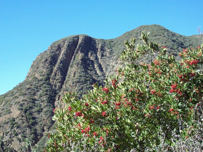
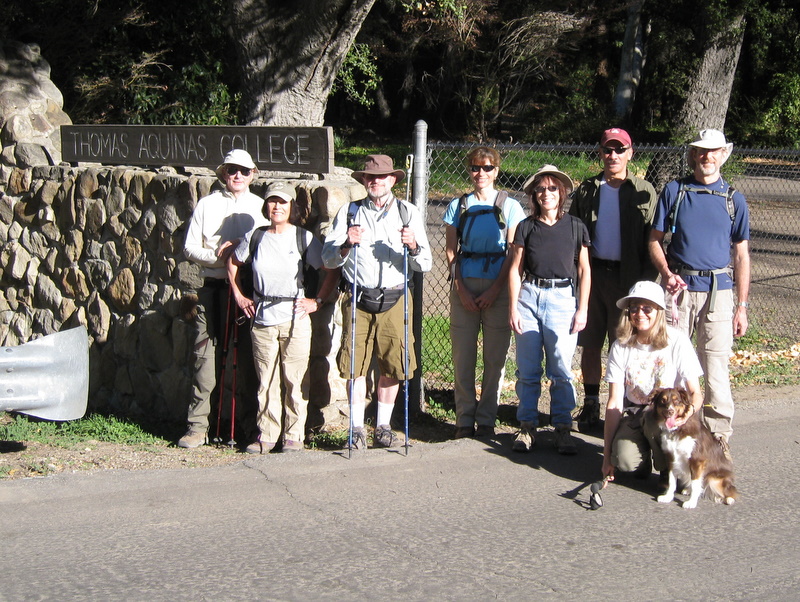
On an unseasonably warm winter day nine Trailblazers began an out-and-back hike in Santa Paula Canyon from the trailhead on Highway 33 a few miles northwest of Santa Paula, a quaint town located in the agricultural Santa Clara River Valley and referred to as the “Citrus Capital of the World” for its orange, lemon, and avocado groves. The initial portion of the hike involved skirting the campus of Thomas Aquinas College, the Ferndale Ranch, avocado groves, and an oil field with mountains looming in the distance. December’s rains lent a pleasing green hue to the vegetation. The winter floods of 2005 washed out much of the old road/trail along Santa Paula Creek, but there is still a discernable trail with many trail markers; in fact, we encountered a crew of volunteers working on trail improvements during the hike. We crossed the creek uneventfully several times, on some logs at one point and on small boulders at other points. Sycamore and alder trees provided intermittent shade. Eventually we began ascending the mountain on the east side of the creek. The trail (an old dirt road narrowed by erosion and plant growth) was pleasingly shaded and led us to Big Cone Campground which has several nice campsites nestled in a grove of big cone Douglas fir trees. Soon after passing the campground we descended into a ravine created by major erosion a few years ago and climbed up a fairly steep slope on the opposite side. The trail then continued a short distance before it descended again, this time to a tributary of Santa Paula Creek. From there we traveled a short but challenging distance downstream to a picturesque waterfall and punchbowl where we rested and enjoyed the scenery for a while. We resumed our hike on the main trail and climbed northward away from the tributary creek on the shady trail. Soon we were able to look down at the large pool below the waterfall and into the narrow gorge through which the creek flows before it becomes a waterfall. We then explored the nearby slick-rock slide area above the waterfall. The main trail – now named the Last Chance Trail – continues northward eventually connecting to other trails providing access to the wilderness areas to the north. However, on this day we went no further. As we returned to the trailhead, we spotted a young man (probably a college student) who had climbed a rope to a ledge above the pool below the waterfall. As we gazed in his direction, he gathered his courage and jumped from his perch into the pool. We continued on our return journey and eventually arrived at the trailhead, a bit tired but mentally refreshed.
January 10th 2009 – Devil Canyon
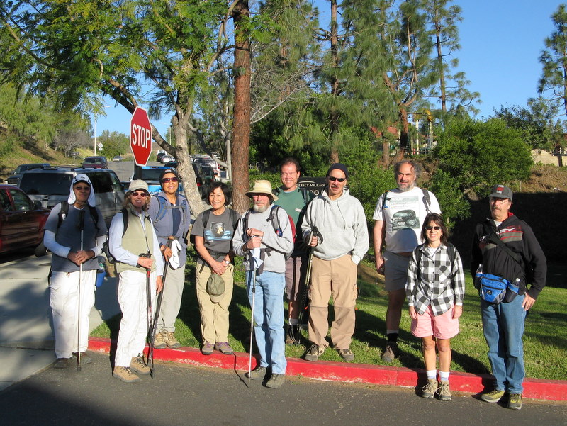
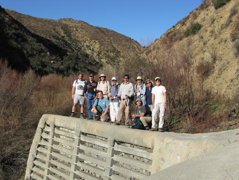


Eleven hikers braved intermittent Santa Ana winds to venture up Devil [aka Devil’s] Canyon northwest of Chatsworth. Soon after leaving the trailhead on Poema Place, the trail dropped into the canyon bottom which afforded good protection against the gusting winds. We followed the Devil Canyon Creek upstream for over a mile-and-a half to a fairly large dam (which has been filled in by debris over the years) located very near the Devil Canyon and Ybarra Canyon junction. The creek had some water in it due to the recent rains, though not enough to make hiking a problem. We then continued on up the canyon to the 3.75-mile mark at which point we encountered a relatively new fence with a locked gate blocking the trail (the old Devil Canyon Motorway). We chose to turn around at this point and selected a sunny meadow-like area covered by new bright-green grass in which to rest and take our lunch break. Although the recent Sesnon (aka Porter Ranch) Fire damaged quite a bit of the foliage in the canyon, the damage was nothing like the devastation caused in the Browns Canyon wash north of De Soto Avenue. Many of the large oak trees that shade portions of the trail have blackened trunks but still have their branches and leaves. Most of the plant life will probably recover before long (within a few months to two years). After lunch we returned leisurely downstream and then followed a short trail rising out of the canyon and returned to the trailhead. The occasional wind and the moderate temperature combined to keep us pleasantly cool during the 7.5-mile hike (with an elevation gain of about 1,000’).
January 3rd 2009 – Nicholas Flat

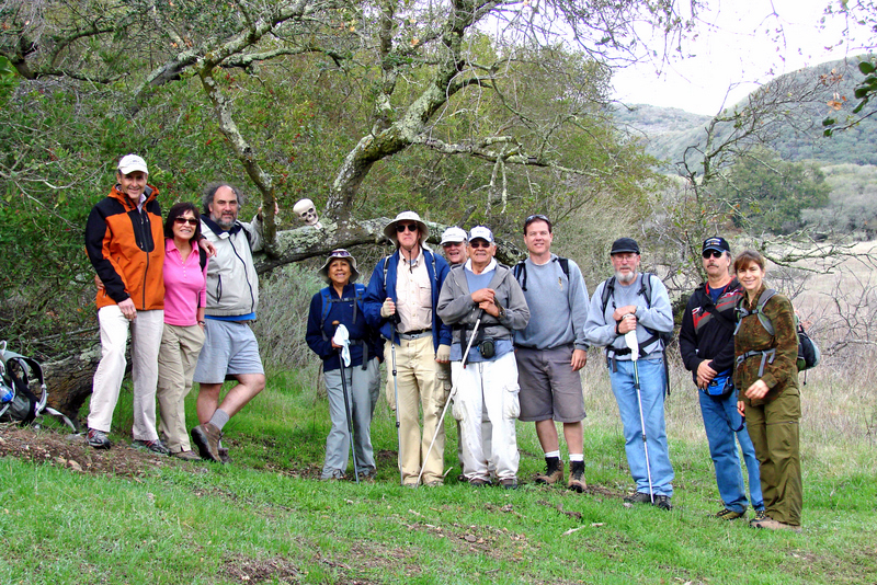
Twelve Trailblazers met on a chilly Saturday morning to car pool to Leo Carillo State Park for a hike up to Nicholas Pond. The drive from Simi Valley to the state park was an adventure in itself as we traveled along Westlake Blvd (Hwy 23) as it wound its way from Hwy 101 up into the Santa Monica Mountains to its junction with Mulholland Hwy. We then followed Mulholland Hwy to Decker Canyon Road which led down to Pacific Coast Highway (and Leo Carillo State Park). This journey provided magnificent views of mountains, valleys, and a cloud-filled sky. Once the group had assembled at the Nicholas Flat Trail trailhead, we began our ascent toward Nicholas Pond, gaining about 1,600’ in a little over 2 miles and testing our circulatory systems. The chilly morning temperature and a cold wind combined perfectly with the heat our bodies produced as a result of the steep climb, making it quite pleasant. Then there was the view of the mountainside and the ocean! The rain the night before left the trees and bushes glistening with water and bright green grass grew in places along the trail; there were even a few early blooms that caught our eyes. We crested the mountain descended through a large meadow, and followed the trail down to Nicholas Pond which was pleasingly full (though several feet below its historic high point). Several ducks were busy at the far end of the large pond. We then followed a short trail up to some large rocks overlooking the pond (at the opposite end from the ducks) and enjoyed a lunch break. As we did so we also enjoyed a stunning view toward the ocean down through a canyon that was displaying fall colors along the creek that ran through it. After lunch we followed the trail a short distance to Nicholas Flat, our turnaround point. We then returned the way we came, taking the Willow Creek Trail on the last leg of our journey; several members of the group spotted some whales in the ocean as we neared the trailhead. Our outing covered 7.6 miles with a total elevation gain of nearly 2,200’.