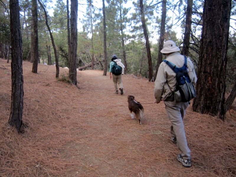
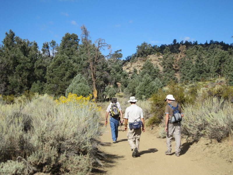
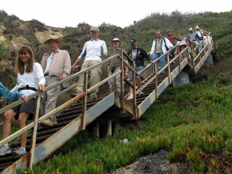
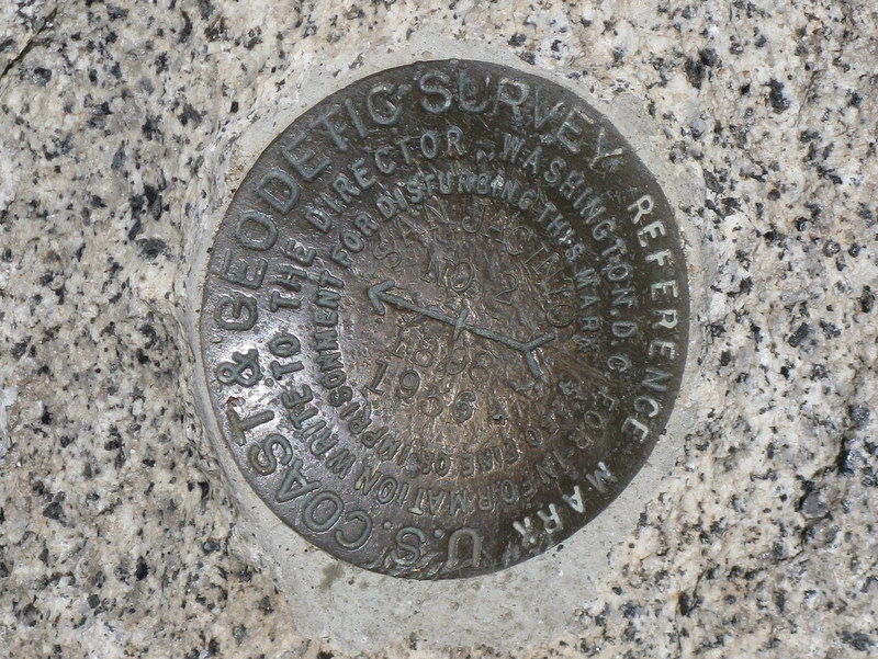
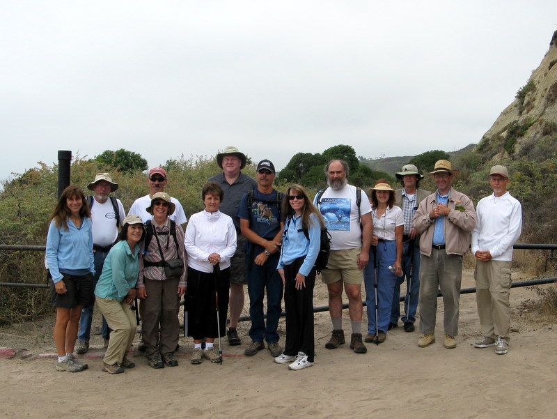
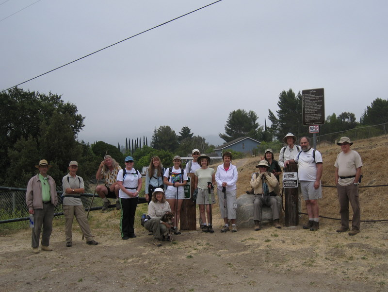
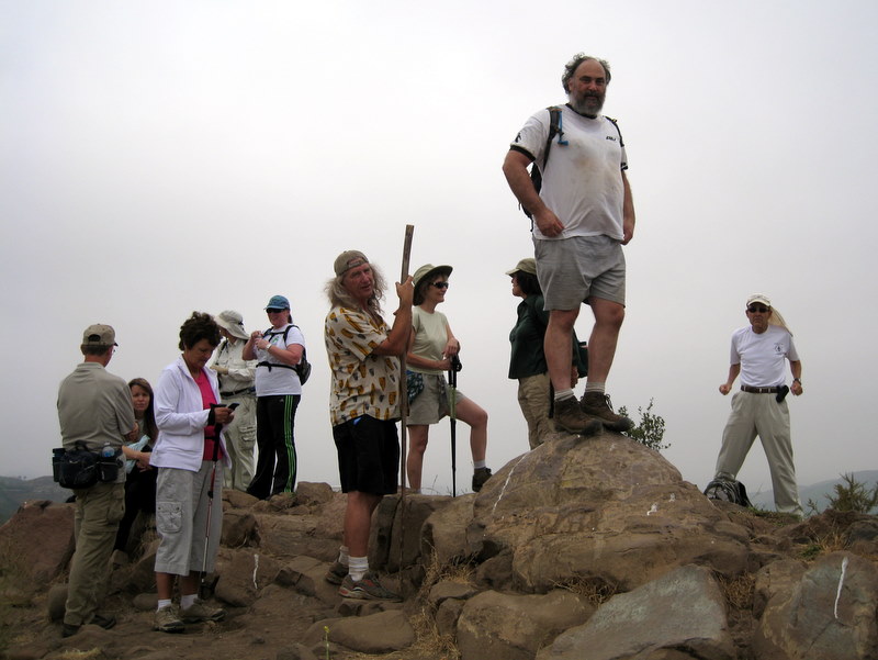
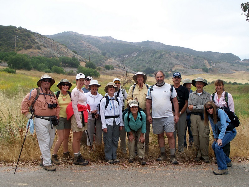
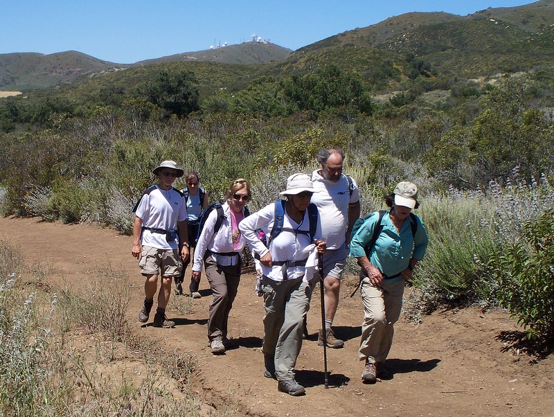
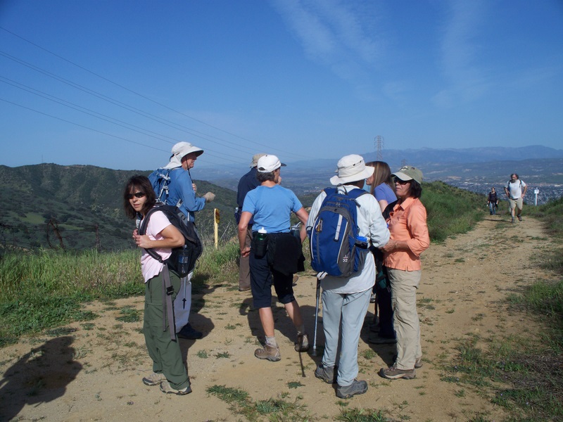
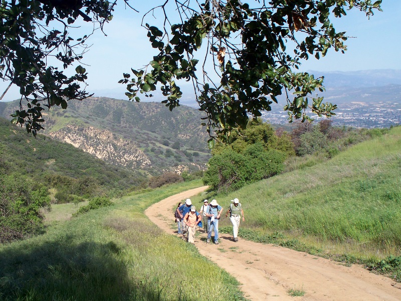
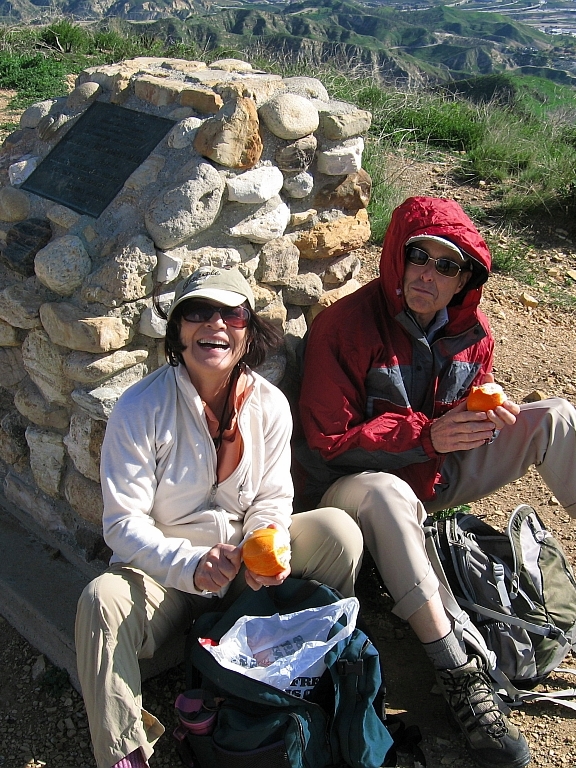
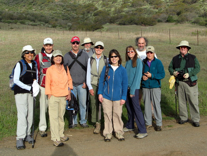
December 11th 2010 – Mt. Hollywood Trail and the Hollywood Sign
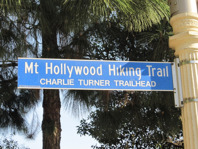
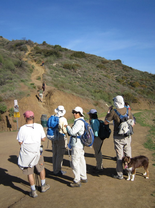
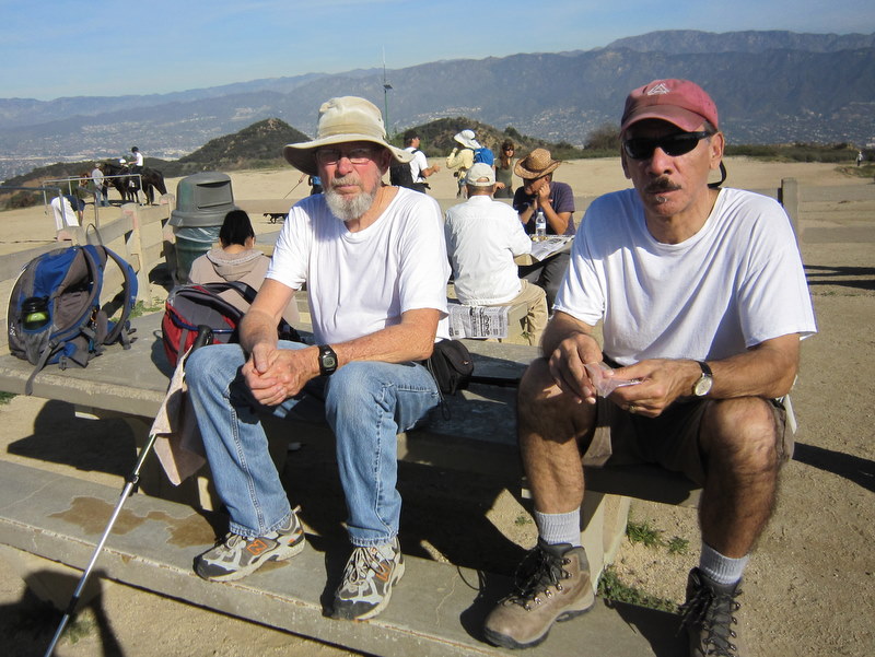
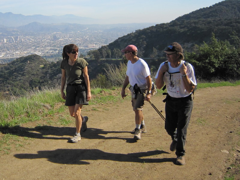
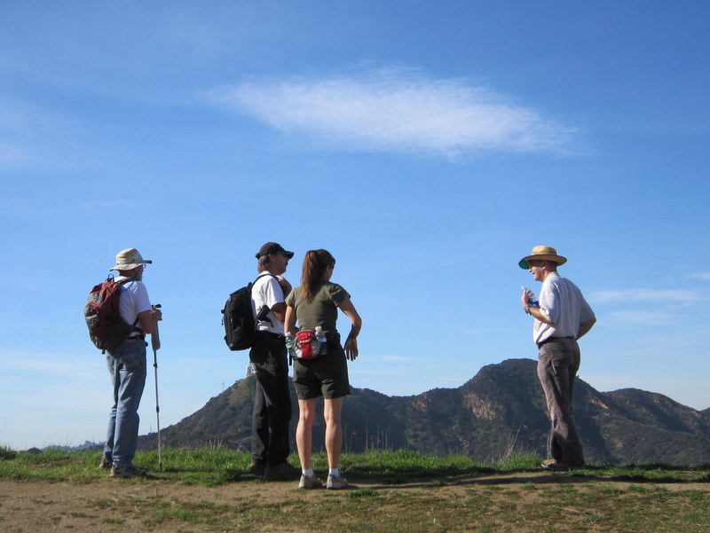
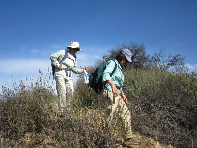
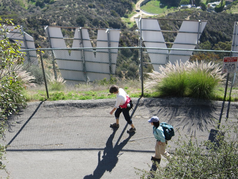
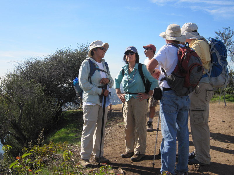
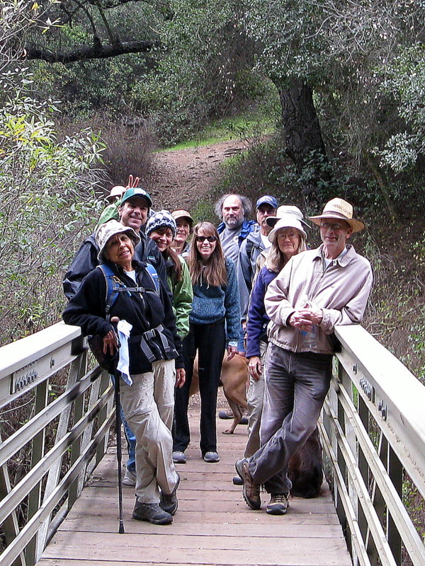
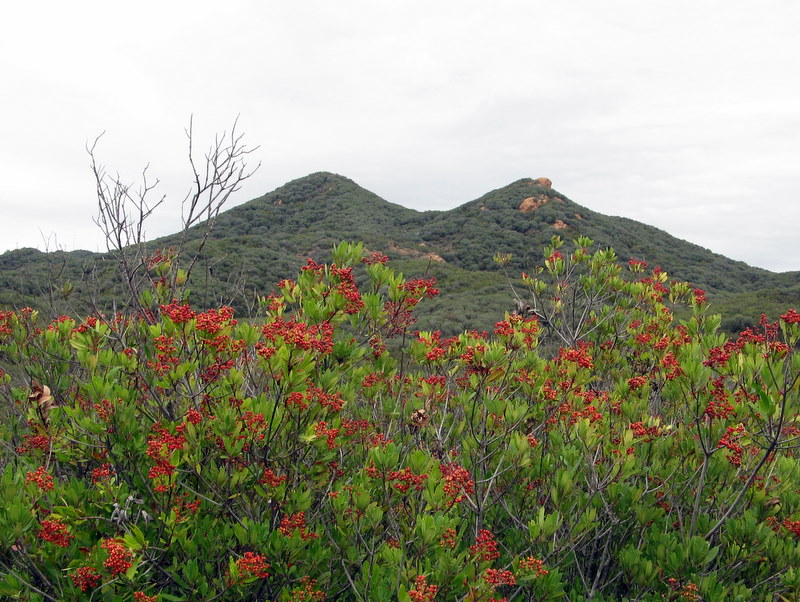
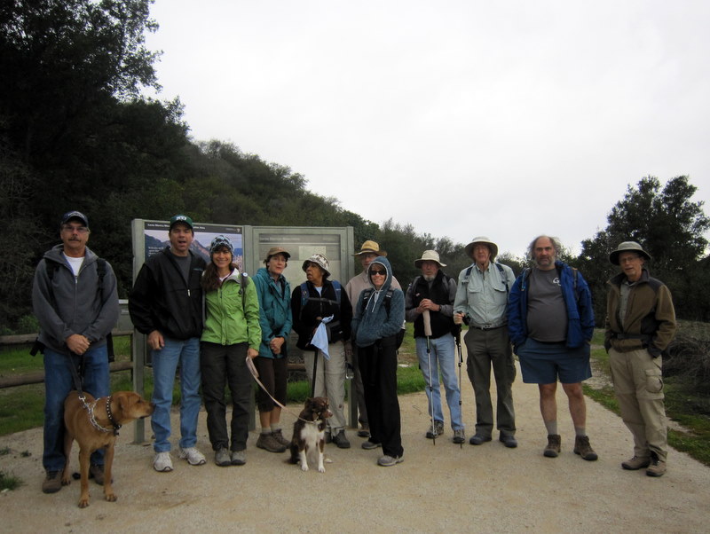
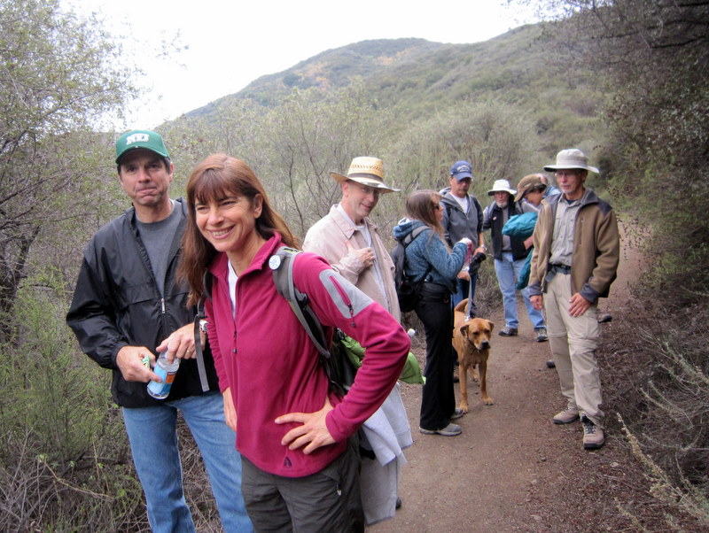
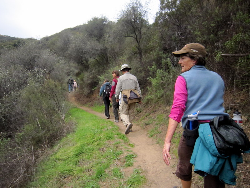
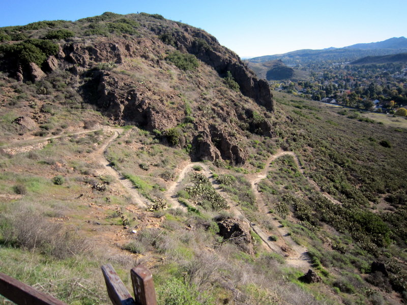
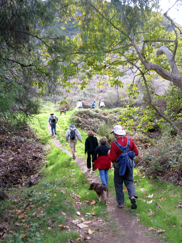
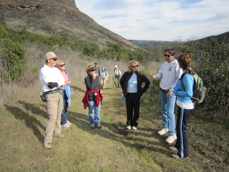
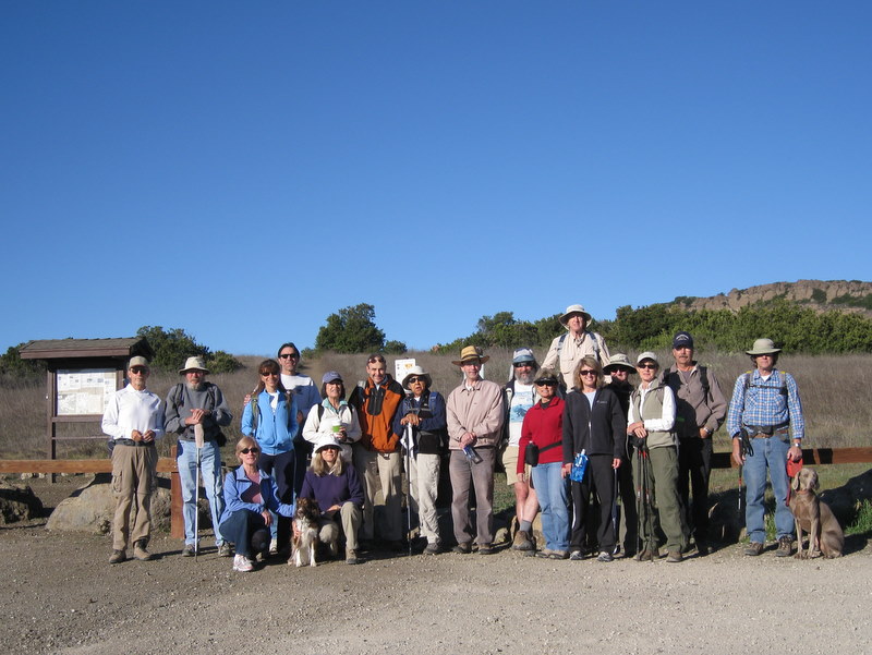
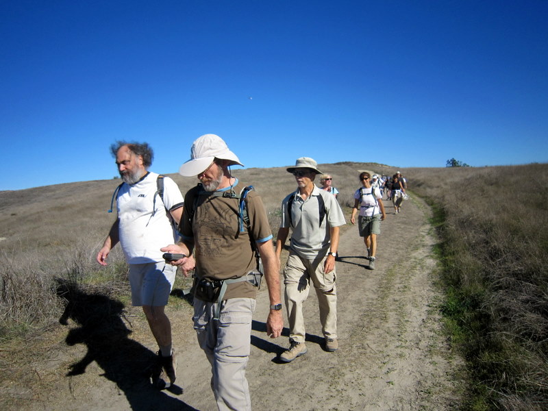
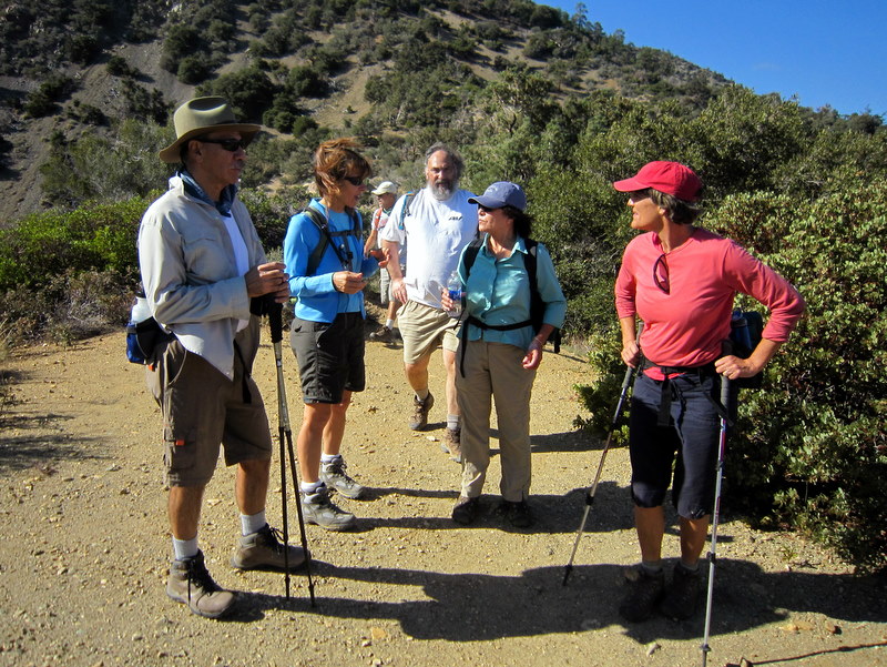
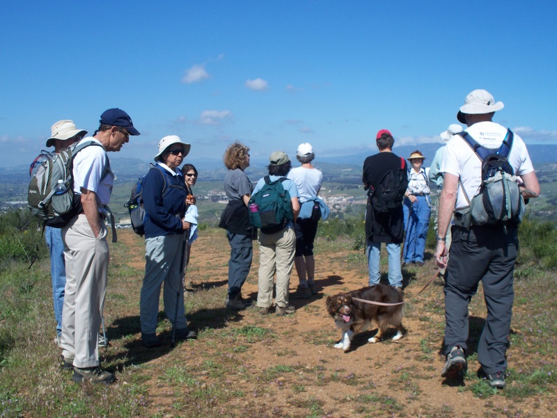
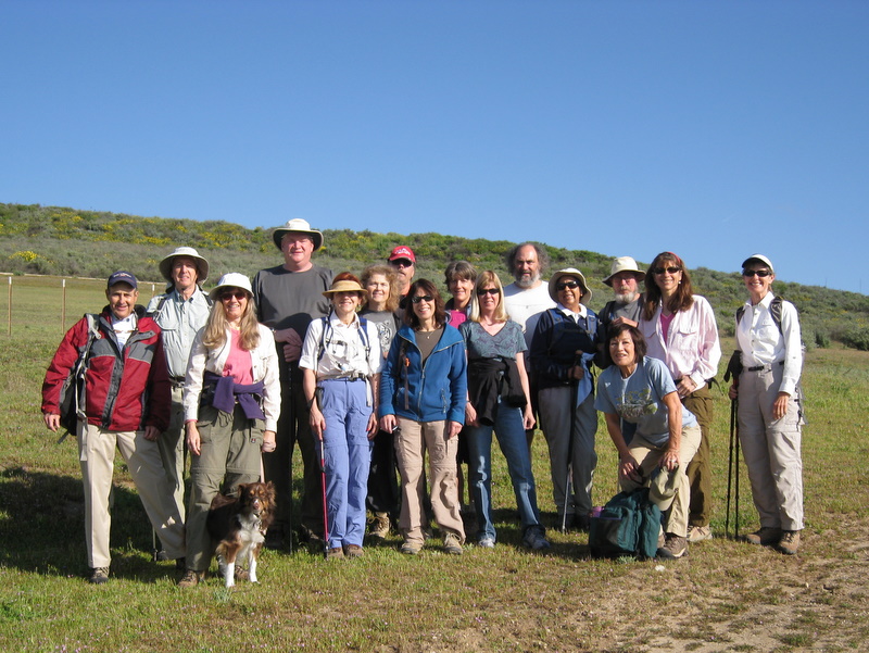
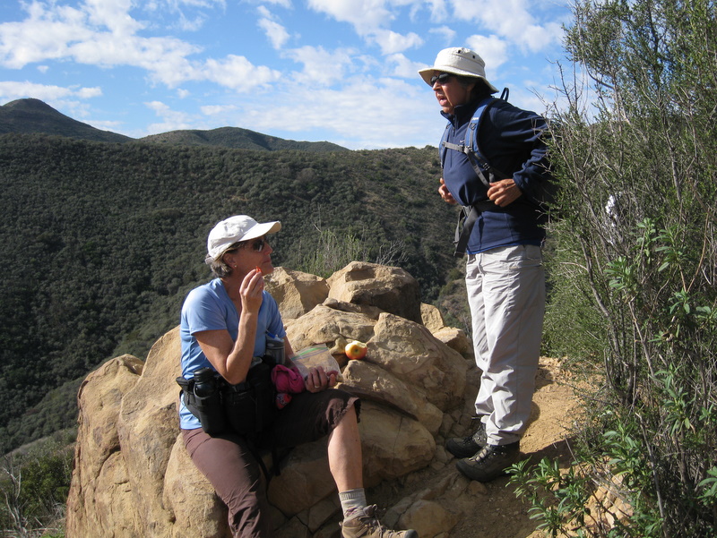
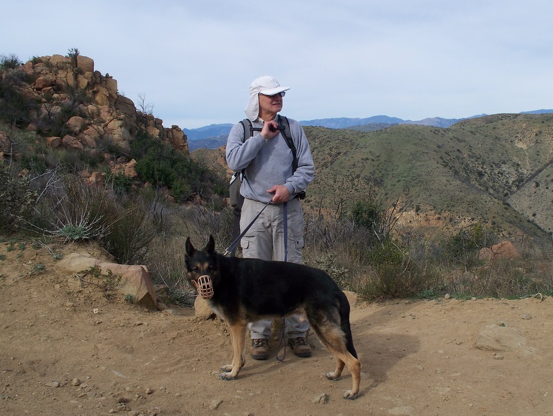
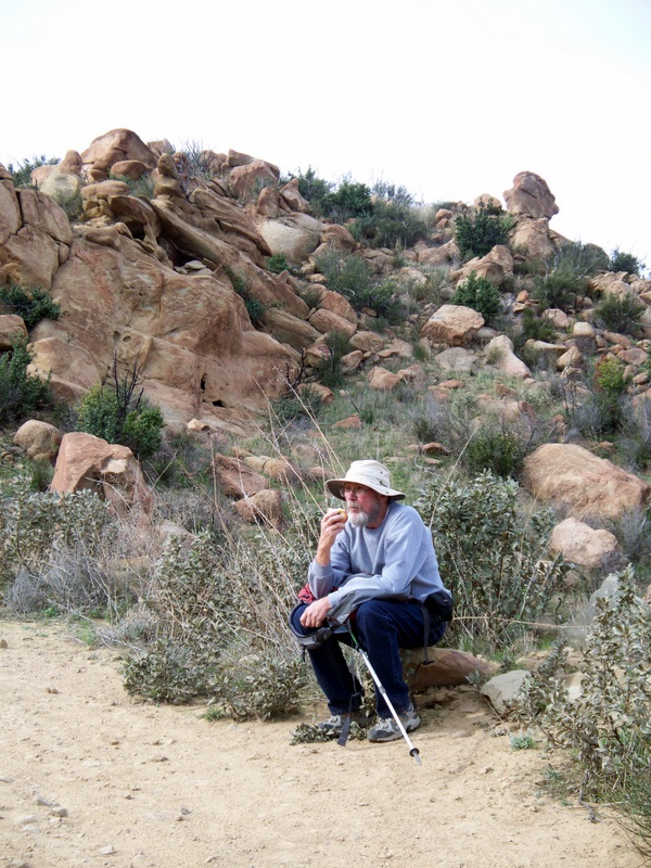
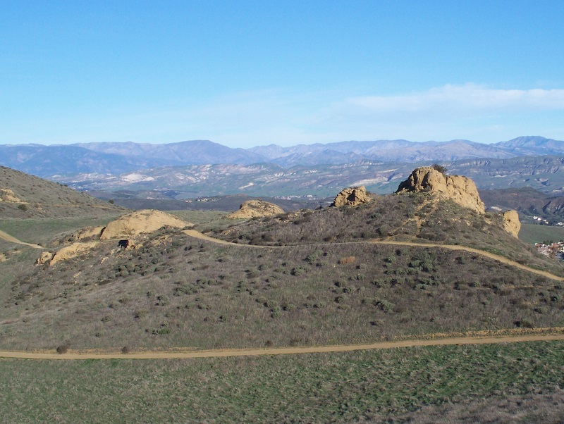
13 hikers (+ one cute dog) met at the carpool point at the Stearns Street Park-and-Ride lot in Simi Valley on a cool windy morning and then carpooled to Ferndell Park (600’) near the southwest corner of Griffith Park via Hwy 118, I5, Hwy 170, Hwy 101, Hollywood Blvd, and Western Avenue. The hike began on a well-shaded trail dominated by large oak and sycamore trees, but soon began climbing northward on the Lower Observatory Trail (a dirt fire road), reaching the Griffith Park Observatory (1,131’) and Planetarium in a mile or so. After a group photo was taken, the hike continued northward through the Berlin Forest, then crossed the Mt. Hollywood Drive tunnel and followed another dirt fire road as it wound its way uphill to the Mount Hollywood overlook (1,625’), the highest point in Griffith Park. It afforded a 360-degree view of the surrounding area: the Los Angeles basin, the San Fernando Valley, and the San Gabriel Mountains. We then embarked on the exploratory portion of the hike, heading north and then west (passing near Mt. Bell and Mt. Chapel) via a combination of dirt fire roads and steep narrow single-track trails to the top of Mt. Lee (1,680’), just above the famous Hollywood sign. We returned to the Griffith Park Observatory a different way via the Mulholland Trail and paved Mt. Hollywood Drive; we then followed the initial section of our hike back down to Ferndell Park. Happy but tired, we headed home having completed a 9-mile hike with 1,743’ of elevation gain/loss.
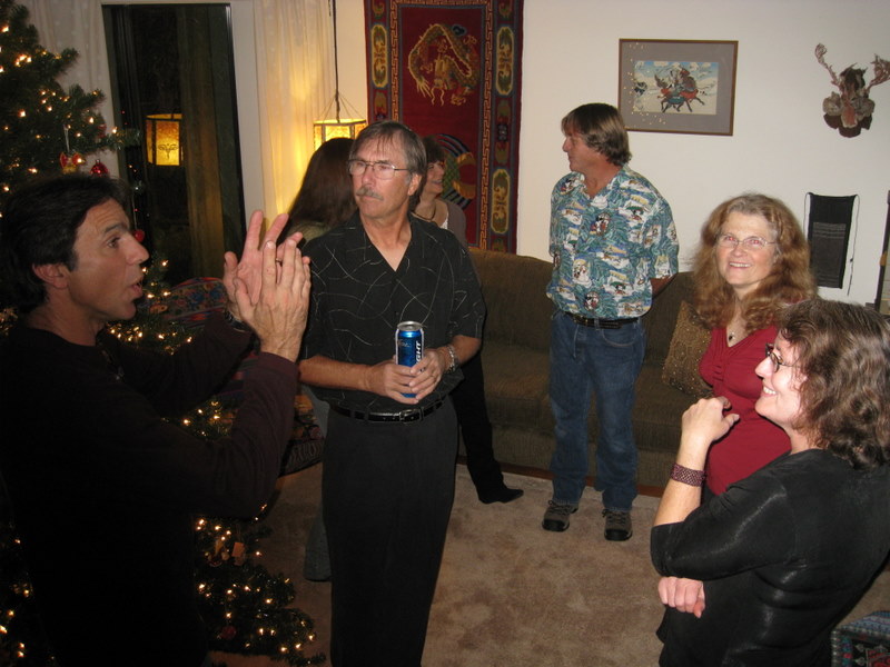
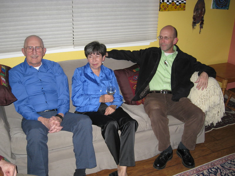
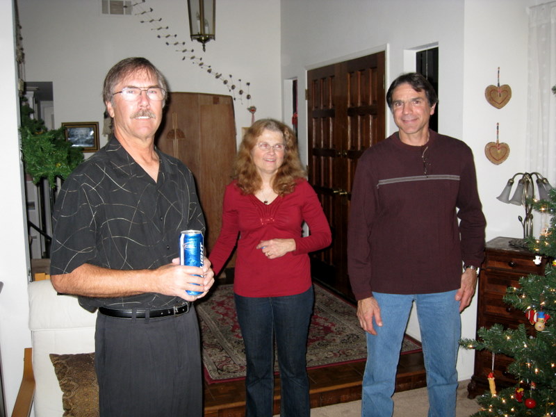
December 10th 2010 – Holiday Party


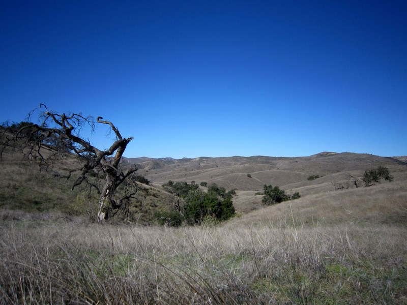
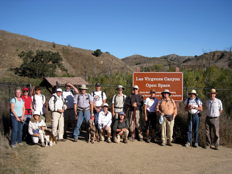
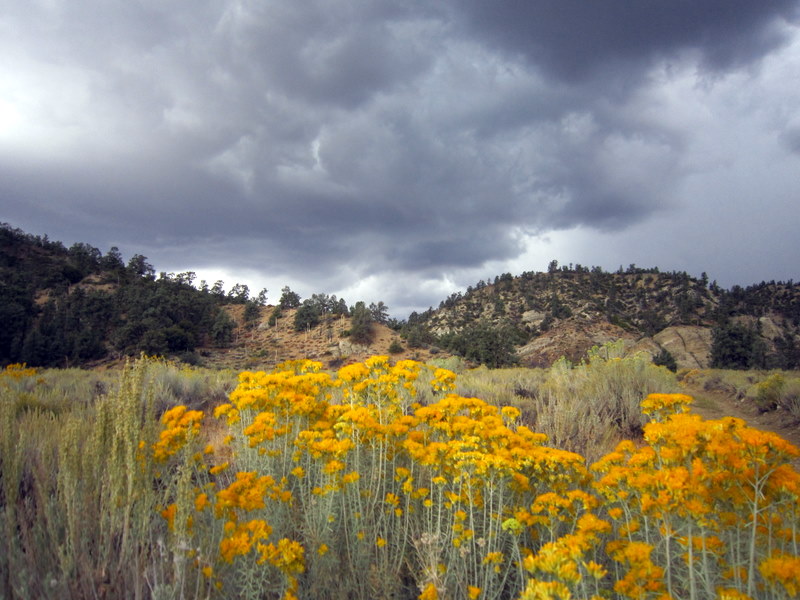
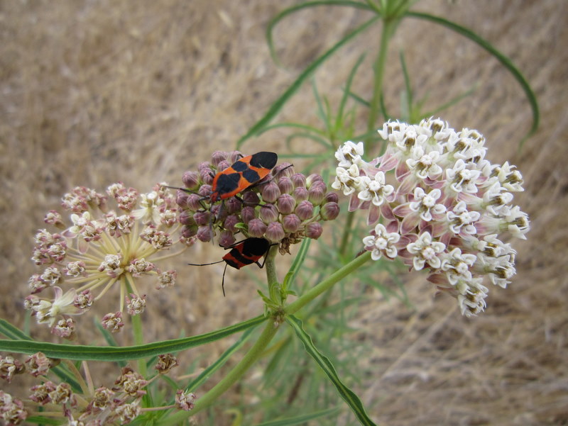
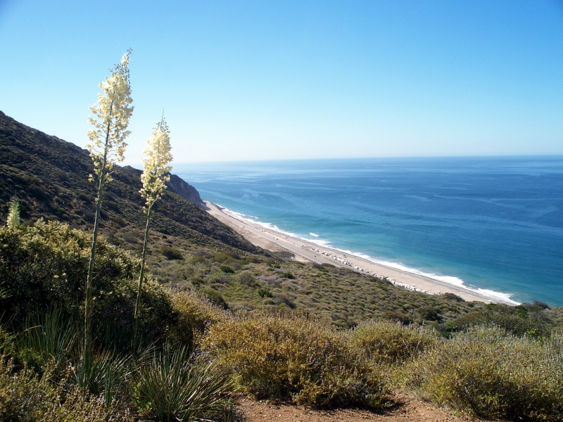
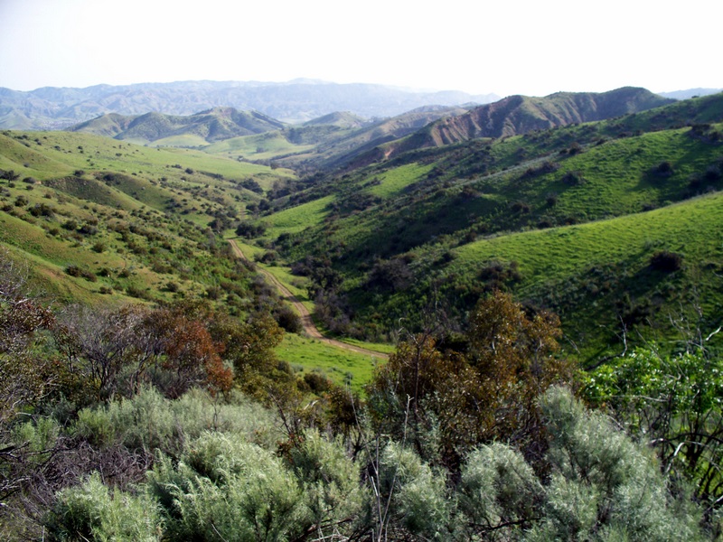
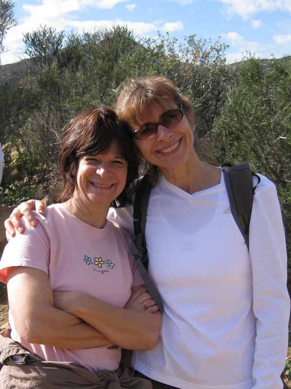
December 4th 2010 – Upper Zuma
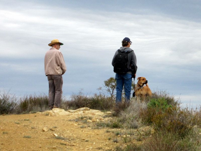
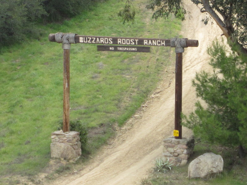
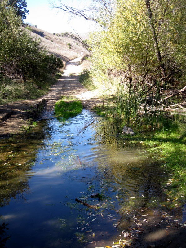
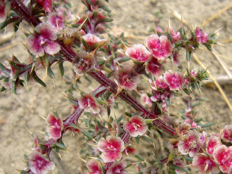
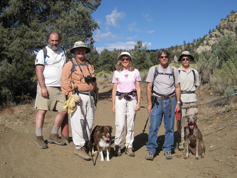
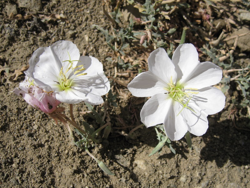
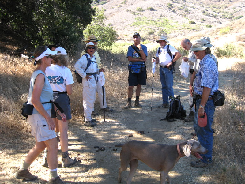
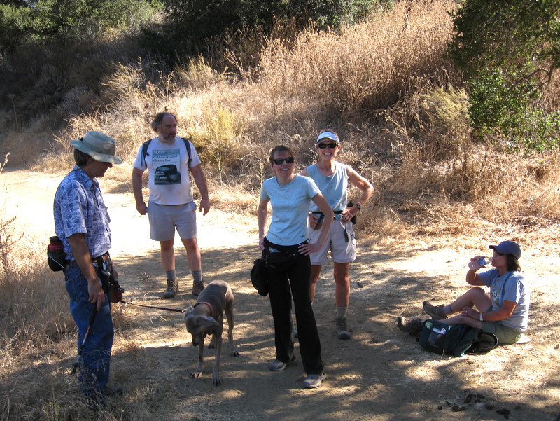
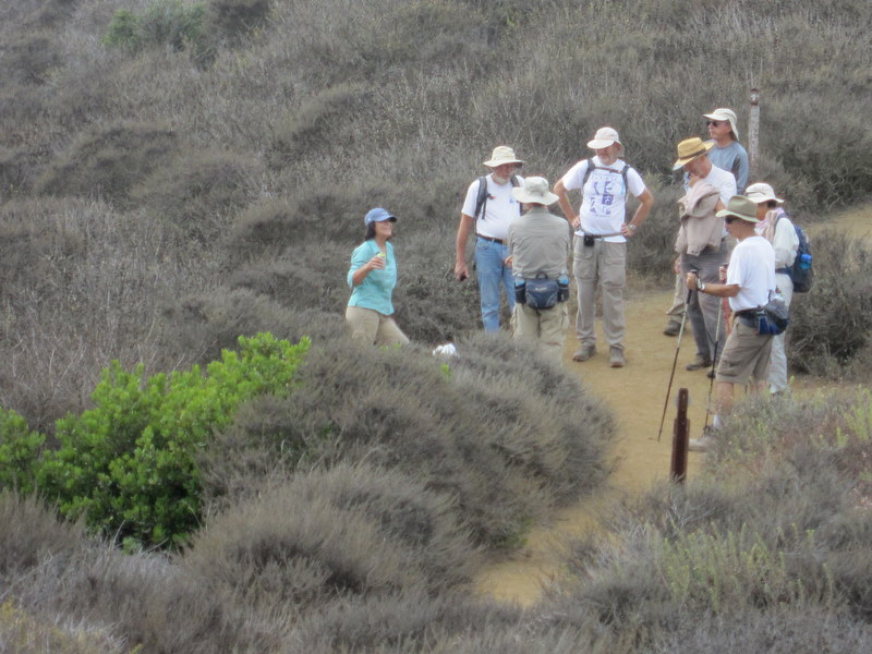
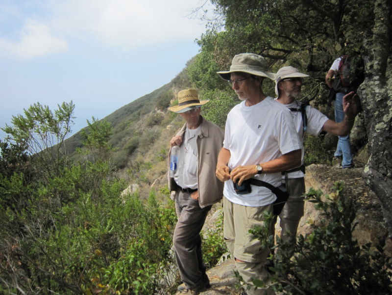
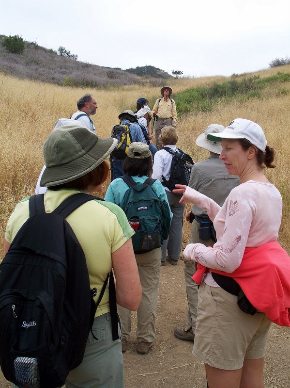
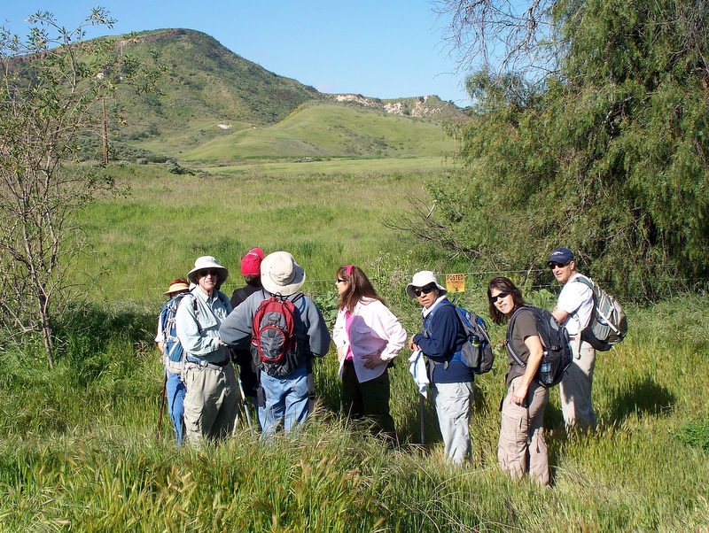
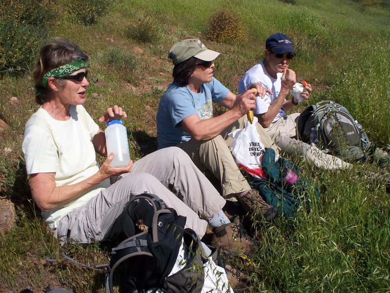
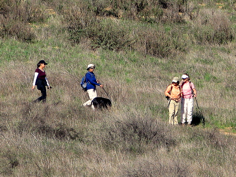
12 hikers (+ two dogs) met at the carpool point near the intersection of Royal Avenue and Madera Road on a chilly morning and then traveled to the Upper Zuma Canyon trailhead in the Santa Monica Mountains via Hwy 23, Hwy 101, and Kanan (Dume) Road. After a group photo was taken, the hike began by heading west along the Santa Monica Mountains Backbone Trail (BBT). Immediately after crossing Newton Creek, we followed a side trail southward along the west side of the creek looking for Newton Canyon Falls. Unfortunately the creek was virtually dry and the falls could not be seen or heard. Returning to the BBT we followed the well-shaded trail as it rose and then fell before reaching a very nice bridge crossing Zuma Creek. We continued following the BBT, enjoying lovely mountain views and occasional glimpses of fall colors. Upon reaching a junction with the Zuma Ridge Trail 2.5 miles from the trailhead, we divided into two groups: one group returned to the trailhead; the other group continued along the Zuma Ridge Trail toward Buzzard’s Roost before returning to the trailhead. We headed home having completed a pleasant 5- to 8-mile hike with 800’ to 1,200’ of elevation gain.
November 27th 2010 – Wildwood Park: Santa Rosa Trail Loop
19 hikers arrived at 8:30 a.m. at the main Wildwood Park parking lot at the west end of Avenida de los Arboles in Thousand Oaks on a crisp, clear morning. After a group photo was taken, the hike began by heading west on the Mesa Trail, but soon turned northward on the Upper Santa Rosa Trail as it climbed up the Mount Clef Ridge. The views to the south of Wildwood Park soon changed to sweeping views of Santa Rosa Valley, parts of Camarillo, and the distant Topa Topa Mountains as we crested the ridge and began a gentle descent to the northeast. Upon reaching a new connector trail (which enabled us to undertake the loop hike), we dropped down to the Lower Santa Rosa Trail which showed evidence of substantial equestrian use. Heading southwest, we hiked along this pleasant trail at the base of the Mount Clef Ridge, passing several bucolic ranches as we approached the Box Canyon Trail, a dirt road that led us back up the Mount Clef Ridge to the Mesa Trail which we followed back to the parking lot. We headed home having completed an enjoyable 6-mile hike with about 1,000’ of elevation gain.
November 13th 2010 – Ahmanson Ranch – Lasky Mesa
Seventeen hikers completed the dual loop 10 mile hike today. The weather was clear and warm, just perfect for hiking. The hills were just starting to turn green, thanks to our recent rains. Despite the multitude of possible routes, we only took a wrong turn once, and we easily recovered, adding only quarter mile to our trip. The first loop included great views, especially at the Victory Boulevard end of the loop. The second loop was far more tranquil and bucolic, following a creek in a riparian area. The hike was just long enough to let your legs know they had a good workout. It’s a blessing that Ahmanson Ranch was dedicated to open space.
November 7th 2010 – Devils Punchbowl – Devil’s Chair
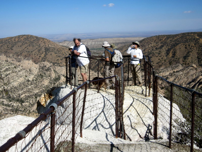
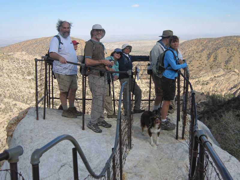
Thirteen of us completed the 8 mile hike, with 1,300’ of elevation gain. The Devil’s Punchbowl area is set on the intersection of two faults. The Punchbowl Fault is to the south of the rock formation, while the Pinyon and San Andreas Faults are to the north. While on the hike, we saw many different colors and unusual formations within between the sedimentary and igneous rocks. Everyone enjoyed the expansive view from The Devil’s Chair. We even walked through a tranquil pine forest.
The weatherman cooperated with us today. The original forecast called for another early season rainstorm. The weather system was moving slower than expected, so we enjoyed almost perfect hiking weather. Aside from some ominous looking clouds to the south, and some strong wind gusts on the exposed ridges, all was well.
It was three years since we last hiked the Devil’s Punchbowl. There are even more trails yet to explore in the area. We’ll be back.
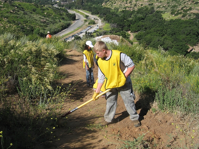
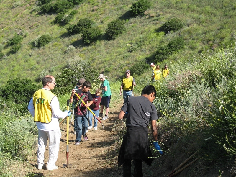
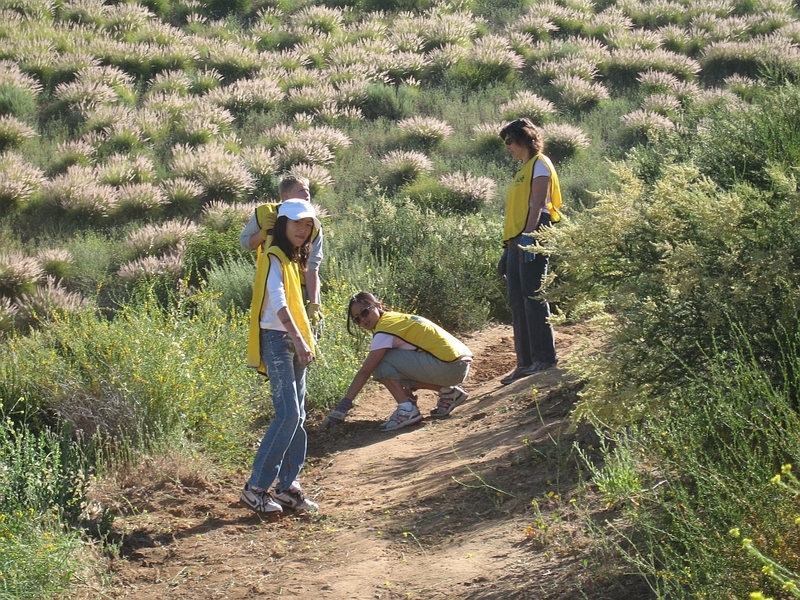
October 16th 2010 – Work Party – Challenger Park
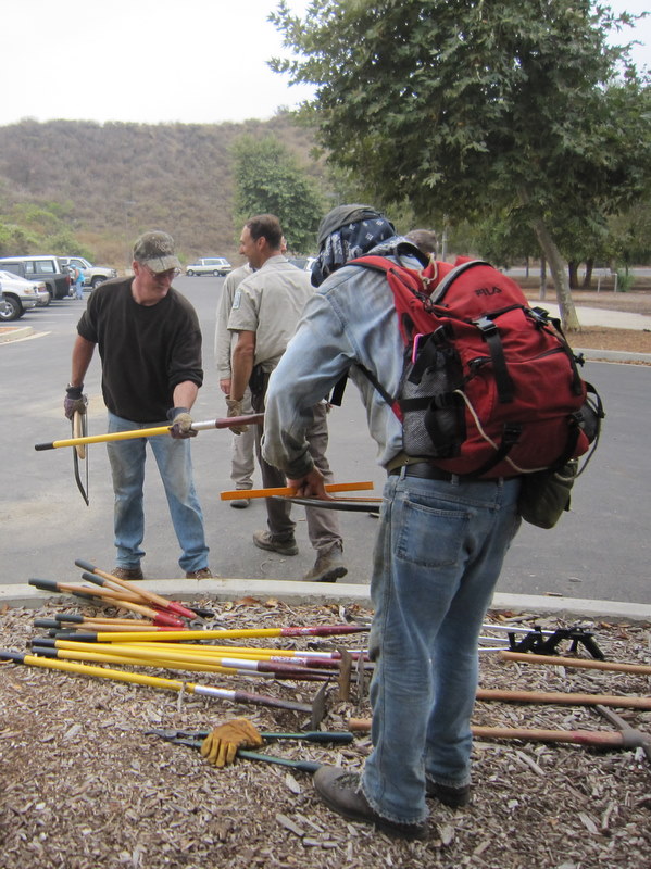
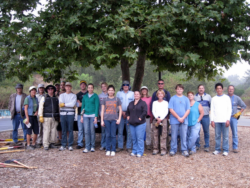
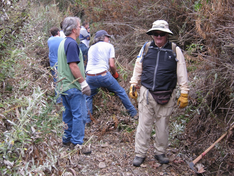
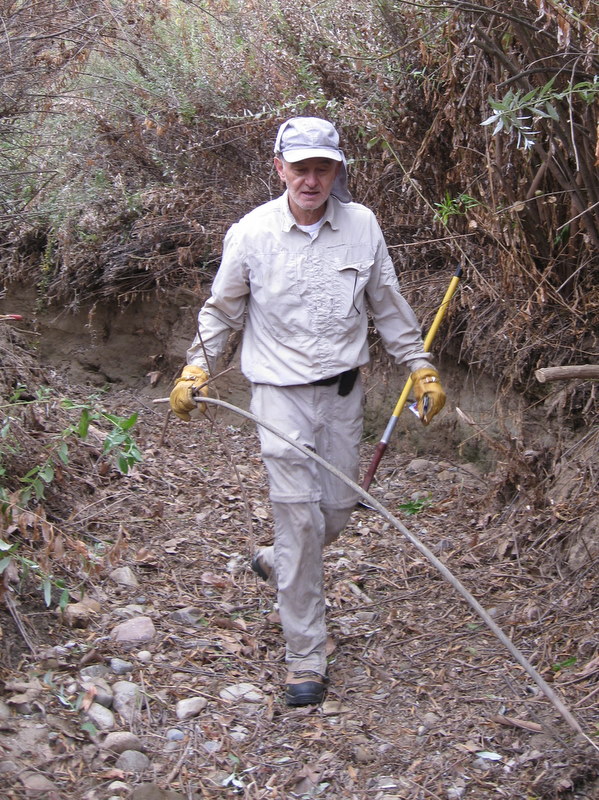
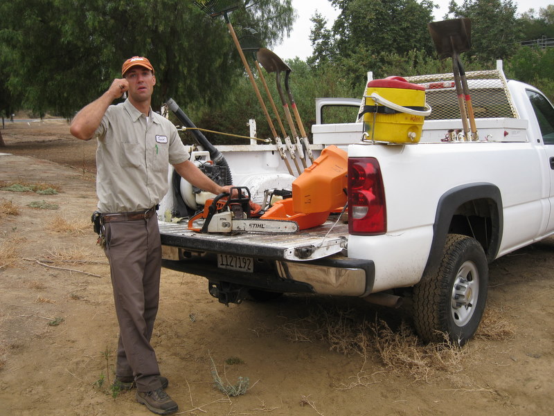
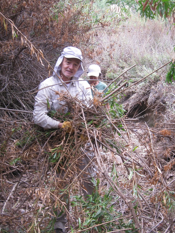
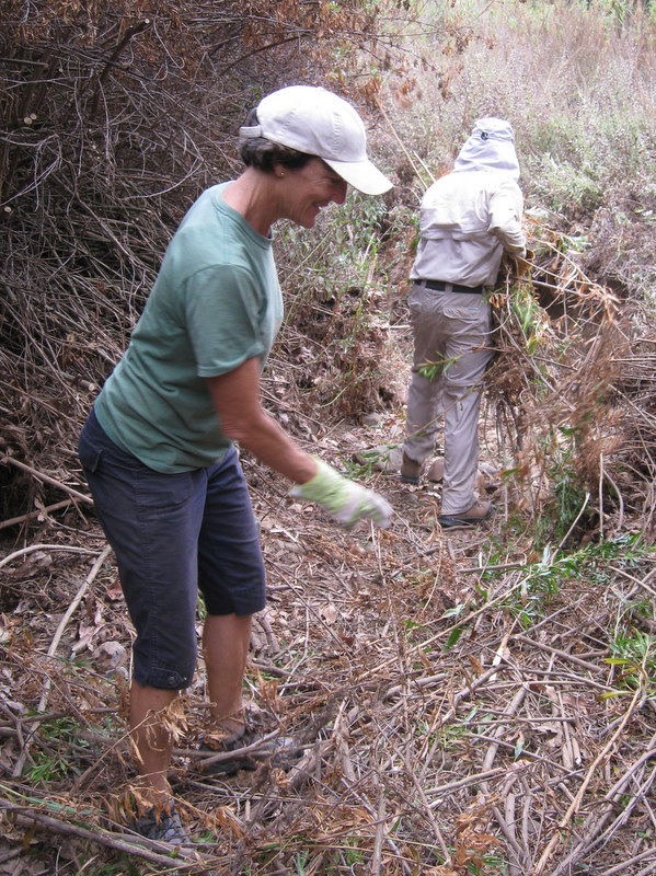
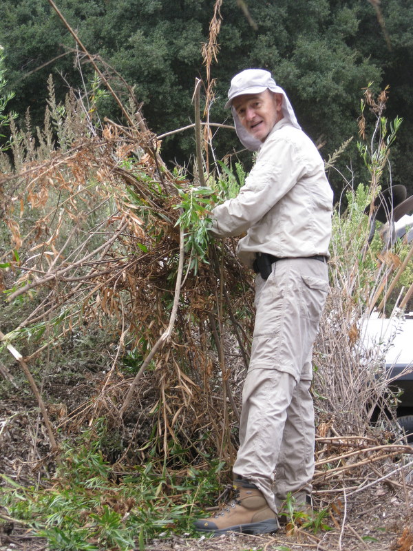
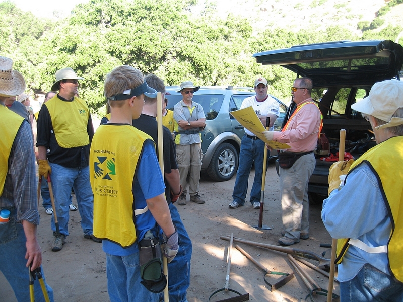
This month’s work party was a cooperative effort between the Trail Blazers, the local geocaching.com community, and four honor students from CLU. In total, there were 26 people in attendance, including two employees from the Rancho Simi Park District. The goal was to remove the trash from the Challenger Park trails and also clean out the debris from the creek, which runs through the northern section of the Park. Chain saws were heard growling away for hours and far more work was accomplished than anyone expected. This was the second annual cooperative effort with the geocaching.com community. Last year, we cleaned up the trash and graffiti at the Wildlife Corridor in record time. Our next October annual cooperative effort work party is not to be missed.
October 2nd 2010 – Camp Three Falls to Lilly Meadows

Nobody can say that today’s hike was uneventful. Although there were only six hikers present, we had enough excitement for at least two-dozen hikers. Little did we know we would stop a mile short of completing the hike, since the weather was relatively clear and warm at the trailhead. About an hour down the trail, the skies began to fill with ominous looking dark clouds. Minutes later, we began to feel the first rain drops, very large rain drops too. What seemed like seconds later, we found ourselves in an all out cloud burst, huddling beneath a somewhat protective tree. Next came a very bright flash and just a second later an extremely loud thunder crash, startling us all, and echoing up the canyon. It didn’t take long for us to come to the conclusion to make run for it back to the trailhead and the safety of our cars. It was then the hail began, with hail stones up to about 3/8 inches in diameter. The ‘stones stung as they hit our heads, faces and shoulders. The trail was slick with mud and covered with inches of water in places. About a mile down the trail, the rain subsided and the sun returned. We found that we had outrun the flash flood behind us and at a point we actually caught up with the leading edge of the water racing down the adjacent creek. It was a great relief to be back at the trailhead. We all agreed that we don’t need another hike this exciting anytime soon.
September 18th 2010 – Bicycle Ride: Ojai Valley Trail – Ventura River
On Saturday September 18th, six Simi Valley Trail Blazers met at Donut Delite for a bicycle ride starting in Ventura at the Main Street Parking lot. The men, Roger and Larry were out numbered by the ladies, Betty, Carolyn, Denise, and Effie. It was a blue sky perfect day. It took us about a hour and a half to ride up to Ojai. Larry rode home but most of us stayed for lunch. There was a short walk thru main street in Ojai while window shopping. Then we got back on our bikes and rode the reverse trip to our cars and drove home. It was a good outing for us all.
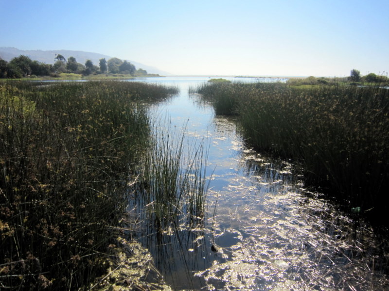
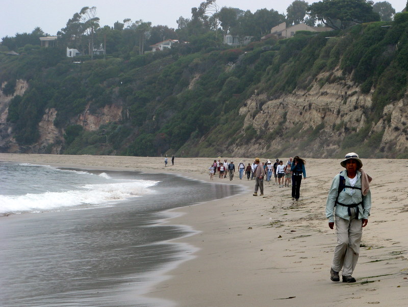
September 11th 2010 – Sycamore Canyon Shuttle
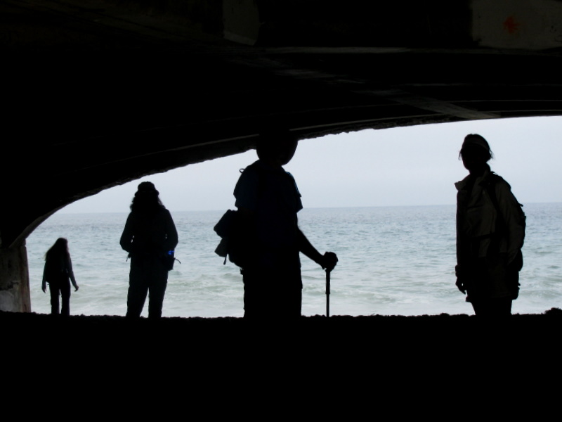
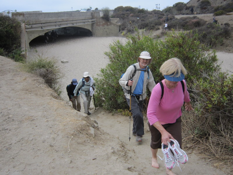
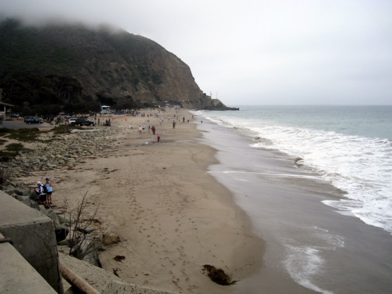
It was yet another unseasonably cool summer day and perfect for a hike. Fifteen hikers gathered, at the Wendy Drive & Portrero Drive trailhead. We hiked past the Satwiwa Native American Indian Culture Center, and down through Sycamore Canyon and to the beach, where we enjoyed a leisurely lunch. Temperatures were in the high sixties at the beach. The shuttle logistics worked well and everything was on schedule. Because of the ample rainfall from the previous spring, Sycamore canyon was quite beautiful. Everyone enjoyed the day.
September 4th 2010 – Montgomery Canyon Loop – Long Canyon Loop

The weatherman told us that Saturday would be the hottest day of the current heat wave. He was right. The plan was to start early and avoid the peak temperatures later in the day. We split our group of 15 hikers in two, with about half of us completing only the Montgomery Canyon loop and the other braver half continuing on and also completing the long Canyon Loop. By the time the turn off came for the first loop, it was already 90 degrees. By the time the second loop was finished, it was 96 degrees at the trailhead. With a steady and somewhat slower pace, and lots of water, we all completed the hike safely.
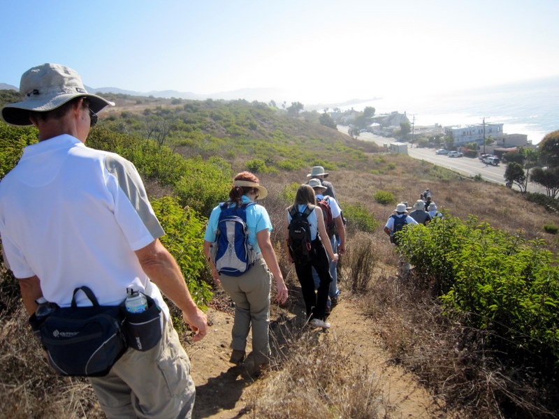
August 28th 2010 – Nicholas Flat from Leo Carillo State Park
Thirteen hikers completed the 8.5 mile, 2,250′ elevation gain hike today. We enjoyed the sudden break in the current heat wave, making the hike quite pleasant. It was only 69 degrees upon our return to the trailhead, but the humidity was still quite high, so there was plenty of sweating to do during the continuous and steady climb seemed not to end. The ocean views were expansive, despite the haze. We had a leisurely lunch at Nicholas Pond, and then took the northeast side of the loop back to the trailhead, adding yet another few hundred feet to the overall elevation gain that day.
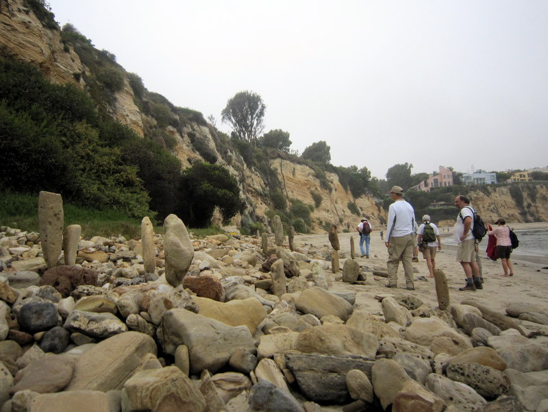
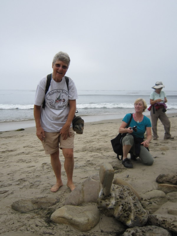
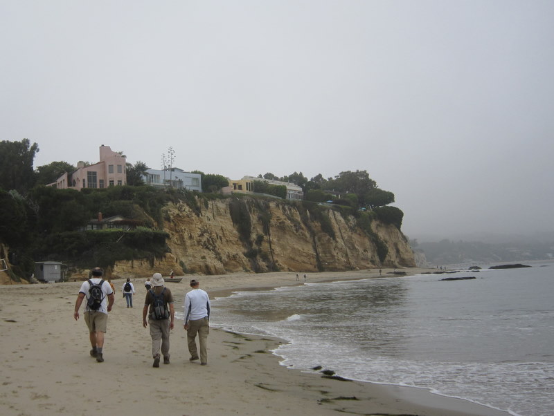
August 21st 2010 – Malibu Bluffs
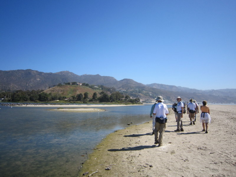
The original plan was to hike Upper Zuma, but with the current heat wave, the forecast called for temperatures in the mid-nineties by the end of our hike. Rather than brace ourselves for a death march, we decided on a substitute hike the afternoon before. We all enjoyed the beach hike so much last week, so why not do another beach hike? Malibu Bluffs was now on the agenda and it was an exploratory hike to boot. 17 hikers drove to the trailhead, near the Michael Landon Center, located in Malibu Bluffs Park. We hiked a total of 5.4 miles, out and back, mostly on the beach. Public beach access is limited, so we found it difficult to find a place to gain access to the beach on the beginning of the hike. On the return trip, we were able to stay on the beach almost all the way back, even though the tide was definitely coming in. The final climb from the beach to the roadway was very steep. We arrived back at the trailhead just in time for the beginning of the Miss Malibu Contest. If we had only known, maybe we could have arranged for a hiker category.
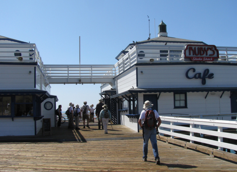
August 14th 2010 – Point Dume to Paradise Cove
23 hikers carpooled to Malibu via Highway 23, Highway 101, and Kanan (Kanan Dume) Road. Reaching Pacific Coast Highway (Hwy 1), we turned right (west) and then turned left a short distance later on Westward Beach Road where some of the hikers took advantage of limited free parking along the road and then hiked to the parking lot; others paid the $10.00 parking lot fee. A marine layer blanketed the coast, keeping the temperature pleasantly cool as we began hiking up and over Point Dume. After an easy climb onto Point Dume, we followed a trail as it led down to Dume Beach. The tide was coming in as we leisurely walked along the sandy beach for two miles, enjoying the ocean sounds and sights, eventually arriving at the Paradise Cove Beach Café (http://www.paradisecovemalibu.com ), a landmark for decades. We rested briefly nearby and reminisced about the TV series “The Rockford Files” which was set in Paradise Cove. Since the rising tide threatened to cut off our return route, we soon resumed our hike and headed back along the beach the way we had come. After climbing back onto Point Dume, we hiked to its highest point which afforded excellent panoramic views; we spotted numerous dolphins and several seals in the ocean. However, the chilly air soon encouraged us to descend and take a slightly lower trail to an observation point (with two benches) that provided some shelter from the wind. We continued on the trail around the point and descended to the parking lot. Agreeing that the outing was a nice change of pace, we then headed home having completed an easy 5-mile hike with 400’ of elevation gain.
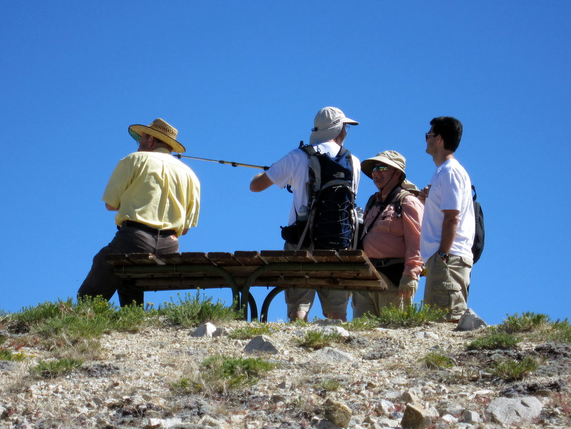
August 7th 2010 – Palm Springs to Mt. San Jacinto via the Palm Springs Aerial Tramway
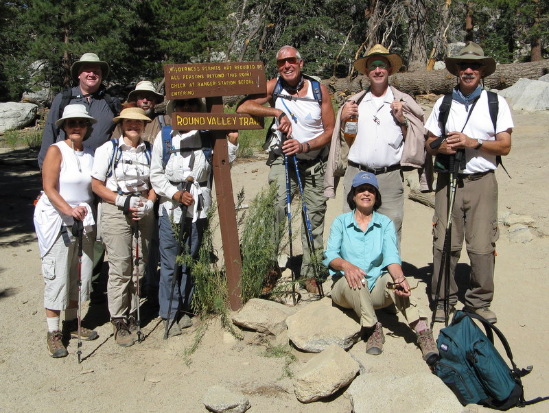
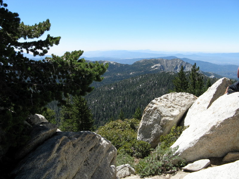
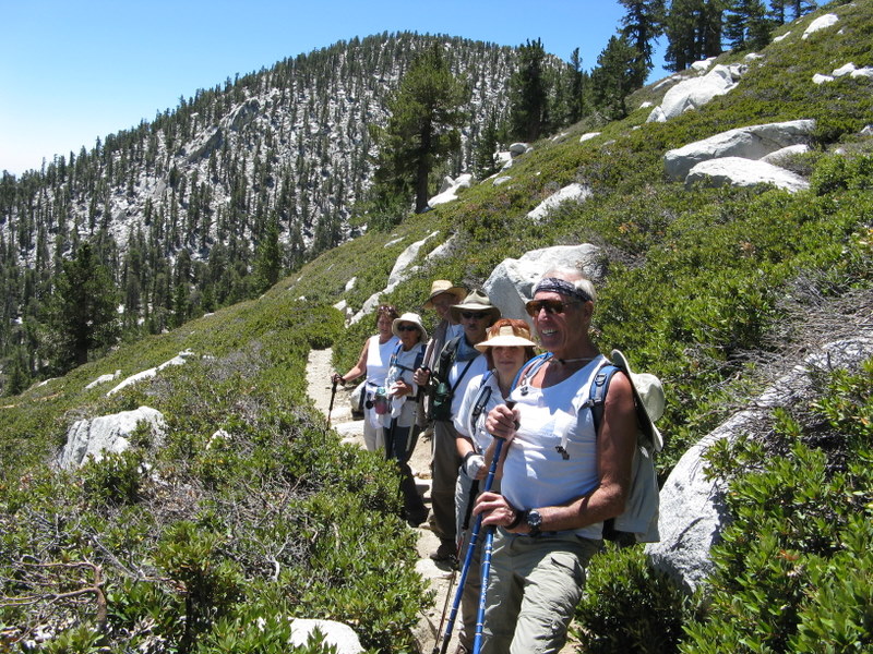
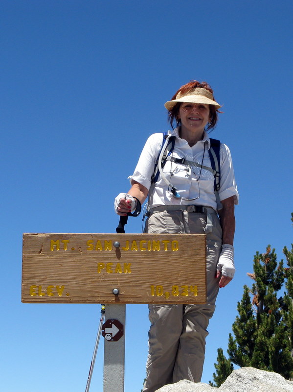
10 hikers arrived at the Palm Springs Aerial Tramway (with its rotating cabin providing a 360-degree view) around 9:00 a.m. on an already hot morning for a scenic 15-minute vertical lift from 2,643’ at the Valley Station to 8,516’ at the Mountain Station where the trail for a planned hike to the peak of Mt. San Jacinto (10,834’) began in the 14,000-acre San Jacinto Wilderness and State Park. Despite the high temperatures on the desert floor, we were greeted by a clear, cool, pine-scented morning as we began our hike, pausing briefly at the nearby Long Valley Ranger Station to obtain a free day-hike permit. The trail soon began rising through a lovely forest of conifers; there was a stream nearby which supported a variety of plant life and there were occasional small meadows and the sounds of birds. After hiking for about 2 ½ miles, we reached Round Valley, the location of one of only four campgrounds in the park. NOTE: A pipe near the trail junction provided a steady stream of water, but a nearby sign stated that the water needed to be filtered/purified before drinking it. After a short break we headed east along the trail as it climbed steadily to Wellman’s Divide where we took a lunch break and enjoyed the fine views to the east of the desert and the Santa Rosa Mountains. Resuming our hike we headed west on the trail as it climbed along the rim of a large bowl-shaped valley providing beautiful views to the north; we spotted the Tramway Mountain Station (where we had begun our hike) across the valley. Eventually we reached a switchback in the trail which allowed us to continue our climb, but now to the southeast. Soon we reached a trail junction with a sign proclaiming that a right turn would take us to the base of the summit in 0.3 mile. We soon reached a stone shelter built by the Civilian Conservation Corps in the 1930’s. From there we began scrambling carefully up large boulders to the actual mountain peak where we joined other “peak baggers,” took photos, rested, and enjoyed the panoramic views. After a while we regrouped and retraced our steps to the Mountain Tramway Terminal and descended to our vehicles, tired but happy, having completed a 12-mile hike with 2,500’ of elevation gain/loss.
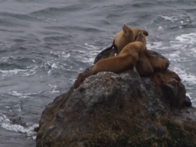
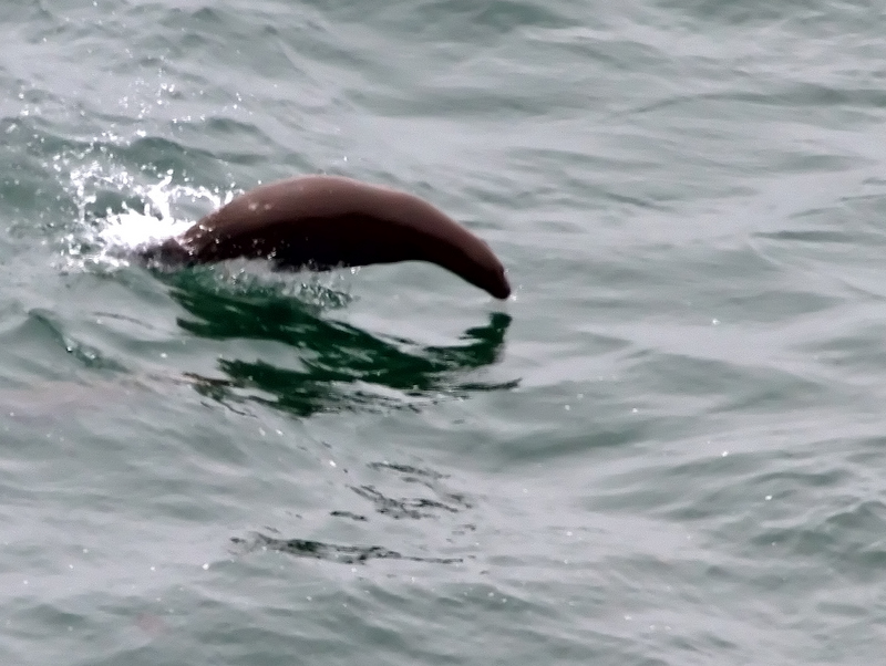
July 31st 2010 – Carpinteria Bluffs and Seal Sanctuary
15 hikers participated in today’s loop hike from Rincon Park along the Carpinteria Bluffs (overlooking the ocean), past the Seal Sanctuary, and then to Tar Pit Park (the turnaround point) also overlooking the ocean. Unusual for this time of year, the day was overcast (bad for photos) and the temperature was mild (good for hiking). Some wildflowers lingered along the trail, but there were no seals on the beach in the sanctuary. However, we did spot several seals in the ocean (their heads were visible). Tar Pit Park contains several examples of naturally occurring asphaltum, a dark bituminous substance that seeps to the surface above underlying petroleum deposits, which was used by indigenous Indian tribes such as the Tongva and the Chumash as an adhesive and in decorations. As we returned, we descended to Bates Beach for a leisurely two-mile stroll beside the ocean back to Rincon Park. We then returned to Simi Valley, having completed a pleasant 4.5-mile hike with around 100’ of elevation gain/loss.
July 24th 2010 – Sheep Camp Day Hike
Five hikers met the Stearns St. Park & Ride this morning. What’s this 7 AM stuff? Where is everybody? Grand Tetons? Yellowstone? Great Basin? The group was small, but still one of the best ever to go on this adventure. It was an exceptional day in the Los Padres at 9,000 plus feet high. Thin air made the elevation gain a bit more difficult, but it was well worth the exertion. The showing of flowers was exceptional. There were whole fields of Indian Paintbrush. It was also an unusually clear day, with good views of the San Joaquin Valley and the southern Carrizo. We escaped the heat well too. It was 82 degrees when we got back to our cars at the trailhead and 98 degrees, in the Santa Clarita Valley, on the drive back home. We all greed it was a great day and great hike.
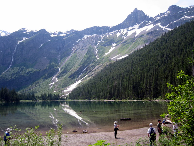
July 10th – 18th 2010 – Glacier National Park

SATURDAY, JULY 10, 2010 – Sperry Chalet and Arrival at Fish Creek Campground – – –
Nine of the ten Rancho Simi Trailblazers who had arrived at Glacier National Park by Friday (7/9/10) gathered at the Fish Creek Campground early Saturday morning and carpooled to the Apgar Transit Center at the south end of Lake McDonald where they caught a free shuttle bus to the Lake McDonald Lodge transit stop and the Sperry Chalet trailhead (3,214’). As the hike began, the trail soon climbed steadily up the base of Mount Brown through an old growth forest of cedar and hemlock via a series of switchbacks; a robust creek provided a pleasant aural accompaniment. After a few miles the trail climbed through Sprague Creek valley as the forest changed to pines, firs, and larch; there were many pretty wildflowers along the trail as well as evidence of the presence of bears in the area. The trail passed the roaring Beaver Medicine Falls and soon provided distant views of Mount Edwards, Gunsight Mountain, and the chalet. As the trail neared the chalet, it crossed Sprague Creek and then climbed through a four-foot-deep snowfield through which the trail had been cleared only two days before we arrived. Reaching the chalet (~6,520’) we were rewarded with hot chocolate, lemonade, great views, and the nearby presence of a couple of white mountain goats. We returned to the trailhead having completed a challenging 12.8-mile hike with about 3,300’ of elevation gain. NOTE: After the hike several of us drove to Glacier Park International Airport and picked up the other nine Trailblazers, increasing our number to 19 hikers.
SUNDAY, JULY 11, 2010 – Trail of the Cedars and Avalanche Lake – – –
19 Trailblazers took a free shuttle bus to the Avalanche Creek transit stop near Lake McDonald. There we followed the self-guiding Trail of the Cedars nature trail along a boardwalk, passing through an old-growth forest with small waterfalls in Avalanche Creek and moss-covered rocks surrounding Avalanche Gorge. Before completing the nature trail, we took the Avalanche Lake Trail which climbed gradually along the scenic creek through stands of western hemlock until it reached the lake which is surrounded by steep mountains on three sides. We hiked to the far (south) end of the lake where there were excellent views of glacier-fed waterfalls on the mountainside. After resting and taking photos of a nearby deer, we returned to the Trail of the Cedars and continued along it to the trailhead having completed a 6.2-mile hike with 500’ of elevation gain.
MONDAY, JULY 12, 2010 – Granite Park Chalet – – –
18 Trailblazers took a free shuttle bus to “The Loop” transit stop near Logan Pass. The Loop Trail (at 4 miles each way) is the shortest trail to Granite Park Chalet, but it rises a strenuous 2,300’. The trail was heavily wooded until the Trapper Peak Fire of 2003. Now there is new undergrowth as well as lots of wildflowers including fields of glacier lilies and there are mountain vistas including great views of Heavens Peak. It was hard to get space on the crowded free shuttle buses at the end of the hike which significantly delayed the hikers return to the transit center.
TUESDAY, JULY 13, 2010 – St. Mary Lake – Sun Point to Virginia Falls – – –
19 Trailblazers carpooled to the Sun Point trailhead at St. Mary Lake on the east side of the Continental Divide. As the hike started along a trail on the north shore of the lake, the day was quite cold and windy. The pleasant trail rose and fell gently as it passed through forest and small meadows filled with wildflowers. It soon reached Baring Falls and then continued on to two separate 50’ waterfalls: St. Mary Falls and then 0.6 mile farther to Virginia Falls. The return hike was not as cold and was much less windy. The hike was about 6 miles with about 400’ of elevation gain.
WEDNESDAY, JULY 14, 2010 – Snyder Lakes – – –
19 Trailblazers carpooled to the Snyder Lake trailhead (3,214’) near the Lake McDonald Lodge. The first two miles of the trail were the same as the previously described hike to the Sperry Chalet. The trail then headed northeast along Snyder Creek climbing gently through mountain ash thickets, Douglas fir, and subalpine fir trees. Unfortunately the trail was closed to hikers at the main (lower) lake’s outlet, so we were unable to hike around the lake. The lakes are nearly surrounded by Mount Brown, the Little Matterhorn, and Edwards Mountain. We did spot a deer across the lake and took some photos. We returned along the same route, completing an 8.8-mile hike with 2,047’ of elevation gain.
THURSDAY, JULY 15, 2010 – Johns Lake Loop and Apgar Lookout – – –
18 Trailblazers carpooled to the Johns Lake Loop trailhead at the northeast end of Lake McDonald. The trail initially led through a cedar-hemlock forest and then Douglas fir, lodgepole pine, beargrass, and huckleberry as it passed Johns Lake. The lake was obscured by the trees and underbrush and its edges were marshy. We reached and crossed the Going-to-the-Sun Road again and descended to a bridge crossing McDonald Creek and affording views of Sacred Dancing Cascade. The [horse] trail then led through a hemlock forest to North Shore Road and a bridge re-crossing McDonald Creek with a view of McDonald Falls. We completed the 2.4-mile loop with 100’ of elevation gain and then carpooled to the Apgar Lookout trailhead. The trail began with modest elevation gain along an old dirt road that ran through forest burned during the Howling Fire of 1994; many larch trees survived the fire. Eventually the road ended and the trail rose more steeply via a series of switchbacks to an old fire lookout tower which is no longer in use. The 360-degree view from the lookout point included the Flathead Range, the Swan Range, and the Livingston Range with Lake McDonald in the foreground. We returned to the trailhead having completed a 5.6-mile hike with 1,835’ of elevation gain.
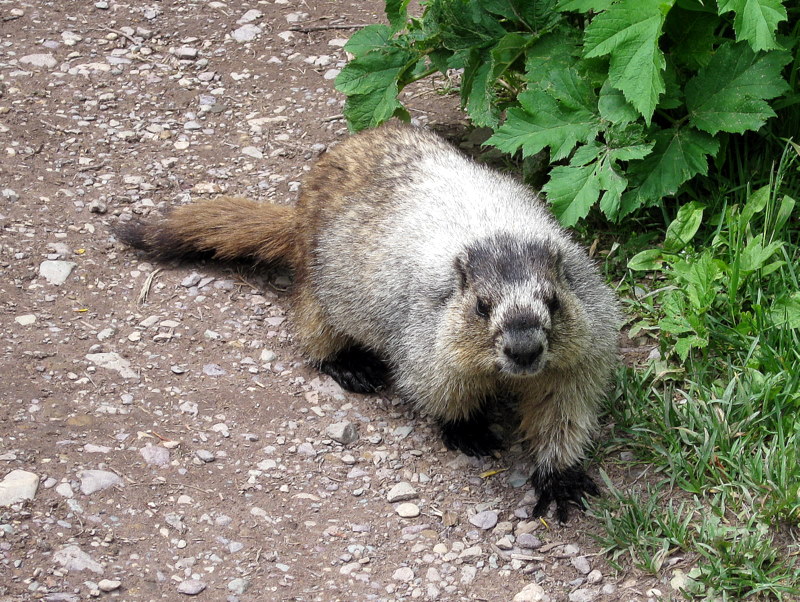
FRIDAY, JULY 16, 2010 – Iceberg Lake & The Swiftcurrent Trail – – –
19 Trailblazers carpooled to the Many Glacier area at the west end of Babb Road. Most of the group hiked to Iceberg Lake, but several members hiked in the Swiftcurrent Valley with its chain of lakes; they saw and photographed a variety of wildlife including moose. After a short easy walk, the trail to Iceberg Lake climbed steeply for a few hundred yards. However, after that the trail climbed steadily but gradually (even pleasantly) to the lake. Virtually every foot of the trail provided spectacular scenery, including distant mountains, forest, streams, waterfalls, fields of wildflowers, rock falls, and snow/ice – as well as the possibility of seeing moose, bears, bighorn sheep, mountain goats, etc. The lake derives its name from the chunks of ice (“icebergs”) that float in the lake during the summer. After resting by the lake, we returned to the trailhead having completed a 10-mile hike with 1,200’ of elevation gain. HIGHLY RECOMMENDED!
SATURDAY, JULY 17, 2010 – Howe Lake – – –
19 Trailblazers carpooled via the dirt/gravel Inside North Fork Road to the Howe Lake trailhead. The trail headed east with a modest uphill grade, passing through a recently burned landscape which has begun to recover. There were vast stretches of small pine trees (only a few feet tall) and many wildflowers including fireweed. After two miles we reached Lower Howe Lake. Upper Howe Lake was visible across a marshland connecting the two lakes. We continued along the little-used trail as it passed the upper lake and climbed to a higher vantage point. We returned to the trailhead having completed a 6-mile hike with about 500’ of elevation gain.
SUNDAY, JULY 18, 2010 – Leave Glacier National Park – – –
Most of the group returned to Simi Valley on Sunday. However, seven members continued on to Yellowstone National Park and then Grand Teton National Park before returning home. NOTE: Six members drove to Glacier National Park in four vehicles; they camped and hiked in Great Basin National Park on the way north.
July 3rd 2010 – Mt. McCoy to the Reagan Library
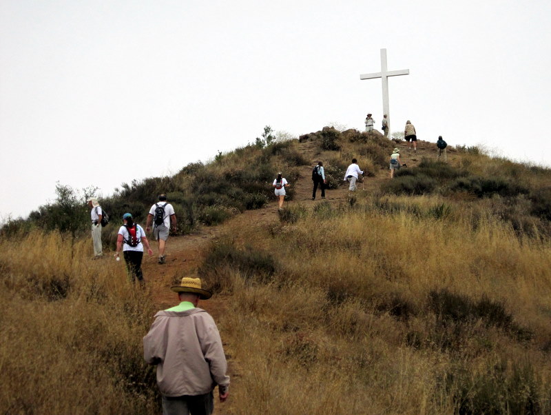
16 hikers (+ one cute dog) met at the carpool point near the intersection of Royal Avenue and Madera Road on another pleasantly cool morning and then (since trailhead parking is quite limited) walked from there to the Mt. McCoy trailhead on Washburn Street a few blocks to the west. The hike began along the trail heading south but it quickly began climbing gradually westward along the well-maintained trail leading to the summit via a series of switchbacks. As the trail rose up the mountainside, we were rewarded with excellent views of the western end of Simi Valley, including Sinaloa Lake, Wood Ranch, and the Bard Reservoir. There is a concrete cross as well as two concrete benches at the summit, from which the Ronald Reagan Presidential Library can be seen. After a short break to enjoy the panoramic view, we hiked southwest to Presidential Drive and then hiked along it to the west side of the library where President Reagan was buried in 2004. The setting of the library is quite beautiful. Eventually we returned the way we came completing a 4.5-mile hike with 700’ of elevation gain.
June 26th 2010 – Solstice Canyon
14 hikers (+ one cute dog) met at the carpool point near the intersection of Royal Avenue and Madera Road on a pleasantly cool morning and then traveled to Solstice Canyon via Hwy 23, Hwy 101, Las Virgenes/Malibu Canyon Road, Pacific Coast Highway (Hwy 1), and Corral Canyon Road. The out-and-back hike began by following gently flowing Solstice Creek along the easy well-shaded Solstice Canyon Trail (a dirt road), taking advantage of two short trails paralleling the dirt road along the way, and reaching the Sostomo Trail after about one mile. We followed the Sostomo Trail as it climbed steadily toward a junction with the Deer Valley Loop Trail. As the trail rose we were afforded excellent views of Solstice Canyon and the Rising Sun Trail across the canyon. The well-maintained trail crossed Solstice Creek twice; both crossing areas were quite lovely and peaceful. At the first crossing there was a stand of blooming Humboldt lilies near the trail; many photos were taken. After reaching Deer Valley, we followed the loop trail in a clockwise direction as it ascended the mountainside to an overlook of the Pacific Ocean. After enjoying the view, we completed the loop and then returned along the Sostomo Trail to the Solstice Canyon Trail. Turning left we walked a short distance to Tropical Terrace, the ruins of the Roberts house build in the 1950s and destroyed by wildfire in 1982. At one time there were giraffes, camels, buffalo, African deer, and exotic birds in the canyon; in fact, we spotted several bright-green South American parrots in the sycamore trees nearby. We took a break at Tropical Terrace, read the signs describing it, enjoyed the ambiance of palm trees and waterfalls in the adjacent Solstice Creek, and spotted a large group of Humboldt lilies near the shrine across the creek. We then returned to the parking lot via the Solstice Canyon Trail – stopping along the way to view the ruins of the Keller House built in 1865 – having completed a 7-mile hike with 1,300’ of elevation gain.
June 13th 2010 – Malibu Creek State Park
16 hikers met at the carpool point near the intersection of Royal Avenue and Madera Road on a cool great-for-hiking “June gloom” morning and then traveled to the trailhead in the northwest corner of the park (at the intersection of Cornell Road and Mulholland Hwy) via Hwy 23, Hwy 101, Kanan Road, and Cornell Road. Heading east from the dirt/gravel parking lot we soon passed the park headquarters facility, formerly part of a ranch owned by Ronald Reagan. Shortly after starting along the Yearling Trail which passes through a large meadow, we took a right fork onto the Deer Leg Trail which winds through an oak woodland, passing a couple of nicely situated picnic tables. Rejoining the Yearling Trail we passed its junction with the Cage Creek Trail and followed the well-shaded Lookout Trail as it climbed to a view point overlooking much of the park. The trail then descended to Crags Road which we followed eastward to a narrow partially overgrown trail that led down through a beautiful display of blooming Matilija poppies (their snowy white flowers are the largest of any plant native to California) to the Rock Pool Trail. After taking a break at the beautiful Rock Pool, we returned to Crags Road, climbed westward, and then descended a short trail to the eastern shore of Century Lake near the dam across Malibu Creek. From there we followed Crags Road southwestward to the former site of the M.A.S.H. television series which has been enhanced recently with informational signs and photos. Returning northeastward we followed the Forest Trail as it led delightfully along the western shore of Century Lake. Retracing our route we hiked the well-shaded Cage Creek Trail as it climbed to its junction with the Yearling Trail. We then headed westward and returned to our vehicles, having completed a 7.6-mile hike with 900’ of elevation gain.
June 5th 2010 – Newton Canyon & The Backbone Trail
5 hikers met at the Stearns Street Park-and-Ride lot in Simi Valley on a warmer-than-usual morning and then traveled to the Newton Canyon trailhead just north of Tunnel #1 via Hwy 23, Hwy 101 and Kanan (Dume) Road. The out-and-back hike covered a heavily-shaded section of the 66-mile-long Santa Monica Mountains Backbone Trail. The trail initially climbed to a point where it crossed above Tunnel #1 and then rose and fell as it wound two-and-a-half miles through a very pleasant oak woodland eventually reaching Latigo Canyon Road. The trail was frequently bounded by a variety of blooming wildflowers and lizards were much in evidence. After crossing Latigo Canyon Road the trail dropped into a canyon as it headed northwest and then east. The temperature had risen considerably by the time the trail left the oak woodland and began climbing through chaparral, leaving the hikers exposed to the direct sunlight. Due to the heat, we turned around at the three-and-a-half-mile point and retraced our steps to the original trailhead, marveling at the beauty of the trail and very grateful for the shade it provided, having completed a 7-mile hike with 1,350’ of elevation gain.
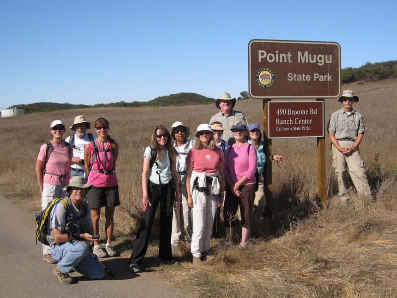
May 29th 2010 – Ray Miller La Jolla Valley Loop
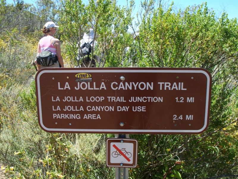
Seventeen hikers completed the 7.28 mile loop today. We enjoyed better and better ocean views as we made the climb up the very windy Ray Miller Trail. The Overlook Trail took us up to just over 1,000’, before we made the left turn to descend into La Jolla Valley. We stopped by the shady La Jolla Campground for lunch, before picking up the La Jolla Canyon Trail which led us back to the trailhead in 2.4 miles. Although it was late season, there was still a fine showing of wildflowers. It was 65 degrees when we started the hike with only a bit of haze on the ocean. It was 70 degrees when the hike was over and 88 degrees when we arrived back home in Simi Valley.
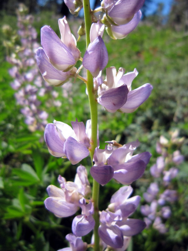
May 22nd 2010 – Sandstone Peak (via the Mishe Mokwa Trail)
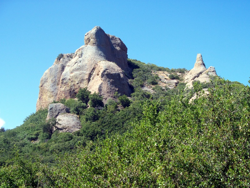
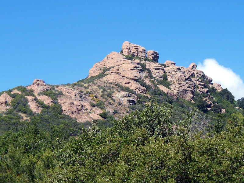
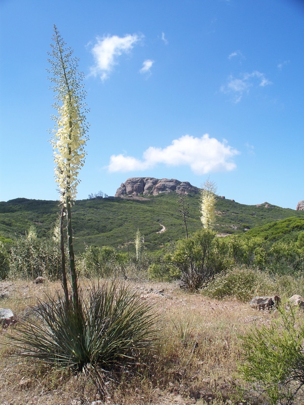
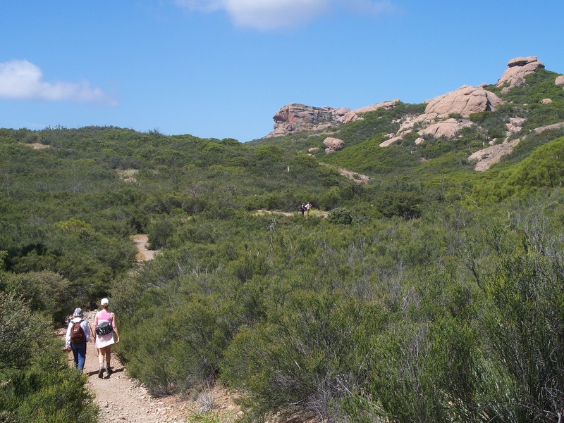
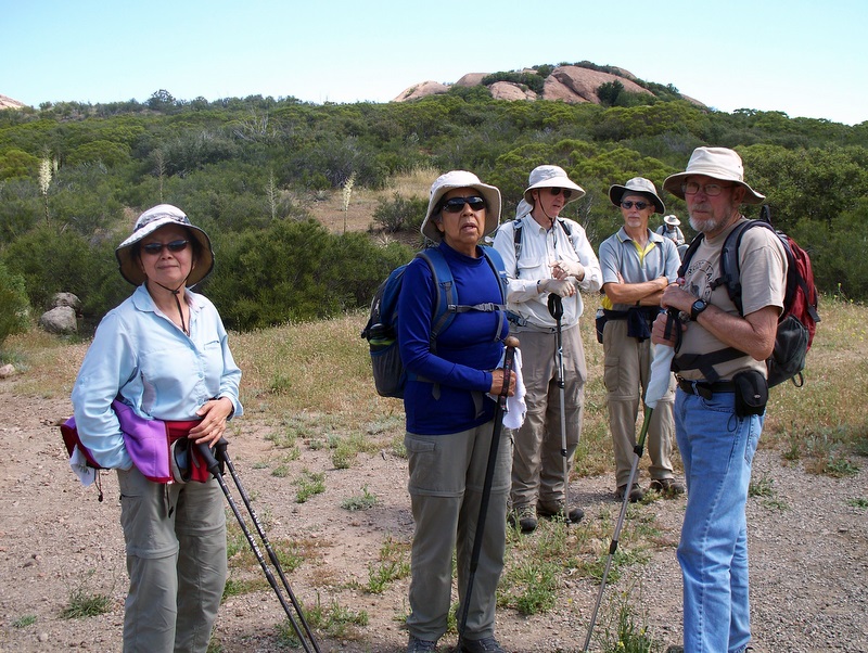
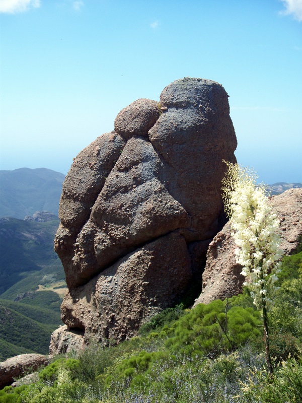
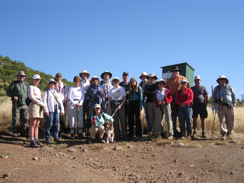
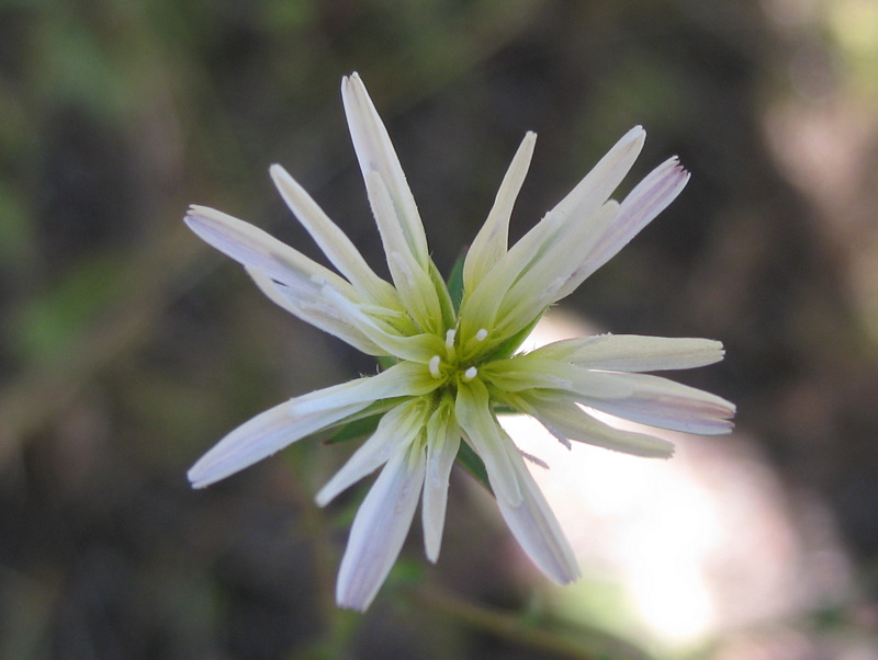
20 hikers (+ Heidi, a cute dog) met at the carpool point near the intersection of Royal Avenue and Madera Road on a cool morning and then traveled to the Mishe Mokwa trailhead at Triunfo Pass (2,100’) in the Santa Monica Mountains via Hwy 23, Hwy 101, Hwy 23 (again), Mulholland Hwy, and Little Sycamore Canyon Road. The counterclockwise loop hike began on the Mishe Mokwa Trail (the name is from the Chippewa Indian legend of the mother bear, Mishe-Mokwa, and her two cubs who swim Lake Michigan for safety after a raging fire destroys their forest home in Wisconsin). The trail climbed quickly and then leveled out for a while before descending into Carlisle Canyon, providing excellent views of the reddish-colored Echo Cliffs (a long stretch of sheer vertical sandstone rock faces) against the green side of Boney Mountain and Balanced Rock, a huge house-sized boulder precariously balancing atop a smaller boulder. The lovely trail was frequently bordered by a wide variety of blooming wildflowers. We took a break at Split Rock where there’s a thick mini-grove of shade trees overhanging a large broken boulder (Split Rock) and one picnic table. As we resumed our hike, the trail climbed southward to a junction with the Backbone Trail (BBT) on a mesa affording great views of various peaks surrounding the area. We took the left (east) fork and continued along the BBT to the short spur trail leading up to Sandstone Peak (3,111’), aka Mt. Allen, the highest peak in the Santa Monica Mountains. The peak is just a hunk of grayish-white rock, but it provides a stunning 360-degree view (depending on the air quality) of the ocean, the mountains, and the Oxnard Plain. Visibility was only fair on this day, but the temperature was perfect for mountain hiking. Returning to the BBT we continued eastward to a junction with a wildflower-rich connector trail which led us again to the Mishe Mokwa Trail; we descended to the parking lot having completed a refreshing 6.3-mile hike with 1,459’ of elevation gain.
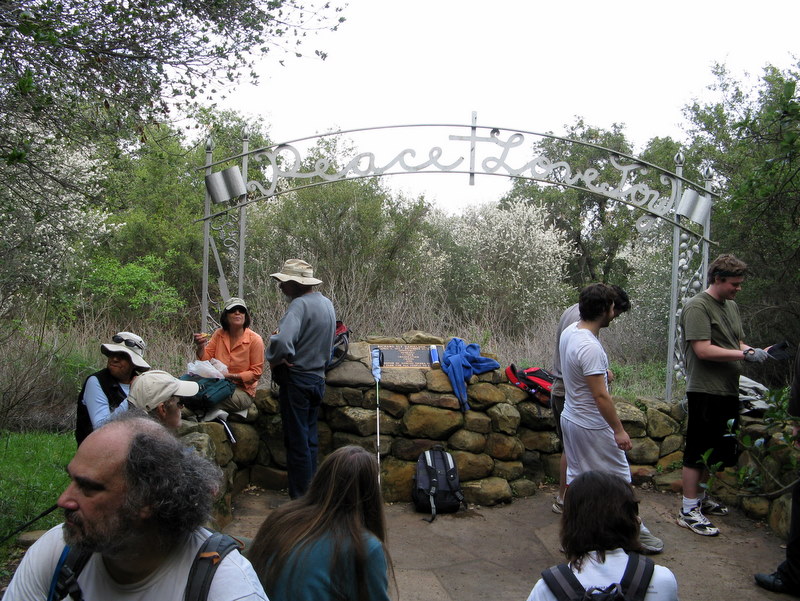
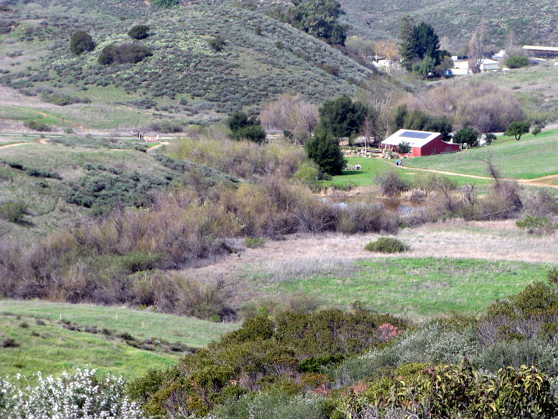
May 15th 2010 – Danielson Memorial & Waterfall

Four hikers met at Donut Delite in Simi Valley and carpooled to the parking lot at Wendy Drive to start the loop hike to the Danielson Memorial (aka Old Cabin Site) via Sycamore Falls. This trail is part of the Rancho Sierra Vista/Satwiwa Recreation area. It was very cool with almost no wind in the 50 degree range with low hanging fog. It was great hiking weather. The flowers were still dense, varied and beautiful. We took the Wendy Trail up to see the still windmill and up to the top of the ridge, using the Satwiwa Loop Trail. It was so foggy still that we could barely see Mount Boney. We headed up to Sycamore Falls on the fire road and dodged the poison oak. The Falls were still full of water, but no salamanders. They must come out later in the year. We headed up the steep ridge around to the memorial. The weather was still cool, and still no views of the ocean, but the fog was starting break. We ate lunch at the monument and rested for a bit before heading back on the other connecting trail back to the cars. We saw wild rose bushes, mariposa lilies, purple martins, poppies, purple and bush lupines, California Everlasting, wild blackberries, cactus, California, fuchsia, sunflowers, thistle, numerous kinds of sage, mustard, and much more. It was the most varied consistent and vibrant display of flowers we had seen in the Sycamore Falls area in many years. When we returned to the cars, we were tired but happy to have completed the approximately 6 to 7 miles and 800 foot elevation gain. Everyone agreed it was a great hike.
May 8th 2010 – Work Party – Lower Stagecoach Trail
Our May 8 work party on the Lower Stagecoach Trail was a success. Approximately 30 volunteers from the Church of Later Day Saints took part as well as five Trail Blazers. While we do not have the names of the Church volunteers, the participating Trail Blazers were John Sabol, Bart Hibbs, Martin DeGoey, Mike Kuhn and Richard Bradley. Much thanks to everyone.
May 1st 2010 – Vasquez Rocks + Pacific Crest Trail Section
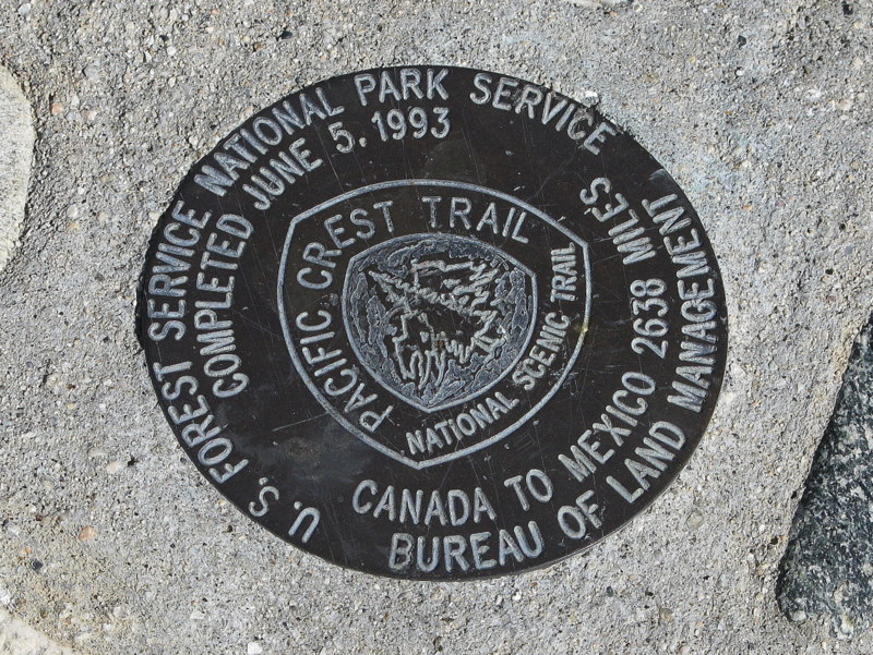
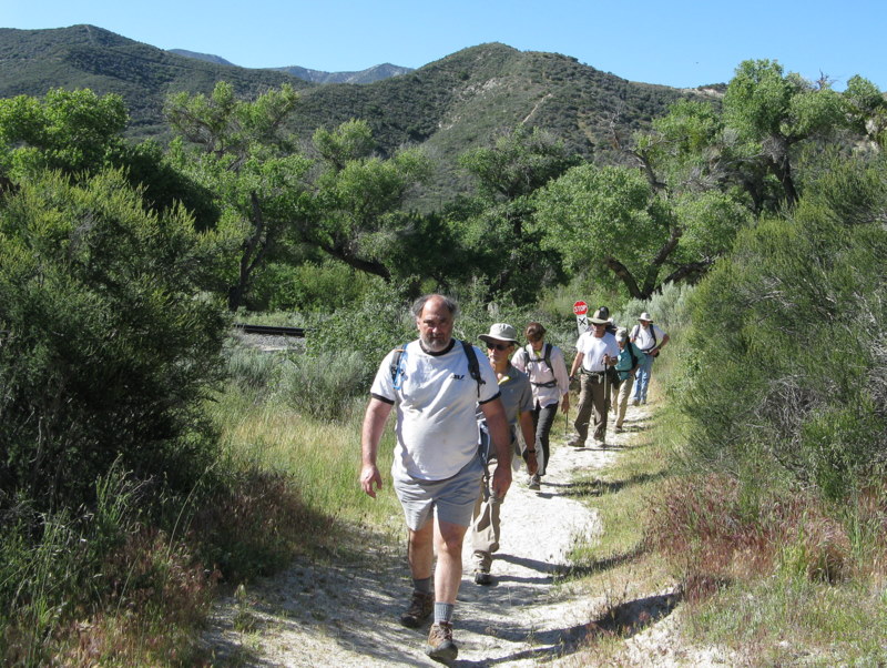
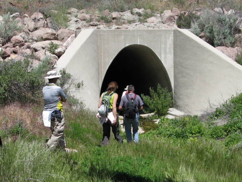
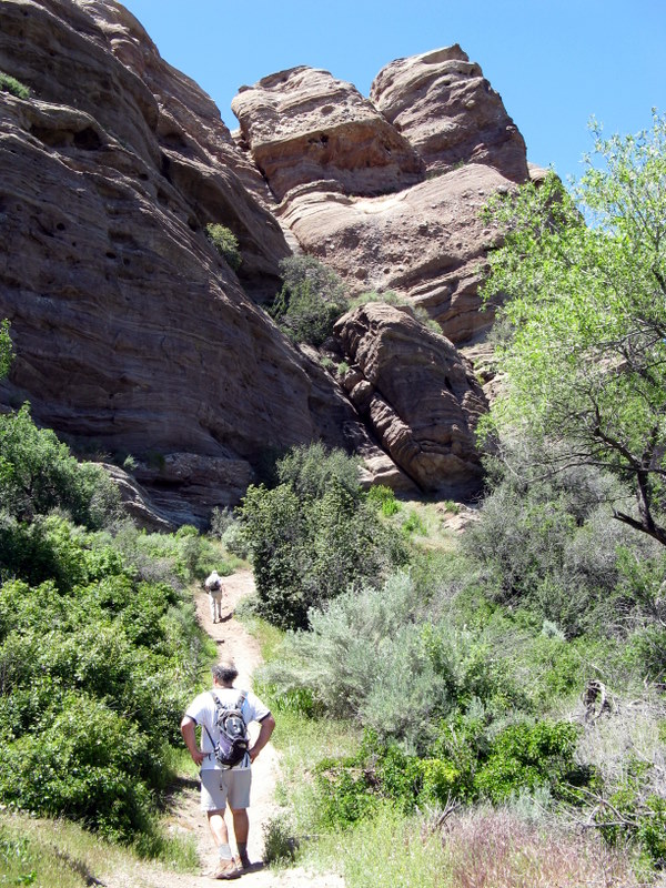
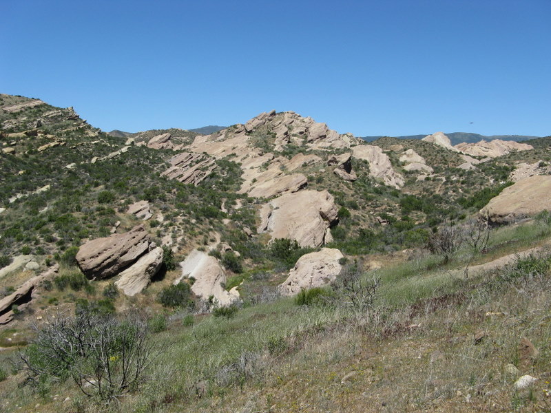
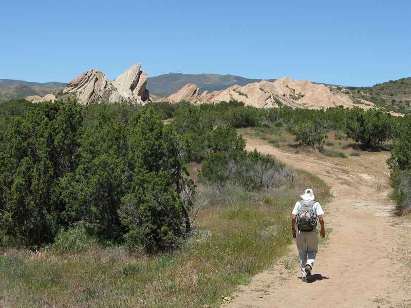
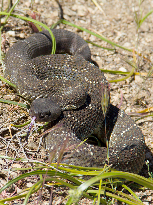
9 hikers met at the Stearns Street Park-and-Ride lot in Simi Valley on a clear and cool, slightly windy morning and then carpooled east and north to the Vasquez Rocks County Park via Hwy 118, I405, I5, Hwy 14, and Agua Dulce Canyon Road. Once there we left two shuttle vehicles and then drove to the point on Soledad Canyon Road at which the 2,650-mile long Pacific Crest Trail (PCT) crosses it. As the trail began it passed through a riparian woodland environment, soon reaching the Golden Spike Monument representing the completion of the PCT on June 5, 1993. The trail then began a gradual climb up the mountainous terrain toward Vasquez Rocks. The temperature was pleasant and a cool breeze kept us from overheating as we followed the wildflower-bordered trail to the mid-point of the hike. We then began descending toward the tunnel under Hwy 14 through which the PCT passes into Vasquez Rocks County Park; at two points along the way we encountered rattlesnakes, both of them quite unhappy with our presence. We stopped for lunch just after passing through the tunnel. When we resumed our hike we were greeted by the awe-inspiring Vasquez Rock formations that abound in the county park, a popular film industry location (Bonanza, Star Trek, and many others). The park is named for the 1850’s bandit Tiburcio Vasquez who used the mazes of rocks to hide out. Continuing on the PCT, we reached our shuttle vehicles, having completed a pleasant 9.1-mile hike with 1,500’ of elevation gain.
April 24th 2010 – Towsley Canyon
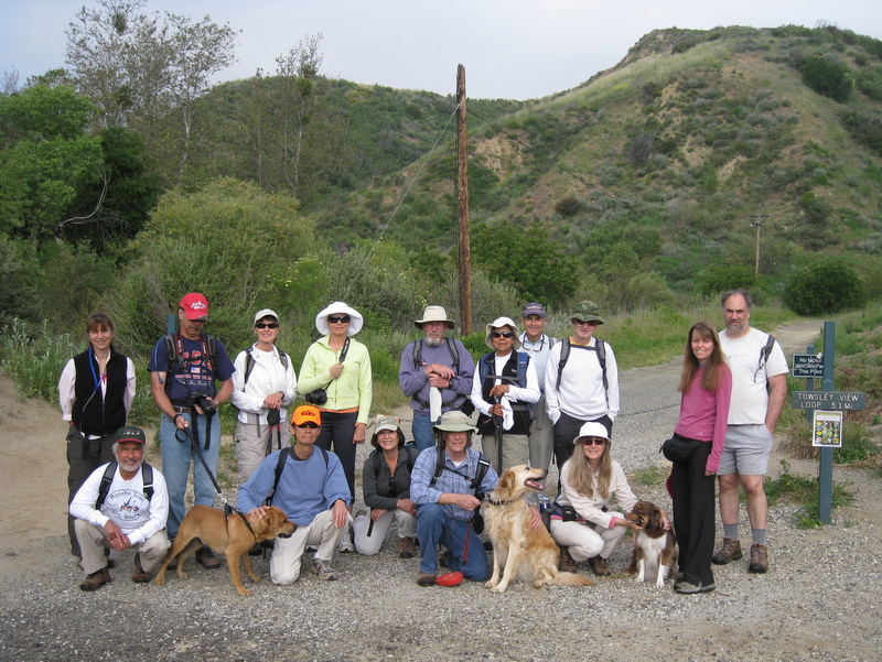
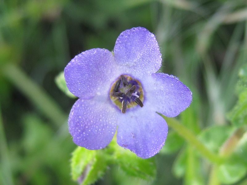
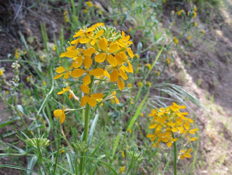
Towsley Canyon is well known for exceptional wildflower showings in the springtime. In past years, we’re been overwhelmed with the sheer quantity of wildflowers. This year wasn’t the best, but the variety was still quite good. There was a good showing of hikers, which more than made up for a less than optimum wildflower showing. We even had three dogs with us. The morning was comfortably cool, affording us great hiking. Everyone had a fine time, so we’ll return again next spring.
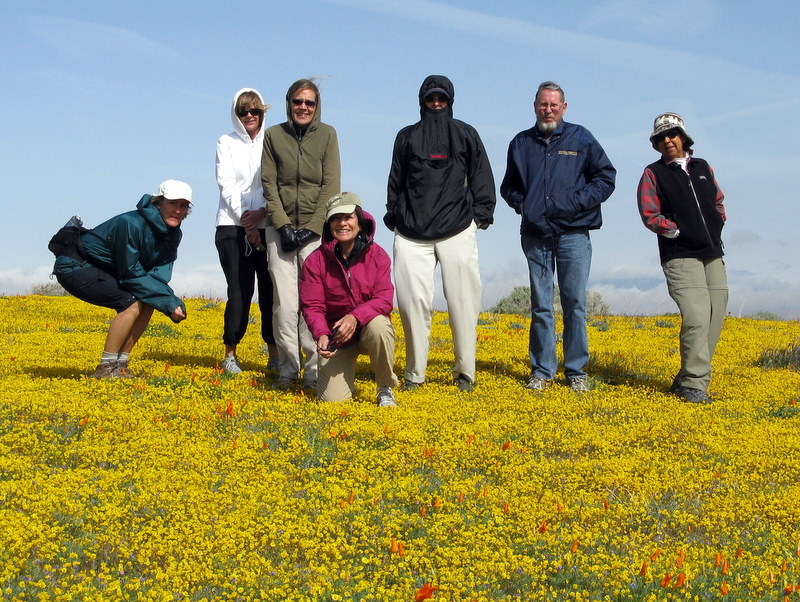
April 16th – 18th 2010 – Carrizo Plain National Monument
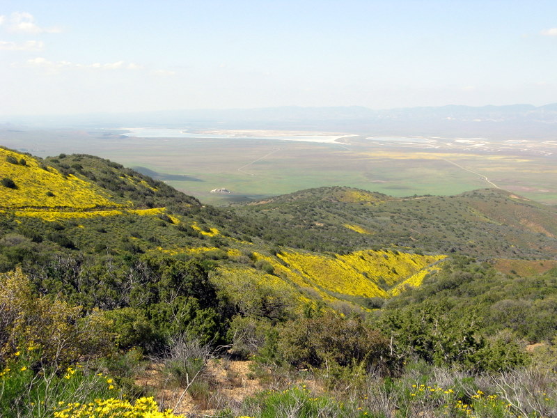
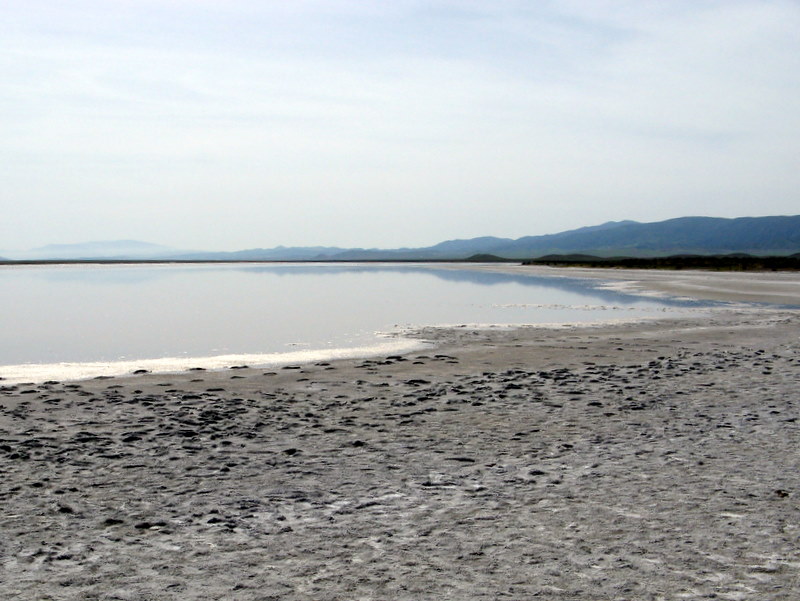
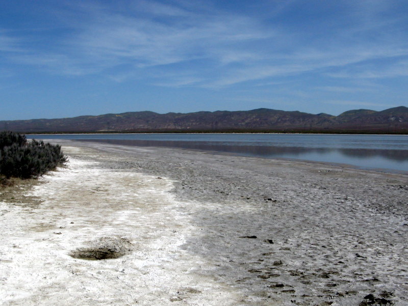
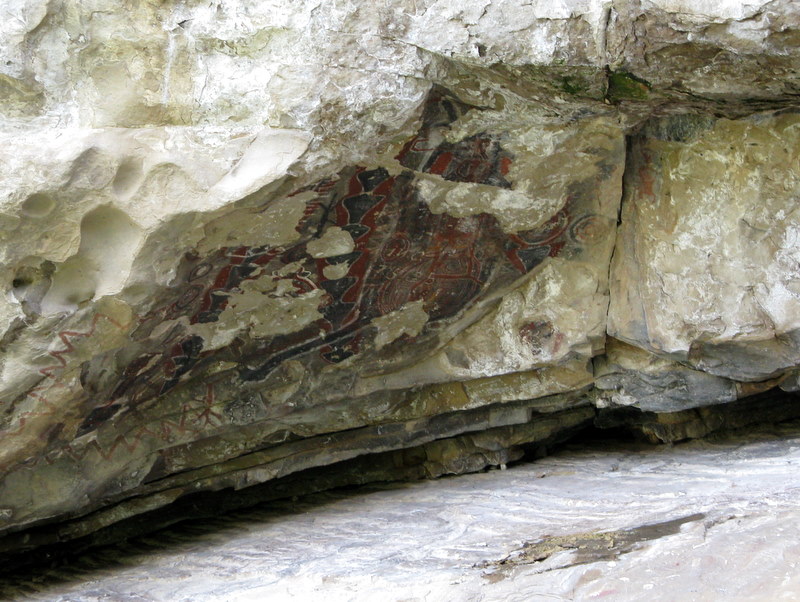
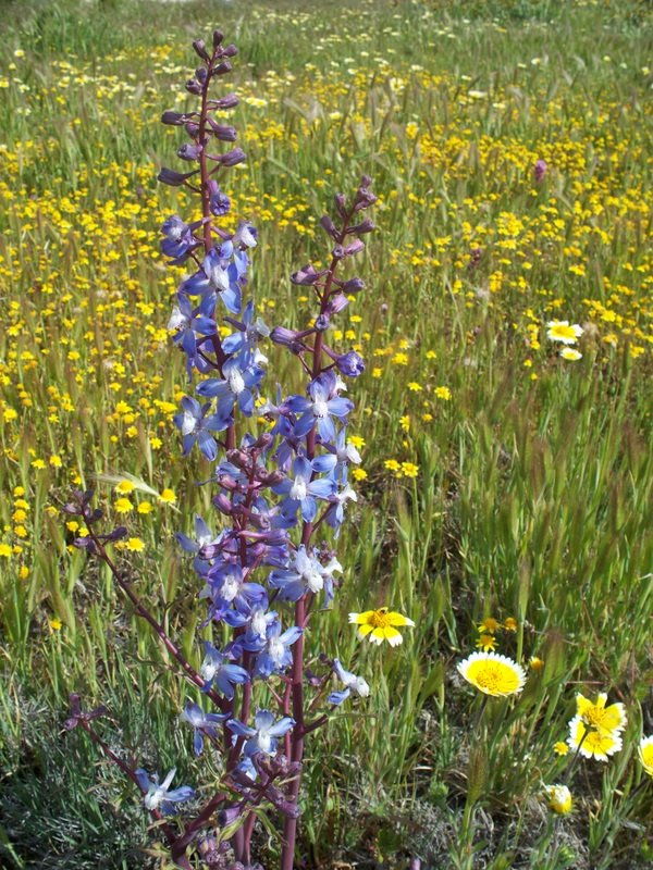
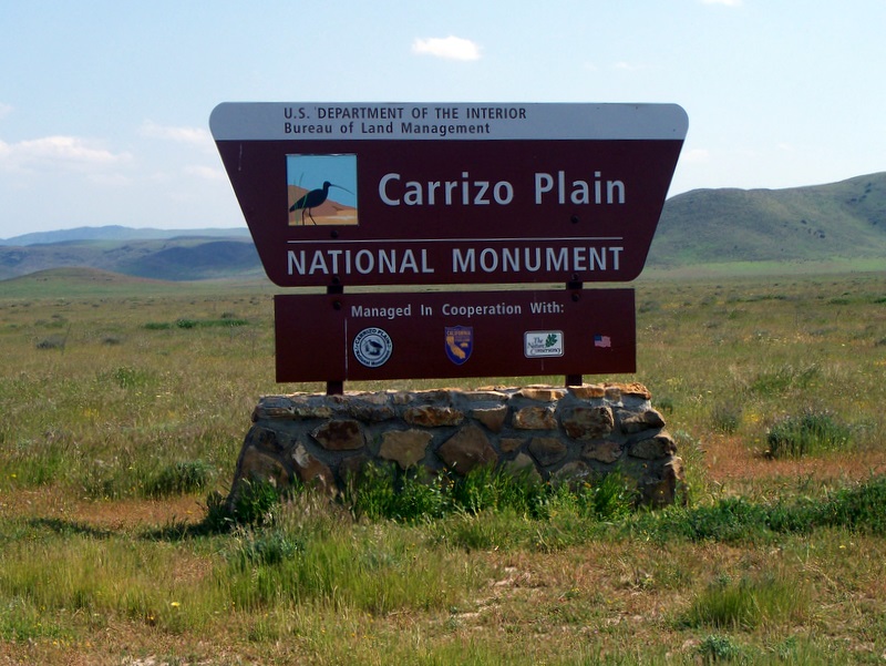
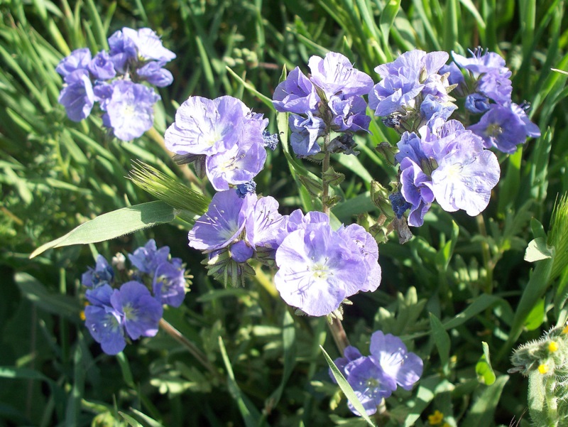
13 campers/hikers carpooled to the Carrizo Plain National Monument (CPNM) via Hwy 118, I405, I5 north and Hwy 166 west through Maricopa, CA to Soda Lake Road (some sections are paved; others are graded dirt) which runs through the entire monument between Highways 166 and 58. We camped at the first come-first served KCL Campground which has several large trees, picnic tables and toilet facilities, but no running/potable water [or RV hookups]; it must be brought in by the campers and all trash must be carried out by them. The CPNM occupies nearly 250,000 acres and is bordered by the Temblor Mountains on the northeast and by the Caliente Mountains on the southwest – Caliente Mountain (5,106’) is the highest peak in San Luis Obispo County. The San Andreas Fault runs through the monument and is particularly visible near Wallace Creek. We arrived near the peak of the wildflower season and were rewarded with stunning vistas of the plain and nearby mountain slopes covered by a dazzling variety of beautiful wildflowers. We drove to Selby Campground (no trees) on Friday afternoon and hiked steeply up a “use” trail to Caliente Ridge Road and then completed a clockwise loop back to Selby Campground while enjoying the panoramic views of the Carrizo Plain. That night we were serenaded by a very vocal owl and awakened the next morning to the sounds of the many birds nesting in the campground trees [there are very few trees on the plain]. We drove to the Goodwin Education Center on Saturday morning and participated in a ranger led nature walk including Overlook Hill (with great views of Soda Lake, the plain, and the surrounding mountains), the Soda Lake boardwalk, and Painted Rock which was probably used for religious ceremonies by Native Americans. We then drove to the Wallace Creek Trail via Seven Mile Road and Elkhorn Road. Once there we viewed the San Andreas Fault and hiked through a rolling grassland in the foothills of the Temblor Range. We struck camp on Sunday and returned home (about 150 miles), grateful for the opportunity to visit such a beautiful place.
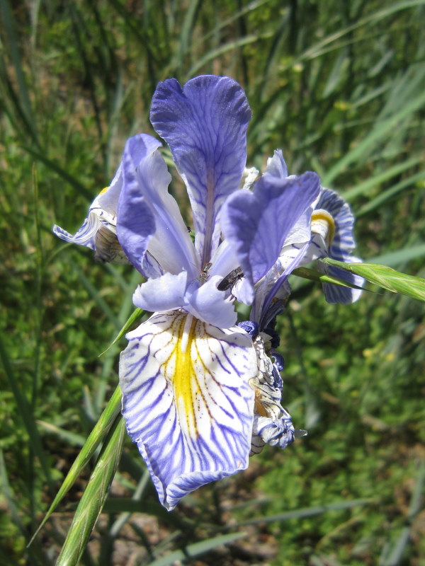
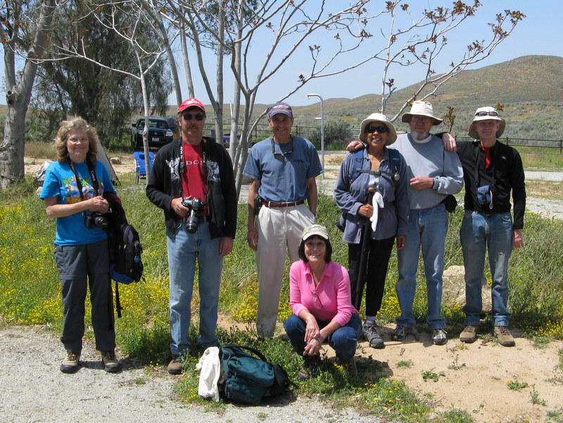
April 3rd 2010 – Wildflower Walk – Antelope Valley
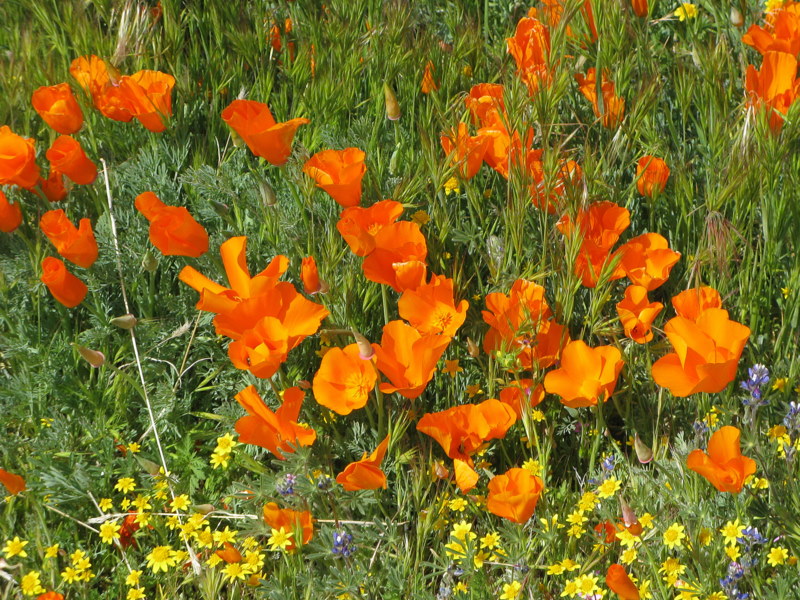
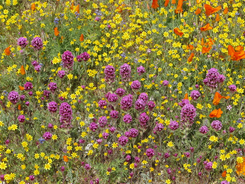
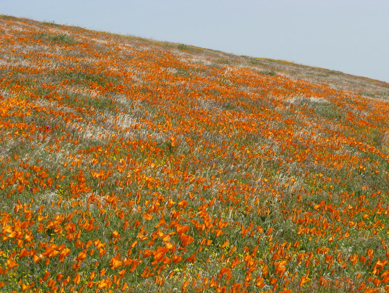
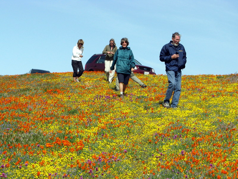
9 hikers met at the Stearns Street Park-and-Ride lot in Simi Valley on a cool spring morning and then carpooled north and then east toward the Antelope Valley California Poppy Reserve via Hwy 118, I405, I5, Hwy 138, and 170th Street, stopping in Gorman for a short “pit stop” along the way. Although the Gorman area was foggy, the sky cleared as we approached our destination. We turned eastward from 170th Street onto a dirt road a couple of miles northwest of the actual Poppy Reserve and began driving through a beautiful wildflower-covered landscape. Not only were there many swaths of orange-colored California poppies, but there were also several types of purple flowers and a vast carpet of yellow flowers on the hillsides. The day was windy and chilly so most of the poppies hadn’t opened, but they were nonetheless quite stunning. After stopping several times to walk among the flowers and taking many photographs, we returned to Hwy 138 and returned home.
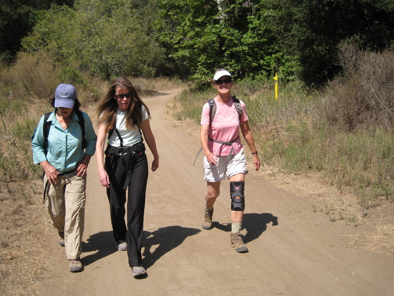
March 20th 2010 – Runkle Canyon Loop Exploratory Hike
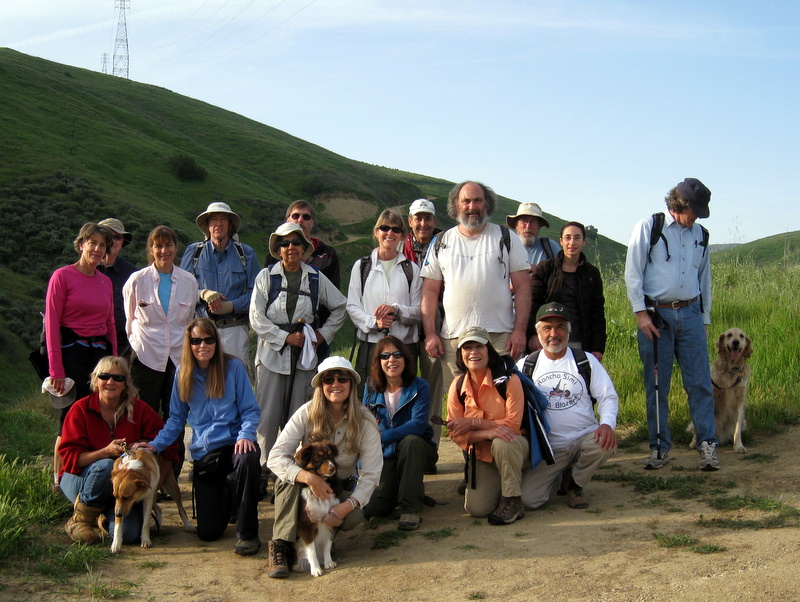
19 hikers (+ three dogs) met at Vista Del Arroyo Park on Chicory Leaf Place just east of Sequoia Avenue and just south of Royal Avenue for a hiking adventure in the beautiful springtime Simi Hills (which could easily be mistaken for Ireland this time of year). The trail initially headed east along the Arroyo Simi with views of the Arroyo Simi Equestrian Center to the south. Soon the trail turned south and began climbing a north-south ridge along the Edison Road toward the Albertson Motorway which runs east-west atop the Simi Hills. Soon we were rewarded with stunning views of the mountains and canyons and the American Jewish University Brandeis-Bardin campus to the east and Runkle Canyon and beyond to the west, as well as sweeping views across Simi Valley to the north, including the Santa Susana Mountains. The trail then descended a bit until it reached a junction with a connector trail heading west to the Runkle [Canyon] Fire Road. Ignoring the connector trail, we continued climbing to the south. As we did so, the Arness Fire Road appeared to the east and several unusually shaped structures on the Santa Susana Field Laboratory property [aka Boeing/Rocketdyne] loomed into view. Pretty wildflowers were abundant and green grasses had grown high due to the recent rains. Eventually we reached the Albertson Motorway (which stretches westward to the east end of Lang Ranch Parkway) where we took a rest/lunch break in the shade of some trees. After leisurely enjoying the pastoral surroundings, we returned to our vehicles, having completed an 8.5-mile hike with about 1,400’ of elevation gain.
March 13th 2010 – Tierra Rejada Park Exploratory Hike

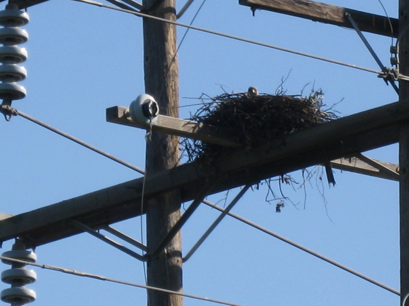
17 hikers (+ one cute dog) met at the Tierra Rejada Park trailhead at the north end of Stargaze Place on a pleasant southern California “winter” morning. The trail initially headed toward the Arroyo Simi, but soon headed uphill to the west along an Edison Road. The verdant hillsides were sprinkled with a variety of wildflowers, including California poppies, thanks to the recent rains and visibility was excellent. We spotted a large hawk’s nest near the top of one of the utility towers. Eventually the trail headed south and then climbed west/northwest along an abandoned, somewhat overgrown, flower- and grass-covered ridge road affording excellent 360-degree views of the surrounding mountains and valleys, including the Reagan Presidential Library and Moorpark College. After taking a lunch/rest break atop a high ridge from which we could see Fairweather Crossing, we retraced our steps to our vehicles, having completed an 8.5-mile hike with 1,686’ of elevation gain on a beautiful day for hiking.
March 6th 2010 – Las Llajas Canyon – Abandoned Mining Operation – Chivo Canyon Loop
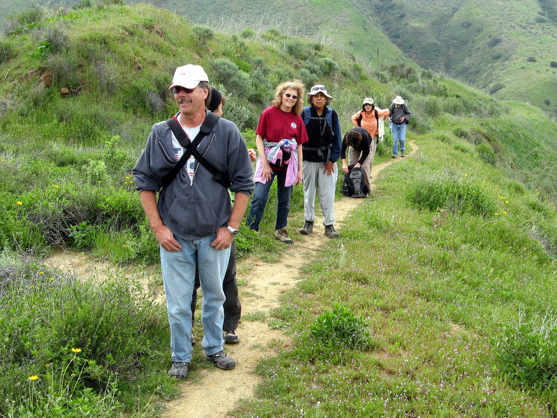
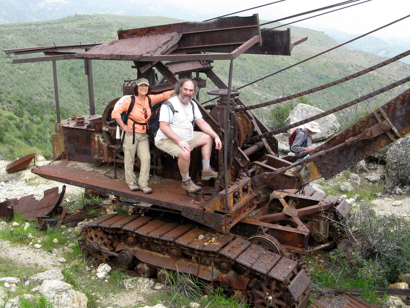
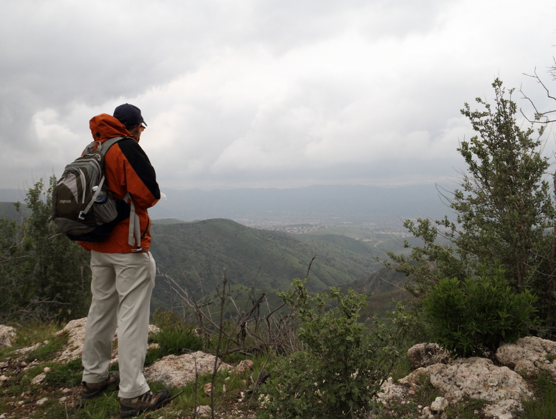
Despite the possibility of some rain, ten hikers met at the Las Llajas Canyon trailhead on Evening Sky Drive in Simi Valley on a chilly morning. We began the hike under a beautiful blue sky by descending a short paved section of road into the canyon bottom; from there we followed the dirt road upstream to the north 1.8 miles, crossing the flowing creek three times. We then took a “use” trail to the west, climbing up the wildflower-covered slope of the mountain toward a peak overlooking Chivo Canyon on which there is an abandoned mining operation. Many mining equipment artifacts are strewn about near the mining site, most notably a P&H Model 206 steam shovel. We walked over to a pair of high points nearby and enjoyed panoramic views of Las Llajas Canyon, Chivo Canyon, and the rolling green countryside to the north and west. We then followed fire breaks and cow paths to upper Chivo Canyon. The trail then led through a pleasant oak woodland to a “slot canyon” section; at that point it began to rain. After donning our rain gear, we continued hiking downstream through the “slot canyon” section, passing the skeletons of a cow and a deer along the way. Upon reaching lower Chivo Canyon, we headed directly to the mouth of Chivo Canyon at Cottonwood Drive, at which point the rain stopped. We walked back to our vehicles along the sidewalk, completing an 8.9-mile hike with 1,305’ of elevation gain, somewhat wet and muddy, but happy to have hiked.
February 13th 2010 – O’Melveny Park Trail
Ten hikers met for the O’Melveny Park Hike to Mission Point. This hike can be done in several ways and we chose to do the climb out of O’Melveny Park. It was a beautiful clear day but quite breezy. The hills were green and lupin wildflowers were everywhere. As we neared the gas company fenced area near the top we discovered some enterprising individuals had cut a switchback path to the top, complete with decorative rock pylons. Although the views from the top were spectacular, the wind was blowing very hard so we didn’t spend much time there. We started down and returned by way of the fire road and exited on Neon Way.
January 30th 2010 – Danielson Memorial Loop via the Fossil Trail, Old Boney Mountain Trail, and Danielson Road
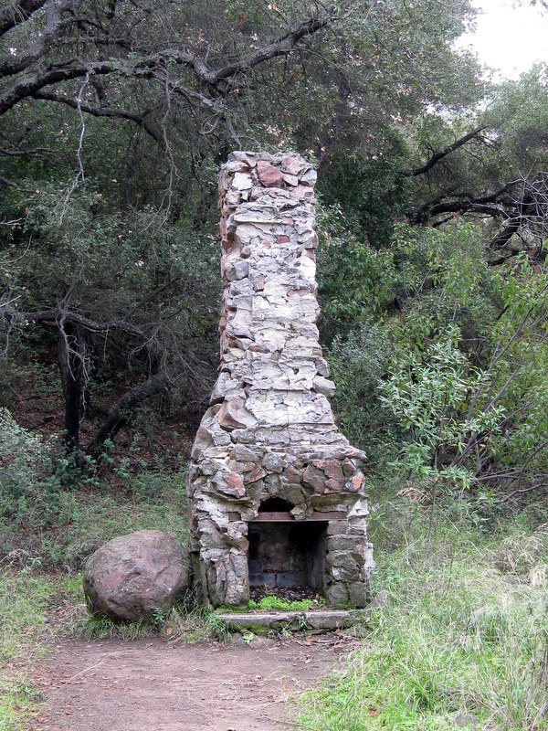
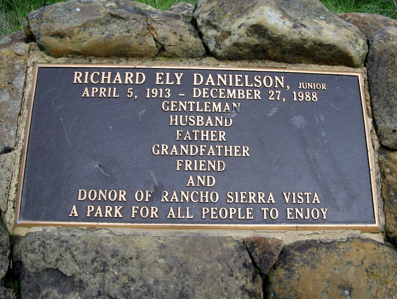
12 hikers met at the carpool point near the intersection of Royal Avenue and Madera Road on a chilly partially overcast morning and then traveled to Rancho Sierra Vista in the Santa Monica Mountains near Newbury Park. The hike began by walking from the main parking lot to the Satwiwa Native American Indian Culture Center and then heading south along the paved Sycamore Canyon Road descending into the canyon. Immediately after crossing the bridge in the canyon bottom, we left the road [and the bicycle riders] and headed northeast on the Upper Sycamore Canyon Trail for a short distance to a junction with the Fossil Trail which we took. The trail began climbing steeply to the east on a flank of Boney Mountain, the scenery growing ever more appealing as we gained elevation. The top of the mountain ahead of us was cloaked in clouds, the air was cool and crisp, and the foliage bright and clean, having been scrubbed by the recent rains. As we neared the junction with the Old Boney Trail, we noticed the fossils embedded in the Fossil Trail which gave the trail its name. After stopping to take photos, we continued our climb, soon reaching the Old Boney Trail. After a short rest break, we turned left (north) on the Old Boney Trail and followed it as it contoured north/northeast around the mountain, providing spectacular views of the upper end of Big Sycamore Canyon. The trail eventually ended at Danielson Road. We turned right (south) and walked 0.3 mile to the Danielson Memorial and the ruins of the Danielson house (only a chimney remains). After a lunch break, we headed back along the Danielson Road as it descended to a creek, taking a short spur to the east to look at a waterfall. After crossing the creek Danielson Road climbed along the north side of Upper Sycamore Canyon to a high point that provided an excellent view of the area surrounding the Satwiwa Culture Center. We then crossed the grassland adjoining the Culture Center and returned to the main parking lot having completed a 7.7-mile hike with 1,730’ of elevation gain on another great southern California winter day.
January 16th 2010 – Cheeseboro Canyon Canyon / Palo Comado Canyon Loop

16 hikers (+ Heidi, a cute dog) met at the carpool point near the intersection of Royal Avenue and Madera Road on a partially overcast morning and then traveled to the Cheeseboro Canyon trailhead in the Simi Hills via Hwy 23, Hwy 101, and Chesebro Road. The hike began on the Modelo Trail as it rose to the north from the main parking lot along a ridge, providing views of the rolling countryside under a cerulean sky dotted with white clouds. Soon the trail headed west on the Palo Comado Connector, passing a couple of horse ranches whose four-legged residents curiously watched our passage. Heading north along the main dirt road in Palo Comado Canyon, we passed through a wide grassland dotted with occasional stands of large oak trees; it was a beautiful day. Soon after the road began its climb toward China Flat, we turned right (northeast) onto a dirt trail that led northward along a steep ridge to an overlook of Palo Comado Canyon to the south. We shared our overlook perch with a group of bicycle riders. After a short break during which we watched several riders on horseback, we headed east, descending toward Shepherd’s Flat at the north end of Cheeseboro Canyon and passing the abandoned Sheep Corral along the way. Turning southward, we began our return trip via always lovely Cheeseboro Canyon, first passing through terrain dominated by striking rock formations and then passing through a riparian woodland at Sulphur Springs. The bicycle traffic in the canyon increased significantly in Cheeseboro Canyon since many other people were also taking advantage of the great weather. We continued southward, passing through a dense oak woodland and then through an open grassland, eventually reaching the lower parking lot, having completed a 10.9-mile hike with 1,254’ of elevation gain on a perfect day to be outside.
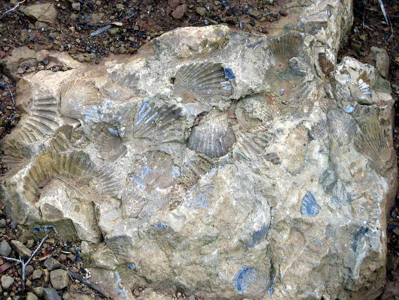
January 9th 2010 – Las Llajas Canyon and Chumash Trail Loop
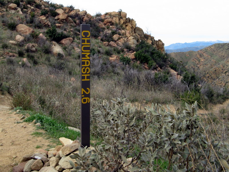
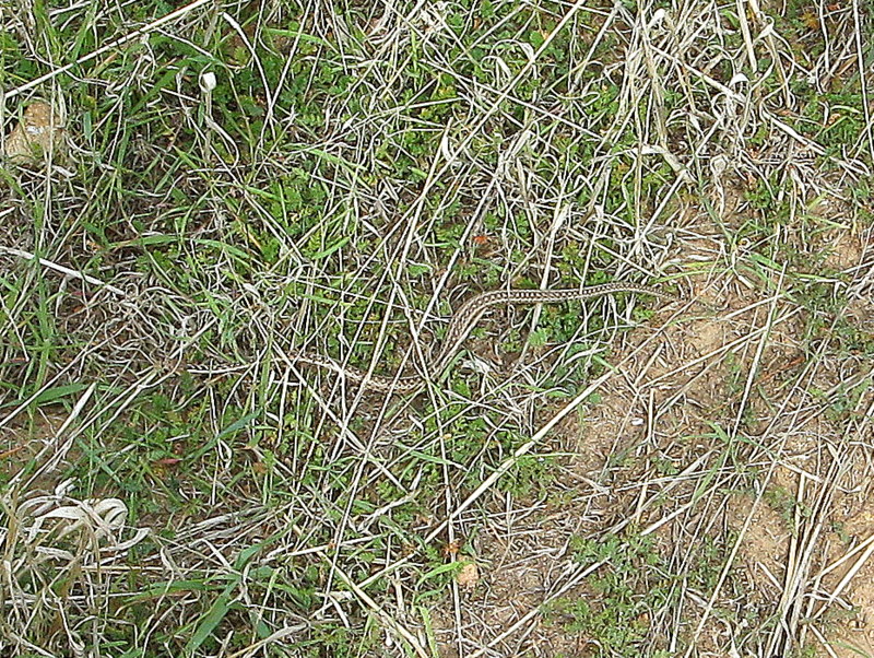
18 hikers (+ 2 dogs) met at the Las Llajas Canyon trailhead on Evening Sky Drive in Simi Valley on a chilly breezy morning. The hike began by descending a short paved section of road into the canyon bottom; from there a wide graded dirt road followed a stream to the north through the canyon, crossing the creek three times; there was some water flowing in the creek, though not much. A mile or so upstream the chilly wind abated and the next 2.5 miles up-canyon to the Poe Ranch gate were quite pleasant. The mountain hillsides were a nice shade of green combined with the usual shade of white where the slopes are very steep and there is little water. After reaching the trail/road junction just short of the Poe Ranch gate, four hikers decided to return to Evening Sky Drive the way they had come [resulting in a 7-mile hike with 500’ of elevation gain]. The remaining 14 hikers (+ 2 dogs) took the right (east) fork and continued up the dirt road leading to an abandoned oil field and then on up to a junction with the Rocky Peak Fire Road, savoring the great views along the way. After reaching the Rocky Peak Fire Road, we turned right and headed south toward the upper end of the Chumash Trail. Along the way we passed Fossil Hill (named for the shells of sea creatures left behind when the area was under a vast sea) and a wide variety of other hikers and bicycle riders. We enjoyed the panoramic views of mountains and canyons to the east, south, and west. Upon reaching the upper end of the Chumash Trail (adorned by a new sign proclaiming “Chumash 2.6 miles”), we rapidly descended the familiar trail almost to the Flanagan Drive trailhead. We then turned right (west) and followed a short trail to a closed, but not locked, gate in a fence at the east end of Evening Sky Drive, passing what appeared to be a baby rattlesnake along the way. A short walk along Evening Sky Drive took us back to our vehicles, having completed a 9.6-mile hike with 1,793’ of elevation gain.
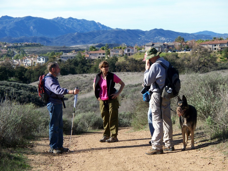
January 2nd 2010 – Long Canyon & Lang Ranch Loop
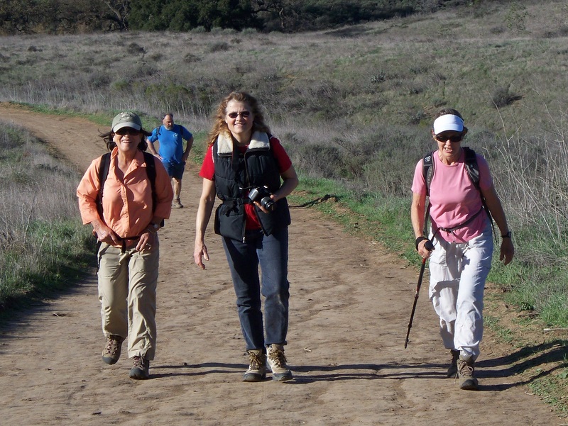
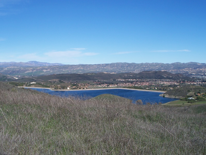
16 hikers (+ 3 dogs) met in the parking lot at the junction of Wood Ranch Parkway and Long Canyon Road in Simi Valley on a beautiful morning. The hike began along the Long Canyon trail as it climbed somewhat steeply 0.7 mile to a trail junction atop a ridge overlooking western Simi Valley to the north as well as the Lang Ranch Open Space to the south. The recent rain had cleansed the air, so the views were quite good. After a group photo was taken, we hiked 0.2 mile southeast along a fire road, then turned right at a trail junction and hiked uphill 0.2 mile to the southwest where we encountered a group of mountain bikers. We took the left fork (a trail rather than a fire road) and descended 0.6 mile to a junction with a fire road. Turning right (south) we hiked 0.4 mile to a junction with the Albertson Motorway, passing through a pleasant grove of oak trees along the way. We turned right (west) and followed the Albertson Motorway 1.5 miles beside (and sometimes through) an oak woodland to the east end of the (paved) Lang Ranch Parkway. A short distance to the west, we followed (paved) Autumn Ridge Drive to the northeast end of Westlake Blvd. There we left the pavement and hiked 0.5 mile north to a three-way trail junction (having taken the l eft fork at the 0.4-mile mark). Four of the hikers decided to follow the direct route 1.1 miles back to the parking lot; the 12 remaining hikers headed west on the Sunset Hills trail (soon passing one trail to the right and then one to the left). The dirt trail became a wide paved trail for a while, but reverted to dirt after crossing a paved road leading into a gated subdivision. As it continued to the west, the trail then climbed to a hilltop which afforded 360-degree panoramic views of the surrounding countryside, including Thousand Oaks, Lang Ranch, and the mountains to the north, south, and east. Soon the trail descended to Sunset Hills Blvd where there is a small public parking lot and a pretty “pocket park.” After a rest break, we crossed Sunset Hills Blvd and resumed our hike on the trail on the north side, now heading east. Soon the trail led along a fence enclosing the Bard Reservoir, providing good close-up views of it. As we continued hiking eastward, we were rewarded with stunning views of giant rock formations and we could see White Face Mountain to the north. We reached the parking lot having completed an 8-mile hike with 1,500’ of elevation gain (the Sunset Hills trail having added two miles to the total distance) on a great day for hiking.