2022
DECEMBER
December 17th – Work Party: Mt. McCoy
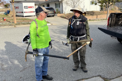
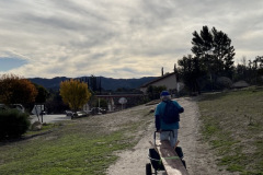
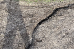
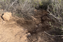
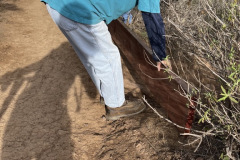
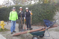
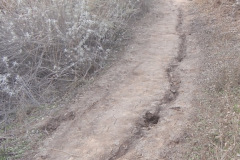
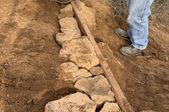
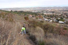
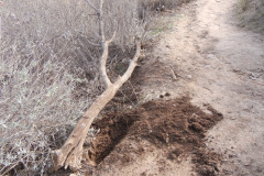
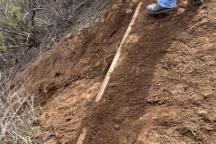
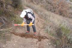
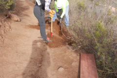
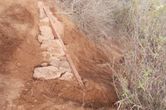
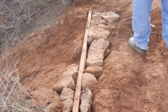
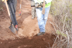
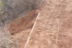
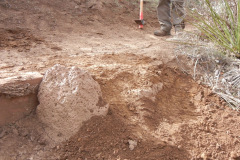
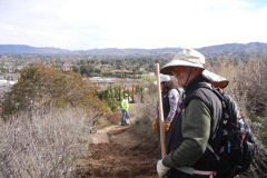
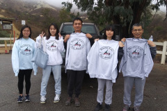
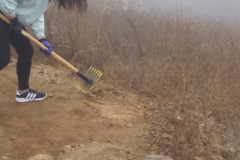
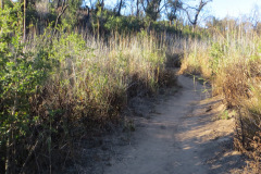
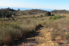
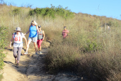
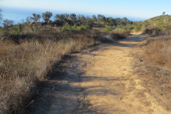
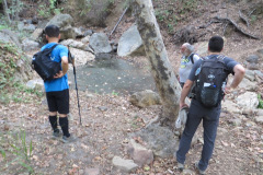
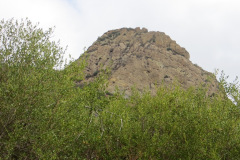
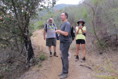
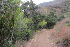
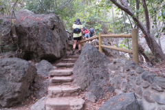
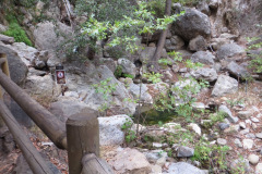
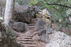
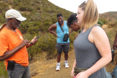
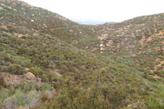
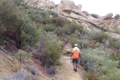
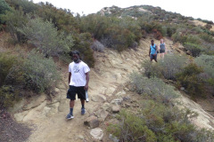
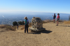
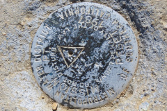
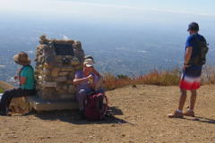
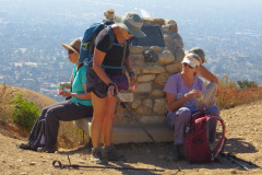
Four volunteers met at the Mt. McCoy trailhead and began work by hauling a retaining plank and filling in ruts. We cleared and created water bars (drain dips) and the ground was in perfect working condition. The air was calm and cool. There were few hikers, probably because of the holidays coming up. The trail was worked to about midway to the cross, where there was an eroded shortcut trail intruding into the main trail. There we trenched in the 2”x12”x8’ pressure treated redwood plank, anchoring it in with carefully fitted rocks, like putting together the pieces of a puzzle. We filled in the trail with dirt from a new water bar a few yards up the trail. RSTB logo shirts are given to all volunteers. Special thanks go out to our star volunteer Geneen Garcia, talented Madison Christian, Mike Kuhn, and Martin DeGoey.
OCTOBER
October 15th – Work Party: Long Canyon
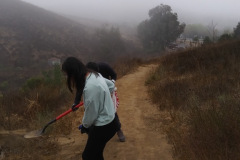
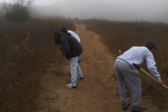
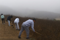
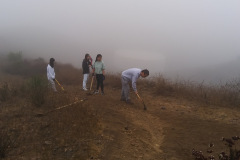
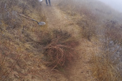
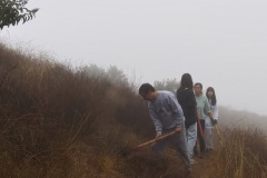
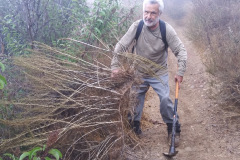
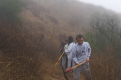
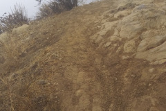
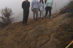
We arrived at the trailhead despite the gloomy sky and slight drizzle. There were plenty of cars in the parking lot, both hikers and people with bikes. Five volunteers showed up and decided to brave the misty weather. We cleaned out water bar runoffs as best we could. The ground was still hard as a rock from lack of moisture. We removed stones and left over dead brush from the trail. There was some Deer Weed (plant), and some California Sage Brush, along the trail to clear before coming growing season. Further up the trail, we leveled out a couple places of rock cropings, and shored up the edge of the trail with the rocks we removed. After a full morning of work, the mist thickened to a drizzle, and we headed back down to the parking lot arriving a little soggy. Special thanks go out to the troopers from Student Corps: Liang Wang, Amy Wang, Yuet Tung Wang, Anna Lu, and Chun Lu.
October 1st – Devil Canyon to Browns Canyon Road
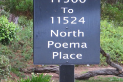
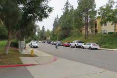
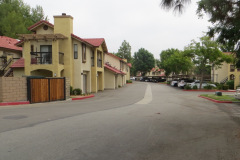
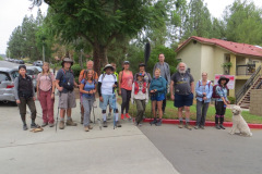
6 hikers (and one dog) met at the hike’s starting point on Poema Place in Chatsworth on a cool early autumn morning. As our hike began we descended along a fairly steep “use” trail into the heavily shaded bottom of Devil Canyon where we followed the remnants of the Devil Canyon Motorway upstream as it frequently crisscrossed the currently dry creek bed (several stretches of trail are in the stream bed) but there was no water in the stream. We spotted lots of interesting sandstone-rock-cliff formations and a variety of healthy plants as we made our way up to the large check dam at the trail’s junction with the mouth of Ybarra Canyon. After a brief rest break we continued upstream along the dry trail. As the canyon widened we passed by hillsides dotted with oak trees. When we reached the upper-canyon Cathedral-like oak woodland, the trail looked more like the one-lane road it once was. Surprisingly the trees and some of the bushes were an attractive bright green despite the ongoing drought.
show more
show less
SEPTEMBER
September 24th – Charmlee Wilderness Park (aka Charmlee Natural Area) in Malibu
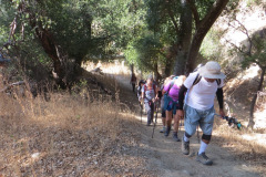
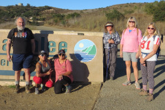
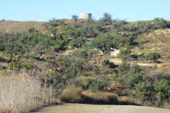
8 hikers gathered just outside the gated entrance road into Charmlee Wilderness Park in the Santa Monica Mountains overlooking Malibu on a pleasantly cool early autumn morning (Note 1: The gate isn’t opened until 8 AM; Note 2: There is no longer a parking fee). The park has a somewhat bewildering network of trails criss-crossing it but our route this day was a clockwise loop mostly around the outer edges of the park. We began our hike at what had been a picnic area (destroyed by the 2018 Woolsey Fire) a short distance south of the information board along the Botany Trail as it rose through a fire-damaged oak grove to a three-way trail split. We continued straight ahead on the main trail as it passed between the eastern edge of the dry grass meadow that occupies much of the park on one side and mostly dead oak trees and rock outcroppings on the other (east) side. Eventually we reached “Ocean Vista” overlooking the Pacific Ocean which lay more than 1,000’ below (unfortunately the distant views were largely obscured).
show more
show less
September 17th – Solstice Canyon, Sostomo Trail, Deer Valley Loop Trail, and Tropical Terrace
5 hikers met in the main parking lot at Solstice Canyon in the Santa Monica Mountains National Recreation Area near the Pacific Ocean on a cool overcast late summer morning. Our out-and-back hike began by following nearly dry Solstice Creek along the almost level, well-shaded Solstice Canyon Trail (a dirt road), taking advantage of two short trails paralleling the dirt road along the way, and reaching the Sostomo Trail junction after about one mile. Next we followed the Sostomo Trail as it climbed steadily toward a junction with the Deer Valley Loop Trail, enjoying a pleasant [not hot] day with green mountainsides. As the somewhat-shaded trail rose we had clear views of Solstice Canyon and the Rising Sun Trail across the canyon.
show more
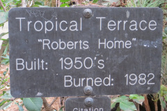
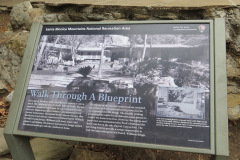
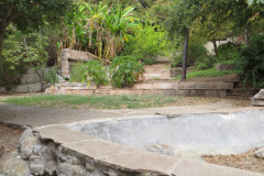
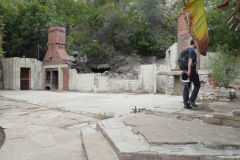
Turning left we walked the very short distance to Tropical Terrace, the ruins of the Roberts house built in the 1950s and destroyed by wildfire in 1982. At one time there were giraffes, camels, buffalo, African deer, and exotic birds in the canyon (but not now!). We took a lengthy rest break at Tropical Terrace and enjoyed the ambiance of palm trees, and murmuring Solstice Creek, but there was no visible water in the nearby “waterfall.” We then returned to our vehicles via the Solstice Canyon Trail having completed a 6.6-mile hike with about 1,600’ of elevation gain/loss.
NOTE: The gate blocking entrance to the driveway leading to the main parking lot was open a few minutes before 6 AM and was empty at that time. A second vehicle arrived at 6:25 AM and a third one arrived at 6:35 AM. After that vehicles arrived at an increased rate; however, there were still a few empty parking spaces at 7:30 AM. After that there were no empty parking spaces [except when a vehicle left and the space was almost immediately filled) until sometime after we left at around 11 AM. Conclusion: It it’s a Saturday morning we should arrive by 7:15 AM
show less
September 10th – Chumash Trail to Rocky Peak Fire Road
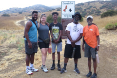
6 hikers met at 7:00 AM at the Chumash Trail trailhead at the northeast end of Flanagan Drive in Simi Valley on a cool somewhat overcast morning that escaped rain from Hurricane Kay during the hike; instead the sky changed so that there were patches of blue sky. We hiked steadily up the trail as it rose through a rocky landscape until we reached the Rocky Peak Fire Road (our turnaround point). Although there were not many blooming plants along the way, the recent rain had “cleansed” the mountain chaparral so it was an attractive bright green. Also we were cooled by an intermittent breeze. After resting for a while at the turnaround point, we returned the way we came, this time “beating the hurricane,” as we completed a nice 5.4-mile hike with an elevation gain/loss of around 1,250’. We encountered very few other hikers and only a single bicyclist.
AUGUST
August 27th – East Canyon (and Corral Sunshine Motorway) to Mission Point
12 hikers met at the trailhead in the “East Canyon, Rice Canyon, and Michael D. Antonovich Open Space” section of the 4,000-acre Santa Clarita Woodlands Park via Interstate 5 and “The Old Road” in Santa Clarita. It was pleasant as we began hiking southward along the shady somewhat-eroded East Canyon Motorway as it followed the small dry creek bed in the canyon bottom. The route was lined with bay laurel, black walnut, cottonwood, sycamore, and oak trees. Soon the dirt road began rising more steeply along the eastern side of a partly wooded ridge and we were exposed to direct sunlight for some distance; fortunately it wasn’t yet a hot morning. After a while the dirt road began rising on the west side of the ridge and there was a lot of shade including lots of black walnut trees. We enjoyed views of the steep slopes to the west and a few surviving relics of the bigcone Douglas-fir trees that once covered the mountain [most of the trees appear to have died as a result of the ongoing drought and wildfire]. An intermittent breeze cooled us and the temperature became pleasant as the road led us upward to a junction with Bridge Road (and the Oat Mountain Motorway) which is blocked by a SoCal Gas fence and gate where we took a break.
show more
show less
August 20th – Las Llajas Canyon to the Abandoned Coquina Mining Operation
25 hikers met at the trailhead on Evening Sky Drive on a pleasant summer morning. We began our hike by descending a short paved section of road into the canyon bottom; from there we followed the wide well-graded dirt road upstream to the north 1.8 miles, crossing the dry streambed three times. We then followed a not-so-overgrown “use” trail (the remnants of an old mining road) as we climbed up the eastern slope of the mountain, atop which we enjoyed panoramic views of the surrounding area including parts of Chivo Canyon, Las Llajas Canyon, the Santa Susana Mountains, and Simi Valley. We were in shade during the first couple of miles of the hike and the temperature was moderate for the trek to the top of the mountain.
show more
show less
August 13th – Upper Zuma Canyon (BBT) and Zuma Ridge Trail to Buzzard’s Roost
[Best_Wordpress_Gallery id=”512″ gal_title=”Upper Zuma Canyon and Zuma Ridge Trail to Buzzards Roost 8-13-2022″]
11 hikers met at the Upper Zuma Canyon trailhead on Kanan Dume Road just north of Tunnel #1 early on a pleasant (but forecast to get hot) morning. We began our hike by heading west along the Santa Monica Mountains Backbone Trail (BBT) as it descended into Upper Zuma Canyon. After crossing Newton Creek, the no-longer well-shaded trail rose and fell until we reached a very nice bridge crossing dry Zuma Creek. We continued following the sparsely shaded BBT westward as the temperature rose but it was still tolerable thanks to our early start. Upon reaching a trail junction 2.5 miles from the trailhead, we left the BBT and headed southward steadily uphill on the Zuma Ridge Trail (actually a well-graded dirt road) toward Buzzard’s Roost where we climbed to a viewpoint just to the west. We enjoyed a cool marine breeze and panoramic views of the surrounding mountains and valleys, but the ocean view was obscured by a marine layer. After a leisurely break we returned along the now hot trail to our vehicles and headed home having completed an 8.2-mile hike with 1,600’ of elevation gain/loss.
August 6th – Serrano Canyon + Serrano Valley Loop (from Sycamore Cove)
[Best_Wordpress_Gallery id=”510″ gal_title=”Serrano Canyon + Serrano Valley Loop 8-6-2022″]
10 hikers met in the Sycamore Cove Beach parking lot via Pacific Coast Highway in Point Mugu State Park on a pleasant summer morning [NOTE: The parking lot opens at 8 AM]. We began our hike along the beach and soon passed through a tunnel under Pacific Coast Highway after which we hiked northward through the Big Sycamore Canyon Campground. We continued hiking northward 1.1 miles up the Big Sycamore Canyon dirt road which we shared with bicyclists and mosquitos (fortunately we had some insect repellent which was quickly applied). Next we headed 1.7 miles eastward through Serrano Canyon on the Serrano (“from the mountains”) Trail as it climbed gradually upstream through the beautiful shaded canyon. We enjoyed some late-blooming plants along the trail, including lots of cliff asters, some morning glories, and poison oak (which provided a festive red and green touch). We emerged from the canyon into lovely Serrano Valley which is ringed on all sides by mountains; it consists mainly of large meadows covered by wild grasses and dotted with a few trees and some bushes along the seasonal streams (all presently dry).
show more
show less
JULY
July 30th – San Buenaventura State Beach from Marina Park to the Ventura River Estuary
[Best_Wordpress_Gallery id=”506″ gal_title=”San Buenaventura State Beach from Marina Park to the Ventura River Estuary 7-27-2022″]
9 hikers traveled to the Greenock Lane “entrance” to San Buenaventura State Beach in Ventura on a pleasant summer morning [Note: Greenock Lane is on the west side of Marina Park; parking is free]. As we began our out-and-back hike along the beach it was nearly deserted, making our walk along the shore easy to enjoy as we watched ocean breakers and various birds searching for food near the water. We passed lots of homes set back a reasonable distance from the shore and a series of four rock groins [“a rigid hydraulic structure built from an ocean shore that interrupts water flow and limits the movement of sediment”] that extend offshore to protect the beach from erosion as we drew closer to the Ventura Pier.
show more
show less
July 23rd – Ormond Beach to Point Hueneme Lighthouse
[Best_Wordpress_Gallery id=”502″ gal_title=”Ormond Beach to Point Hueneme Lighthouse 7-23-2022″]
9 hikers traveled to the gated Arnold Road entrance (opens at 7 AM) to Ormond Beach in Oxnard on a cool overcast summer morning [Note: there is very limited parking at this entrance, so it’s best to arrive early]. As we began the short walk from the parking area to the beach, we spotted over a dozen ducks. The beach is “an 865-acre undeveloped beach in Oxnard that is off the beaten track. The beach is backed by acres of farmland and has an extensive dune structure.” It “also includes a salt marsh wetland preserve, mud flats, and a freshwater lagoon [and the] preserve is on the Pacific Flyway, a 2,000-mile migratory route providing habitat for birds between Alaska and Latin America.” Due to our early morning start, we encountered only a few individual fishermen and a few sandpipers as we hiked northwest along the beautiful nearly deserted beach while enjoying the sound and sight of waves breaking as they approached land.
show more
As we started back the way we had come, we passed by the long fishing pier in Port Hueneme Beach Park and then continued back to our vehicles, returning home having completed an approximately 8-mile hike with less than 100’ of elevation gain/loss on a very pleasant day to be at the beach.
NOTE: The 3.6-mile (RT) Bubbling Springs Recreational Greenbelt Trail is also available from our route (though we did not hike it). Bubbling Springs Park “is a long, narrow greenbelt extending from the ocean at Port Hueneme Beach Park to Port Hueneme’s inner residential area.”
show less
July 16th – Newton Canyon and beyond on the BBT
[Best_Wordpress_Gallery id=”498″ gal_title=”Newton Canyon and beyond on the BBT 7-16-2022″]
9 hikers carpooled to the Newton Canyon trailhead just north of Tunnel #1 on Kanan Dume Road in the Santa Monica Mountains on a pleasant summer morning (which promised to become a lot hotter later). Our out-and-back hike covered a formerly (before 2018’s Woolsey Fire burned it) heavily-shaded section of the 67-mile-long Santa Monica Mountains Backbone Trail (BBT). However, many of the trees died in the Woolsey fire and others were scarred and offered less shade than before.
show more
show less
July 9th – Happy Camp Canyon
[Best_Wordpress_Gallery id=”494″ gal_title=”Happy Camp Canyon 7-9-2022″]
11 hikers met in the dirt parking area at the north end (15100) of Happy Camp Canyon Road adjacent to the Rustic Canyon Golf Course parking lot in Moorpark on a cool foggy (on the highway from Simi Valley) morning. We followed the trail (dirt road) along the east side of the golf course until we reached the signed kiosk entrance to Happy Camp Canyon. We took the left fork just past the signed entrance and followed the old ranch road eastward as it rose 600’ gradually in the canyon bottom between Oak Ridge (to the north) and Big Mountain (to the south). An easy several miles later we reached a shaded picnic/rest area with two tables with benches, two hitching rails, and lots of shade provided by oak trees. After a very pleasant break all but two hikers decided to continue hiking the loop [the other two hikers returned the way we had come].
show more
show less
July 2nd – Mt. McCoy and the Ronald Reagan Presidential Library
[Best_Wordpress_Gallery id=”489″ gal_title=”Mt. McCoy and the Ronald Reagan Presidential Library 7-2-2022″]
16 hikers met at the former carpool point near the intersection of Royal Avenue and Madera Road on a pleasant somewhat overcast summer morning and then (since trailhead parking is quite limited) walked from there to the Mt. McCoy trailhead on Washburn Street a few blocks to the west. The hike began along the trail heading south but it quickly began climbing gradually westward along the well-maintained (but frequently “cut” by bicycle riders) trail leading to the summit via a series of switchbacks. As the trail rose up the mountainside, we were rewarded by intermittent cool breezes and views of the western end of Simi Valley, including Sinaloa Lake, Wood Ranch, and the Bard Reservoir. There is a white concrete cross (erected in 1941) as well as two concrete benches at the summit, from which the Ronald Reagan Presidential Library can be seen.
show more
show less
JUNE
June 25th – Long Canyon, Oak Canyon, Montgomery Canyon, Canyon View Trail Loop
[Best_Wordpress_Gallery id=”485″ gal_title=”Long Canyon, Oak Canyon, Montgomery Canyon, Canyon View Trail 6-26-2022″]
9 hikers arrived at the Long Canyon Trail trailhead parking lot at Wood Ranch in Simi Valley on a pleasant early summer morning which promised to heat up to the low ‘90’s during the day. We began hiking the Long Canyon Trail as it climbed steeply 0.7 mile to a trail junction atop a ridge overlooking western Simi Valley to the north as well as the Lang Ranch Open Space to the south. We then followed a “use” trail down to the dirt road in Oak Canyon while enjoying views of the surrounding mountain slopes and some blooming plants. After a short break we headed eastward fairly steeply up a dirt connector road to a ridge that provided nice views of western Simi Valley. We continued along the dirt road as it dropped into Montgomery Canyon (which still had a surprising display of blooming wildflowers) and headed toward Long Canyon Road. We then crossed the street, walked a short distance northward and then hiked steeply up the northeastern end of the Canyon View Trail. The trail provided views of the surrounding area including the Bard Reservoir as we followed it as it undulated along a ridgeline back to the trailhead parking lot, thus completing a 6.2-mile loop hike with about 1,500’ of elevation gain/loss on a relatively pleasant morning for hiking thanks in large part to an intermittent cooling breeze particularly during the Canyon View Trail portion of the hike. We encountered a rabbit and a few blooming wildflowers including cliff asters, morning glories, bush mallow, tree tobacco, bush sunflowers, and California buckwheat (actually not blooming but still looking nice).
June 11 – Hummingbird Trail to Rocky Peak Fire Road
[Best_Wordpress_Gallery id=”479″ gal_title=”Hummingbird Trail to Rocky Peak Fire Road 6-11-2022″]
9 hikers assembled at the on-street-parking area at the north end of Kuehner Drive at the trailhead (1,175’) for the Hummingbird Trail (just outside the gate into Hummingbird Ranch) on a pleasant but-soon-to-heat-up late spring morning. We began our 2.4-mile eastward climb to the Rocky Peak Fire Road, taking in the increasingly wide views to the west as we gained elevation. The trail passed through (and on) a variety of imposing rock formations along the way including very large boulders and giant slabs of sandstone rock, many with small “caves.”
show more
show more
show less
show less
June 6th – Conejo Mountain
[Best_Wordpress_Gallery id=”475″ gal_title=”Conejo Mountain 6-4-2022″]
6 hikers assembled at the “Powerline Trail” trailhead on Via Ricardo in Newbury Park on a cool autumn morning. The temperature was pleasant for hiking up the mountain and despite an overcast sky the air closer to the ground was surprisingly clear. The trail began gently enough and we soon reached the Edison Road which we followed through a landscape littered with volcanic detritus to a spur road which we followed up to a pair of power transmission towers at the end of the spur road. There were several types of wildflowers along the way. We then followed a “use” trail which led steeply up the eastern flank of Conejo Mountain. Once we summited the eastern portion of the mountain, we could see our destination – the highest point on the mountain – in the distance to the west. We followed the “use” trail southwestward across the rock-strewn landscape to the mountain “peak” where the foggy overcast deprived us of seeing the usual 360-degree views of nearby mountains, the eastern portion of Camarillo, and parts of Newbury Park.
show more
show less
MAY
May 28th – Placerita Canyon Trail to Los Piñetos Trail to Wilson Saddle and then back to the Nature Center via a Steep Firebreak loop
[Best_Wordpress_Gallery id=”471″ gal_title=”Placerita Canyon Trail to Los Piñetos Trail to Wilson Saddle and then back to the Nature Center via a Steep Firebreak 5-28-2022″]
8 hikers arrived in the main parking lot in Placerita Canyon County Park in southeastern Santa Clarita Valley on a somewhat overcast late spring morning. After taking a few photos Placerita Canyon Nature Center (1,550’) they began hiking eastward along the Placerita Canyon Trail. The air was pleasantly cool, there was running water in the canyon, and there was a stunning abundance of blooming plants (many types of wildflowers, etc.) for this time of year particularly since there is an ongoing drought. Eventually we reached the Walker Ranch Group Campground (about two miles from the trailhead) and the lower (northern) end of the Los Piñetos Trail. Boy scouts had camped there a week earlier for the first time since the Covid-19 pandemic started in early 2020 [according to a local hiker].
show more
NOTE: The wildflowers we encountered included (but were not limited to) sticky monkey flower, deerweed, California buckwheat, golden yarrow, cliff asters, bush sunflower, elegant clarkia, speckeled clarkia, climbing penstemon, milk thistle, California everlasting, caterpillar phacelia, fern-leaf phacelia, Chinese houses, Mexican elderberry, and one Plummer mariposa lily. Photos of these wildflowers are available in the May 21st entry below of the solitary “pre-hike” taken by the leader of today’s hike [it was the same route as today’s hike].
show less
May 25th – Work Party: North Ridge Trail
[Best_Wordpress_Gallery id=”467″ gal_title=”Work Party: North Ridge Trail 5-21-2022″]
There was plenty of parking on the south side of Evening Sky Drive. The weather was not too warm, the sky was slightly cloudy, and there was a faint breeze. 15 volunteers gathered to clear weeds from the North Ridge Trail (rsrpd.org) The trail overgrowth was dry. The Mustard and Russian Thistle were tough and there was a lot of Wild Oat grass. The volunteers were good spirited and cleared a good portion of the trail, using weed cutter grass whips, pick mattocks, loppers and hoes. It was a great morning as always working with volunteers from Student Corps. Many thanks to Andrew Chen, Baohui Chen, Jonathan (Junru) Chen, Harry Ding, Stella Ding, Nelson Hu, Jayden Hu, Mingfei Luo, James Miller, Daniel Choi, Noah Kang, Chun Lu, Tianyue lu, Vicky Chen, Mike Kuhn, and Martin DeGoey.
May 20th – Pre-hike: Placerita Canyon Trail to Los Piñetos Trail to Wilson Saddle and then back to the Nature Center via a Steep Firebreak
[Best_Wordpress_Gallery id=”465″ gal_title=”Pre-hike: Placerita Canyon Trail to Los Piñetos Trail 5-21-2022″]
Les Wilson decided to “pre-hike” the route planned for the RSTB hike on the following Saturday (5/28/2022) He arrived in the main parking lot in Placerita Canyon County Park in southeastern Santa Clarita Valley on a very nice spring morning. After taking a few photos Placerita Canyon Nature Center (1,550’) he began hiking eastward along the Placerita Canyon Trail. The air was pleasantly cool, there was running water in the canyon, and there was a stunning abundance of wildflowers, for this time of year particularly since there is an ongoing drought [he took scores of photos]. Upon reaching the Walker Ranch Group Campground (about two miles from the trailhead) he spotted a group of boy scouts setting up camp for the first time since the Covid-19 pandemic started in early 2020 [according to a local hiker Les encountered].
show more
NOTE: The wildflowers encountered included (but were not limited to) sticky monkey flower, deerweed, California buckwheat, golden yarrow, cliff asters, bush sunflower, elegant clarkia, speckeled clarkia, climbing penstemon, milk thistle, California everlasting, caterpillar phacelia, fern-leaf phacelia, Chinese houses, Mexican elderberry, a few Catalina mariposa lilies, and a couple of Plummer mariposa lilies.
show less
May 14th – Wildwood Park: Arroyo Conejo Creek, Hill Canyon Open Space, Wildwood Canyon (Paradise Falls), Lynnmere Trail Loop
[Best_Wordpress_Gallery id=”461″ gal_title=”Wildwood Park: Arroyo Conejo Creek, Hill Canyon Open Space, Wildwood Canyon, Lynnmere Trail Loop 5-14-2022″]
6 hikers arrived at 8:00 a.m. at the trailhead at the northwest end of Calle Yucca on the south side of Wildwood Park in Thousand Oaks on a pleasant spring morning. As the hike began we descended into the shady canyon through which the Arroyo Conejo Creek flows. The trail (an old dirt road) ran through a pleasant woodland of oak and walnut trees; we crossed the creek four times by walking on wooden planks recently placed to facilitate the crossings whereas in the past we had to carefully step on rocks in the stream (hiking poles are still advised) before reaching the (2005) Hill Canyon Wetlands, formerly the home of coots, mallards, herons, and pond turtles. However, there were no signs of life in or around the water, much of which was covered with a layer of light green algae(?).
show more
We continued on upstream to Paradise Falls where we spent a few minutes enjoying the view. We continued further upstream to an access to the Lynnmere Trail and crossed Wildwood Creek for the last time during this hike. We followed the trail (a fairly steep dirt road) as it rose to the southeast before reaching a fork to the west which we followed as it led us around the north side of the mountain and then climbed southward to the top of the mountain, affording us with a spectacular 360-degree view of the surrounding mountains and a light refreshing ocean breeze (the day had become quite hot). We then descended back to the original trailhead and headed home having completed a mostly enjoyable 8-mile loop hike with about 1,200’ of elevation gain/loss. The blooming plants we saw included black mustard, caterpillar phacelia, Catalina mariposa lily, morning glories, purple sage, sticky monkey flower, deerweed [sic], golden yarrow, Chinese house, scarlet bugler, cliff asters, sunflowers, thistle, and bush mallow.
show less
May 7th – Towsley Canyon and Wiley Canyon Loop
[Best_Wordpress_Gallery id=”457″ gal_title=”Towsley Canyon and Wiley Canyon Loop 5-7-2022″]
5 hikers met at the “Ed Davis Park at Towsley Canyon” section of the 4,000-acre Santa Clarita Woodlands Park on a pleasant spring morning. We began hiking along a dirt road toward the Sonia Thompson Nature Center, crossing Towsley Creek on a concrete bridge. Soon we began a counterclockwise hike on the Towsley View Loop Trail. After passing through The Narrows section of Towsley Gorge, the trail began rising via switchbacks along the shaded eastern slope of the canyon. The verdant north-facing slopes of the Santa Susana Mountains rose steeply to the south. The single-track trail passed through sage scrub, stands of California walnut and bay laurel trees, and scattered oak trees as we made our way to the 2,450’ high point on the trail from which much of the Santa Clarita Valley could be seen. The hillsides were adorned by many blooming wildflowers which begged to be photographed. The trail then began dropping into shady Wiley Canyon which we followed downstream to a junction with the Canyon View Loop Trail which rose along the northern flank of the mountain before descending to the Sonia Thompson Nature Center. After a brief respite we followed the dirt road back to our vehicles. We returned home having completed a pleasant 6.5-mile hike with about 1,600’ of elevation gain/loss. The wildflowers we saw/enjoyed included (but were not limited to) caterpillar phacelia, yellow mariposa lily, morning glories, purple sage, lupine, sticky monkey flower, elegant clarkia, deerweed [sic], California poppies, Indian paintbrush, golden yarrow, scarlet bugler, cliff asters, bush mallow, yerba santa, datura (aka Jimson weed), and black mustard.
APRIL
April 30th – Cheeseboro Canyon – Palo Comado Canyon Loop
[Best_Wordpress_Gallery id=”453″ gal_title=”Cheeseboro Canyon – Palo Comado Canyon Loop 4-30-2022″]
April 23rd – Devil Canyon to Browns Canyon Road
14 hikers met at the Cheeseboro Canyon trailhead in the Simi Hills (5792 Chesebro Rd, Agoura Hills; GPS coordinates for the main parking lot entrance: N 34.1543 W -118.7339) on a chilly spring morning. We began our hike by heading north on the Cheeseboro Canyon Trail (a dirt road) under a blue sky with some clouds. Almost immediately the trail was bordered with invasive black mustard plants with their pretty yellow blossoms. We soon passed through what had been an open grassland in the wide canyon bottom and then through a drought-weakened oak woodland; the effect of the prolonged drought (and a past wildfire) was obvious from the number of dead trees lying on the ground. Still the oak woodland was appealing though the trail continued to be bordered with black mustard plants. Eventually we reached Sulphur Springs which in the past produced a strongly pungent smell, but this day there was no water and no stench. As we were hiking, quite a few bicyclists passed us as well as some high-school-age cross-country runners. There was a variety of blooming plants as well as black mustard as our hike progressed.
show more
show less
[Best_Wordpress_Gallery id=”449″ gal_title=”Devil Canyon to Browns Canyon Road 4-23-2022″]
9 hikers met at the hike’s starting point on Poema Place in Chatsworth on a cool spring morning. As our hike began we descended along a fairly steep “use” trail into the heavily shaded bottom of Devil Canyon where we followed the remnants of the Devil Canyon Motorway upstream as it frequently crisscrossed the sometimes wet (thanks to recent rain) creek bed. One stretch of trail was actually the stream bed but it was mostly dry. We spotted lots of interesting sandstone-rock-cliff formations and some dudleya “liveforever” (chalk) plants as we made our way up to the large check dam at the trail’s junction with the mouth of Ybarra Canyon. After a brief rest break we continued upstream along the occasionally muddy, but mostly dry, trail. As the canyon widened we passed by grass-covered hillsides dotted with oak trees. When we reached the upper-canyon Cathedral-like oak woodland, the trail looked more like the one-lane road it once was.
show more
show less
April 16th – Work Party: The Lower Stagecoach
[Best_Wordpress_Gallery id=”445″ gal_title=”Work Party: The Lower Stagecoach 4-16-2022″]
On the most beautiful partly cloudy morning, 13 volunteers gathered near the picnic area at Corriganville Park. After going over safety and tool use we worked our way up the Lower Stagecoach trail, Corriganville Trails (rsrpd.org), using Pick Mattocks, loppers, and shovels. We filled in ruts on the lower portion but mainly cleared plant overgrowth from the trail, mostly Black Mustard, Deer Weed, California Sage and Russian Thistle. We cleared the trail past the small drainage creek and picked up where litter accumulates. We filled in some large gullies with rocks and continued up the trail midway, just before the larger creek crossing, where we shored up a switchback with a 2in x 12in x 8ft plank. Most of the volunteers were from Student Corps, https://studentcorps.org/about/our-mission/. The work party ended with a group picture and with great appreciation to Ming Fei Luo, Nelson Hu, Harry Ding, Liang Wang, Qifan Zhang, Amy Wang, Weijie Zhang, Lian zhi Guo, Yonghong Tong, Anna Lu, Chun Lu, Mike Kuhn, and Martin DeGoey.
April 9th – Simi Peak via China Flat
[Best_Wordpress_Gallery id=”441″ gal_title=”Simi Peak via China Flat 4-9-2022″]
8 hikers met along Lindero Canyon Road (near King James Court) in Oak Park on a pleasant spring morning. Our hike in the Simi Hills began at the easier trailhead in King James Court as we headed uphill along an old dirt-and-rock road as it rose steadily via switchbacks up the south side of the mountain, providing ever-expanding views to the south. Upon reaching the apex of the old road, we headed north and descended into China Flat with its oak trees and sprawling meadows. The oak trees that have survived the 2018 Woolsey Fire (and the ongoing drought) displayed bright green leaves and provided some much-appreciated shade as the morning grew a bit warmer. Fortunately an intermittent cool breeze kept the temperature at a pleasant level and there was a lovely display of wildflowers along the trail.
show more
show less
April 2nd – Johnson Motorway to Rocky Peak Fire Road
[Best_Wordpress_Gallery id=”437″ gal_title=”Johnson Motorway to Rocky Peak Fire Road 4-2-2022″]
12 hikers met at the trailhead on Iverson Road just outside the gated southern entrance to Indian Springs Estates in Chatsworth on a chilly foggy spring morning. After following the easement through the upscale gated community, we reached the beginning of the unpaved Johnson Motorway (once a toll road). The fog was so thick that we could only see a short distance in any direction. The trail (an old dirt and sandstone roadbed) rose westward until it met a short “driveway” leading north to the ruins of the ranch house that was built by Ann and Neils Johnson who were the first English-speaking homesteaders in the San Fernando Valley; they had built their primary home in “Chatsworth Park” in the 1870’s. After exploring the ruins, we followed the Johnson Motorway as it passed through a landscape of dramatic rock formations (which we couldn’t see), climbing steadily, but not steeply, toward the Rocky Peak Fire Road. We soon warmed up thanks to our bodies’ generation of heat as we hiked uphill. We were able to see a variety of wildflowers bordering the trail/road along the way. When we reached the fire road the view of Simi Valley to the west was “invisible” to us since the fog was still thick. We soon retraced our route downhill back to our vehicles and returned home having completed a pleasant 7.25-mile hike with about 1,450’ of total elevation gain/loss. The fog had finally lifted somewhat as we neared the end of the hike.
MARCH
March 26th – Ahmanson Ranch, Lasky Mesa, Las Virgenes Canyon Lollipop Loop
[Best_Wordpress_Gallery id=”433″ gal_title=”Ahmanson Ranch, Lasky Mesa, Las Virgenes Canyon Lollipop Loop 3-26-2022″]
13 hikers carpooled to the trailhead at the north end of Las Virgenes Road in the Simi Hills on a chilly spring morning (cool temperatures, and clear skies). A short distance after the hike began we reached a T-junction and turned right onto the East Las Virgenes Canyon Trail (ELVCT), a dirt road that winds through the Upper Las Virgenes Canyon Open Space Preserve (aka Ahmanson Ranch) to the Victory trailhead at the west end of Victory Blvd in West Hills. The preserve consists of a vast expanse of rolling hills and grasslands dotted with large old oak trees. There were many swaths of yellow “black” mustard on the still-green hillsides. Just before we would have reached the Victory Blvd entrance parking lot, we followed an old ranch road as it climbed up onto Lasky Mesa where we ascended to an overlook that provides a panoramic view (that was fair today) of the San Fernando Valley and the Simi Hills. Continuing our hike on Lasky Mesa we soon reached several buildings on the site of the old ranch house where there is some shade. After a short break we followed a trail (a dirt road at first which became a single-track trail after a while) down to the ELVCT which took us back to our vehicles. We returned home having completed a pleasant 6.8-mile hike with around 850’ of elevation gain/loss.
show more
NOTE 2: Refer to the following web site for an excellent and very interesting history of the Ahmanson Ranch (and surrounding) area:
http://www.moviesites.org/laskymesa.htm
show less
March 21st – Work Party: Mt. McCoy
[Best_Wordpress_Gallery id=”429″ gal_title=”Work Party – Mt. McCoy 3-19-2022″]
Saturday’s Work party was postponed to Monday 3-21-2022. Two volunteers meet at the Mt. McCoy trailhead and began work where the trail goes through the cactus grove, clearing away growth encroaching on the trail. The trail was cleared to about midway to the cross, where on the last of the lower switchbacks the trail was eroded to a sandy slippery side slope, that needed shoring up. The previous Friday, a pressure treated plank was brought up the trail, and the volunteers anchored it in, and filled in the slippery side slope. Much thanks to Mike Kuhn and Martin DeGoey.
March 12th – East Canyon (and Corral Sunshine Motorway) to Mission Point
[Best_Wordpress_Gallery id=”425″ gal_title=”East Canyon (and Corral Sunshine Motorway) to Mission Point”]
13 hikers met at the trailhead in the “East Canyon, Rice Canyon, and Michael D. Antonovich Open Space” section of the 4,000-acre Santa Clarita Woodlands Park via Interstate 5 and “The Old Road” in Santa Clarita. It was a little chilly as we began hiking southward along the non-maintained and somewhat-eroded East Canyon Motorway as it followed the small (nearly dry) creek in the canyon bottom. The route was lined with bay laurel, black walnut, cottonwood, sycamore, and oak trees. Soon the dirt road began rising more steeply along the western side of a wooded ridge adorned with quite a few wildflowers including lupine, sticky monkey flower, fiddleneck, California poppies, miner’s lettuce, and lots of healthy black walnut trees. We enjoyed views of the steep slopes to the west and relics of the bigcone Douglas-fir trees that once covered the mountain [many of the trees appear to have died as a result of the ongoing drought and wildfire]. An intermittent breeze cooled us and the temperature became pleasant as the road led us upward to a junction with Bridge Road (and the Oat Mountain Motorway) which is blocked by a SoCal Gas fence and gate where we took a break.
show more
show less
March 5th – Northern Malibu Creek State Park
[Best_Wordpress_Gallery id=”421″ gal_title=”Northern Malibu Creek State Park 3-5-2022″]
20 hikers assembled at the starting (and ending) point of our planned loop hike in Malibu Creek State Park on a chilly winter morning. Shortly before we started our hike a very friendly deer approached us [no doubt it had been given food in the past] and posed for photos. We began hiking northward along the North Grassland Trail as it passed through a landscape covered with bright green grass and dotted with oak trees blackened by the Woolsey Fire. We soon reached the dirt Liberty Canyon Fire Road which we followed through the oak-dotted rolling hills of the Liberty Canyon Natural Preserve to the Phantom Trail’s northern trailhead. Soon we began climbing steadily up a still-heavily-wooded slope heading southward until we crested high on a ridge. Continuing southward along the ridge we encountered patches of bright green grass and enjoyed distant views of the surrounding area which was still surprisingly green. There were lots of wildflowers of various types including California poppies, lupine, purple nightshade, sunflowers, blue dick, Indian paintbrush, and morning glories as well as lots of blooming white ceanothus trees.
show more
show less
FEBRUARY
February 26th – Mission Point Loop via Neon Way
[Best_Wordpress_Gallery id=”417″ gal_title=”Mission Point Loop via Neon Way 2-26-2022″]
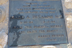
17 hikers gathered in the parking lot at the entrance to O’Melveny Park (the second-largest park in Los Angeles County) in Granada Hills on a chilly but clear winter morning with intermittent wind gusts. Not to be deterred by the weather, we began our hike by walking southwest along the nearby sidewalk on Sesnon Blvd to its junction with Neon Way. We then followed Neon Way three blocks north to the lower end of the Sulphur Spring Fire Road (aka the Dr. Mario A. De Campos Trail). We then began the steady climb along the dirt fire road to Mission Point in the Santa Susana Mountains. As we gained elevation we were treated to expanding views of most of the San Fernando Valley and its surrounding mountains, as well as the view through the Cahuenga Pass of the upper sections of the tallest buildings in downtown Los Angeles and the nearby view of the Los Angeles Reservoir (which replaced the Van Norman Reservoir whose dam nearly failed during the 1971 Sylmar earthquake).
show more
After a short break we resumed our hike by retracing our route a short distance downhill to the junction with the Mission Point Trail which we followed northeast as we made our way down into Bee Canyon; the trail became increasingly steep as it lost elevation. We were treated to excellent views of the rugged landscape to the north. After reaching the floor of Bee Canyon we followed the trail downstream into beautiful 627-acre O’Melveny Park with its well-maintained green lawns shaded by oak and eucalyptus trees; there are still some citrus trees near the entrance to the park but they were not bearing fruit the day of our hike (signs forbade us from “picking fruit”). We reached our vehicles, completing our loop hike, having hiked 6.2 miles with about 1,500’ of elevation gain/loss on a relatively nice morning for mountain hiking.
show less
February 19th – Work Party: Lower Stagecoach Trail
[Best_Wordpress_Gallery id=”413″ gal_title=”Work Party: Lower Stagecoach Trail 2-19-2022″]
The Work Party was spectacular. Thirty People meet by the picnic area at Corriganville. Most were from Student Corps: https://studentcorps.org/about/our-mission/ The atmosphere was lively and the chill in the air was gone. We went over the usual safety rules, then talked a little about the trail, and the volunteers were eager to get started. The younger volunteers, with their trash grabbers, were the first up the trail. Then came the groups with the Pick Mattocks, loppers, and shovels who went to town clearing the trail of encroaching plants. To name a few: Black Mustard, Deer Weed, California Sage, and Russian Thistle. With much appreciation for Mark Scheele, a veteran RSTB volunteer, helped oversee things while the other volunteers were busy filling in sinkholes on the edge of the trail with large rocks. The work party ended where there is some kind of run-off, presumably coming off the freeway, where there was a lot of trash and the trail was washed out down to boulders. Some volunteers gathered many big rocks, and made two huge water bars, and back filled the trail. Other volunteers picked up trash that was mixed in with runoff debris – it was such an incredible job. It was the best work party in many years thanks to GeeGee Garcia, Geno Gonzales, Monty Gonzales, Martin DeGoey and the Student Corps: Jonathan Chen, Harry Ding, Andrew Chen, Nelson Hu, Sansur Borijin, Kevin Wang, Eric Qifan Zhang, Edward Shen, Ryan Shen, Maxwell Zhong, Isabella hou, Simon Yao adults: Naren Borjigin, Mingfei Luo, Baohui Chen, Ada Tang, Stella Tong, Vicky Chen, Yuqin Wang, Yanchun Zhong, Xin Zhou, Apple zhang, Jie zhang, and Jack Borijin. Click here to view a movie.
February 12th – Danielson Memorial via the Wendy, Fossil, and Old Boney Trails
[Best_Wordpress_Gallery id=”408″ gal_title=”Danielson Memorial via the Wendy, Fossil, and Old Boney Trails 2-12-2022″]
25 hikers gathered at the Wendy Trail trailhead at the south end of Wendy Drive in Newbury Park on a pleasant warmer-than-usual winter morning with a clear blue sky. Our Santa Monica Mountains outing began as we hiked the Wendy Trail over to the Satwiwa Native American Indian Culture Center in Rancho Sierra Vista. We then headed south as the paved upper section of Big Sycamore Canyon Road descended into the canyon; as we did so we passed large areas covered with lush green grass. Immediately after crossing the bridge in the canyon bottom, we left the road and headed northeast on the Upper Sycamore Canyon Trail for a very short distance to a junction with the Fossil Trail which we turned right onto [the former sign at the trail junction that was burned badly in the May, 2013 Camarillo Springs Fire is still gone completely]. The Fossil Trail began climbing steeply to the east on a flank of Boney Mountain, gaining 760’ of elevation in 0.9 mile. Our route was adorned with lots of wildflowers including bush sunflowers, purple nightshade, wild cucumber, blue dick, California poppies, deerweed, and ceanothus trees (both white and blue); near the trail’s upper end we stopped briefly to admire several fossils embedded in rock.
show more
show less
February 5th – El Escorpion Park: Cave of Munits and Castle Peak
[Best_Wordpress_Gallery id=”404″ gal_title=”El Escorpion Park Cave of Munits Castle Peak”]
14 hikers met at the El Escorpion Park entrance (905’) at the west end of Vanowen Street in the San Fernando Valley on a cool mid-winter morning. We began our hike into the Simi Hills along the Hunter Allen Trail (aka Moore Canyon Road), a wide dirt road with no shade, but soon turned right/north on a “use” trail which led down to a second heavily shaded “use” trail that led us westward parallel to (but out of sight of) the dirt road. We eventually reached the well-defined “use” trail leading north up to the entrance to the Cave of Munits. Upon reaching the vertical cave entrance a few members of our group decided to climb steeply up into the cave. Doing so required the use of both hands and both feet (a short class 3 climb). As described on the excellent Modern Hiker web site, “The walls of the interior fold and undulate into a seemingly endless series of side caves and back caverns … it’s ceiling is very tall and it can feel like you’re standing inside a natural rock cathedral … this area was spiritually important to the Chumash [Indians].” After exploring the interior of the cave, the hikers exited by returning the way they entered the cave [rather than climbing out one of the cave’s chimneys and carefully circling around on the mountainside back down to the cave’s entrance].
show more
show less
JANUARY
January 29th – Mentryville and Pico Canyon
[Best_Wordpress_Gallery id=”400″ gal_title=”Mentryville and Pico Canyon 1-29-2022″]
5 hikers carpooled to a dirt parking area about 0.4 mile outside the entrance to Mentryville, located in Pico Canyon in the north end of Santa Clarita Woodlands Park (only a few miles [by road] from Towsley Canyon). Mentryville was an oil boom town in the 1880’s and was home to over 100 families until the early 1930’s. Pico Canyon was the site of the first commercially successful oil well (Pico No. 4) in the western United States. Several historic buildings are still standing in Mentryville including Charles Mentry’s grand 13-room mansion, a one-room school house, and a small barn. After taking a quick tour of the “ghost” town, we headed southwest along the paved road into shady Pico Canyon with its towering walls and a pleasant stream until we reached Johnson Park (“the party place for oil miners of more than a century ago”) where we dallied for a while. As we continued further into the canyon, the paved road made a sharp switchback to the northeast, became a dirt road, and we began climbing up out of the canyon. As we gained elevation our views of the surrounding rugged landscape with green mountainsides (thanks to recent rainfall) steadily improved. As we continued southeast toward the road’s upper end we had excellent views of the transverse range of the Santa Susana Mountains. The road ended in a wide flat mountaintop area which was at one time the home of the Union Oil Company’s Odeen #1 oil well, but is now the home of a lone picnic table with two benches. After a leisurely snack/rest break, we returned the way we came and reached our vehicles, having completed an 8.5-mile hike with about 1,450’ of elevation gain/loss on what had turned into a very nice day for hiking.
January 15th – Work Party: The Hummingbird Trail
[Best_Wordpress_Gallery id=”391″ gal_title=”WOrk Party – Hummingbird Trail 1-15-2022″]
It was chilly and a little windy when we arrived. Filming was happening at the Hummingbird Nest Ranch, so there wasn’t much parking. By the time the four volunteers gathered, the wind started to die down. It was a lovely hike up to where we worked. There were two switchbacks, maybe a quarter the way up the Hummingbird trail, that needed shoring up with wood planks. Two 2″ X 12″ X 8′ pressure treated planks, were brought up by wheelbarrow, a couple days earlier. We trenched in the planks, and filled in the eroded trail, by hauling fill dirt by wheelbarrow and flattening out the trail with pick mattock, McLeod hoe, and shovel. The soil moisture content was perfect. It sprinkled a little bit but not enough to get us wet. Thanks for the remarkable accomplishment and the tireless efforts of Sheryl Knight, Muffit Jensen, Mike Kuhn and Martin DeGoey.
January 8th – Santa Rosa Valley Park (Conejo Canyons Open Space)
[Best_Wordpress_Gallery id=”388″ gal_title=”Santa Rosa Valley Park 1-8-2022″]
14 hikers met in a dirt parking area on the left (east) side of Hill Canyon Road just past Santa Rosa Valley Equestrian Park (10241 Hill Canyon Rd, Camarillo) on a chilly winter morning (a 15th hiker joined us during the hike). We began our hike into the Conejo Canyons Open Space just west of Wildwood Park by crossing 25-foot-wide Arroyo Conejo Creek via a nice bridge that provided excellent views of the year-round creek which had lots of water flowing. Our route then followed the Hill Canyon Trail upstream along the creek toward a trail intersection that we’ve named Five Points, but before reaching it we took a “use” trail down to the creek where we noted that the temporary dam that is sometimes there was “missing” and there were no waterfowl in evidence.
show more
show less
