December 29th – The Hummingbird Trail and Rocky Peak
[Best_Wordpress_Gallery id=”174″ gal_title=”The Hummingbird Trail and Rocky Peak 12-29-2018″]
10 hikers assembled at the inadequate on-street parking area at the north end of Kuehner Drive at the trailhead (1,175’) for the Hummingbird Trail (just outside the gate into Hummingbird Ranch) on what promised to be a nice day for hiking. The morning was chilly with an intermittent wind as we began our 2.4-mile eastward climb to the Rocky Peak Fire Road.
show more
The trail passed through (and on) a variety of imposing rock formations along the way including very large boulders and giant slabs of sandstone rock, many with small “caves.” As we gained elevation the views of the area expanded and were enhanced by the very clear skies (thanks to recent strong winds). The trail continues to be damaged by bicycle riders who (without permission) create “bandit trails” that cut steeply through the pleasant original switchback trail; the “bandit trails” make it nearly impossible to discern the original trail at many intersections. We took a rest/snack break when we reached the fire road (2,100’). Two of the hikers decided to return to the trailhead and did so. Those of us who continued on followed the road northward along with a variety of bikers and other hikers while enjoying the sweeping views of eastern Simi Valley, the Santa Susana Mountains, and the Simi Hills. After reaching the customary viewpoint (2,624’) near Rocky Peak (2,715’), we rested briefly while admiring the panoramic views including the San Fernando Valley and the hazy outline of Santa Cruz Island. After taking a short break, we retraced our route and reached the trailhead having completed an 8.4-mile hike with about 2,200’ of elevation gain/loss.
show less
December 22nd – Big Sky Loop
[Best_Wordpress_Gallery id=”172″ gal_title=”Big Sky Loop 12-22-2018″]
18 hikers met along Big Sky Place in Simi Valley on a chilly-early-winter morning for a local hike just south of the Big Sky Movie Ranch for which the nearby housing development was named (the ranch was used for filming many television and film productions such as Gunsmoke, Rawhide, and Little House on the Prairie).
show more
After a short walk northward on a sidewalk along Erringer Road we turned east onto the well-signed Big Sky Trail. After crossing a dry streambed, we began hiking the loop portion of the hike in a counterclockwise direction as we climbed fairly steeply up to the north-south ridge to the east of the development. Upon reaching the sunny ridgetop we enjoyed views of the surrounding area including the west end of Simi Valley and the Santa Susana Mountains, particularly Whiteface Mountain which some of us climbed in the past. We continued our hike by heading north along the ridge nearly to Lost Canyons Drive, taking in the bright green mountainsides and canyon bottoms. Eventually the trail turned sharply to the south as it wound its way along the oak-lined streambed that runs through the Big Sky development. The remainder of our hike was an easy nearly-level stroll and we finished our invigorating outing having completed a 4.7-mile hike with 900’ of elevation gain/loss.
show less
December 15th – Work Party – Lower Stagecoach Trail
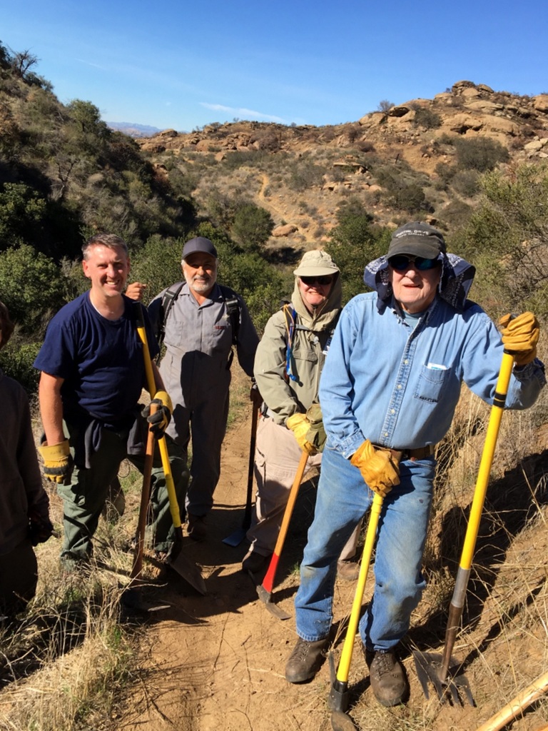
The December work party was on the lower Stagecoach Trail – from the top down. The soil dampness was perfect to compact the soil. Thanks to the participants: Martin DeGoey, John Sabol, Kelly Demel, Kyler Demel, Mike Kuhn, and Paul Friedeborn.
December 14th – Christmas Holiday Party Potluck
[Best_Wordpress_Gallery id=”170″ gal_title=”Christmas Holiday Party Potluck 12-14-2018″]
Ursula Christie again welcomed us into her beautifully decorated home for our annual potluck holiday party. A variety of foodstuffs accumulated as a stream of “Trail Blazers” arrived to partake in the festivities.
show more
The participants quickly took advantage of the rare opportunity to spend non-hiking time with “old” friends as small conversational groups formed and re-formed to trade news of each other’s recent activities and discuss plans for futures activities. A highlight of the event was the presentation of an award to Linda Martins Mann for her eight (8) years of service as Newsletter Editor for the Ranch Simi Trailblazers. Soon the various culinary delights could no longer be ignored so we sat down together and began sampling the plentiful – and mostly healthy – delicacies including rarely seen dragon fruit. As usual, everyone looked even better than usual (hiking gear) in their holiday dress. After finishing our sit-down dinner (during which it was hard not to overeat!), we continued hobnobbing before taking our leave with holiday well wishes and promises to see one another soon. Not surprisingly, we had been unable to devour all of the food that the guests had brought so there were some delightful “leftovers” to take home. We are all grateful for this wonderful opportunity to spend time with good friends, especially Ursula, who is truly one-of-a-kind!
show less
December 8th – Echo Mountain via the Sam Merrill Trail
[Best_Wordpress_Gallery id=”168″ gal_title=”Echo Mountain via the Sam Merrill Trail 12-8-2018″]
11 hikers carpooled to the trailhead of the Sam Merrill Trail which begins at the north end of Lake Avenue in Altadena on a very pleasant late-autumn morning with good visibility. We found parking a few blocks from the trailhead and then gathered at the gated entrance for a group photo.
show more
We started up the well-maintained trail via a series of switchbacks that climbed steadily up the east slope of Los Flores Canyon, benefiting from the shade provided by the mountain for the first two-thirds of the hike upward. As the trail rose we enjoyed increasingly wide views of the surrounding mountainous topography. The trail eventually reached the old rail bed of the Mount Lowe Railway (built in the 1890’s) and we enjoyed a level walk over to the White City ruins, passing nearby shade-producing Coulter pine trees (planted in the 1940’s) and oak trees along the way. White City (named for the elegant white-painted Echo Mountain House Hotel which opened in 1896, but burned in 1900) was conceived by Professor Thaddeus S. C. Lowe (for whom Mt. Lowe is named) and engineer David J. Macpherson. In addition to the main hotel, a second smaller hotel (The Chalet), an observatory, and a small zoo were built. Supporting infrastructure included a powerhouse, machine shop, reservoir, and the world’s most powerful searchlight. The resort drew more than three million visitors from 1896 to 1936. The incline railway was abandoned in 1938. After inspecting the ruins and enjoying a leisurely lunch/rest break, we began our return trip down the mountain. We arrived at our vehicles having hiked 6.5 miles with an elevation gain/loss of about 1,500’ and headed home, grateful for the abundance of nice well-maintained trails in the San Gabriel Mountains Front Range.
show less
December 1st – Piedra Blanca to Twin Forks Camp
[Best_Wordpress_Gallery id=”166″ gal_title=”Piedra Blanca to Twin Forks Camp 12-1-2018″]
13 hikers carpooled to the Piedra Blanca Trail [aka Gene Marshall National Recreation Trail] (22W03) trailhead at the east end of Rose Valley Road (6N31 off Hwy 33) in the Los Padres National Forest north of Ojai, CA. It was a beautiful morning as we began the hike by descending to and crossing the Sespe Creek/River, the main watercourse in the southern Los Padres National Forest; it empties into the Santa Clara River in Fillmore.
show more
While admiring the brilliant fall colors (mostly yellow) along the creek, we followed the trail as it entered the Sespe Wilderness and climbed the chaparral-covered slope to the magnificent Piedra Blanca (white rock) Formations — huge white rounded sandstone outcroppings sculpted by wind and water. After correcting a missed turn in the sometimes-hard-to-follow-across-the rocky-landscape trail, we descended to Piedra Blanca Creek and followed it upstream to Twin Forks Camp (the turnaround point) where large conifers provided shade along the nearby creek which provided sounds of flowing water at times. After a leisurely lunch/rest break we retraced our route, stopping along the way at the large shady Piedra Blanca Camp where we viewed pictographs created by Chumash Indians on some of the boulders. We then returned to the trailhead for the drive home, having competed a pleasant 7.5-mile hike with about 1,400′ of elevation gain/loss (which includes the “bonus” part of our hike among the huge white boulders caused by missing a turn in the trail). NOTE: Recent wildfires have so far spared the landscape through which we hiked.
show less
November 24th – Devil’s Punchbowl to Devil’s Chair
[Best_Wordpress_Gallery id=”164″ gal_title=”Devil’s Punchbowl to Devil’s Chair 11-24-18″]
Twelve hikers met near the Nature Center in the Devil’s Punchbowl Natural Area a few miles southeast of Pearblossom, CA on a pleasant late autumn morning to hike the Devil’s Punchbowl Trail to the Devil’s Chair. Our hike began by climbing uphill on the Burkhart Trail for about a mile to a junction with the Devil’s Punchbowl Trail.
show more
We followed the partially pine-shaded Devil’s Punchbowl Trail as it wound along the north slope of the San Gabriel Mountains overlooking the Antelope Valley; there was good visibility to the north including ever-changing views of spectacular rock formations.
The Devil’s Punchbowl is the point at which the San Andreas Fault and the Punchbowl Fault meet; it’s part of the San Andreas Rift Zone. The trail eventually descended to a junction with the spur trail leading out to the Devil’s Chair which provided excellent “up-close” awe-inspiring views of the colorful geologic formations created by the friction between the two earthquake faults. After taking lots of photos and enjoying a rest/lunch break under some nearby pine trees, we retraced our route to the Nature Center where we looked at specimens of desert fauna, particularly various kinds of snakes and a cute small live owl perched behind the counter (it was rescued after one if its eyes was permanently injured). We returned home having hiked 8 miles with about 1,600′ of elevation gain/loss in a unique geologic area.
show less
November 3rd – Horn Canyon
[Best_Wordpress_Gallery id=”162″ gal_title=”Horn Canyon 11-3-2018″]
Prologue: 12 hikers carpooled toward the Sisar Canyon trailhead on Sisar Road just north of the Summit Community on Hwy 150 between Santa Paula and Ojai in the Los Padres National Forest on a cool autumn morning. However, after driving a short distance on Sisar Road we encountered a locked gate that prevented us from driving to the trailhead for Forest Service Road 4N15. We decided to substitute the “Horn Canyon to Pines Trail Camp” hike for our planned hike.
show more
The 12 hikers then carpooled to the Horn Canyon trailhead adjacent to the Thacher School a few miles east of downtown Ojai. As our hike began, the trail rose gradually upward to the north along a dirt road. The route soon became a shady trail that followed a pleasant creek (with flowing water in it) as it continued up toward the Nordhoff Ridge. After an easy stream crossing in a beautiful shaded riparian setting, the trail began to rise inexorably via narrow switchbacks toward our destination and we were rewarded for enduring the increasing heat of the day with great views of the Ojai Valley and onward to the ocean and Santa Cruz Island plus a view of a small slice of Lake Casitas. Eventually most of us reached the Pines Trail Camp which has been decimated by wildfire and is now quite barren; it appears that none of the pine trees survived (there was no shade). We returned the way we came and reached our vehicles having completed a sometimes demanding 5.5-mile hike with over 1,800’ of elevation gain/loss.
show less
October 27th – Work Party – Wild Animal Corridor – Cache In Trash Out Event
[Best_Wordpress_Gallery id=”160″ gal_title=”Work Party – Wild Animal Corridor – Cache In Trash Out Event 10-27-2018″]
Our 10th annual Wildlife Corridor work party was very special indeed. Just two months before the event, our Work Party chair Mike Howard, lost his life in a freak accident in the Colorado River rapids. Mike died a hero, saving his beloved wife Cheri. Our work party was dedicated to Mike’s memory. Cheri was with us and shared some very heartfelt inspiring words.
We finished the Corridor cleanup in just over an hour, painting over the graffiti and collecting 6 large bags of garbage. After heading back down the trail and arriving at our cars, we all shared fond memories of Mike, telling great stores about what he meant to us. We all miss you, Mike!
October 20th – Camp Three Falls to Lilly Meadows
[Best_Wordpress_Gallery id=”99″ gal_title=”Camp Three Falls to Lilly Meadows 10-20-2018″]
Nine hikers carpooled to the entrance to Camp Three Falls on Boy Scout Camp Road in Lockwood Valley on a very nice morning. We began our hike along the lower end of the North Fork [of Lockwood Creek] Trail (22W02). At first the trail was a dirt road that led through the Boy Scout Camp; we followed the road as it continued through low hills dotted with pine trees and interesting rock formations until we reached North Falls, currently only a small trickle of water.
show more
We then carefully followed a narrow trail as it climbed up the mountainside to skirt the nearly dry waterfall; this took us to a vantage point that provided us with a fine view to the southeast. The trail then followed Lockwood Creek upstream through a surprisingly verdant narrow canyon populated with heavy brush in the streambed, though no water was visible. Eventually we emerged into the lovely pine forest surrounding Lilly Meadows where we took advantage of a picnic table with benches and a couple of well-placed logs for our lunch/rest break. We had not planned to continue further up the mountain so we returned the way we had come. There were campers (possibly not boy scouts) evident in the Boy Scout Camp as we passed through it to reach our vehicles. We returned home having completed a very pleasant 7.7-mile hike with 1,370’ of elevation gain/loss.
show less
October 13th – Zion National Park – The Narrows in the Virgin River
[Best_Wordpress_Gallery id=”149″ gal_title=”Zion National Park – The Narrows in the Virgin River 8-13-2018″]
After breakfast, several of the participants took the park shuttle from the Visitor Center to the Temple of Sinawava stop where they hiked one mile along paved Riverside Walk to the beginning of the hike in the river. After ensuring that their gear, particularly their hiking poles and footwear, was in working order and that their valuables were stowed safely in dry sacks, they entered the North Fork of the Virgin River and headed upstream.
show more
The water level in the river was relatively low when compared to its level in September, 2009 when we last visited Zion NP. The canyon’s sheer walls, carved and smoothed by the Virgin River over eons, were stunningly colorful as they twisted into the distance; there are many hanging gardens clinging to the sides of the canyon. Sometimes there is rocky land that can be walked on for short distances on one side or the other of the river requiring river crossings over submerged slippery rocks with an insistent current tugging at them; frequently it is necessary to walk in the river because the water spans the entire channel. When there is land alongside the river, there are tall trees and bushes and sometimes a short trail on the sandy land. NOTE: Big Spring, a lovely set of three cascades, one above the other, is the furthest point hikers are allowed to go without a special permit. Along the way the river passes confluences with Mystery Canyon and Orderville Canyon. The Zion Narrows clearly deserves its reputation as a world-class slot-canyon river walk. After completing their hike, the participants returned to the campground, broke camp, and headed home (as had the other participants who chose not to hike in the Virgin River).
show less
October 12th – Bryce Canyon National Park – Figure 8 Loop
[Best_Wordpress_Gallery id=”108″ gal_title=”Bryce Canyon National Park – Figure 8 Loop 10-12-2018″]
We left the campground early for the two-hour trip to the trailhead at Sunset Point (8,010’) in Bryce Canyon National Park; we traveled east on Hwy 9, north on Hwy 89, east on Hwy 12, and then south on Hwy 63 (which runs through the park) to the Visitor Center. After exploring the Visitor Center, we moved our vehicles to a nearby parking lot and took the park shuttle to the Sunset Campground stop from which we hiked over to the Sunset Point trailhead where we stared in wonder at the beauty of the unique landscape spread out below us to the east.
show more
It was a chilly morning (perfect for hiking) as we began our descent via the Navajo Trail into the wonderland of hoodoos and other colorful formations that awaited us; we passed such notable formations as Thor’s Hammer, The Temple of Osiris, and Sinking Ship on our way down into the canyon. This unique area is indescribably beautiful and must be seen in person. Reaching the bottom, we took a connector trail to the Peekaboo Loop. We began hiking the up-and-down loop, passing stunning scenery such as The Cathedral and the Wall of Windows, grateful for the high-capacity memory in today’s digital cameras. Just before we reached the junction with the Bryce Point Trail, we took a rest/lunch break. We then finished the Peekaboo Loop, passing The Alligator and the Fairy Castle among other sights. We then retraced our steps on the connector trail and began the climb to Sunrise Point (8,000’), inspecting the Queen’s Garden along the way. After admiring the near-and-distant views from Sunrise Point, we hiked over to the Sunrise Point park shuttle stop and returned to the Visitor Center stop (where we availed ourselves of its amenities). After retrieving our vehicles, we headed back to the Watchman Campground having hiked 7.5 miles with an elevation gain of 1,659’.
show less
October 11th – Zion National Park – Tourist Day
Rain fell from about 4 AM to late morning, delaying activities; leaks were discovered in several participant’s tents, requiring water removal and the drying of the tents’ contents. Several of the participants explored the Lower Emerald Pool, the Court of the Patriarchs, and the Zion Human History Museum; others explored the nearby town of Springdale, Utah or rested to recover from the previous two days of strenuous hiking. One couple drove over to Bryce Canyon NP and observed snow there (it had melted before the next day).
October 10th – Zion National Park – Observation Point
[Best_Wordpress_Gallery id=”107″ gal_title=”Zion National Park – Observation Point 10-10-2018″]
After breakfast we took the park shuttle from the Visitor Center to the Weeping Rock stop where we began hiking the East Rim Trail on the shady east side of the canyon. The trail climbed hundreds of feet up to Echo Canyon via a series of paved switchbacks, passing the short trail to Weeping Rock and the Hidden Canyon trailhead (which was closed) along the way.
show more
Echo Canyon is a narrow hanging canyon that leads northeast away from Zion Canyon; it is a gorgeous canyon that offers stunning rock formations. Leaving Echo Canyon, the trail rises less gently as it approaches a junction with the Observation Point Trail after which it rises fairly steeply via sun-drenched switchbacks to a higher view of Zion Canyon. The trail gains a little more elevation in its final mile as it wends its way across a plateau to Observation Point which provides spectacular views (perhaps the best in the park) of the length of Zion Canyon including a downward view of Angels Landing. After relaxing, sightseeing, and photo-taking, the group returned to the park shuttle stop and returned to camp having hiked 8 miles with a 2,236’ elevation gain.
show less
October 9th – Zion National Park – Angel’s Landing and the West Rim Trail
[Best_Wordpress_Gallery id=”105″ gal_title=”Zion National Park – Angel’s Landing 10-9-2018″]
After a quick breakfast we caught an early park shuttle at the Visitor Center and rode up-canyon to the Grotto stop where we began hiking the West Rim Trail. After we crossed the footbridge, the trail headed northward along the west side of the Virgin River, then northwest via a series of paved switchbacks rising hundreds of feet in about a mile.
show more
We then entered Refrigerator Canyon, a hanging canyon between Angels Landing and Cathedral Mountain, which provides a cool respite from the morning sun. Soon we reached Walter’s Wiggles, a series of 21 cleverly engineered short switchbacks leading to a saddle known as Scout Lookout (5,370’) at the junction of the West Rim Trail and the Angel’s Landing Trail; a privy was available at this point. Half of our group then undertook the final climb to the top of Angels Landing (5,785’) which has a well-deserved reputation for its rigor and its danger – the very narrow trail rises steeply and there are vertical drops of hundreds of feet on both sides it; a fall would surely result in death. A reassuring safety measure is the presence of sections of a single chain that the hiker can hold on to on most, but not all, of the trail. There were already some hikers descending while we ascended, but there were lots more coming up as we descended. The stunning views of Zion Canyon and the surrounding mountains made the climb well-worthwhile. After resting, photo-taking, and sightseeing, we returned carefully to Scout Lookout and then returned to camp. The other half of our group had continued along the West Rim Trail, bypassing Angel’s Landing. After hiking varying distances along that trail, they returned to the Grotto stop and took the park shuttle back down-canyon. The hike to Angel’s Landing and back was only 5.4 miles round trip with an elevation gain/loss of about 1,500’ but it’s difficulty made it exhausting. NOTE: We were fortunate that the West Rim Trail (including access to Angel’s Landing) was reopened on September 24th after being closed for several months following a landslide.
show less
October 8th – Zion National Park – Arrival and Watchman Trail
[Best_Wordpress_Gallery id=”104″ gal_title=”Zion National Park – Watchman Trail 10-8-2018″]
10 Rancho Simi Trailblazers gathered at the Watchman Campground in southern Zion National Park for a week of camping and hiking in one of the most beautiful spots on earth. After setting up camp (3,970’), we walked over to the Visitor Center, then along a path next to the Virgin River to the Watchman Trail trailhead as part of a 3.5-mile warm-up hike with about 400’ of elevation gain.
show more
The trail climbed part-way up red-sandstone Bridge Mountain via a series of switchbacks, eventually reaching a short loop (4,340’) with a good view of the Watchman monolith as well as other nearby mountains. We returned to camp, had dinner, and turned in early.
show less
October 6th – Long Canyon to Challenger Park Loop
[Best_Wordpress_Gallery id=”97″ gal_title=”Long Canyon to Challenger Park Loop 10-6-2018″]
26 hikers gathered at the Long Canyon Trail trailhead parking lot at Wood Ranch in Simi Valley on a mild autumn morning. We began hiking the Long Canyon trail as it climbed steeply 0.7 mile to a trail junction atop a ridge overlooking western Simi Valley to the north as well as the Lang Ranch Open Space to the south.
show more
We then followed a “use” trail down to the dirt road in Oak Canyon while enjoying views of the surrounding mountain slopes. After a short break we headed eastward up a dirt connector road to a ridge that provided nice views of western Simi Valley. We continued along the dirt road as it dropped into Montgomery Canyon and headed toward (but not quite to) Long Canyon Road (NOTE: 5 hikers decided to proceed a short distance to Long Canyon Road at that point and head back to the parking lot). The rest of us then followed a couple of trails over to Challenger Park which was deserted except for one man training a horse. After crossing Long Canyon Road and following an equestrian trail for a while, we climbed steeply up the Canyon View Trail which provided views of the surrounding area including Bard Reservoir and followed it as it undulated along a ridgeline back to the trailhead parking lot, completing a 7.6-mile loop hike with 1,687’ of elevation gain/loss on a pleasant morning for hiking.
show less
September 29th – Mt. Islip
[Best_Wordpress_Gallery id=”65″ gal_title=”Mt. Islip 9-29-2018″]
Nine hikers carpooled via the Angeles Crest Hwy (Hwy 2) to Islip Saddle (6,669’) in the San Gabriel Mountains/Angeles National Forest on a cool autumn early morning in Simi Valley; we were met by a tenth hiker at the trailhead. A chilly wind greeted us as our hike began along the Pacific Crest Trail (PCT) opposite the Islip Saddle parking lot, but as soon as we were shielded from the wind the temperature was just right for hiking uphill.
show more
The trail climbed eastward, soon skirting a large meadow filled with impenetrable prickly bushes and then entering a pine-scented forest of Jeffrey and sugar pines. After 2.5 miles of hiking through the forest, we reached shady Little Jimmy Trail Camp (7,501’) which is equipped with picnic tables, bear lockers, and bathrooms; several backpackers had already set up camp. We then continued on to appropriately named Windy Gap (7,588’), where we had to hold on to our hats to keep them from blowing away; there were good views to the east including the Crystal Lake Recreation area below us and a series of mountain ridges stretching into the distance. Next we followed the Islip Ridge Trail to the south as it climbed to the peak of Mt. Islip (8,250’) via switchbacks. Once there we took a rest/snack break and enjoyed the 360-degree views of the surrounding mountains, the Antelope Valley/Mojave desert, Crystal Lake (which is nearly dry and is covered with algae), and a large reservoir along Hwy 39 to the east. Leaving Mt. Islip, we descended to Little Jimmy Trail Camp via an old trail, bypassing Windy Gap. As we then retraced our route to the parking lot at Islip Saddle, we encountered a surprising number of backpackers (including boy scouts) and day hikers coming up the trail. We arrived back home having completed a very pleasant 7.6-mile hike with about 1,700’ of elevation gain/loss while enjoying mild temperatures, cool (sometimes chilly) breezes, lots of shade, and stunning views at the peak where there was once a fire lookout tower.
show less
September 22nd – Danielson Ranch
[Best_Wordpress_Gallery id=”67″ gal_title=”Danielson Ranch 9-22-2018″]
10 hikers gathered at the Wendy Trail trailhead at the south end of Wendy Drive in Newbury Park on a cool early-autumn morning. Our Santa Monica Mountains outing began as we hiked the Wendy Trail over to the Satwiwa Native American Indian Culture Center in Rancho Sierra Vista. We then headed south as the paved upper section of Sycamore Canyon Road descended into the canyon.
show more
Immediately after crossing the bridge in the canyon bottom, we left the road [and the bicycle riders] and headed northeast on the Upper Sycamore Canyon Trail for a very short distance to a junction with the Fossil Trail which we turned right onto [the sign at the trail junction was burned so badly in the May, 2013 Camarillo Springs Fire that it is useless]. The Fossil Trail began climbing steeply to the east on a flank of Boney Mountain, gaining 760’ of elevation in 0.9 mile. Aside from the large number of dead (but still upright) ceanothus trees, the effects of the 2013 wildfire are muted. When we reached the junction with the Boney Mountain Trail, we turned left and continued on up the mountain with increasingly improving distant views (there was lots of fog when we started hiking, but most, if not all, of it cleared during our hike. There were a surprisingly large number of cliff asters blooming along our route, but not much else. We eventually reached the Danielson Memorial and the ruins of the Danielson house (only a chimney remains) where we took a lengthy break in the still heavily wooded (unburned) area, enjoying the cool temperatures in the shade. As we continued our hike we descended along the Danielson Road, but didn’t visit the (waterless) waterfall along the way. The day had become noticeably warmer as we followed the Windmill Trail back to the parking area which we reached having completed an 8.3-mile loop hike with about 1,975’ of elevation gain/loss.
show less
September 15th – East Canyon to Mission Point
[Best_Wordpress_Gallery id=”69″ gal_title=”East Canyon to Mission Point 9-15-18″]
17 hikers met at the trailhead in the “East Canyon, Rice Canyon, and Michael D. Antonovich Open Space” section of the 4,000-acre Santa Clarita Woodlands Park via Interstate 5 and “The Old Road” in Santa Clarita. It was chilly as we began hiking southward along the non-maintained and somewhat-eroded East Canyon Motorway as it followed the small (dry) creek in the canyon bottom.
show more
The route was lined with bay laurel, black walnut, cottonwood, sycamore, and oak trees. Soon the dirt road began rising more steeply along the western side of a wooded ridge adorned with a modest smattering of cliff asters and a few other wildflowers (and lots of healthy black walnut trees). We enjoyed views of the steep slopes to the west and relics of the bigcone Douglas-fir trees that once covered the mountain [several of the trees appear to have died as a result of the ongoing drought]. An intermittent breeze cooled us as the road led us upward to a junction with Bridge Road (and the Oat Mountain Motorway) which is blocked by a SoCal Gas fence and gate. Having reached the highest point in our hike, we headed southeast along the very pleasant Corral Sunshine Motorway to Mission Point which provides a fairly clear panoramic view of the San Fernando Valley and beyond. After resting/snacking, we retraced our now warmer (but mostly downhill) route to the trailhead and returned home having completed a 9.3-mile hike with about 1,750’ of elevation gain/loss on a nice day for mountain hiking.
show less
September 8th – Las Llajas Trail to the Shovel
[Best_Wordpress_Gallery id=”71″ gal_title=”Las Llajas Trail to the Shovel 9-8-2018″]
14 hikers met at the Las Llajas Canyon trailhead on Evening Sky Drive in Simi Valley on a warm late-summer morning. We began our hike under a clear blue sky by descending a short paved section of road into the canyon bottom; from there we followed the wide well-graded dirt road upstream to the north 1.8 miles, crossing the very dry stream bed three times.
show more
We then followed a slightly overgrown “use” trail (the remnants of an old mining road) as we climbed up the eastern slope of the mountain, atop which we enjoyed panoramic views of the surrounding area including parts of Chivo Canyon, Las Llajas Canyon, the Santa Susana Mountains and Simi Valley. We took a break when we reached our goal, the site of a coquina (a soft whitish limestone formed of broken shells and corals cemented together and used for road building) mining operation. Various mining equipment artifacts are strewn about near the mining site, most notably a P&H Model 206 “steam” shovel. The day had warmed up noticeably but we enjoyed a mild breeze as we retraced our route and returned to our vehicles having completed a pleasant 6.3-mile hike with 1,100’ of elevation gain/loss.
show less
September 1st – Solstice Canyon
[Best_Wordpress_Gallery id=”73″ gal_title=”Solstice Canyon 9-1-18″]
It was a cool and very humid morning. 13 hikers met at Donut Delite and carpooled to the Solstice Canyon trailhead. Once we arrived, we found three more hikers eagerly waiting for our arrival. Our lollipop loop out-and-back hike began on the Solstice Canyon Trail, paralleling the shaded Solstice Canyon Creek. Just over a mile up the trail, we gathered at the junction of the Sostomo Trail.
show more
We rapidly gained over a thousand feet of elevation gain following, the creek through the Sycamore trees, black walnut groves, and Laurel Sumac. Taking the Deer Valley Loop Trail clockwise we began too see expansive views of the coastline, including Point Dume, we we hiked just two weeks ago. Most everyone agreed that the hike was much harder that we remembered from past years, probably due to the very high humidity. Several us did our wet dishtowel imitation very well. After completing the “lollipop,” we found that hiking down the Sostomo trail was much easier. Once we completed the “stick” portion of the lollipop, we took an abrupt left turn, and after a short distance arrived at the ruins of the Tropical Terrace “Robert’s Home.” The once expansive and elegant home was completed in 1952 and burned down in in 1982. After exploring the nearby trickling waterfall, wandering around in the shrine to the now headless Madonna, and enjoying a few snacks, we arrived back at our cars just over a mile down the canyon. We all enjoyed our hike, having completed 6.8 miles with about 1,650′ of elevation gain/loss.
show less
August 25th – Temescal Canyon
[Best_Wordpress_Gallery id=”75″ gal_title=”Temescal Canyon 8-25-2108″]
10 hikers carpooled to the lower parking lot at Temescal Gateway Park. A lovely refuge from the nearby urban congestion, it borders Topanga State Park. Our hike began on a shady trail along the streambed in Temescal Canyon and led pleasantly past rustic buildings constructed in the 1920’s for the Methodist Church as a west coast center for the Chautauqua movement.
show more
The whole area is shaded by towering eucalyptus trees as well as oak trees and a variety of other non-native trees such as palms and conifers. The trail began rising in Temescal Canyon as it entered Topanga State Park and we soon reached a wooden bridge crossing the streambed at a point where there is sometimes a series of cascades (a “waterfall”) though there was no water at this time of year. Continuing westward (and upward) along the trail we reached Temescal Ridge where there are usually panoramic views of the Santa Monica Mountains, the coastline, the Los Angeles skyline, and hazy views of Santa Catalina island and the San Gabriel Mountains. However, on this day visibility was limited by a marine layer which (on a positive note) kept us cool. We then descended along the Temescal Ridge (aka Viewpoint) Trail to the canyon bottom where we made our way to a different trailhead for the second part our hike. We hiked eastward on a shady trail over another ridge and down into Rivas Canyon where the heavily shaded trail followed a seasonal stream (dry this day). Using a short connector trail, we reached Will Rogers State Historic Park where we took a lunch break on the front porch of the old ranch house and enjoyed the rocking chairs and the views of the spacious green lawn and the nearby polo field. We then returned to Temescal Gateway Park and our vehicles via the Rivas Canyon trail, completing a 9.3-mile hike with over 2,000’ of elevation gain/loss on a pleasant day for hiking. NOTE: Though there weren’t many wildflowers at this time of year, there were lots of cliff asters blooming along our way.
show less
August 18th – Westward Beach to Pt. Dume and Paradise Cove
[Best_Wordpress_Gallery id=”79″ gal_title=”Westward Beach to Pt. Dume and Paradise Cove 8-18-18″]
18 hikers traveled to Malibu and Westward Beach Road where some of us took advantage of free parking along the road and then hiked to the parking lot trailhead while others paid to park in the parking lot (due to the large turnout at the beach). The temperature was pleasant but the humidity was high as we began hiking up onto Point Dume.
show more
After an easy climb, we hiked through a maze of trails surrounded by a “forest” of dormant coreopsis plants to the east side of the peninsula with a breathtaking view of Dume Cove and the Pacific Ocean. After gawking at an unusually large group of surfers in the ocean below us, we descended an increasingly dangerous rusty stairway that led to Dume Beach. Despite being very close to low tide, our beach walk to Paradise Cove consisted of rocky stretches interspersed with long sandy expanses; at several points we timed our passage to the outflow of waves as we scampered carefully across the exposed bottom before our footwear was inundated by the next wave (all of which made for an interesting passage). We enjoyed the ocean sounds and sights (which included virtually no sea creatures), eventually arriving at the Paradise Cove Beach Café (
http://www.paradisecovemalibu.com), a landmark for decades. We rested for a while in the free-of-charge Adirondack chairs facing the ocean outside the restaurant and visited the nearby pier. After a while we resumed our hike and headed back along the beach the way we had come; the tide was now “coming in” but it was still possible to minimize getting our footwear wet. After climbing back onto Point Dume, we hiked along a wooden walkway to an observation platform which afforded views of the ocean and a nearby small seal rookery. We then returned to the main trail, descended to the parking lot, and walked back to our vehicles, returning home having completed a pleasant 5.9-mile hike with about 400’ of elevation gain/loss.
show less
August 11th – Carpinteria Bluffs to Tar Pits State Park
[Best_Wordpress_Gallery id=”77″ gal_title=”Carpinteria Bluffs to Tar Pits State Park 8-11-2018″]
This time of year is often the hottest, so we schedule hikes in locations that afford us a break from the heat. Having endured weeks of temperatures in the nineties and triple digits, it was a welcome relief to learn the forecast high was only 76 degrees at the trailhead. 8 hikers began our hike along the Carpinteria Bluffs overlooking Bates Beach.
show more
Again this year, there were no seals to be seen at Carpinteria Seal Sanctuary, except for one bobbing around just off the shore. Passing Carpinteria Bluffs Nature Preserve, Tar Pits Park was the next stop on our hike. It is second only in size to the famous La Brea Tar Pits in Los Angeles. Next the trail took us to Carpinteria State Beach, where we left the trail to begin the first beach segment of our hike. We stopped briefly at at the San Miguel Campground facilities, where several of us took off our boots to better enjoy the walk on the beach. The beach was especially inviting, with it’s unusually high water temperatures, and a welcome change of pace from our usual hikes. Continuing past Marsh Park, we saw hundreds seagulls enjoying the day too. The turn-around point of our hike was Sand Point, where we took a break for lunch and snacks. A welcome and cool ocean breeze started just in time for our return. Just past the Nature Preserve, we took a short and steep connector trail that took us down to Bates Beach. On the way back to Rincon Park, we enjoyed exploring the unusual rock formations, and finding shells along the tide-line. Our hike was 7.9 miles with with 200’ of elevation gain/loss.
show less
August 4th – Serrano Canyon Lollipop Loop
[Best_Wordpress_Gallery id=”81″ gal_title=”Serrano Canyon Lollipop Loop 8-4-2018″]
The plan was to leave an hour earlier to beat the heat this year. What we didn’t know, is the Sycamore Canyon parking lot gates don’t open until 8 AM, so we had what a brief 20 minute wait at the ranger kiosk. More time to tell hiking stories from lore is a good thing. [Note to self: leave Donut Delite at 7:30 AM next year.]
show more
Temperatures were mild throughout the hike and humidity was high. Passing the campground, between the parking lot and the trailhead, the inviting smell of breakfast was in the air, but still we pressed on to the Serrano Trail junction, about a mile ahead. Again, visited us mosquitos along the way, but this time came prepared with bug spray. After a short distance up the Serrano Trail and the mosquitoes were gone and we had the remainder of the hike to ourselves. Next was the beautiful riparian canyon section of the hike, as we gradually gained elevation. This time of year, wildflowers are often scarce, but we still enjoyed Cliff Asters, Scarlet Buglers, Scarlet Monkey Flowers, and some variety of Tar Weed. We briefly rested at the “top of the stick” part of the lollipop, before continuing on the left, choosing to do the loop in a clock-wise direction. The next trail junction afforded us commanding views of Serrano Canyon, where we took a right turn to continue on the loop. At about 4 miles, we took an immediate right turn to the south, where we rapidly started losing all the elevation we worked so hard to gain. On our way back to the “top of the stick” we enjoyed the stark and bright colors of the dead California Buckwheat, Blackened shrubs from a previous fire, and the exposed rock formations. There was a inviting breeze through the canyon, following the “stick” part of the loop on our return. It did wonders to cool us off and keep the mosquitoes away. We all enjoyed our morning, having hiked 8.3 miles with about 1,100′ of elevation gain/loss.
show less
July 28th – Zuma Ridge to Buzzard’s Roost
[Best_Wordpress_Gallery id=”83″ gal_title=”Zuma Ridge to Buzzard’s Roost 7-28-2018″]
14 hikers carpooled to the trailhead in the Santa Monica Mountains at the north end of Busch Drive in Malibu near Point Dume on a soon-to-be-hot morning. After a group photo was taken, our hike began steadily (but not steeply) uphill northward for over 4 miles along the well-maintained Zuma Ridge Trail (dirt road).
show more
The air quality was good but the ocean (near the shore) was covered in fog so the anticipated views – including Zuma Beach, Point Dume, the Pacific Ocean, and Santa Catalina, Santa Barbara, Anacapa, and Santa Cruz islands were not available. However, we had good views of the mountains supporting and surrounding our hike. About two-thirds of the way up, several of the hikers chose the shorter “5-mile” option and turned around and descended the Zuma Ridge Trail. The remainder of the group continued on up the mountain to Buzzards Roost [which is private property]. We then climbed up on the knob across the trail from the private property and enjoyed the nearly 360-degree views (although the ocean near the shore was still covered with fog). Despite the recent hot temperatures, there were still blooming plants along our route, predominately cliff asters and bush mallow with a smattering of other types of wildflowers. After taking a rest/snack break, we descended the way we came thus completing an 8.9-mile hike with 2,158’ of elevation gain/loss.
show less
Sequoia and King’s Canyon National Parks
July 16th – Tokopah Falls Trail
[Best_Wordpress_Gallery id=”85″ gal_title=”Tokopah Falls Trail 7-16-2018″]
Arrival at Lodgepole Campground and Tokopah Falls Trail (4.9 miles with 586’ of elevation gain/loss) – – –
After arriving at Lodgepole Campground (6,700’) in Sequoia National Park, checking in, and setting up camp, several of the 14 Rancho Simi Trailblazers who participated in the seven-day outing in the western Sierra Nevada walked a short distance to the nearby Tokopah Falls Trail trailhead (6,737’) for a late-afternoon hike to help them acclimatize to the higher elevation in the park.
show more
The trail roughly paralleled the Marble Fork of the Kaweah River which was flowing pleasantly nearby; at first the trail rose mildly through a mixed forest comprised mostly of conifers (red and white firs, incense cedars, ponderosa pines, and Jeffrey pines) as we passed beautiful meadows adorned with blooming wildflowers. The riverbanks were lined with willows, aspens, and chokecherries. Eventually the trail rose more sharply and we made our way over a granite rock-based trail to an awe-inspiring cirque with towering granite walls down which easily seen Tokopah Falls plummets in a series of waterfalls. After enjoying the view and resting for a while, we returned to camp the way we came.
show less
July 17th – Lakes Trail to Heather Lake
[Best_Wordpress_Gallery id=”87″ gal_title=”Lakes Trail to Heather Lake 7-17-2018″]
(10.3 miles with 2,283’ of elevation gain/loss) – – –
We carpooled the few miles by road from the campground to the Lakes Trail trailhead (7,285’) at the edge of a large parking lot at the end of Wolverton Road. As soon as we started hiking up the trail we spotted a black bear (with a collar) nearby; it was easily convinced to move further away from us and (after taking photos of the bear) we continued hiking up to a trail junction with a trail connecting with Lodgepole.
show more
to help them acclimatize to the higher elevation in the park. We passed by this turnoff as well as a second trail junction (this one circling Long Meadow). We soon passed by the Panther Gap Trail (leading to Alta Meadow/Peak) and continued on to the lower Hump/Watchtower trail junction. We decided to continue (somewhat steeply) up the Hump Route; the trail was shady and there were lots of wildflowers (where there was water flowing in small creeks) such as monkey flower, cow parsnip, and many beautiful
leopard lilies [which look very much like the humboldt lilies found in the Santa Monica Mountains]. After reaching the highest point during our hike (around 9,400’) we descended the trail to Heather Lake (9,282’) where we spent a leisurely interlude including lunch and for some of the group the opportunity to enjoy a dip in the pretty lake. When we resumed our hike we took the Watchtower Route, a fairly narrow ledge dynamited out of a sheer canyon wall above Tokopah Valley around 2,000’ below; it provides spectacular views of the surrounding area, especially majestic granite mountainsides. When we reached the lower Hump/Watchtower trail junction, we returned the way we came.
show less
July 18th – Mist Falls Trail in Kings Canyon National Park
[Best_Wordpress_Gallery id=”89″ gal_title=”Mist Falls Trail in Kings Canyon National Park 7-18-2018″]
(9.2 miles with 765’ of elevation gain/loss) – – –
We carpooled 61 miles from the campground to Kings Canyon Roads End (5 miles past the Cedar Grove turnoff) and the parking lot near the wilderness permit station; we arrived “early” so there was no problem with parking (and there were public restrooms). We began our hike (5,047’) along a wide sandy trail along the South Fork Kings River with its many cascades and views of The Sphinx and Avalanche Peak on the opposite side of the canyon.
show more
We passed through a forest of incense cedars, ponderosa pines, black oaks, sugar pines, and white firs; lots of severely burned trees gave evidence that a wildfire had burned the area at some point. After hiking 1.9 miles we took the left fork at a trail junction and followed the well-shaded trail through a mixed forest now composed of alders, black oaks, canyon live oaks, incense cedars, white firs, and ponderosa pines as it climbed steadily up toward the majestic Mist Falls (5,628’). Along the way up to the falls we were treated to even grander white-water cascades with their signature roar. Upon reaching the turnaround point not far from the falls in their granite setting, we spent our time taking in the magnificent scenery, eating lunch, and resting. Eventually we returned the way we came.
show less
July 19th – Giant Forest, Crescent Meadow, Sugar Pine Trail, Moro Rock
[Best_Wordpress_Gallery id=”91″ gal_title=”Giant Forest, Crescent Meadow, Sugar Pine Trail, Moro Rock 7-19-2018″]
(7.0 miles with 800’ of elevation gain/loss) – – –
We carpooled the few miles by road from the campground to the General Sherman [Tree] parking lot (6,840’) via Wolverton Road; again, our “early” arrival ensured us of easy parking (and there were public restrooms). We began our hike by descending the trail to the General Sherman Tree, “… the largest living organism on the planet.”
show more
After taking a group photo, we continued along various trails which wound their way through the heart of the Giant Forest (lots of giant sequoias), passing the Circle Meadow and then on to Crescent Meadow. We followed the trail on the east side of Crescent Meadow to the parking lot at its south end where we discovered a trailhead for the little-used Sugar Pine Trail (sugar pine trees have very large pine cones) which we followed over to the base of Moro Rock. Several of us climbed up Moro Rock (a huge granite monolith) via its 380 granite stairs built in 1931 but the 360-degree views at the summit (6,725’) were degraded by smoke in the air. After taking a rest break, we boarded the free summer shuttle Gray Route (#2) bus and rode it to the Giant Forest Museum which we visited. Then we boarded the shuttle Green Route (#1) bus and rode it to our parked vehicles in the General Sherman [Tree] parking lot.
show less
July 20th – Redwood Mountain
[Best_Wordpress_Gallery id=”93″ gal_title=”Redwood Mountain 7-20-2018″]
(9.7 miles with 1,524’ of elevation gain/loss) – – –
We carpooled 24 miles to the large dirt parking area at Redwood Saddle (6,230’); the last 1.7 miles were on a single-lane dirt road (with pullouts) which started at Quail Flat directly opposite Ten Mile Road. Since Redwood Mountain is “off the beaten path,” there were few other hikers in evidence during our hike.
show more
As we began our hike, the trail dropped down to a fork where we turned left onto the Hart Trail which we followed southeast as it wound through “… the largest intact grove of giant sequoias in the world.” In addition to the ubiquitous giant sequoias, interesting sights were Redwood Cabin, Hart Meadow, Hart Tree, and two “free-range” cattle temporarily blocking the dirt road on the way out. During our hike we encountered lush riparian habitats with wildflowers, ferns, and trickling streams; we took a rest/snack break at one such beautiful spot and later a lunch break at another lovely spot (where there were small fish in the stream). We completed the loop portion (95%) of our hike on the Redwood Trail and returned to our vehicles.
show less
July 21st – Mineral King
[Best_Wordpress_Gallery id=”95″ gal_title=”Mineral King 7-21-2018″]
(there was no hike there due to wildfire/smoke) – – –
All but two members of our group left Lodgepole campground Saturday morning (or before); the other two hiked the Tokopah Falls Trail which they had missed on Monday (they left the campground Sunday morning). Three members of our group (including the author) were determined to go to Mineral King (7,839’) and hike the Mosquito Lakes Trail to Mosquito Lake #1 (9,077’) despite the estimated 3-hour tedious drive to get there.
show more
The three of us left Lodgepole Campground and drove down Hwy 198 [almost] to Three Rivers; we were slightly delayed due to some much-needed (due to avalanches) road maintenance that has been going on for a while and has resulted in a two-mile stretch of Hwy 198 being “one lane” with alternating one-way traffic [this accounted for several “late” arrivals on Monday]. After turning left onto Mineral King Road, we tackled the two-hour drive to the upper end of the road. About half way up we noticed an increase in smoke in the air and then spotted three new wildfires on a nearby mountain. We stopped and watched a couple of helicopters drop fire retardant (or water) on the new fires before we turned our vehicles around and headed home, a little disappointed but very pleased overall with the time we spent in the Sequoia/Kings Canyon NP. We highly recommend spending some “me” time in the area.
show less
July 14th – Newton Canyon
[Best_Wordpress_Gallery id=”111″ gal_title=”Newton Canyon 7-14-2018″]
11 hikers carpooled to the Newton Canyon trailhead just north of Tunnel #1 on Kanan Dume Road in the Santa Monica Mountains on a pleasant summer morning (which promised to become hot later). Our out-and-back hike was to cover a heavily-shaded section of the 67-mile-long Santa Monica Mountains Backbone Trail (BBT).
show more
The trail initially climbed to a point where it crossed above Tunnel #1 and then rose and fell as it wound mostly eastward two-and-a-half miles through a very pleasant oak woodland eventually reaching Latigo Canyon Road. Despite the recent record heat and the summer season, there were still a surprising number of blooming plants along our route, particularly cliff asters and climbing penstemon with a smattering of other varieties such as Indian paintbrush and woolly blue curls. Wildlife sightings were mostly of lizards. After crossing Latigo Canyon Road, the trail dropped into another canyon as it headed northeast. The temperature had risen noticeably by the time we reached the point at which the trail left the oak woodland and began climbing through chaparral (with no shade) toward the upper end of Corral Canyon Road. Due to the heat (made worse by the direct sunlight), we turned around at that point and retraced our steps to the original trailhead, marveling at the beauty of the trail and very grateful for the shade it provided, thus completing a pleasant 6.5-mile hike with 1,350’ of elevation gain/loss.
show less
July 7th – Mt. McCoy
[Best_Wordpress_Gallery id=”113″ gal_title=”July 7th – Mt. McCoy”]
3 hikers met at the carpool point near the intersection of Royal Avenue and Madera Road on an “Excessive Heat Warning” summer morning and then (since trailhead parking is quite limited) walked from there to the Mt. McCoy trailhead on Washburn Street a few blocks to the west. Since the temperature was already around 90 degrees, we decided to skip the Reagan Library portion of the hike.
show more
The hike began along the trail heading south but it quickly began climbing gradually westward along the well-maintained (but frequently “cut” by bicycle riders) trail leading to the summit via a series of switchbacks; part way up, a fourth hiker joined us. We took our time and stayed hydrated as the trail rose up the mountainside; we were rewarded with views of the western end of Simi Valley, including Sinaloa Lake (which looked inviting considering the heat), Wood Ranch, and the Bard Reservoir. There is a white concrete cross (erected in 1941) as well as two concrete benches at the summit, from which the Ronald Reagan Presidential Library can be seen. After a short break to enjoy the panoramic view of the desiccated landscape, we returned the way we came completing a 3.2-mile hike with 560’ of elevation gain/loss. The temperature rose to 101 degrees and we only encountered two other hikers during the hike.
show less
June 30th – Eaton Canyon
[Best_Wordpress_Gallery id=”115″ gal_title=”June 30th – Eaton Canyon”]
Ten hikers carpooled to the Eaton Canyon Nature Center (960’) [closed] in Pasadena on a cool early summer morning. Our hike began along the seasonally dry streambed in Eaton Canyon as we headed northward. When we reached the trail’s junction with the “Horse Trail” at Walnut Canyon, we decided to bypass this steep “shortcut” trail leading up to the Mt. Wilson Toll Road; instead we continued upstream in Eaton Canyon to the lower end of the Mt. Wilson Toll Road which we turned onto.
show more
There were scores of early-bird hikers in Eaton Canyon, nearly all of whom were headed to Eaton Falls (or returning from there). We encountered only a few other hikers as we headed up the old toll road, enjoying increasingly wide views as we steadily gained elevation as well as a surprising display of blooming plants including prickly phlox and scarlet larkspur (among others). As we followed the old toll road up the mountain the view expanded, but was limited by the haze over Pasadena and downtown Los Angeles. Somewhat winded due to the nearly 1,700’ elevation gain, we eventually reached lovely Henninger Flats (2,630’), a cool forested notch sitting high on the mountain slopes above Altadena. Henninger Flats was complete in the past with water (none today), picnic tables, bathrooms (padlocked today), and a nature center/museum (closed today). It is the home of the Los Angeles County Experimental Forestry Nursery. After taking a leisurely break in the shade of the forest, we descended along the Mt. Wilson Toll Road to Eaton Canyon. We then continued hiking upstream in the canyon bottom which soon provided shade and a little water in the stream (as well as scores of other day hikers) until we reached Eaton Falls. After enjoying the lower waterfall and its pool, we returned along the Eaton Canyon Trail to the Nature Center (now open) and then headed home having hiked 10 miles with about 1,950’ of elevation gain/loss. NOTE: During our hike we observed a variety of wildflowers including Prickly Phlox, California Buckwheat, Sticky Monkey Flower, Cliff Asters, Scarlet Larkspur, Deerweed, Chaparrel Yucca, Bush Sunflowers, Golden Yarrow, Tree Tobacco, and Spanish Broom (non-native).
show less
June 23rd – Work Party: The Hummingbird Trail
[Best_Wordpress_Gallery id=”117″ gal_title=”Work Party: Hummingbird Trail 6-23-2018″]
We started today with 9 volunteers from a local church (St. Peter Claver, their group “Missions of Mercy”), another 9 volunteers from local Geocachers (one from LA and another from Canada), and a couple of community members for a total of 20 people.
show more
Now this group was only 20, but they worked like they were 40! People were on the lower and upper waterfalls, painting, picking up trash and just overall, cleaning the area up. We had people rock climbing, getting that hard to reach graffiti, along with crawling into caves to pick up water bottles and cans.
On the way out we even got all the trash in the tunnel under the freeway. In all we collected 125 lbs. of trash, 5 lbs. of which were plastic and aluminum cans that we can turn in for money, and purchase more paint to get even more graffiti in other areas.
We thank all the volunteers for coming out today and helping the community kept our trails looking good.
show less
June 17 – Hondo Canyon to Topanga Lookout
[Best_Wordpress_Gallery id=”119″ gal_title=”Hondo Canyon to Topanga Lookout 6-17-2018″]
Eighteen hikers arrived on a cool overcast morning at the trailhead located 0.4 mile northwest of “downtown” Topanga along Old Topanga Canyon Road where the Santa Monica Mountains National Recreation Area’s “Backbone Trail” crosses the road. As we began our hike up the steep north-facing mountain slope we crossed a dry streambed and soon passed through meadows filled with dry yellow grasses and dotted with oak trees and interesting rock formations.
show more
Next we reached a wonderful pink gorge on the right (west) side of the trail where a small waterfall is sometimes visible (but not today). As we continued upward through chaparral, there were glimpses of the pink-colored sedimentary rock formations/cliffs (the Sespe Formation) that form the west side of the canyon. We then entered a dense forest comprised mostly of oak and bay laurel trees; the trail was also adorned with ferns, moss-covered rocks, and lots of poison oak as well as a variety of wildflowers. After negotiating a long series of heavily shaded switchbacks through the forest we neared Saddle Peak Road. However, we headed west on the Fossil Ridge Trail that paralleled/overlooked the road; it was also adorned with a variety of wildflowers. Upon reaching the old Topanga Tower Motorway we left the Backbone Trail and headed north to the end of the road where there was once a fire lookout tower. After a lunch/rest break we retraced our steps and returned home having completed a 10.7-mile hike with 2,350’ of elevation gain/loss on a very pleasant day for hiking. NOTE: During our hike we observed a variety of wildflowers including most notably Matilija Poppies and Plummer’s Mariposa Lilies as well as Sticky Monkey Flower, Cliff Asters, Large Flowered Phacilia, Climbing Penstamon, California Buckwheat, Caterpillar Phacelia, Deerweed, Chaparrall Yucca, Canyon Sunflowers, and Chemise.
show less
June 10th – Trippet Ranch, Eagle Rock, Hub Junction, and Musch Trail
[Best_Wordpress_Gallery id=”121″ gal_title=”Trippet Ranch, Eagle Rock, Hub Junction, and Musch Trail 6-10-2018″]
18 hikers met in the parking lot at Trippet Ranch in Topanga State Park on a nice late-spring morning. We began our hike along the Nature Trail that wound its way upward to the junction of the Santa Ynez Canyon Trail and the Eagle Springs Fire Road. We then followed the fire road up to Eagle Junction and then on up to the western approach to Eagle Rock.
show more
Along the way there was a remarkable display of blooming plants; in particular there were huge quantities of deerweed, buckwheat, and cliff asters. Although the temperature had risen, we were cooled by a fairly steady ocean breeze. Most of the participants climbed up to the top of Eagle Rock, a huge rock monolith providing 360-degree views of the surrounding mountains. Some of the hikers also climbed up on a nearby knob which provided an excellent perch from which to take photos of Eagle Rock and their fellow hikers atop it. We continued our hike along the fire road to Hub Junction where we took a break before following two sections of the Santa Monica Mountains Backbone Trail (
BBT) westward back to the Trippet Ranch parking lot. As before, our route was adorned with a variety of blooming plants. The first section was a dirt road, but the second (and final) section was the Musch Trail (a section of the
BBT containing sections of chaparral, woodlands, meadows, and seasonal streams (presently dry) which provided us with a pleasant mostly downhill (in our case) stroll along a pretty trail interspersed with heavily shaded sections. We reached our vehicles having completed a very pleasant 7.5-mile figure-eight loop hike with about 1,400’ of elevation gain/loss. NOTE: During our hike we also observed the following blooming plants: Yucca, Canyon Sunflowers, Black Mustard, Notable Penstemon, Sticky Monkey Flower, Morning Glories, Purple Sage, Golden Yarrow, Chemise, Tree Tobacco, and a small number of Catalina Mariposa Lilies.
show less
June 2nd – El Escorpion Park, Cave of Munits, and Castle Peak
[Best_Wordpress_Gallery id=”123″ gal_title=”El Escorpion Park, Cave of Munits, and Castle Peak 6-2-2018″]
14 hikers carpooled to the El Escorpion Park entrance (905’) at the west end of Vanowen Street in the San Fernando Valley on a not-yet-hot late spring morning. We began our hike into the Simi Hills along the Hunter Allen Trail (aka Moore Canyon Road), a wide dirt road with no shade, but soon turned right/north on a “use” trail which led down to a heavily shaded “use” trail that led us westward parallel to (but out of sight of) the dirt road.
show more
We eventually reached the well-defined “use” trail leading north up to the entrance to the Cave of Munits. Upon reaching the vertical cave entrance most of the group decided to climb steeply up into the cave. Doing so required the use of both hands and both feet (a short class 3 climb). As described on the excellent Modern Hiker web site, “The walls of the interior fold and undulate into a seemingly endless series of side caves and back caverns … it’s ceiling is very tall and it can feel like you’re standing inside a natural rock cathedral … this area was spiritually important to the Chumash [Indians].” After exploring the interior of the cave, most of the hikers exited by climbing out one of the cave’s chimneys and carefully circling around on the mountainside back down to the cave’s entrance; the other hikers returned the way they entered the cave.
After regrouping, we headed southward down to the Hunter Allen Trail and followed it westward a short distance until it turned southward. At that point we continued westward along a trail/dirt road which we followed to another “use” trail that led us mostly northward past several oak trees and then steeply up a north-south ridge to the main east-west ridge (with Castle Peak at its east end). NOTE: By this time the temperature had risen into the 80’s so we took our time climbing up the ridge. Once up on the east-west ridge, we followed a mostly well-defined single track trail east to Castle Peak until it ended about 20′ from the top of the peak. Along the way we were treated to wide views of the surrounding area as well as interesting rock formations. Several members of our group climbed up to (or near) the top of Castle Peak (1,475’). After resting for a while, we returned the way we came (passing by the Cave of Munits turnoff) and reached our vehicles having hiked 4.9 miles with 1,200’ of elevation gain/loss.
show less
May 19th – Work Party: Corriganville Wildlife Corridor
[Best_Wordpress_Gallery id=”125″ gal_title=”Work Party: Corrigan Wildlife Corridor 5-19-2018″]
I would like to thank Pete and the Rotary club members for helping us paint over the Graffiti in the wildlife tunnel. Special thanks to Pete for getting members to volunteer their time and work. We also had a couple of locals show up to help! Our goal was to give the tunnel a fresh, “ungraffitied” look, because the Santa Monica Mountains Conservancy will soon install wildlife cameras.
show more
With nine of us working together, we painted over graffiti and picked up 125 pounds of trash from the area around the tunnel. The nice cool weather was welcome. Carrying 8 gallons of paint uphill is a lot of work in itself. We took the plastic water bottles and cans we found to be recycled, providing us with money to purchase more custom-colored paint for the rock graffiti within the park.
show less
May 12th – Sespe Condor Sanctuary
[Best_Wordpress_Gallery id=”127″ gal_title=”Sespe Condor Sanctuary 5-12-2018″]
13 hikers carpooled to Dough Flat (2,840’) and the Alder Creek Trail (20W11) trailhead about 15 miles north of Fillmore in the Los Padres National Forest on a chilly overcast spring morning (NOTE: It takes the better part of an hour to drive from the intersection of Hwy 126 and “A” Street up to Dough Flat at a safe speed due to the condition of the winding dirt road and its many blind curves; there’s a short very rough stretch of road shortly before reaching Dough Flat).
show more
The road was lined with a variety of blooming plants and there were increasingly captivating views of the surrounding mountainous terrain. Upon reaching the trailhead we availed ourselves of the nice well-equipped bathroom before starting up the nearby Alder Creek Trail which passes through the condor sanctuary, eventually connecting to the Sespe River Trail which heads west to its junction with the Gene Marshall (Piedra Blanca) National Recreation Trail at Rose Valley (about 25 miles by trail from Dough Flat). Our hike rose and fell (but mostly rose) as we hiked toward Cow Spring Camp and visibility under the overcast sky was good and we were rewarded with lots of dazzling displays of wildflowers, as well as interesting rock formations and mountain slopes. The hike was enhanced by the fact that only a couple of the participants had hiked this trail before [the Forest Service closes the Squaw Flat (FS 6N16) access road a couple of miles below Dough Flat for several months each “winter”; it was reopened on May 1st this year]. Eventually we reached the only fork in the trail during our hike; there was a barely decipherable black sign at the trail junction (3,700’). The right fork was the beginning of the Bucksnort Trail; we continued along the left fork on the Alder Creek Trail. About a mile later the trail descended into a large open flat area which we later discovered was Cow Spring Camp (3,500’). We continued a short distance further as the trail climbed to a nearby summit where we rested, ate lunch, and enjoyed a spectacular view to the west. We returned to Dough Flat the way we came; a very light rain fell during the final portion of the hike (during which there were no steep sections and the trail was “kind” to our feet. We returned home having completed a 7.7-mile hike with about 1,380’ of elevation gain/loss; sadly there were no condor sightings. NOTE: During our hike we observed a variety of blooming plants including yerba santa, sticky monkey flower, black mustard, golden yarrow, phacelia, elderberry, blue dick, and yucca.
show less
May 5th – Charmlee Wilderness Park Loop
[Best_Wordpress_Gallery id=”129″ gal_title=”Charmlee Wilderness Park Loop 5-5-2018″]
Nine hikers met at Donut Delite and carpooled to the Charmlee Wilderness Park, in the Santa Monica Mountains overlooking Malibu. It was a warm and beautiful Spring morning. The park features a honeycomb network of trails, criss-crossing it in several directions. Our route was a clockwise loop, navigating the outside perimeter of the park. We began our hike at a shaded and over grown picnic area, a short distance south of the information kiosk at the Botany Trail.
show more
We began a counter-clockwise hike on the Towsley View Loop Trail. The trail gradually rose, through an oak grove, to a three-way trail split. We enjoyed a a flower filled tail, featuring a plethora of Hummingbird Sage and Canyon Sunflowers. From there we continued on the main trail as it passed between the eastern edge of the grassy meadow, that occupies much of the park on one side and copses of oak trees and rock outcroppings on the other (east) side. Eventually we reached “Ocean Vista” overlooking the Pacific Ocean which lay more than 1,000’ below. Views were relatively good today. We continued as the trail rose through chaparral to an abandoned cistern bordered by eucalyptus trees. The West Meadow Trail led us down to an old well and water pump after which we hiked around the “Black Forest,” partially on the Clyde Canyon Trail which provided views to the west. After rejoining the West Meadow Trail we soon turned left and headed northwest along an unnamed trail through a pleasant oak woodland until we reached Potrero Road which we followed up to a road junction where we turned right and explored the Ranch House ruins before following Carmichael Road and the Botany Trail back to the parking lot. We carpooled back to Donut Delite, having completed a short-but-satisfying 3.5-mile hike with 680’ of elevation gain/loss in this special park, with an amazing diversity of botany and geology.
show less
April 28th – Towsley Canyon Loop
[Best_Wordpress_Gallery id=”191″ gal_title=”Towsley Canyon Loop 4-28-2018″]
16 hikers met at the “Ed Davis Park at Towsley Canyon” section of the 4,000-acre Santa Clarita Woodlands Park this morning. It was perfect hiking weather, never exceeding 73 degrees. Our hike began on the dirt road leading to the Sonia Thompson Nature Center, crossing Towsley Creek on a concrete bridge. We began a counter-clockwise hike on the Towsley View Loop Trail.
show more
After passing through The Narrows section of Towsley Gorge, the trail quickly gained elevation, via multiple switchbacks along the well-shaded shaded eastern slope of the canyon. The verdant north-facing slopes of the Santa Susana Mountains rose steeply to the south. The single-track trail passed through sage scrub, stands of California walnut and bay laurel trees, and scattered oak trees as we made our way to the 2,450′ high point on the trail from where much of the Santa Clarita Valley was seen visible. The hillsides were adorned by many blooming wildflowers which begged to be photographed. The trail then dropped into shady Wiley Canyon, which we followed downstream to a junction with the Canyon View Loop Trail rising along the northern flank of the mountain, before descending to the Sonia Thompson Nature Center. After a brief rest, we returned to our cars at the trailhead. We then headed home, after enjoying a very pleasant 6.7 mile hike, with over 1,450′ of elevation gain/loss.
show less
April 21st – Work Party: Long Canyon
[Best_Wordpress_Gallery id=”132″ gal_title=”Work Party: Long Canyon 4-21-2018″]
The Trail Blazers work party celebrated Earthday a day early this year. We cleaned up the first ½ mile of the trail where erosion cut a groove down the center of the trail. Six new water run-off features where installed and the remaining water cuts were filled.
A big thanks to the five workers that helped us complete our work today!
April 14th – Malibu Creek State Park
[Best_Wordpress_Gallery id=”134″ gal_title=”Malibu Creek State Park 4-18-2018″]
18 hikers assembled at the starting (and ending) point of our planned loop hike in Malibu Creek State Park on a pleasant spring morning. We began hiking northward along the North Grassland Trail as it passed through the lovely verdant landscape covered with bright green grass. We soon reached the dirt Liberty Canyon Fire Road which we followed through the oak-dotted rolling hills of the Liberty Canyon Natural Preserve to the Phantom Trail’s northern trailhead.
show more
Soon we began climbing steadily up a heavily wooded slope heading southward until we emerged into the sunlight high on a ridge. Continuing southward along the ridge we encountered beautiful meadows of bright green grass, California poppies, lupine, and a few mariposa lilies as well as distant views of the surrounding area. Eventually the trail dropped down to Mulholland Drive which we crossed to the Cistern Trail which led us to the Lookout Trail. As we descended the Lookout Trail we had views of Century Lake and the surrounding craggy mountains as well as more displays of blooming wildflowers. We enjoyed a lunch/rest break along the shady shore of Century Lake and watched mallard ducks, coots, and a “tame” Canada goose. We then followed Crags Road eastward to the picturesque Rock Pool (along Malibu Creek) which we shared with a group of students from Maywood High School who were on a Sierra Club Angeles Chapter ICO outing in the park. Along the way to the pool we watched a nearby rock-climbing class for a while. Eventually we followed the High Road and the Grasslands Trail northward back to our vehicles parked along Mulholland Highway west of Las Virgenes Road and returned home having completed a very scenic 8.2-mile hike with about 1,400’ of elevation gain/loss. Among a variety of other blooming plants we spotted during our hike were blue ceanothus, Indian paintbrush, Mexican elderberry, wild cucumber vines, laurel sumac, blue dick, purple nightshade, chocolate lilies, and caterpillar phacelia.
show less
March 31st – Mentryville and Pico Canyon
[Best_Wordpress_Gallery id=”136″ gal_title=”Mentryville and Pico Canyon 3-31-2018″]
11 hikers (plus one dog) carpooled to a dirt parking area about 0.4 mile outside the entrance to Mentryville, located in Pico Canyon in the north end of Santa Clarita Woodlands Park (only a few miles from Towsley Canyon). Mentryville was an oil boom town in the 1880’s and was home to over 100 families until the early 1930’s.
show more
Pico Canyon was the site of the first commercially successful oil well (Pico No. 4) in the western United States. Several historic buildings are still standing in Mentryville including Charles Mentry’s grand 13-room mansion, a one-room school house, and a small barn. After taking a leisurely tour of the “ghost” town, we headed southwest along the paved road into shady Pico Canyon with its towering walls and a pleasant stream until we reached Johnson Park (“the party place for oil miners of more than a century ago”) where we dallied for a while. As we continued further into the canyon, the paved road made a sharp switchback to the northeast, became a dirt road, and we began climbing up out of the canyon. As we gained elevation our views of the surrounding rugged landscape steadily improved as did the number and variety of lovely blooming plants including blue ceanothus, yellow tree poppies, lavender prickly phlox, purple bush lupine, yellow tree tobacco, red Indian paintbrush, Mexican elderberry, the white blossoms of wild cucumber vines, lavender yerba santa, and orange California poppies. As we continued southeast on toward the road’s end we had excellent views of the transverse range of the Santa Susana Mountains. The road ended in a wide flat mountaintop area which was at one time the home of the Union Oil Company’s Odeen #1 oil well, but is now the home of a lone picnic table with two benches where we took an extended break. We returned the way we came and reached our vehicles having completed an 8.5-mile hike with about 1,450’ of elevation gain/loss on another nice day for hiking. NOTE: Although Pico Canyon is only a few miles away from Towsley Canyon, we encountered only a handful of other people during our hike until we were nearly finished, whereas Towsley Canyon is quite crowded on a Saturday.
show less
March 24th – Conejo Mountain
[Best_Wordpress_Gallery id=”138″ gal_title=”Conejo Mountain 3-24-2018″]
15 hikers assembled at the signed “Powerline Trail” trailhead on Via Ricardo in Newbury Park on a nice early-spring morning – the sun was out after several days of rain, there were some puffy white clouds in the sky, and the temperature was perfect for hiking up a mountain. The trail began gently enough and soon afforded us with views of Old Boney Mountain to the east.
show more
As we reached the Edison Road, we had a brief view of Camarillo and beyond to the west. We followed the Edison Road through a landscape littered with volcanic detritus to a spur road that led up to a pair of power transmission towers at which point we regrouped and followed a “use” trail which led steeply up the eastern flank of Conejo Mountain. We were in luck since the previous days’ rain had softened the dirt on the steepest section of the trail (which improved traction), but had not made it muddy. Once we summited the eastern portion of the mountain, we could see our destination: the highest point to the west on the mountain. We followed a “use” trail across the rock-strewn landscape to the “peak” of Conejo Mountain where we enjoyed 360-degree views of both near and distant mountains, and the Pacific Ocean. We retraced our route to Via Ricardo and returned home having completed a very pleasant 5.3-mile hike with 1,350’ of elevation gain/loss on a nice day.
show less
February 24th – Happy Camp Canyon
[Best_Wordpress_Gallery id=”140″ gal_title=”Happy Camp Canyon 2-24-2018″]
February 17th – Work Party – Mt. McCoy
[Best_Wordpress_Gallery id=”142″ gal_title=”Work Party – Mt. McCoy 2-17-2018″]
The Hardcore trail work group showed up today: Mike K, John, Martin, Jamie and Cheri and me. Martin didn’t think carrying all the tools was enough, so he added carrying two 2”x14”X8’ boards on a wheelbarrow up the hill (with some help from Jamie).
show more
We used the boards to solve a water rut problem on two of the switchbacks going up the hill. Just a ton of hard work by Martin and John on these two projects. Mike K got ahead of us and dug out rocks in the middle of the trail that we would use later in building water run- off solutions. He also started a few water run-offs on some of the worst sections.
Jamie, Cheri and I used dead brush/tree branches to cover up some of the shortcuts that were “unauthorized”. These shortcuts were created by people taking shorter routes down the hill, trying to make that downhill trip easier, but in effect, has long-term damaging effects.
When we all caught up with Mike K, he had started leveling a bad turn on one of the switchbacks. Once everyone caught up with us at Mike’s spot , we now had all the help that we needed to use some more of the rocks (in addition to some other rocks that we found). Passing the rocks up to Jamie, our cooperative efforts created a very impressive rock wall. This will help to fortify this portion of the trail that was at-risk for erosion.
Cheri had also doubled up again as our Historian running around between trail work to take pictures.
Some great work done today and a big thanks to everyone for all the help!
show less
February 10th – New Millenium Loop Trail
[Best_Wordpress_Gallery id=”144″ gal_title=”New Millenium Loop Trail 2-10-2018″]
Despite a longer-than-usual hiking distance, 8 hikers met at the Bark Park on Las Virgenes Road in Calabasas on a slightly chilly mid-winter morning. We began our hike under an overcast sky along a 1.2-mile gently rising connector trail to a junction with the New Millennium loop Trail that circles around mountainous terrain in the Santa Monica Mountains.
show more
Electing to hike in a counterclockwise direction, we headed south and then east along chaparral-covered hillsides adorned with bright green grass and occasional blooming plants including sunflowers and tree tobacco. Reaching the southeast corner of the loop, the trail climbed via a series of exposed switchbacks to panoramic views of the area, including Calabasas Peak to the east and the mountain-top enclave of Calabasas Park Estates immediately to our west. As we headed northward the trail rose and fell near the fence line of the mountain-top community before dropping through a verdant grassland dotted with oak trees to Parkway Calabasas (and the gated entrance to the Oaks of Calabasas community). Continuing northward we climbed via exposed switchbacks to a large water tank at the crest of the mountain. After taking a lunch/rest break we continued as the trail dropped down the beautiful grassy, oak-dotted mountainside and began heading westward and then climbed back up the mountain to an old dirt road. Ignoring the noise pollution from Hwy 101, we followed the dirt road until it dropped into a canyon to the south. We took a shortcut down to a series of wooden steps that reunited us with the New Millennium Trail at a junction at which we took the right fork and followed long easy switchbacks as the trail made its final climb southward. We soon reached the junction with the trail connecting to Bark Park and followed it down to the parking lot completing a magnificent 13.8-mile hike with 2,600’ of elevation gain/loss on a nearly perfect day for hiking – giving thanks to whoever invented gentle switchbacks.
show less
February 3rd – Cheeseboro Canyon – Cheeseboro Ridge Loop
[Best_Wordpress_Gallery id=”147″ gal_title=”Cheeseboro Canyon – Cheeseboro Ridge Loop 2-3-2018″]
17 hikers carpooled to the Cheeseboro Canyon trailhead in the Simi Hills on a pleasant non-winter-like morning. We began our hike by heading north on the Cheeseboro Canyon Trail (a dirt road) under a clear blue sky. We soon passed through an open grassland in the wide canyon bottom and then through a drought-weakened oak woodland; the effect of the prolonged drought was obvious from the number of dead trees lying on the ground.
show more
Still the oak woodland was very appealing with its bright new green grass and we spotted a couple of woodpeckers taking advantage of some dead/dying oak trees that were still standing. Eventually we reached Sulphur Springs which in the past produced a strongly pungent smell, but this day there was no water and no stench. As we were hiking, scores of bicyclists passed us, many more than we’d seen on this route before on a Saturday (it was also a nice morning for bike riding). Continuing we soon reached Shepherd’s Flat at a trail junction. After a short break we headed west on the Sheep Corral Trail (the corral is all but gone) and ascended the ridge between Cheeseboro and Palo Comado Canyons. Our immediate objective, an overlook of Palo Comado Canyon, was filled with a large group of bicyclists but they soon left and we enjoyed a rest/lunch break and enjoyed the surrounding views. We then began hiking south through Palo Comado Canyon and soon realized that the morning had heated up to a summer-like degree. The final portion of our hike became difficult for some of the participants so we slowed our pace and worked on our hydration. Eventually we reached the trailhead parking lot having hiked approximately 11 miles with about 1,300’ of elevation gain/loss.
show less
January 27th – Nicholas Flat Trail from Leo Carrillo State Park to Nicholas Pond
[Best_Wordpress_Gallery id=”152″ gal_title=”Nicholas Flat Trail from Leo Carrillo State Park to Nicholas Pond 1-27-2018″]
11 hikers met on a pleasant Saturday morning in Simi Valley to car pool to the Nicholas Flat Trail trailhead in Malibu; two other hikers met us at the trailhead. We drove through the Santa Monica Mountains via Hwy 23 to Pacific Coast Highway (Hwy 1) and then headed to the parking lot at Leo Carillo State Park.
show more
Thanks to relatively mild overnight “devil winds” our journey provided magnificent views of mountains, valleys, the Pacific Ocean, and a clear blue sky. The hike began with a steady, fairly steep, ascent as the trail gained around 1,600’ in about 2.5 miles which tested our pulmonary and circulatory systems. The mild morning temperature and a light breeze combined perfectly to keep us from overheating. There were great views of the Santa Monica mountains, Point Dume, and the ocean as well as views of Santa Catalina, Santa Barbara, Anacapa, and Santa Cruz Islands plus the vague outline of San Nicholas Island. We crested the mountain, descended through a large meadow, and followed the trail down to Nicholas Pond which contained a surprising amount of water [it had been bone-dry during our last visit] and several ducks/coots were floating on the pond. We then followed a short trail up to some large boulders and enjoyed the view toward the ocean looking out over San Nicholas Canyon. After a while we returned the way we came, taking the Willow Creek Trail on the last leg of our journey. We had most of the hike to ourselves although we did encounter several hikers, particularly on our way back down. Our very pleasant outing covered 7.2 miles with a total elevation gain/loss of nearly 2,200’.
show less
January 20th – Work Party: Tapo Open Space
[Best_Wordpress_Gallery id=”154″ gal_title=”Work Party: Tapo Open Space 1-20-2018″]
Our first trail work of the New Year: Tapo Open space/Chivo Canyon trail. We were joined by eleven Boy Scouts and their three chaperones along with four Trailblazers. We headed back through Chivo Canyon, to the Tapo Open space turnoff, and after almost a mile of hiking reached the Southeastern part of the loop, the location we would be working on today.
show more
After our safety meeting, we quickly handed out the assignments and the Scouts went to work. Very good seeing these youngsters discussing together and finding solutions for some of the work they were doing. We had three working on a small landslide, clearing it off the trail and then smoothing it all out.
After clearing a quarter mile of trail fairly fast, we headed off for the next section. In this section, we had two groups working on a set of two water runoffs. These run offs are experimental water disruption techniques that we learned of while on a recent trip to Wisconsin (while working with their trail group). They really do get a lot of rain throughout the year and have worked out some very nice (we hope) solutions for water-cutting ruts into the middle of trails. The Scouts dug drain ditches 18” across and 8” deep at a 30-45 degree angle, draining into the creek alongside the trail. These ditches were then filled with rocks to break up the force of the water and then drain down and away from the trail.
The group really put forth a great effort today as evidenced by all of the “thanks for all the trail work!” kudos from the many hikers that we encountered.
From the Trailblazers: a big thanks to all the Boy Scouts for their work today!
show less
January 13th – Devil Canyon to Browns Canyon Road
[Best_Wordpress_Gallery id=”157″ gal_title=”Devil Canyon to Browns Canyon Road 1-13-2018″]
NOTE: This hike replaced the scheduled “PCT crossing at Soledad Cyn Rd to Vasquez Rocks County Park” due to a High-Wind-Warning for the Agua Dulce area (20-25 mph w/40 mph gusts). I posted a cancelation notice on Meetup.com to inform the folks who were planning to meet us at Vasquez Rocks.
show more
However, a dozen of us showed up at the Stearns Street Park-and-Ride lot where we decided to hike in Devil Canyon instead (later two hikers decided to go on up to Vasquez Rocks and hike there anyway, one of them having hiked the section of the PCT before).
10 hikers met at the Stearns Street carpool point in Simi Valley and decided to hike in Devil Canyon to avoid the very strong winds forecast for the Agua Dulce area where the day’s hike had been originally scheduled and to avoid the strong winds forecast for Simi Valley. We then drove over to the hike’s starting point on Poema Place in Chatsworth on a cool windy winter morning. Our hike began as we descended into the heavily shaded bottom of Devil Canyon where we followed the remnants of the Devil Canyon Motorway upstream as it frequently crisscrossed the sometimes wet creek bed (thanks to Tuesday’s rain). We spotted lots of chalk dudleya “liveforever” plants as we made our way up to the large dam at the junction with the mouth of Ybarra Canyon. After a brief rest break we continued upstream along the dry (though occasionally muddy) trail which from this point on had been transformed a few of years ago from single-track to a “one-lane” dirt road [the reason for this not being apparent though several short dirt “side roads” and one long one heading north have also been created]. As the canyon widened we passed by grass-covered hillsides dotted with oak trees and spotted two red-tailed hawks riding the thermals. As we reached the upper-canyon Cathedral-like oak woodland, the trail reverted to its natural undisturbed state (including lots of fallen oak trees, presumably killed by wildfire and drought). We spotted several head of free-range cattle grazing on a hillside along the way (they watched us warily as we continued up the trail). Upon reaching Brown’s Canyon Road we turned right (east) and hiked a short distance uphill where we took a break and enjoyed views to the south. We then retraced our route back to our vehicles – spotting a slow moving gopher snake along the way – and returned to our vehicles having completed a very pleasant 9.8-mile hike in this unique canyon with about 1,200’ of elevation gain/loss and having successfully avoided the high winds and, as it turned out, remaining cool despite the 80-degree temperature we encountered at the end of our heavily shaded hike.
show less
January 6th – Simi Peak from King James Court via China Flat
[Best_Wordpress_Gallery id=”158″ gal_title=”Simi Peak from King James Court via China Flat 1-6-2018″]
17 hikers met along Lindero Canyon Road (near King James Court) in Oak Park on a beautiful early-winter morning. Our hike in the Simi Hills began at the upper end of King James Court along an old dirt-and-rock road as it rose steadily up the south side of the mountain, providing ever-expanding views to the south.
show more
Upon reaching the apex of the old road, we headed north and descended into lovely China Flat with its oak trees and sprawling meadows. Despite the continuing drought, many of the oak trees displayed bright green leaves. When the trail “leveled out” in China Flat, we followed a single-track trail westward and climbed to Simi Peak (2,403’), the highest point in the Simi Hills (which occupy the area between Simi Valley and Hwy 101 and between Hwy 23 and the San Fernando Valley), where we were rewarded with good visibility in all directions including Anacapa and Santa Cruz Islands. We took a leisurely rest-and-snack break atop the peak and enjoyed the panoramic views and pleasant temperature. Eventually we returned to our vehicles the way we came with a couple of minor exceptions including taking the single-track trail near the end of the hike down to the signed trailhead on Lindero Canyon Road as we completed a 6.25-mile hike with around 1,300’ of elevation gain/loss.
show less