Josephine Peak
8.3 MRT – Moderate to Strenuous (1,900′ elevation gain/loss)
Meet at the 118 & Stearns St. Park & Ride. Bring your camera, water and lunch. Wear boots.
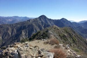
Our hike will begin at the trailhead near the junction of Angeles Crest Highway (Hwy 2) and Angeles Forest Hwy (N3) in the Angeles National Forest. We will follow the Josephine Peak Fire Road (2N64) as it rises steadily uphill with ever-improving views of the surrounding mountains, including Hoyt Mountain and Mt. Lukens to the west, Strawberry Peak to the east, and Josephine Peak’s rocky slopes immediately to the north. About 2.5 miles into the hike, we’ll reach Josephine Saddle where a ridgeline trail from Strawberry Peak to the east joins our route. We’ll turn left and continue climbing upward to the end of the fire road at 3.7 miles. A short and single-track trail rises steeply up to the small, rocky summit. We’ll return the way we came.